 DoneThat
This walk, which is 2 miles each way, can be completed in 75 minutes, one way, at a brisk pace. For a more leisurely pace allow one and a half hours each way. It is an easy walk and generally well signposted but a copy of the 25000 scale map is advised. You could print a copy of this map and take it with you. The red circle marks the start of the walk. Follow the same route in reverse to return to Hadleigh. We did it on a gloriously warm sunny day in mid-May which made the Suffolk countryside look wonderful.
The walk
Probably the best car park for this trip is the Magdalen Road car park if you are walking on Monday to Saturday or the High Street car park if you are walking on a Sunday when parking time is unrestricted (see the street plan). After parking head for Duke Street shown in the bottom left corner of the street plan and head towards the river and the Medieval Toppesfield Bridge. Go over the bridge past the picnic area on the right and keep right onto a wide stony track which runs roughly parallel to the river.
The stony track will soon change to a wide unsurfaced track. Continue on this track until you see a narrow track curve off to the left and follow the left hand track. This track passes along the edge of the wooded Broom Hill Nature Reserve. Ignore the first gate that you see on your right and continue until you reach a path crossing left to right on Constitution Hill (this junction is shown on the above 25000 scale map link, just to confuse matters, as a right junction only). Turn right onto this path which leads through the edge of the wood and up to a stile. Cross over the stile and turn right along the edge of the field with good views across to Hadleigh from time to time.
When you reach the corner of the field turn right into the next field then immediately turn left following the top edge of that field. Do not follow the track that goes diagonally across the field. When you reach the far corner of the field you will see a narrow gap in the hedge and some steps down to a road. Turn left onto this road which has steep banks either side. We saw a Slow-worm, Anguis fragilis, on the bank which, for those that don't know, looks like a small snake, about 12 inches long, but is in fact a legless lizard and is completely harmless. Continue along the road for about 200 yards and look out for a public footpath going off to the right marked with a signpost. This is opposite Friars Hall Farm marked on the map.
Follow this path along the edge of the field with a ditch on your left. A short way along the path will veer to the right and goes through the crop and slightly uphill. At the top of the hill you will reach a junction where you should keep left. This short section leads down to a road. This road is fairly straight and traffic travels fast so cross the road with care.
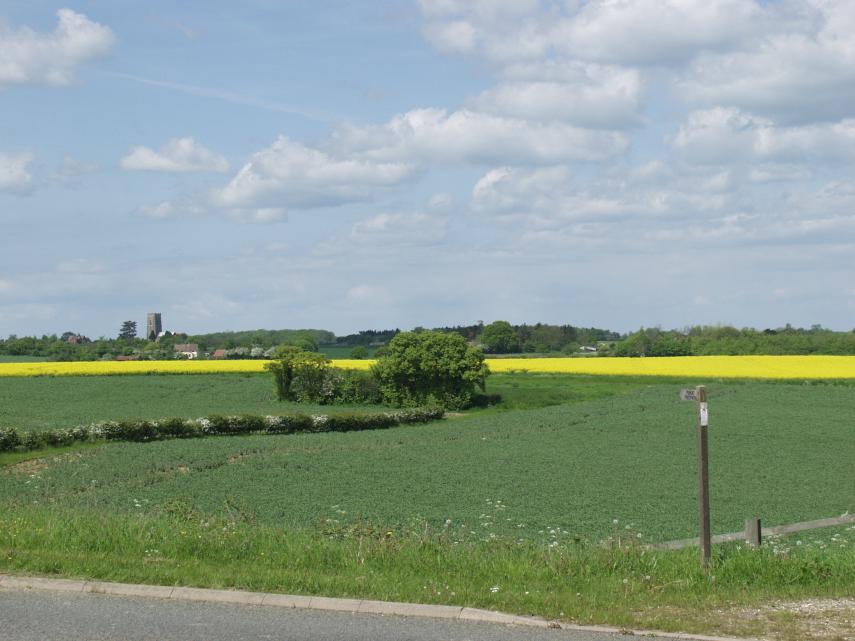
Again the footpath is signed diagonally across the field but there was no sign of a path so we turned right and followed the hedge turning left at the next corner. Following along by the higher hedge then right at the next corner up to an obvious track between the green field and the yellow field. Turn left and a short distance along the track is a footpath sign with one arm pointing right through a crop of shoulder high Oil Seed Rape, the yellow field, and again no sign of a path.
A word of warning - when we emerged from this field we, and the bags that we were carrying, were covered in yellow pollen. If you suffer from pollen allergies then this is something of which you should be aware. The crop is shoulder high and the path is narrow so that it is virtually impossible to avoid touching the flowers. We are both mildly allergic to some pollen but were totally unaffected by this.
This view was taken when we were on our way back. You can just see my wife's head poking above the Oil Seed Rape. Although the path cannot be seen easily in this picture it is much more obvious than it appears here.
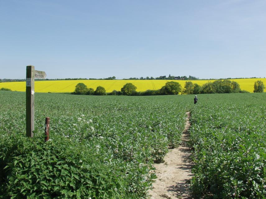
This picture was taken from the top edge of that field and so we are looking back the way we have come up to this point. The Oil Seed Rape is still very apparent in the distance as is both the footpath in this field and the footpath sign.
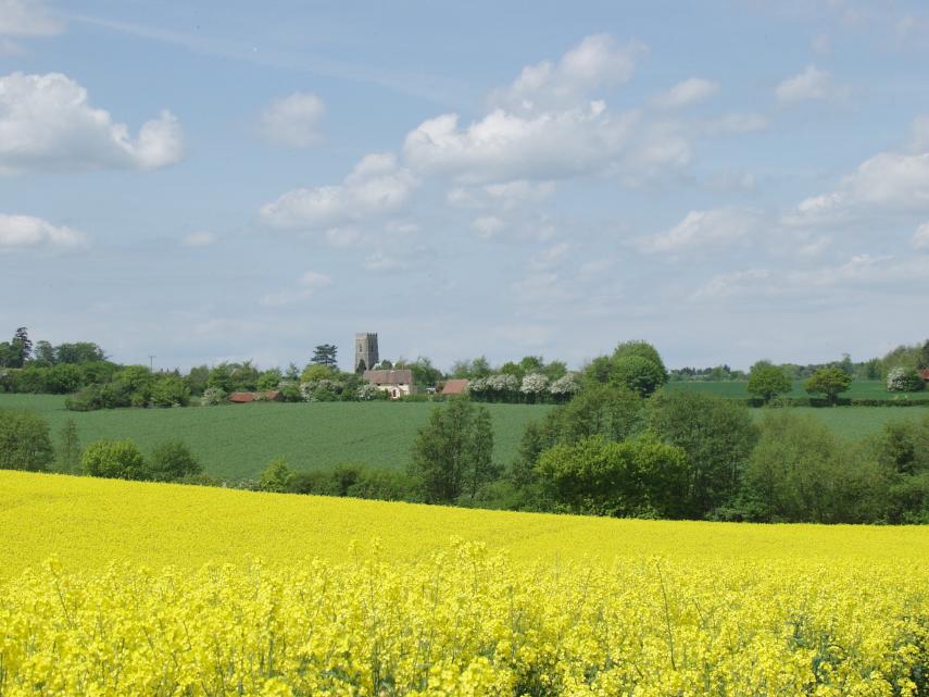
Turn left along this track which soon changes to a tarmac surface and you will see one part of the track going off to the the right which is the entrance to a house, marked as Noaks Tye Farm on the map, and which you should ignore. A short way past this junction look for a narrow gap in the hedge. There was a small signpost and waymarker but rather hidden in the undergrowth. Go through this gap and follow the obvious path across the fields until it meets a road. Turn left and, when you are roughly level with the tower of Kersey Church turn right onto a wide public footpath which leads into the village of Kersey.
We arrived in Kersey at about 1 o'clock and, after exercise like that, HAD to go into the 14th century Bell Inn for a roast Sunday lunch. Very satisfying; and we were still able to walk back to Hadleigh afterwards.
NOTE: The crops in these fields may change from year to year so don't necessarily expect to see the same crops that we saw and that are shown in the photographs. The directions, however, remain the same. There is no reason why you shouldn't do this walk in reverse, i.e. start from Kersey and walk to Hadleigh, but you will have to reverse the directions.
