Browsed by
Category: Sussex

Down South – Day 1 – Thursday 24th Sept.

Down South – Day 1 – Thursday 24th Sept.

We left home in the morning on a gloriously warm sunny day heading for the Sussex Coast. Our first stop, however, was to be Battle (1066 and all that!) and they have some peculiar parking arrangements in Battle. The abbey has its own car park for which you have to pay and you have to pay again to go into the abbey so we weren't going to do either of those things. The other council run car parks are pay and display but in the Pay & Display cark park off Caldbec Hill there is what they call an overspill car park (unsurfaced) which is free and, consequently, it is very popular. We did actually find a space but it took a 99 point turn to get into it because there was so little room to manouevre.

We had been here last year when Marie came over but I forgot to take a photograph of the Abbey Gatehouse (silly me) so I rectified that omission this time.

We had arrived in Battle shortly before lunchtime and now it was lunchtime so we looked for somewhere to get a light lunch. We found a delicatessen, Battle Deli, which was also a little teashop and went in there.  We both enjoyed our lunch very much and I had the nicest soup I've had in a long while. Very good value. Recommended.

Not far from the car park was this ancient house.

Now there's an interesting shape.

A short way past the abbey is this view. The field on the other side of the gate is called 'Lake Field', although I don't know why as there isn't any lake, and was bought by the National Trust to preserve the view. It's a view worth preserving.

We decided that it was time to move on and headed for Eastbourne. Once settled in we went for a walk along the seafront. It had clouded up a bit by this time but was still pleasantly warm. We drove through Eastbourne, along the seafront, with Marie when she was over here and staying in Rye and it looked quite impressive then so we were very interested to be able to have a good look this time.

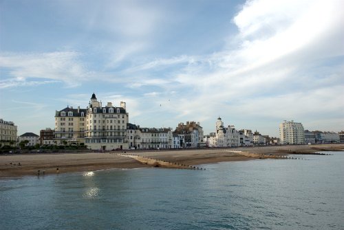
It certainly seems a nice town. There were a lot of rather grand buildings, mostly hotels, along the seafront and they looked well cared for; no peeling paint. There was a pebble beach and a pier.

We walked along the pier and were able to catch this view in the evening sunlight.

Nice pier and very well kept with some interesting little buildings including the 'Victorian Tea Rooms' and a Camera Obscura which was closed – pity.

So back for dinner and wait and see what the weather brings for tomorrow's walk.

Blooming Marvellous!

Blooming Marvellous!

On Friday 29th May we heard that the weather was forecast to be warm and sunny for the next four days so we did what anyone would do under the circumstances; we booked to go to Lewes or, if you want to be pedantic, to Offham which is two miles from Lewes town centre.

We picked Offham because The Blacksmiths Arms had accomodation available and it's not easy to get accommodation in Lewes with its own parking without paying for very expensive hotels. There was also a bus into Lewes which stopped right outside the Blacksmiths Arms. So that was settled then and we were due to go on Sunday 31st May.

Sunday arrived warm and sunny. We left home about 10:00 AM and arrived in Offham at about 12:15 PM after a relatively stress free journey.

Sunday 31st May

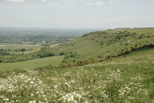
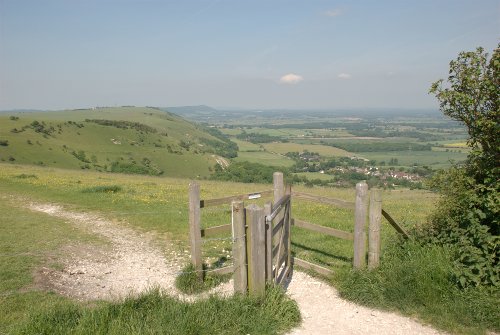
After unpacking we immediately left again for Ditchling Beacon on the South Downs which was an easy 9 mile drive. There is a car park on top of Ditchling Beacon which was very handy and this is the view that greeted us when we got out of the car.

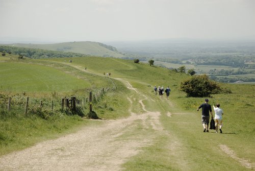
We were planning to walk along the ridge to see Jack and Jill and so we set off together with numerous other people. This was a sunny Sunday remember and everyone was out and about. Jack and Jill must be along there somewhere.

After a very picturesque walk in the sunshine of some two miles or so we caught our first glimpse of Jack.

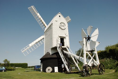
Jack as you can see is a tower mill. Very soon after seeing Jack we arrived at Jill which you can see is a post mill.

Jill was actually working, although you can't see that in the still photographs, and occasionally the little vane on wheels would start to rotate as the direction of the wind changed and the wheels would start to move along their track keeping the mill pointed into the wind.

We went inside right up to the top floor where we could feel the mill swaying. It is after all a whole building pivoting on a single post so there is bound to be some movement.

Here are Jack and Jill together with the moon showing above Jack (the black mill).

We shall leave you with this view from the windmills showing Ditchling village at the bottom of the hill.

As a matter of interest that white blob in the distance is yet another post mill. We now have another two miles to walk back to the car but we do get a second look at all that lovely scenery on the way. Along part of the ridge we could see the sea and part of Brighton and a small patch of white chalk cliff further east. Back to the hotel at the end of the day but will the weather last?

Monday 1st June.

Today is another sunny day and after breakfast we catch the bus outside the Blacksmiths Arms arriving in Lewes High Street about ten minutes later.

Our trip to Lewes, as with the other places, will all appear on the main web site in detail sometime later so I'm only going to give a brief account here.

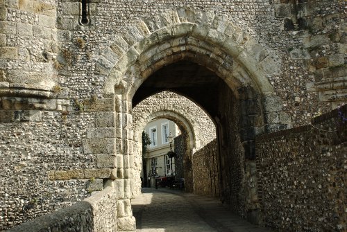
A little way from where we got off the bus is the medieval castle entrance in the High Street. It had been closed the whole of the winter for maintenance and was still closed so we couldn't go inside. It apparently opened later in the week that we were there but we were too early. It looks moderately impressive but nowhere near as impressive as Bodiam or Conwy.

This is the view through the Barbican Gatehouse.

What's left of the Keep stands on a separate mound within the castle boundary and I believe visitors can go up both the Barbican Tower and the Keep.

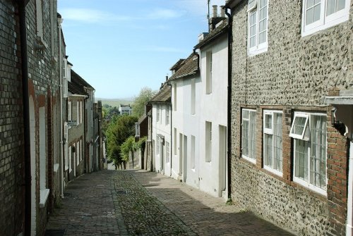
After looking around the outside of the castle we arrived back in High Street and spotted an old timber-framed building which we went to look at. It turned out to be on the corner of Keere Street which is one of those quaint, steep and narrow cobbled streets – rather picturesque.

We had to walk down Keere Street, of course, and found ourselves by Southover Grange Gardens – a beautiful little oasis in the middle of the town. As we were now at the bottom of the hill we made our way to Anne of Cleeves House which is another fine old timber-framed building which is open to the public but we didn't go in.

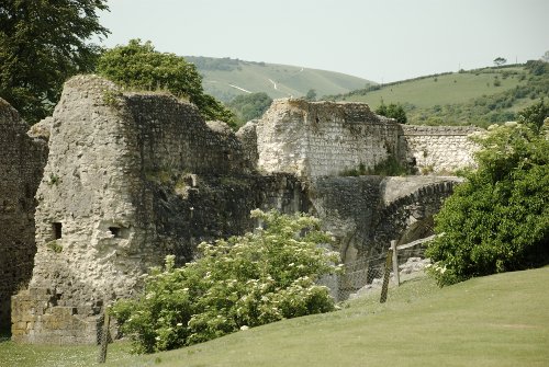
A little further is the ruined Lewes Priory.

You can see how lumpy it is around here from the view of the hills in the background.

We went from the Priory back towards the lower part of the town centre by the river. One thing I will say for Lewes is that it has a lot of nice places to eat. We spotted Chapel Lane which gives access to a footpath up onto the Downs but more of that later and we also saw English's Passage which is supposed to be one of the narrowest Twittens in the country and there are houses along both sides.

We were both getting tired by this time but I was determined to get up onto the Downs so Amanda decided to potter round the shops whilst I did the heroic climb. I set off for Chapel Lane which is pretty steep and found the public footpath going up onto the downs. I set off up the path but crikey, puff, wheeze, hang on a minute, gasp – now that WAS steep. After numerous rests the path became, thankfully, less steep and after about one and a half miles I took this picture.

Lewes is somewhere down there in the valley. I managed another half mile and decided I didn't have time, or the energy, to continue so I went back into Lewes and met up with Amanda again. I had walked just over 10 miles in Lewes today. It was now getting late in the day so we decided to get the bus back to the Blacksmiths Arms. We will see what the weather brings tomorrow.

Tuesday 2nd June.

Another fine sunny day so we put Plan 'A' into action which was to travel the short distance north to a place called Sheffield Park. We chose that for two reasons. It was one end of the Bluebell Line, a heritage steam railway, and it was home to the National Trust's Sheffield Park Garden.

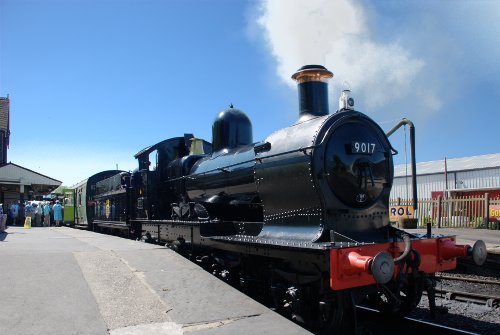
The Bluebell Line was a few hundred yards nearer than the gardens so we stopped there first and we were in luck as there was a steam train in the station waiting to go. We weren't going for a ride as that would take too much time but we were hoping to see one.

After the train had gone we had a look in the engine shed. It was a very large shed packed with locomotives on three lines and standing next to some of these on the same level as the bottom of their wheels they looked gigantic! In the yard behind the shed were other numerous locomotives of which these rather cute tank engines were just two.

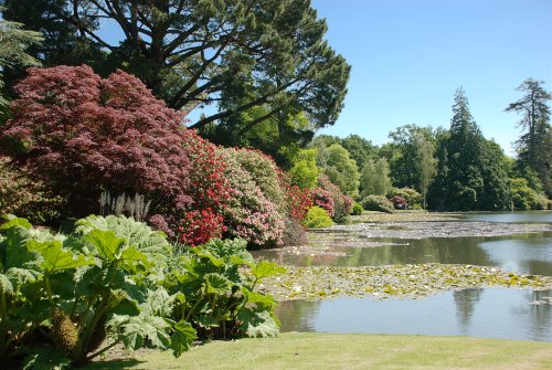
So now on to our main reason for this trip – Sheffield Park Gardens. This garden, at this time of year, was a revelation and we thought it to be the best garden of its kind that we had yet seen. A detailed report will appear on the web site sometime so I'll give just a flavour of what we saw here.

What a riot of colour and not just the flowers. There were even red, green, grey and yellow foliage on the trees. This garden was indeed blooming marvellous. Needless to say we spend most of the day here and finally went back to our accommodation tired but happy. More good weather tomorrow (the day we leave for home)?

Wednesday 3rd June.

Yet another warm sunny morning but today we go home. However before we do that we decide to go to Devil's Dyke which would also allow Amanda to call in on a plant nursery nearby that specialises in Pinks for some particular varieties that she wants.

Devil's Dyke is a well known beauty spot but shouldn't be too crowded mid-week in early june and that proved to be the case. There is a road up the hill and a car park on top which is fortuitous as we both feel somewhat knackered after the exertions of the last few days.

This is what we saw when we got out of the car.

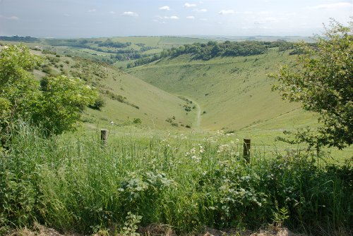
That view does not include the actual dyke itself but this next view does. The dyke is the deep valley seen from the top looking down. Dyke is another term for ditch and it is said that this 'ditch' was created by the devil.

This view is from the bottom looking up.

So we did that and now it's time to go to the nursery for Amanda to buy her plants. Then we head home. The interesting thing is that after we'd left the nursery around lunchtime it started to cloud up and within an hour there was no blue sky to be seen. How's that for timing?

A rather good trip and wonderful weather.

P.S. By Friday it was too cold for a short sleeve shirt and even with a long sleeve shirt another layer was required to be comfortable. That's English weather for you. :???:

Hip, Hip, Hoo Rye

Hip, Hip, Hoo Rye

Tomorrow we leave for Rye and the day after that we meet, for the first time, our forum friend from the U.S.A. – Marie. After that anything could happen. smilies I am hoping that when the hotel says it has Internet access it actually works. We shall see. If it does work I'm hoping to update this report on the day that we arrive and, subsequently, on other days. When I got up this morning it was snowing hard and continued like that for a few hours but, I'm glad to be able to report, it has now stopped and what snow there was on the ground has melted. The weather forecast for tomorrow is sleet with sunny intervals and for Tuesday and Wednesday it's light rain. With weather at this time of year anything could happen. smilies Watch this space!

================================

Well, Ok, it didn't happen – the blog posting I mean not the trip. It turned out that because we had so much to do the only time I would have had to write the blog would have been late after dinner in the evening and, to be quite honest, I really didn't feel like it. However, here is the report a little late.

The Rye Trip Day 1 – Monday (Rye)

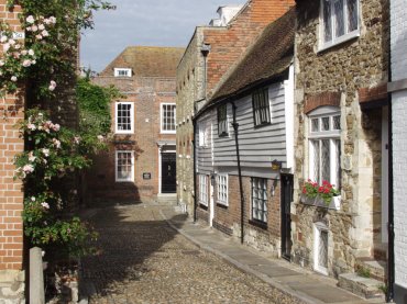
We arrived in Rye, after an uneventful 2 hour drive, at about lunchtime. Driving through the narrow, cobbled streets around Church Square and into Watchbell Street, where our hotel was, was fun! The streets are not wide enough for two cars to pass and some of the corners were pretty tight but we got there. Our hotel was very nice and rather quaint. This shows the side of the hotel in Watchbell Street.
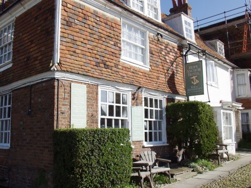
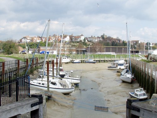
This part of Rye is on the top of the old sea cliff and gives a super view over the harbour and marshes. This view of the hotel is from the bottom of the cliff near the harbour.

This last picture, taken from the bridge on the Rye Harbour road, gives an overall view of the town on the hill with the church tower and spire showing on the right-hand side and our hotel is the building on the extreme left.
We had lunch in the hotel and afterwards went for a walk around the town. The weather was a bit cloudy with some sun but there was a very cold wind. We didn't stay out for long because it felt so chilly and went back to the hotel to organise our belongings and prepare for dinner. Tomorrow, Tuesday, we plan to go to Hastings Old Town by bus and meet up with Marie on our return.

Day 2 – Tuesday (Hastings)

The day dawned with a cloudless sky, not that I was awake at dawn to see it, and as there was no wind it felt a lot warmer altogether. We had breakfast and, as we were planning to go by bus, collected our rucksacks with clothing for all eventualities. We caught the number 100 bus outside Rye Railway Station. The bus stops are arranged in laybys either side of the road running toward the camera with the station at the back and you can see part of the layby on the right-hand side where we caught our bus.
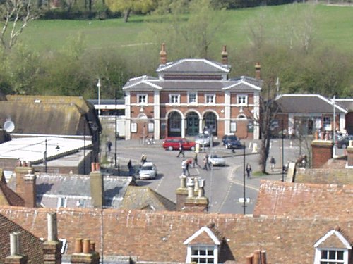
This bus starts from Dover goes through Folkestone to Rye then onward to Hastings where it terminates. It is a double decker so, on those narrow little roads, it sometimes felt like riding in a small house. The bus journey took about 40 minutes and we got off in Hastings Old Town. The first building we saw looked very interesting and was a hint of things to come.

The road the bus used through the old town was a fairly ordinary town road but the streets we wanted to see run off to each side of this. Just opposite us was a narrow interesting looking little lane which we followed and came out in the High Street.

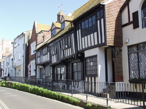
What a fascinating and picturesque street this is with it's ancient buildings and high pavement which runs for quite a long way. You can see on the right of the picture where some steps take the pavement up to an even higher level. I don't know the reason for this, especially as it occurs only on one side of the street, but I would like to find out. This is All Saints Street which runs parallel to High Street but on the opposite side of the bus route. Here the pavement is returning to around road level and there are still plenty of ancient timber-framed houses along here.
There are lots of narrow side alleys which connect these various streets which are great fun to explore. Here is an example.

You should be able to see, in the dark patch ahead, a small slit of light which is where the alley goes through the houses and continues on. We found many others like this, all different, but then spotted one with a sign pointing to 'The Castle and Caves' so, of course, we had to follow it.

This eventually, after a bit of a steep climb, came out onto a large open grass area with amazing views over the old town. This is West Hill.

The view above is looking across the old town to East Hill which we climbed up later. We found the ruins of Hastings Castle on the top of West Hill. There is not an awful lot of it left but what does remain is interesting. There are some old dungeons cut into the sandstone below the castle and they are so confined that a photograph would have shown very little so I didn't take any down there but I did take some of the ruins.

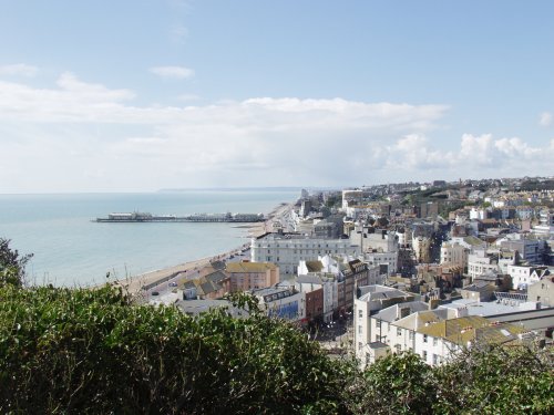
This view is of the modern part of Hastings which is on the west side of West Hill. Just to try and make things clearer – first when coming from the east is the high ground of East Hill then the valley with Hastings Old Town in it. Next is the high ground of West Hill with the castle and caves and finally beyond and below West Hill is the newer part of Hastings including the pier. This is what you see from the castle.
There is a cafe on West Hill where we had lunch before returning to Hastings Old Town. On the way down to the High Street we came across this narrow road by an old chuch.
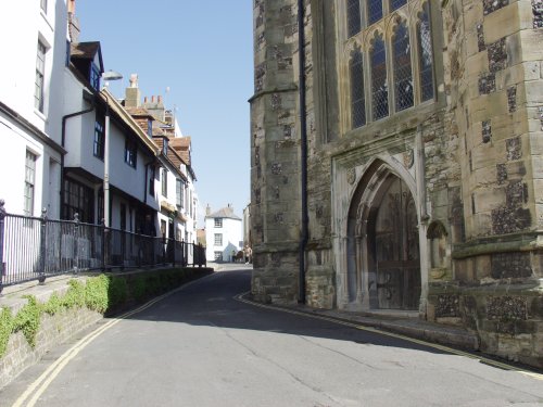
Yes cars can drive through there but only just. Notice those high pavements again. Having reached sea level once again we climbed up East Hill using the steps which climb next to the funicular which, incidentally, was undergoing maintenance and so was not in use.

Lets face it – if you want to go anywhere in the old town you go either up or down. Level? What's that? After coming down from East Hill it was time to catch the bus back to Rye and while we were walking to the bus stop my mobile 'phone rang and it was Marie to say that she had arrived. We got off the bus outside the Railway Station and walked along to the 15th century cottage that Marie was renting for a week. Marie invited us in and we spent about an hour chatting before returning to our hotel. We had arranged for Marie to come up to the hotel the following morning when we planned to drive to Bodiam Castle, Battle Abbey and Birling Gap. The saga continues on Wednesday.

Day 3 – Wednesday – The three 'B's (Bodiam, Battle and Birling Gap)

I forgot to mention in the previous section that the many little alleyways in Hastings Old Town are known as Twittens. This is an Anglo Saxon word related to the German Twiete meaning a narrow lane. The old English plural 'en' at the end of a word rather than 's' probably means that Twitten is actually a plural i.e. 'lanes'. However, back to the saga. Marie came up to the hotel whilst we were having breakfast and had a cup of tea with us until we had finished our breakfast. I gather she's a bit of an early bird and gets up at a time I would regard as the middle of the night. We set off for Bodiam spotting wild flowers (Wood Anemones and Bluebells) as we drove through the countryside and arrived at Bodiam Castle at just about opening time, parked the car, and walked to the castle. What a picturesque setting and with a cloudless sky!

We had to walk round the moat to the other side which is where the very impressive entrance was. This picture shows the bridge across the moat and Amanda and Marie about to step on it.
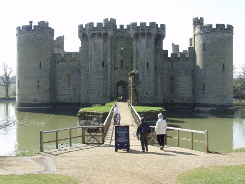
We had a look in one of the towers where the wooden floors no longer exist and so it's not possible to go up.
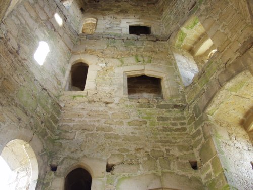
After a bit more wandering about we found the way to the really interesting bits – the top of the two towers where visitors can get access.


Medieval spiral stone stairways are definitely not built for two-way traffic. Before starting up it's advisable to listen for people coming down and vice versa. In spite of her dodgy knee Marie was hopping up and down the stairways like a good'un. This picture, taken from 'our' tower, shows people on another tower – just like us. We later went up that one too.
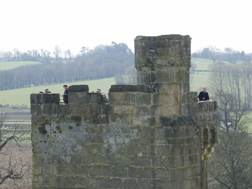
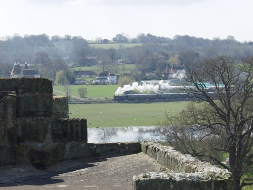
Good views from up there over the surrounding countryside especially if a steam train just happens to be passing.
And in the other direction we could see what appeared to be a Hop field complete with Oast Houses.

Then in the 'other' direction i.e. down, we could see the layout of the inside of the castle although I wasn't able to include it all.
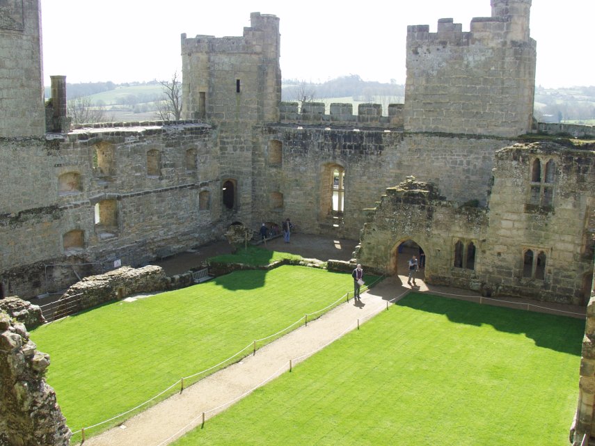
The doorway on the path is the entrance from the bridge over the moat. It appears that they weren't all that primitive in those days when it came to creature comforts. In many of the rooms we saw there would be another little room off to one side which inevitably turned out to be a Garderobe (Toilet). I even volunteered to photograph one of the ladies sitting on one but they both declined. Perhaps that's what is known as 'toilet humour'? That is where we leave Bodiam Castle and sally forth to Battle (so to speak). It was but a short drive to Battle and we soon found the Abbey and parked in their own car park which, at £3.00 a go, I thought was a bit steep. Quite by chance it turned out that we didn't have to pay – but more of that when we've finished our visit. The main abbey gatehouse is probably the most complete building left in the abbey and does look quite impressive.

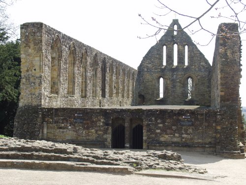
There are other ruined buildings botted about the place of which this is but one:
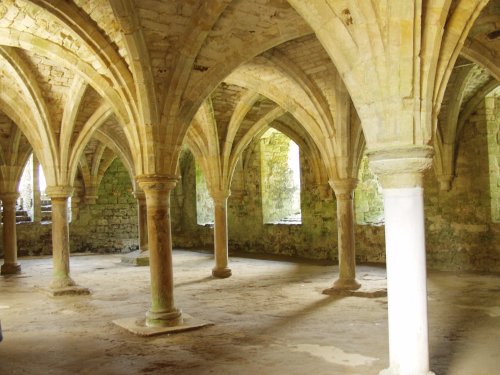
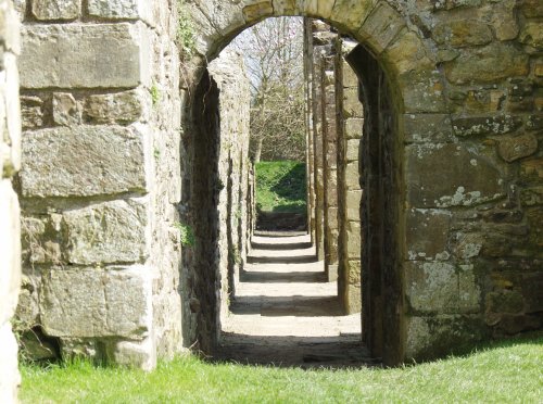
It's always worth hunting around for the odd doorway or two because one never knows where it may lead and the most interesting part of this building is not what you can see from here but what is underneath:
At the far end of this building I found this interesting little view. I don't remember what it was but I believe Marie found out at the time and if she can remember perhaps she will jog my memory.
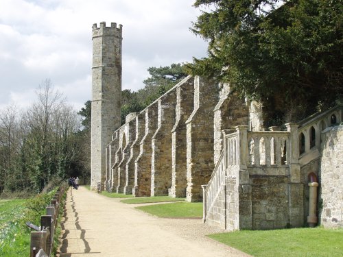
This part of the abbey was next to the original battlefield which is just over the fence to the left where there are 'battle walks'.
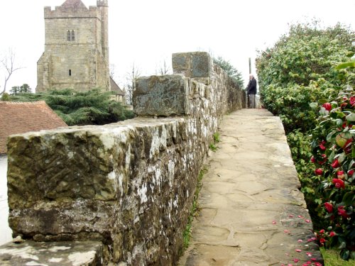
Finally the whole abbey complex used to be surrounded by a substantial wall complete with walkway.
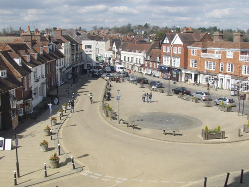
Having finished our tour we went back to the car. In this car park there is an automatic barrier at the exit where one is supposed to pay however when it was time to leave there was a car parked on the outside of the barrier which was down. There was a lady talking to one of the English Heritage staff and another lady sitting inside the barrier on the kerb. There must have been some sort of problem/incident although I don't know what it was but another member of staff was waving cars out of the 'in' gate so we didn't have to pay. This part of Battle village I saw through one of the gatehouse windows:
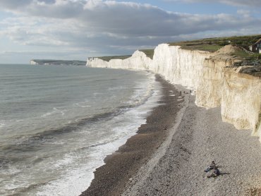
Just outside Battle Abbey was a small teashop which provided us with a lunch stop after which we moved on to Birling Gap and the white chalk cliffs. Amanda was doing the map reading and navigating and we discovered that at Polegate, only a few miles from Birling Gap, some swine had changed the road layout and it no longer matched our map. Howver after a short circular tour we did get back on the right road and arrived at Birling Gap. There is a set of steps here to get down the relatively low point in the cliffs to the beach. We have been here before, of course, and there are pictures on the main web site to prove it. This time we were here so that Marie could see the white cliffs. We walked east along the beach to where the cliffs started to get higher and let Marie have a close look at the stuff. These chalk cliffs are rather friable and bits, large and small, can fall off at any time but they didn't, I'm glad to say, whilst we were there. We went back up the steps and walked on top of the cliffs for a while getting a good view of Birling Gap from the higher ground.

Our car was parked down there somewhere and so, after an enjoyable day, we made our way back to the car and thence back to Rye. So that was Wednesday. Tomorrow, Thursday, will be our last day together as we leave both Rye and Marie on Friday morning. The saga continues on Thursday.

Day 4 – Thursday (Camber Castle and Rye)

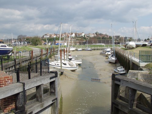
Thursday morning and it was dry, bright but cloudy. After breakfast Amanda and I walked down to Marie's cottage and the three of us set off through the town for Romney Marsh and Camber castle. This involved following the Winchelsea Road for a short distance and turning down Rye Harbour Road, across the River Brede at the lock gates and onto the public footpath across the marsh. This shows the view back to Rye from that bridge over the river and you can even see part of the lock gates.
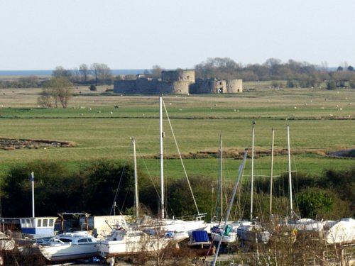
It wasn't long before we could see Camber Castle in the distance – it is pancake flat out here after all. This castle was built by Henry VIII – well he didn't actually build it himself but paid other people to do it for him. It was original very close to the shoreline but a few hundred years later it was abandoned because the sea had receded so far. It is probably around one and a half miles inland now. This picture was taken from our hotel window.
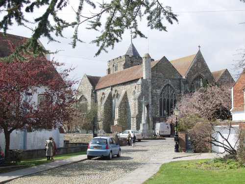
More pictures of Camber Castle can be seen on the Rye pages from our previous trip. After wandering around the castle we continued on a circular route back to rye passing many sheep and lambs and back in Rye we headed for the lunch shop. After lunch we continued our explorations of Rye and ended up at the church. This is the church seen from near the Ypres Tower.
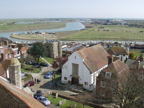
I threatened to go up the tower as the sun was shining and the last time I went up and took some photographs it was cloudy. Marie decided she didn't want to struggle up more steps but when I decided I was going up she just didn't want to be left out of the adventure and changed her mind and so we all went up. This is one of the views from the top showing the Ypres Tower down below and the view across the marshes towards the sea.
After coming back down to earth we took Marie along to see the Ypres Tower.
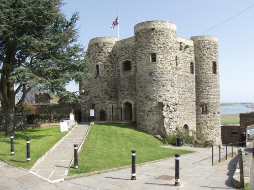
Built in 1249 this tower is one of Rye's oldest buildings. Going down some steps to the street below we somehow ended up by the Strand Quay and all the antique shops – I'm not sure how I let that happen. Do I need to say that Amanda and Marie disappeared inside pronto? No of course I don't. When they did re-appear some days later we went back to the hotel. At about 6:00 PM Marie went off to her cottage and we prepared for dinner. Tomorrow we say goodbye to Rye and Marie.

Day 5 – Friday Marie came up to the hotel this morning and had a cup of tea with us at breakfast. She was all togged up for her planned walk to Winchelsea. After breakfast we, reluctantly, said goodbye to Marie and she then went off to start her walk and we did all our packing, loaded the car and had a relatively straightforward trip home. Can't wait for the next trip.

Ups and Downs – Day 3.

Ups and Downs – Day 3.

Another sunny October day – a bit of a chill in the air but still shirt sleeves weather.

Today was to be our longest walk of this trip at about 8 miles. We were starting from Alfriston and walking over Windover Hill to the village of Jevington on the other side where we hoped we would be able to get a decent lunch. There is only one pub, the Eight Bells, and we have no idea what it's going to be like.

Walking on the South Downs Way, which runs across the white footbridge over the Cuckmere River, we started up the slopes of Windover Hill. Only a short way along the path we thought that the view was so nice that we stopped for a picture.

There was Alfriston nestling in the valley with the church facing us and the ridge that runs through Firle Beacon beyond. Breathtaking!

As we climbed higher the views opened up even more. We were planning to pass directly above the Wilmington Long Man but before we reached that point we met some horse riders coming down. This path is a bridleway so can be used by both pedestrians (us) and horse riders (them).

A little further up the path and we could see the Long Man cut into the hillside ahead and when we reached the point directly above his head we took this picture.

The view from the village of Wilmington is much better and there is a small free car park there. The funny white squiggles just above the bottom of the picture, in the shadow, is the Long Man with his legs running (not literally) down the slope and his arms outstretched to the sides.

The slope below, at this point, is really very steep and not far off the vertical which is why there's a fence along this section of the path.

Shortly after passing this point we reached a small gate and stile which Amanda is negotiating here.

Now what about that view beyond? Well we though it was pretty amazing.

Our intended route from this point was straight on in the direction in which we had been travelling but Amanda 'collects' Ordnance Survey trigonometry points and she could see one on the map about a half mile off our route so we turned left to find it.

And here it is complete with Amanda and that stunning view at the back. She wanted to take it (the trigonometry point, not the view) home but I suggested that it might make the rucksack a little heavy and so she agreed that a photograph would be a good substitute.

On our way back from that little detour we met some of the local residents.

Have you ever noticed that sheep have rectangular irises in their eyes?

The path we were going to take towards Jevington was barely visible on the open grassland up here but there were marker posts at fairly widely spaced intervals to assure us that we were on track.

Can you just see the two small figures on the near horizon with Firle Beacon behind them? It gives an indication of scale. The path, incidentally, is immediately to the right of the marker post. You should be able to see a slight difference in colour compared with the surrounding grassland. I did say it wasn't easy to see.

This is me taking the picture that I've just been talking about. That patch of blue on the right-hand edge between the sky and the land is the sea somewhere around Beachy Head.

I think I've said this before but I'm still going to say it again – the scenery up here is stunning and I'm going to bore you with yet another picture of it.

Soon after we started to descend towards Jevington and caught a glimpse of the village and the top of the church tower – the little dark red triangle of roof just left of the centreline with a little patch of smoke behind it.

We arrived a the Eight Bells just before 1:00 PM – time for lunch.

Nice place, nice people. We needn't have worried about the food as the choices and the quality were both excellent and we would recommend it without hesitation.

We didn't want a full blown lunch, we have yet to walk back remember, so we had a starter and a dessert but no main course. Amanda remarked that her starter could easily pass for a main course, which it could have. They don't do 'small' here! The trouble with sitting down to an excellent lunch is that it has to end sometime and the walk back beckoned.

We were taking a different route back. A path we had walked about 19 years ago when we drove into the area from our hotel near Hastings to Jevington and walked to Littlington about two miles from Alfriston.

Down the hill, kink left and up the other side. It's all ups and downs around here. In fact the Downs are up – if you see what I mean. After a mile and a half we had Alfriston in sight once again. The farthest edge of the farthest ploughed field would be where we started up Windover Hill earlier this morning.

We arrived back at the Star Inn at the end of an absolutely super day and the end of our all too short trip. This is an incredibly scenic area and, no doubt, we will be back.

The next day we had a relatively straightforward drive home. Till the next time.

Ups and Downs – Day 2.

Ups and Downs – Day 2.

The weather forecast for our our second day was cloudy but dry and we woke to a clear blue sky and it stayed sunny all day. So much for English weather forecasts.

After breakfast we drove the few miles to Friston Forest where we parked the car in one of the two official car parks. This one is on the west side of the forest about 2 miles south of Littlington.

After paying our 1.50 GBP for a day’s parking, the only option there is, we walked off into the forest heading for the little village of West Dean about a half mile away.

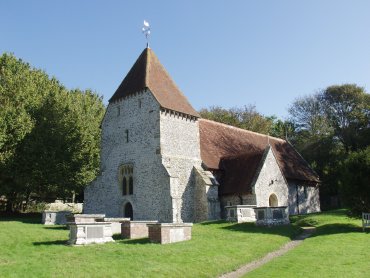
In spite of stopping here and there along the way to look at plants we arrived in West Dean fairly quickly and decided to have another look, we’ve been before, at the little church.

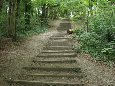
Through the village to the path through the forest to the Seven Sisters Country Park Visitor Centre. Ah yes – that path. Not quite as innocuous as it might sound.

That’s the one. It wasn’t as strenuous and didn’t take as long as you might imagine to get to the top. The next section of path was gently downhill all the way to the visitor centre and we had then walked about mile from the car. We had a brief stop here for coffee in the Exeat Farmhouse Restaurant which I mentioned on the Cuckmere Haven page from our previous trip.

So crossing the A259, Seaford to Eastbourne Road, we headed towards Cuckmere Haven.

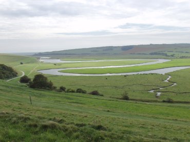
Here you can see the Cuckmere River meandering across it’s flood plain towards the sea with the path on the left-hand edge of the picture. You can just about see the sea on the left edge of the horizon.

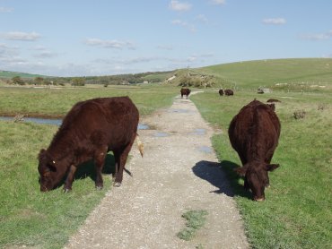
On our previous visit there was no livestock to be seen but this time there was. This pair were grazing contentedly each side of the path and we had just walked between them when I turned and took this photograph.

Cattle are usually nervous enough that they will move away from people if they get too near but these were obviously used to people and didn’t so much as twitch when we walked between them.

So after walking another mile we soon arrived at the beach at Cuckmere Haven.

Don’t be mislead by the sandy beach – most of it is pebbles and it’s hard work walking on them. I wanted to get some more pictures of the chalk cliffs so we walked further along the beach. Here I am taking my life in my hands, well I could have got seriously wet feet, to get the sort of pictures you see on the web site.

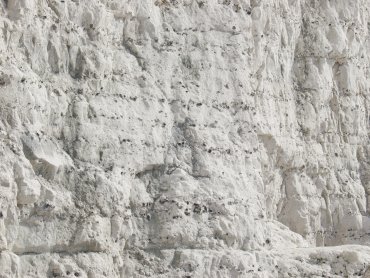
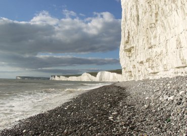
You will notice that, in this close-up of part of the chalk cliff, there are rows of small dark blobs. These are flints formed in the chalk and, when the cliff is eroded by the sea and the weather, they are washed out and rolled by the waves to form the rounded pebbles of which the beach is comprised.

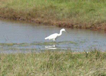
As we started back towards the visitor centre at Exceat we saw a Little Egret in one of the lagoons.

We were back at Exceat in time for a late lunch at the Exeat Farmhouse Restaurant and then walked back through the forest, via West Dean, to our car.

As we still had some time left in the day we drove to Birling Gap and parked in the free car park there. Birling Gap is so called not because there is a complete gap in the cliffs but because the cliffs there are only about 30 feet high whereas the cliff heights either side are measured in hundreds of feet.

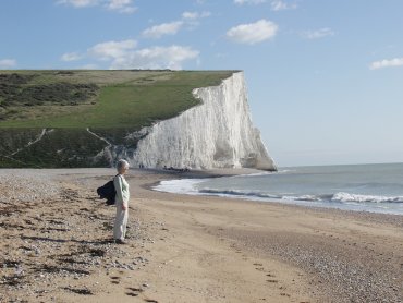
There is a metal stairway from the top of the cliff to the beach and this picture was taken from the top of the stairway looking west at the Seven Sisters chalk cliffs.

We did, of course, go down the stairway to the beach and walked east in the hope of seeing Beachy Head round the next corner but we reached a point where the sea was still lapping against the cliffs so were not able to go any further.

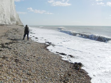
I did, however, take this picture after we’d turned round to walk back to the stairway.

On the way along the beach one could not avoid the noise of the surf. The waves crashed noisily on to the beach and, as the water withdrew, the sound of pebbles grinding as they were rolled could easily be heard. Standing there listening to that noise one could imaging how the rough lumpy flints were transformed into smaller rounded pebbles.

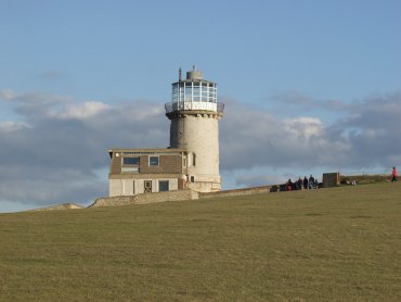
When we got back to the car park there was still time for another short expedition so I walked east up onto the cliff tops whilst Amanda stayed down below. Until I reached the top of the cliffs I hadn’t realised that the Belle Tout Lighthouse was so close so I had to go at least that far.

Just before I got there a long thin strip of cloud obscured the sun and I ended up waiting 15 minutes for it to clear – but what a beautiful place to have to wait. The sparkling sea to the south, the Seven Sisters white cliffs beyond Birling Gap to the west and East Dean and Friston Forest to the north.

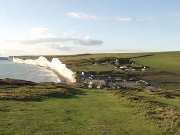
Coming back down from the lighthouse I saw this view of Birling Gap

The sun was getting noticeably low and it would be dark within 2 hours so we made our way back to the hotel after a very pleasant day.

Tomorrow will be mostly ups and downs.

Ups and Downs – Day 1.

Ups and Downs – Day 1.

At the beginning of September last we visited Alfriston in Sussex which, apart from being a lovely little village in the middle of the Sussex Downs, is also only about 5 miles from the coast. We liked the area so much that, 5 weeks later, we went again staying at the Star Inn in the centre of the village on both trips and have just returned from that second visit.

Pictures from the first visit are already on the web site and can be accessed from the Sussex page – South Downs.

The day that we started our second visit was cloudy with rain at times but that was not unexpected as the weather forecast had foretold cloud and rain for that day. We arrived in Alfriston around lunchtime, by which time the weather had improved a little, and decided that lunch would be our next step. Instead of having lunch in The Star, as we did last time, we decided to try 'The Singing Kettle' a few hundred yards down the road. We last visited that Tea Room about 19 years ago and wanted to see what it was like now.

It was taken over by new owners about 6 years ago and now has a very good selection of items on the menu. We had a light lunch here and were very impressed.

The Singing Kettle is the centre one of the block of three buildings facing the camera at the far end of Waterloo Square.

By this time the weather had improved considerably to the point that there were patches of blue sky appearing together with a bit of sun. We thought that a little afternoon walk would be good so decided to walk alongside the River Cuckmere that flows through Alfriston. We walked across the footbridge and turned left, up river, to look at the little brick bridge that carries a small lane over the river. We had gone only a short way along the river when we saw a heron standing by the river looking for fish.

Because the bricks in the bridge were fairly large we thought that it was probably Victorian and, therefore, not very old. We used that bridge to cross the river to the footpath on the other side and headed back towards Alfriston, past the church, and on, down river, towards Littlington.

After passing Alfriston we looked back to this view of Alfriston Church in the hazy autumn sunshine.

The heron that we had seen on the way to the bridge we had disturbed on the way back and it had flown off down stream the way that we were going so it was inevitable that we surprised it again. I managed to get a photograph of it in flight

and another as it landed on the far side of the river.

Herons are, as you can probably see, fairly large birds.

Having reached the footbridge at Littlington we crossed the river and headed back to Alfriston stopping to take this last picture of cattle grazing by the river.

That easy, flat, walk covered about 3 miles in total and back at The Star Inn we relaxed and prepared for dinner. Tomorrow was going to be a longer walk involving Friston Forest and Cuckmere Haven.

Walking on cobbles

Walking on cobbles

We have just returned from a trip to Rye in Sussex. Those of you who followed the Channel 4’s Mapp & Lucia series will probably know that filming for the town of Tilling, in that series, was done in Rye. What a quaint and interesting place it is.

Most people who have heard of Rye will know of the Mermaid Inn in Mermaid Street and I’d hate to disappoint you so here it is.

That cobbled road surface can be uncomfortable to walk on unless one’s footwear has very sturdy soles. There is a narrow pavement down one side but even that disappears occasionally.

There are cobbled streets aplenty here and West Street is another one. Note the narrow pavement.

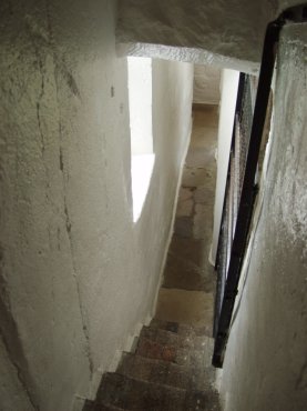
The church tower is open to the public most days so we couldn’t resist a visit to the top to look at the views. One does have to squeeze along this little passage to get there and it is as narrow as it looks.

The tower is divided into three stages. The first is where the bellringers do their stuff and is also where the mechanism of the tower clock is housed. This mechanism is the oldest clock mechanism in the country and dates from 1561.

The next stage is the bell chamber itself where the bells are hung. We chanced to be looking at the bells at two o’clock when suddenly there was an almighty BOOOONNGGG followed soon after by another. One of these bells is used to strike the hours and if you are not expecting it it will take you by surprise. It is very, VERY LOUD!!!! The views from the top were worth having one’s ear drums rattled though.

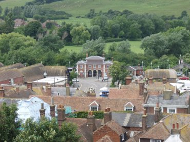
The rather grand looking building in the centre of the picture is Rye Station.

Rye used to be on the coast and town sits on the edge of the old sea cliffs although the sea has now retreated 2 miles. Makes a change from the coast being rapidly eroded.

We had a lovely and interesting time in Rye and I shall now start preparing the pages for the main web site. I don’t know when they’ll appear as there is a lot to write about.

Everything comes to him who waits.