Browsed by
Tag: Churches

Sun, Signals and Sabrina

Sun, Signals and Sabrina

We have been to Shrewsbury twice before and I have blogged both trips as you may remember. On each of those occasions it was cloudy but today was forecast to be sunny intervals. We have experienced forecasts like that before where we have two minutes of sun followed by two hours of cloud so we weren't hopeful but decided to risk it. So we started off on our third trip to Shrewsbury on the train and it turned out to be third time lucky.

I have shown you pictures of our little one carriage train before, but from the outside, so here's a picture of the inside.

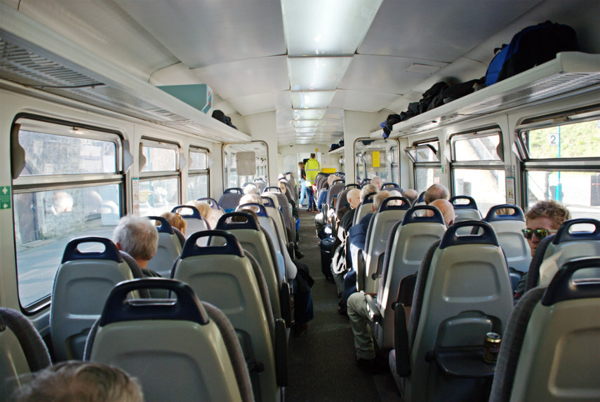
You may notice that it is very popular, especially at this time of year as between 1st October and 31st March old people like us who have bus passes may travel free. This covers the whole line from Swansea in the south to Shrewsbury in the north; a total trip of around four hours. Our part of the trip from Knighton to Shrewsbury is only 50 minutes.

This is a picture of the signal box outside Shrewsbury Station. I took it from the train as we flashed past inasmuch as our little train can flash past anything. "But wait", I hear you cry, "why are you showing us pictures of a signal box.? We don't want to see pictures of signal boxes." Well, you do, but you just don't realise it yet.

This signal box was built in 1903 and is the largest mechanical signal box in the world which is still working. There, you can't fail to be impressed by that can you? When I first saw it I thought it was big but I didn't think it was THAT big.

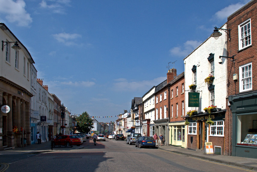
We emerged from the station into a sunny Shrewsbury and headed south east along Castle Gates. We hadn't gone far when we realised that we had just passed some some steps and we thought 'I wonder where they go?'. Well we had to find out didn't we? The steps led us up to a higher level walkway and I spotted this view.

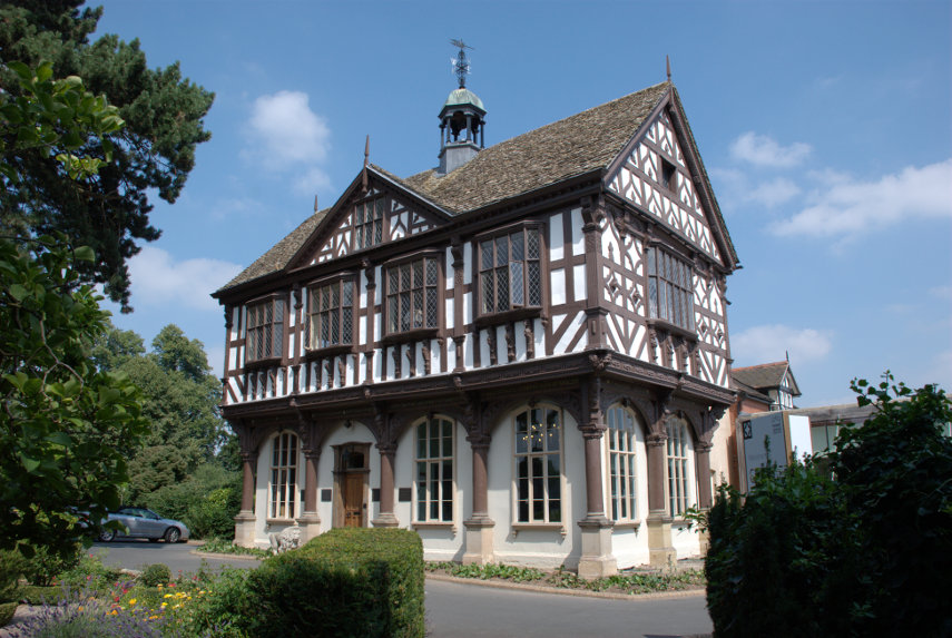
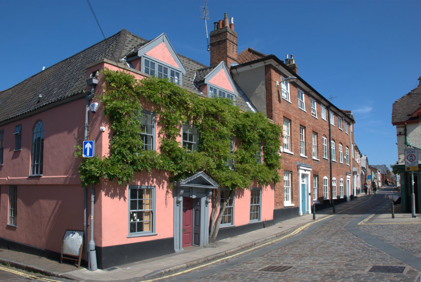
What do you think that building is? A stately home, a museum perhaps or even a prison. Nope! None of those. It is, in fact, Shrewsbury Railway Station. Quite impressive for a railway station eh? Built in 1848 it is now designated a grade II listed building.

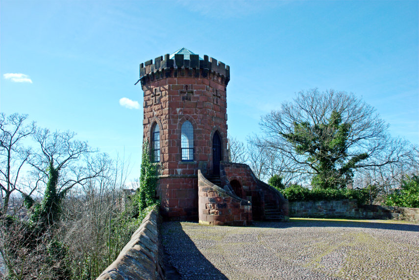
We went back down the steps and after a short walk entered Shrewsbury Castle grounds. Bearing right along a path which was sloping upward we eventually arrived here at the top of a knoll. This is Laura's Tower built by Thomas Telford, in 1790, for Laura, the daughter of Sir William Pulteney, as a summer house.

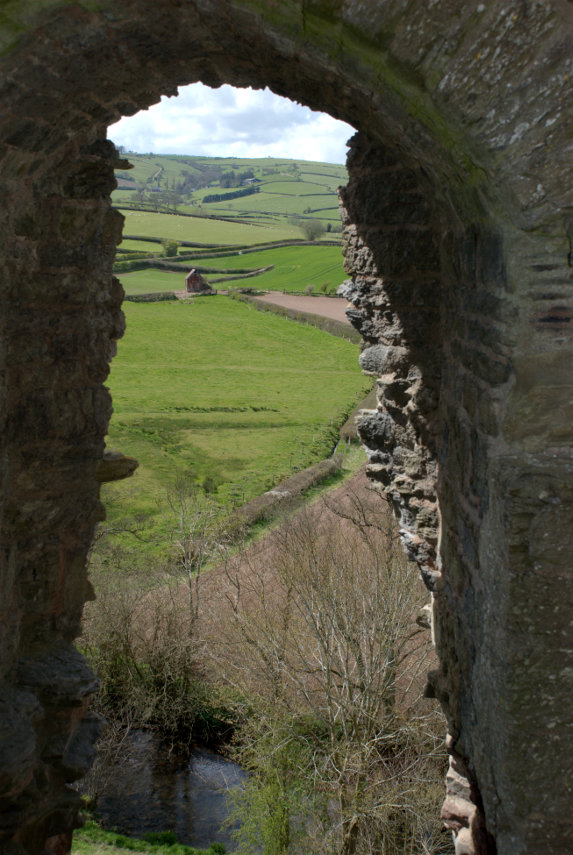
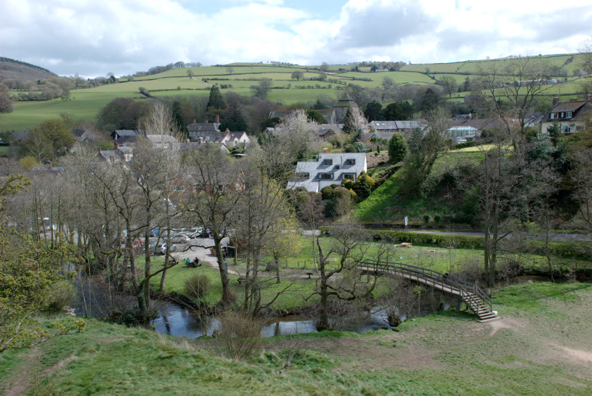
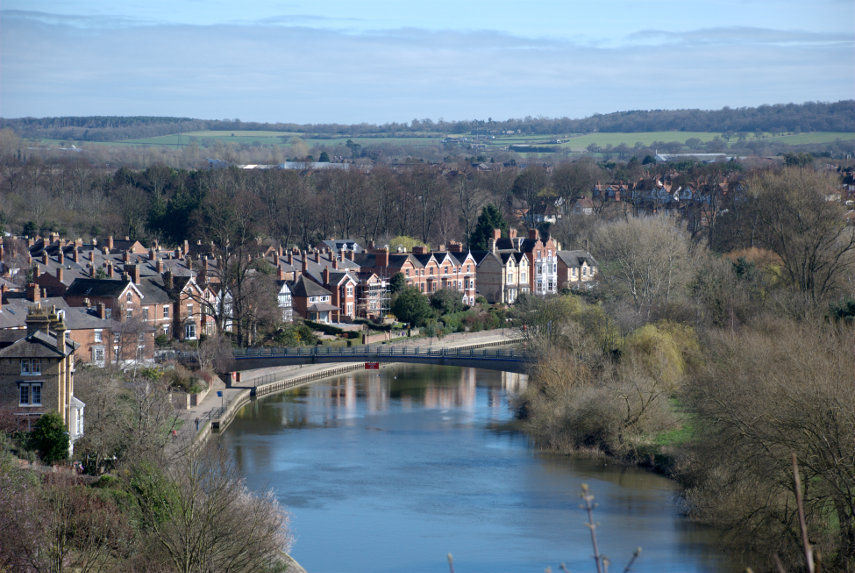
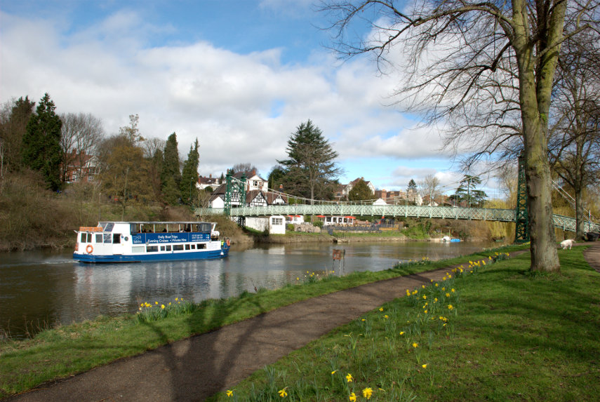
There are some impressive views to be had from the top of this knoll although some of them are obscured by trees. Luckily for us it was March and there were no leaves on the trees so we had some lovely clear views such as this one along the River Severn. Incidentally the steps and walkway we decided to follow earlier would have taken us across that footbridge but we didn't want to spend time going that far today.

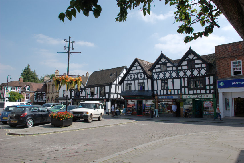
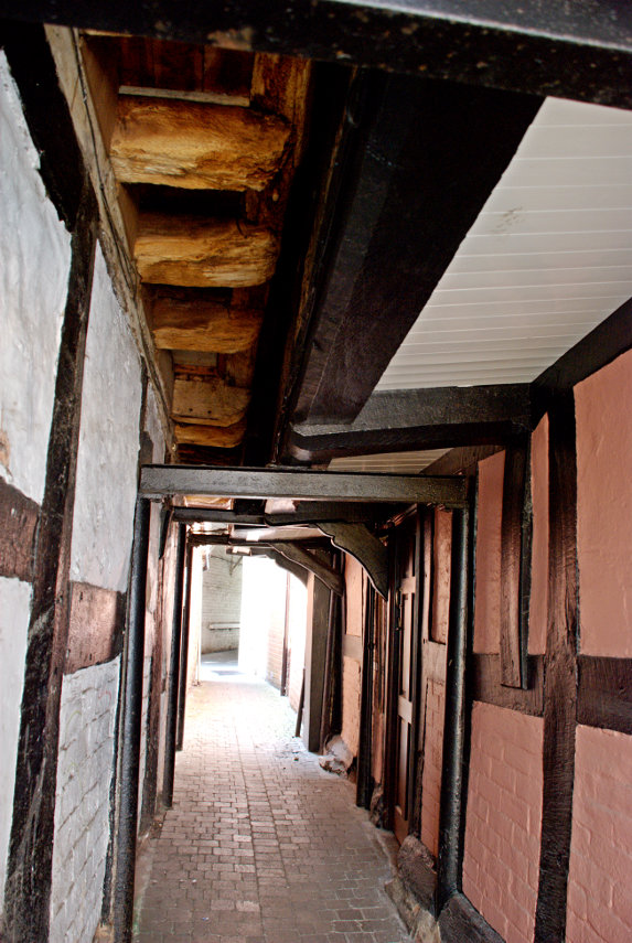
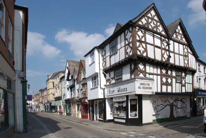
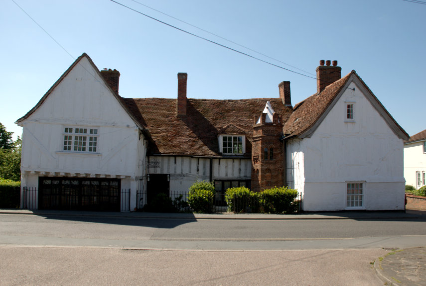
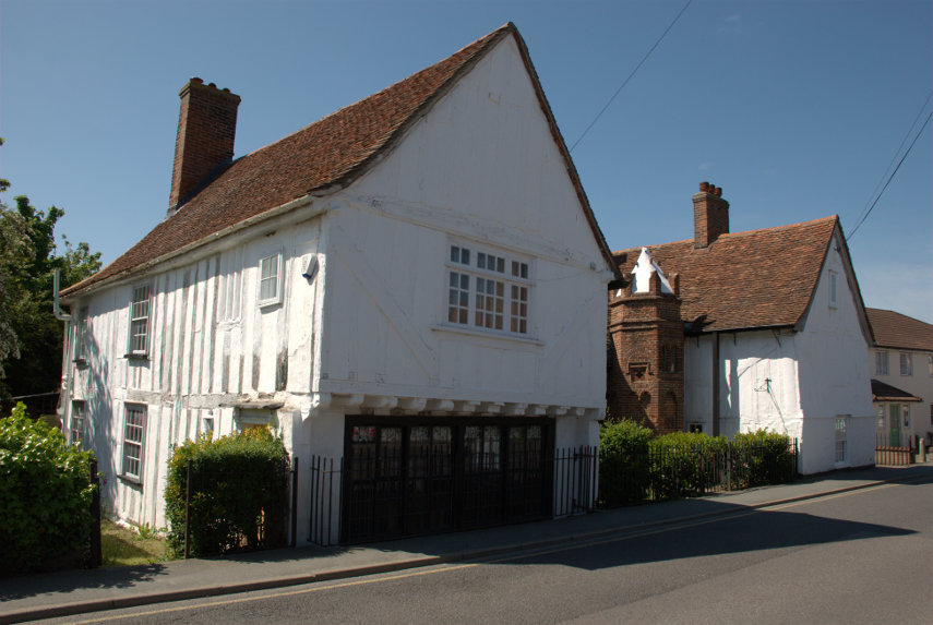
After a surfeit of views over the town we went back down to ground level and continued our walk through the town along Castle Street then Pride Hill where we turned into Butcher Row and saw this fine timber-framed building.

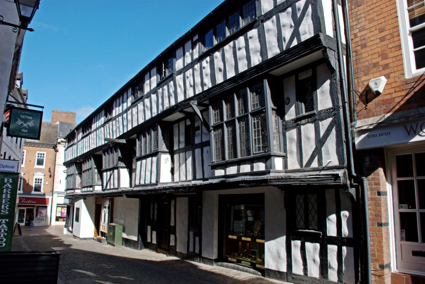
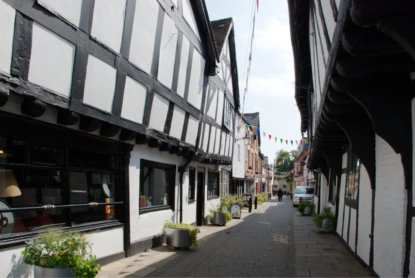
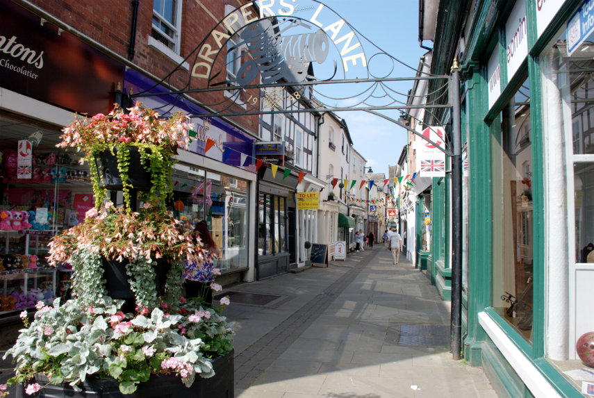
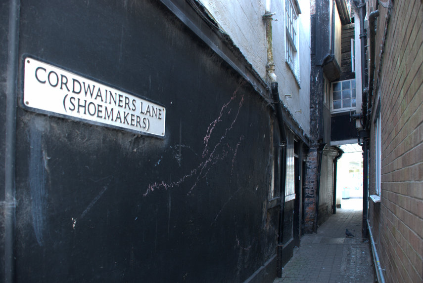
The timber-framed building shown below is at the south-east end of Butcher Row and on the corner of Fish Street which runs across the top of Grope Lane which I have mentioned in previous posts. This particular building still has its original frontage with the deep window sills on which the merchants would have displayed their wares.

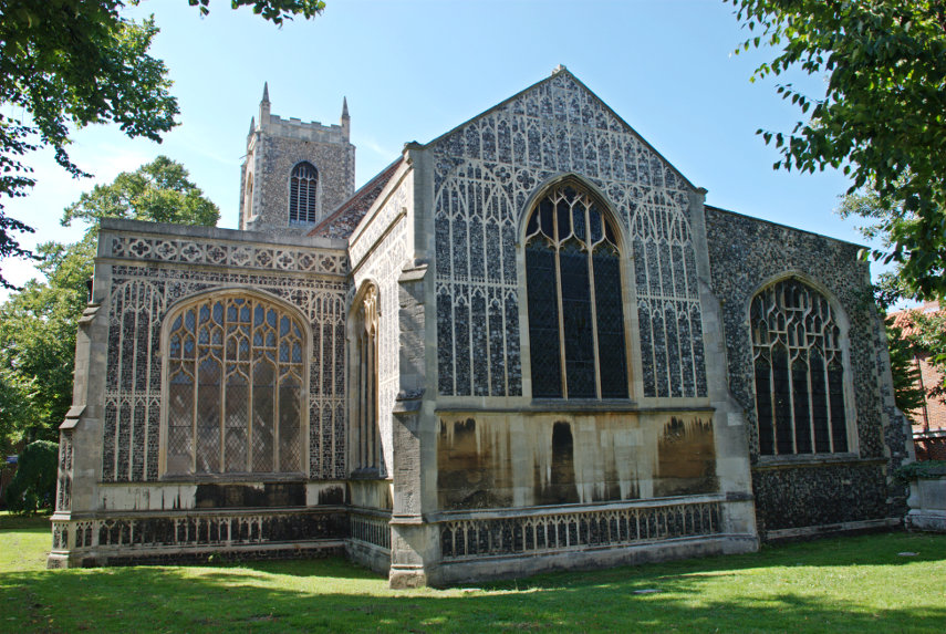
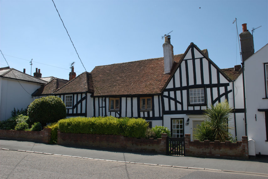
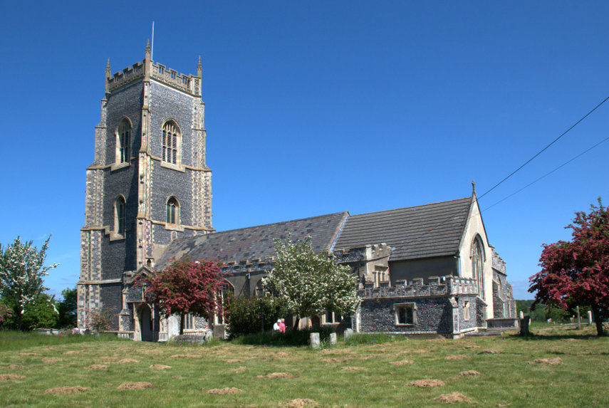
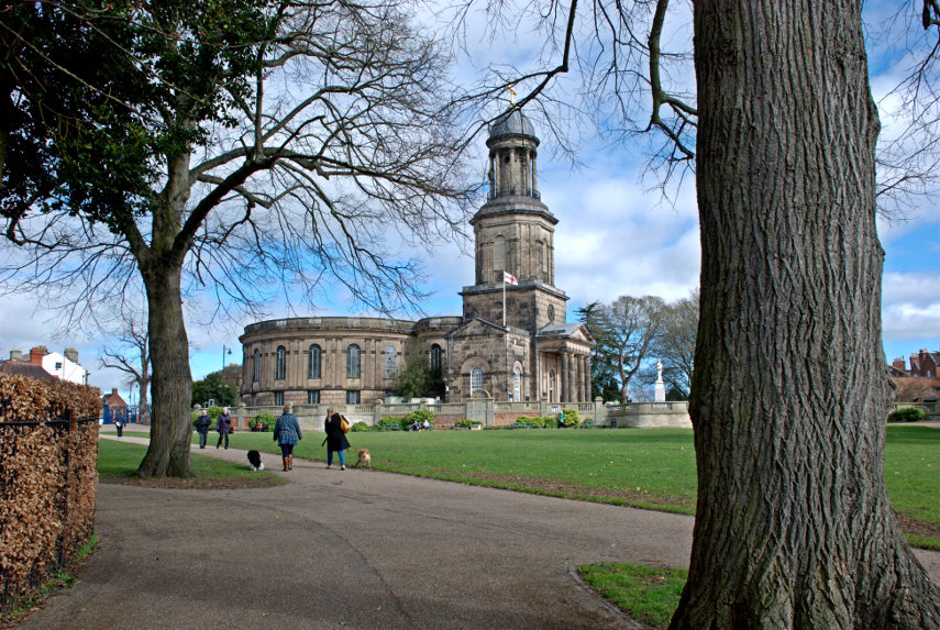
We went back along Butcher Row and turned left along Pride Hill heading south-west. We eventually reached St. Chad's Terrace where we found (you've guesssed it) St. Chad's Church. Built in the 1700s, so not that old, but quite an impressive and unusual church. It created a stir at the time because it had a circular nave. 

I was hoping to get a photograph of Ebeneezer Scrooge's gravestone in the churchyard but we couldn't find it. Yes we know that Scrooge was a fictional character but the churchyard was used in the making of the film and the gravestone was left when filming was finished. It is still there somewhere.

The circular nave is unique, with pews arranged like a maze and Charles Darwin was baptised in St Chad’s Church.

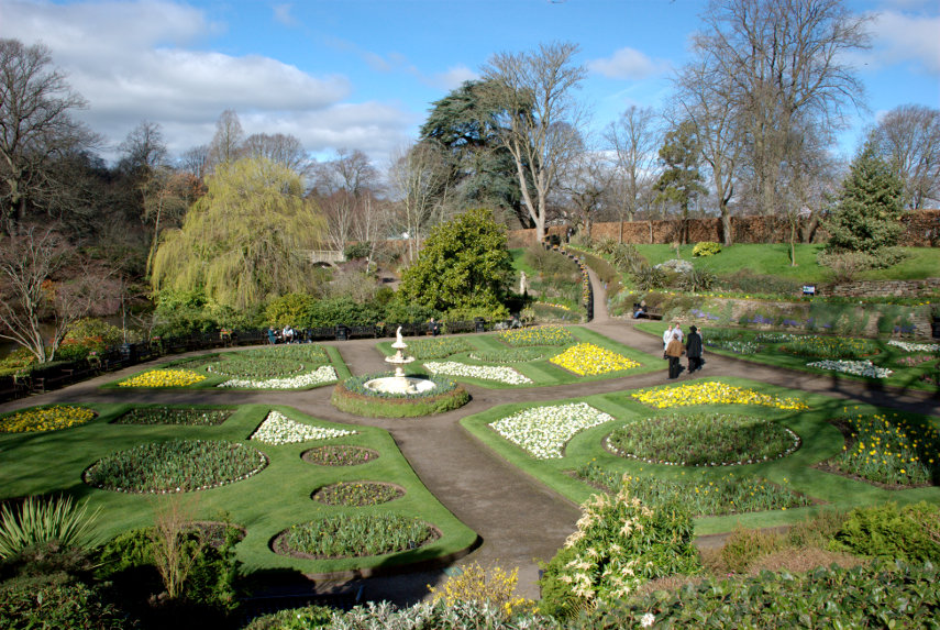
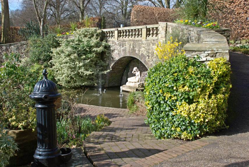
Just across the road is the Quarry park which incorporates the Dingle. Dingle, apparently, is another name for a Dell. Either way it's a very attractive garden and there were plenty of blooms in spite of it being the middle of March.

This view shows St. Chad's Church, with its very tall tower, in the background.

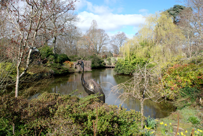
This statue of Sabrina was created in 1846 by Peter Hollins of Birmingham for the Earl of Bradford. A folk etymology developed, deriving the name from a mythical story of a nymph, Sabrina, who drowned in the River Severn nearby and Sabrina is also the goddess of the River Severn in Celtic mythology.

That, however, is not the only Sabrina, as there is a boat called Sabrina which takes visitors for a cruise around Shrewsbury on the river. It was very convenient that it happened to come along as I was photographing the river.

After our last two visits Amanda wasn't particularly enamoured of Shrewsbury but she says now that she is really beginning to like it. We are, of course, planning to come again in the warmer weather when the leaves are on the trees.

We caught the train back home where we arrived without incident.

I suppose that that was our first 'proper' trip of the year. More trips to come I hope.

Up and Down and Round and About.

Up and Down and Round and About.

Two for the price of one! You lucky people!

Work on the house is still progressing satisfactorily and this coming week will be a significant stage as the scaffolding around the house is coming down. smilies

We are, however, still managing to make a few trips and this time we did a half day walk followed a day later by a trip to Leominster ( pronounced Lemster ).

Trip 1. (Powys)

We walked from the top of Panpunton Hill at Knighton along the ridge to Cwm Sanaham Hill near Knucklas. We have walked up Panpunton Hill before and I even took a photograph of Knucklas Viaduct from the top but we didn't get anywhere near Cwm Sanaham Hill that time.

It was a fine warm day, which is unusual this summer smilies, and we set off towards Cwm Sanaham Hill with Amanda in the lead; quite a bit in the lead actually (that's her on the skyline).

You can see that there is plenty of Gorse in flower at this time of year and you should be able to see that we are still going up. Then we get our first sighting of Cwm Sanaham Hill; the one dead ahead.

As we cross another path we can see Knucklas down below and if you look carefully you should be able to see the railway viaduct.

Cwm Sanaham Hill is getting nearer and, on the extreme right of the next picture, you can see our path curving round the edge of the trees just below the horizon.

We have been following undulating ground all the way along this route but this is the final undulation. We are now going downhill into a small valley and then we start our final climb along the path which passes just below the trees on the left.

We finally reach the summit to be rewarded with some tremendous views and Amanda tries to stop the trigonometry point from falling over.

We didn't stop here for long as we were soon accosted by a big buzzy fly which we suspected was some sort of biting fly looking for a free meal and we didn't intend to supply it. So with much wild waving of arms we descended below the summit and, luckily, the fly didn't follow.

I took this photograph just below the top looking homeward as we set off back. The total distance travelled out and back was 4 miles and for most of that time the only sounds were sheep bleating in the distance and the breeze rustling in the trees. Wonderful!

We returned home without incident.

Trip 2. (Herefordshire)

We weren't able to go out the following day (building work y'know) but the day after we set off in the car to Leominster which is just under 30 miles from us. We hadn't been there before so we were looking forward to exploring.

The weather forecast for today was sunny and clear skies. There was, of course, about 80% cloud cover and little sun when we arrived and it stayed like that until the afternoon when the amount of sun did increase.

Our nearest point of interest was the church so we went there first. The church was once part of Leominster Priory, which no longer exists, and it was huge. There were three naves the earliest of which was Norman but there was also an interesting object now stored in the church.


Although the church was Norman and was very large it didn't really have much of interest although the roof over the earliest of the three Naves was nicely decorated.

I didn't take any photographs of the exterior of the church because of the lack of sun and because we will go to Leominster again hopefully on a better day.

By this time it was actually getting near lunchtime so we found somewhere for lunch and after lunch, when the sun appeared, we wandered off to see Grange Court.

Built in 1633 it is the last surviving market house, built by John Abel a local master carpenter, which originally stood at the top of Broad Street and housed the weekly butter market, selling chickens, eggs, and butter. It was then known as the Butter Crosse.

By the mid nineteenth century the market hall was proving to be a traffic hazard so the building was dismantled and lay in pieces in a builder's yard until 1859 when the building was bought and then rebuilt on the park known as the Grange.

This is Broad Street.

Although it is perhaps wider than usual it's not that wide and I'm sure a building like Grange Court plonked in the middle of the road would have been a significant traffic hazard.

This view of Corn Street which is like a little square shows where we had our lunch in the Merchant's House. The Merchant's House is the black and white timber-framed house on the left-hand edge of the picture.

There is an alley running down the left-hand side of the Merchant's House which leads to Grange Court and in the centre of the picture you should be able to see a small gap in the buildings which is the entrance to a little lane called School Lane. This is School Lane:

Another nice little lane is Drapers Lane.

There were also a number of alleyways of which these are two:


We'll leave you with this view of High Street.

As I said above we will be back for further explorations.
 

The quietest place under the sun

The quietest place under the sun

Clunton and Clunbury,
Clungunford and Clun,
Are the quietest places
Under the sun.

 (A. E. Houseman)

Of those four places, mentioned by A E Houseman in his poem, we visited Clun.

On our outward journey we didn't actually stop in Clun but drove straight through to Clunton where we turned north past Radnor Wood and Steppleknoll to Sunnyhill. We parked our car in a free car park provided by the Forestry Commission which was very handy otherwise we couldn't have stopped because the lane was so narrow (one car's width). We set off up the track where Sunnyhill didn't live up to its name – it started raining. smilies

Luckily the rain didn't last long and we started to see some sunny spells although the wind was still cold. After a short walk we arrived at Bury Ditches.

Bury Ditches is a British Iron Age Hill Fort dating from about 500 BC and one of the best preserved in the country. In the picture above Amanda is standing on one of the banks with a ditch to the left and another bank to the left of the ditch with another figure on the top. The main area enclosed by the defences is to the right.

You may notice that the views from up here are pretty spectacular.


This is how the fortified village would have looked when it was in use.

Having had a thorough look round we went back to the car and headed back to Clun.

Clun is a small, attractive market town in Shropshire just over 7 miles from us. This photograph shows the Market Hall and the square beyond.

The 2011 census recorded a population of 680 and research by the Campaign for the Protection of Rural England suggests that Clun is one of the most tranquil locations in England.

We arrived at lunchtime and liked the look of the Maltings Cafe next to the Sun Inn. So, based on that, we went in. It was a good decision. They had an amazing range of food for a small cafe and the food turned out to be excellent. We would recommend it without hesitation.

After lunch it was back to the hard work of looking round. We wandered along one of the narrow back streets looking at the old buildings and liked what we saw.

At the end of this lane we stumbled on the Hospital of the Holy and Undivided Trinity which is a well preserved example of courtyard-plan almshouses. This was founded in 1607 and in this case the term 'Hospital' is another name for 'Almshouses'. The pretty gardens and the chapel are open to the public but the inner courtyard is not. We had a look at the garden and the chapel.


A rather attractive and peaceful garden. Clun is not exactly a bustling metropolis and this is right on the outer edge of this quiet town so it was, well, very quiet.

Back towards the 'town centre' we started looking for the castle ruins. We knew Clun had a castle so all we had to do was find it. I remembered that it overlooked the river and we knew where the river was so we headed in that direction. We spotted some pinnacles of wall ruins and soon found the castle.

It has to be said that there isn't much of it left; the largest part being the remains of the Keep but up close that Keep looks fairly impressive. The whole thing was built on a grassy knoll high above the town and the surrounding countryside.


You can just see a small part of the river way below at the bottom of the top picture. All we have to do now is find our way down to that river and cross it. We walked across the top of the motte and were rewarded with this view.

That bridge is our way across so we scrambled down and it was pretty steep in places. There is the main road bridge, of course, but that route would have been slightly more circuitous. You can probably see the car park, which is free, and entry to the castle is free. However, having got down there, we walked towards the main bridge because I wanted to photograph it. It is an old packhorse bridge built in 1450.


It's not very wide as you can probably see (it was built for packhorses) but it is one vehicle's width so traffic can, and does, use it.

Our final destination was the church. The oldest part of the building appears to be the tower which was built around 1200 AD. The Nave is 12th century; the Chancel is actually 19th century.


That is a pretty impressive 14th century roof.

We were both feeling a bit tired by now so decided to call it a day and headed for home. The weather could have been better, but wasn't, and in any case it's only 7 miles from home so we can, and probably will, come back to Clun any time we like. smilies


Is there Much Wenlock?

Is there Much Wenlock?

Is there Much Wenlock? There is actually Little Wenlock!

Confused? I'll explain. Little Wenlock is a village, a little south of the town of Wellington in Shropshire, and Much Wenlock is a small market town also in Shropshire. The 'Much' part indicates that it is larger than Little Wenlock. We stayed in Much Wenlock for three nights at the Talbot Inn in High Street. High Street is only one vehicle wide which may give you an idea of the size of the place.

It is a nice little inn with a courtyard accessed through the arch.


The accommodation was basic but comfortable with the bedroom and bathroom ensuite and the food was good.

Immediately opposite the Talbot Inn was Raynald's Mansion dating from the early 1400s. A very impressive building but privately owned and not open to the public.

Near the end of High Street is The George pub and next to that is an alley.

An alley in the Shropshire dialect is a 'shut'. The name, apparently, comes from old english.

Opposite the far end of High Street in Wilmore Street is the 16th century Guildhall another impressive timber-framed building with an interesting interior. The Guildhall is open to the public between April and October on Friday, Saturday, Sunday and Monday.


A little further along Wilmore Street is the church built in 1150 by the Cluniac monks of Wenlock Priory.

A little further along the same road we found this rather interesting old police station. Victorian I imagine.

The following day we drove to Church Stretton and into Carding Mill Valley owned by the National Trust. This valley forms part of the Long Mynd which is a heath and moorland plateau and is, itself, part of the Shropshire Hills. The Long Mynd geology is mostly Pre-Cambrian and the high ground is designated as an Area of Outstanding Natural Beauty.

I realised at this point that I had left my camera back at the inn. Bother! (or something like that). So for this walk I had to use my smartphone camera.

We set off walking up the valley alongside the small stream.


You may have noticed that there is plenty of heather about. We reached the Lightspout Waterfall which may be  only 12 feet high but attractive nevertheless.

I'm sorry about the strange lady but she just wouldn't get out of the way. At this point we decided that we'd had enough and went back the same way to the car. Driving back to Much Wenlock we stopped en-route to try and get a view from Wenlock Edge.

It was tricky finding a place where trees were not completely obscuring the view and that was the best that we could do.

The following day we went to Ludlow where we've been twice before and there are plenty of pictures of that town already on the web site so I didn't take any more especially as it was dull and cloudy.

From Ludlow we went to Bishops Castle; a little town near the Welsh border and this time I remembered to take my camera.


It was a nice little town but we felt that it had an odd atmosphere. We later decided it was because there were so few people around. I don't know why that would have been as there were plenty of shops and it was only late afternoon. Perhaps they had wind of our visit.

The following, and last, day we went to Shrewsbury on the bus. This is Shropshire's county town and I had been here once before about 60 years ago but could remember nothing about it and Amanda had not been here before.

We both liked Shrewsbury and it had plenty of interesting buildings, many of them timber-framed, and many interesting streets. We got off the bus in the Square right near the Old Market Hall (Elizabethan); the stone building on the left in the next photograph.

This next view is a short way from the bus stop.

Shrewsbury has plenty of narrow alleyways or 'shuts' as they are known in the local dialect although in the last of these three pictures the alley is labelled 'Compasses Passage'. I suppose that alley may have been built or renamed at a date when the term 'shut' had fallen into disuse.


Those steps in the corner of the next picture are Bear Steps named supposedly after a pub called The Bear which no longer exists. These steps take you through the 15th century building, part of which is visible to the left of the steps, and into St Alkmund's Place shown in the second picture below.


The next photograph is Henry Tudor House, in Barracks Passage, built in the early 15th century.

We walked to Shrewsbury Castle and had a brief look from the outside. The original castle was Norman but very little of that remains and the current building, in red sandstone, looks much more modern so we didn't go in.

However we did see this lovely timber-framed building by the castle entrance but I haven't been able to find out anything about it.

Shrewsbury was our last day so after returning to Much Wenlock for the night we travelled back home, without incident, the next day.


mTicket to Ride

mTicket to Ride

No, it isn't a typographic error it's meant to be 'mticket'.

I discovered something rather useful recently. It is that we can buy railway tickets on our railway line via a mobile phone and after paying for them they are then downloaded and stored on the mobile 'phone. These tickets can then be shown on the phone's screen to anyone who may need to see them. We then don't need to visit the ticket office or get tickets from a machine. So I decided to try it.

It has been a long time since we have been on any sort of trip which was because either the weather was bad or because domestic commitments got in the way. For example we have just had the outside of our house painted which was quite a long job but we now seem to be clear of domestic tasks so we were just waiting for a sunny day.

The weather forecasts don't help. A few days ago the weather forecast for Saturday was sunny all day. Then it changed to some sun and some sunny spells. Then it changed again to mainly sunny spells plus the chance of some showers in the afternoon. Then on Friday the forecast for Saturday was mostly sun so we took the chance.

We don't like generally travelling on a weekend because that's when everybody else does but this time the weather dictated when we travelled so on Friday I bought two mtickets and on Saturday 22nd August we caught a train to Norwich for the day.

It cost us less to travel to Norwich than it does to London even though Norwich is a bit further. We boarded a train at our one horse local station, where we have never had to show our tickets, and got off two stops later at Colchester where we caught the London to Norwich train. We were doing quite well until we were just south of Diss where the train slowed down and stopped. Signals I thought but then an announcement was made to the effect that there was a fault on the locomotive. It said that the driver was in contact with the service department and they were hoping to fix the fault within 15 minutes.

About 12 minutes later the train began to move – phew – and we eventually arrived in Norwich about 12 minutes late. I was expecting to show our mtickets on the train at some stage but, no, nobody wanted to see them. I did, however have to show them at the station barrier.

We caught a No. 26 bus in the station forecourt which took us to the Roman Catholic Cathedral. I bet you didn't know that Norwich has two cathedrals did you? This cathedral is no where near as old as the Anglican Cathedral, having been built in the late 1800s, but it is still a very impressive cathedral. When we were in Norwich last, 9 years ago, I did take one photograph of the outside but didn't have time to do any more.

This is another outside view that I took this time from the Cathedral Garden.

We went into their visitor centre, called the Narthex, where we encountered our first dragon. From 21st June until 5th September there are 184 dragons scattered around Norwich which they call an 'Art Sculpture trail'.

We were very kindly given a cathedral tour by one of the Deacons who retired a short while ago but who still obviously loves 'his' cathedral. It was a very interesting tour and we learned a lot that we would not have otherwise known about.

This shows the view along the Nave towards the East End.

There are lots of individual stone sculptures at the base of the pillars, at the top of the pillars and above them showing a great variety of forms and shapes. This is one on the base of a pillar.

This next photograph was taken from the East End looking under the crossing and along the Nave and the one after shows the Crossing.


We finished up having a cup of tea/coffee and a sausage roll in the cathedral refectory and, I must say, their sausage rolls are particularly nice; cooked that day I was told. They do have other food here which I suspect is just as good so if you want a light lunch this is the place to go.

We left the cathedral and decided a quick visit to the Plantation Garden was in order. We photographed it thoroughly last time but the weather was decidedly better this trip and I took another couple of photographs.


If you look, in the second picture, just above the steps on the left you will see Amanda sitting behind the bench under the tree playing her part as an 'extra'.

We made our way back onto the streets of Norwich and headed for the river. In doing so we crossed Pottergate.

Norwich really does have some nice streets. We wound our way through numerous narrow back streets to the river bridge which took us north of the river; an area which we hadn't visited before. Our first point of interest was the 16th century Church of St. Michael Coslany at the junction of Oak Street and Colegate.

It was locked so we weren't able to go inside but it was yet another building with some fine flushwork.

We saw a number of churches which I won't picture or describe here but we finished at St. Georges back in Colegate where we found another dragon.

The view of the church from the eastern part of Colgate was rather nice together with that very attractive timber-framed building which was built by Henry Bacon who became sheriff of Norwich in 1548.


We continued along Colegate and turned right into Fye Bridge Street and along to the River Wensum. Over the bridge we found two more dragons.


We then turned left along Quay Side and thence onto the riverside walk. From there we went a short distance to the church of St. Martin at Palace Plain where I left Amanda to rest whilst I crossed back over the river and found yet another dragon.

I walked along the north bank of the river on the riverside path to try and get a photograph of Cow Tower across the river. When we were last in Norwich I took some photographs of Cow Tower from the same side of the river as the tower and now I have it surrounded.

I walked back to the churchyard to find Amanda and there she was with a 'friend'. It was a Sparrow Hawk which had killed a pigeon and was eating it on the grass a short distance away. When I arrived it stopped eating and glared at me but didn't move away.

After watching it for a while we both moved slowly away and it remained, apparently, undisturbed. We headed back to Quay Side along to Wensum Street then right into Elm Hill. This is Elm Hill.

A well preserved medieval street. Looking in the opposite direction we can see the Britons Arms, the white building, where we are hoping to get afternoon tea.

Amanda had Darjeeling Tea, I had coffee and we both had Raspberry, Cream and Hazelnut Meringue Roulades which were the size of tea plates. On our last visit to Norwich we had lunch here and we both had their home-made pork pie. You just cannot get better anywhere.

After our late afternoon blowout we caught a bus nearby down to the railway station and caught the train home.

A good day.

P.S. Apparently the temperature around our tea time was in the low eighties – too hot. smilies

Dial-a-ferry

Dial-a-ferry

Six weeks ago to the day we were going to do this very trip but I had a heart attack instead so it had to be cancelled. However no heart attack this time so we left home to do the short drive (10 miles) to East Mersea. You have probably not heard of East Mersea which is not surprising as it is in the middle of nowhere and there is very little there except Salt Marsh, sand and water.

So why are we bothering? Well we don't intend to spend the day at East Mersea as we are going to call the foot ferry which will take us across the water to Brightlingsea. You've probably not heard of Brightlingsea either but never mind.

We parked our car and walked down the footpath to the river wall and this is the view from that river wall.

Across the other side of the River Colne is Brightlingsea. We need to get onto that sandy spit this side because that is where the foot ferry lands. We had, by this time, telephoned  from my mobile phone for the ferry to come over from Brightlingsea to pick us up. The ferry runs a scheduled service from the middle of July to the end of August but outside of those times there is a scheduled service at weekends and bank holidays but during the week it has to be requested by telephone. It's rather novel really and something we have not done before so we had to give it a try.

We reached the beach easily enough although some of it was hard work in the very soft dry sand. One step forwards, half a step back, but we got there. Having reached the pick-up point we could see, in the distance, the ferry making its way toward us.

As it got nearer we could see that there were passengers on board who were obviously coming to East Mersea.

The bow of the ferry grounds on the beach and a small ramp is lowered to afford easy access. That funny woman in the red coat is apparently keen to get on board.

Well she did get on board and so did I and off we set. Warm, sunny and calm – just right. On the way across the boatman and I were discussing our heart attacks, as you do, and in a fairly short time we were nearing Brightlingsea Harbour.

It wasn't long before we were moored at the end of the harbour pontoon and we set off along the pontoon to reach land.


The first rather obvious building we noticed is this one. It used to be the Anchor Hotel but has now been converted to appartments. Dating from around 1901 it is a listed building although only just over a hundred years old. A very attractive building.

A little further along the street is this Cinque Ports Wreck House built around 1811. Interestingly there is another building in Sydney Street in Brightlingsea which is labelled "Cinque Ports Wreck Warehouse". I haven't been able to discover why there are two similarly named buildings.

Having walked from the harbour area into the centre of the town we found Jacobes Hall, reputedly the oldest timber-framed building in England, built during the fourteenth century. The people that lived in this house paid for the church to be built so they must have been pretty wealthy.


 A little further along the same road was another timber-framed hall house.

We wanted to visit the parish church next but it was on the outer edge of the town, about 1.5 miles from the centre, so we decided to go by bus. Built around 1250 this church is not easily missed with a tower not far short of 100 feet high and most of the building covered in flushwork which is extraordinary. In the recent blog post "Following the Stones" I mentioned the flushwork on Hall Place but this church puts it to shame. We have not seen so much flushwork on one building.


There is an unusual feature inside the church in the form of memorial tiles in a strip all round the church. There is one for each parishioner who lost their life at sea – 213 in all.


At this point we realised that we were only about half a mile from the Thorrington Tide Mill, built around 1831, so we decided to walk there. We followed the footpath on the side of the road and soon found the mill entrance. The public have access to the mill only in the afternoon of the last Sunday of each month and also bank holidays so we weren't able to go inside but we did have a good look around the outside.


A tide mill works from a large mill pond, shown in the first of the two pictures above, which is filled at high tide then closed off. After the tide level has dropped the sluice can be opened to let the water back out via the water wheel, shown in the second photograph above, which then drives the mill. Clever eh? We would like to see inside so perhaps we'll have to try and arrange a re-visit when it's open.

We now crossed the road to the bus stop and got the bus back to Brightlingsea but got off one stop before the town centre. This takes us a little closer to Bateman's Tower which we were planning to see next and after a short walk there it was.

That sandy point across the water is where we started this trip from.

Built in 1883 by John Bateman the tower was used as a folly for his daughter to recuperate from consumption; however it may have been intended as a lighthouse as part of a failed plan to expand the port.

You may notice that the horizon in the picture is level but that the tower is leaning so it's not the photographer's fault. It is said that its foundations were laid on bundles of faggots (brushwood) so the fact that it leans shouldn't come as a surprise.

We walked back, on the little promenade, to the harbour where we asked to be taken back to East Mersey on the ferry and thence home.


Leave a comment

Following the stones

Following the stones

We started today with a little trepidation because 4 weeks ago to the day we were also going on a day trip, although to a different destination, and immediately after finishing breakfast I had a heart attack and was carted off to hospital where I spent the next 4 days. It turned out to be a minor heart attack but it is, apparently, going to take 6 weeks to get back to normal (another 2 weeks to go from now).

We were not really expecting any problems today, and there weren't any, so we set off for the railway station.

We were headed for London, change at Stratford onto the DLR for Woolwich Arsenal then just two more stops on South-Eastern Trains to Abbey Wood Station. A short walk and here we are. But where exactly?

This is Lesnes Abbey Woods in the London Borough of Bexley just two miles south of the River Thames at Cross Ness or two and a half miles east of Woolwich Ferry. In the picture above the pointed skyscraper of Canary Wharf is visible near the centre line of the image with the top of the Shard showing more to the left.

The ruins at the bottom of the picture above is one of the features we've come to see. The abbey was built during the 12th century and  the first inmates probably came from the Holy Trinity Priory in Aldgate.

Although there is not a lot of structure left above ground the ruins are quite extensive. The area below was obviously the abbey church showing the bases of the columns in the church nave and the second picture shows its position relative to the other parts.


There are some parts with a significant amount showing above ground as shown here.


The inhabitants were known as Augustinians or Black Cannons and they used to meet every day in the Chapter House to discuss the business of the day and here Amanda is trying to pretend to be one of the  Cannons sitting on the bench. She doesn't seem to have much of an audience (perhaps they were warned that we were coming). smilies

It is interesting to speculate how they aquired, and organised the delivery of, all the stone needed for such a large building especially as there is no stone like it locally. The River Thames, as I said previously, is 2 miles away so the stone could have been delivered by sea – but from where? How would they have contacted the people who could supply the stone.

The abbey ruins are situated next to a wood which we wanted to explore next. Just bear in mind that it isn't flat around here and you will, like us, be going up and down some hills but the wood is really lovely and covers some 217 acres.


We were also looking for some geological deposits known as the Blackheath beds which are very fossiliferous and which I visited about 55 years ago. They were easy to find then, I have the fossils to prove it, but we couldn't find them this time. That was a little disappointing but I'd like to try again sometime.

The abbey was demolished around 1525, partly because of the dissolution of the monastaries by Henry VIII and partly because it was then already in a rather neglected state, and some of the stone was used to build Hall Place (Tudor) about 3 miles away measured in a straight line. We decided to follow the stones to Hall Place and so jumped on a number 229 bus which would take us very near Hall Place. The journey took around 50 minutes because the bus goes a rather long way round but it does make the journey simple.

The walk from the bus stop to Hall Place, which is still in the London Borough of Bexley, was quite short and we had our first glimpse of Hall Place from the road.

It certainly looked interesting so we hurried round to the entrance. Entry to the grounds is free and there is a lot to see but to go into the house requires an entrance fee of £8 per adult, £6 pounds for oldies (us) and a further discount of 50% for National Trust members (also us) so we paid £3 each for the house. If you have a National Art Pass from the ArtFund then entry to the house is free.

However it was now lunchtime so before we got to the house we found their cafe by the River Cray and had some lunch. I had seen some reviews of the cafe on the internet and they tended to be rather disappointing so we were not expecting much. However things must have improved as my soup and bread roll was really tasty and Amanda's bacon sandwich, she said, was exceptionally good. We also had no complaints about our coffee and tea. We sat outside on the river terrace and could watch the ducks and geese swiming about including Mrs Canada Goose and family.


After lunch we crossed the river over the bridge next to the cafe to see the Rock Gardens and it was certainly worth the short walk. You can see the house, with the cafe this side of it, in the second picture which will give an idea of distance.

There was a great variety of plants including some that were of particular interest to Amanda and lots of different colours which made a really attractive display.


Back across the river we turned away from the house towards the greenhouses where we found a large conservatory which was free entry so we went in. There was a rectangular path with the centre taken up with a pond surrounded by lush vegetaion and around the outside of the path were benches covered in various plants, flowers and cactuses.


We then made our way towards the western end of the grounds which had some beautiful areas of parkland together with lots of colour from numerous Azaleas which are in bloom at this time of year.


Walking towards the colour we were soon to realise just how many Azalea blossoms and colours there were and these pictures show just a few.


There was another bridge here over the river which was partly festooned with Wisteria.

The only downside to this part of the grounds is the traffic noise from a very busy road nearby. We turned round here and started to head back towards the house passing through the 'Really Useful Garden' on the way. Yes, that really is the name. It appears to be a herb garden with, yes, really useful herbs and I must say the Box hedges look really neat.

Next we went into this garden with flower beds divided into compartments by rather neatly trimmed wavy hedges. We expected to walk out the far end but discovered that the way in was the only way out.

As we neared the house we encountered the Queen's Beasts – a set of ten brilliantly executed topiary heraldic animals which were planted to celebrate our current queen's coronation. They've grown into big beasts.

At the far end of the Queen's Beasts is this turret on the house demonstrating some pretty impressive flushwork.

In architecture  flushwork is the decorative combination of flint and stone on the same flat plane. Flushwork begins in the early 14th century, but the peak period was during the wool boom between about 1450 and the English Reformation of the 1520s. Flushwork, and flint architecture in general, is usually found in areas with no good local building stone. Although the labour cost of creating flushwork was high, it was still cheaper than importing the large quantity of stone necessary to build or face the entire structure. The dark squares are flint and the light squares are stone.

The same technique has been used on the front of the house to good effect.

We finally went in to this Tudor house built in 1537 although the brick part was added in the 17th century and started our visit in the Great Hall with the Minstrel's Gallery.

Just off the Great Hall is the Kitchen.

One of the other rooms has this ornate ceiling.

Hall Place is one of London's hidden gems and, in our opinion, one that shouldn't be missed. I'm surprised that it isn't better known but I'm glad it isn't. smilies

I am supposed to be taking things easily but I don't think that I did that today. Consequently by this time I was feeling tired and so was Amanda so we decided to call it a day. We caught a bus, from the same stop from which we alighted when we arrived, to Bexley Station and then a train to London Cannon Street and thence to Liverpool Street Station and home.