Browsed by
Tag: Geology

Cow Gap

Cow Gap

Day One

The weather forecast for the next 3 days was cloudy but dry. Well, we can handle that so off we went to Eastbourne. Why Eastbourne? We'll get to that later.

We decided to travel by train. We don't have to drive and we don't have to find somewhere to park (the hotel doesn't have its own car park) – can't be bad.

I looked at the train status on my smartphone and saw, with some dismay, that an empty train had derailed earlier and would be causing a delay on our journey. Bummer! smilies The delay was reported to be 20 minutes and we had 45 minutes to walk across to Stratford International Station to make the connection. We were going to Stratford International not because Eastbourne is considered to be exotic but because we can use the high-speed line to get to Ashford and thence a local train to Eastbourne. That delay would still leave us with 25 minutes for the change which should be plenty.

We caught our 'usual' train, which was on time, from our local station and although there was a small delay we arrived only 10 minutes later than planned leaving us oodles of time for the connection. Having alighted at Stratford, in Greater London, we walked across to the International Station with plenty of time to spare. The train arrived on time and 30 minutes later, after an uneventful journey, we arrived at Ashford in Kent.

The Eastbourne train was waiting in the platform and we were soon headed for Eastbourne where we arrived at around 12:40 and after a short walk we were at our hotel at lunchtime.

Driving time would have been about two and a half hours and the train journey, including waiting times, was 3 hours so not really much difference.

Having arrived at lunchtime we had a brilliant idea – we could have lunch and so we did. After lunch we wandered off towards the pier. The last time that we were on Eastbourne Pier the steps up to the Camera Obscura level were closed off and I was hoping we might be able to get up there this time but, no, the steps were closed off. That's two bummers in the same day. smilies

We didn't do a lot today and went back to our hotel to prepare for dinner. Tomorrow is the big day.

Day Two

After breakfast at about 9:30 AM we left the hotel and walked down to the seafront. This view is looking in the direction in which we are headed.

We followed the coast road westward until it reach the grass downland where it bends sharp right. We bent sharp left along a track going towards the cliffs. When we reached to edge of the cliffs we could see back to Eastbourne.

You may just be able to see the end of Eastbourne Pier sticking out beyond the promentary where the beach disappears from sight. The weather is better than forecast this morning but the sun is watery and it's not very clear. There is also a strong wind of about 15 mph gusting to 21 mph which we could do without. Looking in the opposite direction we can see our first target – the shore. Do you think that the sign is trying to tell us something?

You may notice that the shore is covered in rock fragments caused by erosion and we are planning to walk on that. smilies

We still have a way to walk along the top of the cliffs yet. We follow the footpath until we see a path forking off to the left and we follow that fork.

We start heading down. That shore looks nearer but it doesn't look any better. More steps to go down.

Can you read the name on the sign? It says 'Cow Gap'. 'Gap' around here is a point in the cliffs which is low enough for it to be practical to build some steps down to the shore. There aren't many gaps. We have visited the other two and have been waiting for an opportunity to visit this one so we've made it at last.

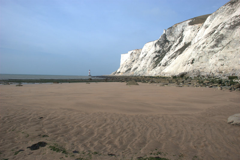
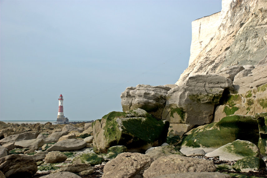
There is Amanda at the foot of the steps and we are now on the shore. Take a look at the shore because we are proposing to walk over a half mile on that. After a while of scrambling it was nice to reach some solid rock to walk on for a while and just showing at the foot of the cliffs on the horizon is our second target – Beachy Head Lighthouse.

We eventually ran out of solid rock but after yet more scrambling we came across a nice large patch of sand. Woo Hoo! That was a welcome relief.

Unfortunately that nice flat sand didn't last for long and we were back to scrambling once again. We did reach another relatively small area of flat rock but there was more loose rock ahead.

The next picture shows how the shore looked further on. That's not going to be easy to walk on.

That cliff on the right is Beachy Head. We realised at this point that we wouldn't make it to the lighthouse because the tide had now turned and was coming back in so this is as near as we got. smilies This is not a good place to be caught by the tide.

On the way back to Cow Gap we had a good look at the rocks and saw many old fossils. (Waits for obvious comments. smilies )


The pictures above, in order, starting from the top are:

Ammonite shell impression
Turitella type shellfish
Section of a Brain Coral
Section of a sponge

We also came across two plants which are typical of this environment.

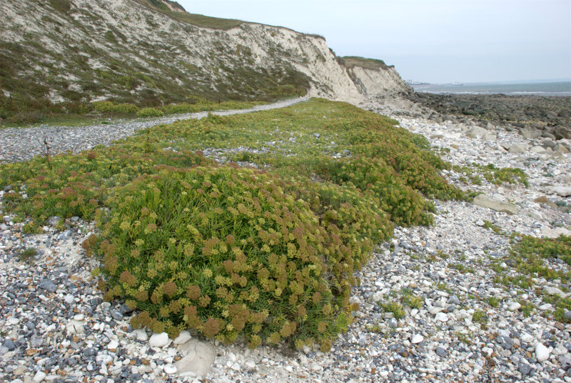
Sea Kale which looks rather like cabbage.

 and Rock Samphire which looks like, well, Rock Samphire.
On the way back to Eastbourne I managed to sneak up on this Speckled Wood butterfly.

We went back to our hotel to change and were out again in time for afternoon tea. Yum yum. Tomorrow I'm doing another walk and Amanda is going to a museum.

Day Three

Amanda decided after yesterday's walk that she didn't want to do more walking today so she is going to visit the 'How we lived then' museum, packed with nostalgic items from the past, and I am getting on the bus.

My bus, the number 126, leaves from a stop near the railway station at about 9:45 and I walk up to the stop with time to spare. Whilst I'm waiting a lady asks me if the 126 goes to Alfriston. I explain that I hope it does because that's where I'm planning to go. We share a seat on the bus and chat. It turns out that her name is Nicky (Nicola) and she is on holiday from Switzerland and someone here suggested that she would probably like visiting  Alfriston.

We arrive in Alfriston after about 30 minutes and she decides to join me on a visit to the Clergy House. Amanda and I have stayed in Alfriston before but were unable to visit the Clergy House because it opens only on some days and wasn't open when we were last there.

The Clergy House is a 14th-century Wealden hall-house and is owned by the National Trust. It was their first ever purchase in 1896 and cost the princely sum of £10.00.

This picture shows why it is called a hall-house.

It has a hall-like room which goes right up into the roof. Very impressive but, I would imagine, a devil to heat in the winter.

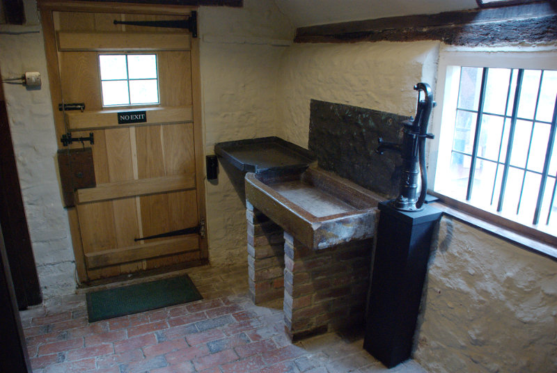
This shows the kitchen with all mod. cons. Well it does have a sink and water pump.

There were also some nice gardens.

Nicky was apparently going to spend the whole day looking around Alfriston so I said goodbye and made my way to the river.

Not much of a river I grant you; more like a stream at this point. However I plan on following the river down to Exceat where I hope to catch a bus back to Eastbourne so I set off.

I soon came across a group of locals having a meeting and there's one on the extreme right that's right on my path.

We shall see what she will do when I get closer. Well I walked close by her right-hand side and apart from a brief glance at me she got on with her eating. They must be used to seeing people.

I passed the little village of Littlington part of which is shown here. Pity the weather isn't better.

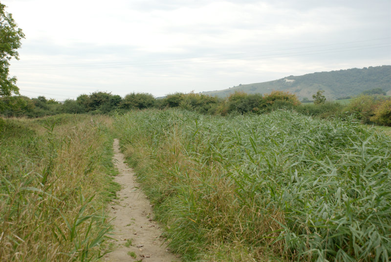
Soon after I passed littlington I had my first glimpse of the white horse, on High and Over, seen across the reeds on the edge of the river to the right.

A little further on and there is a better view of the river with the white horse beyond.

The banks of the river look muddy because the river is tidal at this point and the tide is low so the river level is down. Incidentally High and Over is the name of a hill between Alfriston and Seaford and is the hill directly ahead.

This is about as close as I got to the white horse then following the river takes me further away.


At one point I walked past these Canada Geese who seemed to be honking away most of the time. There were also some other white birds in the distance which I couldn't identify. They all sounded as though they were having a honking good time.

It didn't take much longer to get to the bus stop at Exceat and a little while later along came my bus back to Eastbourne.

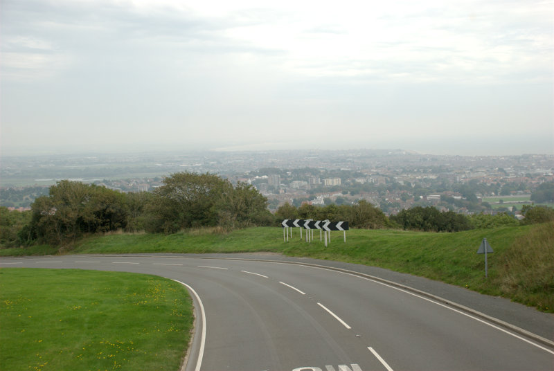
After an uneventful ride (front seat, top deck) we reached the top of the hill down to Eastbourne with a good view of the town laid out below. That probably would have looked nice in good weather.

I got off the bus at Eastbourne Station where Amanda was waiting for me with our luggage and we got the train back home. It was a short but enjoyable trip. We will probably be back.


Lynn – Day 3

Lynn – Day 3

Another day, another sunny morning.

Today we are going further north to the coast at Hunstanton known colloquially as 'Sunny Hunny'. It's about 40 years since I was there last and we are going once again to look at the cliffs. It was a straightforward, uneventful journey and we reached the old lighthouse in about 30 minutes. We went into the obvious, very large car park to find that the charges were approximately £1.80 per hour with a small reduction for longer stays. We turned round and left.

We drove along the road past the car park entrance and found space further down to park in the road at £0.00 per hour unrestricted. No contest really.

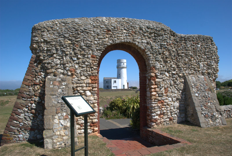
We were now going to walk back the way we came, along the top of the cliffs, until we can access the beach. A short way after leaving the car we came across the only remaining part of St. Edmund's Chapel built in 1272.

Hunstanton has long been associated with Sir Edmund who, as King of East Anglia, led a small army against the invading Vikings, was captured and, after refusing to give up his Christian faith, was tied to a tree and shot by Danish archers. Legend has it that when St Edmund first came from Saxony in AD855 he landed near Hunstanton cliffs.

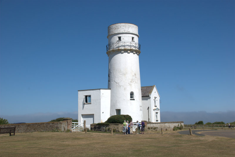
Then of course there's the old lighthouse.

There has been a Lighthouse here since 1665 which was built of wood with an iron basket of burning coals as a light. Hunstanton had the world's first parabolic reflector, built here in 1776, and the current lighthouse was built in 1840. There is no access inside as it is now a private residence.

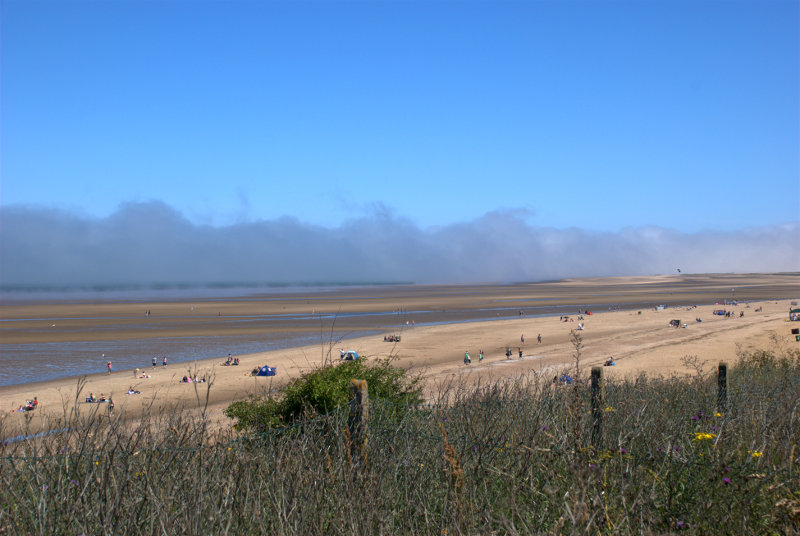
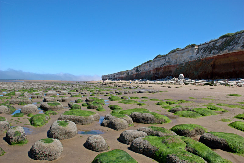
We went on past the lighthouse down towards the beach as the cliffs became lower and lower. We could see a large expanse of beach and, further out to sea, a bank of mist touching the water.

Having reached the beach we reversed our direction so that we were now walking back along the beach, instead of the cliff top, in the direction of our parked car. The cliff here comprises three layers of which the bottom layer is Carstone. This is a type of sandstone and shows a distinct pattern of raised, rounded blocks here when eroded by the sea.

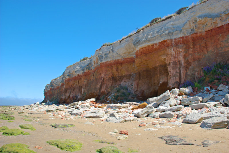
The cliffs themselves are the striped cliffs I mentioned in the Prologue and you should be able to see three distinct colour bands. The youngest rock at the top is bog standard white chalk laid down during the Upper Cretaceous then below that is what is known as Red Chalk laid down during the Lower Cretaceous. Both of these layers are limestone. At the base is the Carstone which is brown in colour and which we saw protruding above the beach as rounded blocks in the previous picture.

For those of you who prefer to work in years these sediments are around the 100 million year mark – a teensy bit older than I am.

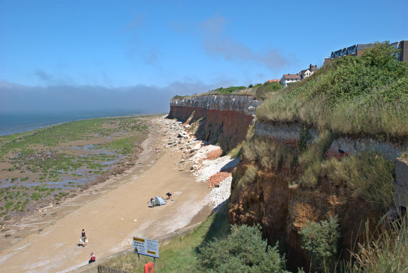
We walked a little further on until we found some steps and a path to take us back to the top of the cliffs. You can probably see that these cliffs are subject to significant erosion.

After that final look at the cliffs we found a nice little cafe at the top of the cliffs overlooking the sea where we had lunch. After lunch we walked back to the car and headed back to King's Lynn.

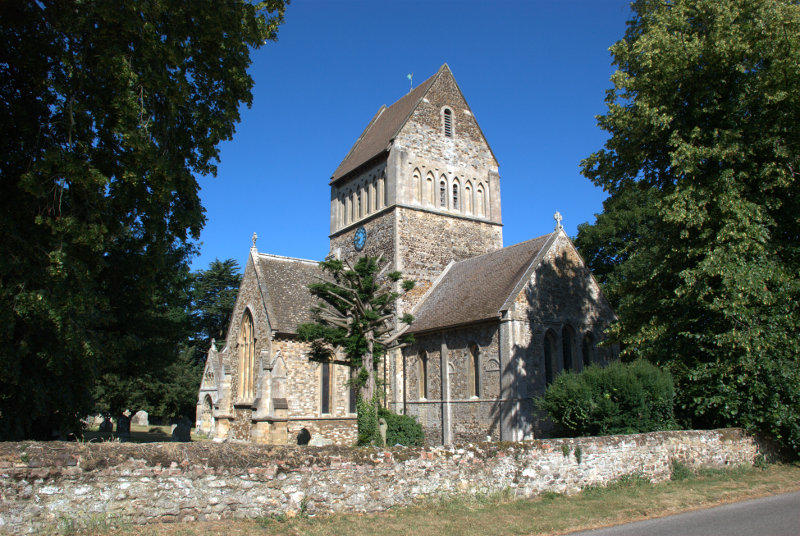
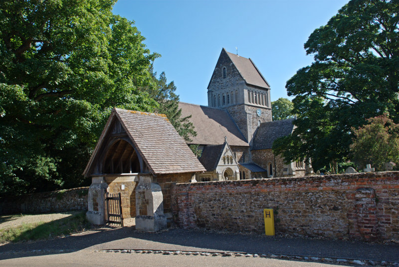
About 5 miles this side of King's Lynn is a small village called Castle Rising where we expected to find, as you've probably guessed, a Norman castle. What we didn't expect to find was an imposing Norman church.


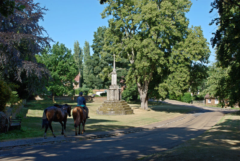
On the other side of the church is the old market cross dating from the 15th century which we thought was in a rather nice setting.

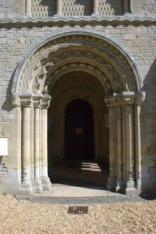
The church itself had a rather spendid, and typical, Norman doorway.

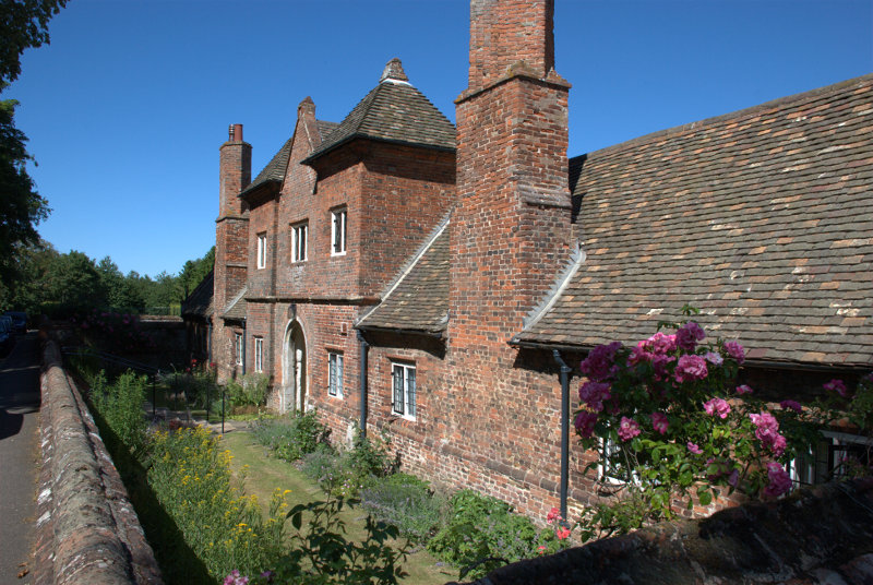
Opposite the church was the Tudor Trinity Hospital founded by the Earl of Northampton in 1614 and although the roof is now tiled the original roof was thatched. The term 'hospital' in Tudor times was applied to almshouses.

The inhabitants, known as 'Sisters', were expected to be "of an honest life and conversation, religious, grave and discrete, able to read, a single woman, 56 years of age at least, no common beggar, harlot, scold, drunkard, or haunter of taverns" and had to attend chapel every day.

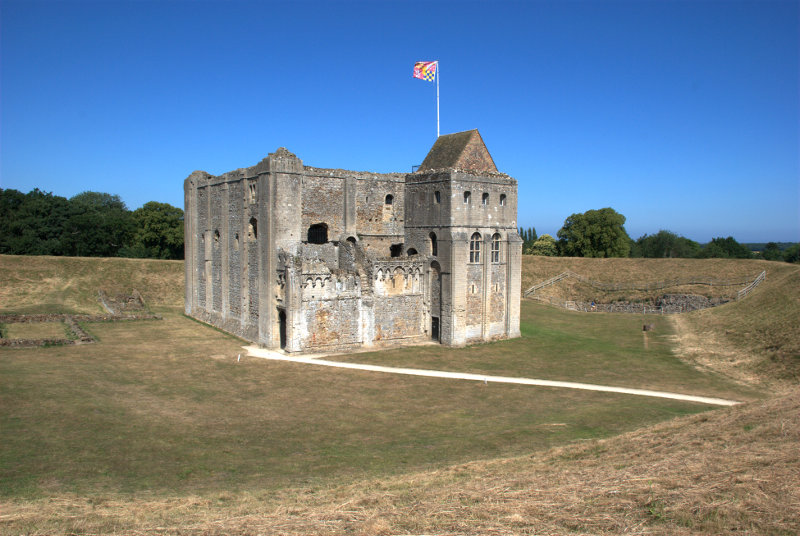
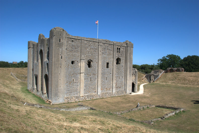
Finally we got round to seeing what we came here to see – the 12th century castle.


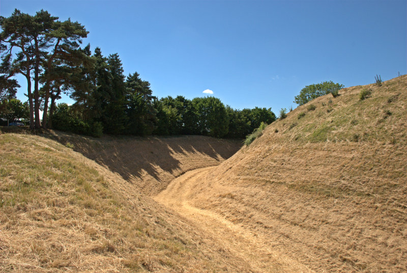
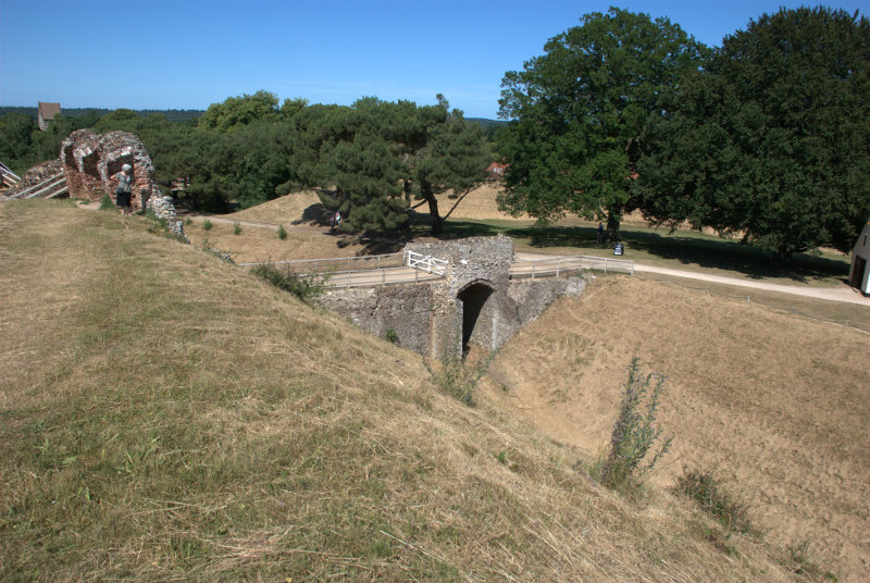
I'm standing on the high earthwork bank which completely surrounds the castle with a very, very deep ditch on the outer edge. That's Amanda teetering on the edge in the second picture.


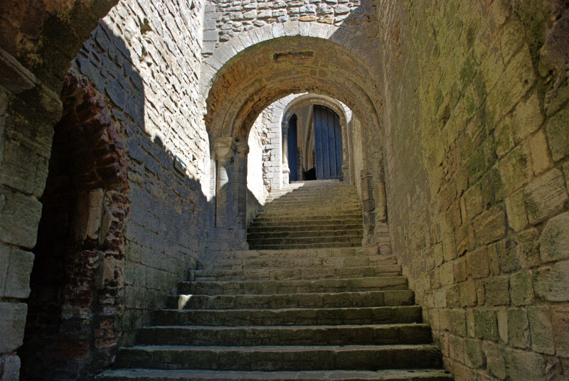
The main stairway into the castle is quite impressive and it was meant to look that way to impress visitors.

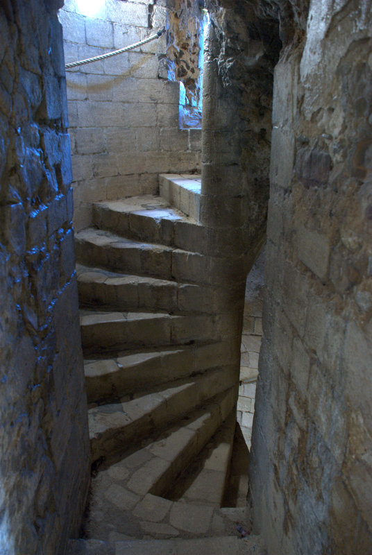
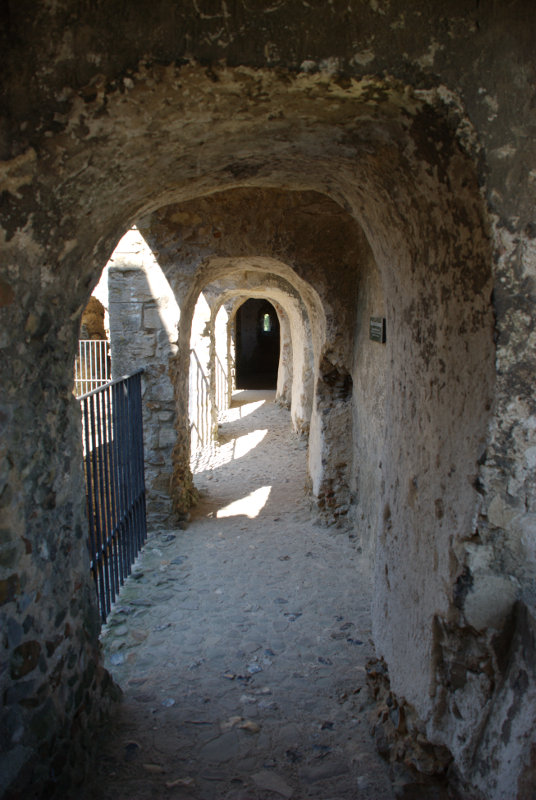
The rest of the castle, however, is accessed via the more traditional medieval spiral stairways and passages.


When we came to leave we realised that we were the only people in the castle. An interesting experence.

It's worth a visit if you're ever that way.

The end of another day and tomorrow we go home – but …..


Rock and Water – Day 4

Rock and Water – Day 4

Amanda and I aren't talking to each other this morning! That's because we are each going to different places, me back to Great Asby Scar and Amanda to the small market town of Kirkby Stephen.

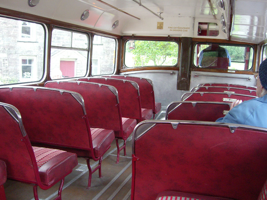
Amanda is catching a heritage (rather old) bus into Kirkby Stephen and she actually took a photograph of the inside whilst she was going along. This bus had a platform entrance at the rear and a conductor!

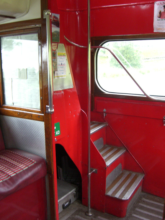
The stairs to the upper deck started from the rear platform.

The roads around here can be very steep and Amanda said the bus made a bit of a meal of them and, at one point, she was afraid that the driver would run out of gears but they arrived safely in Kirkby Stephen.

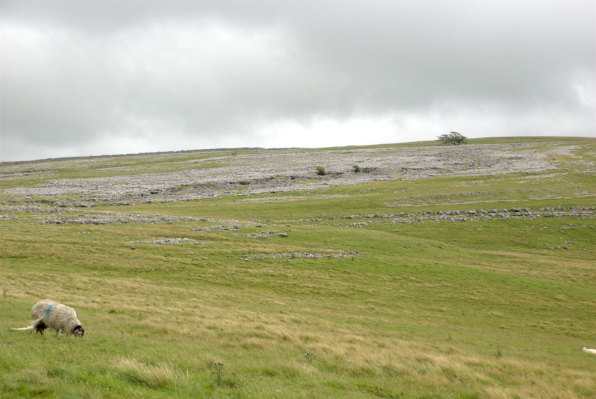
Meanwhile I had driven up to Great Asby Scar again but to the west side this time. I had heard that the limestone pavements on that side had a distinctly different appearance so I parked the car and set off over the moors. One and a half miles later I could see my destination in the distance.

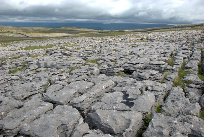
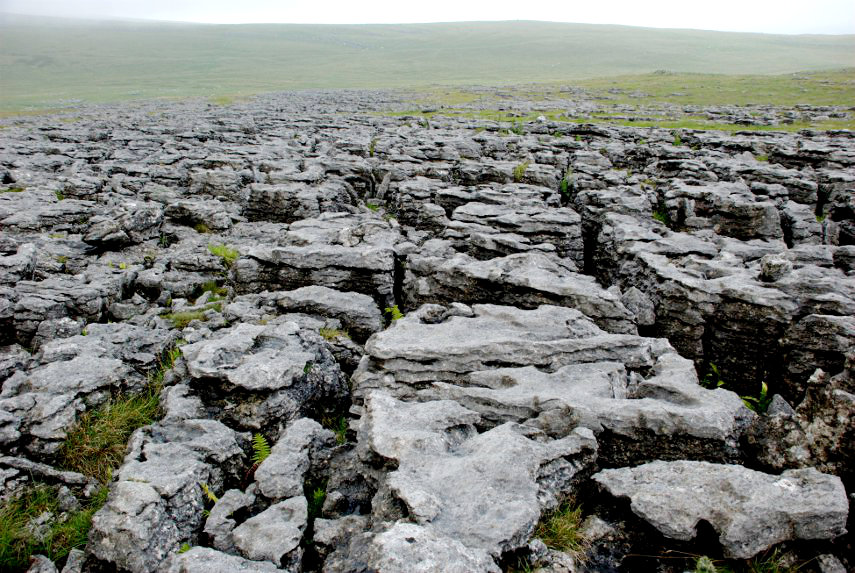
It didn't take long to get there and find that it was much the same as the pavement on the eastern side.

Perhaps I wasn't in the right place but I didn't have any more time and it would take hours looking around an area like this so I made my way back to the car and thence to Kirkby Stephen. Nice scenery though.

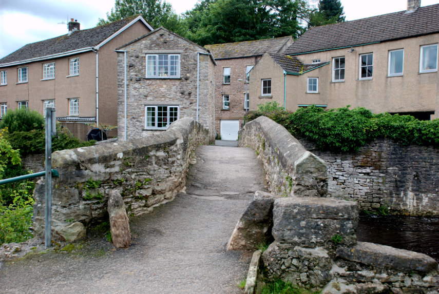
I met up with Amanda in Kirkby Stephen and we had some lunch before venturing out into the little town. We first visited Frank's Bridge; a 17th century corpse lane bridge across which coffins were carried on their way to the church.

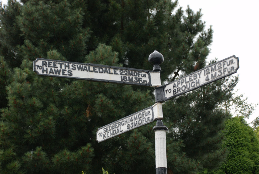
In the town we saw this old signpost with distances marked in miles and furlongs and for those of you that don't know there are 8 furlongs to a mile.

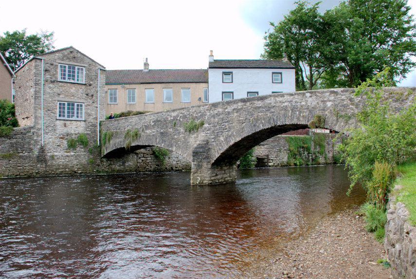
We then chanced to walk over a bridge, looked over the edge, and this is what we saw.

There was obviously a serious amount of water there making quite a lot of noise. It was now getting late in the day so we went back to our hotel to prepare for dinner. Tomorrow is our last whole day before we leave for home.
 

Rock and Water – Day 3

Rock and Water – Day 3

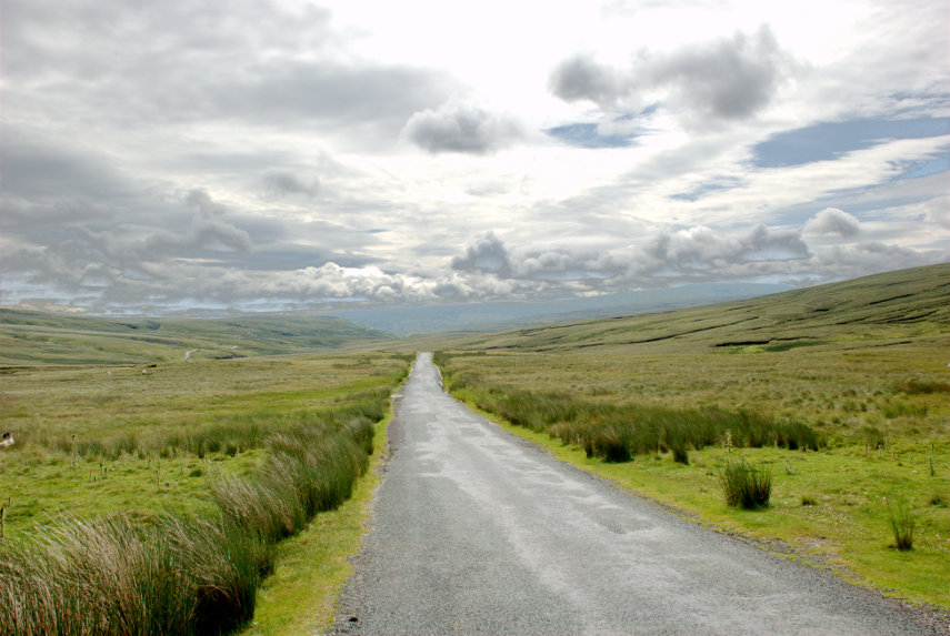
Today was our first full day in the area and we set off eastwards into the Yorkshire Dales towards Keld and Muker along the B6270 road. Don't take the 'B' classification as an indication that it is a reasonably fast road because this road is only one car wide, bends left and right and goes up and down all over the place. Luckily there are places where one can squeeze past other vehicles although we saw few of those (vehicles not passing places) but the scenery is really wonderfully dramatic.

Looking at the road in the picture above you will see that it disappears over a hump in the distance and then, if you look carefully, you can see the road re-appear over to the left about halfway between this section that we're on and the left edge of the picture. It really does wander all over the place. Ocasionally one can find an area big enough to pull off and stop which is what we did around Hollow Mill Cross by Tailbrigg Hill and look what we found – another limestone pavement.

One of the interesting features of this limestone area is that the soil is mostly acid which seems to be a contradiction on limestone but there is so much rain up here that all the calcareous content has been leached from the soil.

This pavement is very well weathered and you'll notice the little tarn (lake) in the distance which is only there because the acid soil is relatively impermeable and just to the right of that tarn is the tiny figure of Amanda who is just about to make an interesting discovery.

She is heading for that row of humps to the right of her figure and this is what she found.

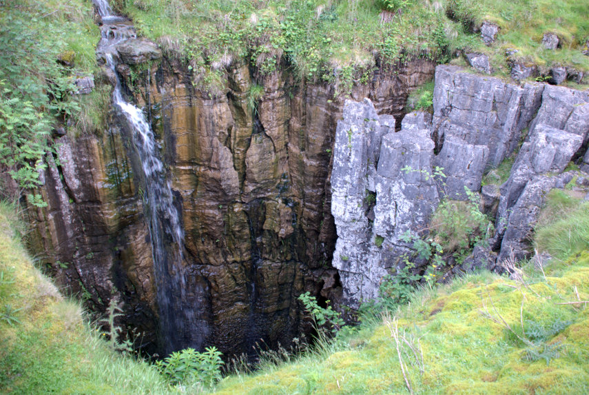
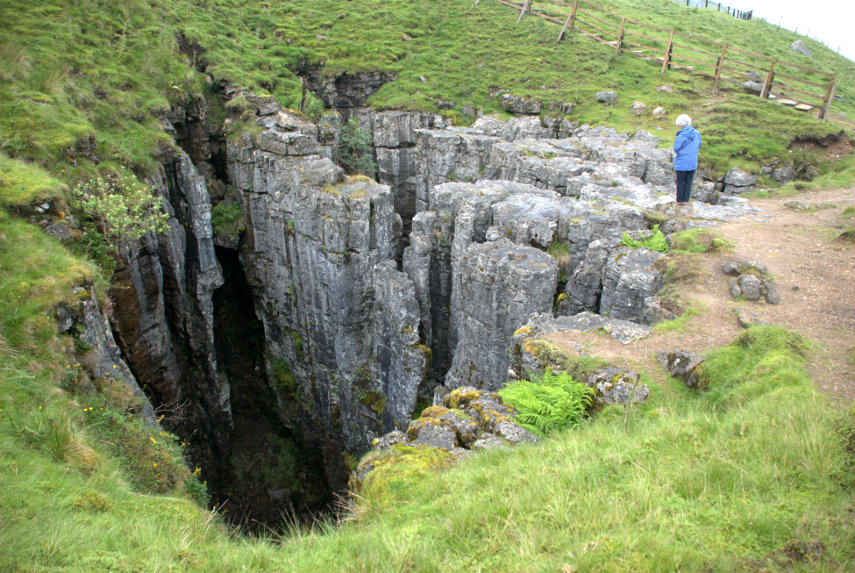
It's what is known as a Shake Hole. These are often 60-80 feet deep or more and can be caused by the collapse of part of a cave system below, fracturing the limestone, and allowing water to seep down and dissolve the limestone to form these shafts.

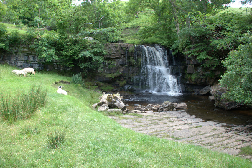
We decided to move on and eventually came down off the high ground into a very small village called Keld. We found a place to park and walked down to the river where there were a couple of nice little waterfalls.

You may have noticed that on this trip the weather is rather changeable but it hasn't actually rained yet and we have had a little sun. We moved on to Thwaite where we had lunch and I now have a little tale to tell.

We had been to this area before, about 35 years ago, and on one night we stayed in a small pub in a small village and Amanda and I couldn't remember exactly where it was but she was keen to try and find out.

She remembered that it was called either The Queens Head or The Kings Head and we both remembered that it was run by an old lady. We both remembered that it was next to a small river which was thundering along because of all the rain at that time (nothing much changes does it?).

One of the people where we had lunch though, after hearing our tale, suggested that it may well have been in Gunnerside a few miles further along the road. So after lunch we set off and very soon caught a glimpse of Gunnerside.

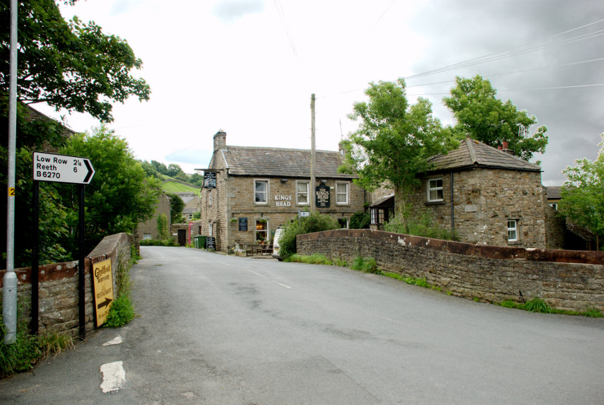
Arriving in the village we soon found the Kings Head. This view of it is across the bridge over a small river. We went in and spoke to the people who now run it and had a brief look around and Amanda thinks that this could be the one. So one mystery solved.

Our next destination was the Buttertubs up on the Buttertubs Pass at around 1700 feet. Now that was an interesting road with a steep drop on one side and, again, rather narrow. There was a flimsy looking barrier along the edge which I remember wasn't there when we came this way before. They do seem to pander to motoring wimps these days.

We arrived at the Buttertubs and found space (there isn't much) to park. It was also raining and I was trying to take photographs and keep the camera dry. This is one of those Buttertubs.

Needless to say you wouldn't want to fall into one of those and here is Amanda doing her "let's look down a big deep hole but don't go too near the edge" thing by another of the Buttertubs.

Where does the name come from? It is said that the name of the potholes came from the times when farmers would rest there on their way to market. During hot weather they would lower the butter that they had produced into the potholes to keep it cool. I can't say I'm thoroughly convinced by that but I can't offer an alternative explanation.

We decided to call it a day at this point, having seen an awful lot of rock and water, and returned via that same hairy road to our hotel. More tomorrow.


Rock and Water – Day 2

Rock and Water – Day 2

We started from Peterborough and went north on the A1 as far as Scotch Corner where we turned west onto the A66 as far as Brough. Here we turned south through Kirkby Stephen.The Google estimated time was wrong once again and after a straightforward journey of three hours and thirty minutes, instead of the forecast four hours, we arrived at Ravenstonedale in Cumbria but very near the border with the Yorkshire Dales.

We are staying in a nice little hotel called the Black Swan Inn in what they rather grandly call a suite, consisting of a bedroom, bathroom and sitting room, on the second (top) floor which gives us a nice view across the surrounding countryside. Note the low cloud even though the sun is shining.

After settling in and having some lunch we didn't have a lot of time left in the day but we wanted to see some of the local features. This area, and the Yorkshire Dales, is on Carboniferous Limestone which can create some very dramatic scenery.

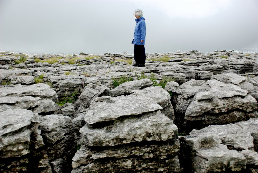
Not far from our village is Great Asby Scar, a hill of just over 1200 feet, with a large area of limestone pavement on it. Amanda is standing on a section of this limestone pavement and, as you can see, she is well wrapped up. Well it is July in England so it must be cool and raining and, as it happens, it was cool and raining.

Carboniferous Limestone is very well jointed so that over time water percolating down the joints slowly dissolves the limestone and can form a distinctive feature called a Limestone Pavement. The grooves between the blocks are known locally as Clints and the blocks are known as Grykes. Walking on this stuff is fun as long as you don't put your leg down a clint by accident and break it (The leg I mean not the clint)!

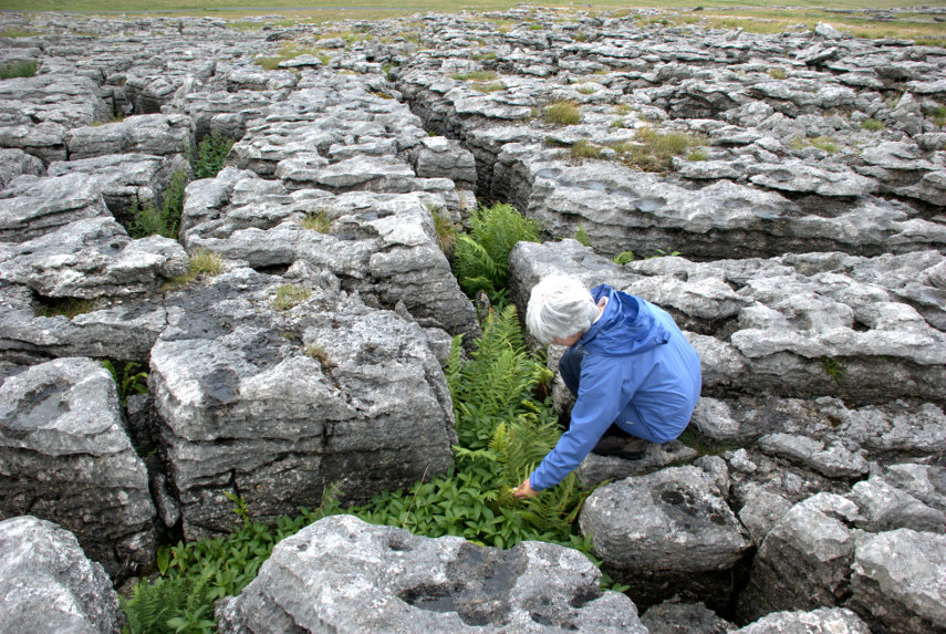
The clints can become quite well developed and often have plants growing in them which would not otherwise survive without the shelter provided by the limestone. Amanda was hoping to find something interesting and found a number of ferns which are typical of limestone pavements.

We did return to the hotel without any broken legs and we are going to look for some more limestone features tomorrow.
 

My New Torch

My New Torch

When we went on our last trip to London I took a photograph of Tower Bridge illuminated at night and that was when I realised something important. I couldn't see the controls on my camera in the dark so if I wanted to change a setting I had to walk across to the nearest source of light, change the setting and then walk back to my original viewpoint. :oops:

I decided I needed a torch small enough to fit in one of the pockets in my camera bag. I managed to get one which is just 3.5 inches long and 1 inch in diameter. It takes 3 small batteries and the light comes from 9 LEDs which use little power so the batteries will last a long time. On the last trip, when we got back, we also had trouble following the footpath in the dark across the fields from the station to where we had parked our car so the new torch would be useful for that. :lol:

So the new torch was put to use when we returned from our trip to London yesterday, Wednesday, and very useful it was.

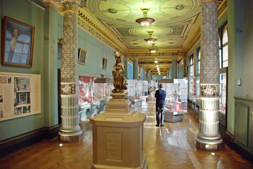
We had been on another trip to the South Kensington Museums and started with the Victoria and Albert Museum to see some of the areas we had missed on the previous trip. One of those was the Silver Gallery. Notice the two elaborately decorated pillars in the foreground and you should also be able to see that there are more pairs of pillars further along the gallery but that they are plain. Originally all of the pillars were as elaborately decorated as the first two but at the beginning of the 1900s it was decided that, because tastes had changed, the decorative tiles should be removed.

Now it has been decided that the decorative tiles are a good idea but there were only enough left to complete two pillars. Better than none at all I suppose.

We also visited the British Galleries which seem to hold a lot of items that aren't actually British but were brought back to this country by British travellers to decorate their homes. I'm not really convinced that that is a valid reason for including them in a 'British' Gallery.

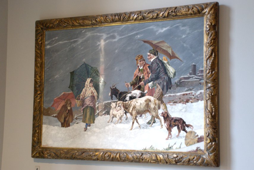
However we did see this picture and thought it would be of interest. "Well", I hear you say, " it is attractive but not particularly special" but you would be wrong! The picture has been created using nothing but small stone shapes, not micro-mosaics, and I suspect the sky is a piece of marble with the veining looking like clouds. Each shape must have been cut to perfectly fit in with all the other shapes and I think that that is astonishing.

The odd vertical shape just to the left of centre is a reflection which I couldn't do anything about.

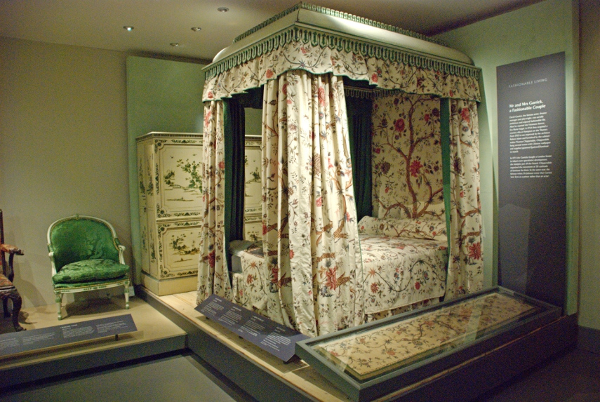
There was an exhibition devoted to the eighteenth century fashion setters, Mr & Mrs Garrick. The Garricks were certainly a fashionable couple, David Garrick was a famous actor, theatre manager and playwright and his wife Eva Maria Veigel was a Viennese dancer. They were very keen on fashionable society and created their own lifestyle to be at the height of London fashion.
This was a corner of their bedroom.

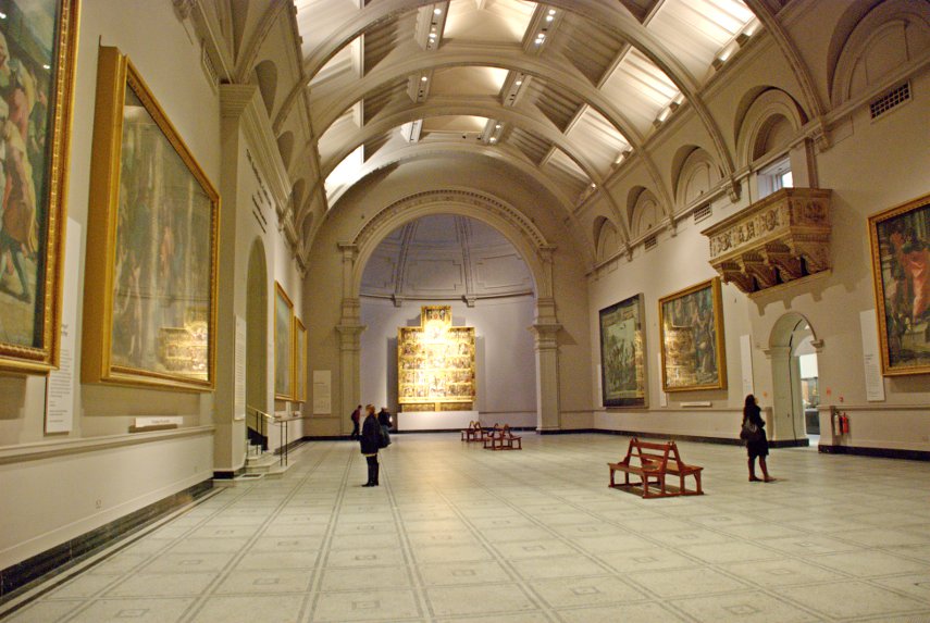
This is the Raphael Gallery which I though was rather imposing. The gallery houses the surviving designs painted by Raphael for tapestries commissioned in Rome in 1515 by Pope Leo X. These cartoons, as they are known, have been owned by the British Royal Family since 1623 and they have been on loan to the Museum since 1865.

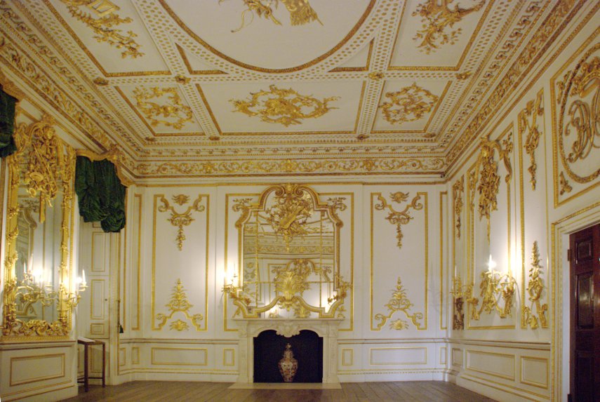
This room set shows the panelling in the Music Room from Norfolk House. Norfolk House was located on the west side of St James's Square and was the London residence of the Dukes of Norfolk from 1722 until it was demolished in 1938.

What is a remarkable coincidence is that it's just like our music room. Well, actually, we don't have a music room but if we did we'd have one just like this.

We did, eventually, run out of things to look at and decided to have a sit down and a cup of tea/coffee. We also decided to try a cafe in the Natural History Museum as the price of such things in the Victoria and Albert Museum Cafe is about twice what I'd expect to pay in London. It turned out that although the Natural History Museum was cheaper it wasn't by very much.

After we had finished our drinks we thought we'd have a look round at some of the things we had missed on our previous visit. That included the Dinosaur Gallery.

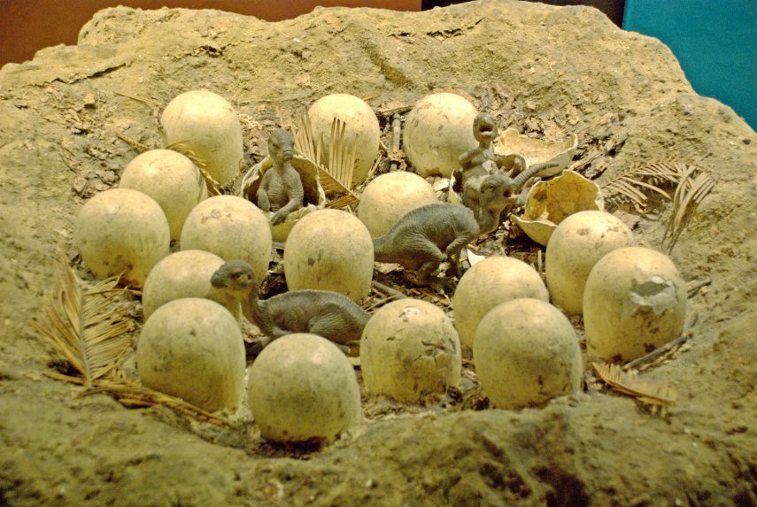
One of the exhibits that caught my eye was this replica of a dinosaur's nest. I think that the little dinosaurs are rather cute.

Meeting one of these wouldn't be so cute. :shock:

There was one exhibit that we both thought to be very well done and that was a life-sized replica of Tyrannosaurus Rex which was animated in a remarkably life-like manner. I couldn't take a photograph because the lighting was too dim and the replica didn't stop moving so ruled out a very slow shutter speed. It's worth seeing if you visit the Natural History Museum.

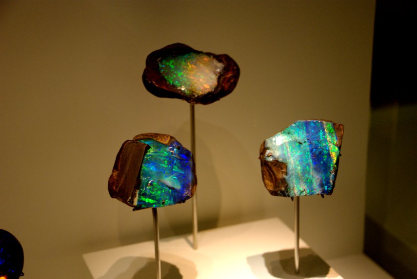
Afterwards we wandered around the Mineral Gallery and saw these very pretty opals together with a lot of other rather colourful minerals.

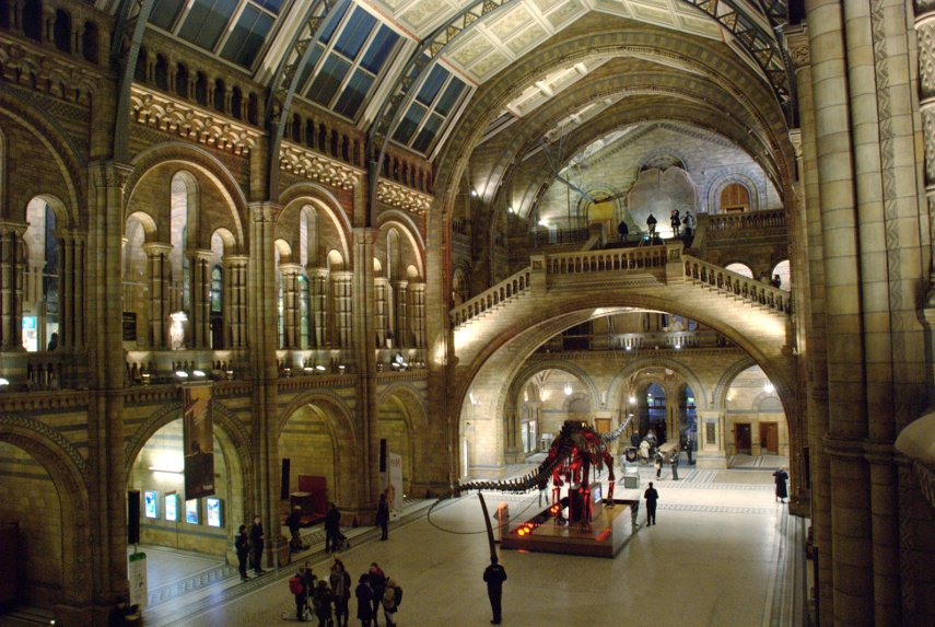
We were very definitely flagging now and it was time to leave for Liverpool Street Station, and home, so I'll leave you with this view of the Main Hall after dark.
When we arrived back at our local station we had to walk across a public footpath across the fields to get back to where we had parked our car. My new little torch proved to be invaluable in this situation so it was a worthwhile purchase. It was bitterly cold walking across the fields and we were glad to get back inside our car. Brrrrrr!
England’s smallest and England’s oldest – Wednesday.

England’s smallest and England’s oldest – Wednesday.

Today we leave for home but we haven't finished yet as we can visit other places on the way. Remember yesterday we stopped to look at a distant view of Bradgate park and said that we'd be going there today? Well that's first on the list after breakfast.

Bradgate Park is only a few miles from Woodhouse Eaves so we were soon there. This publicly accessible open space is about twice the area of Beacon Hill Country Park, has views which are just as breathtaking and has those spiky outcrops of precambrian rock that you have grown to know and love so well.

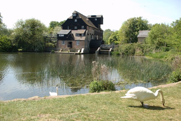
We didn't really explore this area, other than looking around the top of the hill, as there is so much of it; another time perhaps. We set off again, travelling south, with the intention of calling in at Houghton Mill on our way past. We arrived at Houghton around lunch time and so had a snack in the National Trust Tea Rooms – not a bad spot at all.

The swan, on the bank in the next picture, and I didn't really hit it off.

He waddled up to me and looked me straight in the eye with an expression that said "Come on, where's the food then?". There wasn't any food. After a short pause he reached out and nibbled my shoes, decided they were not at all tasty, looked at me with contempt and gave a loud hiss of displeasure. Ah well you can't win 'em all.

We did, however, see a pair of Great Crested Grebes on the river.

At least they didn't take a dislike to me – they just ignored me. :bawl: We went home.