Browsed by
Tag: Archaeology

Archaeology

High & Low – First Trip of 2021

High & Low – First Trip of 2021

This trip took place on 30th March 2021 and this Blog Post is obviously late and there will probably a few more posts that will also be late.

Welsh travelling rules have recently been relaxed so it was time for a day out. We weren’t going far, just 16 miles to the high ground near Newtown and although the road is a typical narrow, winding Welsh backroad it didn’t take us long. We parked in the little free car park at the start of the Kerry Ridgeway which runs for about 15 miles to Bishops Castle although we weren’t going anywhere near the distance.

This is where we stopped and shows the Knighton-Newtown road with the little car park to the right and the start of the Kerry Ridgeway path along the side of the road. The Kerry Ridgeway is one of the oldest paths in Wales probably from the time of the Bronze Age.

We started up the path and soon reached the bend where the path turns away from the road and continues uphill.

As we had started from high ground we had good views almost instantly although it was very hazy.

We walked further along the path looking for the Cross Dyke and soon found it. We couldn’t really miss it could we?

The Cross Dyke, just beyond that wooden post, crosses our path and the next picture shows the twin banks heading downhill towards Newtown and the following picture shows them running down to cross our path and join the top picture of the two below.

The Cross Dyke marks an ancient boundary long since forgotten but, rather like Offa’s Dyke, they took a lot of trouble and effort to build it.

Nearby are the Two Tumps which are Bronze Age burial mounds. There is one on the left, just poking above the far horizon, and one to the right of that, and a little further back, with the far horizon just showing over the top.

We headed further up the path as far as this viewing point which has information, hill names etc., to identify what you can see around you.

It was now time to leave the Kerry Ridgeway, as we had more to do, so we headed back down the path admiring the views on the way.

Along the path I spotted a small area of tiny flowers and there is also a daisy to give a scale. Difficult to identify precisely because there are so many different varieties but it probably is a member of the Whitlow-grass group.

We soon arrived back at the car having been serenaded by Skylarks along the way. We drove towards Knighton for no more than a half-mile and parked in a large layby next to a landscape feature know as ‘The Ring’.

The Ring is a geographical feature caused by the River Teme eroding the bank and causing the higher ground to collapse and then the collapsed soil to be washed away. This picture was taken from road level on a previous occasion and the river is partly in flood producing this waterfall.

On this trip it was relatively dry with little water flowing.

This is the Ring itself. It’s called ‘The Ring’ because it is shaped like a large semi-circular amphitheatre.

We decided that we needed to climb down to look more closely at the waterfall which was at the bottom. It is not safe to climb down just anywhere because the sides are generally far too steep. So we had to visually plot a route down and then set off. The route we followed proved to be quite easy and it didn’t take us long to reach the river.

There was just a trickle of water over the waterfall, which is a pity, so we shall, perhaps, have to try again sometime when it is a bit wetter.

This is the River Teme, the same River Teme that flows through Knighton, heading off from the waterfall down the valley towards Knighton and we now hope to do the same. All we have to do is get back up to the road. We did that without incident, although slower than coming down.

The end of our short, but interesting, trip.

Butterflies and Flowers

Butterflies and Flowers

Butterflies? Flowers? February? It’s not as silly as it sounds. It all started this morning with a bright sun in a cloudless sky – it was going to be a beautiful day so we just had to go somewhere. That somewhere turned out to be Croft Castle.

We wanted to try and find some snowdrops which were supposed to be found in Pokehouse Wood. Don’t ask me where that name comes from because I don’t know and I’m not about to start guessing but the wood is on the western edge of the Croft Castle Estate. If one parks at Croft Castle then it’s going to be a five and a half mile return walk to Pokehouse Wood which we didn’t really want to do so we, naturally, cheated. On the way to Croft Castle we pass through the small village of Amestrey which, surprisingly, is on the western edge of the Croft Castle Estate so we didn’t pass through, we stopped and parked.

We used a public footpath to reach the edge of Croft Castle Estate where we found a sign, by some steep steeps, which told us that we had arrived at Pokehouse Wood. Up the steps we went and eventually arrived at a wide path where we turned right. Walking along the path, which we noticed was going downhill very slowly, we kept a lookout for Snowdrops. Not a sign. Not a tiny speck of white to be seen anywhere. But then we found these. Not a lot admittedly but it is a start.

As the path was going downhill we eventually arrived at river level, you can see the river below us in the image above, onto another path where we turned right.

Then things started to get interesting.

So, finally, we did find a few. We also noticed that the Snowdrop flowers were beginning to die back so we were lucky that we hadn’t left it another week as we may then have been disappointed.

We also spotted this solitary Primrose.

The path we were on seemed to be heading back towards our starting point so we decided to risk it and continued on this path. It wasn’t long before we arrived at the bottom of the steps we had climed previously so we needn’t have climbed them in the first place. Bummer!

On our way back along the public footpath we stopped to have a look at this tree.

Now that is a tree that you couldn’t easily miss. That tiny person at the bottom is Amanda trying to identify it. She eventually decided that it was a Wellingtonia. Wellingtonias are native to California in America and that is where they grow to their maximum height. They do also grow in other parts of America but not to such a height. However they do also like it here in Britain; growing not to such a height as they grow in California but higher than they grow in other parts of America.

We drove round to the car park in Croft Castle then walked to the restaurant where we had some much appreciated sustenance.

Our next plan was to walk around the upper reaches of Fishpoool Valley so we set off and came across another interesting tree.

This is known as the Candelabra Oak which Amanda estimates can’t be far short of 1000 years old. So you should be able to work out that it is an Oak and I don’t want any dimwits asking “Barry, why is it called the Candelabra Oak” as it should be fairly obvious. We started down the wooded path into Fishpool Valley.

Some way further down we saw, across on the other side, the Grotto which we had heard about but hadn’t seen so we went across to have a look.

It has to be said that we were not awe struck. Apparently some of it is now missing but what and where I don’t know. The second photograph above shows the Grotto on the left with Amanda sitting a little way in front. Walking on we came across our third flower of the day – a wild daffodil.

From the look of the area there should be a lot more of those in bloom in a few more weeks. We’ll have to come back and see. Back to our walk. The path went on – and on – and on.

It may be long but we were enjoying it. At this time of year with no leaves on the trees and a low sun the atmosphere was ethereal.

Our final picture, before we climbed out of Fishpool Valley and went back to our car, is of one of the ponds. The surface of the water was completely still and acted like a mirror showing some amazing reflections.

We also saw some butterflies – a Brimstone, a Comma and a Small Tortoiseshell so it must be Spring. That was the end of our day but we hope to be back for more daffodils – weather permitting.

The quietest place under the sun

The quietest place under the sun

Clunton and Clunbury,
Clungunford and Clun,
Are the quietest places
Under the sun.

 (A. E. Houseman)

Of those four places, mentioned by A E Houseman in his poem, we visited Clun.

On our outward journey we didn't actually stop in Clun but drove straight through to Clunton where we turned north past Radnor Wood and Steppleknoll to Sunnyhill. We parked our car in a free car park provided by the Forestry Commission which was very handy otherwise we couldn't have stopped because the lane was so narrow (one car's width). We set off up the track where Sunnyhill didn't live up to its name – it started raining. smilies

Luckily the rain didn't last long and we started to see some sunny spells although the wind was still cold. After a short walk we arrived at Bury Ditches.

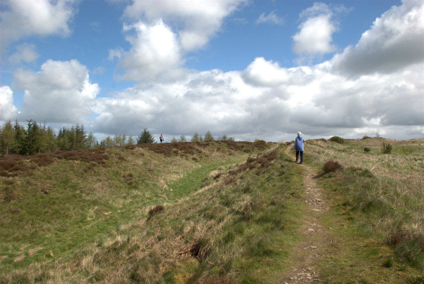
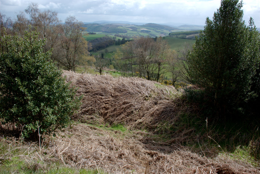
Bury Ditches is a British Iron Age Hill Fort dating from about 500 BC and one of the best preserved in the country. In the picture above Amanda is standing on one of the banks with a ditch to the left and another bank to the left of the ditch with another figure on the top. The main area enclosed by the defences is to the right.

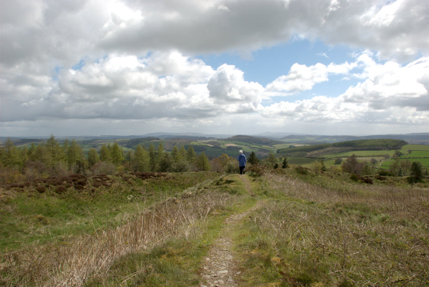
You may notice that the views from up here are pretty spectacular.


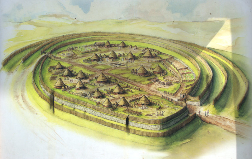
This is how the fortified village would have looked when it was in use.

Having had a thorough look round we went back to the car and headed back to Clun.

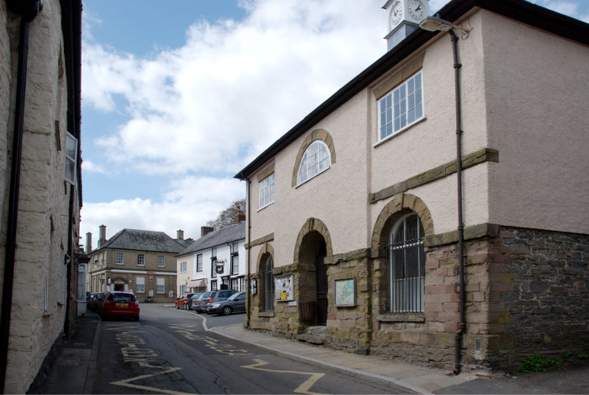
Clun is a small, attractive market town in Shropshire just over 7 miles from us. This photograph shows the Market Hall and the square beyond.

The 2011 census recorded a population of 680 and research by the Campaign for the Protection of Rural England suggests that Clun is one of the most tranquil locations in England.

We arrived at lunchtime and liked the look of the Maltings Cafe next to the Sun Inn. So, based on that, we went in. It was a good decision. They had an amazing range of food for a small cafe and the food turned out to be excellent. We would recommend it without hesitation.

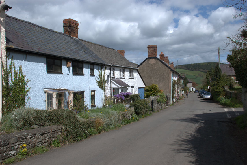
After lunch it was back to the hard work of looking round. We wandered along one of the narrow back streets looking at the old buildings and liked what we saw.

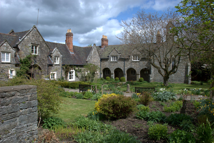
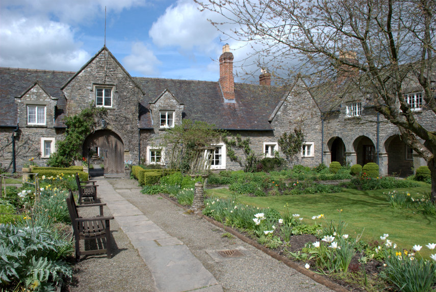
At the end of this lane we stumbled on the Hospital of the Holy and Undivided Trinity which is a well preserved example of courtyard-plan almshouses. This was founded in 1607 and in this case the term 'Hospital' is another name for 'Almshouses'. The pretty gardens and the chapel are open to the public but the inner courtyard is not. We had a look at the garden and the chapel.


A rather attractive and peaceful garden. Clun is not exactly a bustling metropolis and this is right on the outer edge of this quiet town so it was, well, very quiet.

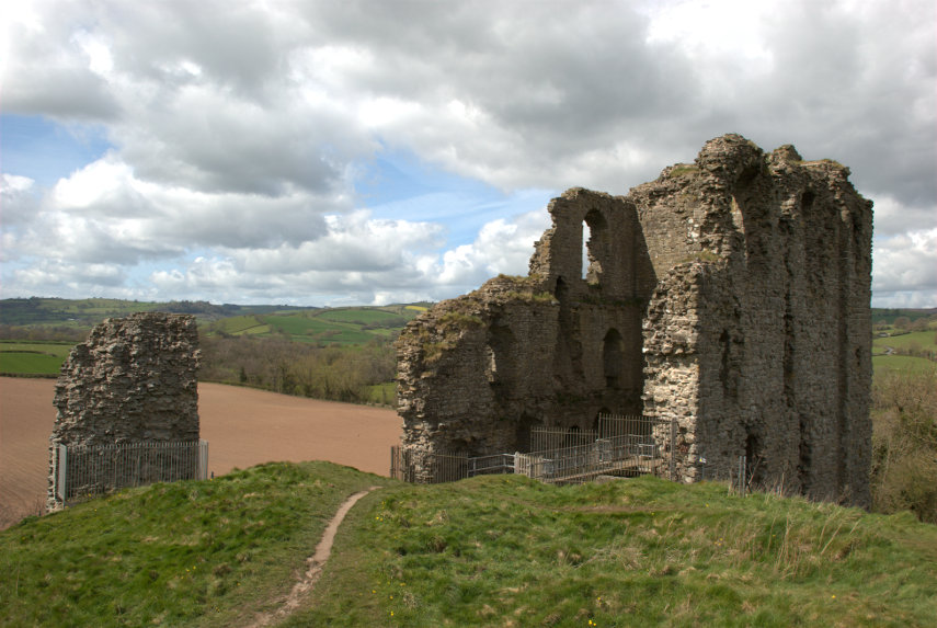
Back towards the 'town centre' we started looking for the castle ruins. We knew Clun had a castle so all we had to do was find it. I remembered that it overlooked the river and we knew where the river was so we headed in that direction. We spotted some pinnacles of wall ruins and soon found the castle.

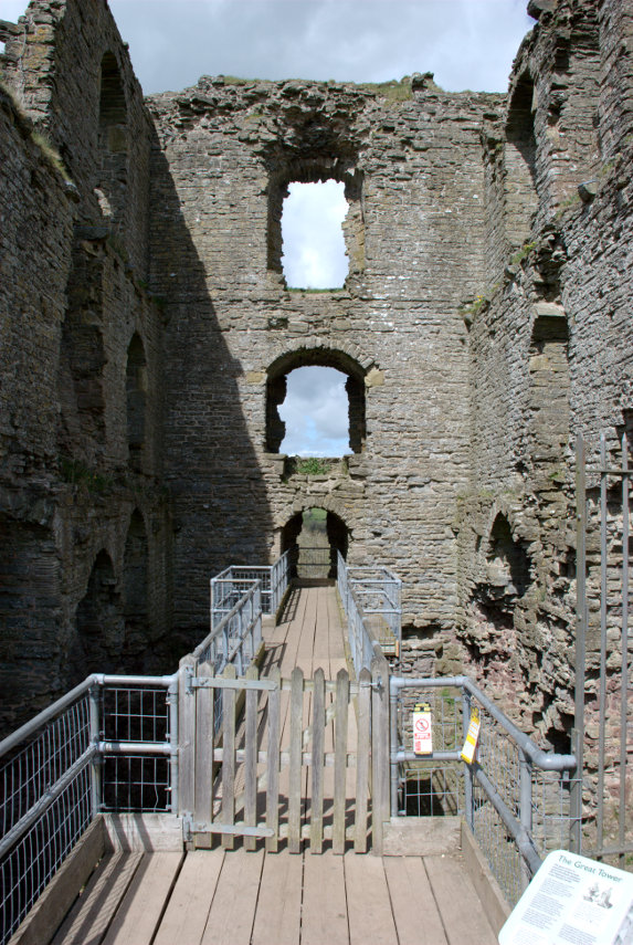
It has to be said that there isn't much of it left; the largest part being the remains of the Keep but up close that Keep looks fairly impressive. The whole thing was built on a grassy knoll high above the town and the surrounding countryside.


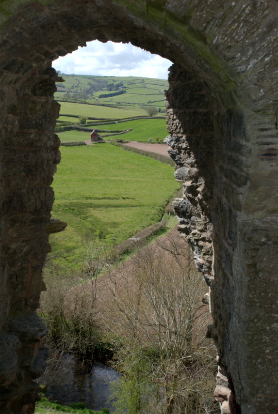
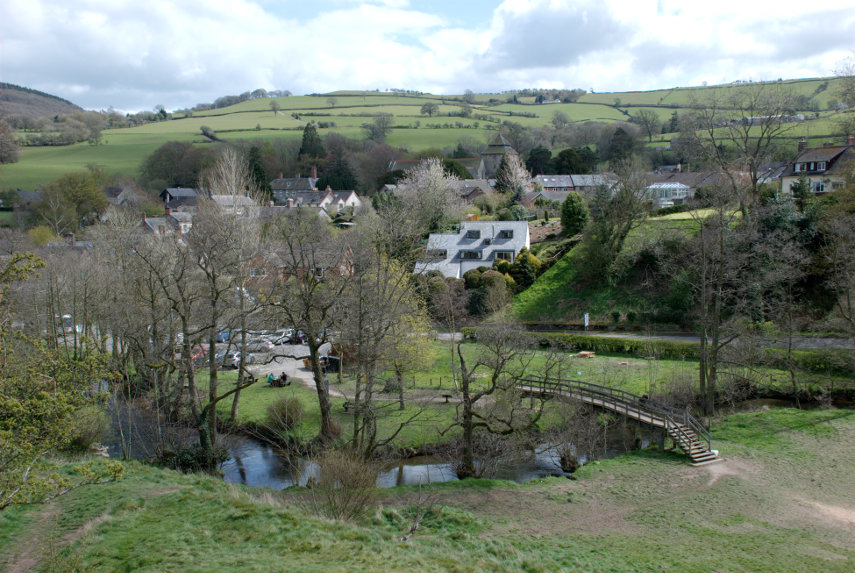
You can just see a small part of the river way below at the bottom of the top picture. All we have to do now is find our way down to that river and cross it. We walked across the top of the motte and were rewarded with this view.

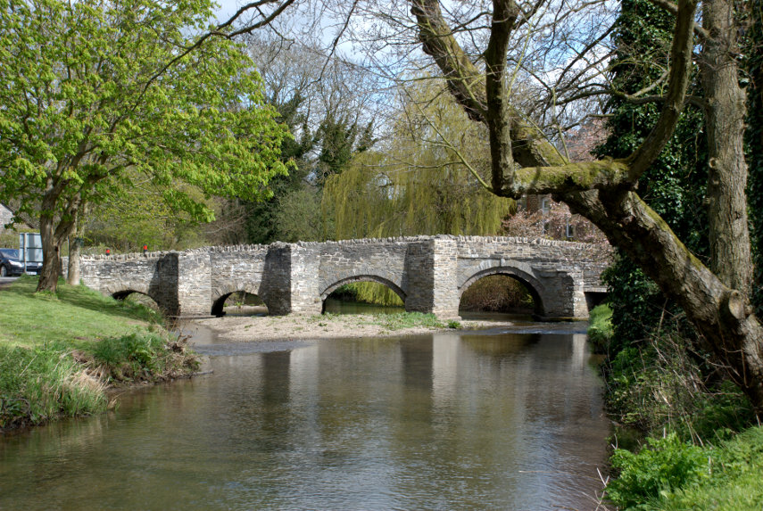
That bridge is our way across so we scrambled down and it was pretty steep in places. There is the main road bridge, of course, but that route would have been slightly more circuitous. You can probably see the car park, which is free, and entry to the castle is free. However, having got down there, we walked towards the main bridge because I wanted to photograph it. It is an old packhorse bridge built in 1450.


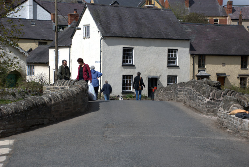
It's not very wide as you can probably see (it was built for packhorses) but it is one vehicle's width so traffic can, and does, use it.

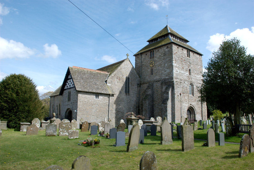
Our final destination was the church. The oldest part of the building appears to be the tower which was built around 1200 AD. The Nave is 12th century; the Chancel is actually 19th century.


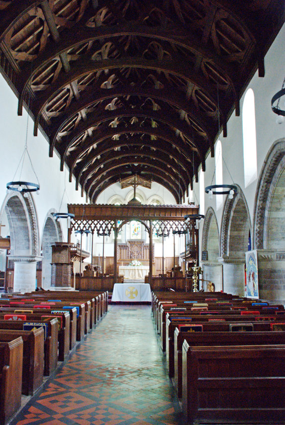
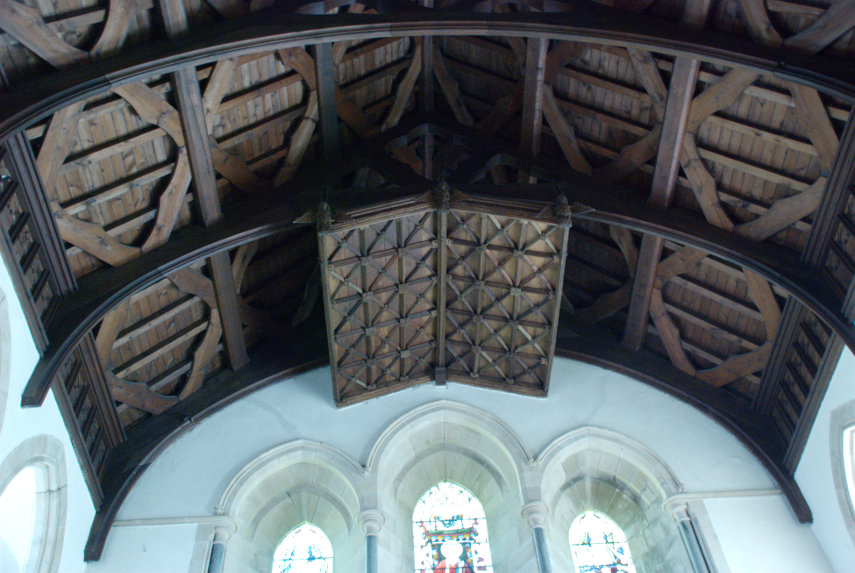
That is a pretty impressive 14th century roof.

We were both feeling a bit tired by now so decided to call it a day and headed for home. The weather could have been better, but wasn't, and in any case it's only 7 miles from home so we can, and probably will, come back to Clun any time we like. smilies