Browsed by
Tag: Harbours

Somewhere Else

Somewhere Else

Now that some of the Covid-19 restrictions in Wales have been relaxed we can go somewhere else – anywhere – so we did just that.

We headed 60 miles due west and found ourselves in Aberystwyth, Ceredigion. It took us about one hour and fortyfive minutes to do those 60 miles because most Welsh roads are anything but wide and straight. The last 10 miles was particularly wiggley but we got there.

We parked in a large car park on Park Avenue and were expecting to pay £1.70 for the day but all the pay machines were covered with large bags and there was no explanation so we ended up paying nothing.

We headed fo the sea front and soon after leaving the car park we walked past the Vale of Rheidol Railway Terminus which is a Heritage Steam Railway that runs to Devil’s Bridge. The last time we went to Devil’s Bridge we saw the other end of this line and took some photographs when a train arrived from Aberystwyth.

This time the terminus in Aberystwyth was closed with no signs of life anywhere so we continued past. Probably because of Covid-19. Pity really.

We headed for the harbour and were then planning to walk north along the sea front as far as the Funicular Railway at the far end of the bay. Where we parked was an obviously new area including a retail park but the buildings and streets suddenly changed when we reached the old part of the town.

This was one of the streets in the area of New Street and the hill in the distance could be Constitution Hill and the funicular railway runs up that.

It was a short walk further on to the harbour which includes the River Rheidol just before it runs into the sea. Both pictures are taken from the same viewpoint but in different directions.

A short walk from the harbour brought us to the sea front. This view is looking south and shows the wall at the entrance to the harbour.

Walking on South Marine Terrace along the sea front we passed these colourful houses and could see the castle in the distance.

Then an equally colourful plant bed.

A short way on we reached Aberystwyth Castle built by Edward I in 1289 but by 1343 the castle was in a bad state of repair. In 1649 Oliver Cromwell ordered the castle to be slighted, i.e. rendered unusable, hence its current condition.

We finally left the castle after having a really good look round and went back down to the sea front onto the New Promenade which was completed in the early 1900s.

On Constitution Hill in the distance, on the left of the next picture, there is a straight line visible running from the top to the bottom – this is the funicular railway of which more later.

In 1795 John Nash built the Old College buildings on the right, with George Jones as the architect, in Gothic style. It was later sold to the University of Wales who turned it into a college for higher education and it later became the University of Aberystwyth. It remained as the main part of the university until the 1960s when the university open a new campus near the National Library of Wales.

A short way on and we found two things – an ice cream kiosk and the pier. We had some ice cream, to help the local economy you understand, and had a look at the pier. It has to be said that this is the shortest seaside pier that we have ever seen. It does have amusements inside and a restaurant at the outer end which has a sun deck visible at the far end. We didn’t have time to visit the restaurant so we moved on.

When we reached this point along the sea front there was a turning off to the right which, having previously looked at the map, I knew led a short distance to the Tourist Information Centre. Having previous looked at some web sites which gave opening times I thought we’d pop in to see if there was anything we should visit that we might have missed. Needless to say it was closed with no signs of life. It was, however, a pleasant part of the town.

We went back to the seafront which has, as you can see, a rather fine beach. This beach runs all the way along the seafront promenade and has a greyish sand but sand nevertheless and there were plenty of people enjoying themselves.

We continued on towards the Funicular Railway passing some colourful, fine looking houses on the way.

We finally arrived at the bottom station of the funicular railway expecting it not to be running because of the current virus problems but it was so we decided to make use of it and take the easy way up.

We were asked to wear masks whilst on the ‘train’, which they supplied at a small charge, and the single fare was £7 for two.

We boarded the coach and, after a short time, it started to move. As with all funiculars there are two sets of rails and two coaches. When one coach is going up the other is coming down so that each coach acts as a counter-weight for the other.

This funicular is interesting in that the rails start up steeply then level off a little then go up an even steeper slope. When we reached the top I took a photograph from the station looking down.

You will be pleased to hear that there is a cafe at the top -we certainly were. They had a good selection of items on the menu including cake so we had to try some. We both had some cheesecake (very nice) and a cup of coffee each. The view from this level is really quite amazing.

The second picture was taken with a telephoto and is of the castle area with the war memorial on the right and parts of the castle showing on the left. You can also see the sundeck on the pier.

Once we had finished our cake and coffee we had to walk back down but just before we did that we had a look at the view north of Aberystwyth towards Clarach Bay. Beautiful.

This is the start of the footpath down but it isn’t that wide all the way.

We are almost at the bottom now.

On the way down we saw a number of wild flowers including Sea Campion, Thyme and Quaking Grass.

Finally back to sea level we now have to walk back to where we parked the car but we did pass through some more interesting parts of Aberystwyth.

We finally staggered back to the car and set off home but this time we are going home via the mountain road rather than the main road which brought us here.

We first go from Aberystwyth to Devil’s Bridge where we join the mountain road.

The next picture, which is just before we reach Rhayader, will be of particular interest to our friend Marie because she has been there. It shows one of the reservoirs in the Elan Valley and we brought Marie this way on that little road in the bottom right corner.

We reached home without incident although Amanda was feeling a little travel sick by this time. It took her about an hour to recover.

I wonder where we’ll go next time!
Sun, Sea and Sand – Day One

Sun, Sea and Sand – Day One

We struck lucky with the weather on this trip although the first part of the first day was cloudy (no sun, sea or sand) but after that it was sun all day every day.

We left home at about 9.00 AM for a two and a half hour journey so decided to break it up by visiting a National Trust Property at about the one and a half hour mark.

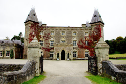
We stopped at Dinefwr Park and, for those of you that don’t know, Dinefwr is pronounced “Din ever”. It consists of Newton House (a stately home), the ruins of a medieval castle (Dinefwr Castle) and lots of parkland which is home to a herd of deer.

As I mentioned above this morning was cloudy but I took the following picture anyway.

However we called in here again on our way home when the weather was better and I photographed it again. Which picture do you think is better?

Inside the house it didn’t matter what the weather was like outside so I carried on taking photographs.

Those rooms, as you might expect, look rather grand. The Dining Room in the top picture and the Sitting Room in the bottom picture. The interesting thing about this property is that nobody minds if you touch the furniture or walk on the carpets or even sit on the chairs.

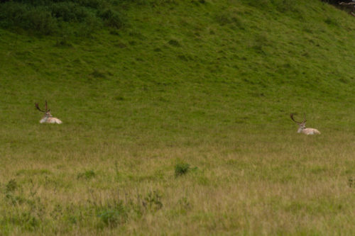
I did go out to the back of the house where it overlooks the Deer Park and surprise, surprise I saw some deer. They were quite a long way away so even using my telephoto lens to its maximum this is the best that I could achieve. You should, at least, be able to see their antlers.

I took that photograph above from the small formal garden shown below which is at the back of the house. That is the only gardens they have here.

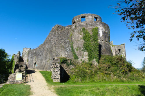
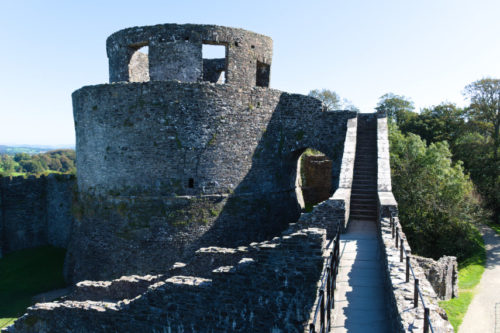
We also had a look at the castle both times we stopped here so as the weather was better on the way back these photographs are from then.

There is a reasonable amount to see in this castle ruin even extending to a few medieval spiral stairways which can be tricky to negotiate because the height of each tread can vary as can the width.

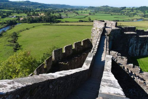
It is possible to see Newton House, together with some lovely views, from some of the high points of the castle so it is worth the scramble.

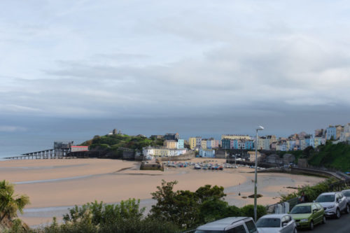
We had some lunch here at Dinefwr then headed off to our final destination. We booked into our hotel and after sorting out our parking space (they have only 10) which we had reserved we went outside and this is the first photograph I took of Tenby from outside the hotel.

Here in Tenby at 4 o’clock we now have sea and sand but no sun yet but we set off to explore anyway. The hotel has gardens at the front that are terraced down the steeply sloping cliffs to the beach and that is where we went.

It is now 5 o’clock and look, the sun has appeared! So now, finally, we have sun, sea and sand. What a change in just an hour.
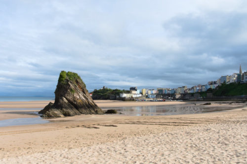
We were able to walk along the beach as the tide was out and went to have a look at that lump of rock sticking through the sand. You can see that the rock bedding is steeply inclined and, as we later discovered, that applies to most of the rock on this coast. That tiny bit of head together with a splash of red on the right-hand edge is Amanda.

We walked along the beach until we found some steps up into the town. This is a view back the way we came from town level. You can see that lump of rock that we stopped to make friends with and just to the left of it is a small cream building. Our hotel is directly above that.

It is now 5:30 PM and you may notice that the cloud is dispersing rapidly.

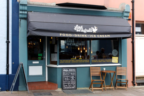
Now I have to ask – have you ever seen a fat seagull?

Well you have now. As you can no doubt work out it is a little cafe so we went in for some coffee and cake.

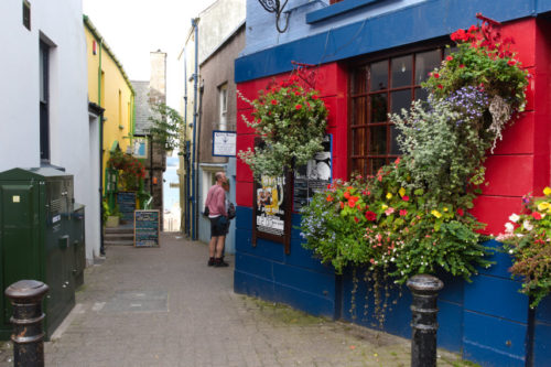
It was a nice little place and the cake was good. That’s Amanda over on the right against the wall. Having finished our refreshments we went back into the town. Want some colour? We can find you some colour!
This is just one of the many narrow lanes in Tenby. There is plenty more to see but we are calling it a day and are going back to the hotel until tomorrow.

The Other End – Day 1

The Other End – Day 1

You may remember that in posts in the recent past I have mentioned the 'Heart of Wales Line' which is the railway that runs through our town, Knighton, and that we have twice travelled to Shrewsbury on it. We decided that it was time to visit the other end of the line which is Swansea. The trip north to Shrewsbury takes less than an hour which makes a day trip feasible but the trip to Swansea takes more than three hours so we made a three night trip of it.

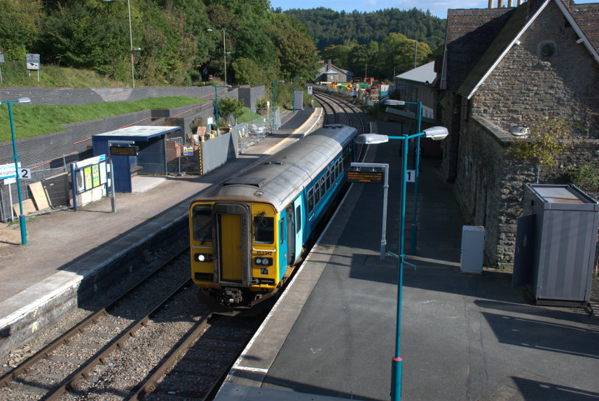
We took one case, with wheels, to keep luggage to a minimum and Amanda, my wife, and I set off one sunny morning and trundled down to the station to catch the 11:01 AM train to Swansea. We made sure that we were in plenty of time as there is a train only every four hours so if we missed it we'd have a long wait. This is the train in our little station and, yes, that's all of it; one whole carriage. Well there is only two of us. smiley

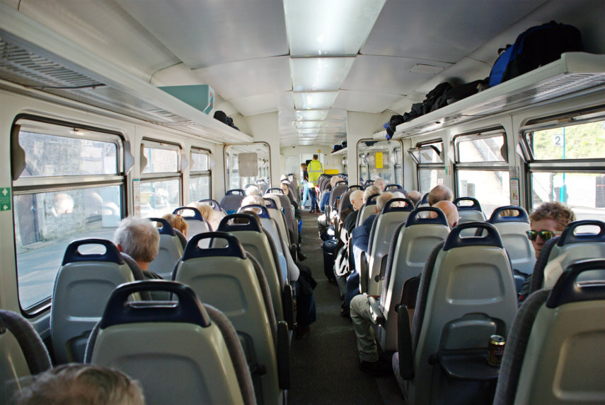
There were plenty of seats and we were very quickly settled. There turned out to be no refreshments available but we had come prepared with a paper bag full of lunch and one can of fizzy drink. The doors shut and we were off! Some of the stations on this line are request stops and if you are waiting on such a station you have to hold your hand out for the train to stop and if you want to get off at one of those then you should tell the ticket man and he will make sure that the driver knows to stop.

After five stations we stopped at Llandrindod Wells and sat there for twenty minutes. This was not unexpected as it is a single line all the way except in some stations, like this one, where trains can pass and we were waiting for the train coming the other way. When it arrived we continued on. This line runs through very picturesque countryside which is, of course, covered in the inevitable sheep. After travelling for around two hours we had our packed lunch and we eventually arrived in Swansea at around 2:30 PM.

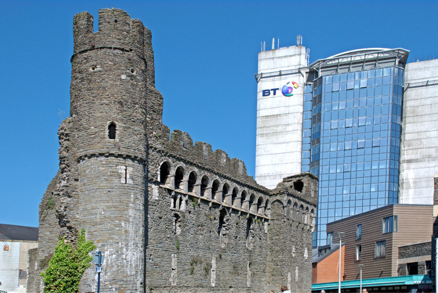
We set off down High Street (trundle, trundle) passing through Castle Square on the way which, amazingly, contains the remains of a Norman castle.

There isn't a lot of it left and one cannot go inside but it is a real medieval castle and I rather like the contrast between the old and the new. We continued on (trundle, trundle) and soon arrived at our hotel – Morgan's.

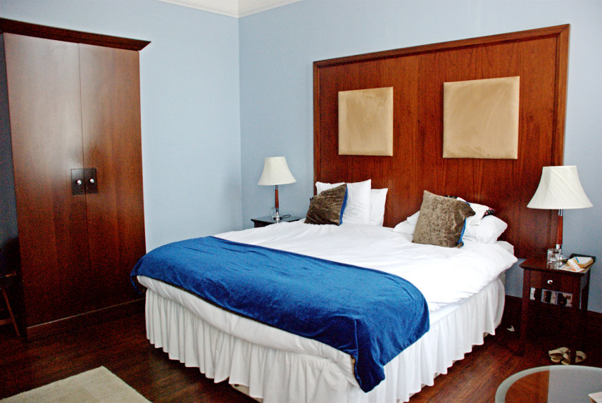
A rather nice Victorian building which used to house the Port Authority but which has now been converted to an hotel. Our room was on the first floor and there is a lift for those who cannot manage stairs. The room doors have electronic locks operated using a credit card sized card, there is air conditioning in the rooms for those who want it and the rooms have good sized en-suite bathrooms.


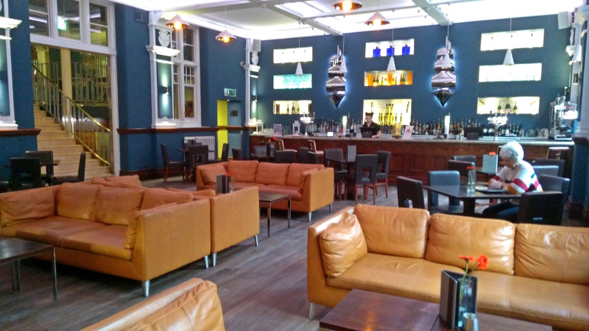
They do have an odd eating arrangement here. Dinner, in the dining room, is served only Thursday to Saturday and on other days food is available in the bar. It is, however, a very nice bar and the food really is excellent with a reasonable number of options on the menu. We settled ourselves into our room and then went out for a look round. One has to bear in mind that the Germans flattened Swansea during the last war so there are few old buildings but we didn't see any new buildings which we disliked and, overall, Swansea has a nice atmosphere.

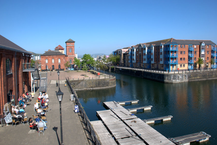
It was a short walk to the Marina where we found the Waterfront Museum but didn't go in as we were saving that for the day we were leaving. The museum is the building on the immediate left which incorporates a small cafe with people sitting outside at tables although there are also tables inside.. The red brick building with the small tower is an old Victorian water pumping station which has now been converted to a pub.

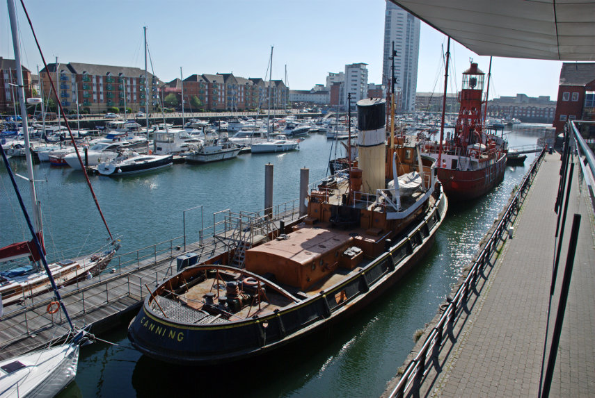
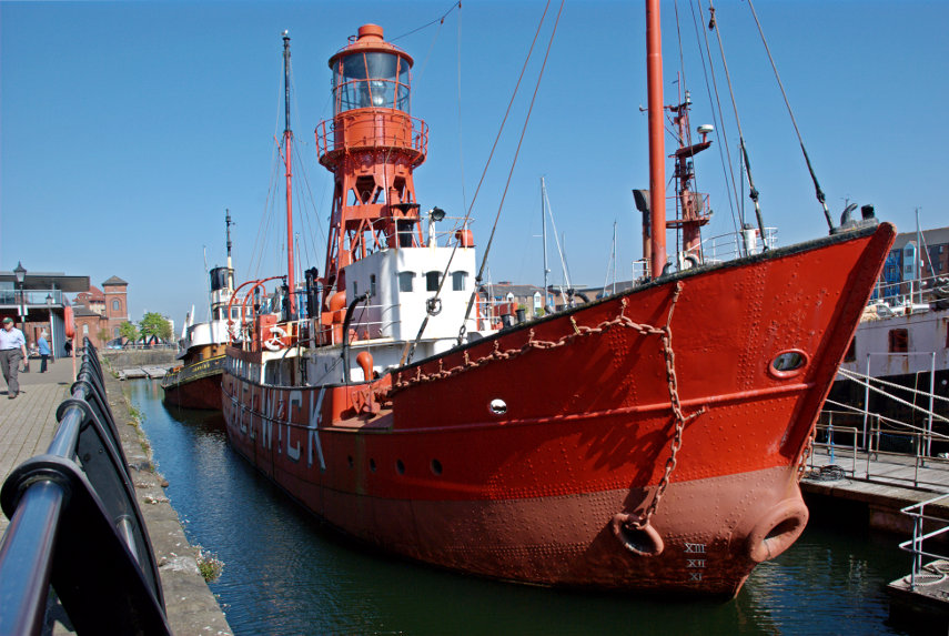
Looking in the opposite direction we can see boats in the marina and, in particular, two old vessels. The nearest is 'Canning', an old steam operated tug, and the further of the two is 'Helwick', an old lightship, both of which are no longer in service and have been kept as museum pieces.

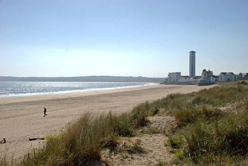
Swansea is on the coast and the sea can be found a short walk south across the marina. It is on a bay called Swansea Bay, no surprises there, and there are long stretches of beach composed of fine sand, suitable for children, which run round the bay as far as Mumbles.

We were both getting a bit tired now so it was back to the hotel to prepare for an evening meal. So far we have liked what we've seen and tomorrow is another day.

Dial-a-ferry

Dial-a-ferry

Six weeks ago to the day we were going to do this very trip but I had a heart attack instead so it had to be cancelled. However no heart attack this time so we left home to do the short drive (10 miles) to East Mersea. You have probably not heard of East Mersea which is not surprising as it is in the middle of nowhere and there is very little there except Salt Marsh, sand and water.

So why are we bothering? Well we don't intend to spend the day at East Mersea as we are going to call the foot ferry which will take us across the water to Brightlingsea. You've probably not heard of Brightlingsea either but never mind.

We parked our car and walked down the footpath to the river wall and this is the view from that river wall.

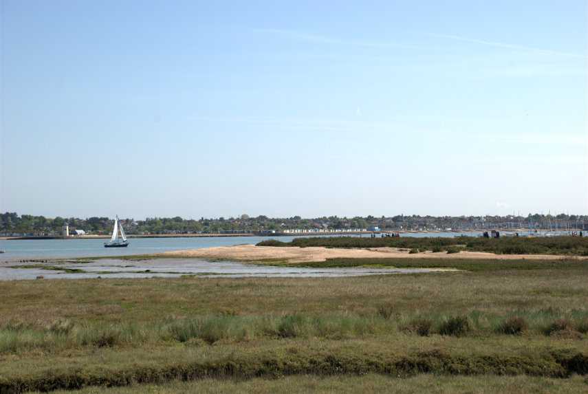
Across the other side of the River Colne is Brightlingsea. We need to get onto that sandy spit this side because that is where the foot ferry lands. We had, by this time, telephoned  from my mobile phone for the ferry to come over from Brightlingsea to pick us up. The ferry runs a scheduled service from the middle of July to the end of August but outside of those times there is a scheduled service at weekends and bank holidays but during the week it has to be requested by telephone. It's rather novel really and something we have not done before so we had to give it a try.

We reached the beach easily enough although some of it was hard work in the very soft dry sand. One step forwards, half a step back, but we got there. Having reached the pick-up point we could see, in the distance, the ferry making its way toward us.

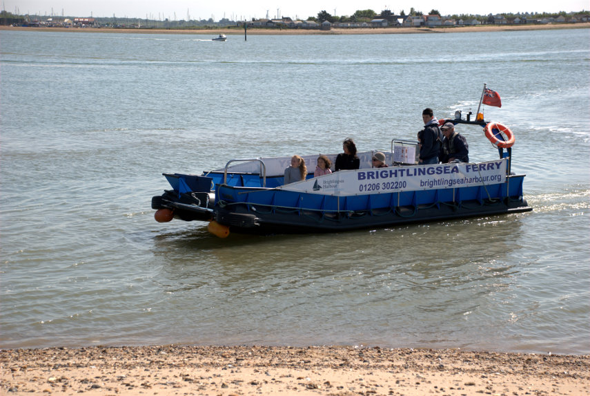
As it got nearer we could see that there were passengers on board who were obviously coming to East Mersea.

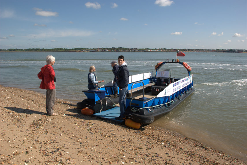
The bow of the ferry grounds on the beach and a small ramp is lowered to afford easy access. That funny woman in the red coat is apparently keen to get on board.

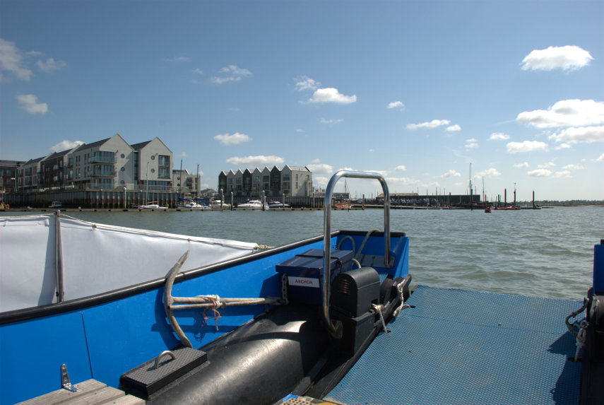
Well she did get on board and so did I and off we set. Warm, sunny and calm – just right. On the way across the boatman and I were discussing our heart attacks, as you do, and in a fairly short time we were nearing Brightlingsea Harbour.

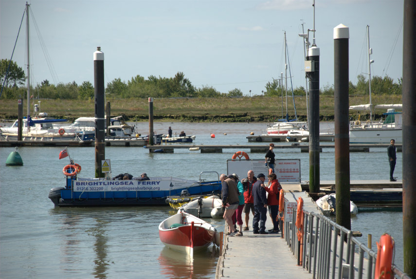
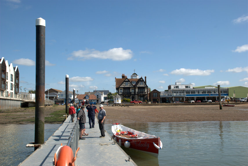
It wasn't long before we were moored at the end of the harbour pontoon and we set off along the pontoon to reach land.


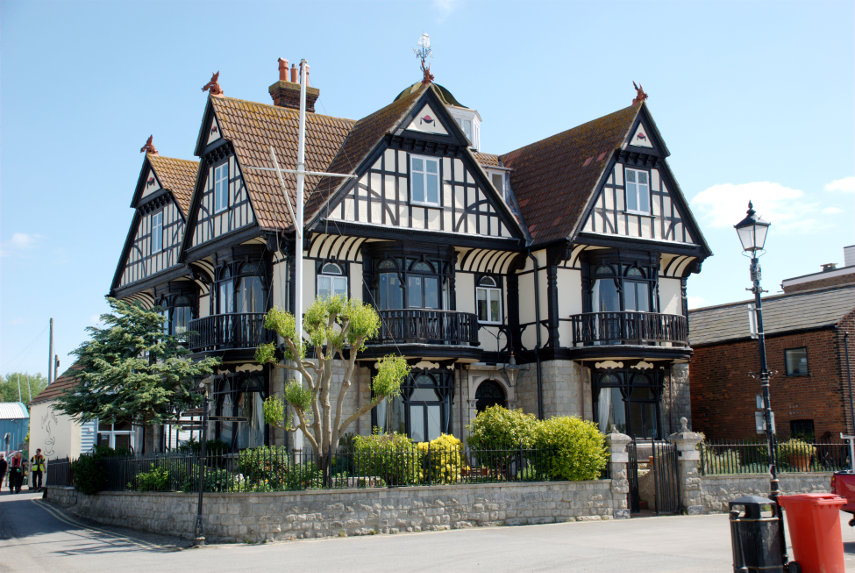
The first rather obvious building we noticed is this one. It used to be the Anchor Hotel but has now been converted to appartments. Dating from around 1901 it is a listed building although only just over a hundred years old. A very attractive building.

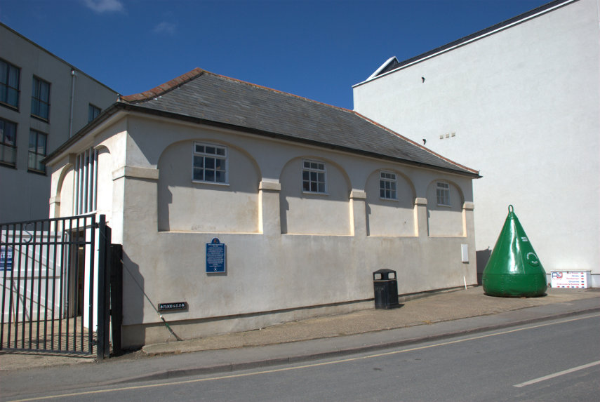
A little further along the street is this Cinque Ports Wreck House built around 1811. Interestingly there is another building in Sydney Street in Brightlingsea which is labelled "Cinque Ports Wreck Warehouse". I haven't been able to discover why there are two similarly named buildings.

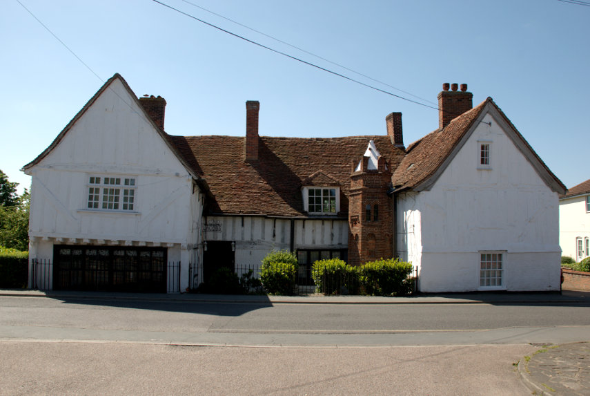
Having walked from the harbour area into the centre of the town we found Jacobes Hall, reputedly the oldest timber-framed building in England, built during the fourteenth century. The people that lived in this house paid for the church to be built so they must have been pretty wealthy.


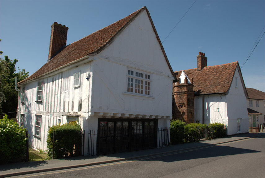
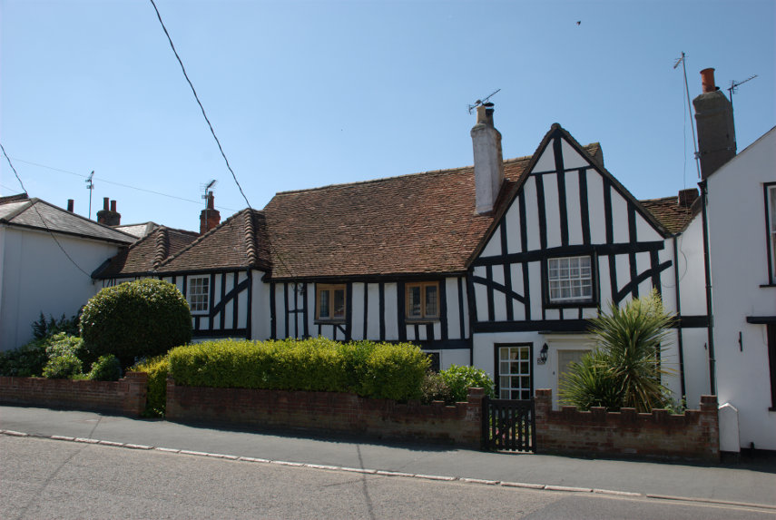
 A little further along the same road was another timber-framed hall house.

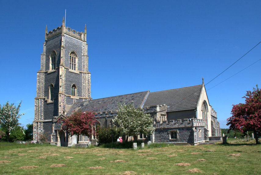
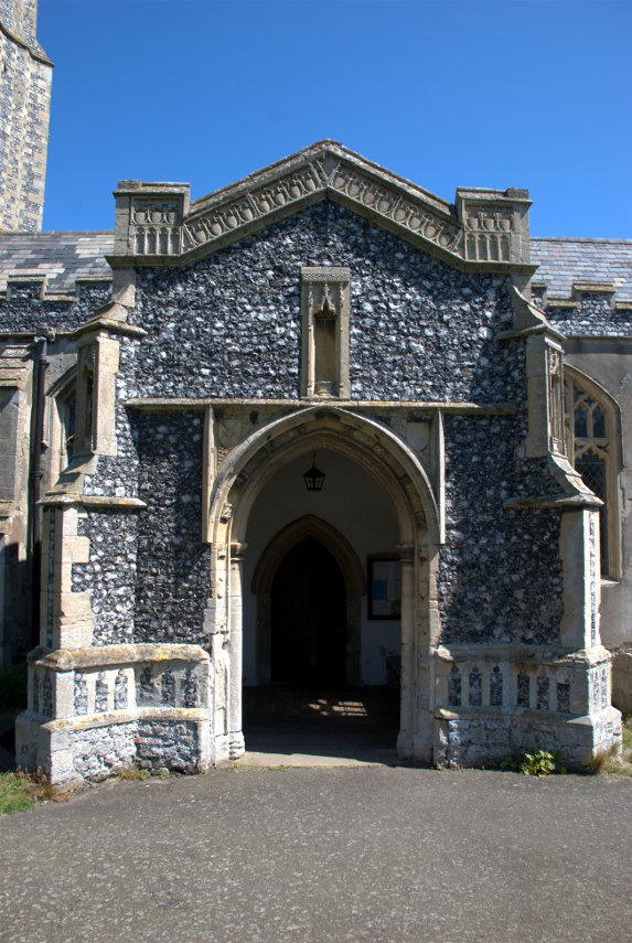
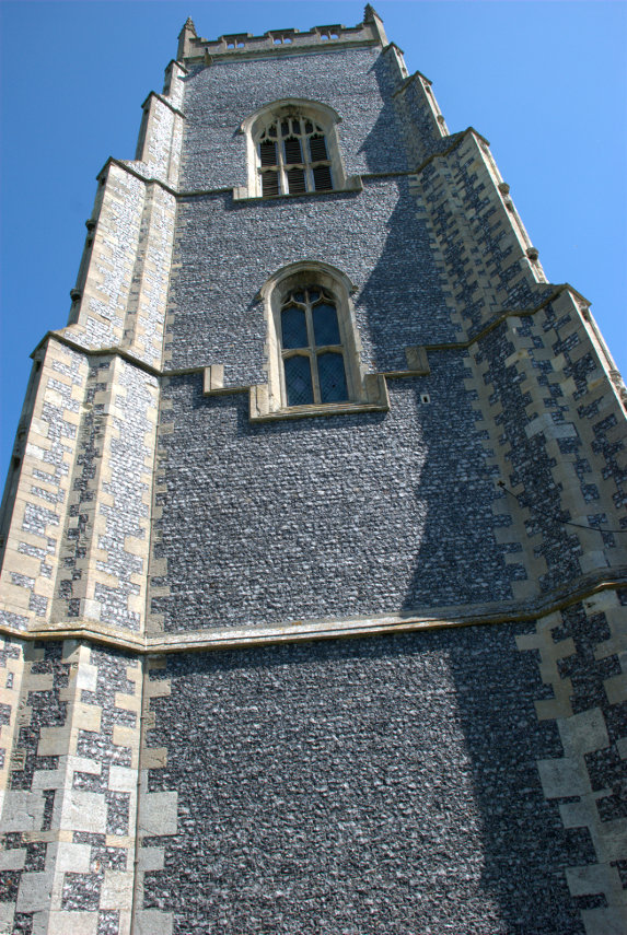
We wanted to visit the parish church next but it was on the outer edge of the town, about 1.5 miles from the centre, so we decided to go by bus. Built around 1250 this church is not easily missed with a tower not far short of 100 feet high and most of the building covered in flushwork which is extraordinary. In the recent blog post "Following the Stones" I mentioned the flushwork on Hall Place but this church puts it to shame. We have not seen so much flushwork on one building.


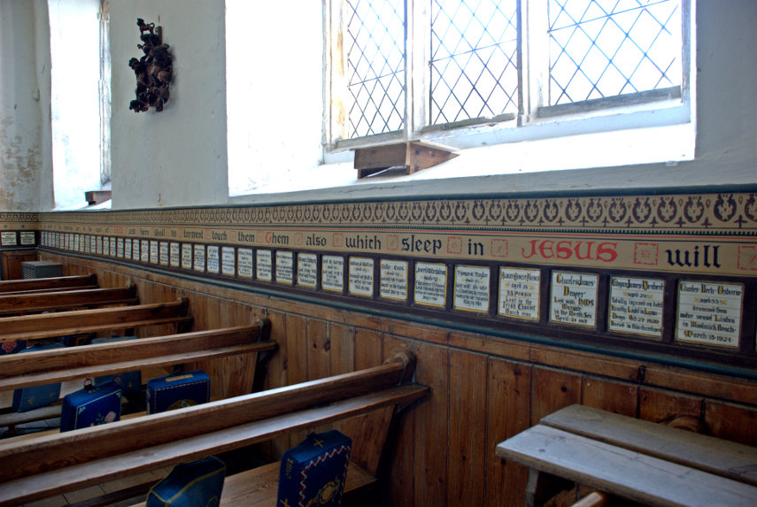
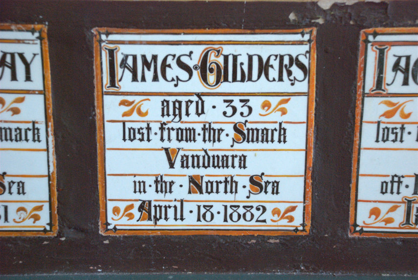
There is an unusual feature inside the church in the form of memorial tiles in a strip all round the church. There is one for each parishioner who lost their life at sea – 213 in all.


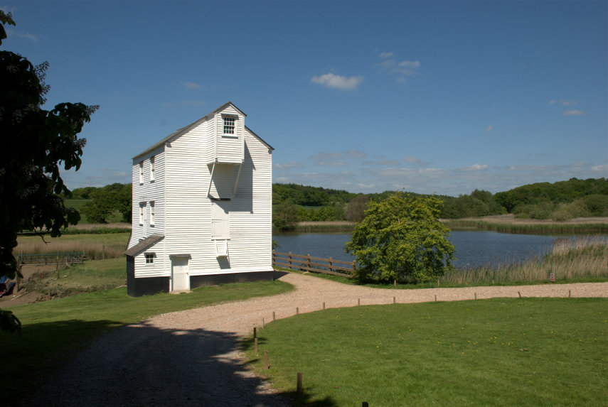
At this point we realised that we were only about half a mile from the Thorrington Tide Mill, built around 1831, so we decided to walk there. We followed the footpath on the side of the road and soon found the mill entrance. The public have access to the mill only in the afternoon of the last Sunday of each month and also bank holidays so we weren't able to go inside but we did have a good look around the outside.


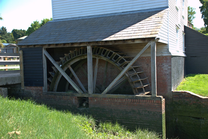
A tide mill works from a large mill pond, shown in the first of the two pictures above, which is filled at high tide then closed off. After the tide level has dropped the sluice can be opened to let the water back out via the water wheel, shown in the second photograph above, which then drives the mill. Clever eh? We would like to see inside so perhaps we'll have to try and arrange a re-visit when it's open.

We now crossed the road to the bus stop and got the bus back to Brightlingsea but got off one stop before the town centre. This takes us a little closer to Bateman's Tower which we were planning to see next and after a short walk there it was.

That sandy point across the water is where we started this trip from.

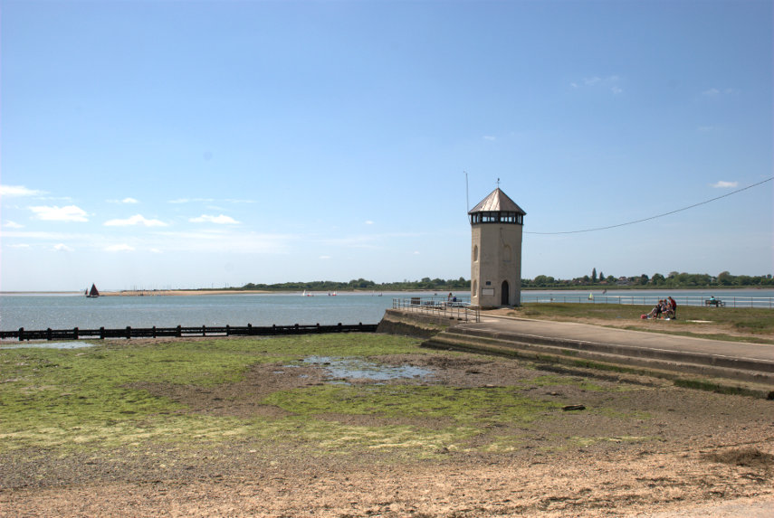
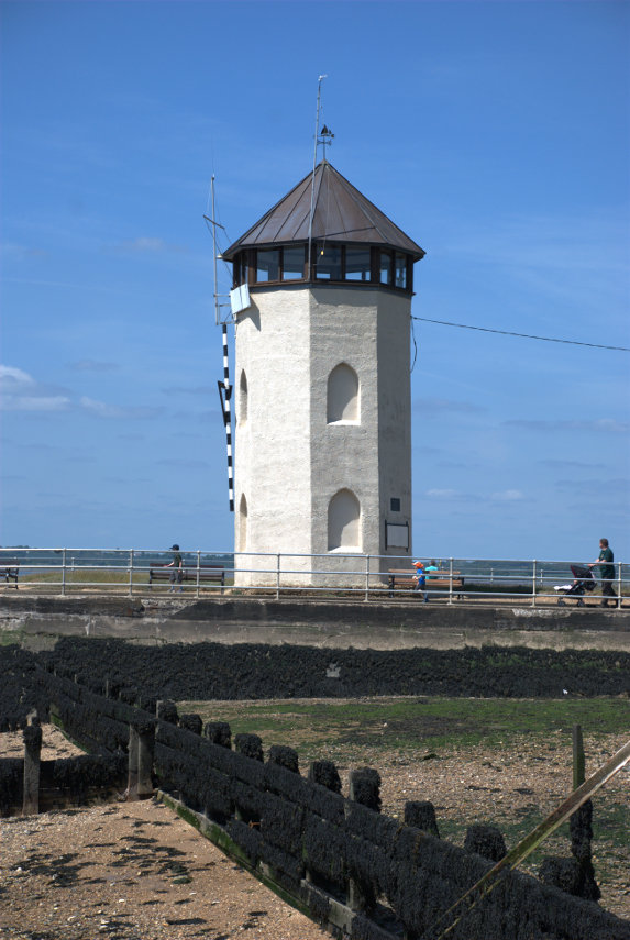
Built in 1883 by John Bateman the tower was used as a folly for his daughter to recuperate from consumption; however it may have been intended as a lighthouse as part of a failed plan to expand the port.

You may notice that the horizon in the picture is level but that the tower is leaning so it's not the photographer's fault. It is said that its foundations were laid on bundles of faggots (brushwood) so the fact that it leans shouldn't come as a surprise.

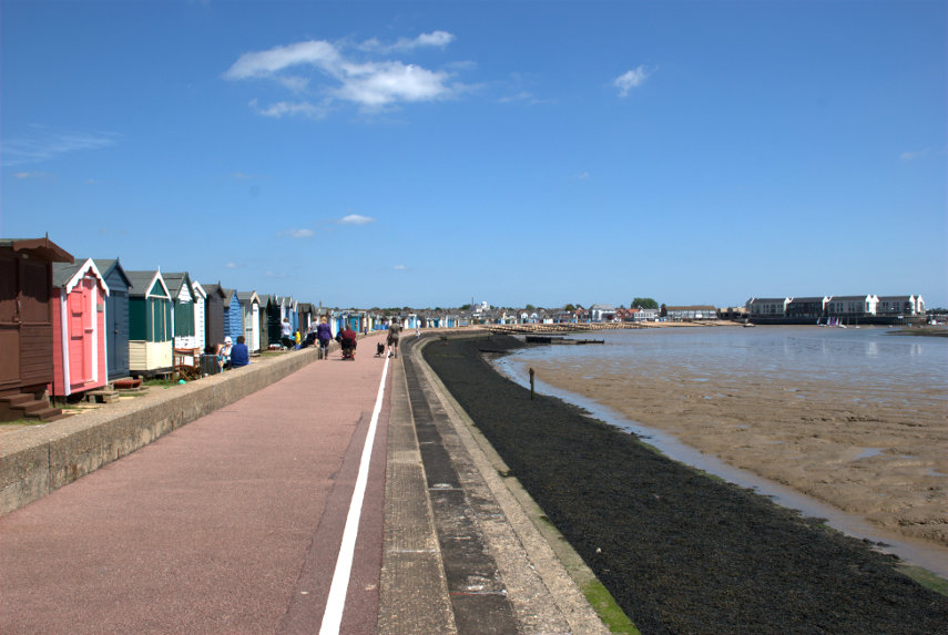
We walked back, on the little promenade, to the harbour where we asked to be taken back to East Mersey on the ferry and thence home.


Leave a comment

I went 220 miles to Devon for 30 minutes – Sunday.

I went 220 miles to Devon for 30 minutes – Sunday.

I was on my own because Amanda was unable to come with me this timesmilies but she drove me to our local station where I was to catch the train to London but we were greeted with the news that the train was cancelled. Brilliant!  smilies  smilies

The next train was in half an hour which meant there would be little margin between getting to London Waterloo and catching the train to Axminster. Missing that train would mean an hour's wait for the next one.

I did get the next train and changed at Stratford onto the Jubilee line bound for Waterloo. When we were about halfway to Waterloo I decided I'd get to Waterloo at the time my train was due to leave and so probably wouldn't get it. As we travelled nearer to Waterloo the time/distance between stations seemed to be getting shorter. Was there hope yet? smilies

We finally arrived at Waterloo about ten minutes before my train left so I had a chance and finally reached the entrance to the platform with five minutes to spare. I did, after all, catch my intended train at 11:15 AM. smilies

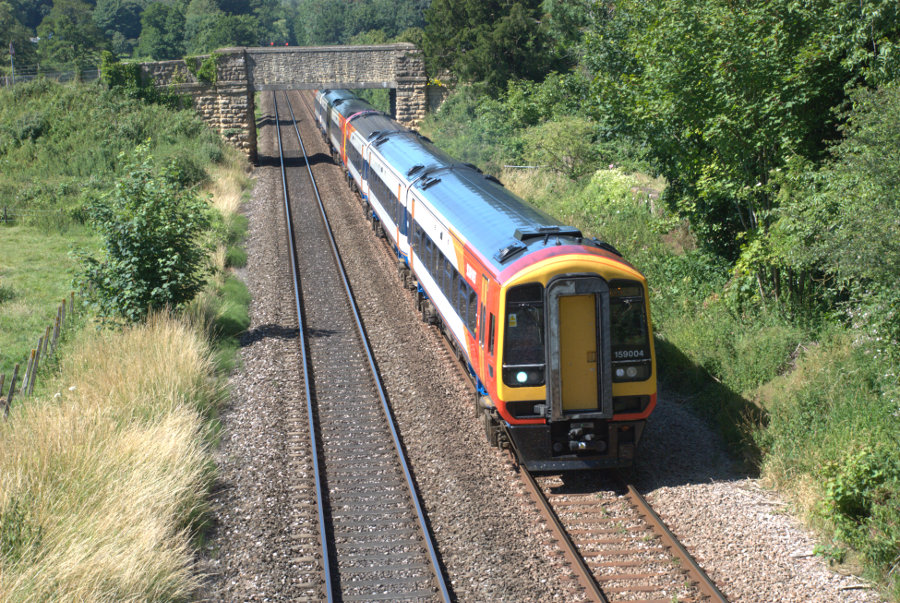
This train, on the Waterloo-Axminster line, is the sort of train I travelled on:

After an uneventful journey of 2 hours and 45 minutes we arrived at Axminster in Devon. My bus was waiting outside the station and we set off south for the coast shortly after.

What I really wanted to do was to go to Lyme Regis in Dorset which is where I'm staying for the next few days. The bus soon reached the Devon/ Dorset border and I'd left Devon about 30 minutes after I'd reached it.

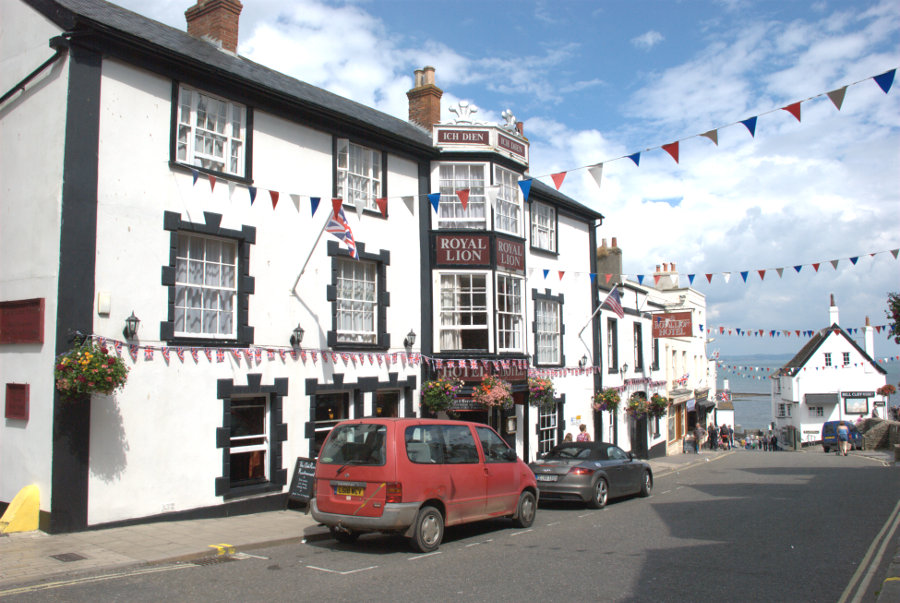
It was an interesting 30 minute ride on roads which were often only just wide enough for the bus and, at last, we were on the downhill stretch into Lyme Regis where I got off. After a very short walk I arrived at the Royal Lion Hotel which was to be my base for the next three nights.

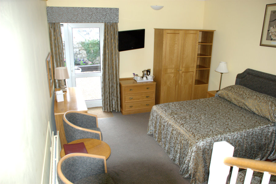
Very friendly and efficient staff here and I was soon shown to my room. Note that the sea is just at the bottom of High Street.

It was a triple room with the single bed that I used just out of sight on the right (You can actually just see the corner). The entrance to the room was at a higher level hence the few steps down with part of the banister rail showing. The bathroom was also at the higher level. There was also a small outside terrace accessed using the door at the far end where a small part of the sea was visible.

A nice room in, what turned out to be, a nice hotel. It was, at one time, a coaching inn and dates from around 1610.

I telephoned Amanda to let her know that I had arrived safely and then made myself a cup of coffee. Having settled in I wound up my legs and set off to explore. I have a feeling that I should have had a larger spring fitted.

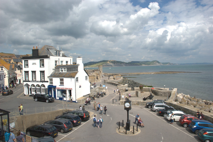
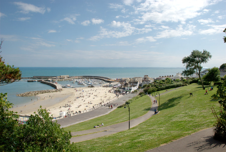
At the bottom of High Street is the Square and you can see that the time is now about 3:15 PM.

I headed west along Marine Parade which was lined with chip shops and ice cream shops together with an amusement arcade at the far end. This proved to be the tackiest part of the town but very popular.

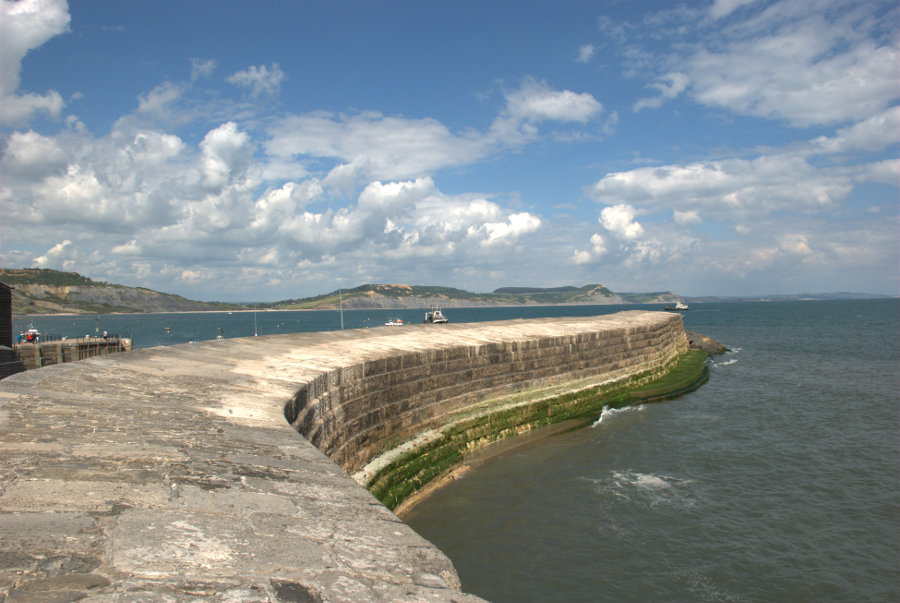
I reached the harbour and just HAD to walk out on one of the harbour walls known as the Cobb.

This harbour wall features in Jane Austen's novel 'Persuasion', and in 'The French Lieutenant's Woman', a novel by British writer John Fowles, as well as the 1981 film of the same name, which was partly filmed in Lyme Regis.

Do you think I'd make a film star?

Lyme Regis is mentioned in the Domesday Book of 1086 and in the 13th century developed as a major port. The first record of the Cobb is in 1328 and it has been destroyed or severely damaged by storms several times. It was swept away in 1377 when 50 boats and 80 houses were also destroyed.

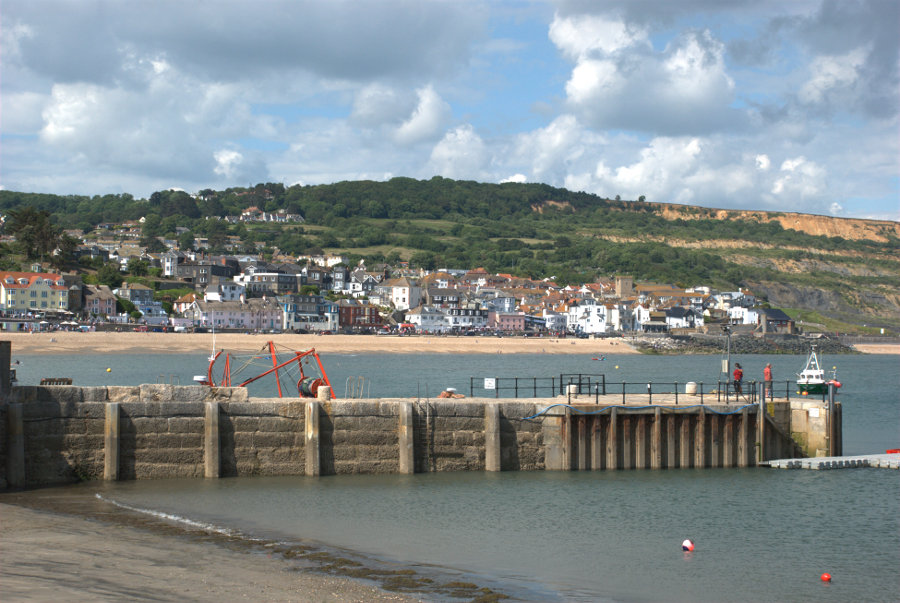
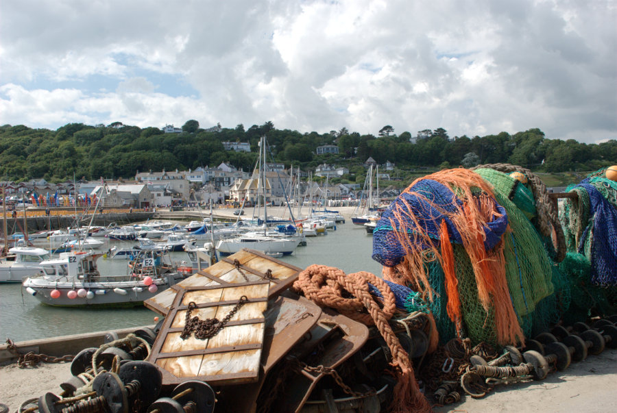
The next (top) picture is Lyme Regis seen from the outer end of the Cobb and the second picture looking across the harbour shows the western most part of Lyme Regis, like a small detached village, which is also known as the Cobb. Confusing ain't it?


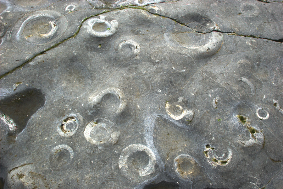
A 15 minute walk further west along the beach with a low tide and I reached some exposed slabs of rock which were obviously very fossiliferous.


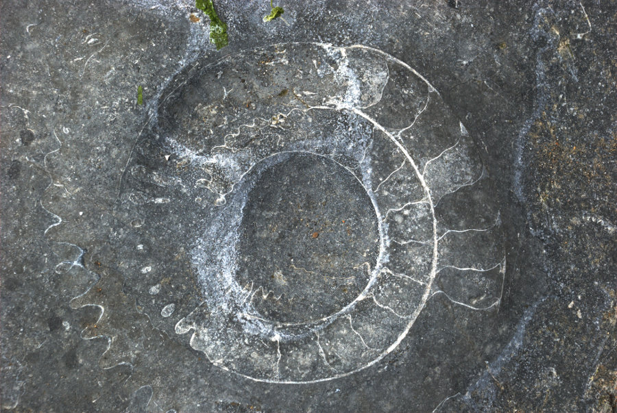
Each of those circular shapes are Ammonites which are about 200 million years old (at last I've found something which is older than me). In the second photograph erosion has effectively sectioned an ammonite showing the internal septa.

I walked back along the beach and, at this juncture, I have to admit that sandals were not the best choice of footwear (sand and gravel gets between feet and sandals) but I didn't want to wear boots for the whole time so I was stuck with them.

From the Cobb village I went up into Lister Gardens which is mostly grass and trees with a good view of the harbour.

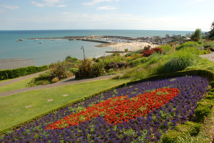
A little further towards the town it changes to Langmoor Gardens which features a number of flowering plants and is, consequently, more colourful.

Back in town I found the Riverside Walk.

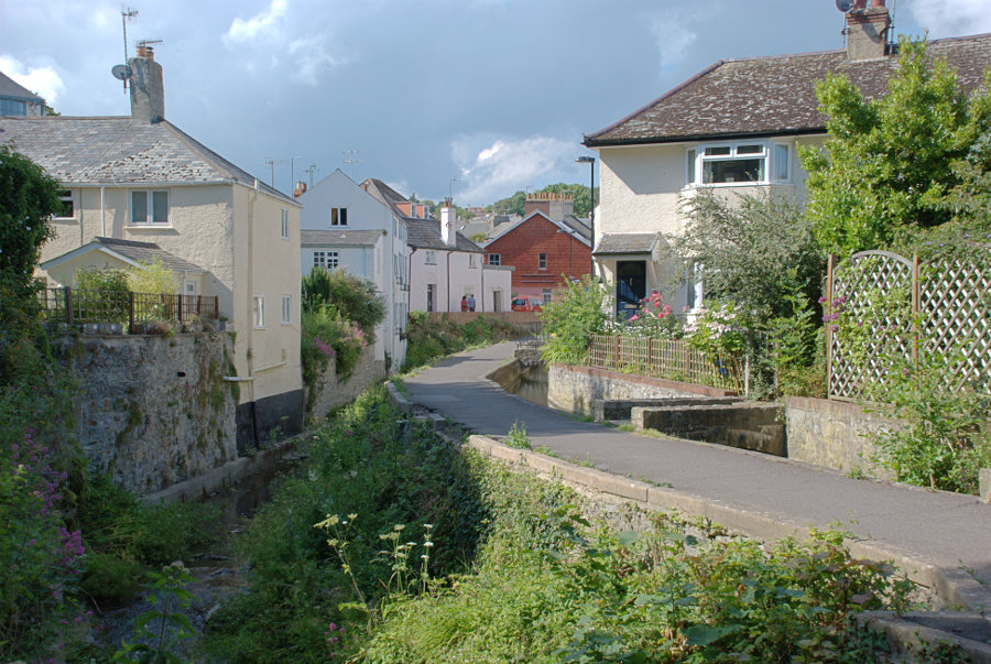
The River Lym, down in the gully on the left, is really quite small except when it's in flood and is only 3 miles long from source to sea although there were as many as thirteen mills using the energy provided by this short river before the steam engine was invented.

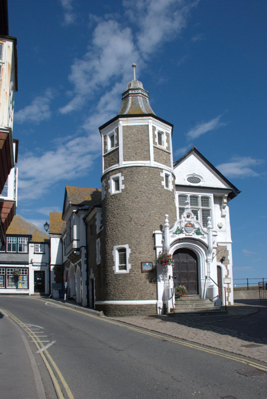
There are plenty of narrow lanes and streets here and I eventually emerged on one opposite the Guildhall.

Back to the hotel in plenty of time for dinner.

(Tomorrow, Monday: I take a ride, go up in the world and suffer abject failure)


Lynn – Day 2

Lynn – Day 2

Another hot, sunny day dawned although I wasn't awake to see that part. We went down to breakfast and very nice it was. We both had a cooked breakfast followed by toast and marmalade, of course, then it was time for some serious tourism.

Wherever we went in Lynn we went via The Walks past the Red Mount Chapel. It wasn't because we liked it so much but it was the most convenient route into the old part of the town.

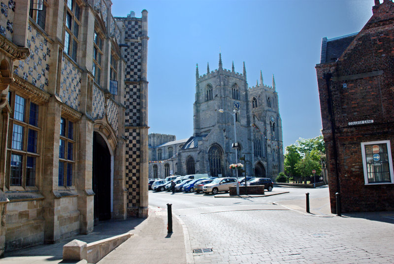
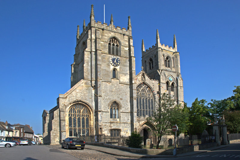
We were headed for St. Margaret's Church, or the Minster as it is known, and Saturday Market Place. King's Lynn was originally two towns so it has two churches, two guildhalls and two market places. We will be seeing the other market place later.

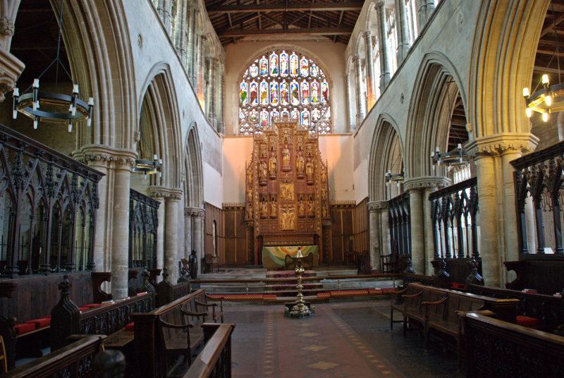
For a parish church the minster is big.


The space on the left where there are some parked cars is Saturday Market Place which is used as a car park when there isn't a market being held.

Parish churches don't normally have two towers and especially towers that large and you can probably see in the top picture that there is a sizeable tower, although not as high, further back over the crossing.

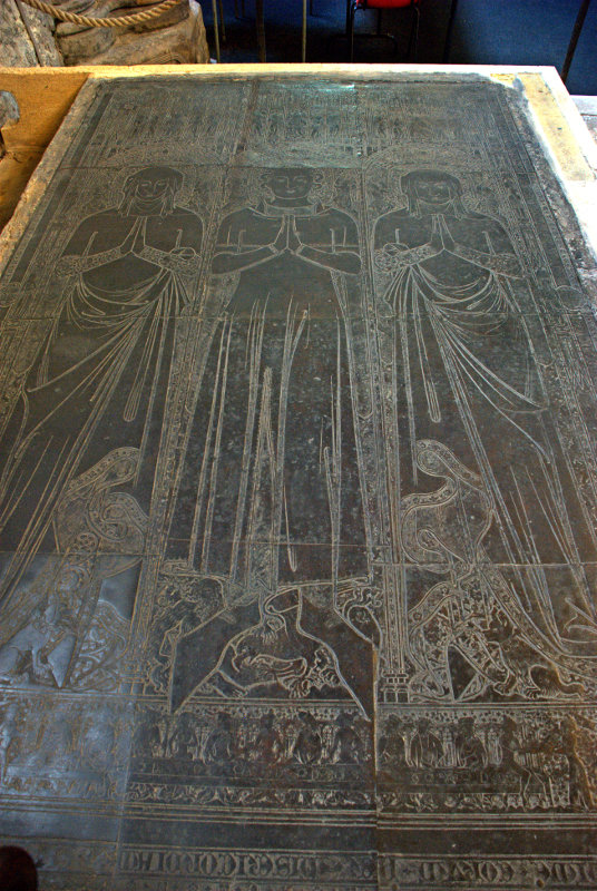
This church also contains the largest monumental brasses in the country dating from the 14th century and the figures depicted must be near life-size. This is one of the pair.

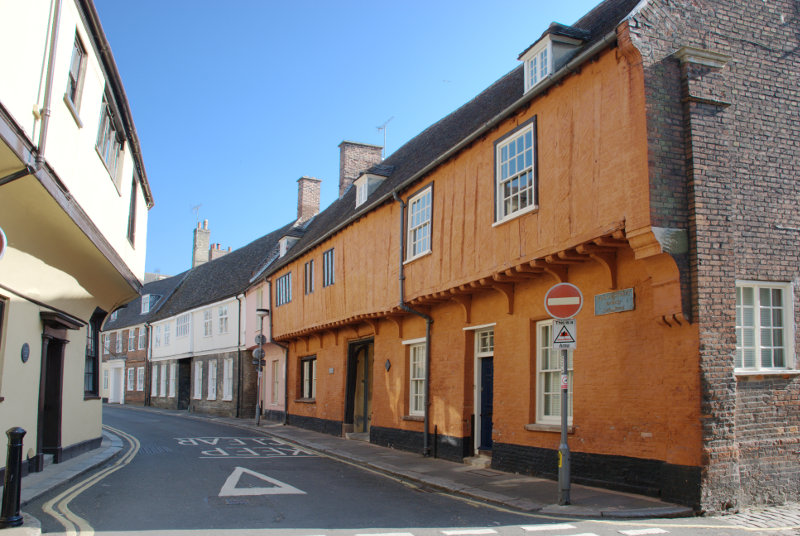
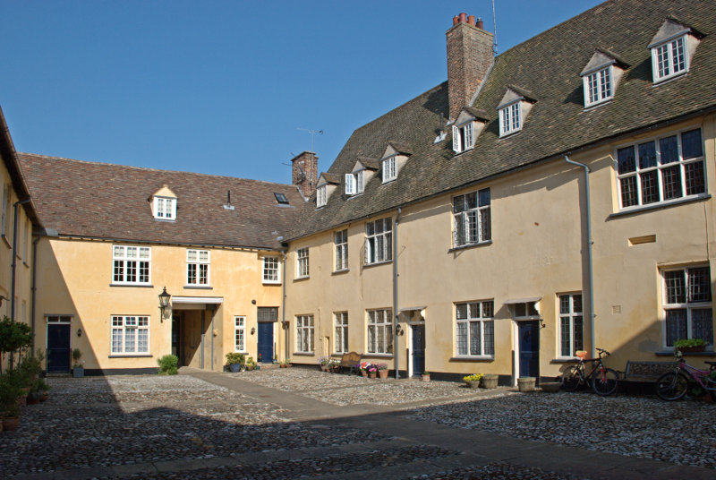
Just south of the minster is Nelson Street and Hampton Court. This is not Hampton Court Palace in London but it is pretty spectacular all the same. The whole building was formed over a period of 300 years.

The South Wing was constructed first, consisting mainly of a 14th-century merchant's hall house and is thus the earliest surviving section.

The West Wing was constructed towards the end of the 15th century, probably as a warehouse which was later converted into a house. The East Wing was also constructed at the end of the 15th century.

The North Wing completed the courtyard a century later.

In the picture above the doorway into this courtyard is visible in the far wall.

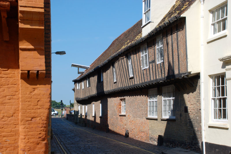
Next to the north wall of Hampton Court is St. Margaret's Lane with the 15th century Hanse House, a Hanseatic Warehouse, along one side. The Hanseatic League was a trading confederation which existed from the 13th to the 17th centuries.

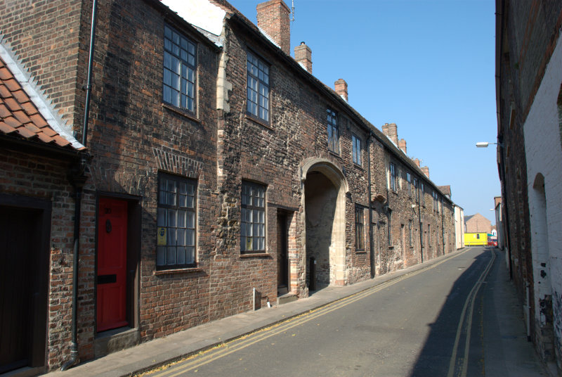
Running eastward from the junction of St. Margaret's Lane and Nelson Street is Priory Lane.

St. Margaret's Church, the Minster, was originally part of a medieval Benedictine Priory until the Reformation when the priory was disbanded by Henry VIII but the church was saved as a parish church. Priory Lane includes buildings in the medieval priory range. Note the rather imposing archway.

It was rather nice walking around this area with its old narrow streets because it offered plenty of cool shade.

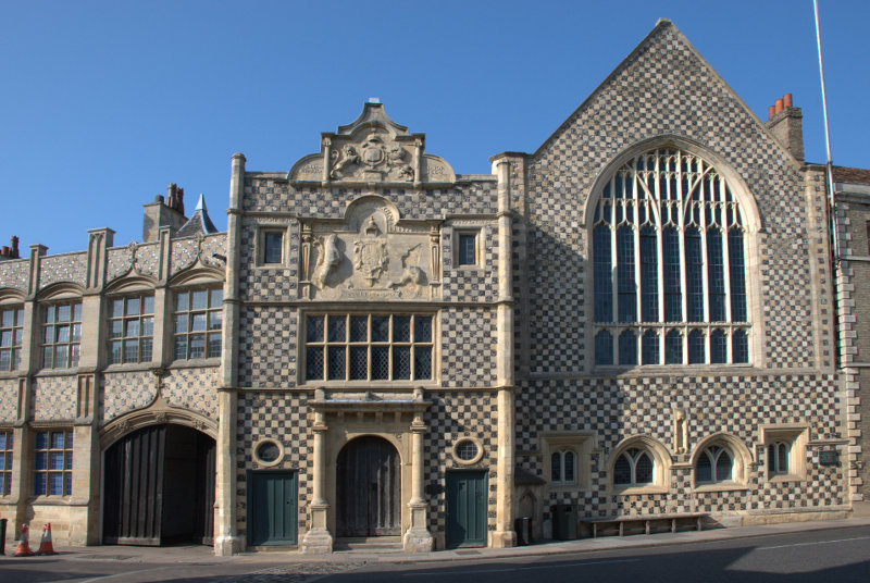
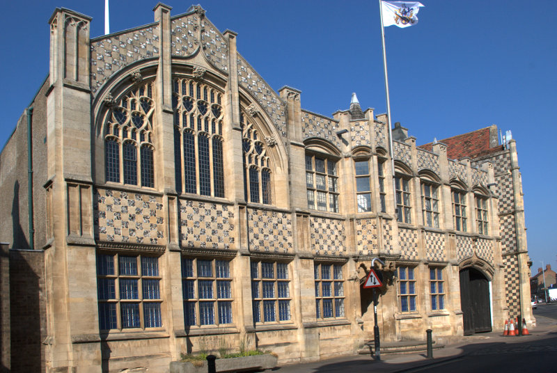
We walked back past the church to the north side of Tuesday Market where we found the town hall complex which included the 15th century Trinity Guildhall.

The guildhall includes the facade with the doorway in the centre of the picture and the gabled building to its right. The part on the left is the town hall shown below.

The town hall is an extension built in a similar style in 1895. You can see the Guildhall jutting out at the far end.

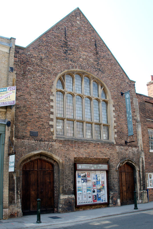
We were now heading further north along Queen Street and then King Street to see St. George's Guildhall. The largest surviving 15th century guildhall in England.


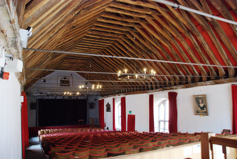
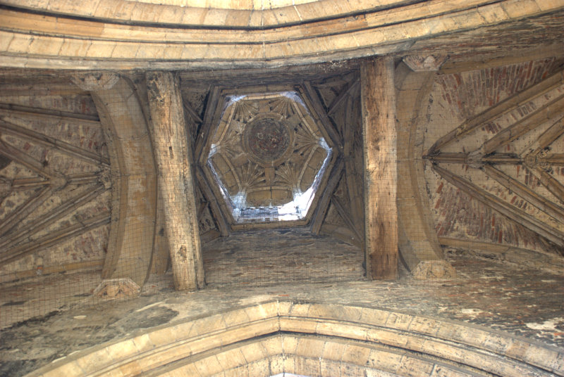
The guildhall ha since been converted for use as a theatre and the second picture shows the structure of the original roof.

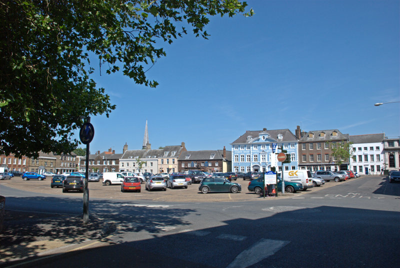
We now travelled the short distance to the larger Tuesday Market Place. As is the case with Saturday Market Place when a market is not beig held this market place is also used as a car park.

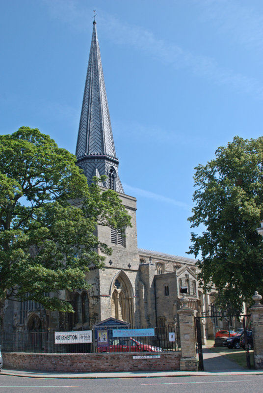
The prominent blue and white building is the Dukes Head Hotel and the spire poking up above the rooves to the left is St. Nicholas' Chapel. I think that I can say, without exaggeration, that this is the largest chapel that I have ever seen.

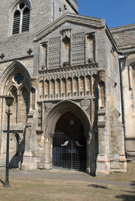
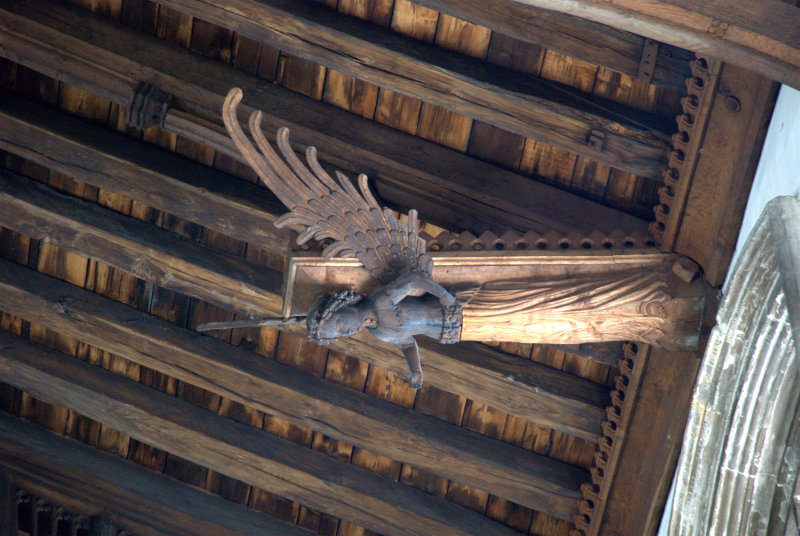
Apparently it can't be called a church because it isn't a parish church and that honour goes to St. Margarets so it must be a chapel. Built in the 15th century it has a very fne porch and some of the best carved wooden angels in the roof that we have seen.


To the south of the chapel by a side entrance to the churchyard was the Exorcist's House. The position of Exorcist in past enturies was one which a Catholic priest could hold as he progressed up the church career ladder. It has a side entrance that leads directly into the churchyard and has the reputation of being haunted.

Behind the chapel is Pilot Street where we spotted these nice timber-framed buildings.


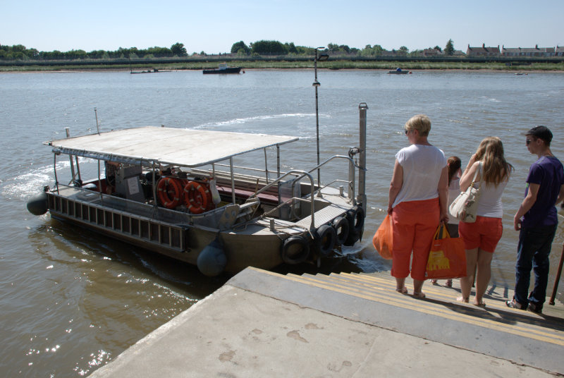
We now headed for the river down Ferry Lane. You won't be able to guess where we're going.


It was a strange looking little boat but eminently suited for its purpose.

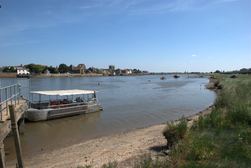
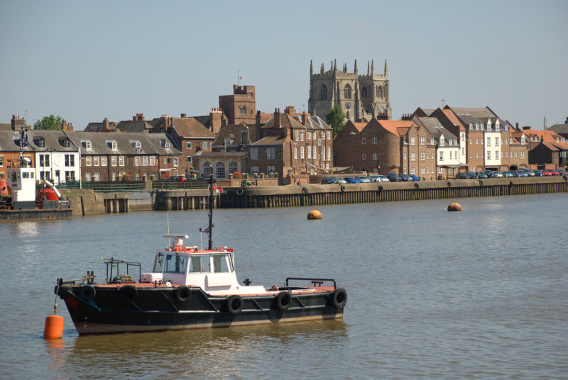
Here we are on the other side of the river in West Lynn looking back at the King's Lynn waterside.

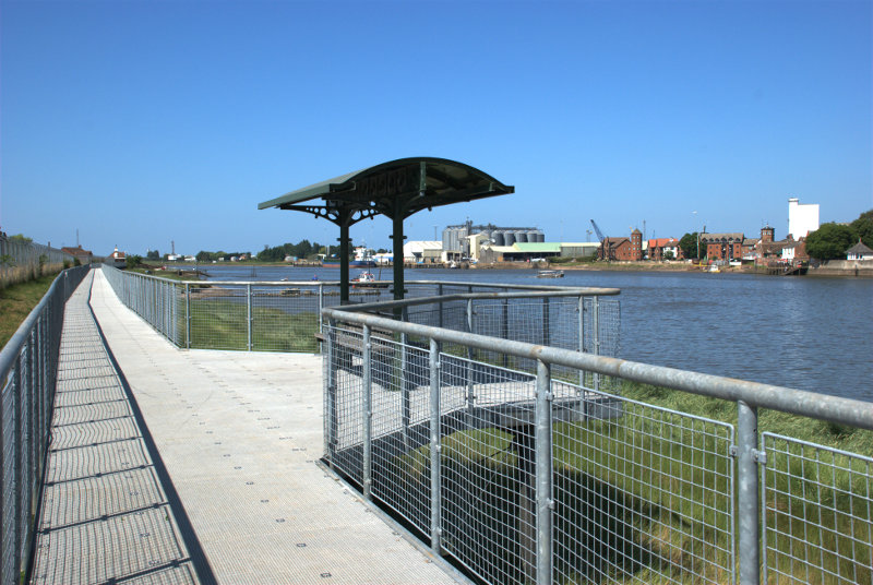
We walked along the boardwalk which runs along the bank and had some good views of King's Lynn.


Somewhere back there is where we got off the ferry and we have to walk back again. We had worn our legs down to short stumps by now so that is what we did. We went back to the ferry and went 'home'.

We're off somewhere different tomorrow.


Lynn – Day 1

Lynn – Day 1

As someone, somewhere, had decided to award us a week of summer weather we decided we'd better make use of it before it disappears so we arranged to go to King's Lynn for four days.

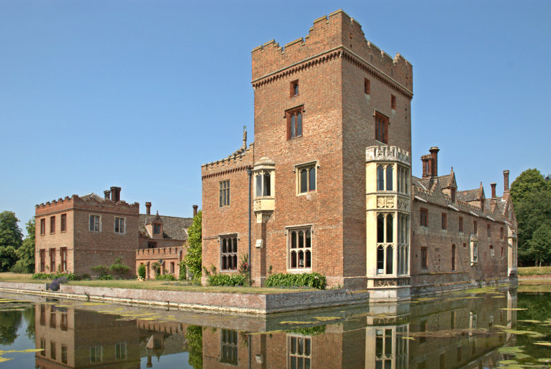
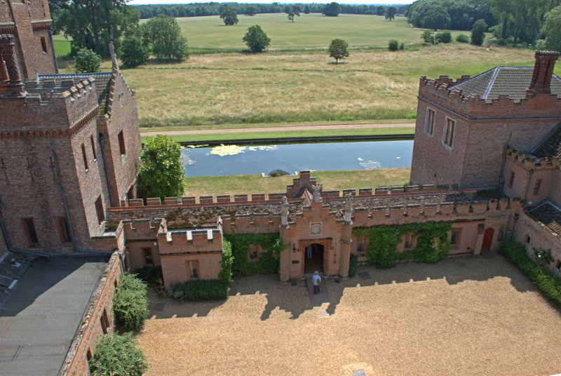
So, on a hot sunny Wednesday, we set off for a 93 mile journey north to north-west Norfolk which took just over two hours and took us through Braintree, Sudbury, Bury St. Edmunds, Thetford, Mundford and Oxburgh. One wouldn't normally go through Oxburgh on the way from Mundford to King's Lynn but we chose the few miles detour because we wanted to see Oxburgh Hall. Built around 1482 Oxburgh Hall is a moated manor which was always intended as a family home and not a fortress as the crenellations are symbolic fortifications rather than actual.

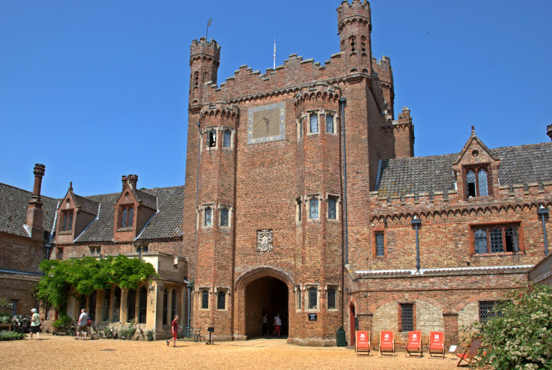
The main entrance and gatehouse is on the opposite side of the view shown above and the house is arranged around a large open quadrangle where the next picture was taken showing the large impressive gatehouse.

The eyesore deckchairs have been provided by the National Trust who must have been desparate for visitors to notice them.

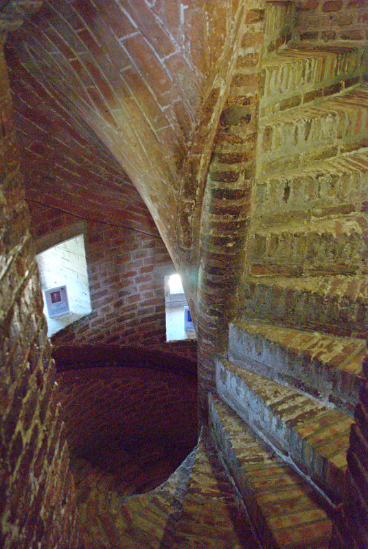
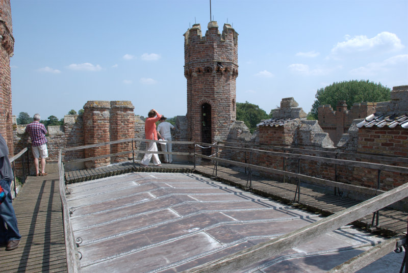
It is possible to go up onto the roof of the gatehouse if you don't mind the climb up the spiral stairway.


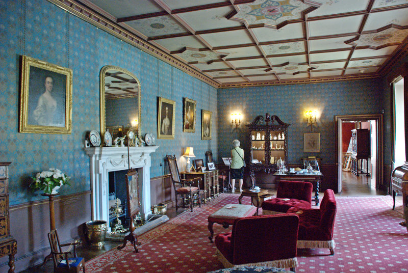
The rooms, as one might expect, are pretty impressive as this view of the West Drawing Room shows although one needs to ignore the strange lady at the far end.

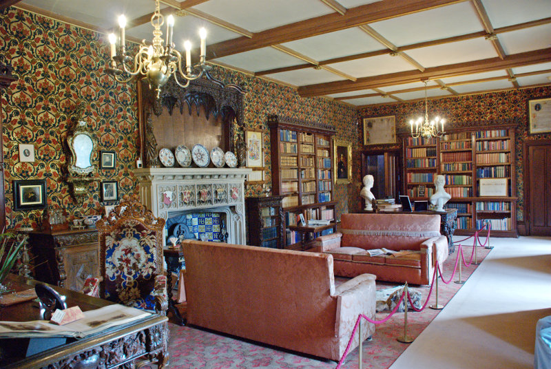
The Library is equally impressive.

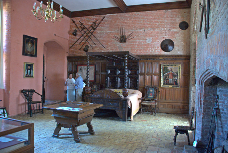
The Queen's Room is, as you'd expect, quite large.

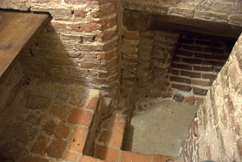
But off to the left, out of the picture, is another small side chamber and in the floor of this chamber is a small trapdoor which, when closed, blends in with the tiled floor. However, when opened, this trapdoor gives access to the Priest Hole. Because of the Catholic faith of the Bedingfeld family, a Catholic priest may have had to hide within the small disguised room in the event of a raid.

The entrance is just large enough for a person to slip through and this is all that there is inside. I am sitting on one of two benches with the other showing to my left and the brick slope on the far side of the floor is the only way in and out. Calling it a room, even a small room, is stretching the imagination somewhat. Getting in, and out, is not easy and it reminded me of my caving days. When I came out Amanda went in. We both survived.

If the King's men (soldiers) turned up unannounced then any visiting priest would have had to get in here quickly and possibly stay there for a few days. There is no toilet and no light so don't even think about it but it was better than being dead.

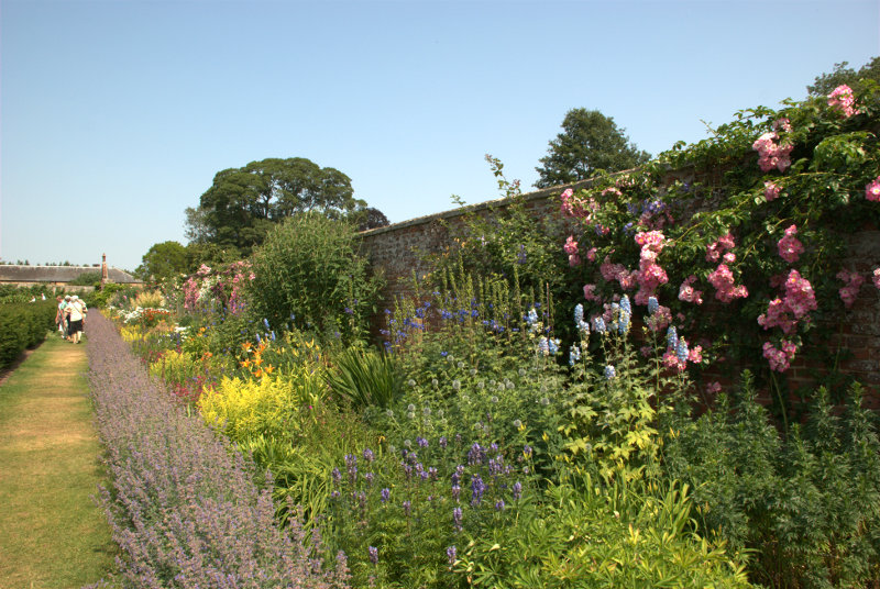
On a lighter note there is a very impressive flower border in the grounds.

It was an interesting and enjoyable visit but now we must go onward to King's Lynn. We arrived in King's Lynn at our B&B at around mid-afternoon and settled in then decided to have an initial short exploration leaving tomorrow, Thursday, as our main exploration day for the town.

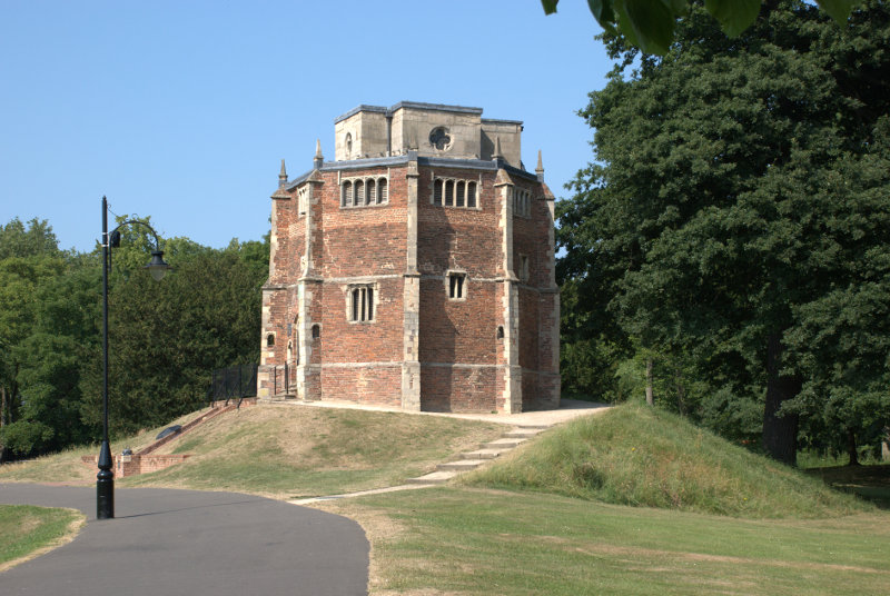
A short way from our B&B was a public park called The Walks and we knew that within the park was the 15th century Red Mount Chapel. It is unique and no other building like it can be found. It was built to contain a relic of the Virgin Mary but was also used by pilgrims on their way to Walsingham.

Built on instructions from the prior of Lynn the inner core is divided into 3 storeys and there is an additional cross-shaped ashlar building in Ancaster stone on top.

A strange place indeed which Pevsner described as one of the strangest Gothic churches in England.

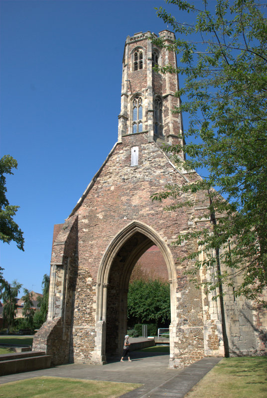
Moving towards the river to the west end of The Walks we crossed the road into another small park known as Tower Gardens. In this park is the Greyfriars Tower which is all that is left of a Franciscan Monastery. Take no notice of the strange woman at the base of the tower she seems, somehow, to get into a lot of my photographs.


Henry VIII had all such monasteries demolished but the tower at Lynn was left untouched because it was considered to be a useful seamark by sailors entering the town and is still clearly visible on the town's skyline to this day.

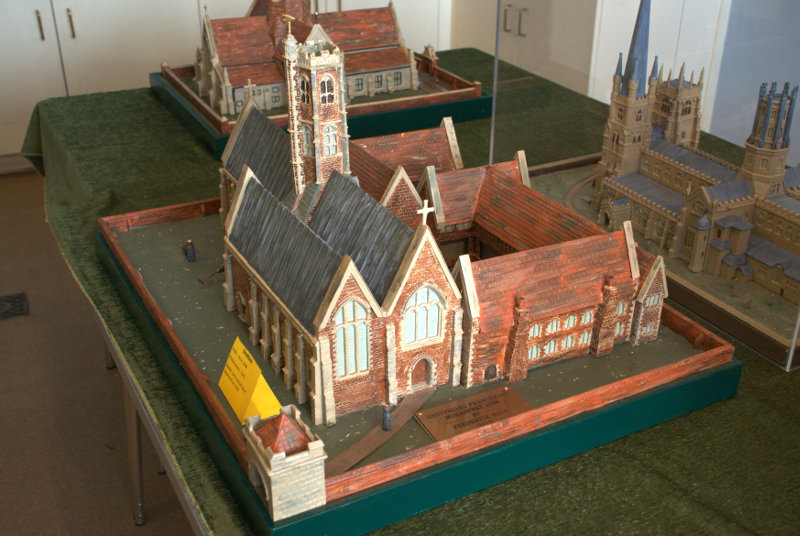
You can see from this model just where the tower fitted in.

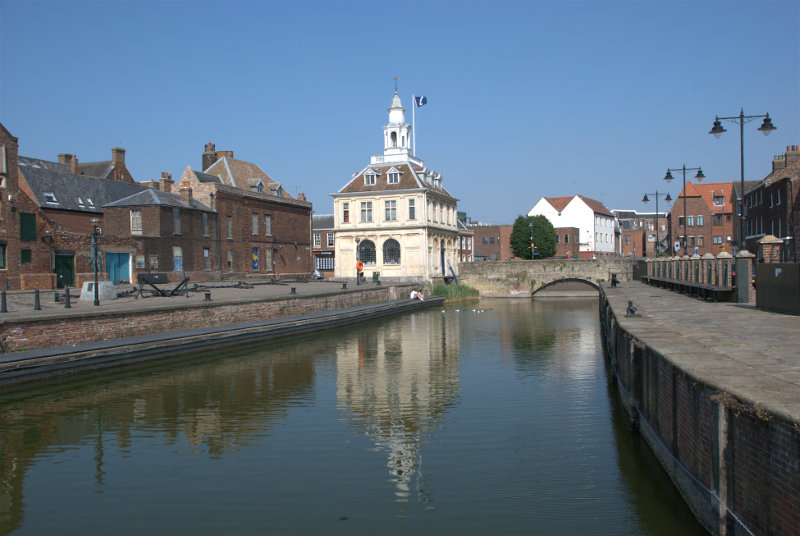
We moved further towards the river looking for the Tourist Information Centre so that we could get a free street plan of the town. We knew that it was located in the Customs House and eventually we spotted it.

Situated on the edge of Pur Fleet this building started life in 1683 as a merchant exchange but was bought by the Crown in 1717 for £800 and occupied by HM Customs and Excise until their move to a central office at Ipswich in 1989. It is now occupied by the local TIC. Pur Fleet runs into the River Great Ouse just behind the camera.

We'd had enough by this stage so having collected our free street plan of the town we headed back to our B&B. We'll be back in this area tomorrow.