| BeenThere-DoneThat |  |
The Unofficial Guide to Great Britain |
| Wells-next-the-Sea | Pictures by Subject | Norfolk | Home | |
| Forum is closed | The Blog | |||
| Wells-next-the-Sea (2), Norfolk | Location map |
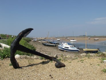 |
Wells-next-the-Sea.
This view is looking along the Harbour channel towards the sea which is about a mile away. The sea was much nearer in medievel times, when Wells was an important port, but sand has been deposited slowly since then causing the coastline to advance seaward. To reach the sea, and the beach, you can walk along the causeway, the green bank on the left, use the narrow gauge Wells Harbour Railway or drive down but you will have to pay to park your car. Because it is possible to drive the beach is a popular place although very extensive especially when the tide is out.
|
|||||
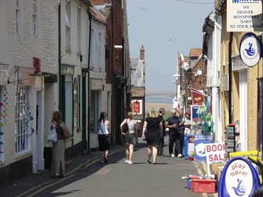 |
Wells-next-the-Sea.
This is Staithe Street where most of the shops and cafes are to be found and is, as you can see, rather narrow with some narrow alleys leading off. Staithe Street runs from the Quay up to Station Road although the railway no longer runs here and there is now no station.
|
|||||
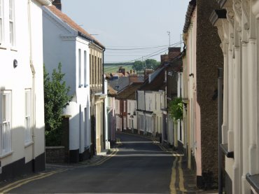 |
Wells-next-the-Sea.
Looking down High Street, once the commercial centre of the town, but which is now purely residential. I cannot, at present, find a reason for why the shopping centre moved from here to Staithe Street.
|
|||||
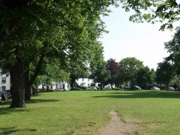 |
Wells-next-the-Sea.
This green, which runs parallel with High Street, is known as The Buttlands and was, apparently, used for archery practice in medieval times - hence the name.
|
|||||
| Forum is closed | The Blog | |||
| Wells-next-the-Sea | Pictures by Subject | Norfolk | Home | |
| Norfolk | |
England |
| All photographs are the copyright © of Barry Samuels unless stated otherwise |