 DoneThat
Long Melford, Suffolk, England
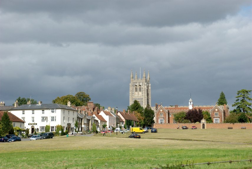

Part of Long Melford village green showing the church perched on top of the hill and the Tudor red brick Trinity Hospital (tudor for 'Old Folks Home'), built by Sir William Cordell, in front of it.
The church is at the northern most part of the village with the large village green running slightly downhill, past Melford Hall, to the bridge over the Chad Brook which is a tributary of the River Stour. South of the bridge is the main part of the village. Hall Street, the main street, is very wide with room both sides for cars to park at right angles to the road.
| Comment |  |

The church of the Holy Trinity was built mostly in the 15th Century and was completed in 1484. You cannot really avoid noticing what appears to be an extension on the end nearest the camera. This is the Lady Chapel which was completed in 1496.
| Comment | Another church view |
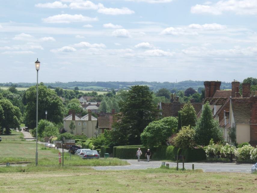
This view is from just by the Tudor hospital looking down to Chad Brook and the main part of the village running along the Stour Valley with Melford Hall just out of the picture to the left.
Long Melford gets it's name partly because, well, it's long! The village measures approximately 2 miles from north to south and just 1 mile south of the southern end, down the Stour Valley, is the town of Sudbury which was the birth place and home of painter Thomas Gainsborough.
| Comment | More village views |
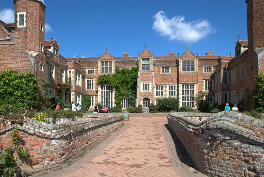
Kentwell Hall.
The Clopton family rebuilt Long Melford's church in the 15th century before building Kentwell Hall in the first half of the 16th century. The current owners purchased the house in 1970 which, by then, was in a very poor condition. Since that time they have brought it back to life and you can now see what they have done.
This view shows the front of the house and the bridge over the moat. We think that you'll be impressed.
| Comment | More views of Kentwell Hall |

Melford Hall.
Queen Elizabeth I was entertained in this turreted brick-built Tudor mansion which was built in 1578.
The property is currently managed by the National Trust and is open to the public but is not open all day so check opening times before you go.
| Comment | More views of Melford Hall |

This village is about 7 miles North of Long Melford and is clustered around a large village green with the church situated on the South East corner of the green.
It is a picturesque little place with some interesting old buildings but it's not worth making a special journey to see. If you are passing nearby then do have a look.
Parking here is a bit tricky!
| Comment | Location Map |