Browsed by
Tag: Lakes and Ponds

Butterflies and Flowers

Butterflies and Flowers

Butterflies? Flowers? February? It’s not as silly as it sounds. It all started this morning with a bright sun in a cloudless sky – it was going to be a beautiful day so we just had to go somewhere. That somewhere turned out to be Croft Castle.

We wanted to try and find some snowdrops which were supposed to be found in Pokehouse Wood. Don’t ask me where that name comes from because I don’t know and I’m not about to start guessing but the wood is on the western edge of the Croft Castle Estate. If one parks at Croft Castle then it’s going to be a five and a half mile return walk to Pokehouse Wood which we didn’t really want to do so we, naturally, cheated. On the way to Croft Castle we pass through the small village of Amestrey which, surprisingly, is on the western edge of the Croft Castle Estate so we didn’t pass through, we stopped and parked.

We used a public footpath to reach the edge of Croft Castle Estate where we found a sign, by some steep steeps, which told us that we had arrived at Pokehouse Wood. Up the steps we went and eventually arrived at a wide path where we turned right. Walking along the path, which we noticed was going downhill very slowly, we kept a lookout for Snowdrops. Not a sign. Not a tiny speck of white to be seen anywhere. But then we found these. Not a lot admittedly but it is a start.

As the path was going downhill we eventually arrived at river level, you can see the river below us in the image above, onto another path where we turned right.

Then things started to get interesting.

So, finally, we did find a few. We also noticed that the Snowdrop flowers were beginning to die back so we were lucky that we hadn’t left it another week as we may then have been disappointed.

We also spotted this solitary Primrose.

The path we were on seemed to be heading back towards our starting point so we decided to risk it and continued on this path. It wasn’t long before we arrived at the bottom of the steps we had climed previously so we needn’t have climbed them in the first place. Bummer!

On our way back along the public footpath we stopped to have a look at this tree.

Now that is a tree that you couldn’t easily miss. That tiny person at the bottom is Amanda trying to identify it. She eventually decided that it was a Wellingtonia. Wellingtonias are native to California in America and that is where they grow to their maximum height. They do also grow in other parts of America but not to such a height. However they do also like it here in Britain; growing not to such a height as they grow in California but higher than they grow in other parts of America.

We drove round to the car park in Croft Castle then walked to the restaurant where we had some much appreciated sustenance.

Our next plan was to walk around the upper reaches of Fishpoool Valley so we set off and came across another interesting tree.

This is known as the Candelabra Oak which Amanda estimates can’t be far short of 1000 years old. So you should be able to work out that it is an Oak and I don’t want any dimwits asking “Barry, why is it called the Candelabra Oak” as it should be fairly obvious. We started down the wooded path into Fishpool Valley.

Some way further down we saw, across on the other side, the Grotto which we had heard about but hadn’t seen so we went across to have a look.

It has to be said that we were not awe struck. Apparently some of it is now missing but what and where I don’t know. The second photograph above shows the Grotto on the left with Amanda sitting a little way in front. Walking on we came across our third flower of the day – a wild daffodil.

From the look of the area there should be a lot more of those in bloom in a few more weeks. We’ll have to come back and see. Back to our walk. The path went on – and on – and on.

It may be long but we were enjoying it. At this time of year with no leaves on the trees and a low sun the atmosphere was ethereal.

Our final picture, before we climbed out of Fishpool Valley and went back to our car, is of one of the ponds. The surface of the water was completely still and acted like a mirror showing some amazing reflections.

We also saw some butterflies – a Brimstone, a Comma and a Small Tortoiseshell so it must be Spring. That was the end of our day but we hope to be back for more daffodils – weather permitting.
Dally in the Valley

Dally in the Valley

This is a companion post (sequel) to March through the Arch which was our first visit to Croft Castle and this visit being our second. In case anyone doesn't know what 'Dally' means it means to walk slowly.

This time, although we revisited the Walled Garden, our prime objective was to walk through Fishpool Valley. Before we walked to Fishpool Valley the Walled Garden called.

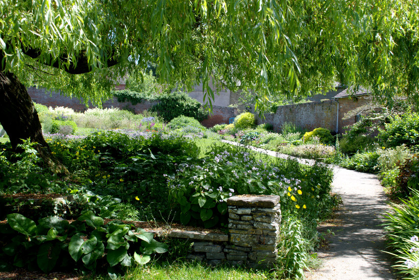
The garden looked as delightful as ever.

There were plenty of flowers about with some visitors goggling at the view. cool

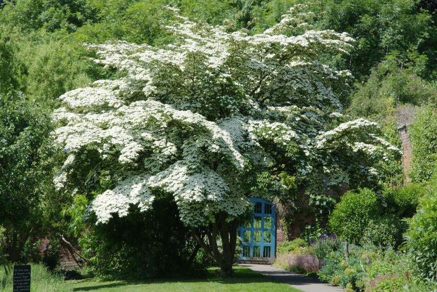
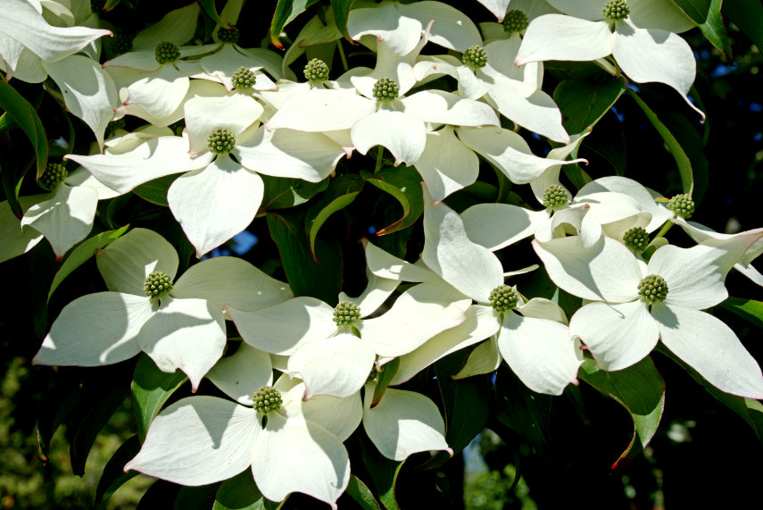
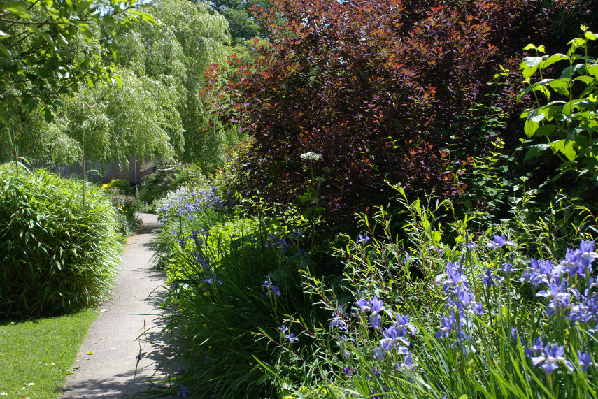
We couldn't have missed seeing this Dogwood in full bloom if we'd tried. What a sight!

It was now time for Fishpool Valley.

So – what is Fishpool Valley? It is described thus "Fishpool Valley was landscaped in the late eighteenth-century in the ‘Picturesque’ style. This was the movement to create a more natural landscape, using the principles of intricacy, roughness, variety and surprise. It features a chain of dams and pools, as well as architectural features such as an icehouse, grotto, pumphouse and limekiln. The careful planting of Oak, Ash, Willow, Poplar and evergreen species suggested the ‘bold roughness of nature’. Carriage rides and other walks were designed to follow the contours of the landscape, providing dramatic views across a wild, but beautiful, contrived scene."

However, because of lack of maintenance, the whole place is in a sorry state but the National Trust is starting a project to restore it to its original state.

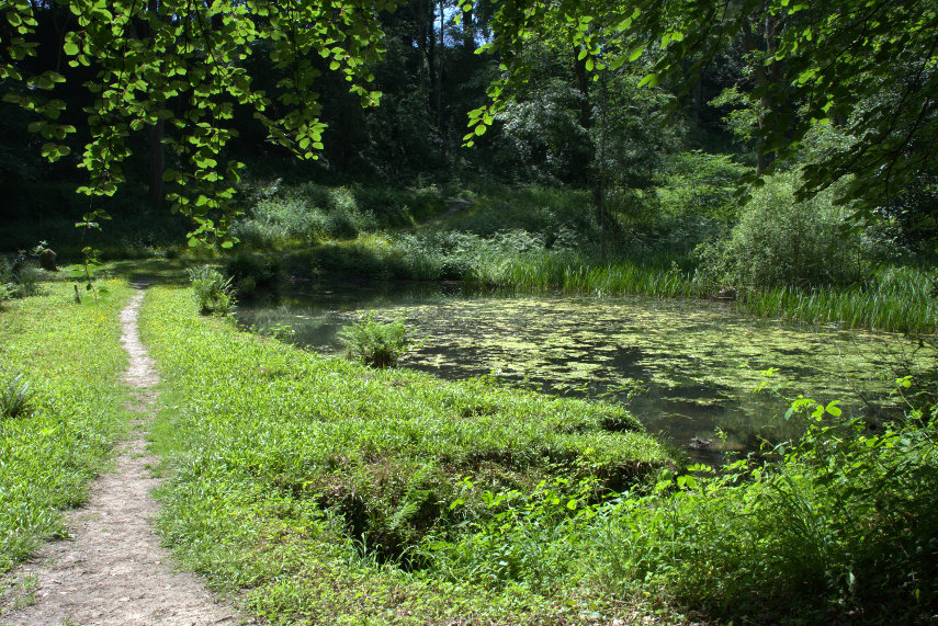
 We started our walk from one end of Fishpool Valley and the first point of interest was a pond.

It did look a little unkempt and in need of some TLC but somebody liked it. There were literally clouds of damsel flies over the water; some brilliant blue and some red. For those of you that don't know damsel flies are part of the dragonfly family. They were obviously very happy here. We walked on.

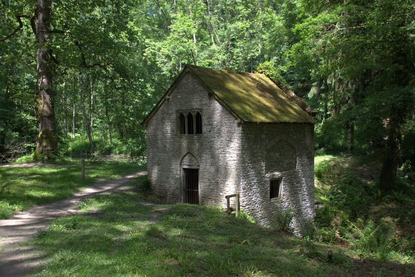
We soon reached another pond and, if you look carefully, you should see a little stone building near the centre of the picture. That is the Pumphouse.

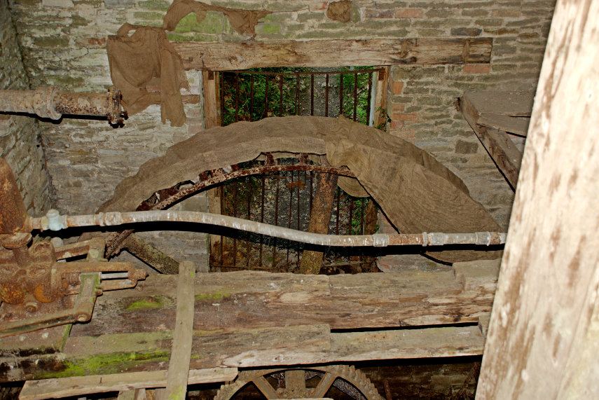
We peeked through the metal grill to see inside and were surprised to see some old machinery in the form of a waterwheel and some gearing.

These pools are fed by springs and the water is very clear. The Pumphouse was used to pump some of this water up to the house.

Walking ever onward we came across this stretch of path with some nice, very tall, trees which we thought were probably Douglas Firs.

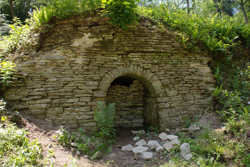
Finally we reached the farthest point of our walk – the Lime Kiln. It is now in a ruinous state with the eastern tunnel in a reasonable condition but the opposite western tunnel has collapsed. The central chargehole is brick-lined but cannot be seen at present. I can see why they would have sited a kiln here as there is a small limestone cliff just behind it to provide the material to heat in the kiln and the resultant lime would have been used on the fields as a fertiliser.

We discovered after returning to the castle that there were the remains of a grotto further on which we missed. Oh well, next time then.

On the walk back from Fishpool Valley, which was a different route from our outward journey, we walked through some wood pasture featuring some impressive trees. When we saw the tree in the picture below Amanda said 'Ooh that's a lovely old Oak. I must go and have a look'. When she got nearer she suddenly stopped and said 'Oh it isn't an Oak it's a Chestnut. It is certainly a massive tree.

A little further on we saw this very large Purple Beech which is the same species as a Copper Beech but a different variety where the leaves are purple coloured rather than copper. Another very fine tree.

Well, once again, we come to the end of another little trip. We will probably go back.

Walls of water

Walls of water

On Tuesday the weather forecast for Wednesday was that it would been mostly sunny until around 3:00 pm and on Wednesday morning, yesterday, it was the same; mostly sunny. So we set off for the Elan Valley to see if it was worth returning in the, hopefully, better and warmer weather next year.

It was about an hours drive from home and was sunny for most of that until we got near our destination when cloud miraculously appeared and left us with very little intermittent sun. What a surprise. Well not really as this area is known to be one of the wettest in Wales otherwise it wouldn't be what it is.

So what is it? Here's a clue:

It's a series of five reservoirs, known as Claerwen, Craig-goch, Pen-y-garreg, Garreg-ddu, and Caban-coch, which were built between the end of the 19th century and the beginning of the 20th century. The one above, Caban-coch,  is the first dam to be reached when approaching from the nearest town – Rhayader (pronounced 'Raider') which is just 3.5 miles away.

The next picture shows the same dam, the reservoir beyond, and the rather threatening looking weather.

This link shows a map of the area which will give you an idea of where we went.

http://www.streetmap.co.uk/map.srf?X=290040&Y=265910&A=Y&Z=126

We started from the little white square near the 'Elan Village' label and went back along the white road to the B4518 where we turned left and followed that road until we reached the Y shaped junction where we turned left. Although the map appears to show that the road goes under the reservoir it doesn't – it goes across a long stone bridge with numerous arches. We just followed that road to its termination at the Claerwen Reservoir dam.

This dam was opened by the Queen in 1952.

The road continues across the dam and stops at the other side where we get some different views.

The picture above was taken from the top of the dam looking south back the way we came.

We set off back along the road we came on, as there is simply no other choice, until we came to that Y junction. where we turned left towards the Penygarreg Reservoir. 

We made a brief stop to photograph this little series of waterfalls

and continued on to the dam at Craig Goch reservoir.

You may notice that by this time, around 1:00 pm, the cloud cover is increasing making the foreground pretty gloomy. We could have driven along this reservoir until we joined the road that we had used on a previous trip through the Cambrian Mountains to Devil's Bridge and then turned right back to Rhayader but it was near lunch time so we returned the way we came to the Visitor Centre.

They had a restaurant there and we had had a brief look at the menu when we started and wanted to try some of the appetising items on offer. We parked in their car park for which we had to pay £2:00, that covers a day, but we get a discount of 10% on whatever we spend in the restaurant. 

The restaurant seems typical of this sort of establishment except that the food turned out to be anything but typical. The food was really very good and is produced on site. We both had their home made curry, chicken for me and beef for Amanda, and thoroughly enjoyed every morsel. Excellent! We would have like to have tried the cakes but we were just too full. Next time perhaps.

The photograph below was taken from where I was sitting and you may notice that through the window you should be able to see that wall of water flowing over the dam. We hoped the wall would hold out until we had finished our meal.

This trip was enough to convince us that was a lot here to see including lots of dramatic scenery and we intend to return next year in warmer weather to do a lot more exploring. It is only an hour's drive away after all.

The next day when we were back home it started to snow. Admittedly it was rather sparse and none of it settled but it was our first snow of the winter and in November. Brrrrr!