Browsed by
Tag: Parks

Lynn – Day 1

Lynn – Day 1

As someone, somewhere, had decided to award us a week of summer weather we decided we'd better make use of it before it disappears so we arranged to go to King's Lynn for four days.

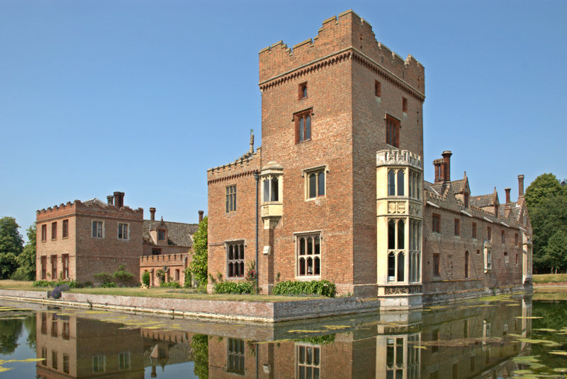
So, on a hot sunny Wednesday, we set off for a 93 mile journey north to north-west Norfolk which took just over two hours and took us through Braintree, Sudbury, Bury St. Edmunds, Thetford, Mundford and Oxburgh. One wouldn't normally go through Oxburgh on the way from Mundford to King's Lynn but we chose the few miles detour because we wanted to see Oxburgh Hall. Built around 1482 Oxburgh Hall is a moated manor which was always intended as a family home and not a fortress as the crenellations are symbolic fortifications rather than actual.

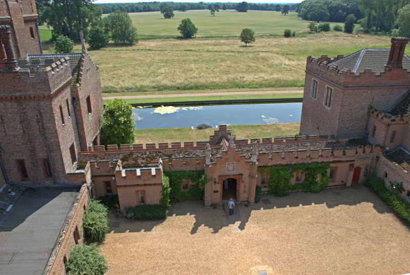
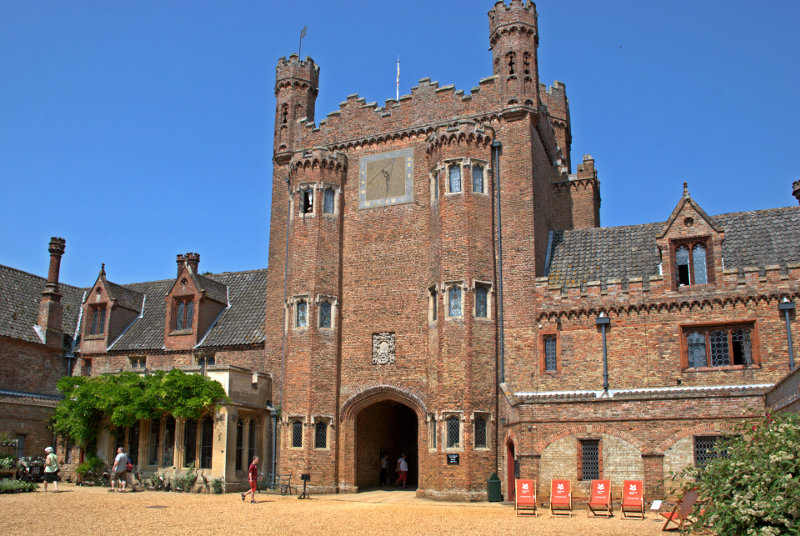
The main entrance and gatehouse is on the opposite side of the view shown above and the house is arranged around a large open quadrangle where the next picture was taken showing the large impressive gatehouse.

The eyesore deckchairs have been provided by the National Trust who must have been desparate for visitors to notice them.

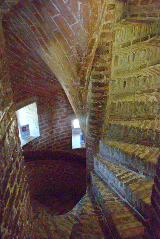
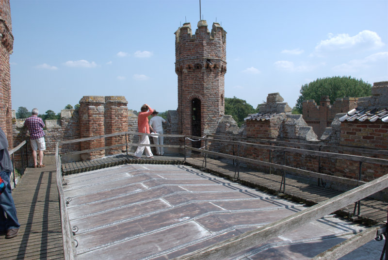
It is possible to go up onto the roof of the gatehouse if you don't mind the climb up the spiral stairway.


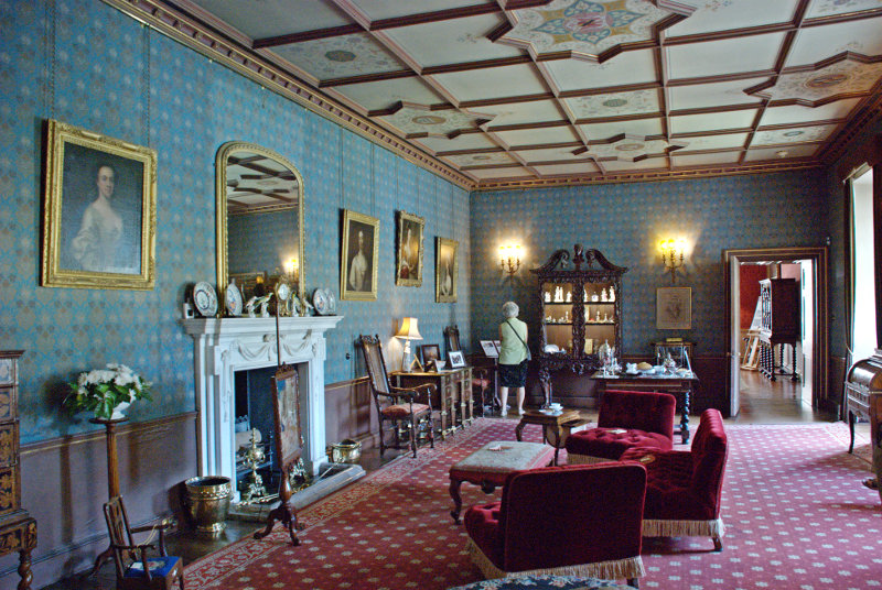
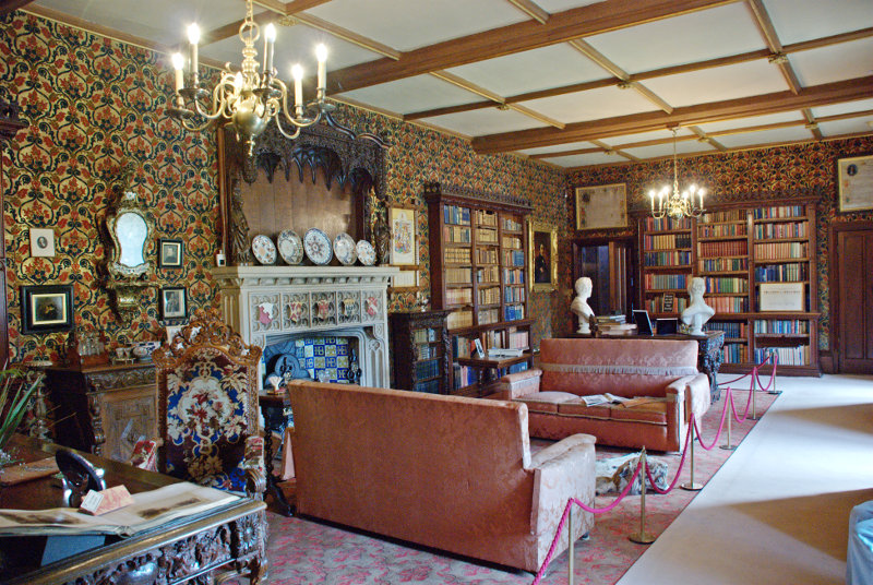
The rooms, as one might expect, are pretty impressive as this view of the West Drawing Room shows although one needs to ignore the strange lady at the far end.

The Library is equally impressive.

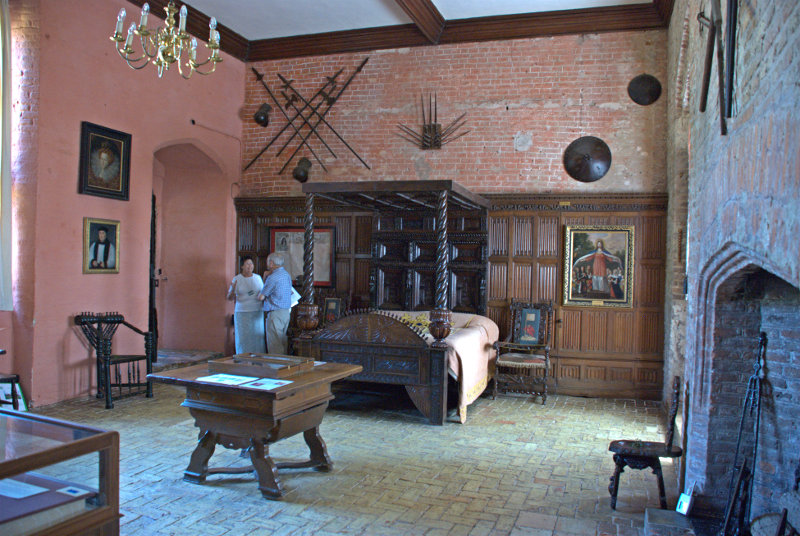
The Queen's Room is, as you'd expect, quite large.

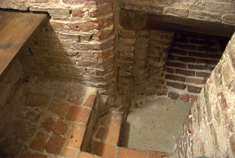
But off to the left, out of the picture, is another small side chamber and in the floor of this chamber is a small trapdoor which, when closed, blends in with the tiled floor. However, when opened, this trapdoor gives access to the Priest Hole. Because of the Catholic faith of the Bedingfeld family, a Catholic priest may have had to hide within the small disguised room in the event of a raid.

The entrance is just large enough for a person to slip through and this is all that there is inside. I am sitting on one of two benches with the other showing to my left and the brick slope on the far side of the floor is the only way in and out. Calling it a room, even a small room, is stretching the imagination somewhat. Getting in, and out, is not easy and it reminded me of my caving days. When I came out Amanda went in. We both survived.

If the King's men (soldiers) turned up unannounced then any visiting priest would have had to get in here quickly and possibly stay there for a few days. There is no toilet and no light so don't even think about it but it was better than being dead.

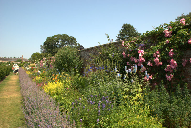
On a lighter note there is a very impressive flower border in the grounds.

It was an interesting and enjoyable visit but now we must go onward to King's Lynn. We arrived in King's Lynn at our B&B at around mid-afternoon and settled in then decided to have an initial short exploration leaving tomorrow, Thursday, as our main exploration day for the town.

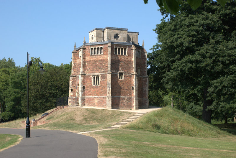
A short way from our B&B was a public park called The Walks and we knew that within the park was the 15th century Red Mount Chapel. It is unique and no other building like it can be found. It was built to contain a relic of the Virgin Mary but was also used by pilgrims on their way to Walsingham.

Built on instructions from the prior of Lynn the inner core is divided into 3 storeys and there is an additional cross-shaped ashlar building in Ancaster stone on top.

A strange place indeed which Pevsner described as one of the strangest Gothic churches in England.

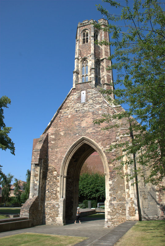
Moving towards the river to the west end of The Walks we crossed the road into another small park known as Tower Gardens. In this park is the Greyfriars Tower which is all that is left of a Franciscan Monastery. Take no notice of the strange woman at the base of the tower she seems, somehow, to get into a lot of my photographs.


Henry VIII had all such monasteries demolished but the tower at Lynn was left untouched because it was considered to be a useful seamark by sailors entering the town and is still clearly visible on the town's skyline to this day.

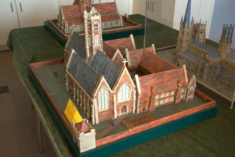
You can see from this model just where the tower fitted in.

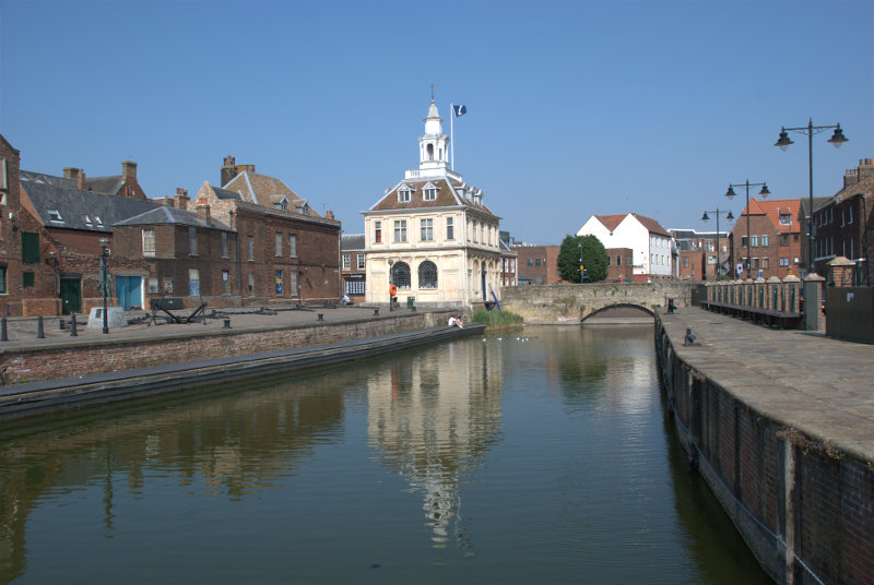
We moved further towards the river looking for the Tourist Information Centre so that we could get a free street plan of the town. We knew that it was located in the Customs House and eventually we spotted it.

Situated on the edge of Pur Fleet this building started life in 1683 as a merchant exchange but was bought by the Crown in 1717 for £800 and occupied by HM Customs and Excise until their move to a central office at Ipswich in 1989. It is now occupied by the local TIC. Pur Fleet runs into the River Great Ouse just behind the camera.

We'd had enough by this stage so having collected our free street plan of the town we headed back to our B&B. We'll be back in this area tomorrow.
 

A high speed trip.

A high speed trip.

The high speed railway route from St. Pancras Station in London runs down through Ashford in Kent, under the English Channel, and thence to foreign climes. On its way it also passes through Stratford International Station in Greater London and, as I have mentioned before, the rail route from our local station goes through Stratford on its way into London.

Part of that high speed route can also be used to get to other places in Kent so on Saturday we went, by high speed train, to meet two friends of ours, Ian and Carole, in Kent who live very near Rochester and that is where we all met.

We caught our usual train from our usual station and travelled to Stratford then walked for 10 minutes to Stratford International Station and caught the train to Rochester. The run to Ebbsfleet, the next station, is on the high speed line but it is mostly underground having to pass under the River Thames. We were obviously travelling fast but I've no idea what our actual speed was although these trains have a maximun speed of 140 MPH. It took us 30 minutes to get to Rochester where Ian and Carole were waiting for us at the station.

Walking out of the station we crossed a road or two and very soon found  ourselves in High Street.

You can see that the town was expecting us because of the bunting hung across the street. A short distance along and we came across this building – notice the legend just above the doorway in the second picture.


The building is late 16th century and was once a town house but has been converted to three shops. This building was used by Dickens as the model for Pumblechook's home.

The Kent countryside near Gad's Hill Place, Dickens's last home, is the setting for Pip's childhood in Great Expectations, and Rochester is the model for the 'nearest town'.

Mr. Pumblechook was charged with escorting Pip to Miss Havisham's house for the first time. Because of this, Mr. Pumblechook believes forevermore that he had a big hand in helping Pip to his fortune.

A little further on we saw Eastgate House dating from around 1590.


The second picture is the rear view showing the Swiss Chalet, where Dickens wrote some of his greatest works, which was given to him by the French actor Charles Fechter and it arrived on Christmas Eve 1864. It was originally located opposite Dickens' house on Gads Hill.

There are two rather dubious looking Dickensian characters sitting on the wall and some even more dubious characters over to the left. Amanda on the right, Carole in the centre and Ian on the left. This is the middle of June and you'll notice that we are all wearing jackets. We are still waiting for a proper summer.

Leaving Eastgate House we hopped up Crow Lane to the Vines. The Vines used to be the vinyard of the local monks but now it's a small park and a very nice one.

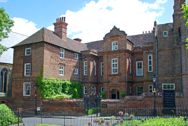
Just opposite the Vines in Crow Lane is Restoration House where Charles II stayed on his return to England in 1660 to be crowned (the restoration of the monarchy). The building is the amalgamation of two medieval houses.

We left the Vines at the far end and emerged into Minor Canon Row. These Canons are not the BOOM BOOM sort but the eclesiastical sort, you understand, and they needed somewhere to live so this row of 7 Georgian townhouses were built for them between 1722 and 1735.

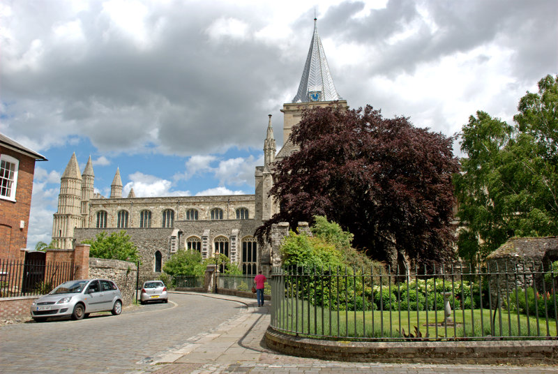
Walking round the corner at the far end and we get our first view of the cathedral.

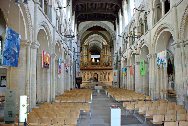
It didn't take us long to get to the west end and the main entrance where we went in. Entrance is free.

There are more photographs of the interior but you'll have to wait for those to appear on the main web site.

Back in the High Street we stopped for lunch in a nice little restaurant called the Atrium with plenty of wooden beams. Service turned out to be a bit slow but the food was very nice. Well, of course I had the Chocolate Truffle Torte for dessert – I mean, do I look silly?

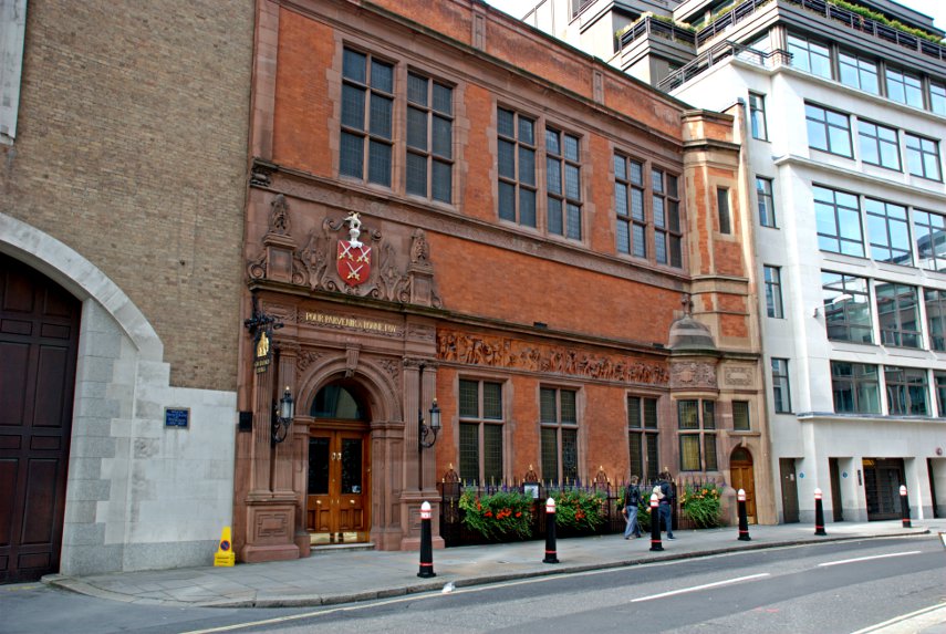
Whilst we were having lunch we could see, out of the window, this building across the street.

It was the Poor Travellers' House dating from the late 16th century. It was endowed under the terms of Richard Watts' will of 1579 providing a night's board and lodging for six poor travellers. More pictures will appear on the web site later.

A little further along High Street next to Two Post Alley is this rather interesting Tudor building and it really is that wonky.

You may notice a small bit of the castle beyond the end of the alley.

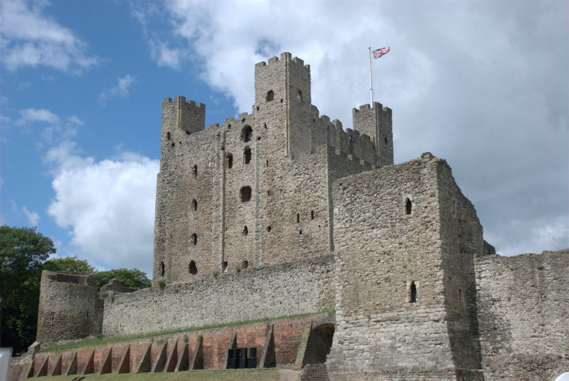
The weather was deteriorating by this time with a very strong wind so we went for a quick look at the castle and I managed this photograph in a quick flash of sunlight.

It looked very impressive but we didn't want to hang around in this weather so we'll have to make a return visit.

Ian and Carole took us back, in their car, to their house for some tea. We had strawberries and cream with some coffee and walnut sponge to follow which was very nice indeed. I'm desparately trying to make you envious here; I hope it's working.

When it was time for us to leave Ian and Carole drove us back to Rochester Station where we caught our train to Stratford and thence another train home.

Rochester was a very pleasant town packed with interest and just 40 minutes from London making a nice day trip destination.


Medieval, Monumental and Modern

Medieval, Monumental and Modern

8:30 PM Wednesday 1st May 2013.

Just back from our day trip today and this comes under the ‘Modern’ category.

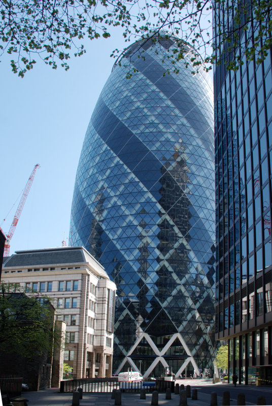
Before I continue with this post I’m going to get you to guess what/where this might be. I’ll give you a few days and I’ll also give you a clue. It’s in London. There, that narrows it down a bit doesn’t it? smilies


9:30 AM Sunday 5th May 2013.

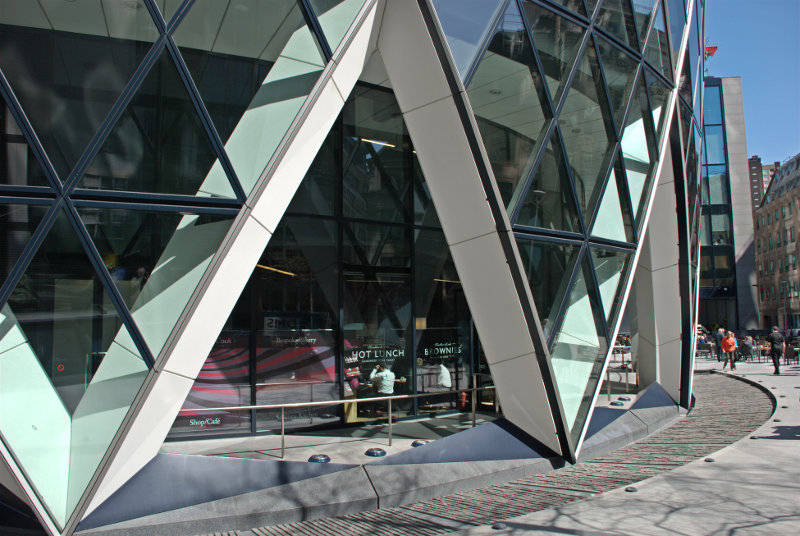
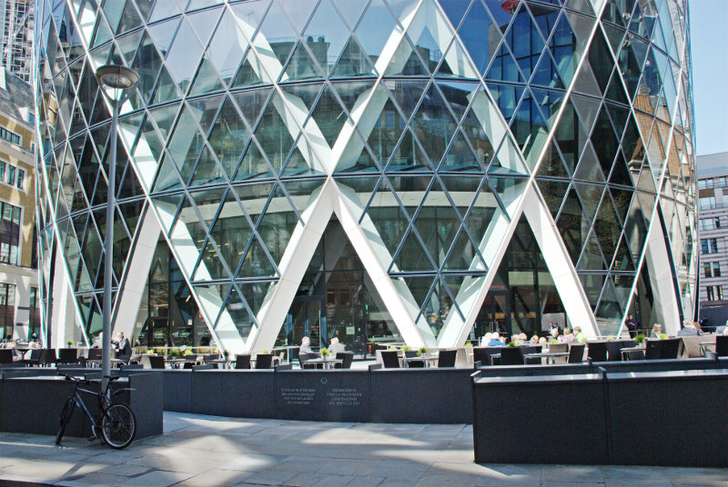
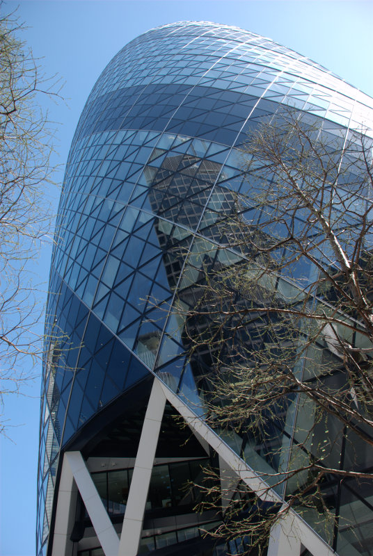
Clever-clogs Annecyborn was the first with the correct answer. It was, indeed, the Gherkin and this shows the whole width of the base.


Another sunny day forecast, another trip.

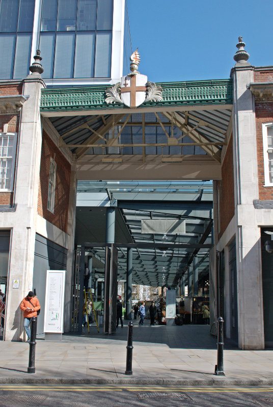
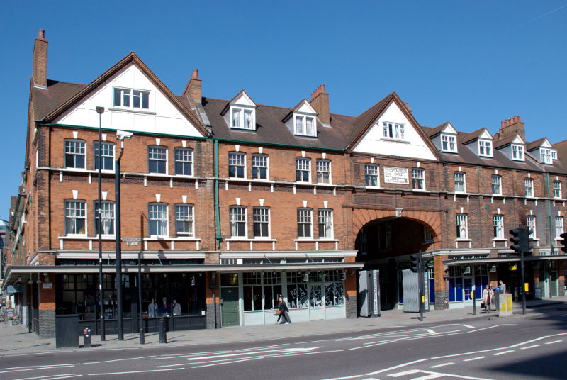
We arrived at our London terminus, Liverpool Street Station, and went out into Bishopsgate where we turned north and walked until we reached Brushfield Street on the east side of Bishopsgate. Walking along Brushfield Street we soon arrived here:

That is one of the entrances to Old Spitalfields Market. The area belonged to St Mary Spital, a priory or hospital erected on the east side of the Bishopsgate thoroughfare in 1197, and the name is thought to have been derived from that.

By the later 19th century inner Spitalfields had eclipsed rival claimants to the dubious distinction of being the worst criminal area in London and it is this area that is associated with Jack the Ripper.


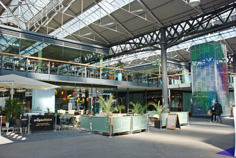
The market building is 19th century and turned out not to be particularly interesting architecturally unlike, for example, Leadenhall Market. There are plenty of shops including cafes which seem popular but we weren’t really interested in those so we moved on.

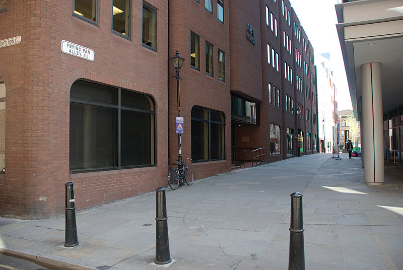
We came out of the eastern end on Spitalfields Market and walked south along Commercial Street, turned right into White’s Row, left into Bell Lane until we came to Frying Pan Alley. There is nothing special about Frying Pan Alley except it’s name and with a name like that we just had to walk through it.

It is an old alley although, sadly, all the old buildings have been razed to make way for modern buildings. However this alley once housed numerous Ironmongers who identified their premises by displaying a frying pan outside.

On the map above Spitalfields Market is top right and Frying Pan Alley is marked with an arrow.

We came out of the west end of Frying Pan alley, turned left into Sandy’s Row, right into Middlesex Street, forked left into Catherine Wheel Alley (named after the Catherine Wheel Inn which was demolished in 1911) then left again into Cock Hill. It’s a maze of narrow streets and alleys round here. That took us, via a dog leg, into New Street and after turning left into yet another alley we found ourselves in Devonshire Square. You may be able to trace our route on the map above in the darkened rectangle.

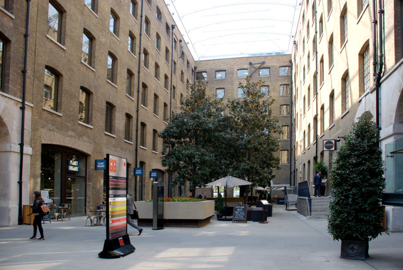
Devonshire Square is area enclosed by buildings and accessible only via alleyways. All these alleys and squares are old but the buildings have obviously been replaced.

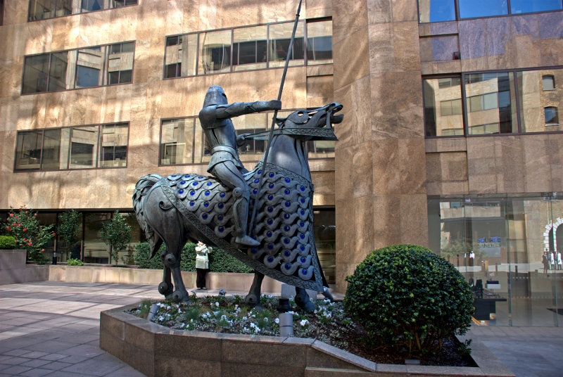
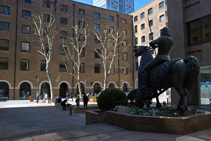
Devonshire Square is actually a number of individual squares connected by alleyways and as we wandered through we came across this life-size sculpture of a knight on horseback.


King Edgar (944-975) made an agreement with a group of 13 knights that he would give them land near to this spot on condition that they would each engage in three combats, one on the ground, another on water and the third below ground.

We did wonder how they could have fought below ground but after thinking about it we decided that they could have used a cellar or crypt.

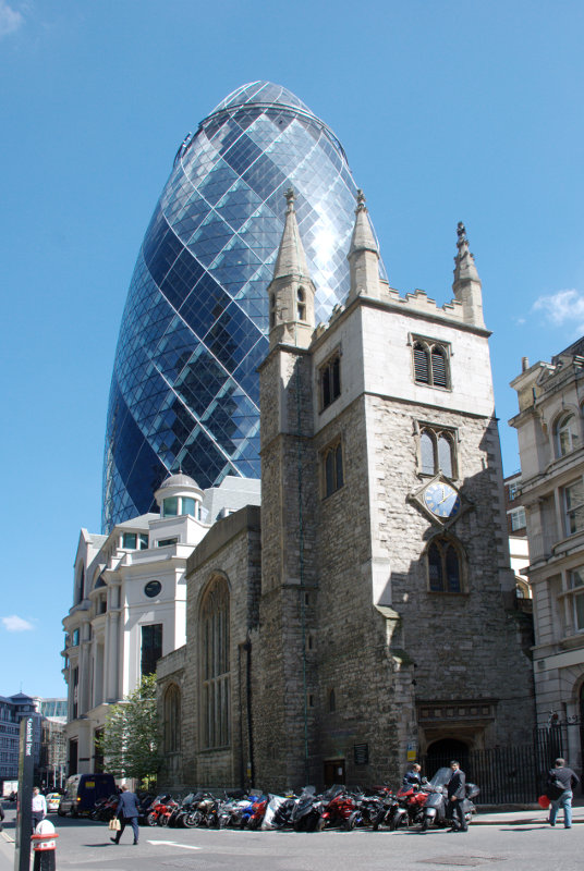
We made our way out of these squares and alleys and headed south towards the Gherkin.


We couldn’t really miss it could we?

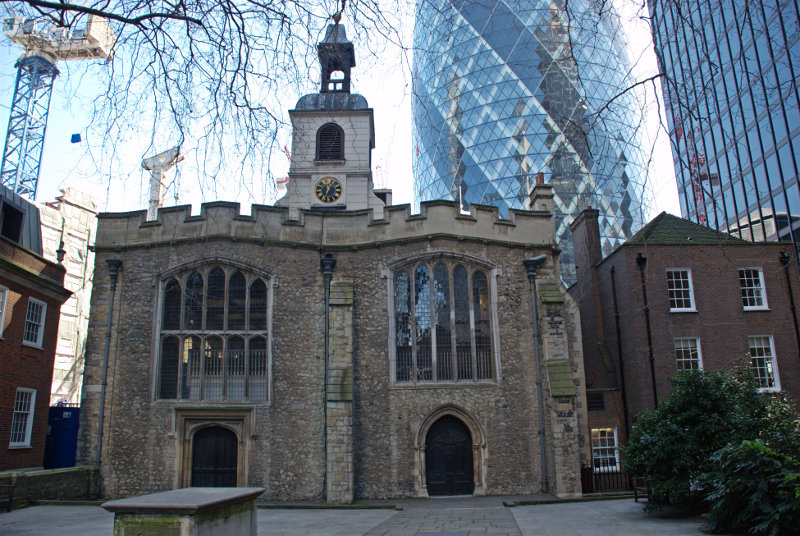
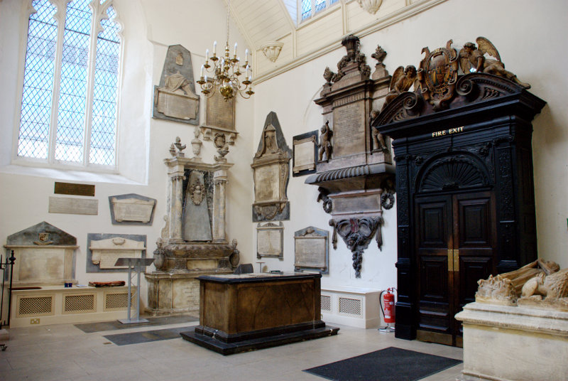
Nearby is the medieval church of St. Helen’s dating from the 11th century. It is the largest surviving church in the City of London and it contains more monuments than any other church in Greater London except for Westminster Abbey.

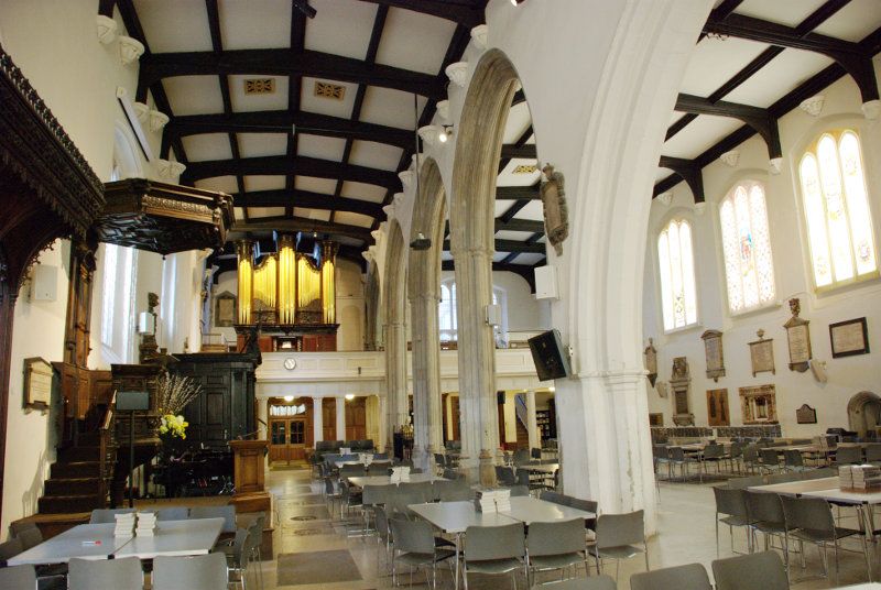
It is unusual in that it was designed with two parallel naves, giving it a wide interior.  Until the dissolution of the priory in 1538, the church was divided in two by a partition running from east to west, the northern half serving the nuns and the southern the parishioners. That partition has since been removed. It is the only building from a nunnery to survive in the City of London and one of the few churches to survive both the Great Fire of London of 1666 and the Blitz during World War II.


You can see that they have cornered the market in monuments and there were more all over the floor. This church was William Shakespeare’s parish church when he lived in the area in the 1590s.

Heading south down St. Mary Axe towards Leadenhall Street we passed another medieval church – St. Andrew Undershaft dating back to the 10th century although the current building is mainly 16th century. This is another city church that survived both the Great Fire of 1666 and the Blitz.

The church’s curious name derives from the shaft of the maypole that was traditionally set up each year opposite the church until 1517 when the custom ended.

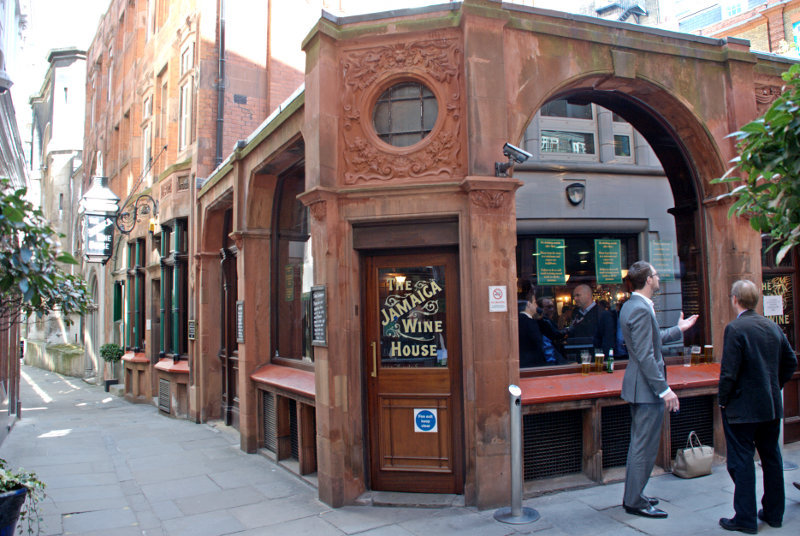
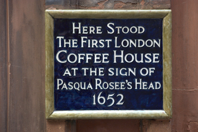
We were now headed west to the Guildhall where I was hoping to get a photograph which is better lit than the last time we were here. We went via St. Michael’s Alley, which we previously visited when we went to Leadenhall Market, and I took a photograph of the Jamaica Wine House. This was originally London’s first Coffee House.


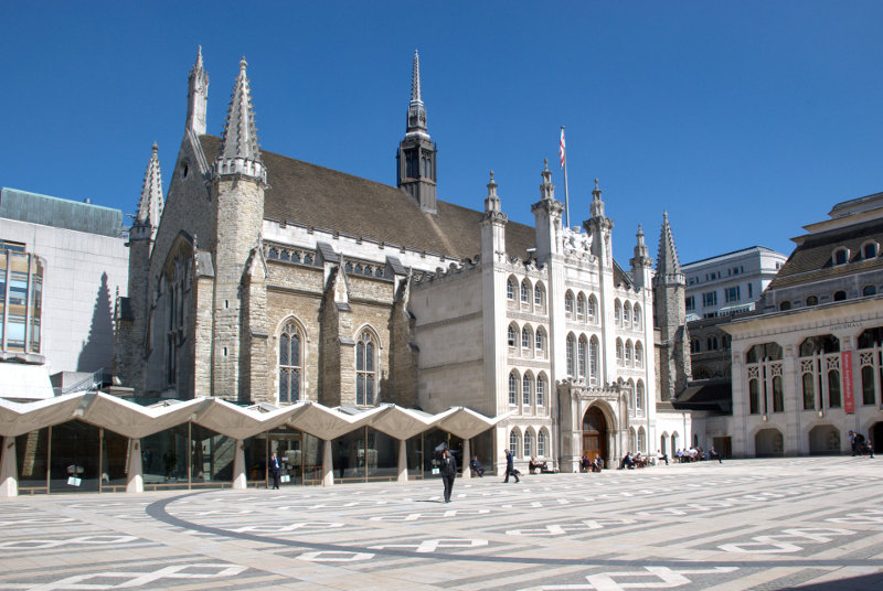
We soon arrived at the Guildhall where I took my photograph.

The last time I tried it was late in the day when the sun was low and there was a large dark shadow across the courtyard and across part of the building. Much better this time.

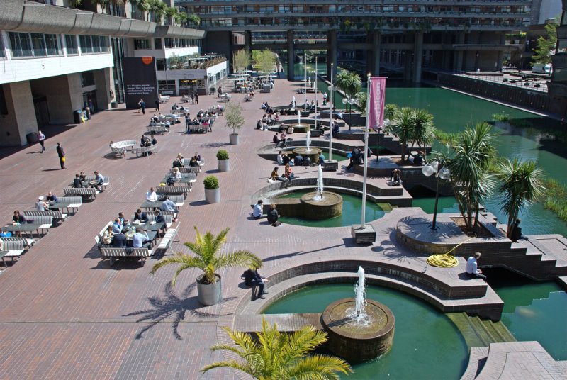
We now headed for the Barbican and arrived at about lunchtime. This is the Barbican Centre Terrace and that low building ahead on the left is the Barbican Food Hall (not a particularly imaginative name) where we were going to have lunch.

It was not at all expensive at around £9.50 for a main course and the food was beatifully cooked and very tasty. We both had Thai Red Curry of Duck Leg with saffron rice, vegatable rolls and Coconut Dip. The duck meat just fell off the bone and we thoroughly enjoyed it. To be recommended if you are ever this way.

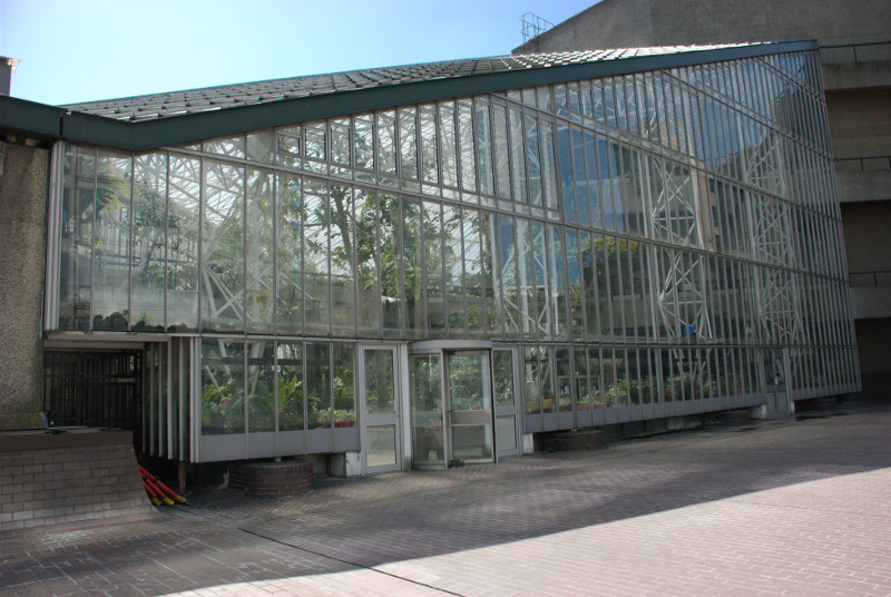
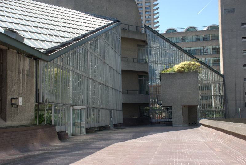
After lunch and before we left we went up 3 levels to where the conservatory is situated. It was not open today as we expected but I took a photograph from the outside of part of it to show what the construction is like.


We left Barbican and emerged into Aldersgate Street a little north of the Museum of London where we caught a bus going north to the Angel, Islington, where another bus took us west along Pentonville Road to St. Pancras.

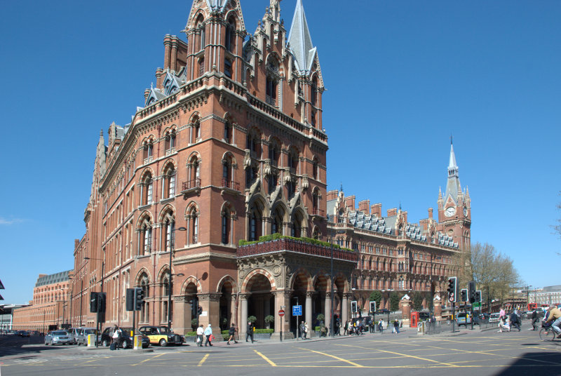
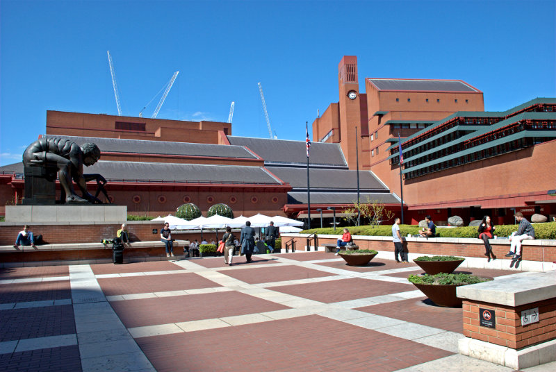
For a railway terminus that is a pretty impressive victorian building. However we hadn’t come here to see that specifically we had come to visit the British Library.


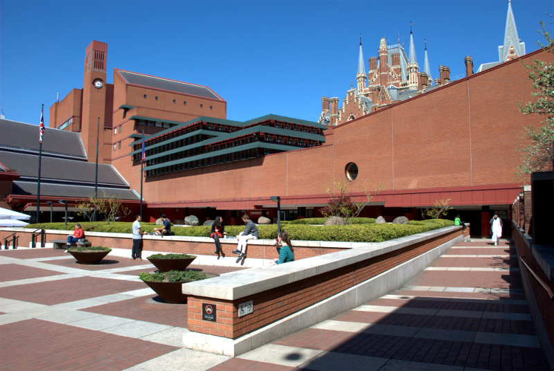
That’s St. Pancras Station peeping over the wall in the second picture.

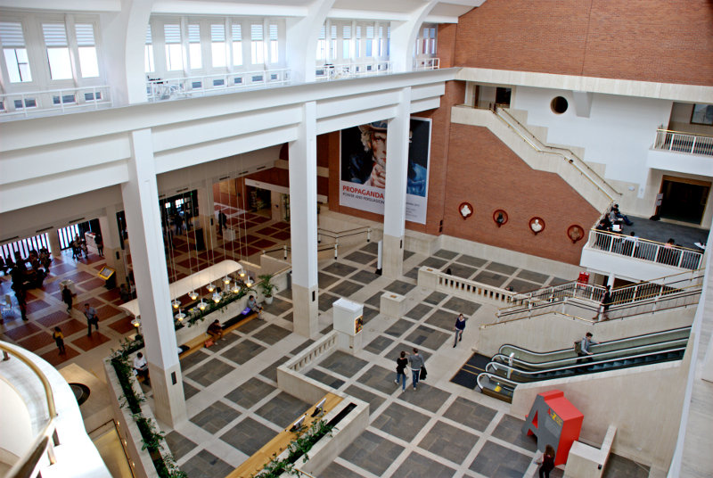
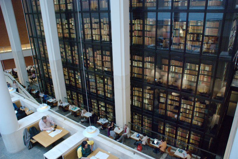
This is a large, impressive modern building with a very interesting construction. This is the entrance hall.

The library holds over 150 million items from many countries, in many languages so it may take you a little while if you want to read them all. It also includes the King’s Library; a collection donated by King George III and housed in the King’s Library Tower, a six-storey glass and bronze structure in the entrance hall. This shows just part of the King’s Library Tower.

A number of books and manuscripts are on display to the general public in the Sir John Ritblat Gallery which is open seven days a week at no charge. Some of the manuscripts in the exhibition include Beowulf, the Lindisfarne Gospels and St Cuthbert Gospel, a Gutenberg Bible, Geoffrey Chaucer’s Canterbury Tales, Thomas Malory’s Le Morte d’Arthur (King Arthur), Captain Cook’s journal, Jane Austen’s History of England, Charlotte Bronte’s Jane Eyre, Lewis Carroll’s Alice’s Adventures Under Ground, Rudyard Kipling’s Just So Stories, Charles Dickens’s Nicholas Nickleby, Virginia Woolf’s Mrs Dalloway and a room devoted solely to Magna Carta. That lot should keep you amused.

They also hold copies of all web sites and blogs which have the suffix .uk which will include this web site and blog. In that copy of this web site there will be a picture of the British Library and in that library will be a copy of this web site and …. ad infinitum.

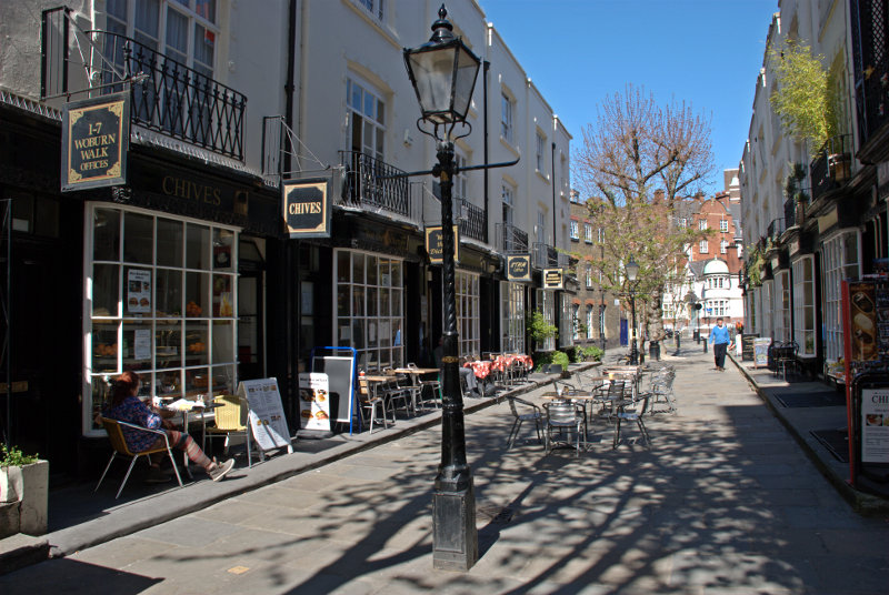
We decided it was time to leave and so went out into Euston Road. Walking south-west along Euston Road we turned left at Dukes Road which led us to Woburn Walk.

This attractive pedestrian street features beautifully preserved bow-fronted buildings that were built in 1822. A plaque on one of the buildings marks the house of W. B. Yeats, who lived here between 1895 and 1919 and the street is home to restaurants, bookshops, and galleries.

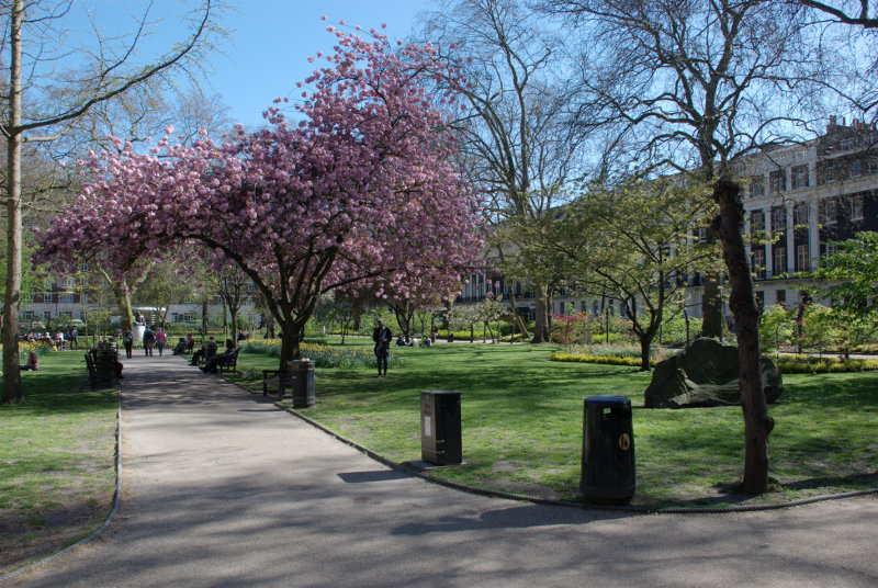
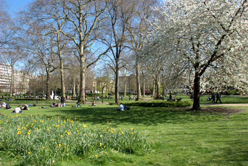
Our next, and last, planned stop was the Charles Dickens Museum just off Grays Inn Road in Doughty Street. We planned to walk through a number of what we hoped would be attractive squares on the way. It turns out that they were.

Starting with Tavistock Square:


and finishing with Russell Square.

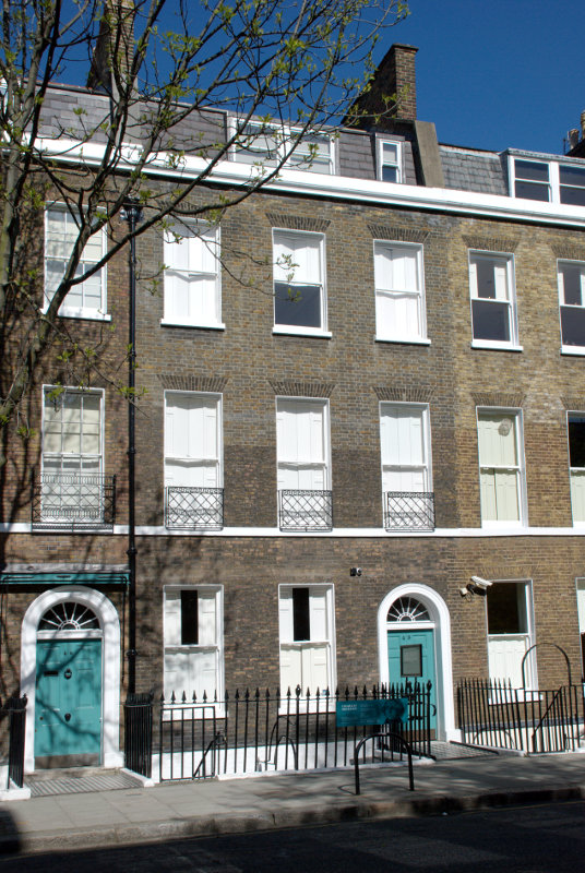
We soon after arrived at the museum. The entrance door is the one on the right.

There is a sign on the railings giving opening times and it closes at 5:00 PM with last entry at 4:00 PM. So what’s the time? 4:10 PM. Oh #@**&^!! smilies

So we didn’t get to see it after all that. Next time perhaps. We caught a bus to Holborn, changed to a bus to Liverpool Street Station and caught the train to go back home.

Trains, Cranes and Cobbles

Trains, Cranes and Cobbles

Chance is a fine thing. Our weather forecasters invariably get it wrong but occasionally a forecast will turn out to be right purely by chance. Saturday was one of those forecasts. It was forecast to be sunny all day and so it was.

We leaped on a train, figuratively speaking, and leaped off at Stratford (one station before our normal terminus – Liverpool Street Station). There are two stations at Stratford now; the one that we just used, which has been there a long time, and Stratford International which is relatively new. It's called Stratford International because the international trains don't stop there (what?). They were supposed to but the train operators refused to stop there because it's only a few minutes out of St. Pancras. However they were threatened with being forced to stop there so they agreed to re-examine the situation after the Olympics. We shall see.
However there are trains that stop there which go to parts of Kent. Well that's foreign because it's south of the river and we are thinking of taking a day trip down into Kent at some point so we thought we'd see what was involved in getting from one station to the other.

This map shows the relationship between the two stations with Stratford International just below the top (Blue lettering), Stratford Station just below that and to the right (grey lettering) and the Olympic Statium lower down and to the left.

The large grey/brown block between the two stations is the Westfield Shopping Centre. It turned out to be a fairly straightforward walk through the shopping centre from one station to the other so we'll know for next time.

Having walked to Stratford International we didn't have to walk back because we were then going on the Docklands Light Railway, henceforth known as the DLR, to Blackwall. We managed to get a front seat looking out the window so I took a few photographs on the journey.

This one is as we were leaving Stratford Internaional because I thought that arch looked rather graceful.

A little further on and we were approaching Stratford and the Olympic Park with the stadium on the right and the strange twisty helter-skelter thing on the left.

One has to be very quick in composing a shot when trying to take photographs from a moving train and it's also tricky holding the camera steady whilst bouncing up and down with the train's movement but I managed this shot of the Millenium Dome as we went past.

We had to change trains at Canning Town to get to Blackwall and this is our next train arriving. They are rather cute. The nice thing is being able to sit behind the front window as there is no driver (they are controlled by computer).

Arriving at Blackwall DLR Station we went to start our walk. The first thing to do is look for the sign pointing to Billingsgate Fish Market and follow the wide paved path going out of the picture on the right.


So we did that. This brought us to a main road and a very short way away to the left was a short flight of wide stone steps which took us up to the edge of Poplar Dock.

It was nice to see, when this dock was redeveloped for housing, that the old dockside cranes were left in position.

Walking along the dock we saw a lot of boats and from here the cranes can be seen over to the left and a red DLR train in the distance on an elevated section of railway. Walking to the southern end of Poplar Dock we were able to cross into Blackwall Basin and see the buildings in Canary Wharf reflected in the water.

 We also caught a glimpse of the Millenium Dome again just beyond these waterside apartments which we saw from the footbridge.


We eventually reached the lock which is the entrance to West India Dock with yet more, and larger, cranes just off Prestons Road. The buildings of Canary Wharf are prominent in the background.

On the other side of Prestons Road is yet another view of the Millenium Dome. That thing seems to pop up everywhere.

We eventually reached the western end of West India Dock and headed east along the other side of the dock and started to see a bit of greenery.

Bearing in mind that the London Marathon comes through here tomorrow we saw very few signs of that. Just a few TV broadcasting vans with dish aerials on their rooves but nothing else. We did wonder if there might be crowd barriers is place specifically to spoil any photographs I might want to take but, no, not a sign.

We reached No. 1 Canada Square which is one of the very tall buildings and went into the shopping centre at its base. This shopping area must go under a large number of the buildings because it is v-a-s-t. There are also free public toilets here if that interests you (and if you can actually find them – we did smilies ).

We did finally find our way through to Cabot Square and emerged once more into sunlight and were surprised by a couple of little attractive cameo views that suddenly appear here from time to time.


We left Cabot Square and made our way north towards West India Quay, not to be confused with West India Dock which we have already passed, and we emerged from the left onto the footbridge in the distance just beyond the cranes.

This view was obtained by going up on to one of the DLR platforms of West India Quay station which is on an elevated section of the railway at this point. Yet more cranes which, I thought, looked a bit like Martian War Machines. Here is another view of the Martian War Machines with the DLR showing in the background in the station from which I took the previous view.
The area on the right of the footbridge includes some of the original docklands buildings which have been restored and fronted by the original cobbled surface. This includes the Museum of London Docklands and also numerous restaurants. Walking along here and looking at all the different menus one is rather spoiled for choice. We eventually decided on one particular menu at a restaurant called Henry's and decided to have lunch.
We were shown to a table in the sun with padded seats, which was nice, and our order was taken very soon after. Our drinks arrived first and our meals not long after that. Table service was very efficient but drinks and meals took longer than we would have expected although not too long so I expect the slight hold up was in the kitchen.

Amanda had roast belly of pork with dauphinoise potatoes and vegatables and I had pork schnitzel with red cabbage and sautéed new potatoes. We both enjoyed our meals and the food really was very good. So much so that I had to refrain from licking the plate. Amanda made the point that her dauphinoise potato was some of the best that she'd had.

The problem started when we decided to have a dessert. We placed our order and waited, and waited, and waited. We queried this a number of times and were told it would arrive soon. It didn't. We finally got our order 30 minutes after it was placed. Both of our desserts were cold items so no cooking needed. The desserts, like our main courses, were very nice and although we were given an apology I said that waiting 30 minutes really was unacceptable. They cancelled the cost of the desserts by way of compensation.

In spite of that long wait I think that it must have been an unusual problem because it was busy and obviously very popular so we will go back if we are that way again and give then another chance. From the point of view of table service and quality of food I would recommend them without hesitation.

We now headed to the Museum of London Docklands shown here in part of the restored warehouse with a cobbled frontage.

The museum is big with a variety of exhibits including some which try to show what the narrow streets of old London would have looked like.

After spending some time looking around we realised that we were both feeling tired and so decided to head for home. Leaving the museum we headed through the grassy Canada Place.

Then through Jubilee Park

and towards the nearest DLR station thence back to Stratford and on the train home. Our second trip of the year (our first being to meet Marie in London on her birthday).


The best laid plans of mice and men . . . .

The best laid plans of mice and men . . . .

Did you know that Google Maps can be used to navigate when using public transport in London? You can use it either on your computer before you go or on your smartphone whilst on the move.

We planned to go to London yesterday. I wanted to go to the British Museum again and Amanda wanted to go to Regents Park to see the roses so we used Google Maps, 'Get Directions'.

First select the type of transport which, in our case, was Public Transport. Our starting point was Liverpool Street Station and my end point was the British Museum. Click the 'Options' link just below the destination box and select the 'Prefer' option. We wanted to use buses so we selected 'Bus'. Click 'Get Directions' and a map should be displayed together with a short list of routes in a box on the left. I chose the No. 8 in preference to the 242 because it got me slightly nearer my destination.

We discovered that the No. 8 terminates at Oxford Circus which, Amanda decided, would be near enough to Regents Park for her to walk the last bit allowing us to travel together on the same bus.

We normally allow 35 minutes between when we leave home to when our train departs. We left home at the normal time and a short while later were held up by traffic lights at some road works which had appeared suddenly this morning. In fact they were still setting up the road works when we arrived to do whatever it was they were planning to do. Then when we were near the railway station we found ourselves in an unexpected traffic queue. Time was getting short! After parking the car we had to do a fast walk across the fields to the station to find that there was a queue at the ticket office. We did eventually get our tickets a few minutes before the train arrived.

Google Maps tells us that the bus stop is in Bishopsgate just outside the station and that it is 'Stop L'.

"Liverpool Street station
Bishopsgate
London, UK EC2M 7QH"

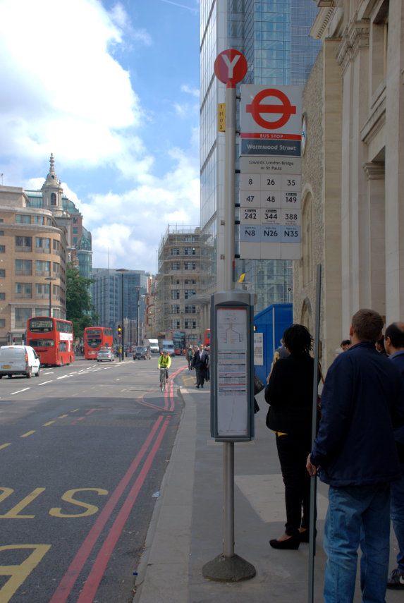
There are two stops 'K' and 'L' and different routes stop at each stop. The stops have a plate on the very top with the large letter identifier easily visible.

We went to the appropriate stop only to find a sign on it saying 'Bus stop not in use'. Bummer! This is because there are roadworks along the centre of Bishopsgate making the road narrower than normal. We decided to walk in the direction in which the bus would travel and find the next stop which was 'Y'. It was a relatively short walk to where Bishopsgate changes into Gracechurch Street.

The No. 8 bus is supposed to run every 6-10 minutes so we expected not to have to wait very long. Although there was almost a constant stream of buses of every other route we were still waiting for a No. 8 twenty minutes later.

Then we saw a No. 8 approaching. But wait, what do I see? The destination board on the front of the bus says 'Holborn Circus' but it should say 'Oxford Circus'. We ask the driver who tells us that all the No. 8s are turning round at Holborn Circus because of delays further along the route. Bummer again!

What we should have done in advance of our journey is to look on the "Transport for London" web site but which we didn't think of doing.  :oops:

Go to www.tfl.gov.uk, select 'Live Travel News' then select your mode of transport i.e. Tube, Buses etc. With buses you can enter the route number and get information on any delays or cancellations on that particular route and doing that for the No. 8 gives a list of possible problems.

We decided to go as far as we could i.e. Holborn Circus and walk the rest. We chose the bus because it would have got me significantly nearer the British Museum than the Tube would have done but in this case the Tube would have been quicker and nearer. It was our own fault for not checking TFL's web site for possible delays first.

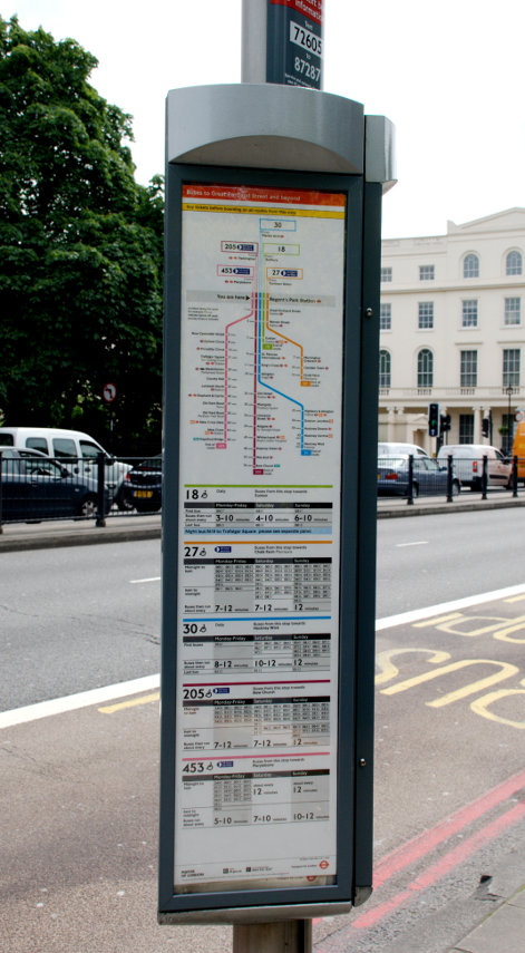
Travelling on the London Buses should normally be easy and straightforward. Bus stops are obvious and give details of the routes calling at this stop.

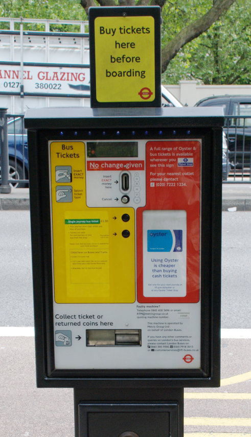
There are no facilities on the buses in central London for buying tickets so payment must be made in advance. If you are travelling around as a visitor then you will probably have a Travelcard or an Oyster Card both of which can be used on the buses. If you need to purchase a ticket then there are machines like this at some stops but it is an expensive way of doing it.

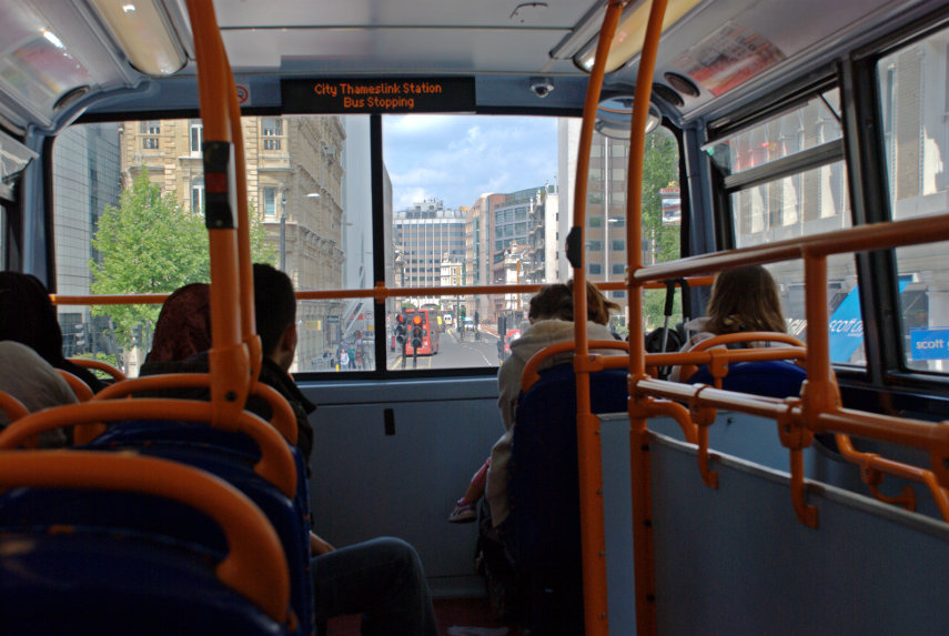
This is a view from the upper deck.

Access to the stairs is on the right surrounded by a guard rail and above the front window is an electronic display giving the bus route number and either the current stop or the next stop if the bus is moving. There are also automatic announcements giving the same information.

Sitting in the front seats, when available, gives the best views.

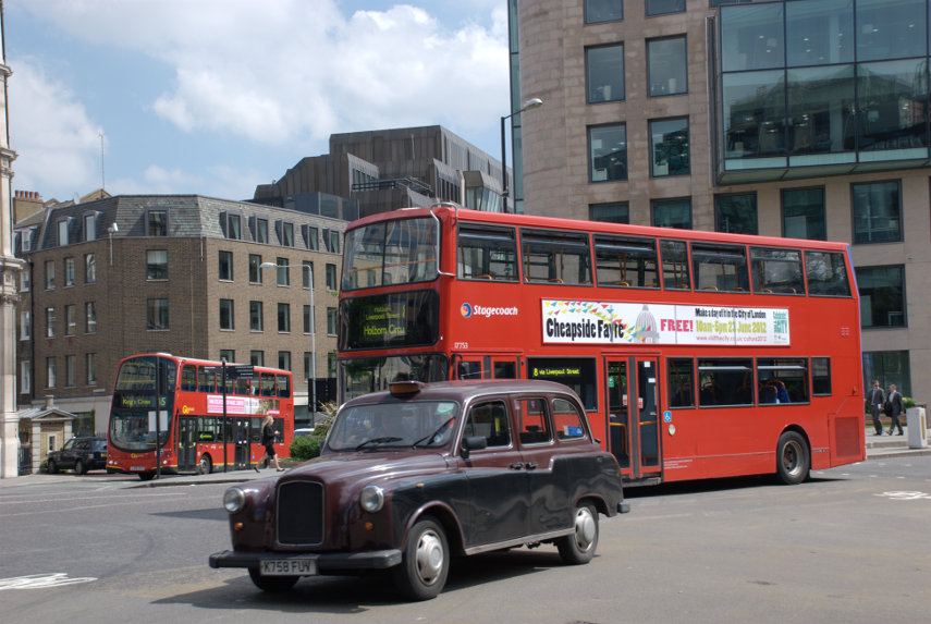
This is our bus driving into the roundabout at Holborn Circus to go all the way round and back the way it came for its return journey.

We walked from Holborn Circus to New Oxford Street where I turned north up Museum Street for the British Museum and Amanda went off to Regents park.

When I went into the British Museum, at around 11:30 AM, the first thing that struck me was the noise; most of which was probably from the multitude of school groups in evidence. I don't remember this much noise on our last visit.

Most of the rest of the world had obviously also chosen today to visit the museum and I don't remember it being as crowded on our last visit. On our last visit we arrived at the museum in the late afternoon which is probably a better time of day to visit as the school groups are likely to have gone by then.

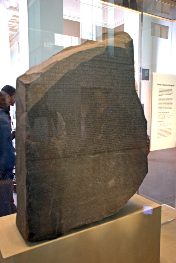
I hadn't managed to photograph the Rosetta Stone on our last visit so I thought I'd try that. It seemed to be permanently surrounded by visitors and I had to wait a long time to get this:

Not a very good picture partly because of the reflections in the glass case and partly because it's very poorly lit.

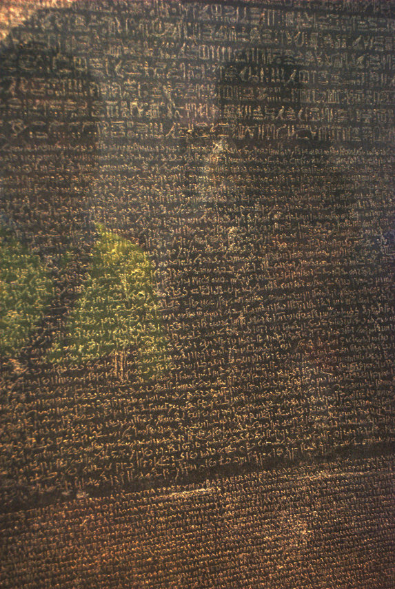
This shows the three different scripts. The upper text is Ancient Egyptian hieroglyphs, the middle portion Demotic script, and the lowest Ancient Greek. Because it presents essentially the same text in all three scripts (with some minor differences between them), it provided the key to the modern understanding of Egyptian hieroglyphs.

The close-up photograph again a little spoiled by reflections.

It was a little after this that I realised that I wasn't enjoying the experience, as I'd hoped, because of the cacophany and the sheer numbers of visitors so I decided to give up and walk to Regents Park to re-join Amanda.

I arrived in time for lunch so we had lunch in the Garden Cafe as we did on our last visit before venturing out again into the park. Amanda had come to see the roses in Queen Mary's garden so that is what we did although the weather had turned cloudy but we were expecting that for the afternoon.

There were a LOT of roses here.

When we finished here we went into Marylebone Road, which runs along the south edge of Regents Park, and caught a No. 205 bus which took us back to Liverpool Street Station by a route which was completely different from that of the No. 8. The only point of interest that we went past was the British Library. Perhaps a visit for the future?

Today's visit shows that however thorough you think your plans are they can go awry on numerous occasions. :banghead:
 

A narrow perspective

A narrow perspective

I often see prospective visitors to this country asking what the weather will be like at such and such a time of year. The simple answer is that nobody knows. Even our weather forecasters often get it wrong.

Let me give you an example. On Friday the forecast for Saturday was clear skies all day and on Saturday we did have some sun but there were clouds all across the sky and they were moving slowly which meant that when a cloud covered the sun it was often ten minutes before it shone again. This meant that at just the point I wanted to take a photograph the sun went in and I was twiddling my thumbs for 10 minutes waiting for it to come back out.

Remember, this forecast was only 24 hours in advance.

So what was I photographing?

Well, it started at Liverpool Street Station where we normally come in to London, or did it? We went from there by Underground to Paddington so did it really start from Paddington? You decide.

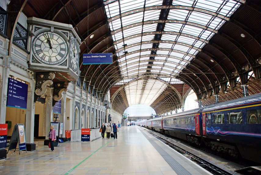
Having arrived at Paddington we went into the Mainline Terminus to have a quick look at Brunel's handiwork.

This station served as the London terminus of the Great Western Railway and its successors since 1838. Much of the current station dates from 1854, and was designed by Isambard Kingdom Brunel. That glazed roof is supported by wrought iron arches in three spans, respectively spanning 68 feet, 102 feet and 70 feet. The roof is 699 feet long, and the original roof spans had two transepts connecting the three spans. This shows just one of the roof spans.

One has to admit that the roof does look impressive.

Paddington Station wasn't part of our original plan but as we were passing through we thought that we'd have a look. So where were we headed? Paddington Basin of course, where else!

Paddington Basin is the terminus for the Paddington arm of the Grand Union Canal and is on the eastern edge of Paddington Station. But back to the picture above first. Notice at the far end of the station there is a grey horizontal band running over the train – that is a footbridge and that is where we are going. Up to the footbridge and over the tracks we follow signs and suddenly emerge on the edge of Paddington basin. There are other ways to get there but that was most convenient for us.

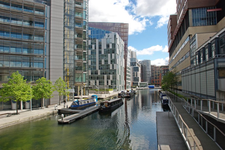
We turn right towards the end of the basin and very soon passed a very modern looking footbridge to the opposite side of the basin which we ignored and continued to the next footbridge from which I took this picture.

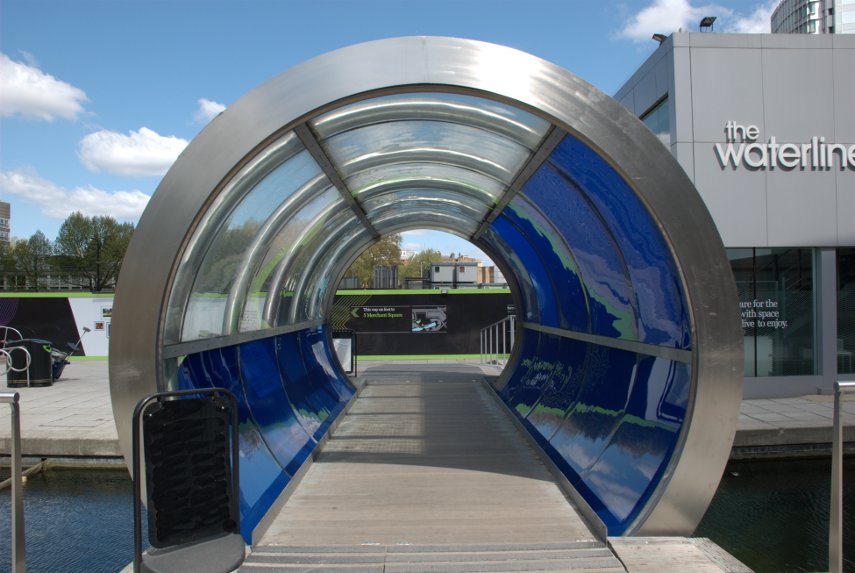
In its heyday it was a very busy goods transhipment facility but like a lot of London's docks it fell into disuse when the traffic dwindled. The basin is now the centre of a major redevelopment as part of the wider Paddington Waterside scheme and is surrounded by modern buildings as you can see (The Canary Wharf treatment). Towards the far end is this unusual bridge, which you can just see in the picture above if you look carefully, but it's not what we mean when we talk about 'travelling by tube'.

You may notice that all of the boats are canal narrowboats. This is to become today's theme.

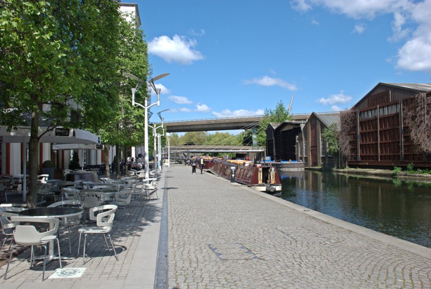
After having a leisurely look round we started off along the canal-side path in the opposite direction towards the main part of the Grand Union Canal. I was going to refer to the path as the 'towpath' which is what they are generally called but that didn't seem to really do it justice as it looked like this.

Although it looks pleasant enough those two bridges in the distance are carrying road traffic and consequently it isn't quiet here. Nice place for a cup of tea or coffee in the canal-side cafe perhaps?

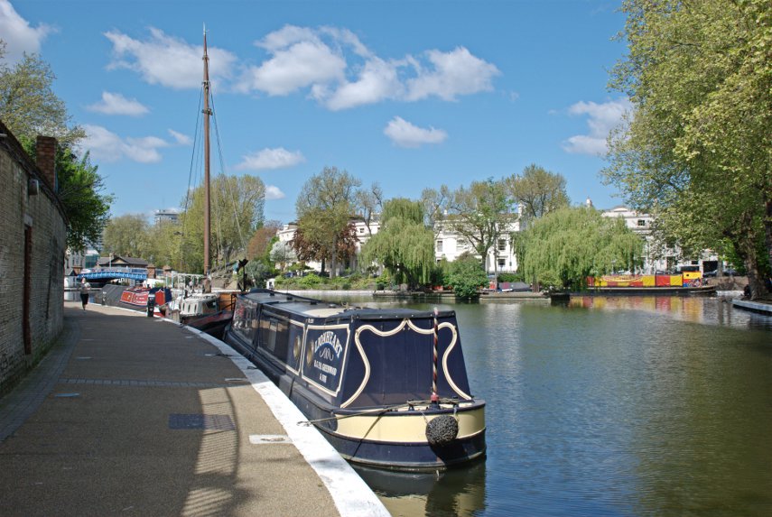
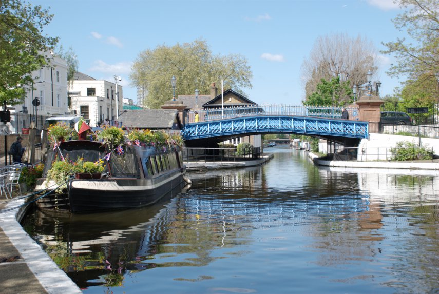
A little further on we have our first sight of Little Venice. This is where the Paddington arm joins the main Grand Union Canal forming this large basin. To continue on our planned route we need to be on the far side and, at first, I thought that Amanda would have to wade across carrying me on her back.

But having continued around the bend we spotted a nice little bridge.

That narrowboat is a floating cafe, you may notice some tables and chairs on the path beside the boat, which would have been an interesting experience for a meal but it was only mid-morning so we passed on that one. That bridge carries a road and so gives access to the local area should you so desire – we didn't.

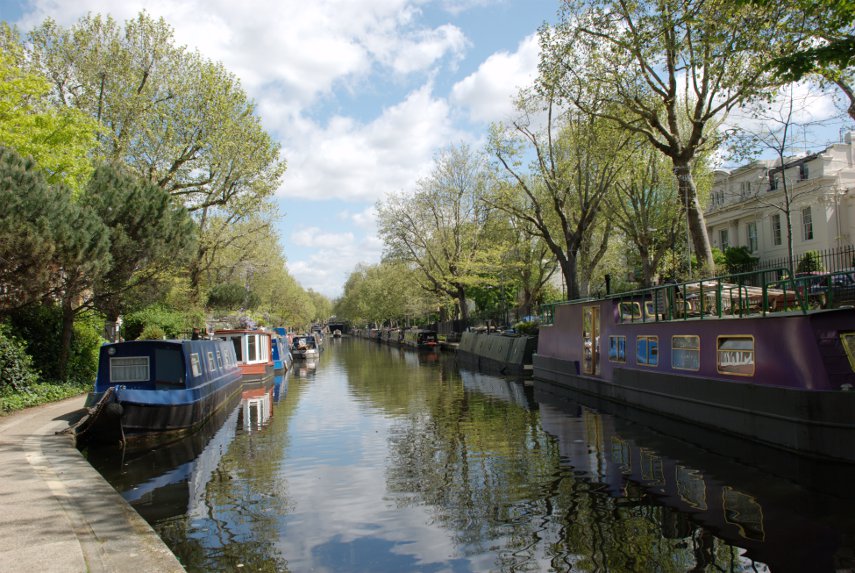
The part of the canal that you can see beyond the bridge is not the part that we wanted so we crossed the bridge and turned right. Just as we left the Little Venice basin we came across numerous narrowboats moored along the canal on both sides. A lot of these, possibly all of them, appear to be 'permanent' moorings i.e houseboats where people live. We had to leave the towpath soon after this point, because the path was 'residents' only, and walk along the road for a short way.

You may notice in the far distance a boat in the middle of the canal and just behind it a dark rectangle which is the entrance to a tunnel. There is no path through the tunnel so we followed the road slightly uphill until we were at the same height as the top of the tunnel then followed the road opposite, Aberdeen Place, until it bent sharp left. Opposite us, on the bend, was a footpath which lead back to the side of the canal.

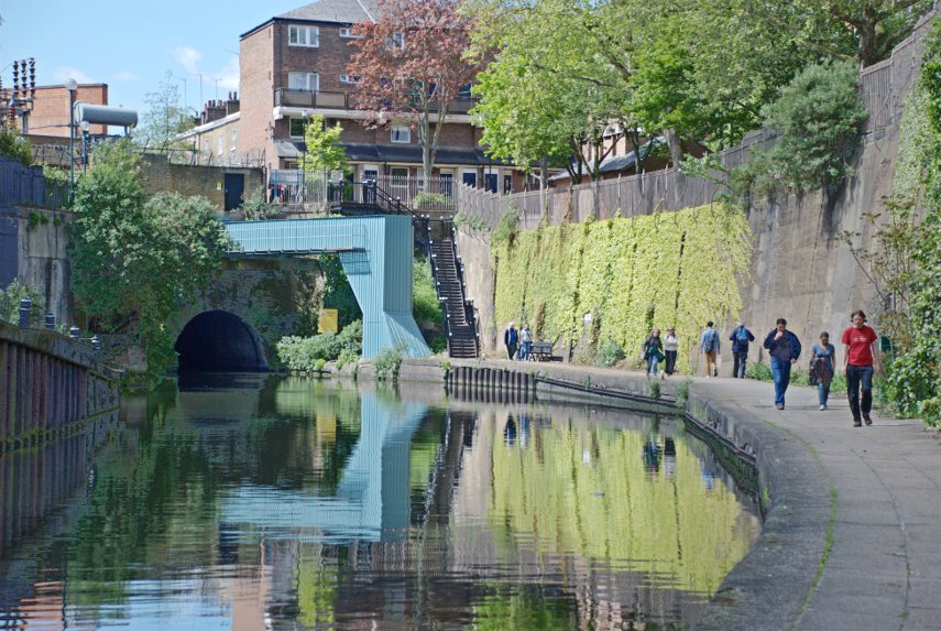
You can see the exit from the tunnel and the steps we came down to reach the canal-side path and we certainly weren't alone on this walk.

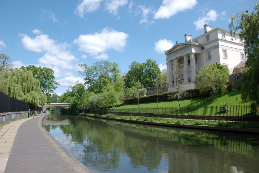
The surroundings started getting green and leafy so we guessed that by this time we were entering Regents Park and then we came across this house.

We couldn't decide whether it would make a nice weekend cottage or not so we decided not to buy. A mistake perhaps?

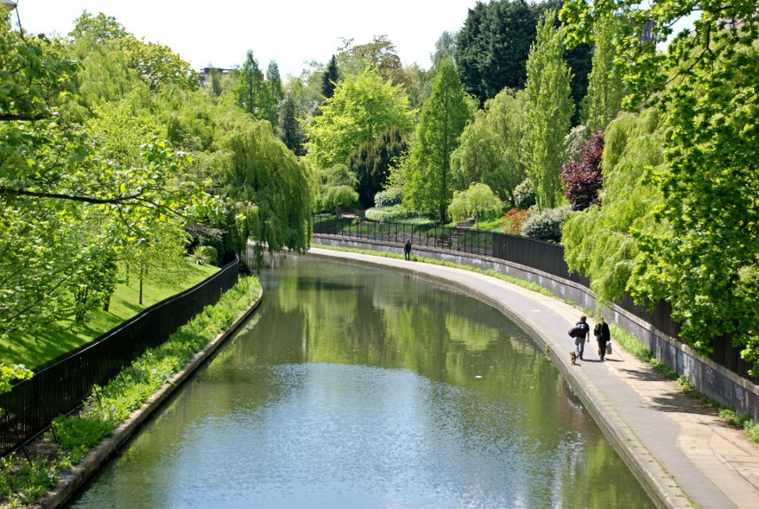
When we reached a bridge that gave us the opportunity to leave the canal we went up to ground level but don't worry because we will be returning to the canal later. This was our last veiw of the canal for the time being.

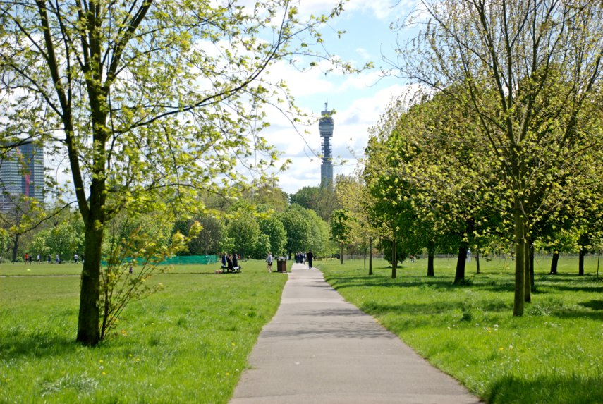
Crossing the canal we found ourselves in the green oasis of Regents Park with the BT Tower showing in the distance.

Regents Park is big! It covers 410 acres and it was just over a mile from the canal to where we were heading – Queen Mary's Gardens. The canal crosses the northern edge of the park and Queen Mary's gardens are, of course, near the southern edge. This involved crossing the 'Inner Circle', one of the few roads in the park, which surrounds Queen Mary's Gardens.

On the other side of the road we found the Garden Cafe and it now being lunch time what could we do but try it? There are two separate areas; the waitress service part and the part for the Hoi Poloi. I was going to suggest the waitress service part as I'd spotted something on the menu which sounded nice but then Amanda saw that they had a 'Stew of the day' in the other part which she liked the sound of – so we joined the Hoi Poloi. Today it was Chicken Stew and it really was very nice. I thoroughly enjoyed it, well we both did but we didn't enjoy the paper plates and plastic utensils. The waitress service next time perhaps.

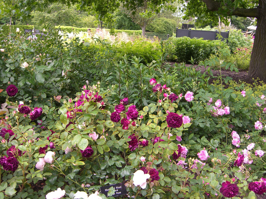
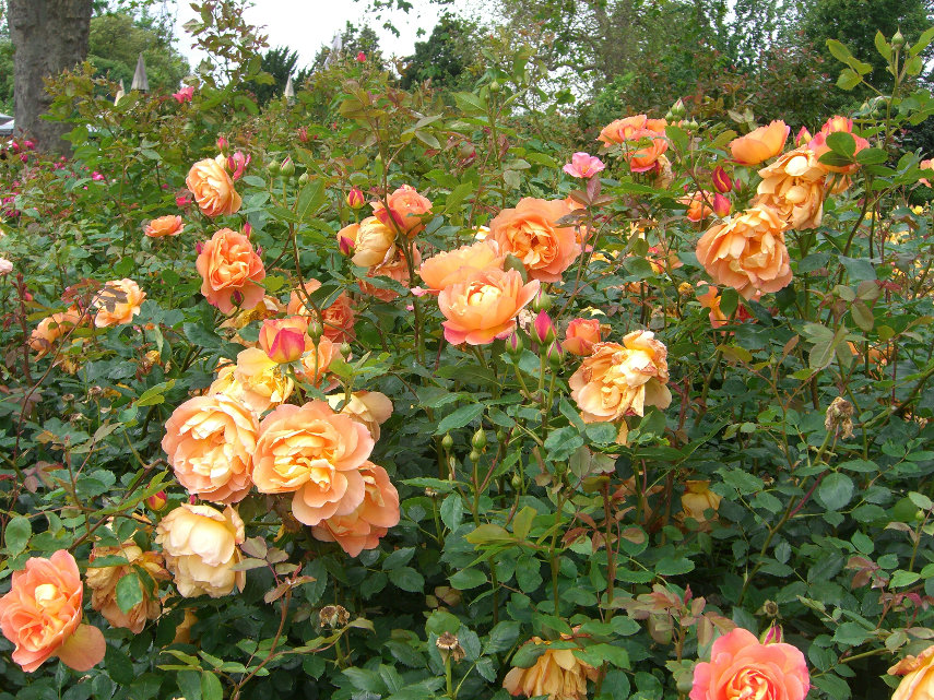
After lunch we went to look at the gardens. They are mostly roses and, being roses, they won't bloom until about mid-june and there are 30,000 roses of 400 varieties. Amanda wants to come back after they bloom. I wonder if she'll count them?

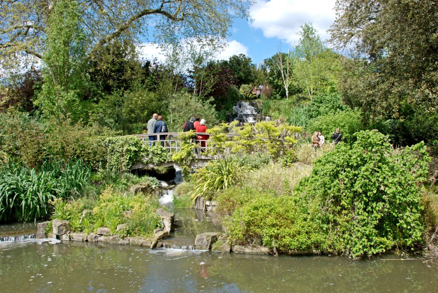
We found an area including a pond, a nice little bridge and a cascade which looked rather picturesque that didn't involve roses.

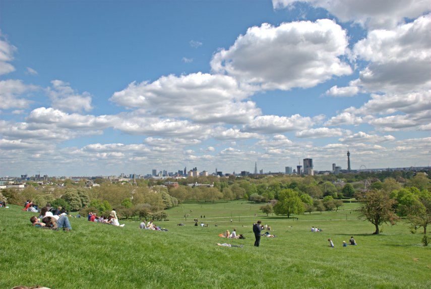
We finally started back north towards the canal but when we reached it we first crossed over onto Primrose Hill. A bit like a continuation of Regents park with grassland liberally dotted with trees but also a hill! We had a really good view from the highest point and, as you can see from the photograph, it's really popular with visitors.

What we could see from right to left was the London Eye, the BT Tower, the Shard, St. Paul's Cathedral and Canary Wharf. Certainly worth the not very arduous climb of 256 feet.

So, back to St. Mark's Bridge on the canal at the bottom of Primrose Hill where we go back down to the canal-side path and yet more narrowboats – some moored some moving. Do you see a theme here?. After an interesting little walk along the canal it is not long before we reach our final destination.

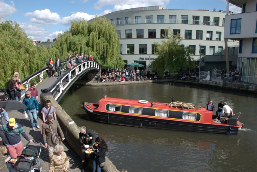
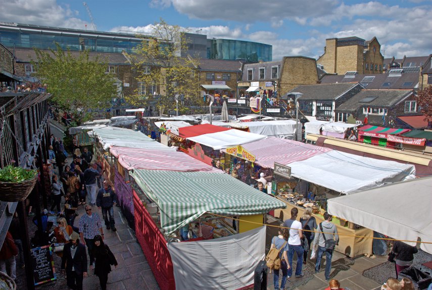
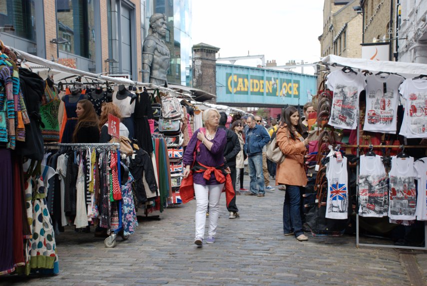
Camden Lock and Camden Lock Market. You may notice that there were a lot of people – it was seething! This was a Saturday afternoon, remember, on a sunny day. I wonder what it's like during the week?

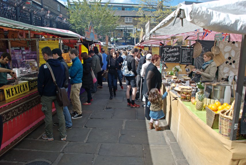
After turning off the canal-side path into the market at West Yard our nostrils were assailed with the very tempting smell of hot food. It smelled really delicious and appetising but, as we'd had lunch only a short while ago we had no appetite – bummer!

One thing we quickly discovered is that this place is a warren which made it even more interesting. Going through the stalls to the back we found a short passage into another large area of stalls, Camden Lock Place, and then there are all the stalls inside the surrounding buildings.

They seem to sell everything here – hot food, clothing, fabrics, jewellery, fancy goods, geological specimens, antiques – you name it they seem to have it.

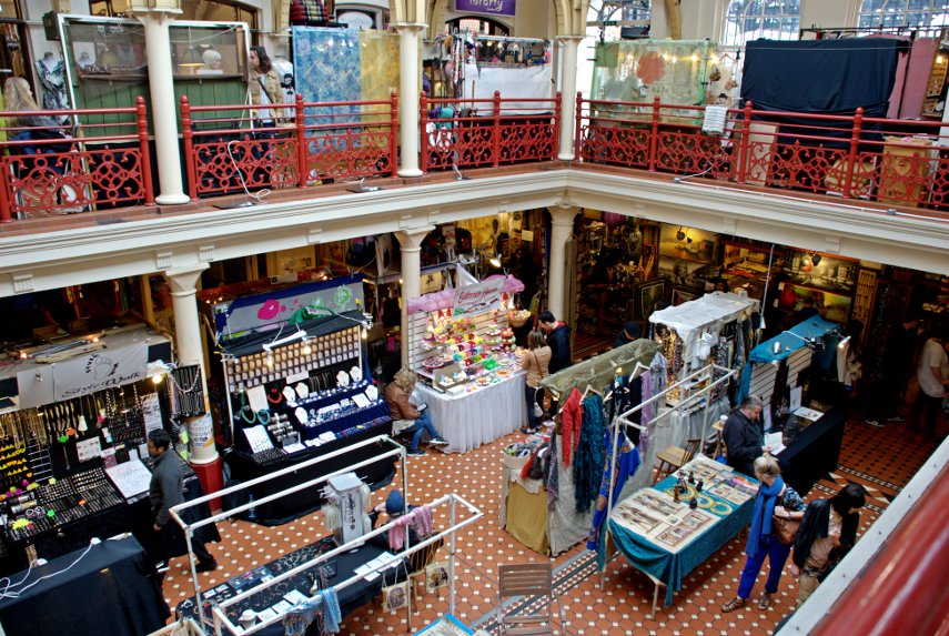
Then there were the stalls inside the Market Hall building over two levels.

This market is interesting, amazing, stupendous! If you like markets you cannot afford to miss this one. We finally dragged ourselves away from all the stalls and emerged back onto the canal-side.

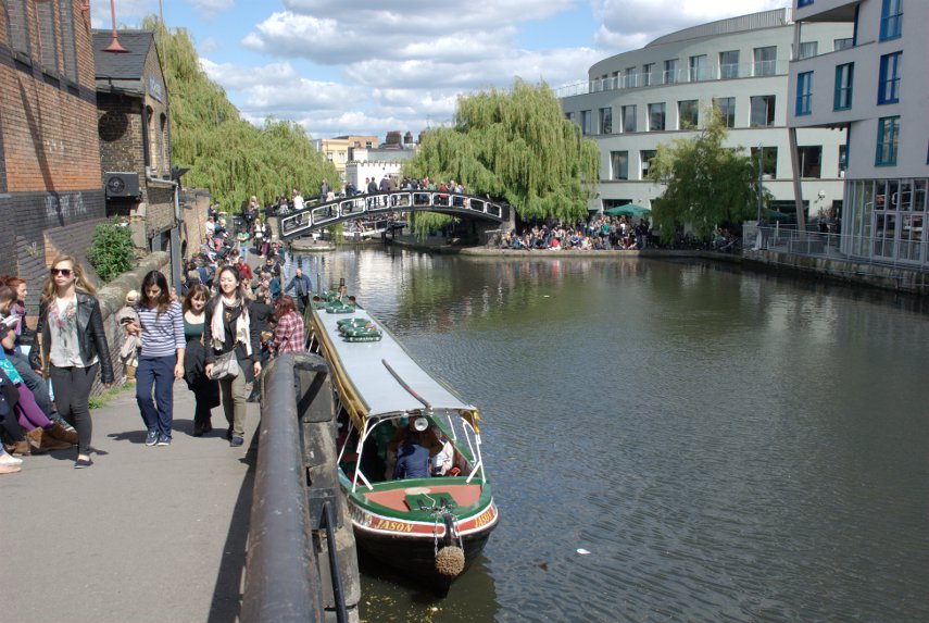
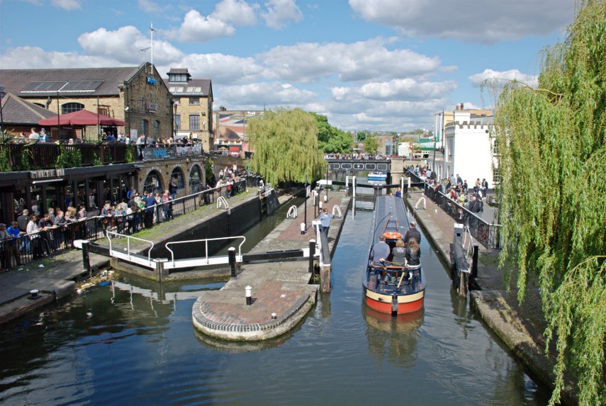
That boat in the foreground is one of the water buses which carry fare-paying passengers from Little Venice to Camden Lock (and back if so required). Then we crossed that bridge in the distance from which we had a good view of Camden Lock.

From here we set off towards the nearest underground station, Camden Town, along Chalk Farm Road and realised that there were also lots of small shops which were almost as interesting as the market. An amazing place indeed.

I took a lot more photographs than I have shown here many of which will appear on the main site in due course. Time to go home to rest our weary legs.
 

A later date.

A later date.

At the end of my last post I said "we plan to return for more at a later date" – this is that later date on a Sunday.

We came back to the City of London, as distinct from the City of Westminster and the West End, and started from the Monument this time.

We were last here when we went up to London to meet Jerry, 'Old Guy USA' on the forum, and this is where we parted at the end of our day together. Jerry went off to his hotel and we went home. The day had been cloudy with showers then but today it was sunny.

From the Monument we went into Pudding Lane where the Great Fire of London started, and no, we didn't start it – not even by accident.

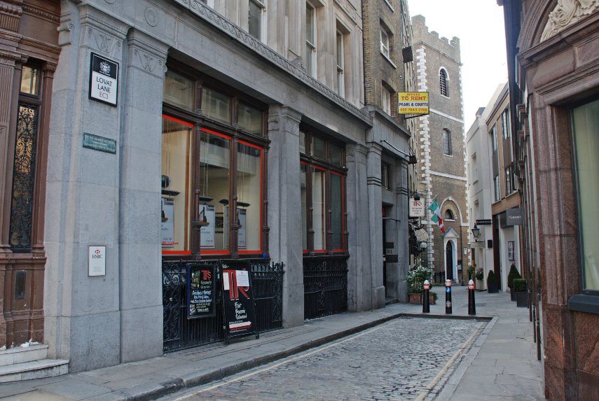
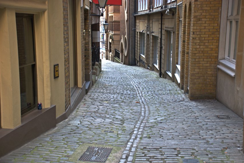
Pudding Lane looks totally different now, although it is still cobbled, compared to how it was in 1666 but nearby is Lovat Lane which gives an idea of how Pudding Lane might have looked at the time. Lovat Lane slopes down towards the Thames.

The top picture of the two is the top end of the lane where it joins Eastcheap and just out of sight past the church is the view in the second picture. Note how the sides of the cobbled surface slope towards the centre forming a central drainage channel. That is how all the roads at the time of the fire were constructed and that is where all the sewage would have been thrown. Nice! :yuck:

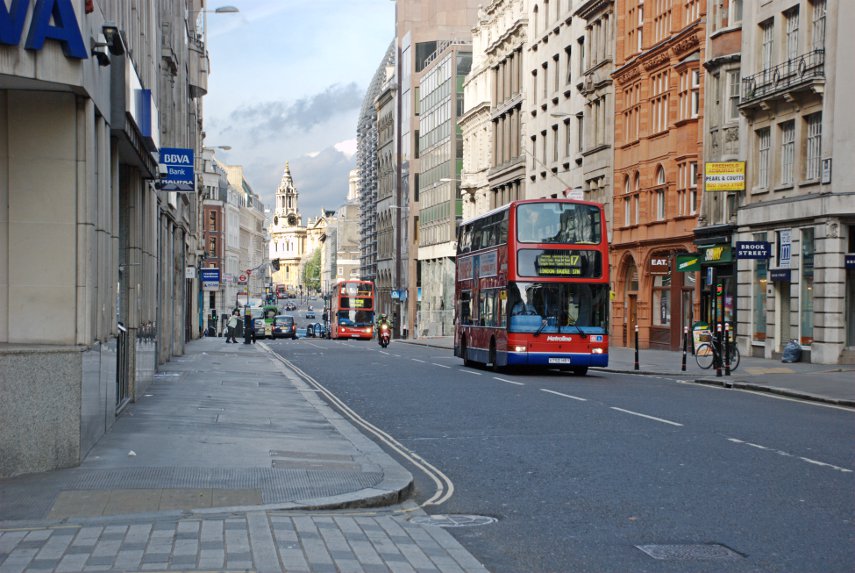
Pudding Lane is east of the Monument and Lovat Lane is east of Pudding Lane so we turned around and walked back west to Cannon Street which was really quiet, being Sunday, compared with a weekday. There are, as you can see, still buses around although we weren't here to look at buses.

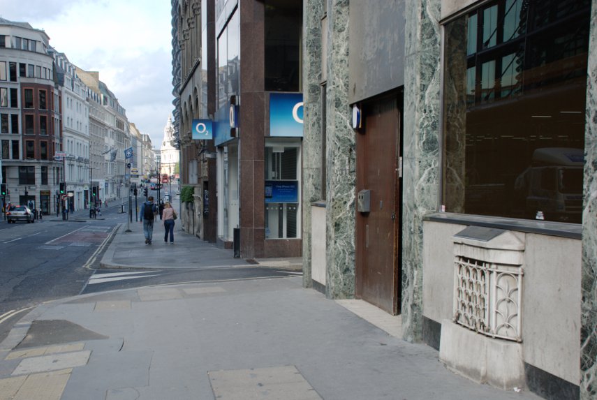
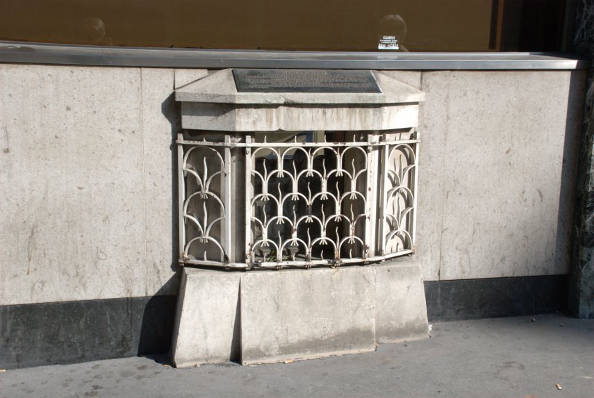
Just opposite Cannon Street Station is a small grille near pavement level which would be very easy to ignore. But if you did ignore it (You did didn't you?) you'd be missing part of London's history.

It is virtually impossible to photograph beyond that grill because there is a sheet of glass behind it which is covered in reflections from the bright light outside and behind that, just visible, is the London Stone. This is the stone from which the Romans measured all their distances from London.

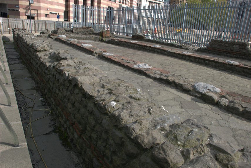
We then walked a little further along Cannon Street, turned right into Walbrook, left into Bucklersbury then left into Queen Victoria Street. A short way along on the lefthand side are the foundations of the Temple of Mithras.

This foundation was discovered during rebuilding work in 1954 and is, perhaps, the most famous of all twentieth-century Roman discoveries in the City of London. This temple was built in the mid-3rd century and, during excavation, various artifacts were discovered and are now in the Museum of London.

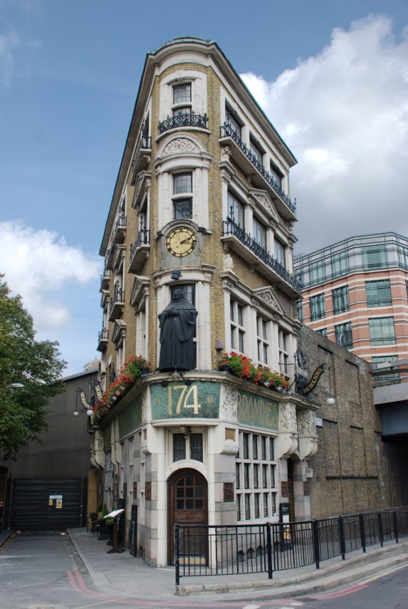
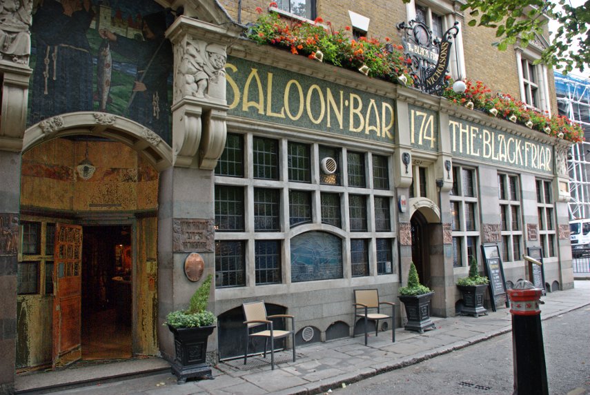
We continued along Queen Victoria Street as far as the junction with Black Friars Lane where we found this wedge shaped pub which as you can see in the lower picture is The Black Friar.

This pub was built on the site of a thirteenth century Dominican Priory, hence the name, but it is the interior, an Art-Nouveau masterpiece created in 1905 by the Royal Academy sculptor Henry Poole, that makes this pub so interesting. If you want to see the inside then you know where to go (they do provide cooked meals).

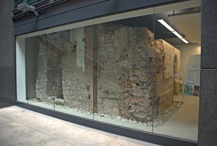
We went right into New Bridge Street and crossed over into Tudor Street, along Tudor Street then right into Whitefriars Street. We were looking for Magpie Alley/Ashentree Court along on the lefthand side of Whitefriars Street and spotted the narrow entrance to the alley. This led us into an obvious courtyard of all modern buildings, some with steps down to basement level. At the bottom of one of these basement steps is this:

It is all that remains of a Carmalite 13th century crypt.The crypt lay buried for centuries until it was unearthed in 1895 but it was not restored until the 1920s. It is protected by plate glass but is available to view at any time by going down the steps from the courtyard above.

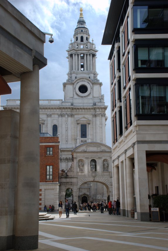
From here we made our way into Fleet Street and Ludgate Hill towards St. Paul's cathedral and into Paternoster Square with this view of Temple bar and one of the towers of St. Paul's Cathedral.

We had lunch, which was quite good and reasonably priced, in the St. Paul's Crypt cafe. There are also publicly accessible toilets down there.

After lunch we walked up Warwick Lane seeing Cutler's Hall on the way.

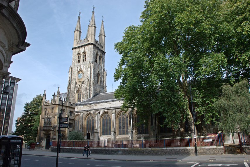
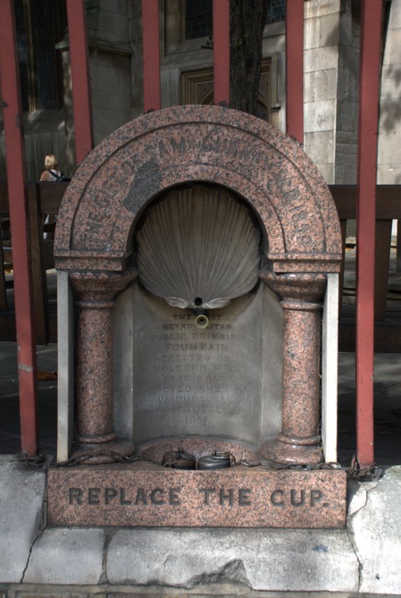
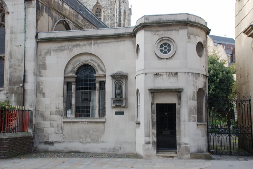
Then left along Newgate Street where we saw St. Sepulchre's Church on the corner of Giltspur Street. Built into the railings of the churchyard is London's first ever public drinking fountain (shown in the second picture) and round the corner in Giltspur Street is the Watch House (shown in the third picture).

The Watch House was built to deter grave robbers which were rather prevalent in those times as freshly dead bodies were in great demand for surgeons to practise on and fetched a high price.

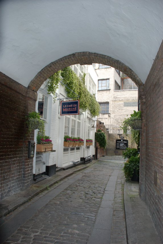
We went up past Smithfield Market to Charterhouse Square and saw this attractive little alley nearby.

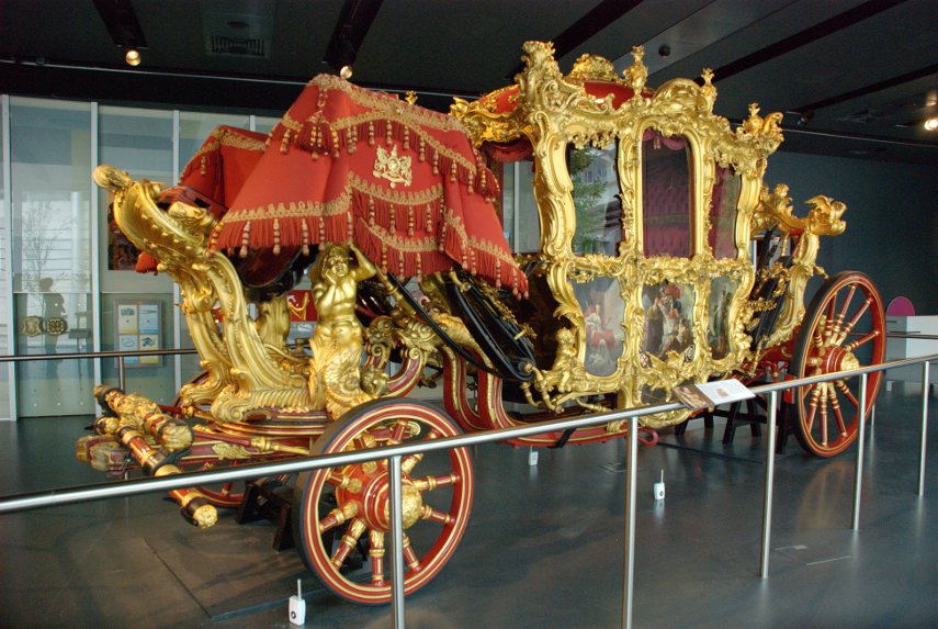
Then back to Barbican to revisit the Museum of London where, this time, we saw the Lord Mayor's Coach (and had a cup of coffee).

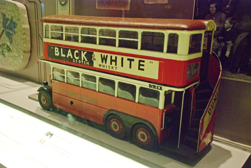
We also saw this model of an old London bus with an external stairway to the upper deck. I hate to have to admit this but I can remember going to school on one of those exact buses as a child. :oops:

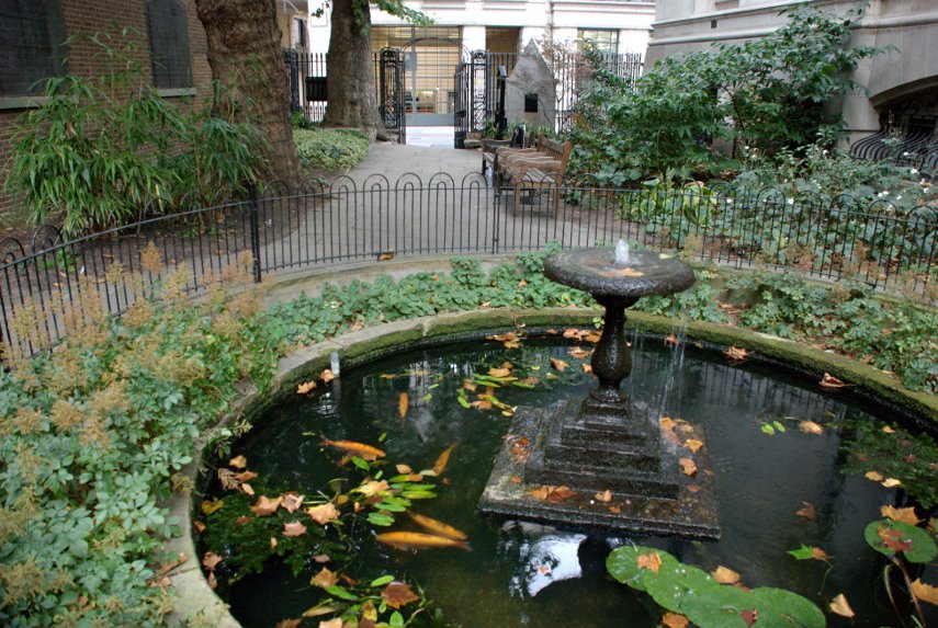
Just round the corner from the Museum of London we made a quick visit to Postman's Park. A small, little known but interesting little park.

Last, but not least, we went back to St. Paul's and at the east end walked into One New Change. New Change is the name of the street and One is the address/name of a very modern, covered shopping centre. If you like shopping then you will probably like this and there are lots of places providing food of various kinds.

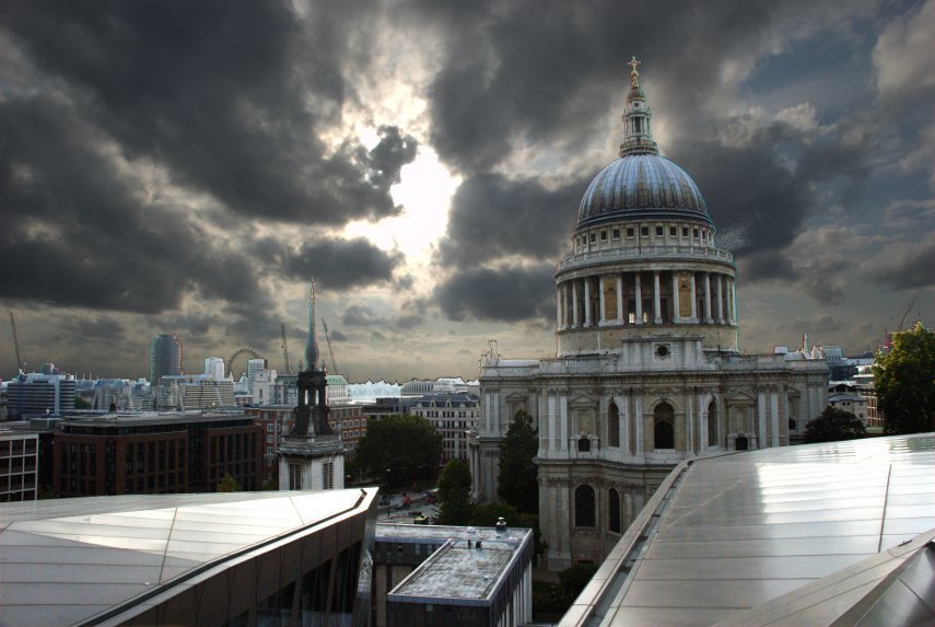
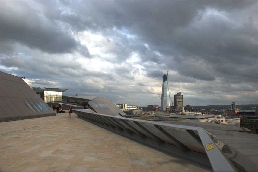
We didn't go in for either of those things. There are lifts which are made of glass and run on the outside of the building and if you go up to the 6th floor you will find a roof terrace which is freely accessible to the public and that is where we went.

The first picture, looking directly into the sun, gives quite a good view past St. Paul's across London with the top part of the London Eye just visible on the horizon.

The second picture shows just part of the actual roof terrace.

That was the end of our second day trip to the City of London.