Blog Help
For mobile phone users the controls (Search, Counties, Categories, etc.) normally visible on the side panel are available by scrolling down to the bottom of the page.
For mobile phone users the controls (Search, Counties, Categories, etc.) normally visible on the side panel are available by scrolling down to the bottom of the page.
Recently we drove to Bromfield with the intention of walking to Ludlow and discovered that Bromfield had a few surprises up its sleeve.
We first went to see the church and the entrance to the churchyard is through a delightful Lych Gate.

This was a priory church rebuilt in the 12th century. We walked through the churchyard and entered the church, shut the door behind us, and turned around. That was when we had a big surprise.


Wow! What a sight. The ceiling of the Chancel was painted in 1672 and the Reredos was painted in 1880. Standing underneath the Chancel ceiling is like looking up into the sky. The number of times we have passed through Bromfield and we had no idea what we were missing.
Following the Dissolution of the Monasteries in 1541 the church and priory were leased to Charles Foxe, who then purchased the property in 1558. He converted parts of the church into a house but in the 17th century the house was damaged by fire, and Foxe’s descendants moved away.
The remains of Foxe’s house are still present, attached to the south side of the church.

Next to the church is the medieval timber-framed gatehouse to the priory now owned by the Landmark Trust and let as a holiday property.

We started off along the footpath towards Ludlow but hadn’t gone very far when we came across this old mill.

It is, apparently, a water powered corn mill, dating from the mid 1800s, although the water wheel is now missing.
We continued our walk following a tarmac lane through a private estate, although the lane was a public footpath, with some nice views.


After about a mile we branched left across a potato field (yes, I know, we do all the really exciting stuff).

This section eventually led us to a very large cornfield and it was here that I started to feel a little unwell and reached the point where I decided to lay down in the corn before I fell down. I have to admit that I had two cups of coffee after getting up but nothing to eat at all. A contributing factor perhaps?
I felt a bit better after a while so we continued for at least another mile when we arrived at Dinham Bridge.


We still had to walk up into town, I still felt somewhat fragile, so we continued (no other choice really) and eventually arrived in Castle Square.

After having some lunch I was back to normal (which isn’t saying much). Draw your own conclusions.
We caught a bus back to Bromfield where we’d left the car.
Day 3.
Staying in Settle meant that we were on the Settle to Carlisle Railway which is well known for its scenery and for the Ribblehead Viaduct which it crosses so we thought we would pay the viaduct a visit.
We drove over to Ribblehead and found some easy parking.
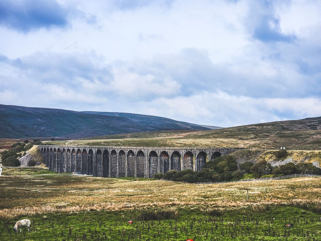
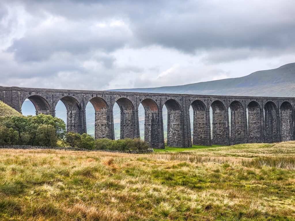
Building this impressive viaduct started in 1869 and required a workforce of 2300. The railway across it opened in 1876.
Nearby we found this.
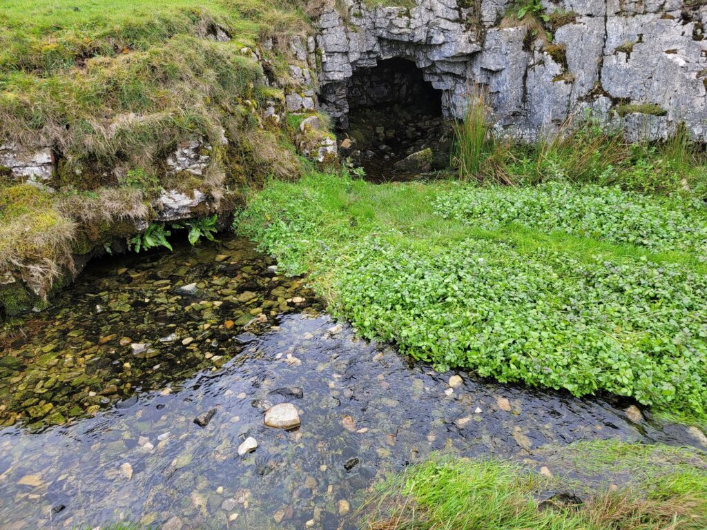
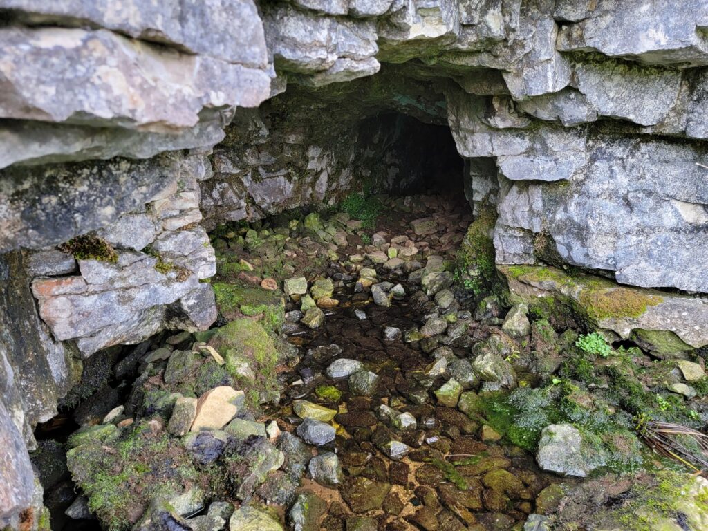
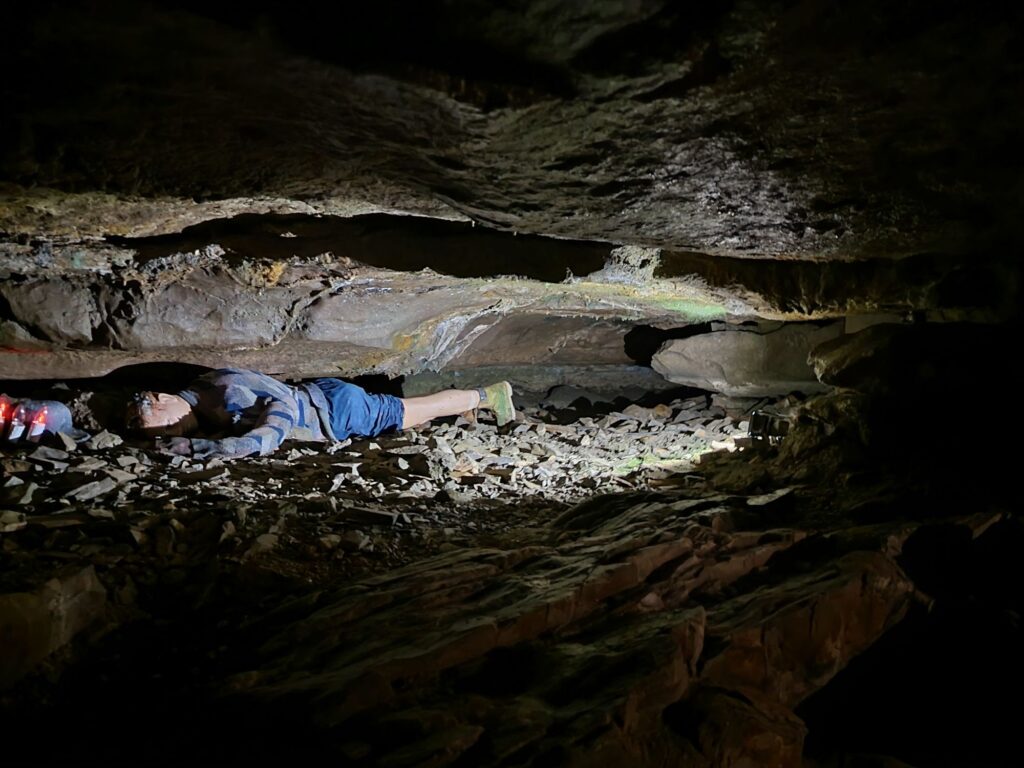
Finding it wasn’t accidental. I came here when I was a young caver and exploring it required crawling on hands and knees in the stream. Unfortunately, after only a relatively short distance the roof came down to floor level. End of exloration.
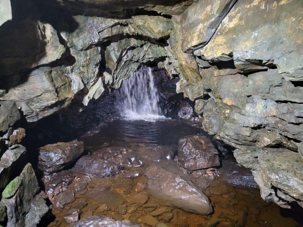
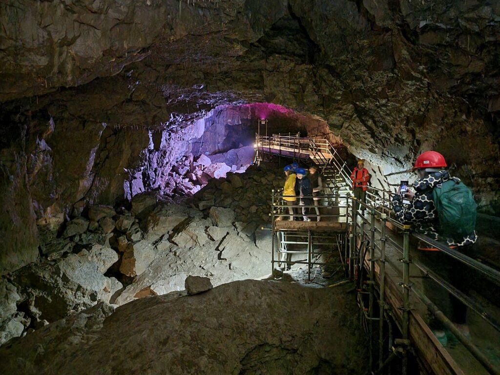
After this we thought that we should find a real cave so we drove a few miles towards Ingleton to White Scar Cave. This cave is open as a show cave and tours run throughout the day.
It is an active cave with a stream running through it and, consequently, is subject to flooding. In 2016 the water pouring out of the cave destroyed the buildings outside together with the car park. Everything has since been rebuilt. In bad weather check opening times in case it has to be closed.
Access to the cave is via a tunnel cut through the rock. Part the way along this tunnel it shows part of the cave passge that the original explorers had to traverse laying flat. Not a comfortable experience.
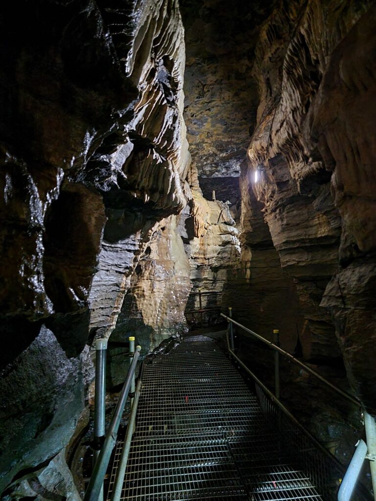
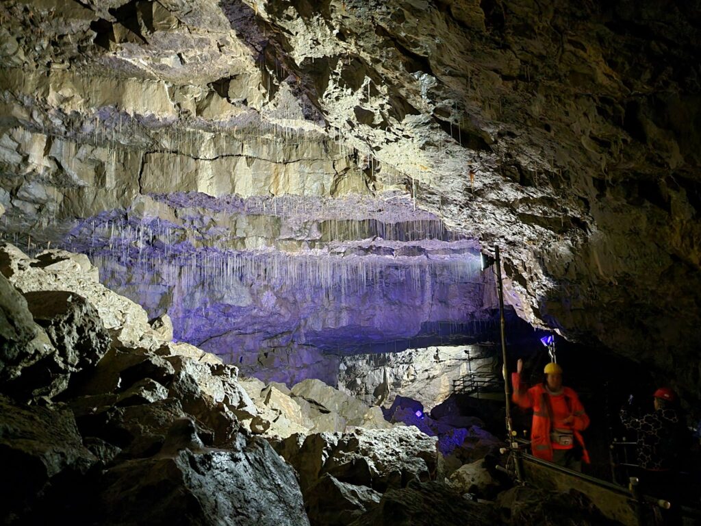
The entrance tunnel meets the show cave proper in the active stream passage.
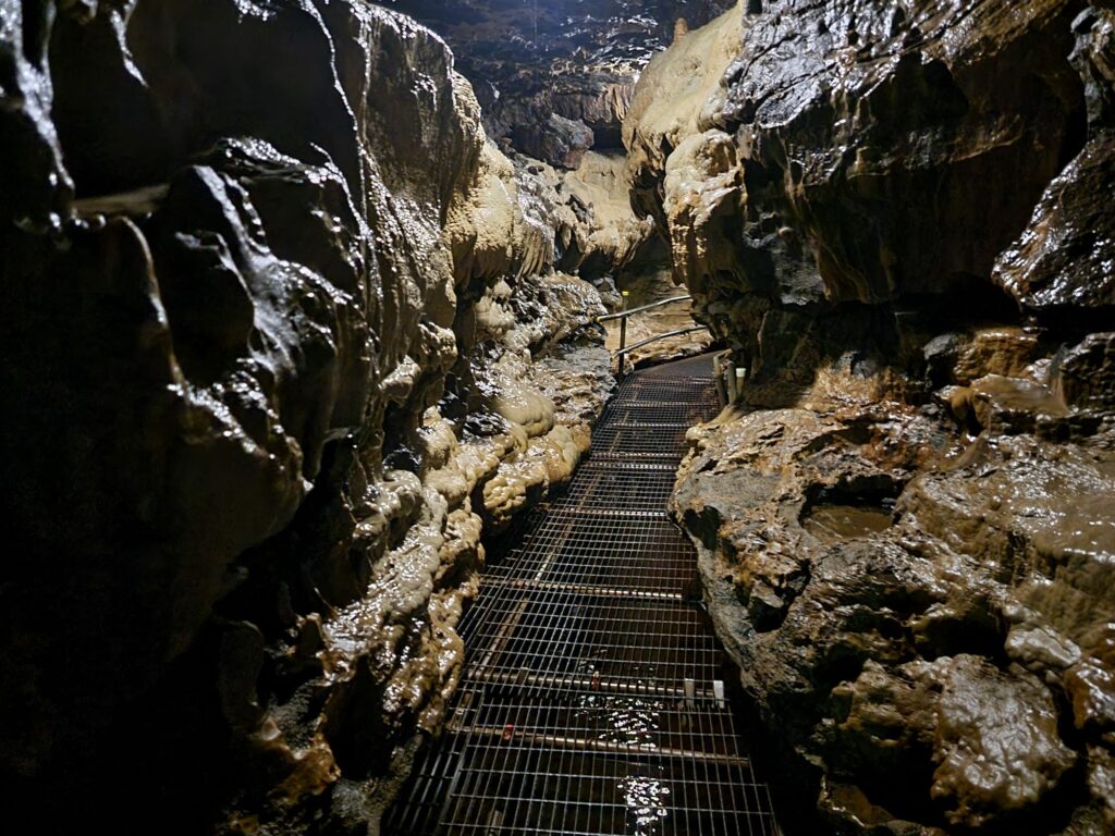
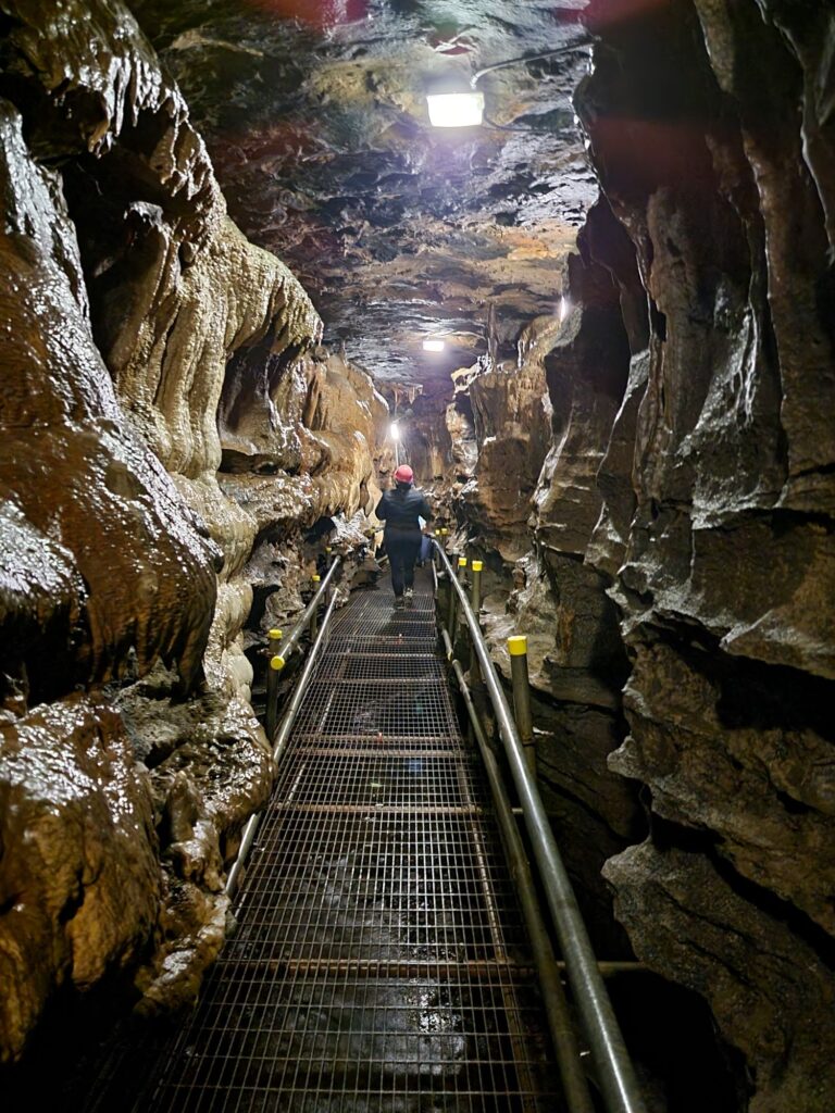
If you were a caver you’d have to walk along this passage with your feet in the stream but, luckily for you, there’s a strong, well constructed, metal walkway so that you can keep your feet dry and admire the spectacular underground scenery.
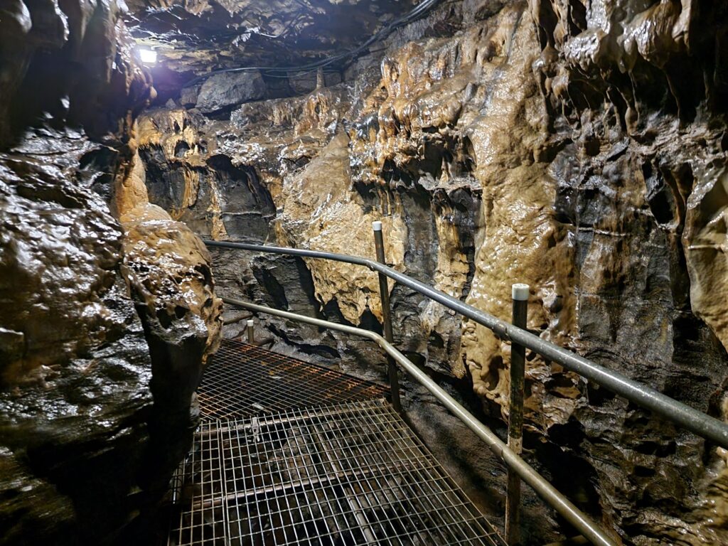
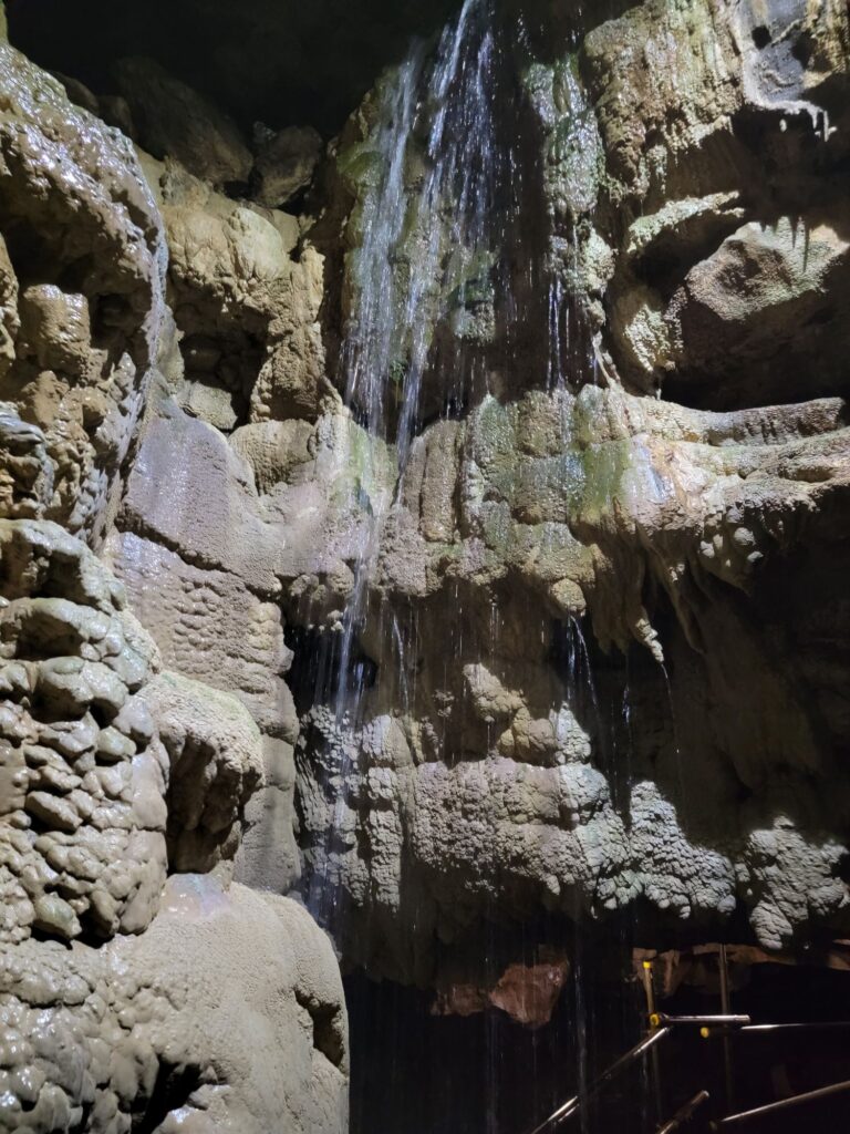
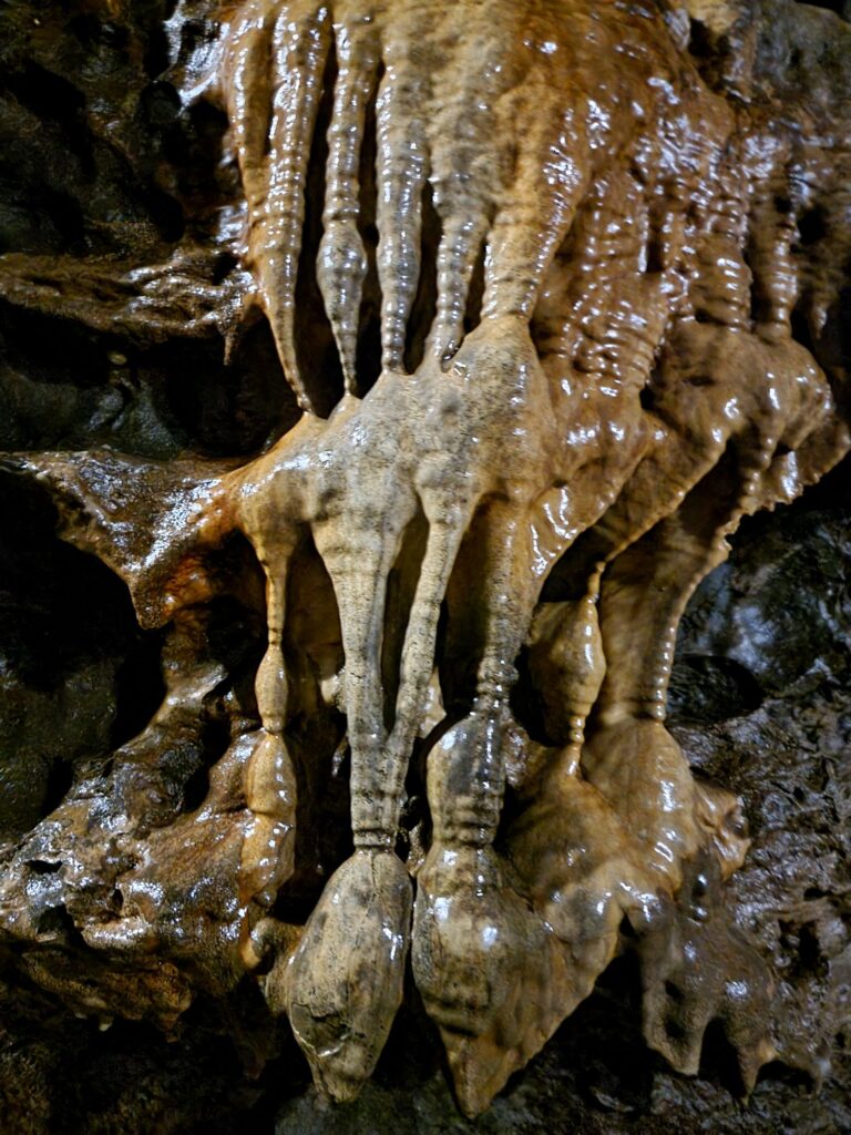
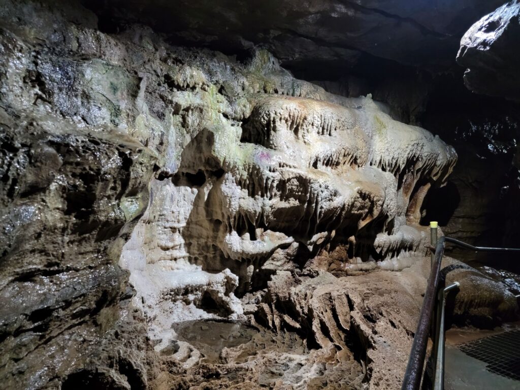
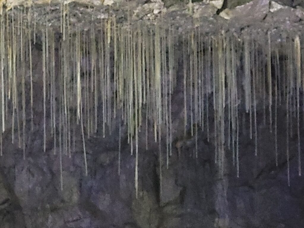
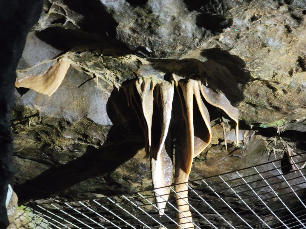
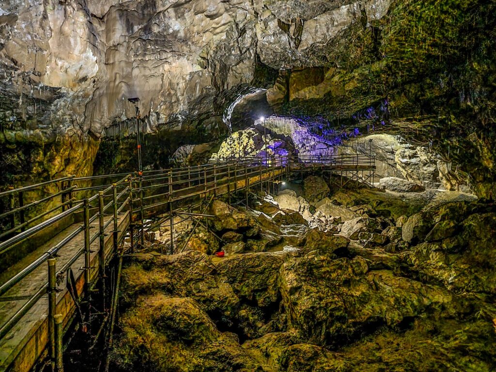
There is plenty to admire including extraordinary formations like this.
There is a lot to see in this cave and the normal tour takes over an hour.
Finally, after climbing a stairway through a man-made tunnel, you will reach the Battlefield Cavern. This is the latest part of the show cave.
After that adventure we made our way back to the cave entrance and went back to our hotel.
Day 2
We made Settle our base for this trip and so, this morning, we drove from Settle to Horton-in-Ribblesdale (6 miles, 10 minutes)s where we parked. We were planning to walk on the Pennine Way towards Pen-y-Ghent but weren’t planning to walk up it.
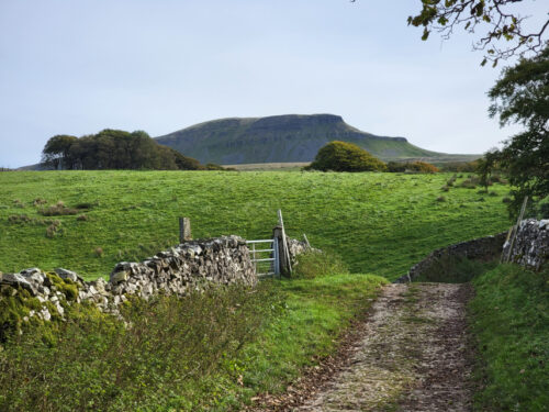
It was a very pleasant walk along a wide track which wasn’t too steep although it was uphill all the way and we soon arrived at our first destination.
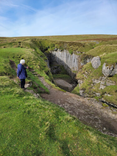
This is Hull Pot measuring 60 feet deep, 60 feet wide and 300 feet long. There is no access to any underground passages, even if you could get down there safely, but a small waterfall can be seen and the water from that emerges down near Horton-in-Ribblesdale.

This pothole can fill with water in very wet weather.
We went back to the Pennine Way and turned towards Pen-y-Ghent for a short distance to see this.

No, not the very obvious Pen-y-Ghent, but that triangular dark patch just below the centre line of the picture. The next picture shows a closer view.

Yes, yet another hole in the ground. This is Hunt Pot and that black patch at the bottom of the depression is the top of a 180 foot shaft so don’t go too near. This pothole, unlike Hull Pot, does give access to lots of underground passages and the only way in is down that shaft. No, we didn’t.

After that we decided to make our way back to base. A bit of a long walk back to the car, past the impressive Pen-y-Ghent, but very scenic and enjoyable.


We decided on a trip to the Yorkshire Dales in October and the theme turned out to be a little unusual.
Day 1 – Getting there.
It was a rather long drive for us of about four hours so we decided to break the outward trip into two segments with a stop about 4.5 miles south-west of Congleton, Cheshire at Little Moreton Hall. This is a National Trust property and a stunning one at that.
The people that built this were obviously working on the premise “If you’ve got it, flaunt it.”

The first part of this building was built between 1504 and 1508 the Long Gallery on the top floor was added later. You may notice that the Hall is rather wonky. That is probably because the original foundations were not designed to cope with the additional weight of the Long Gallery extension.
The house is surrounded by a moat.

One of the many interesting features of this house is this conjunction of these three staircases as, at first glance, it rather boggles the mind but, with care, it can be visually sorted out.

One of the other main features is, of course, the Long Gallery on the top floor which was added about 1554. The last major extension was added in 1610.

This is a truly astonishing building and more detail is available on the main web site.
We then drove on to Settle in the Yorkshire Dales which was to be our base on this trip.
We had to go to Ludlow recently and Amanda wanted to see what Christmas Cards were available in the parish church. We have been to this church before and it is featured on the web site in the Ludlow pages. However on our last visit I posted only one picture of the Misericords in the Quire so I thought that I would improve upon that this time.
The Church of St. Laurence in Ludlow is the largest parish church in Shropshire and the photograph below gives an idea of its size looking along the Nave, through the crossing and Quire to the East Window. It is, basically, huge! Walking around this church is like walking around a cathedral.

The Crossing looks very impressive as one passes under it to reach the Quire and the tower is 157 feet high and was rebuilt between 1433 and 1471.

After passing through the Crossing we reach the Quire entrance which, itself, is pretty impressive.

The Quire has stalls along each side which is where one will find the Misericords.

Misericords, as you will know, are small folding seats, just a simple flap of wood that folds down, and there are 28 of them of which there is a good sample below. Each one has carving on the underside and they are 26 inches long, 12 inches deep and 6 inches thick. 16 of the misericords are older than the rest dating from around 1425. Eight have an unusual carvers mark in the form of an uprooted plant and a distinctive profile to the moulding running round the edge of the corbel. The remainder were carved around 1447.


Finally we get to the title of this piece. There used to be a phrase ‘What a carry on’, used in the vernacular, which was used to describe a commotion or loud noise and this is where the gadget below becomes relevant. It is a Carillon which is a device for automatically ringing the church bells and, as it is french, the pronunciation is very similar to ‘Carry On’ which is what the ordinary people thought it was. The carillon consists of a huge wrought iron cylinder which is turned by the church clock mechanism and the projecting pins cause hammers to strike the church bells rather like a giant music box. It has been used in this church since 1683.

Well, that was an interesting visit and Amanda did get her Christmas Cards.
We have been to Hergest Croft Gardens, near Kington, a number of times but we had never been further up the lane to Hergest Ridge at the top. It was now time to change that.
We took our normal route to Hergest Croft Gardens but instead of turning into their car park we went straight past to the end of the lane where we parked and continued on foot through the gate along Offa’s Dyke Path.


Hergest Ridge straddles the English and Welsh border and is part of the Offa’s Dyke walk as well as a standalone highlight in any exploration of Herefordshire.
If you decide to start at the main carpark in Kington a modest climb of 1300 feet up from the quaint town will bring you to this point, where we started, and we continue through the gate on the Offa’s Dyke Route.
Heading for the top the views emerge all around and, as you walk, run, or cycle along the beautiful moorland, you may chance on wild ponies grazing , we didn’t see any, but we saw some wonderful views.


There were numerous people walking up here and you can probably see that Offa’s Dyke Path is well worn and, therefore, easy to see and follow.

There were plenty of wild flowers about and we saw this Tormentil and Gorse on the way up.


From the ridge you can look across to the Black Mountains and even as far as the Malvern Hills, with uninterrupted English and Welsh countryside landscapes all around.

Look out for the Victorian racecourse that sits atop Hergest and imagine the thrills and spills as the horses galloped around the track. As we approached the summit we could see the Monkey Puzzle Trees ahead. This area is part of the Hergest Estate and the trees were planted by one of the owners having seen similar trees growing on mountain tops in Chile in the early 1990’s.

You should also see the Whetstone near the summit, a natural stone, which in medieval times was used as a place to distribute food to people suffering from leprosy. Legend has it that the stone rolled down to Hindwell Brook each time it heard a cock crow. but it doesn’t attempt to explain how it managed to get back up the hill again.


On the way down we noticed this tree in blossom. Although the blossom is pink we think that it’s a Blackthorn.


This was an easy and very pleasant walk on a warm sunny day.