Browsed by
Tag: Rivers

Lynn – Day 2

Lynn – Day 2

Another hot, sunny day dawned although I wasn't awake to see that part. We went down to breakfast and very nice it was. We both had a cooked breakfast followed by toast and marmalade, of course, then it was time for some serious tourism.

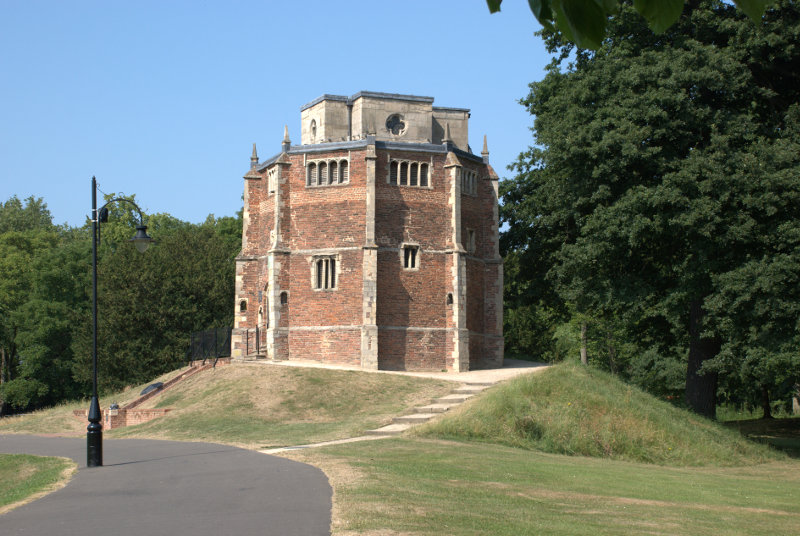
Wherever we went in Lynn we went via The Walks past the Red Mount Chapel. It wasn't because we liked it so much but it was the most convenient route into the old part of the town.

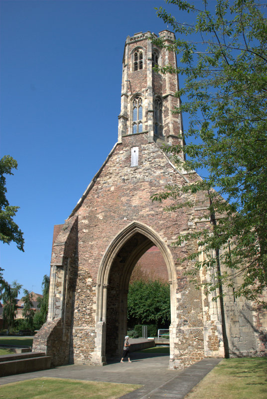
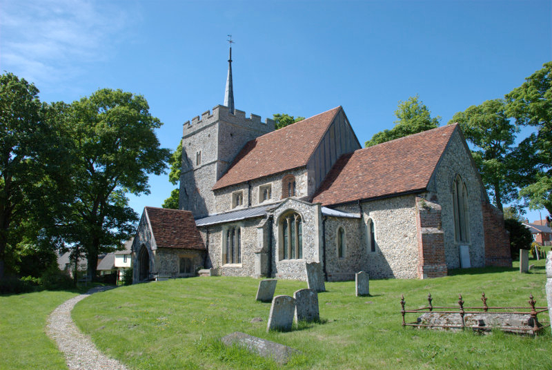
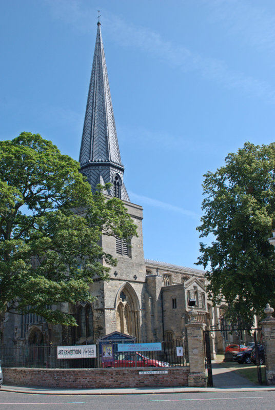
We were headed for St. Margaret's Church, or the Minster as it is known, and Saturday Market Place. King's Lynn was originally two towns so it has two churches, two guildhalls and two market places. We will be seeing the other market place later.

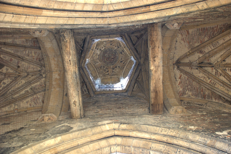
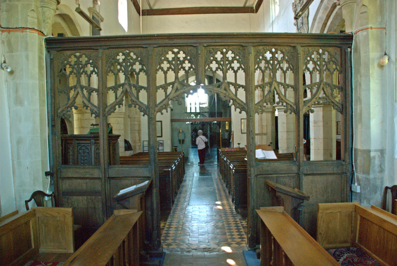
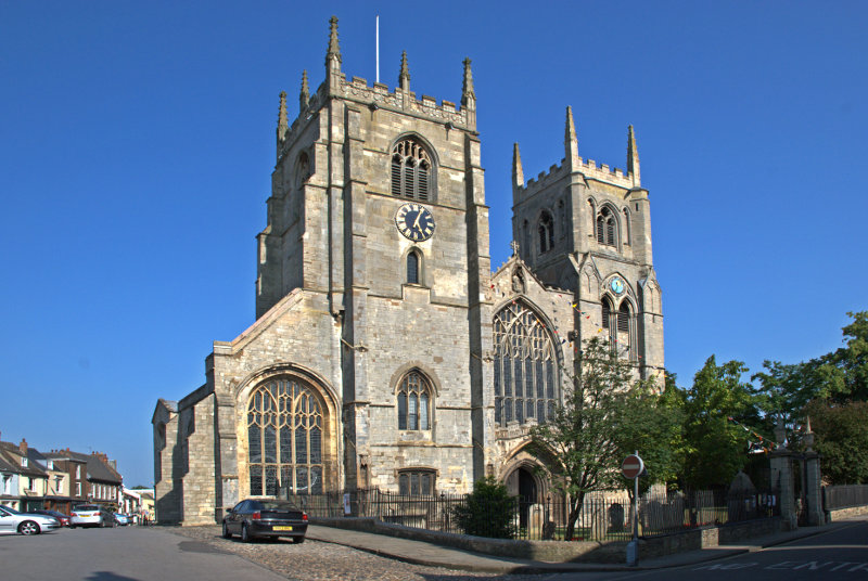
For a parish church the minster is big.


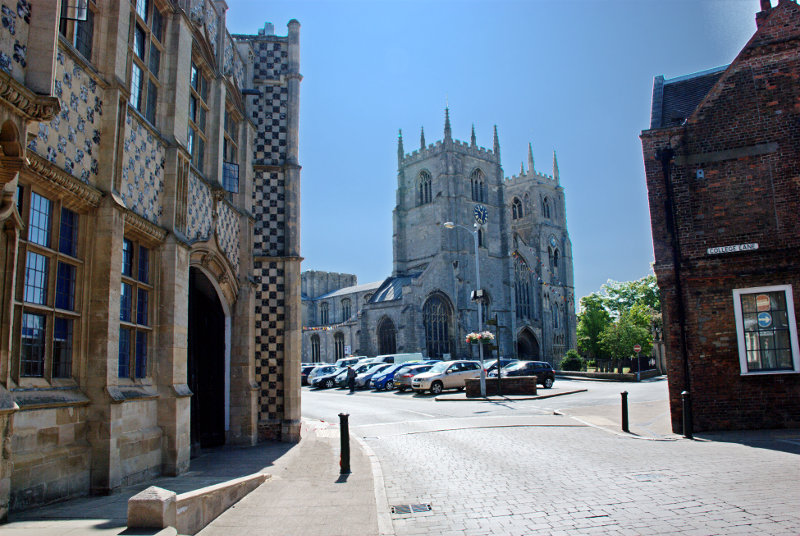
The space on the left where there are some parked cars is Saturday Market Place which is used as a car park when there isn't a market being held.

Parish churches don't normally have two towers and especially towers that large and you can probably see in the top picture that there is a sizeable tower, although not as high, further back over the crossing.

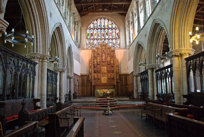
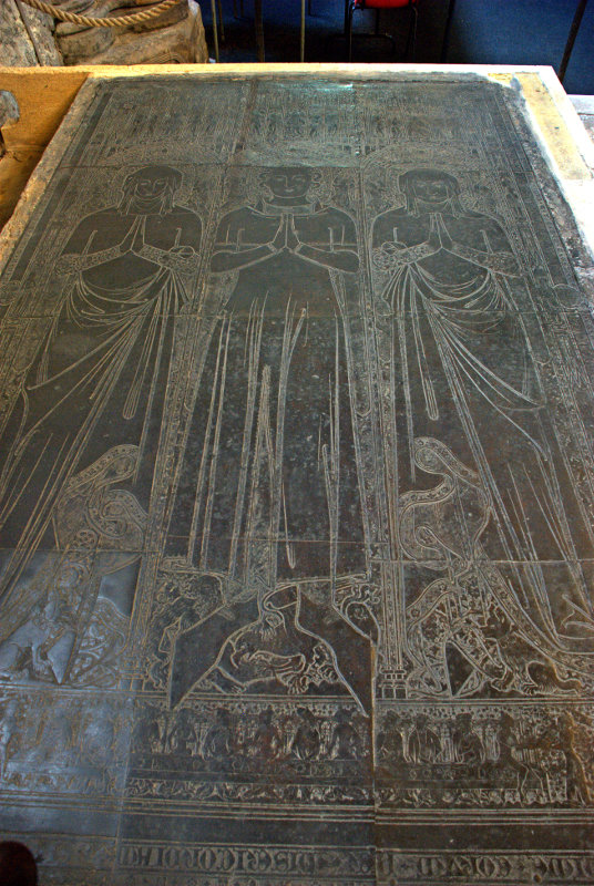
This church also contains the largest monumental brasses in the country dating from the 14th century and the figures depicted must be near life-size. This is one of the pair.

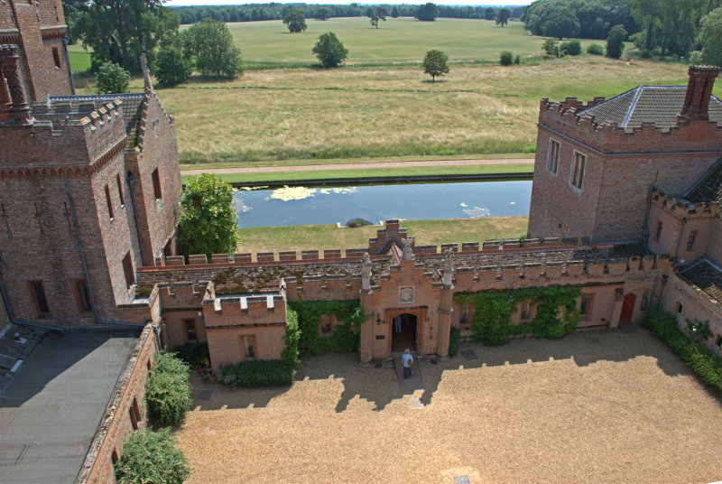
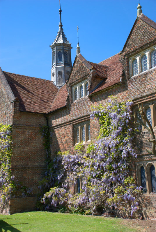
Just south of the minster is Nelson Street and Hampton Court. This is not Hampton Court Palace in London but it is pretty spectacular all the same. The whole building was formed over a period of 300 years.

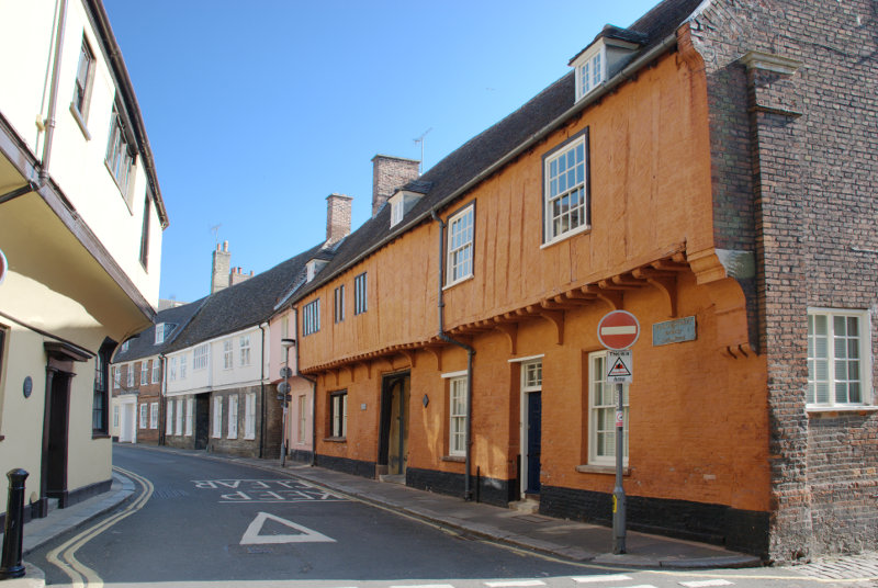
The South Wing was constructed first, consisting mainly of a 14th-century merchant's hall house and is thus the earliest surviving section.

The West Wing was constructed towards the end of the 15th century, probably as a warehouse which was later converted into a house. The East Wing was also constructed at the end of the 15th century.

The North Wing completed the courtyard a century later.

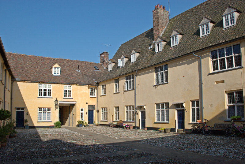
In the picture above the doorway into this courtyard is visible in the far wall.

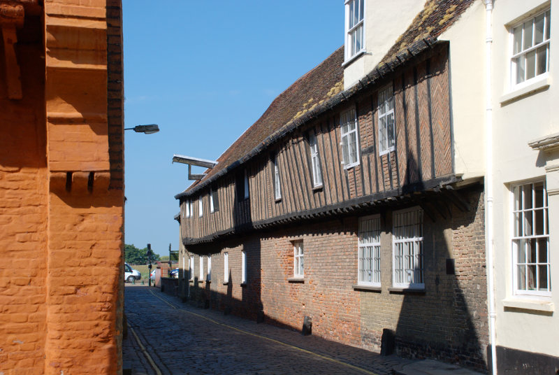
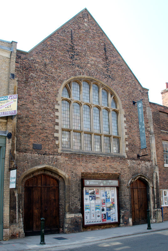
Next to the north wall of Hampton Court is St. Margaret's Lane with the 15th century Hanse House, a Hanseatic Warehouse, along one side. The Hanseatic League was a trading confederation which existed from the 13th to the 17th centuries.

Running eastward from the junction of St. Margaret's Lane and Nelson Street is Priory Lane.

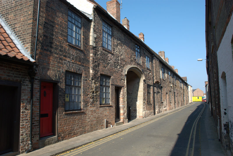
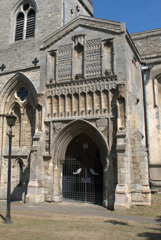
St. Margaret's Church, the Minster, was originally part of a medieval Benedictine Priory until the Reformation when the priory was disbanded by Henry VIII but the church was saved as a parish church. Priory Lane includes buildings in the medieval priory range. Note the rather imposing archway.

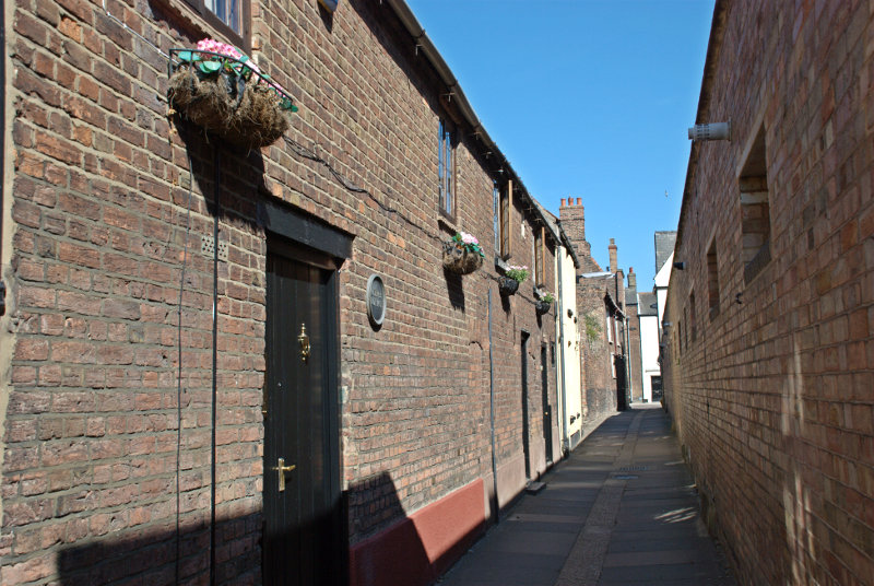
It was rather nice walking around this area with its old narrow streets because it offered plenty of cool shade.

We walked back past the church to the north side of Tuesday Market where we found the town hall complex which included the 15th century Trinity Guildhall.

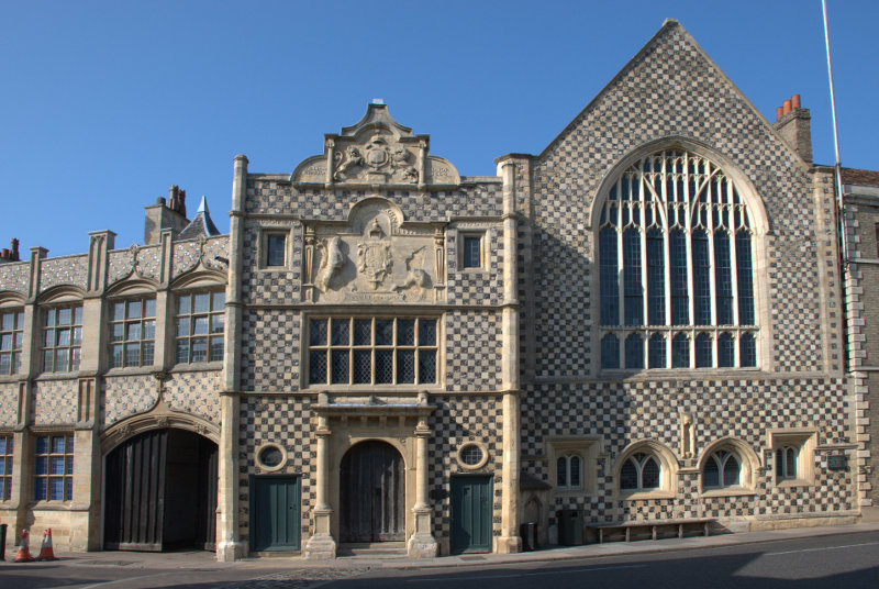
The guildhall includes the facade with the doorway in the centre of the picture and the gabled building to its right. The part on the left is the town hall shown below.

The town hall is an extension built in a similar style in 1895. You can see the Guildhall jutting out at the far end.

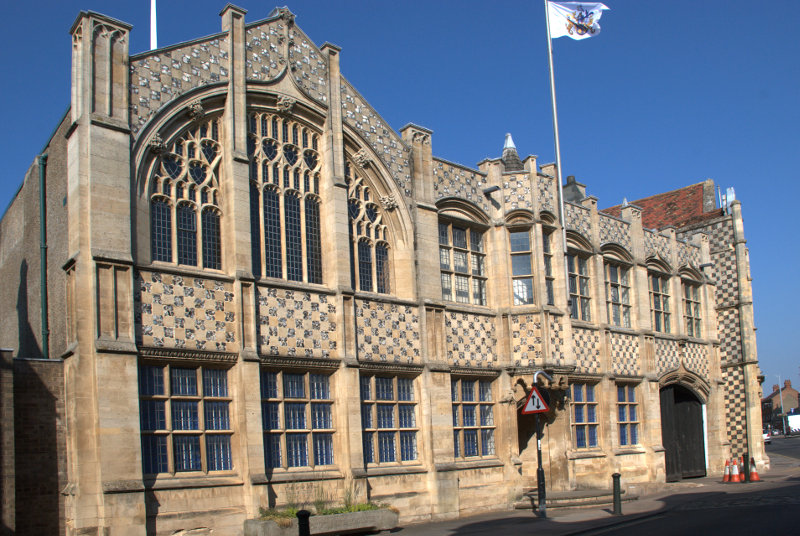
We were now heading further north along Queen Street and then King Street to see St. George's Guildhall. The largest surviving 15th century guildhall in England.


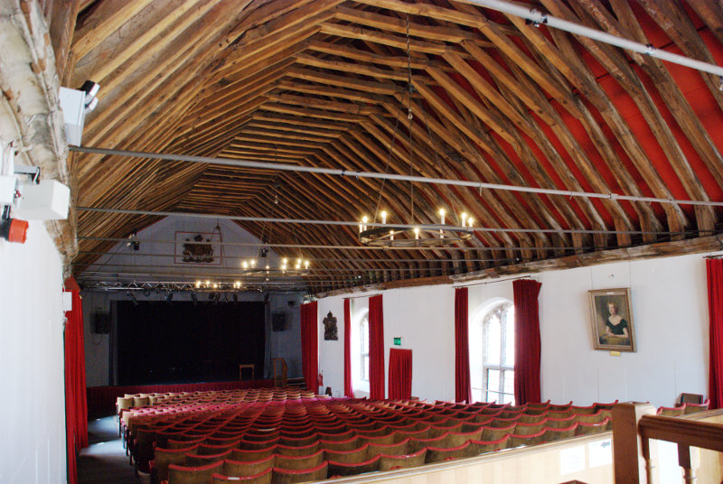
The guildhall ha since been converted for use as a theatre and the second picture shows the structure of the original roof.

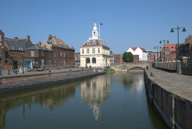
We now travelled the short distance to the larger Tuesday Market Place. As is the case with Saturday Market Place when a market is not beig held this market place is also used as a car park.

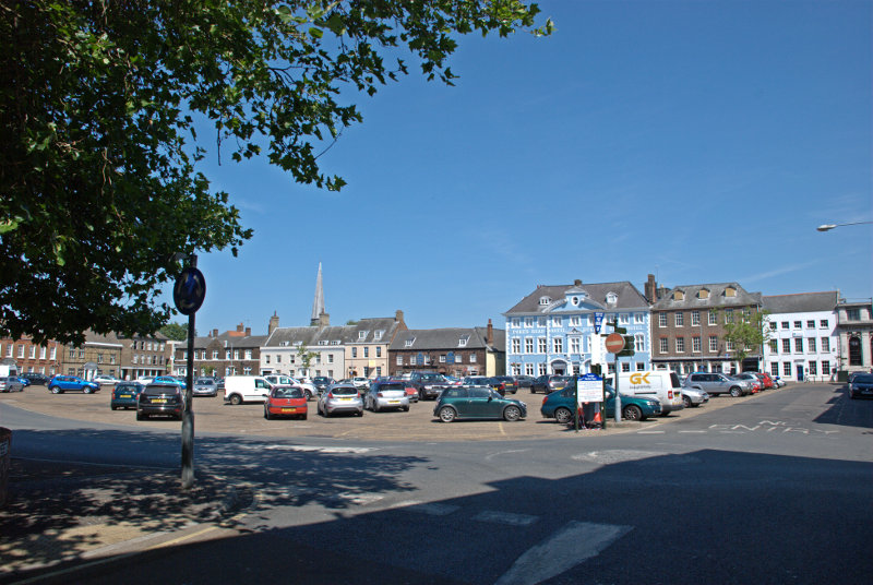
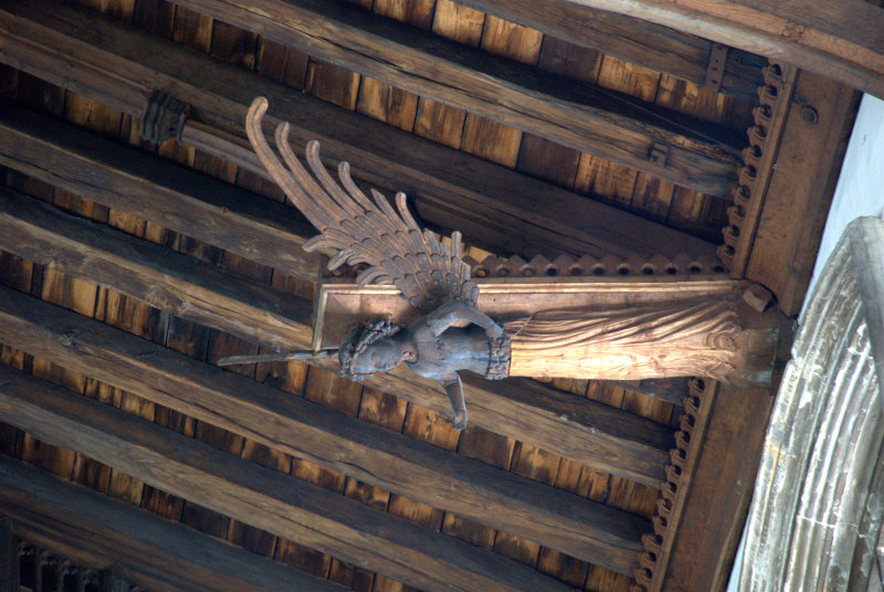
The prominent blue and white building is the Dukes Head Hotel and the spire poking up above the rooves to the left is St. Nicholas' Chapel. I think that I can say, without exaggeration, that this is the largest chapel that I have ever seen.

Apparently it can't be called a church because it isn't a parish church and that honour goes to St. Margarets so it must be a chapel. Built in the 15th century it has a very fne porch and some of the best carved wooden angels in the roof that we have seen.


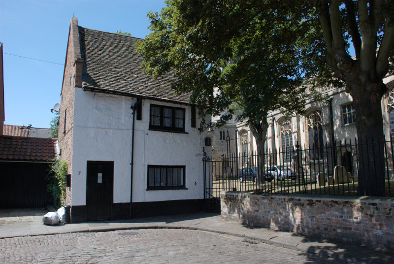
To the south of the chapel by a side entrance to the churchyard was the Exorcist's House. The position of Exorcist in past enturies was one which a Catholic priest could hold as he progressed up the church career ladder. It has a side entrance that leads directly into the churchyard and has the reputation of being haunted.

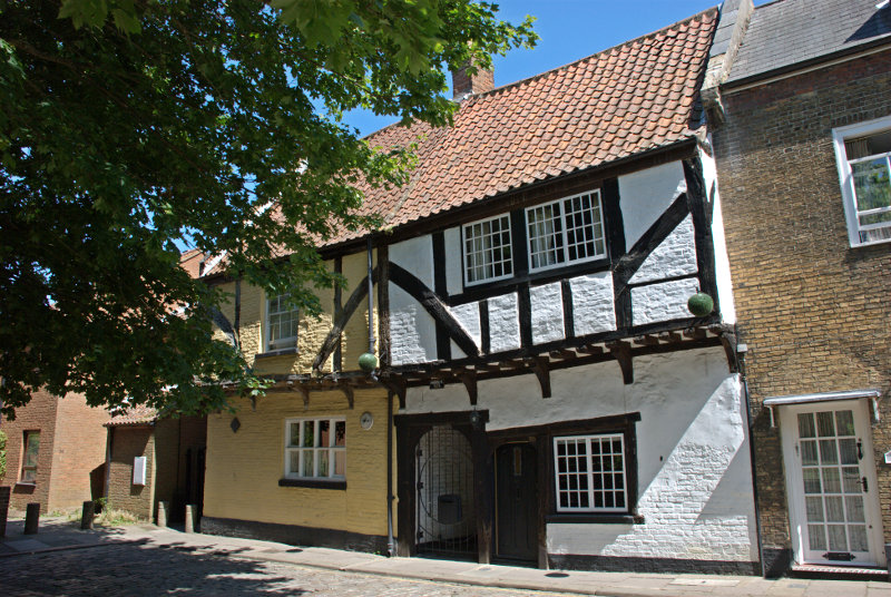
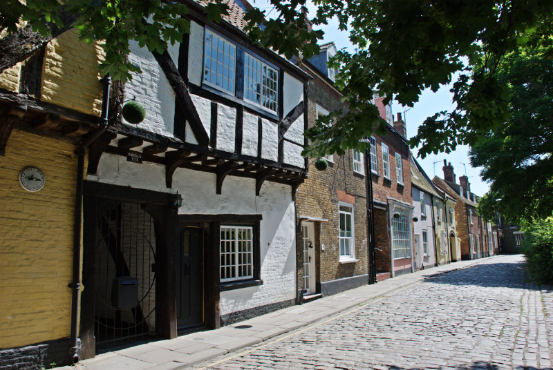
Behind the chapel is Pilot Street where we spotted these nice timber-framed buildings.


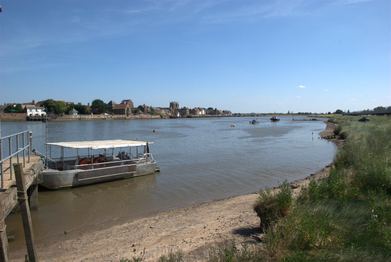
We now headed for the river down Ferry Lane. You won't be able to guess where we're going.


It was a strange looking little boat but eminently suited for its purpose.

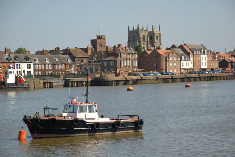
Here we are on the other side of the river in West Lynn looking back at the King's Lynn waterside.

We walked along the boardwalk which runs along the bank and had some good views of King's Lynn.


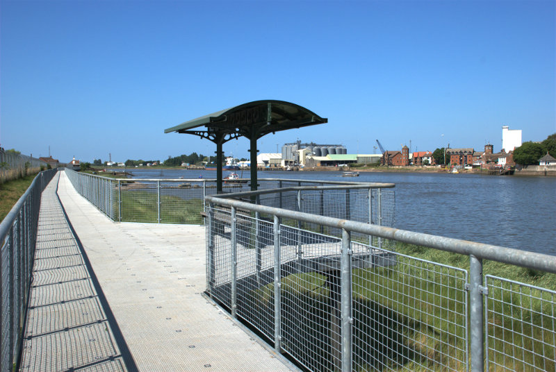
Somewhere back there is where we got off the ferry and we have to walk back again. We had worn our legs down to short stumps by now so that is what we did. We went back to the ferry and went 'home'.

We're off somewhere different tomorrow.


Lynn – Day 1

Lynn – Day 1

As someone, somewhere, had decided to award us a week of summer weather we decided we'd better make use of it before it disappears so we arranged to go to King's Lynn for four days.

So, on a hot sunny Wednesday, we set off for a 93 mile journey north to north-west Norfolk which took just over two hours and took us through Braintree, Sudbury, Bury St. Edmunds, Thetford, Mundford and Oxburgh. One wouldn't normally go through Oxburgh on the way from Mundford to King's Lynn but we chose the few miles detour because we wanted to see Oxburgh Hall. Built around 1482 Oxburgh Hall is a moated manor which was always intended as a family home and not a fortress as the crenellations are symbolic fortifications rather than actual.

The main entrance and gatehouse is on the opposite side of the view shown above and the house is arranged around a large open quadrangle where the next picture was taken showing the large impressive gatehouse.

The eyesore deckchairs have been provided by the National Trust who must have been desparate for visitors to notice them.

It is possible to go up onto the roof of the gatehouse if you don't mind the climb up the spiral stairway.


The rooms, as one might expect, are pretty impressive as this view of the West Drawing Room shows although one needs to ignore the strange lady at the far end.

The Library is equally impressive.

The Queen's Room is, as you'd expect, quite large.

But off to the left, out of the picture, is another small side chamber and in the floor of this chamber is a small trapdoor which, when closed, blends in with the tiled floor. However, when opened, this trapdoor gives access to the Priest Hole. Because of the Catholic faith of the Bedingfeld family, a Catholic priest may have had to hide within the small disguised room in the event of a raid.

The entrance is just large enough for a person to slip through and this is all that there is inside. I am sitting on one of two benches with the other showing to my left and the brick slope on the far side of the floor is the only way in and out. Calling it a room, even a small room, is stretching the imagination somewhat. Getting in, and out, is not easy and it reminded me of my caving days. When I came out Amanda went in. We both survived.

If the King's men (soldiers) turned up unannounced then any visiting priest would have had to get in here quickly and possibly stay there for a few days. There is no toilet and no light so don't even think about it but it was better than being dead.

On a lighter note there is a very impressive flower border in the grounds.

It was an interesting and enjoyable visit but now we must go onward to King's Lynn. We arrived in King's Lynn at our B&B at around mid-afternoon and settled in then decided to have an initial short exploration leaving tomorrow, Thursday, as our main exploration day for the town.

A short way from our B&B was a public park called The Walks and we knew that within the park was the 15th century Red Mount Chapel. It is unique and no other building like it can be found. It was built to contain a relic of the Virgin Mary but was also used by pilgrims on their way to Walsingham.

Built on instructions from the prior of Lynn the inner core is divided into 3 storeys and there is an additional cross-shaped ashlar building in Ancaster stone on top.

A strange place indeed which Pevsner described as one of the strangest Gothic churches in England.

Moving towards the river to the west end of The Walks we crossed the road into another small park known as Tower Gardens. In this park is the Greyfriars Tower which is all that is left of a Franciscan Monastery. Take no notice of the strange woman at the base of the tower she seems, somehow, to get into a lot of my photographs.


Henry VIII had all such monasteries demolished but the tower at Lynn was left untouched because it was considered to be a useful seamark by sailors entering the town and is still clearly visible on the town's skyline to this day.

You can see from this model just where the tower fitted in.

We moved further towards the river looking for the Tourist Information Centre so that we could get a free street plan of the town. We knew that it was located in the Customs House and eventually we spotted it.

Situated on the edge of Pur Fleet this building started life in 1683 as a merchant exchange but was bought by the Crown in 1717 for £800 and occupied by HM Customs and Excise until their move to a central office at Ipswich in 1989. It is now occupied by the local TIC. Pur Fleet runs into the River Great Ouse just behind the camera.

We'd had enough by this stage so having collected our free street plan of the town we headed back to our B&B. We'll be back in this area tomorrow.


Our trip is at an end.

Our trip is at an end.

… and to be more precise it's at Audley End. As you all probably know (Who am I kidding?) 'end' is the Saxon word for 'home' and this was Thomas Audley's home.

Not a bad home eh? These Jacobean piles are two a penny around here (Essex and Suffolk) and this one is on the outskirts of Saffron Walden in Essex about a 70 minute drive from us.

There are also a number of other 'ends' around here. I remember coming past Cole End on the way; there is Sparrows End a little south of here near Wendens Ambo (of which more later) and there is a Duck End in Finchingfield.

Audley End was originally the site of a Benedictine monastery (Walden Abbey), granted to the Lord Chancellor Sir Thomas Audley in 1538 by Henry VIII but was later converted to a domestic house for him, known as Audley Inn. That dwelling was later demolished by his grandson, Thomas Howard (the first Earl of Suffolk and Lord Treasurer), and a much grander mansion was built, primarily for entertaining King James I.

The layout reflects the processional route of the King and Queen, each having their own suite of rooms. It is reputed that Thomas Howard told King James he had spent some £200,000 on creating this grand house, and it may be that the King had unwittingly contributed. In 1619, Suffolk and his wife were found guilty of embezzlement (oops!) and sent to the Tower of London. However, a huge fine secured their release, but Suffolk died in disgrace at Audley End in 1626.

Sir John Griffin, later fourth Baron Howard de Walden and first Baron Braybrooke, introduced sweeping changes in 1762, in particular, the commissioning of Capability Brown to landscape the parkland.

The house is now only a third of the size of the original and is in the ownership of English Heritage although the contents are owned by the current Lord Braybrooke.

We arrived about 10:30 in the morning on a fine sunny day. The first thing that we noticed was this astonishing topiary hedge grown from Yew and Box. It's really quite, er, lumpy.

I don't know why it's been trimmed this way but I'm certainly glad that I don't have to maintain it.

As the sun was at the back of the house we decided to start there. Those bright blue flowers are Forget-me-not and, I assume, a cultivated variety rather than the wild one as the wild ones are a paler blue.

On the high ground behind the house is the Temple of Concord built in 1790 in honour of George III.


After coming down off the high ground we went back to the front of the house and beyond into the parkland then down to the River Cam, which runs through the estate, where we saw the Adam Bridge designed by Robert Adam who also remodelled a number of the reception rooms in the house. Ducks? What ducks? Oh, those ducks. They were making their way towards a lady with a pram hoping that she might be a provider of food. They were out of luck. They obviously didn't like the look of me.

At this point we were very close to the Old Stables and yet another bridge.

That person lurking on the very right-hand edge of the picture is Amanda. She does a very good lurk. You may also notice that there is a black swan nibbling grass on the bank.

These are the Old Stables. Quite fancy for stables.


We continued along by the river until we reached the Victorian Kitchen Gardens and they were vast.

That is Amanda disappearing rapidly into the distance being 'pulled' by the attraction of two very large greenhouses.

See, I told you, she couldn't wait to get inside but I managed to get to the larger of the greenhouses first with its pretty amazing display of Schizanthus (the poor man's orchid).


Ater leaving the Kitchen Garden we found ourselves in the Pond Garden.

That figure is Amanda trying to get away from me as usual. Is she trying to tell me something?

There are two rectangular ponds with, in the dark shadows at the end, a large vertical rockery of ferns and shamrocks. There was also a solitary duck in the far pond and the water level was quite low down and we did wonder if the duck would be able to take off and fly as there wasn't much room but we were also sure that the staff would be used to that sort of occurance and would rescue the duck if need be.

After leaving this garden we emerged into the Elysian Garden with a number of very large trees of which this mighty specimen was one. Amanda thought it was an Oriental Plane.

The little building over the stream is the Tea House Bridge designed by Robert Adam.


We had managed to choose a day, unknowingly, when entrance to the house was by guided tour only. They apparently also have what they call 'free flow' entry which means that you can wander round at your own pace but not today. In either case photography in the house is prohibited and, needless to say, that annoyed me greatly.

It will probably annoy many other people as well. We got just 30 minutes for our tour which is not a lot for the entry charge. At one time it was possible to pay to enter the gardens only but that does not now seem to be available so bear in mind that almost half the charge was for the house and you may get only 30 minutes for your money. There is nothing on the English Heritage web site, that I can see, about Audley End that mentions the two types of access to the house.

So once again we have no interior photographs.

After we left Audley End we travelled the few miles to Wendens Ambo. The name originates from the joining of two villages, Great Wenden and Little Wenden to form Wendens Ambo where Ambo means both Wendens. There is a railway station within the village, Audley End, which is the nearest station to Audley End House two miles away and habitation here dates back to Roman times.

This is the view from just inside the churchyard.

and this is the church. A rather cute little church and quite old. It seems to have been built about the time Domesday Book was written (1086 A.D.) with later additions in the 13th, 14th, 15th and 19th centuries.

There was a fragment of a wall painting dating from about 1330 in the Chancel.

The church organ casing dates from the late 1700s

and the Chancel Screen dates from the 15th century.

Amanda, shown on the other side of the screen, does not date from the 15th century.

We went home.


Trains, Cranes and Cobbles

Trains, Cranes and Cobbles

Chance is a fine thing. Our weather forecasters invariably get it wrong but occasionally a forecast will turn out to be right purely by chance. Saturday was one of those forecasts. It was forecast to be sunny all day and so it was.

We leaped on a train, figuratively speaking, and leaped off at Stratford (one station before our normal terminus – Liverpool Street Station). There are two stations at Stratford now; the one that we just used, which has been there a long time, and Stratford International which is relatively new. It's called Stratford International because the international trains don't stop there (what?). They were supposed to but the train operators refused to stop there because it's only a few minutes out of St. Pancras. However they were threatened with being forced to stop there so they agreed to re-examine the situation after the Olympics. We shall see.

However there are trains that stop there which go to parts of Kent. Well that's foreign because it's south of the river and we are thinking of taking a day trip down into Kent at some point so we thought we'd see what was involved in getting from one station to the other.

This map shows the relationship between the two stations with Stratford International just below the top (Blue lettering), Stratford Station just below that and to the right (grey lettering) and the Olympic Statium lower down and to the left.

The large grey/brown block between the two stations is the Westfield Shopping Centre. It turned out to be a fairly straightforward walk through the shopping centre from one station to the other so we'll know for next time.

Having walked to Stratford International we didn't have to walk back because we were then going on the Docklands Light Railway, henceforth known as the DLR, to Blackwall. We managed to get a front seat looking out the window so I took a few photographs on the journey.

This one is as we were leaving Stratford Internaional because I thought that arch looked rather graceful.

A little further on and we were approaching Stratford and the Olympic Park with the stadium on the right and the strange twisty helter-skelter thing on the left.

One has to be very quick in composing a shot when trying to take photographs from a moving train and it's also tricky holding the camera steady whilst bouncing up and down with the train's movement but I managed this shot of the Millenium Dome as we went past.

We had to change trains at Canning Town to get to Blackwall and this is our next train arriving. They are rather cute. The nice thing is being able to sit behind the front window as there is no driver (they are controlled by computer).

Arriving at Blackwall DLR Station we went to start our walk. The first thing to do is look for the sign pointing to Billingsgate Fish Market and follow the wide paved path going out of the picture on the right.


So we did that. This brought us to a main road and a very short way away to the left was a short flight of wide stone steps which took us up to the edge of Poplar Dock.

It was nice to see, when this dock was redeveloped for housing, that the old dockside cranes were left in position.

Walking along the dock we saw a lot of boats and from here the cranes can be seen over to the left and a red DLR train in the distance on an elevated section of railway. Walking to the southern end of Poplar Dock we were able to cross into Blackwall Basin and see the buildings in Canary Wharf reflected in the water.

 We also caught a glimpse of the Millenium Dome again just beyond these waterside apartments which we saw from the footbridge.


We eventually reached the lock which is the entrance to West India Dock with yet more, and larger, cranes just off Prestons Road. The buildings of Canary Wharf are prominent in the background.

On the other side of Prestons Road is yet another view of the Millenium Dome. That thing seems to pop up everywhere.

We eventually reached the western end of West India Dock and headed east along the other side of the dock and started to see a bit of greenery.

Bearing in mind that the London Marathon comes through here tomorrow we saw very few signs of that. Just a few TV broadcasting vans with dish aerials on their rooves but nothing else. We did wonder if there might be crowd barriers is place specifically to spoil any photographs I might want to take but, no, not a sign.

We reached No. 1 Canada Square which is one of the very tall buildings and went into the shopping centre at its base. This shopping area must go under a large number of the buildings because it is v-a-s-t. There are also free public toilets here if that interests you (and if you can actually find them – we did smilies ).

We did finally find our way through to Cabot Square and emerged once more into sunlight and were surprised by a couple of little attractive cameo views that suddenly appear here from time to time.


We left Cabot Square and made our way north towards West India Quay, not to be confused with West India Dock which we have already passed, and we emerged from the left onto the footbridge in the distance just beyond the cranes.

This view was obtained by going up on to one of the DLR platforms of West India Quay station which is on an elevated section of the railway at this point. Yet more cranes which, I thought, looked a bit like Martian War Machines. Here is another view of the Martian War Machines with the DLR showing in the background in the station from which I took the previous view.

The area on the right of the footbridge includes some of the original docklands buildings which have been restored and fronted by the original cobbled surface. This includes the Museum of London Docklands and also numerous restaurants. Walking along here and looking at all the different menus one is rather spoiled for choice. We eventually decided on one particular menu at a restaurant called Henry's and decided to have lunch.

We were shown to a table in the sun with padded seats, which was nice, and our order was taken very soon after. Our drinks arrived first and our meals not long after that. Table service was very efficient but drinks and meals took longer than we would have expected although not too long so I expect the slight hold up was in the kitchen.

Amanda had roast belly of pork with dauphinoise potatoes and vegatables and I had pork schnitzel with red cabbage and sautéed new potatoes. We both enjoyed our meals and the food really was very good. So much so that I had to refrain from licking the plate. Amanda made the point that her dauphinoise potato was some of the best that she'd had.

The problem started when we decided to have a dessert. We placed our order and waited, and waited, and waited. We queried this a number of times and were told it would arrive soon. It didn't. We finally got our order 30 minutes after it was placed. Both of our desserts were cold items so no cooking needed. The desserts, like our main courses, were very nice and although we were given an apology I said that waiting 30 minutes really was unacceptable. They cancelled the cost of the desserts by way of compensation.

In spite of that long wait I think that it must have been an unusual problem because it was busy and obviously very popular so we will go back if we are that way again and give then another chance. From the point of view of table service and quality of food I would recommend them without hesitation.

We now headed to the Museum of London Docklands shown here in part of the restored warehouse with a cobbled frontage.

The museum is big with a variety of exhibits including some which try to show what the narrow streets of old London would have looked like.

After spending some time looking around we realised that we were both feeling tired and so decided to head for home. Leaving the museum we headed through the grassy Canada Place.

Then through Jubilee Park

and towards the nearest DLR station thence back to Stratford and on the train home. Our second trip of the year (our first being to meet Marie in London on her birthday).


Under an Essex sky

Under an Essex sky

Today, Thursday, is the BIG one. I plan to do an eight mile walk from Tollesbury to Salcott-cum-Virley along the edge, and through, some of the Essex salt marsh.

It wasn't practical for me to drive to Tollesbury as I wasn't reurning there so I planned to go by bus but Amanda immediately volunteered to drive me to Tollesbury. So was it her altruistic nature showing through? Well, no it wasn't, it was because I was planning to have lunch, when I got to Tollesbury, in a little tea room that we discovered recently and which neither of us had tried and she certainly wasn't going to be left out of that.

So we parked the car and headed down towards Tollesbury Waterside. This tea room is called 'The Loft' because it is in one of the old sail lofts which I have mentioned before.

We arrived at around 12:30 to find plenty of vacant tables, chose one and settled ourselves down and you can see Amanda avidly studying the menu. We didn't have long to wait for our order to be taken and my coffee and Amanda's tea arrived very soon after. It wasn't very long after that that our lunches arrived so the service was certainly good. I was having Mediterranean vegetable soup which turned out to be very tasty and the bread, from the local bakers, was excellent. Amanda had a free range chicken, homemade sausage meat stuffing and cranberry sauce sandwich which she thoroughly enjoyed. The food served here is all local produce and they also have some very tempting cakes which, I believe, are also homemade. Although it was quiet when we arrived by the time we left it was very busy. An obviously popular place.

Having sampled the fare I was very tempted to suggest that we spend the afternoon sitting here drinking coffee and eating cake but decided that it wouldn't make a particularly interesting blog post. So it was time for Amanda to go back home and for me to start my walk the beginning of which was virtually next to the tea room.

My route, produced on my GPS as I walked, is shown on this map with the start at the bottom.

There are waypoints marked at 1 hour, 2 hours and 3 hours into the walk with the final waypoint at the end.

This is the start of my journey into the unknown (I haven't done this before) so up onto the sea wall and out into the wilderness. This next view is only a few hundred yards, if that, from the start of the path shown above with the salt marsh stretching off into the distance past the houseboat.

It wasn't long after I started that I saw a Little Egret standing in the marsh and I was hoping to get a photograph with the telephoto when I was near enough but it flew off long before that.

I suppose it would have been about 30 minutes into the walk when I took this next photograph.

The habitation on the horizon is West Mersea on Mersea Island on the other side of Salcott Channel. By the time I get to waypoint 'B' I shall be a lot nearer but that won't be for some time yet.

Not long after taking the above photograph I turned round and looked the other way. This picture was taken at that point with the sun and Tollesbury just out of the picture to the right. I'm probably looking towards Shinglehead Point (see map).

After about 40 minutes I reach Old Hall Farm which, as you can see on the map, is at the end of a little lane which comes in to the marshes and stops at the farm.

A little further on at the 1 hour mark I saw this next view looking across the marsh to Tollesbury. A little to the left of centre, on the horizon, is the Tollesbury Lightship and you can just about see the tower on the lightship sticking up above the horizon in the larger picture. It looks a long way away now.

Not long past the last view I reach a junction where I have to decide to branch left and take a shorter route or carry on round the edge the long way with no chance of changing my mind. I ask myself 'Are you a man or a wimp?' and my legs quickly answer 'A wimp, a wimp' but I decide to ignore them and go the long way anyway. I may regret that later and my legs certainly will.

Further along the wall I found that I had to wade through a lot of Norfolk Reed. It's certainly unusual to find it on the top of the wall as it normally grows on the edge of water. You can see the wall curving gently to the left with the River Blackwater on the outer edge of the marsh to the right.

Occasionally I hear the cry of a Curlew but don't actually see any. I am now heading along the sea wall on the northern edge of North Channel which runs between me and Great Cob Island. If I turn and look inland I'm looking across Old Hall Marshes towards Peldon (off the top of the map). The water in the foreground will be fresh water because it's on the inside of the sea wall.

A little further on I met this group of local ladies having a chat on the wall.

They didn't seem particularly pleased to see me and went off in a huff. I think that they were envious of the fact that I could navigate the stile and they couldn't. The buildings visible beyond are part of West Mersea on Mersea Island and are a lot nearer now than when I mentioned them earlier.

It was pretty breezy out here and there were a number of sailing vessels on the water including these small sailing boats which appeared to be in a race of some sort.

I then come across a small shell bank (bottom right of next picture) with Mersea Island in the distance. You may be able to see that the sea wall runs straight ahead towards Mersea and then turns abruptly left. That turn should be around my 2 hour mark. You can also see that parts of the marsh are now almost submerged as the tide is coming in.

I finally reach my two hour point, waypoint 'B', and I'm as near to Mersea as I'm going to get. Doesn't look very far away does it? The sun seems to have taken a break though.

Looking inland over Old Hall Marshes, at this same point, I can see Pennyhole Fleet.

Pennyhole Fleet is the area of fresh water in the foreground. A 'fleet' is an old channel that has since been blocked at both ends. Whilst I'm looking at this view I hear a lot of distant honking and then seen a flock of geese flying in from the right and they curve round towards me and land on the far side of the marsh. They are too far to see once they've landed but they are probably Brent Geese coming from more northern climes to overwinter in this country.

A little later I took this photograph, again of Old Hall Marshes, because I rather liked the look of the back lighting when looking directly into the sun.

Surely I must be getting near the end by this point? Well the bad news is that I still have an hour to go and I am beginning to get tired. My legs are trying to mutiny but I'm in charge and they do as they're told. So there!

I'm now at Quince's Corner, just short of the three hour 'C' waypoint.

Quince's Corner is a small bay in Salcott Channel. You can probably see the curved shape in the picture with Mersea over to the far left and the path I've been following along the top of the wall and it can't be far to the three hour mark surely? Well no it isn't far and I reach it shortly after (waypoint 'C'). I pause to telephone Amanda to get her to come to Salcott to pick me up and then continue towards salcott. A little after this I hear a Curlew and see it land on the opposite edge of the channel.

Those buildings in the trees on the horizon must be Salcott. I wish they didn't look quite so far away.

I finally get to the point where I have to leave the wall and cross a field to get into Salcott and there, at the end, is Amanda waiting for me at the end of the lane (waypoint 'D').

That turned out to be 8.5 miles in 3 hours 30 minutes. Whew!  :cool:

It was, however, a lovely day to be out on the marshes although a lighter breeze would have been a bonus and I suppose I'll do it again – sometime. :mrgreen:


And now for something slightly different.

And now for something slightly different.

Another sunny day today. I don't mean by that that it was sunny yesterday (it wasn't), oh no, I mean another sunny day this year. Whenever we have a sunny day we try to make use of it so it meant another walk around Tollesbury. Although this is the same walk I did last time it was with a nearly high tide which made things look a bit different.

We did see a couple of Little Egrets and four Marsh Harriers this time and heard, but didn't see, the inevitable Curlew. The Curlew's call is so atmospheric on the marshes.

I did warn you that I'd be doing this walk again and again. :cool:
 

1,2,3,4,5 – Right, that’s enough!

1,2,3,4,5 – Right, that’s enough!

We haven't been out and about this year anywhere near as much as we normally do thanks to the dreadful weather we've had this summer and I've noticed that on our recent trips I'm not as fit as I'd expect to be at this time of the year. :unhappy:
So there's nothing for it but take some exercise. Excercise? Oh no! :bawl:

Oh yes. So this morning I decided to do a 5 mile walk and Amanda even decided to join me. We drove to Tollesbury, parked the car and started on our walk around Tollesbury Wick. Wick is an old english word, sometimes spelled 'wyck', which means 'marsh'. From the centre of the village we walked across the fields to the edge of the River Blackwater at Mill Creek but  there's no mill there now even if there ever was one.

We started off along the top of the river wall with the river on our right and the wick (marsh) on our left. The tide was low so I was able to get this view with the sunlight reflected on the wet mud.

There were quite a lot of sailing boats about including, in the distance, a couple of Thames Barges under sail. They are easy to recognise because their masts tower above the other, smaller, boats.

After a few miles we reached Shinglehead Point which we have visited before. By this time we could see the red lightship at Tollesbury in the distance but we had some way to go before we reached that. However it didn't take us long before the lightship was only a short distance from us moored out in the creek.

When we passed Tollesbury Marina we noticed a lot of White Poplar trees simply because of the way the underside of their leaves show up against the blue sky. You can see why they are called White Poplar.

From there we go past the old sail lofts and back to our car.

A five mile exercise walk in about two and a half hours which is an average speed, over rough ground, of 2 miles an hour. A reasonable speed – not good, but reasonable.

I'm going to have to do that again – and again – and again. :roll: