Browsed by
Tag: Geology

A Hole New Adventure 3

A Hole New Adventure 3

Day 3.

Staying in Settle meant that we were on the Settle to Carlisle Railway which is well known for its scenery and for the Ribblehead Viaduct which it crosses so we thought we would pay the viaduct a visit.

We drove over to Ribblehead and found some easy parking.

Building this impressive viaduct started in 1869 and required a workforce of 2300. The railway across it opened in 1876.

Nearby we found this.

Finding it wasn’t accidental. I came here when I was a young caver and exploring it required crawling on hands and knees in the stream. Unfortunately, after only a relatively short distance the roof came down to floor level. End of exloration.

After this we thought that we should find a real cave so we drove a few miles towards Ingleton to White Scar Cave. This cave is open as a show cave and tours run throughout the day.

It is an active cave with a stream running through it and, consequently, is subject to flooding. In 2016 the water pouring out of the cave destroyed the buildings outside together with the car park. Everything has since been rebuilt. In bad weather check opening times in case it has to be closed.

Access to the cave is via a tunnel cut through the rock. Part the way along this tunnel it shows part of the cave passge that the original explorers had to traverse laying flat. Not a comfortable experience.

The entrance tunnel meets the show cave proper in the active stream passage.

If you were a caver you’d have to walk along this passage with your feet in the stream but, luckily for you, there’s a strong, well constructed, metal walkway so that you can keep your feet dry and admire the spectacular underground scenery.

There is plenty to admire including extraordinary formations like this.

There is a lot to see in this cave and the normal tour takes over an hour.

Finally, after climbing a stairway through a man-made tunnel, you will reach the Battlefield Cavern. This is the latest part of the show cave.

After that adventure we made our way back to the cave entrance and went back to our hotel.

A Hole New Adventure 2

A Hole New Adventure 2

Day 2

We made Settle our base for this trip and so, this morning, we drove from Settle to Horton-in-Ribblesdale (6 miles, 10 minutes)s where we parked. We were planning to walk on the Pennine Way towards Pen-y-Ghent but weren’t planning to walk up it.

It was a very pleasant walk along a wide track which wasn’t too steep although it was uphill all the way and we soon arrived at our first destination.

This is Hull Pot measuring 60 feet deep, 60 feet wide and 300 feet long. There is no access to any underground passages, even if you could get down there safely, but a small waterfall can be seen and the water from that emerges down near Horton-in-Ribblesdale.

This pothole can fill with water in very wet weather.

We went back to the Pennine Way and turned towards Pen-y-Ghent for a short distance to see this.

No, not the very obvious Pen-y-Ghent, but that triangular dark patch just below the centre line of the picture. The next picture shows a closer view.

Yes, yet another hole in the ground. This is Hunt Pot and that black patch at the bottom of the depression is the top of a 180 foot shaft so don’t go too near. This pothole, unlike Hull Pot, does give access to lots of underground passages and the only way in is down that shaft. No, we didn’t.

After that we decided to make our way back to base. A bit of a long walk back to the car, past the impressive Pen-y-Ghent, but very scenic and enjoyable.

Sun, Sea and Sand – Day One

Sun, Sea and Sand – Day One

We struck lucky with the weather on this trip although the first part of the first day was cloudy (no sun, sea or sand) but after that it was sun all day every day.

We left home at about 9.00 AM for a two and a half hour journey so decided to break it up by visiting a National Trust Property at about the one and a half hour mark.

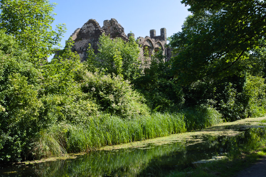
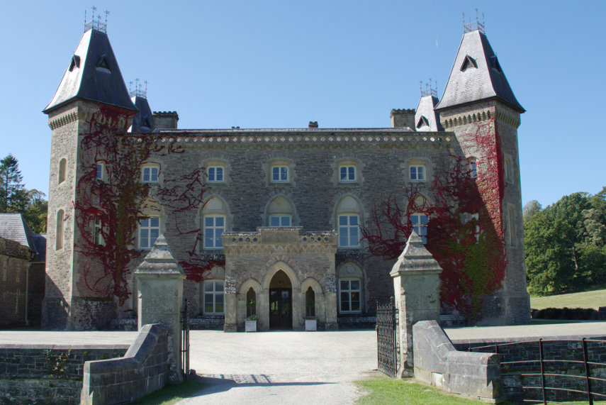
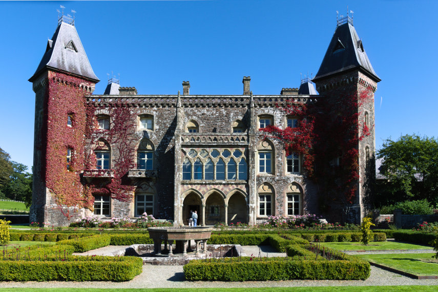
We stopped at Dinefwr Park and, for those of you that don’t know, Dinefwr is pronounced “Din ever”. It consists of Newton House (a stately home), the ruins of a medieval castle (Dinefwr Castle) and lots of parkland which is home to a herd of deer.

As I mentioned above this morning was cloudy but I took the following picture anyway.

However we called in here again on our way home when the weather was better and I photographed it again. Which picture do you think is better?

Inside the house it didn’t matter what the weather was like outside so I carried on taking photographs.

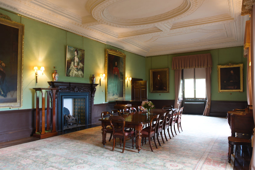
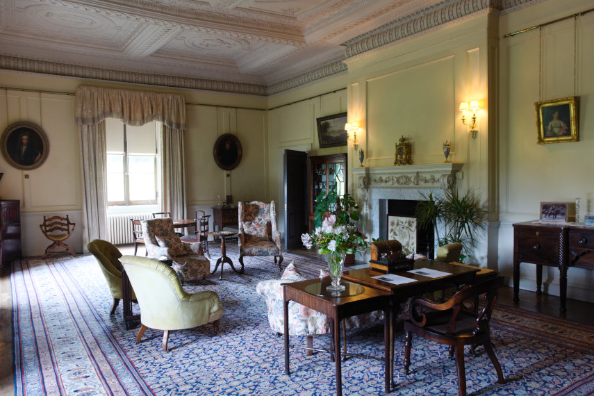
Those rooms, as you might expect, look rather grand. The Dining Room in the top picture and the Sitting Room in the bottom picture. The interesting thing about this property is that nobody minds if you touch the furniture or walk on the carpets or even sit on the chairs.

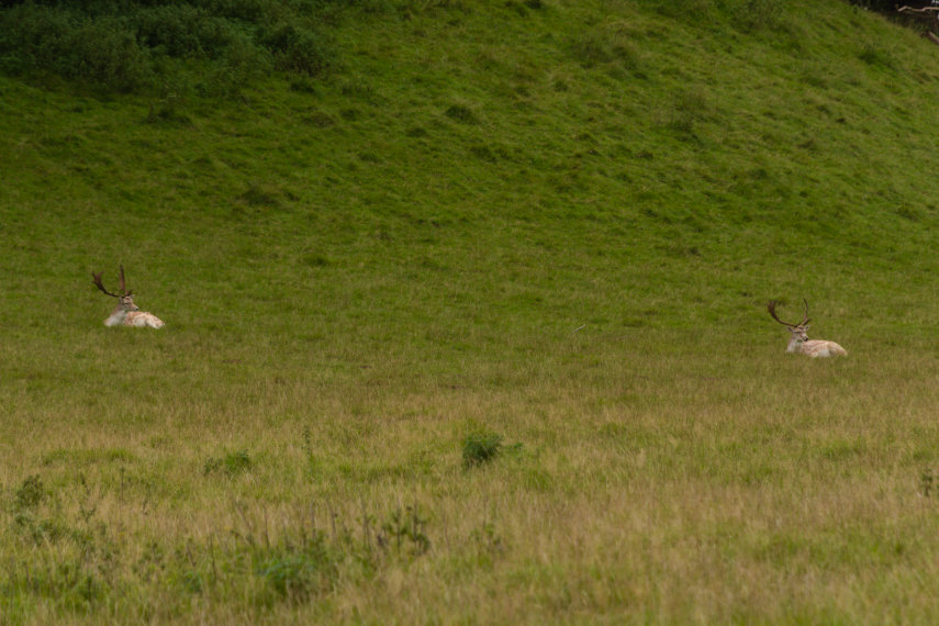
I did go out to the back of the house where it overlooks the Deer Park and surprise, surprise I saw some deer. They were quite a long way away so even using my telephoto lens to its maximum this is the best that I could achieve. You should, at least, be able to see their antlers.

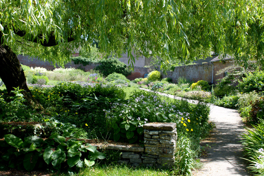
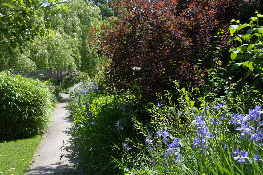
I took that photograph above from the small formal garden shown below which is at the back of the house. That is the only gardens they have here.

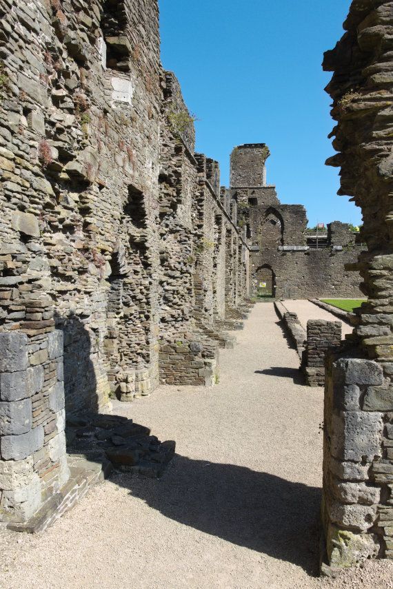
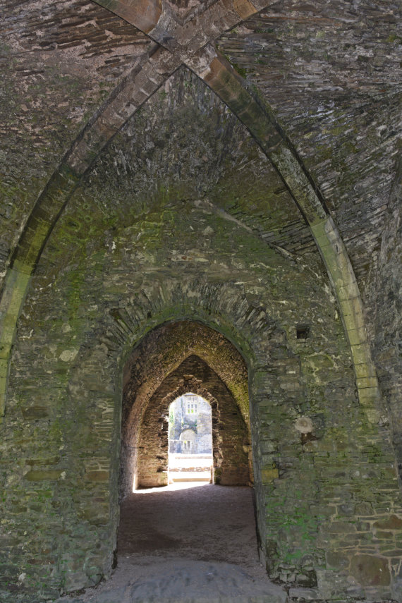
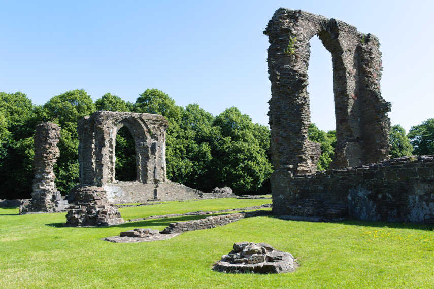
We also had a look at the castle both times we stopped here so as the weather was better on the way back these photographs are from then.

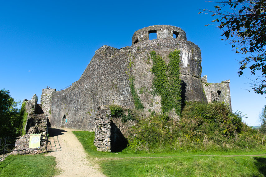
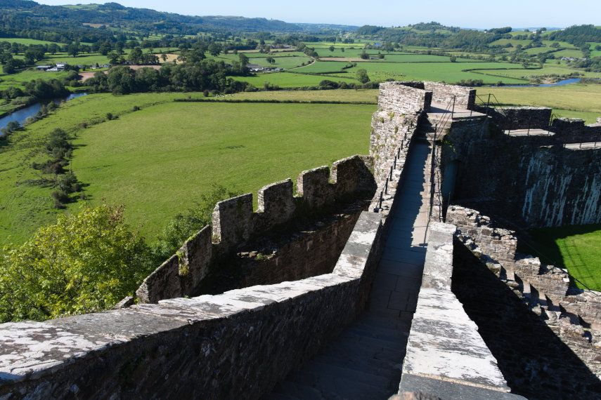
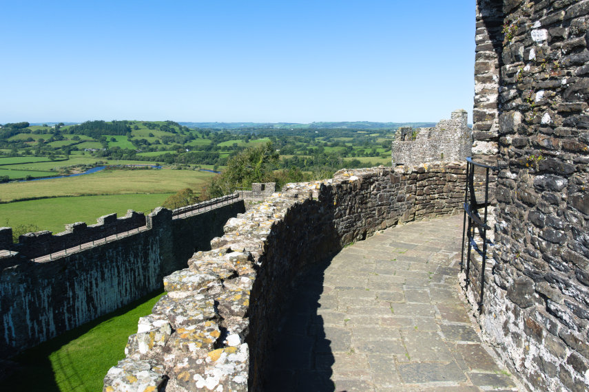
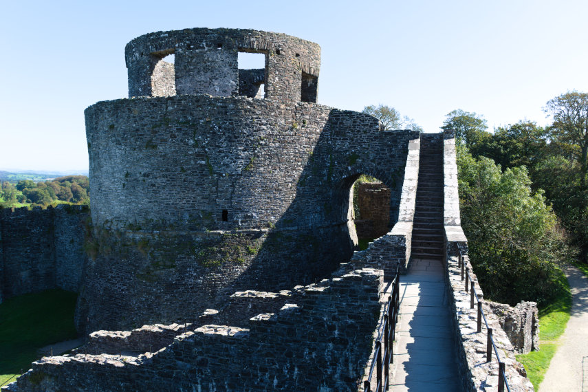
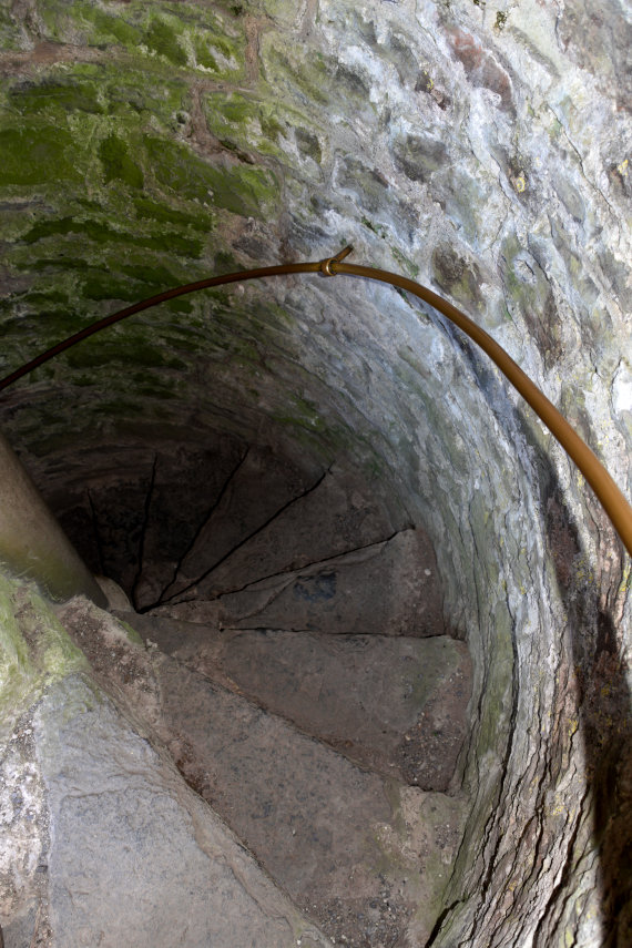
There is a reasonable amount to see in this castle ruin even extending to a few medieval spiral stairways which can be tricky to negotiate because the height of each tread can vary as can the width.

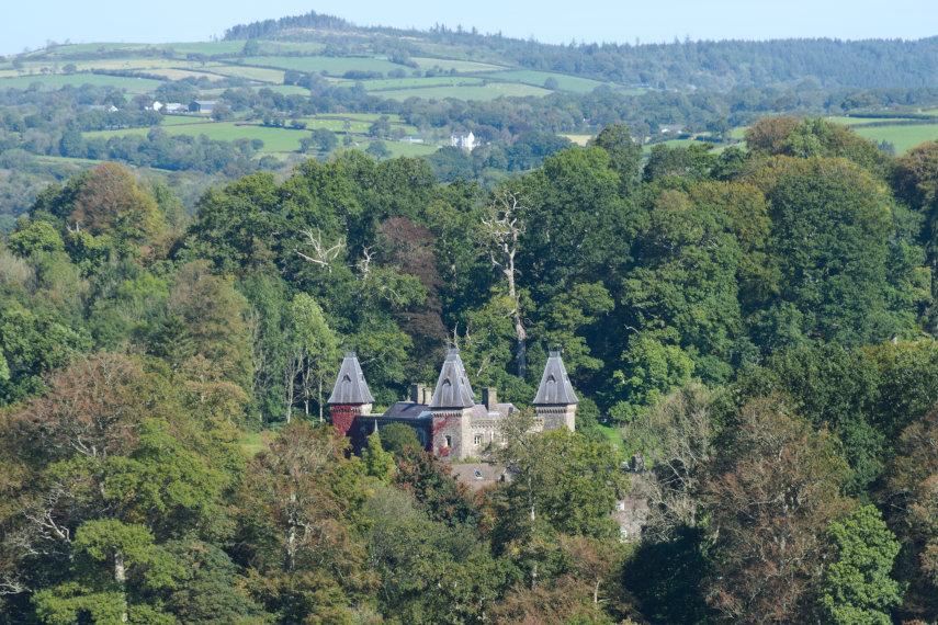
It is possible to see Newton House, together with some lovely views, from some of the high points of the castle so it is worth the scramble.

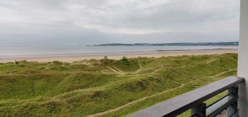
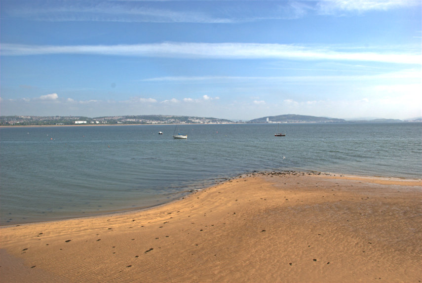
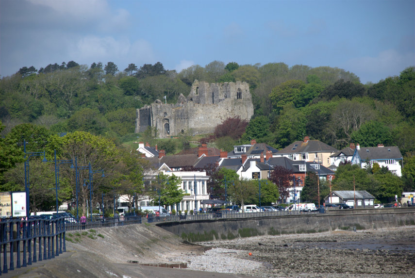
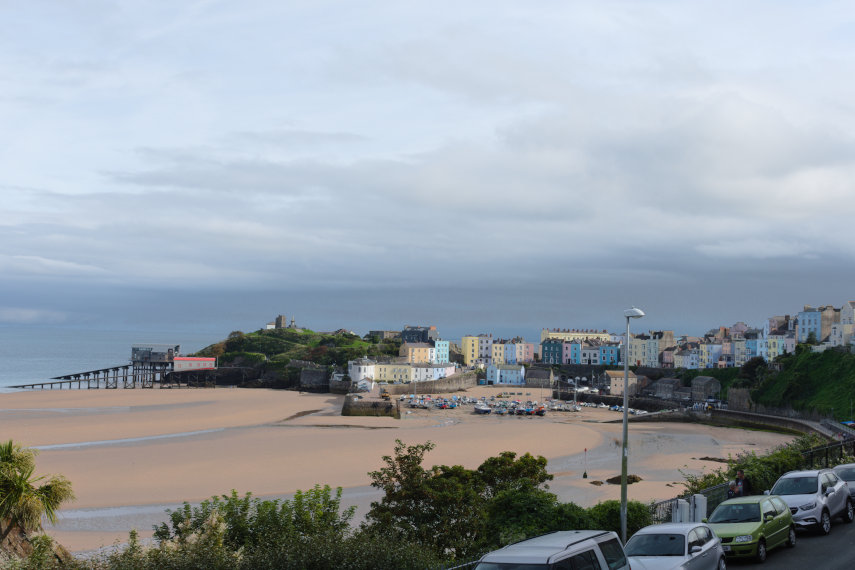
We had some lunch here at Dinefwr then headed off to our final destination. We booked into our hotel and after sorting out our parking space (they have only 10) which we had reserved we went outside and this is the first photograph I took of Tenby from outside the hotel.

Here in Tenby at 4 o’clock we now have sea and sand but no sun yet but we set off to explore anyway. The hotel has gardens at the front that are terraced down the steeply sloping cliffs to the beach and that is where we went.

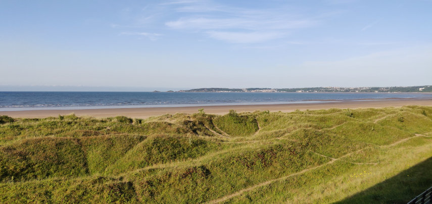
It is now 5 o’clock and look, the sun has appeared! So now, finally, we have sun, sea and sand. What a change in just an hour.

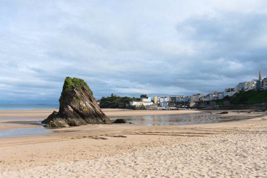
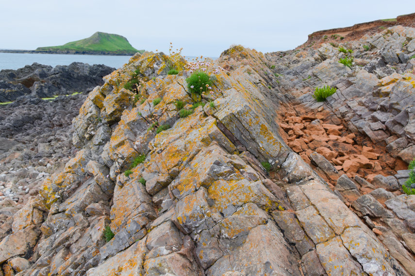
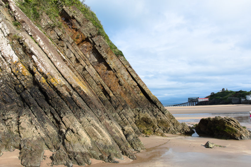
We were able to walk along the beach as the tide was out and went to have a look at that lump of rock sticking through the sand. You can see that the rock bedding is steeply inclined and, as we later discovered, that applies to most of the rock on this coast. That tiny bit of head together with a splash of red on the right-hand edge is Amanda.

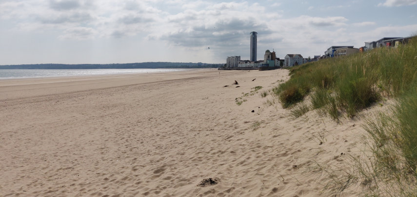
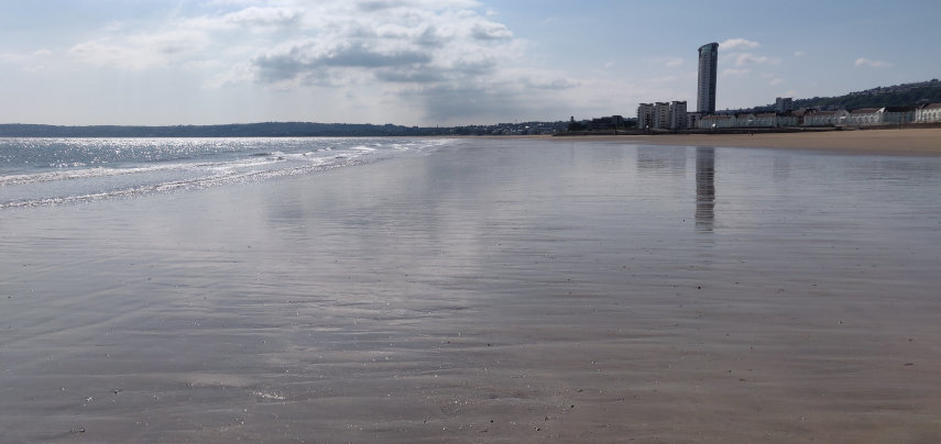
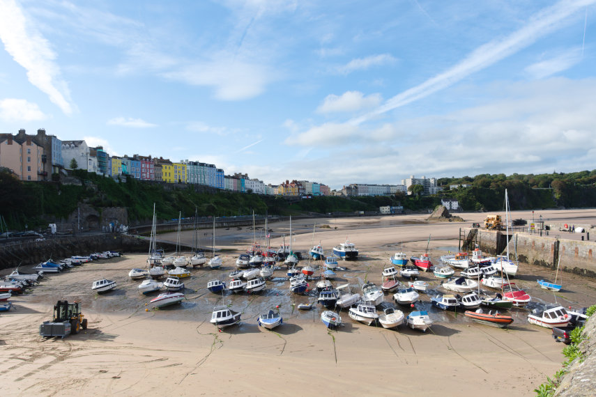
We walked along the beach until we found some steps up into the town. This is a view back the way we came from town level. You can see that lump of rock that we stopped to make friends with and just to the left of it is a small cream building. Our hotel is directly above that.

It is now 5:30 PM and you may notice that the cloud is dispersing rapidly.

Now I have to ask – have you ever seen a fat seagull?

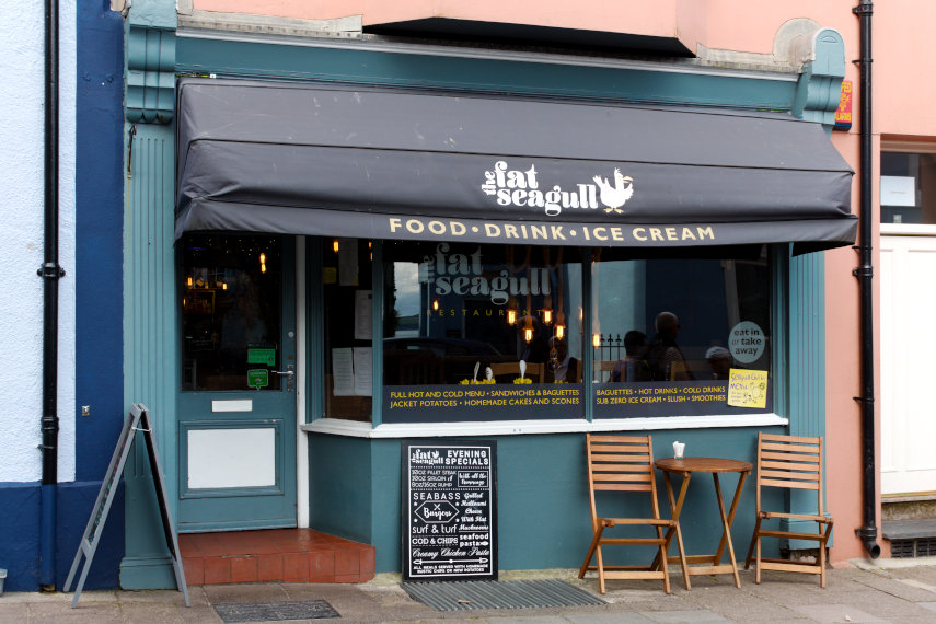
Well you have now. As you can no doubt work out it is a little cafe so we went in for some coffee and cake.

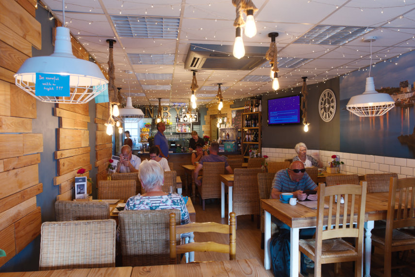
It was a nice little place and the cake was good. That’s Amanda over on the right against the wall. Having finished our refreshments we went back into the town. Want some colour? We can find you some colour!

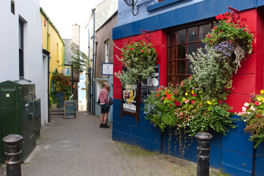
This is just one of the many narrow lanes in Tenby. There is plenty more to see but we are calling it a day and are going back to the hotel until tomorrow.

1 Trip, 2 Bays, 3 Waterfalls

1 Trip, 2 Bays, 3 Waterfalls

We had to go to Swansea recently and decided to add a couple of extra days for amusing ourselves. We had rented a flat for this stay overlooking Swansea Bay and this was the view from our balcony. It’s a pity it was cloudy.

The weather on the third (last) day was better.

The morning of the second day was when our trip began to get interesting. We drove to Rhossili Bay at the end of the Gower Peninsula. The weather was cloudy but dry which was not good for photography but there was little we could do about it.

Having parked the car we walked to the cliff top and we couldn’t really miss seeing Rhossili Bay could we?

We started walking roughly west along the cliff top (that’s left out of the picture above) but not too near the edge you understand. These cliffs are fairly high and the rocks are steeply bedded. It is very unlikely that one of those figures in the picture below is likely to be me.

As we walked along, on our left away from the sea, there were some meadows which were covered in Dog Daisies but, looking a little closer, one could see that there were a variety of wild flowers growing in among the daisies. Lovely!

A little further along we had our first sighting of Worms Head which is accessible only at low tide and for a limited time so if you get it wrong you’ll be spending the night there.

There were a lot of wild flowers around, which attracted butterflies, and I managed to sneak up on this Painted Lady without frightening it away.

When we reached the coastguard lookout station overlooking Worms Head there was a path which wound down to beach level so, of course, we had to follow it. We did end up on the shore and had a different view of Worms Head. I suppose I should call it the shore rather than the beach as it is all rock here – not a sign of sand.

We huffed and puffed our way back up the path and thence back to our car. We arrived back at our flat in the late afternoon and, being so near the beach, we decided to go and have a look at the sea.

As you can see we had to fight our way through the holidaymakers packed onto the beach but we did manage to make our way down the beach towards the sea. On the way we passed a number of bands of shells which included Oyster shells and I thought that they looked rather attractive so I picked some up. We finally arrived at the waters edge and I found myself carrying about 12 Oyster shells. Those shells are now at home and all I need is to think of something to do with them. The following photograph is a sample.

Just to prove that we finally reached the sea.

That tower is the Meridian Tower and we had dinner there in the evening in the Grape and Olive restaurant on the top, 29th, floor. This is supposed to be the highest building in wales.

The following morning dawned fine and sunny – well it would wouldn’t it because today is the day we go home. However we may be going home but we are planning a few visits on the way and our first stop was Neath a short 15 minute drive from Swansea.

Here we are by the Tennant Canal in Neath. But, wait, what is that peeking over the trees at us? It’s Neath Abbey of course; yet another ruined abbey, one of many that litter this country, under the stewardship of CADW.

Founded in 1130 this is not a small place and along with Llanthony Priory and Tintern Abbey, the ruins of Neath Abbey are the most important and impressive monastic remains in south-east Wales.

There was some restoration in progress when we were there and a large part of the abbey was covered in scaffolding so I didn’t photograph any of that.

Just as we were about to leave Amanda spotted a swarm of bees on one of the walls.

Having had a good look around we set off for our next destination which, again, was only a short drive away.

This is Aberdulais Falls owned by the National Trust and, although the falls are very picturesque, it is more that just a waterfall.

This narrow gorge at the mouth of the Dulais River outside Neath has been at the heart of the Welsh industrial story, thanks to its bountiful supplies of coal, timber and, of course, water.

It all started with copper-smelting which gave way to ironworking, the milling of textiles and grain and, most significant of all, the manufacture of 19th century tinplate. It is a truly picturesque scene now and it is difficult to imagine the heat, dust, noise and dirt that must have dominated the scene back then.

There is a very large waterwheel which can often be seen running but they had had to stop it before we got there, naturally, because a blackbird had decided to set up its nest in the wheel.

The waterwheel can be seen in context with the remains of some of the old furnaces and the smoke stack.

This is the highest (up river) of the falls and was quite spectacular even though it hasn’t been particularly wet lately and just below it are the next waterfalls.

There is a tea room and toilets here which is rather handy so we made use of both and left for our next destination which, you may have guessed, was just a short drive away. This was the village of Melincourt and we parked in the sign-posted car park (free) and followed the sign-posted path for about 15 minutes. This is what we came to see.

The path up follows the stream valley and makes a pleasant walk to the falls but, having seen the falls, it was time to walk back to the car and proceed to our final destination. This time it was more than a short drive so lets get on with it.

After driving along a narrow lane, one cars width, for what seemed like forever we finally spotted the National Trust car park. Although this is owned by the National Trust entry is not controlled and one can come and go as one pleases. We parked and started off down the path which turned out to be nowhere as near straight-forward as the previous destination.

The path was steep and one eventually arrives a a point where it seems to level off and gives one hope that this must be near the bottom – but no. We had to climb a bit and then descend again and the route included these steps and a bridge.

That’s Amanda down there on the bridge – wait for me!

We did get there in the end.

This is Henrhyd Waterfall and that tiny figure on the ledge behind the water is Amanda.

This was our last call of the day so it was time to go home but first we have to go back UP that path. It wasn’t as bad as we thought it might be and we arrived at the car without having to crawl the last few yards.

We were still south of Brecon so we still had an hour and fifteen minutes to drive home. We got there. Until next time.

From Iron to Copper – Day 4

From Iron to Copper – Day 4

We appear to have another sunny day and another breakfast. Do we have any special plans for today? Well yes we do. We are going to the top of that limestone lump in the distance on the far side of the bay but we are going to cheat.

We set off walking along the sea front eventually taking an upward path and after a short climb we look back to this view of the Llandudno sea front.

A bit higher still we get this view with the mountains of Snowdonia showing beyond the town. However, have you noticed anything? There is less and less blue sky – the cloud is building.

A bit higher and we get a nice view of Llandudno Pier but now with a cloudy sky.

Looking in the opposite direction we can see the Great Orme (the limestone lump) that we are going up and some lingering blue sky.

However before we go up any higher we have come to look at the 19th century Happy Valley Gardens. This area was a quarry before being developed and landscaped as rockery gardens . These gardens are generally sloping and a bit steep in places but worth visiting if you can cope with the slope. There were a few sculptures scattered around and we particularly liked these.

There were plenty of flowers but there should be even more later in the season.

They even have their own Laburnham Arch which is not going to compete with the one at Bodnant but it is already looking very pretty.

We walked a little way back into town to catch the tram to the top of the Great Orme. I did tell you we were going to cheat.

This is where we passed the tram which was coming down. The ‘driver’ doesn’t actually do anything, as the tram is moved by a cable worked by a winding engine, but he is there in case we need emergency braking.

We didn’t need any emergency braking after all but we are not impressed with the weather up here. We now have total cloud cover and it is rather cool which is made worse by the strong wind (cloud+cool+wind=dismal). Still it shouldn’t worry us where we’re going – underground.

We are going to visit the pre-historic copper mines re-discovered in 1987. These mines date back 4,000 years to the Bronze Age and, before you ask, that is before my time. The mine is thought to be the largest prehistoric mine so far discovered in the world.

We started by having a look around the surface workings.

We could see various dark holes going down vertically but luckily for us we won’t have to go down those. One of the shafts here goes down 437 feet :shock: . There were obvious spaces on the surface where they would have extracted the ‘easy to get to’ copper ore but that would have run out fairly soon so it was a matter of giving up or tunnelling and they chose the latter.

The entrance is between the path in the foreground and the steps on the right-hand edge in the picture above and this is it. Not very big is it?

The tunnels turned out to be just wide enough to walk along carefully. Amanda is somewhere ahead in the dark!

It was also essential for us to be wearing hard hats otherwise we both would have ended up with bent heads.

There were also steps in a number of places going both up and down. These steps have been installed for visitors and the original miners didn’t have that luxury.

The passage takes one on a U-shaped journey and eventually emerges a short distance from the entrance. I would have liked to show you some of the other features that we saw but the lighting is very dim and my little flash was too small to cover the larger spaces. It was, however, a very interesting and unusual trip.

What visitors see is just a small part of the total mine workings. There are, literally, miles of passages; some so small that they must have been excavated by children around 6 years old.

We went back down on the tram, of course, and that was the end of our day.

We were originally planning a visit of some sort on the journey home tomorrow but as the weather forecast is much the same as today but with rain we went straight home so no ‘Day 5’.

‘Day 5’ did turn out to be a cool, cloudy day and we did have rain on the drive home.

Better luck next time.   :roll:

Dally in the Valley

Dally in the Valley

This is a companion post (sequel) to March through the Arch which was our first visit to Croft Castle and this visit being our second. In case anyone doesn't know what 'Dally' means it means to walk slowly.

This time, although we revisited the Walled Garden, our prime objective was to walk through Fishpool Valley. Before we walked to Fishpool Valley the Walled Garden called.

The garden looked as delightful as ever.

There were plenty of flowers about with some visitors goggling at the view. cool

We couldn't have missed seeing this Dogwood in full bloom if we'd tried. What a sight!

It was now time for Fishpool Valley.

So – what is Fishpool Valley? It is described thus "Fishpool Valley was landscaped in the late eighteenth-century in the ‘Picturesque’ style. This was the movement to create a more natural landscape, using the principles of intricacy, roughness, variety and surprise. It features a chain of dams and pools, as well as architectural features such as an icehouse, grotto, pumphouse and limekiln. The careful planting of Oak, Ash, Willow, Poplar and evergreen species suggested the ‘bold roughness of nature’. Carriage rides and other walks were designed to follow the contours of the landscape, providing dramatic views across a wild, but beautiful, contrived scene."

However, because of lack of maintenance, the whole place is in a sorry state but the National Trust is starting a project to restore it to its original state.

 We started our walk from one end of Fishpool Valley and the first point of interest was a pond.

It did look a little unkempt and in need of some TLC but somebody liked it. There were literally clouds of damsel flies over the water; some brilliant blue and some red. For those of you that don't know damsel flies are part of the dragonfly family. They were obviously very happy here. We walked on.

We soon reached another pond and, if you look carefully, you should see a little stone building near the centre of the picture. That is the Pumphouse.

We peeked through the metal grill to see inside and were surprised to see some old machinery in the form of a waterwheel and some gearing.

These pools are fed by springs and the water is very clear. The Pumphouse was used to pump some of this water up to the house.

Walking ever onward we came across this stretch of path with some nice, very tall, trees which we thought were probably Douglas Firs.

Finally we reached the farthest point of our walk – the Lime Kiln. It is now in a ruinous state with the eastern tunnel in a reasonable condition but the opposite western tunnel has collapsed. The central chargehole is brick-lined but cannot be seen at present. I can see why they would have sited a kiln here as there is a small limestone cliff just behind it to provide the material to heat in the kiln and the resultant lime would have been used on the fields as a fertiliser.

We discovered after returning to the castle that there were the remains of a grotto further on which we missed. Oh well, next time then.

On the walk back from Fishpool Valley, which was a different route from our outward journey, we walked through some wood pasture featuring some impressive trees. When we saw the tree in the picture below Amanda said 'Ooh that's a lovely old Oak. I must go and have a look'. When she got nearer she suddenly stopped and said 'Oh it isn't an Oak it's a Chestnut. It is certainly a massive tree.

A little further on we saw this very large Purple Beech which is the same species as a Copper Beech but a different variety where the leaves are purple coloured rather than copper. Another very fine tree.

Well, once again, we come to the end of another little trip. We will probably go back.

The Other End – Day 3

The Other End – Day 3

Wake up. Draw curtains. Wall to wall sunshine again. Whoopee. Another nice, relaxed breakfast.

Today we are going back to the bus station and catching the same bus again but we are going a little farther this time; a 20 minute journey. We alight at the first bus stop after the bus turns away from the coast road in Oystermouth which is part of Mumbles. Both names are said to be corruptions of welsh names. We walk, for just a few minutes, back to the coast. Looking straight across Swansea Bay we can see Swansea on the other side.

Looking to our left we can see buildings in Oystermouth. That rather prominent stone building on the hill is Oystermouth Castle.

Looking to our right we can see Mumbles Pier which is where we're headed. Mumbles seems to be quite a busy little place with plenty of shops and cafes and we have a slow, pleasant walk along the pedestrian/cycle path which follows the shoreline. It isn't very long before we arrive at Mumbles Pier.

Mumbles Pier is Victorian, as most piers are in this country, and is apparently privately owned. Access is free and we walked out to the decking at the outward end. That part of the pier between the shore and this deck at the outward end is in a bit of a state but it is apparently being renovated as this outer part shows.

The pier buildings on the shore are also Victorian and the left-hand end is a cafe where we had our morning coffee. It is a nice little cafe which also serves food but we didn't try that. The cafe seems to have preserved many of the original Victorian features including the chandeliers and fans.

After our brief rest we climbed the obvious steps to the top of the cliff and walked south-west past Middle Head and Mumbles Head and then looked back to this view. Mumbles Head is the one with the lighthouse on it and Middle Head is the one behind it.The lighthouse was completed in 1794 and initially two open coal fire lights were displayed which were difficult to maintain and were soon replaced by a single oil-powered light within a cast-iron lantern. The lighthouse is now unmaned.

We walked as far as Limeslade Bay and went down onto the beach where we rumaged around looking at the rocks. The rocks on the Mumbles promontory are steeply inclined and from the Carboniferous period being limestone at the seaward end and coal measures at the landward end. We found this among some of the bedrock and I don't profess to know what process would have caused it but it is very striking.

It was at this point that we made another mistake. Looking at the map it was obvious that if we went back the way that we came we would be travelling in a semi-circle whereas cutting through the side streets would be a straight line. Well it would have been if the ground had been flat so we ended up travelling in a semi-circle, but vertically, as we went up and over the hill. I should have looked more closely at the contours shouldn't I? The road down turned out to be interesting as it was obviously an old road, very narrow in places and winding all over the place.

We got there in the end and ended up at Oystermouth Castle. The castle is Norman, probably built around 1220, and is the responsibility of the local authority but is run by a volunteer group called 'The Friends of Oystermouth Castle'. The entry charge is £3.50 for adults and £2.50 for us oldies. I have to say it is certainly worth it.

One of the unusual features is a glass bridge about 30 feet up and, yes, we did walk over it and back again. The fun part is going up and down the spiral stairway and there are a number of those in this castle.

There are lots of features in this castle including wall walks, intricate passages running hither and thither and various halls and rooms. One could become quite disorientated with little effort but that's part of what makes it interesting.

There are also good views from the upper parts.

We left the castle early afternoon to get the bus back to Swansea as we wanted to visit the Tram Museum by the Marina. This museum is open only on Wednesday and Saturday and as today was Wednesday now was our chance. I suggested to Amanda that we go back to the bus stop then start to research bus times in case one comes along. When we got to the road a bus came along with 'Swansea City Centre' on its indicator board so we had to run for it. The doors shut just as we got there but the driver did notice us and re-opened the doors. Nice chap.

But, there had to be a but didn't there, this turned out to be one of those buses which diverts from the short route to make a circuit of the suburbs. Luckily it wasn't as long as happened yesterday but I did say then that we learn from our mistakes; we obviously don't. We may have been more fortunate if we had missed that particular bus. We still got back in time for the Tram Museum except for one minor point; it wasn't open. I enquired in the Swansea Museum nearby to be told that only one of the two required volunteers had turned up that morning so they weren't allowedto open it. Bother!

A quick change of plan saw us heading back north in the direction of the railway station to a shopping centre called 'Parc Tawe Shopping Centre' just north-east of Castle Square. No, we weren't going shopping but we were planning to visit 'Plantasia'. The local council describe it thus:

'We decided to create a Rainforest in the middle of the City to highlight the need and importance of looking after and protecting the World we live in. So come in and walk around our Tropical Paradise, take time to learn about the plants and animals which call the beautiful Rainforests their home.'

The entry charge is £3.95 for adults and £2.95 for us oldies. Not a lot.

Lots of interesting plants and there is a large pond with a waterfall together with a lot of large fish. When we leaned over the rail to get a better look the fish came rushing over to have a look at us. We saw a notice later which mention packs of fish food to buy so I think that they must be used to visitors giving them food. They were out of luck this time.

They also had two Cotton Top Tamarin monkeys which are among the most endangered primates in the world with a population of somewhere around 2500 individuals and which were apparently rescued from a zoo that was closing down. So they now have a home here in a wired off enclosure that appears to be the full hieight of the building.

They normally hide in the densest undergrowth which is what they were doing when we arrived but a bit of patience paid off when they eventually appeared. They are about the size of a domestic cat and rather cute with it.

There is also a separate section where some tropical birds can fly freely although not this particular one. It does know a few words but wasn't at all communicative when we were there. I seem to have that effect on people.

These Lorikeets were able to fly around and at one point I felt the draught as they flew close over my head. Cheeky little blighters. They are capable of talking and are also good whistlers. We didn't hear any of them say anything but their whistles were piercing.

The end of another perfect day so back to the hotel for a meal and, hopefully, a good nights sleep. So I'll wish you all a good knight and, luckily, we have one to spare courtesy of Oystermouth Castle.

Sorry but I couldn't resist.

More sightseeing tomorrow – our last day.