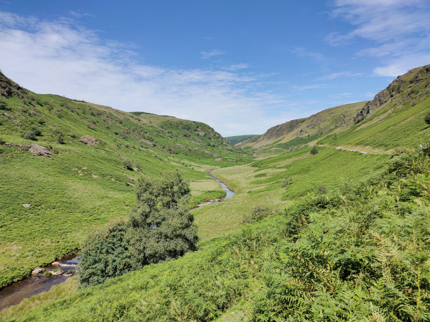
We have been to Hergest Croft Gardens, near Kington, a number of times but we had never been further up the lane to Hergest Ridge at the top. It was now time to change that.
We took our normal route to Hergest Croft Gardens but instead of turning into their car park we went straight past to the end of the lane where we parked and continued on foot through the gate along Offa’s Dyke Path.
Hergest Ridge straddles the English and Welsh border and is part of the Offa’s Dyke walk as well as a standalone highlight in any exploration of Herefordshire.
If you decide to start at the main carpark in Kington a modest climb of 1300 feet up from the quaint town will bring you to this point, where we started, and we continue through the gate on the Offa’s Dyke Route.
Heading for the top the views emerge all around and, as you walk, run, or cycle along the beautiful moorland, you may chance on wild ponies grazing , we didn’t see any, but we saw some wonderful views.
There were numerous people walking up here and you can probably see that Offa’s Dyke Path is well worn and, therefore, easy to see and follow.
There were plenty of wild flowers about and we saw this Tormentil and Gorse on the way up.
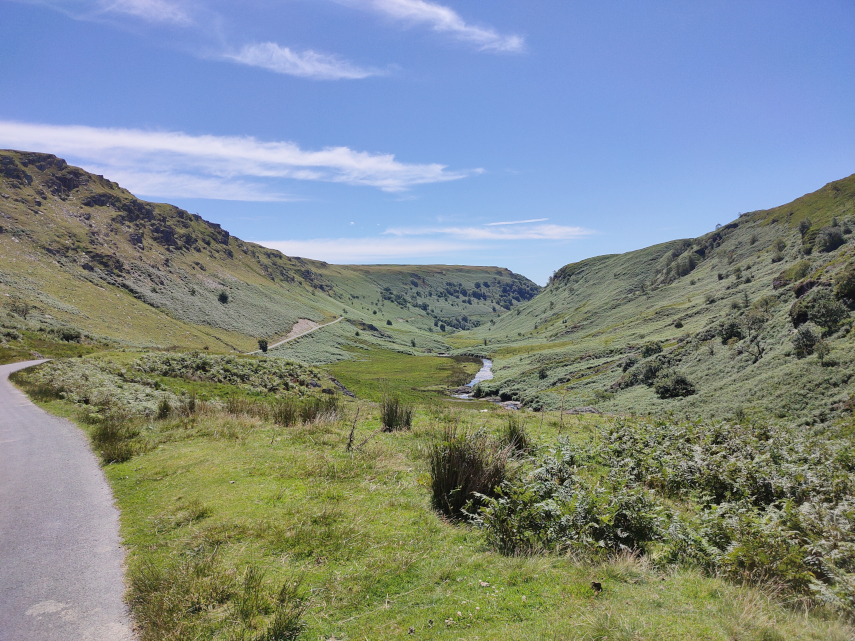
From the ridge you can look across to the Black Mountains and even as far as the Malvern Hills, with uninterrupted English and Welsh countryside landscapes all around.
Look out for the Victorian racecourse that sits atop Hergest and imagine the thrills and spills as the horses galloped around the track. As we approached the summit we could see the Monkey Puzzle Trees ahead. This area is part of the Hergest Estate and the trees were planted by one of the owners having seen similar trees growing on mountain tops in Chile in the early 1990’s.
You should also see the Whetstone near the summit, a natural stone, which in medieval times was used as a place to distribute food to people suffering from leprosy. Legend has it that the stone rolled down to Hindwell Brook each time it heard a cock crow. but it doesn’t attempt to explain how it managed to get back up the hill again.
Amanda giving an idea of the stone’s size.
The Whetstone and the Monkey Puzzle Trees.
On the way down we noticed this tree in blossom. Although the blossom is pink we think that it’s a Blackthorn.
This was an easy and very pleasant walk on a warm sunny day.
This trip took place on 30th March 2021 and this Blog Post is obviously late and there will probably a few more posts that will also be late.
Welsh travelling rules have recently been relaxed so it was time for a day out. We weren’t going far, just 16 miles to the high ground near Newtown and although the road is a typical narrow, winding Welsh backroad it didn’t take us long. We parked in the little free car park at the start of the Kerry Ridgeway which runs for about 15 miles to Bishops Castle although we weren’t going anywhere near the distance.
This is where we stopped and shows the Knighton-Newtown road with the little car park to the right and the start of the Kerry Ridgeway path along the side of the road. The Kerry Ridgeway is one of the oldest paths in Wales probably from the time of the Bronze Age.
We started up the path and soon reached the bend where the path turns away from the road and continues uphill.
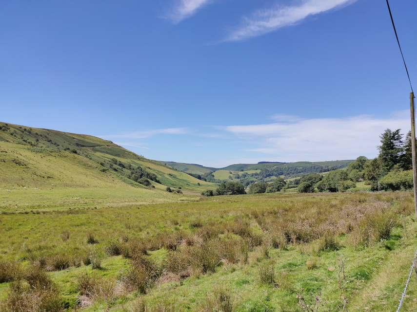
As we had started from high ground we had good views almost instantly although it was very hazy.
We walked further along the path looking for the Cross Dyke and soon found it. We couldn’t really miss it could we?
The Cross Dyke, just beyond that wooden post, crosses our path and the next picture shows the twin banks heading downhill towards Newtown and the following picture shows them running down to cross our path and join the top picture of the two below.
The Cross Dyke marks an ancient boundary long since forgotten but, rather like Offa’s Dyke, they took a lot of trouble and effort to build it.
Nearby are the Two Tumps which are Bronze Age burial mounds. There is one on the left, just poking above the far horizon, and one to the right of that, and a little further back, with the far horizon just showing over the top.
We headed further up the path as far as this viewing point which has information, hill names etc., to identify what you can see around you.
It was now time to leave the Kerry Ridgeway, as we had more to do, so we headed back down the path admiring the views on the way.
Along the path I spotted a small area of tiny flowers and there is also a daisy to give a scale. Difficult to identify precisely because there are so many different varieties but it probably is a member of the Whitlow-grass group.
We soon arrived back at the car having been serenaded by Skylarks along the way. We drove towards Knighton for no more than a half-mile and parked in a large layby next to a landscape feature know as ‘The Ring’.
The Ring is a geographical feature caused by the River Teme eroding the bank and causing the higher ground to collapse and then the collapsed soil to be washed away. This picture was taken from road level on a previous occasion and the river is partly in flood producing this waterfall.
On this trip it was relatively dry with little water flowing.
This is the Ring itself. It’s called ‘The Ring’ because it is shaped like a large semi-circular amphitheatre.
We decided that we needed to climb down to look more closely at the waterfall which was at the bottom. It is not safe to climb down just anywhere because the sides are generally far too steep. So we had to visually plot a route down and then set off. The route we followed proved to be quite easy and it didn’t take us long to reach the river.
There was just a trickle of water over the waterfall, which is a pity, so we shall, perhaps, have to try again sometime when it is a bit wetter.
This is the River Teme, the same River Teme that flows through Knighton, heading off from the waterfall down the valley towards Knighton and we now hope to do the same. All we have to do is get back up to the road. We did that without incident, although slower than coming down.
In April 2017 we traversed the Cambrian Mountains, on our way to Devil’s Bridge, on one of only two roads which go over the Cambrian Mountains. This is the blog that covers that trip. https://www.beenthere-donethat.org.uk/deoprrssw/?p=2428
We now decided that it was time to explore that second road. We weren’t going to a particular destination but purely to see what that road was like (Have you ever had a premonition that you are about to make a mistake?).
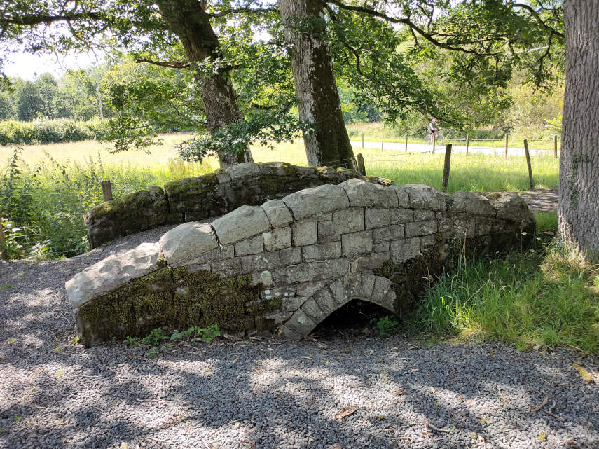
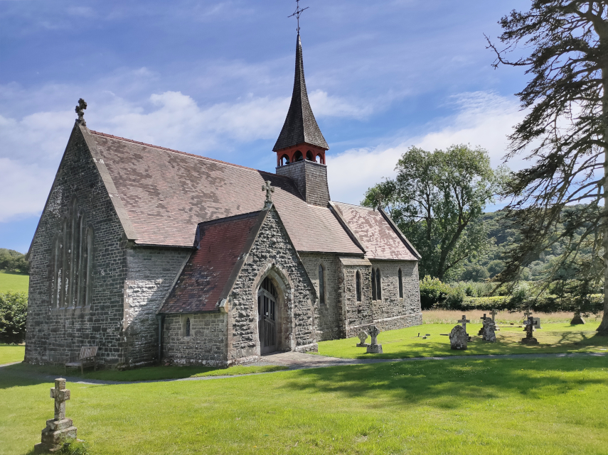
We headed off, on a warm sunny day, towards Beulah. Yes, I know, you’ve never heard of it. Well it’s a small village about 8 miles south-west of Newbridge-on-Wye in Powys. This is where the mountain road starts and having turned on to it, and before we’d left Beulah, we spotted a nice little church which we had to explore. The original path into the churchyard went over this cute little bridge but the current path bypasses the bridge.
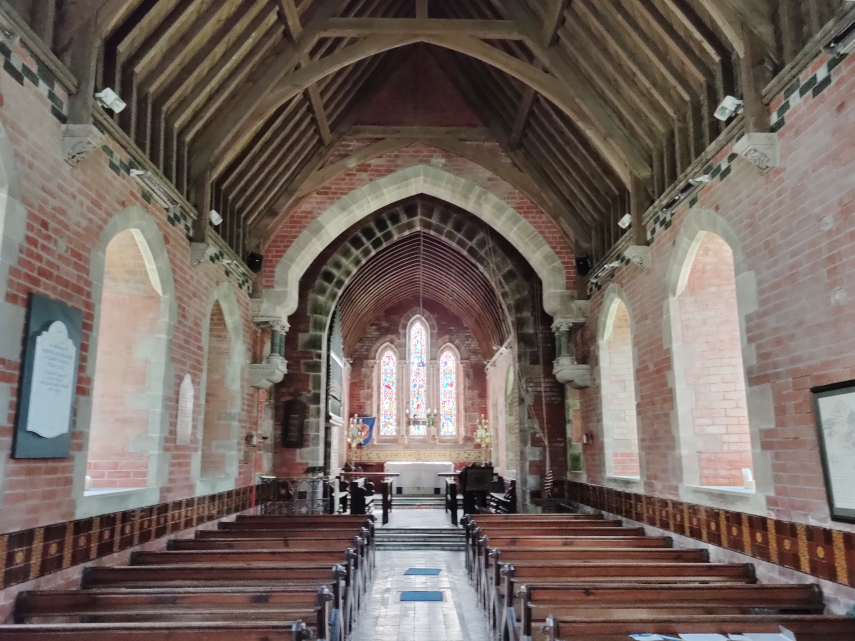
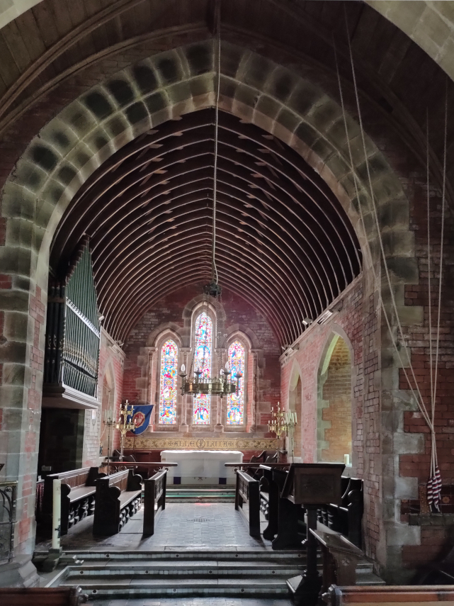
And this is the little church. It is not very old, having been built in 1867, but it is very attractive.
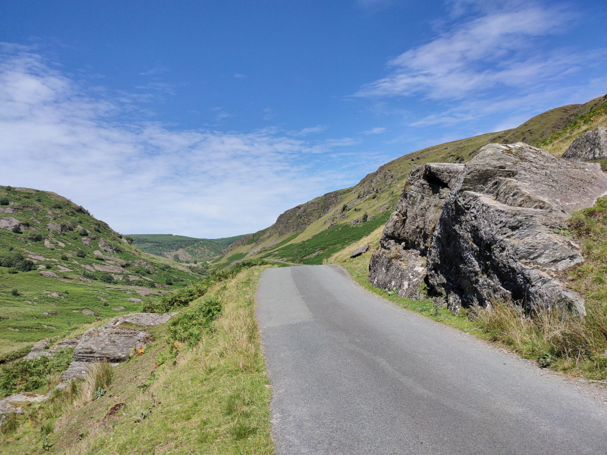
Having had a quick look round ( what else can you do with a church that small?) we set off again along the road. This road is just one car’s width and does have passing places but you can bet that you won’t be near one when you meet a car coming the other way.
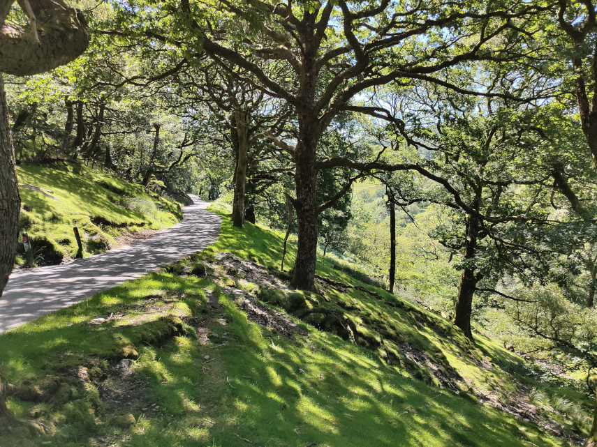
The first part of this road is mainly wooded but eventually after a gentle climb of some miles we came out into the open. We continue to head upwards through that valley round to the left.
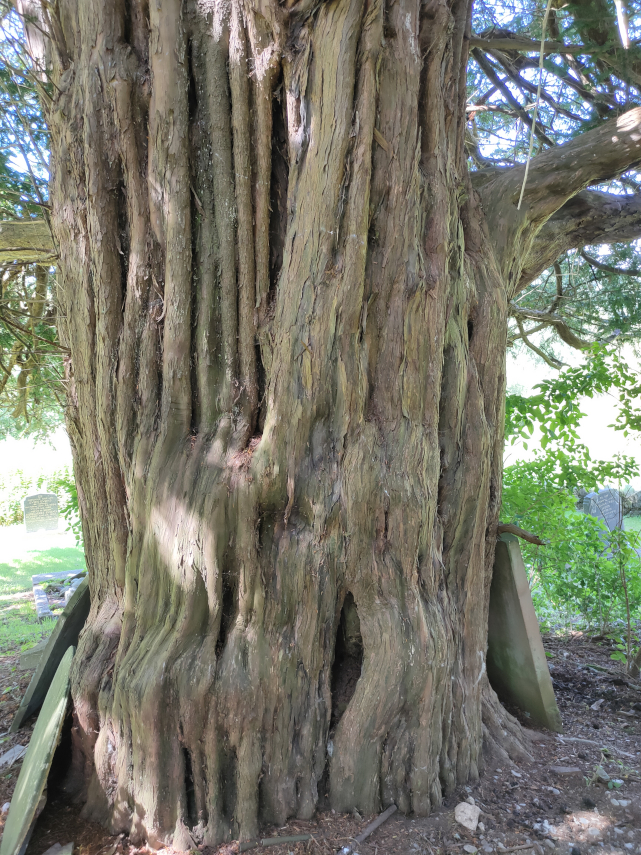
We carried on to the village of Abergwesyn where we’d heard there was a ruined church. We couldn’t find the ruined church, if it still exists, but we did find the old churchyard with a mega Yew tree.
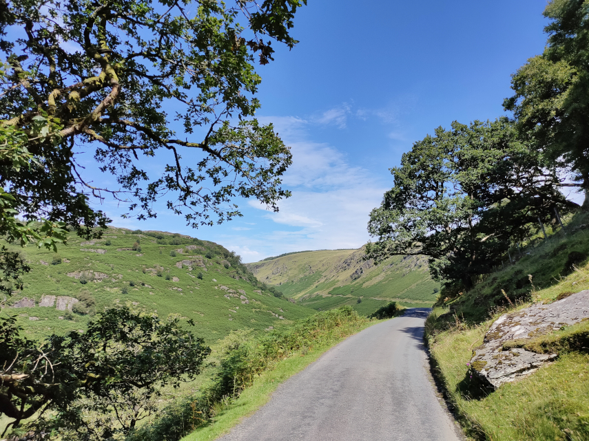
We carried on and soon went into another wooded section of the road with an unprotected steep slope on one side. No barrier to stop you driving off the edge and you do have to drive relatively near the edge because the road is so narrow.
I was quite pleased when that was over. Next we reached the Devil’s Staircase – a steep bit of read with some hairpin bends. The name is more worrying than the actual road and we successfully negotiated that section without problems. We reached another open area and we are still climbing but the views were getting better.
The road was beginning to get interesting now. It was bending in three dimensions and they tended to be sharp bends. When the bend was in the vertical plane the road beyond the top of the hill couldn’t be seen until the car was beginning to tip down the other side so one couldn’t see which way the road was going to go and there was always the possibility of a car coming the other way. Travelling was slow and if there was a short stretch where one could attain 20 MPH then that would be considered very fortunate. The same applied to bends in the horizontal plane – it meant driving really quite slowly. Don’t pick an argument with a rock – you won’t win.
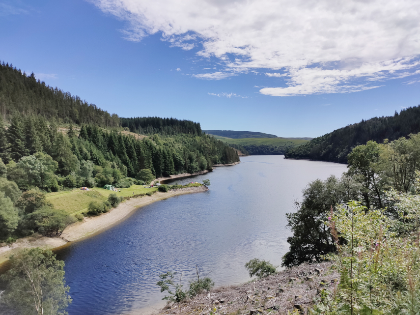
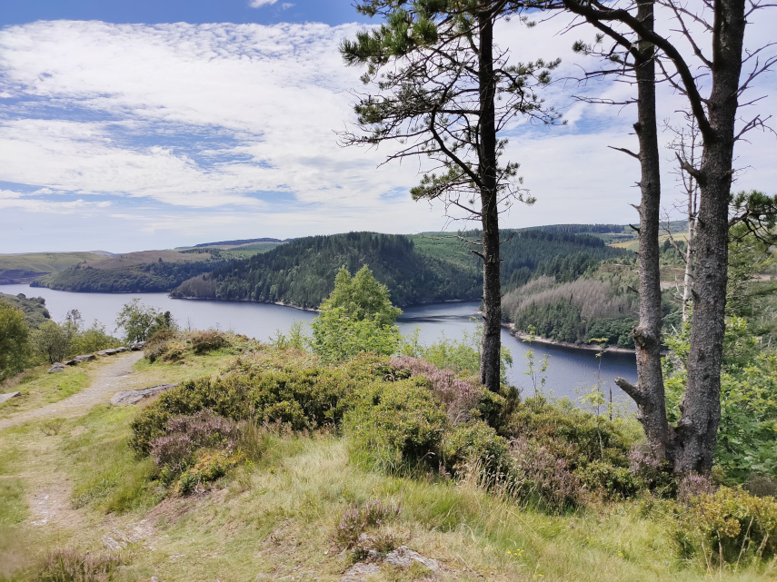
Having reached the top we took a 7 mile detour to have a look at a reservoir we had heard about, Llyn Brianne, and it turned out to be a worthwhile detour. But it certainly increased our bend count.
Our road was now going downhill again but the bends didn’t get any better.
We finally reached the end of the road in a small town called Tregaron which was a relief from the bends – but not for long. We now had to return home which meant travelling the same route in the opposite direction. I was really looking forward to doing all those bends again.
I can tell you that by the time we reached Beulah again I was rather tired and we still had an hour to go to reach home. However we did reach home without incident and I don’t intend doing that journey again in a hurry!
Now that some of the Covid-19 restrictions in Wales have been relaxed we can go somewhere else – anywhere – so we did just that.
We headed 60 miles due west and found ourselves in Aberystwyth, Ceredigion. It took us about one hour and fortyfive minutes to do those 60 miles because most Welsh roads are anything but wide and straight. The last 10 miles was particularly wiggley but we got there.
We parked in a large car park on Park Avenue and were expecting to pay £1.70 for the day but all the pay machines were covered with large bags and there was no explanation so we ended up paying nothing.
We headed fo the sea front and soon after leaving the car park we walked past the Vale of Rheidol Railway Terminus which is a Heritage Steam Railway that runs to Devil’s Bridge. The last time we went to Devil’s Bridge we saw the other end of this line and took some photographs when a train arrived from Aberystwyth.
This time the terminus in Aberystwyth was closed with no signs of life anywhere so we continued past. Probably because of Covid-19. Pity really.
We headed for the harbour and were then planning to walk north along the sea front as far as the Funicular Railway at the far end of the bay. Where we parked was an obviously new area including a retail park but the buildings and streets suddenly changed when we reached the old part of the town.
This was one of the streets in the area of New Street and the hill in the distance could be Constitution Hill and the funicular railway runs up that.
It was a short walk further on to the harbour which includes the River Rheidol just before it runs into the sea. Both pictures are taken from the same viewpoint but in different directions.
A short walk from the harbour brought us to the sea front. This view is looking south and shows the wall at the entrance to the harbour.
Walking on South Marine Terrace along the sea front we passed these colourful houses and could see the castle in the distance.
Then an equally colourful plant bed.
A short way on we reached Aberystwyth Castle built by Edward I in 1289 but by 1343 the castle was in a bad state of repair. In 1649 Oliver Cromwell ordered the castle to be slighted, i.e. rendered unusable, hence its current condition.
We finally left the castle after having a really good look round and went back down to the sea front onto the New Promenade which was completed in the early 1900s.
On Constitution Hill in the distance, on the left of the next picture, there is a straight line visible running from the top to the bottom – this is the funicular railway of which more later.
In 1795 John Nash built the Old College buildings on the right, with George Jones as the architect, in Gothic style. It was later sold to the University of Wales who turned it into a college for higher education and it later became the University of Aberystwyth. It remained as the main part of the university until the 1960s when the university open a new campus near the National Library of Wales.
A short way on and we found two things – an ice cream kiosk and the pier. We had some ice cream, to help the local economy you understand, and had a look at the pier. It has to be said that this is the shortest seaside pier that we have ever seen. It does have amusements inside and a restaurant at the outer end which has a sun deck visible at the far end. We didn’t have time to visit the restaurant so we moved on.
When we reached this point along the sea front there was a turning off to the right which, having previously looked at the map, I knew led a short distance to the Tourist Information Centre. Having previous looked at some web sites which gave opening times I thought we’d pop in to see if there was anything we should visit that we might have missed. Needless to say it was closed with no signs of life. It was, however, a pleasant part of the town.
We went back to the seafront which has, as you can see, a rather fine beach. This beach runs all the way along the seafront promenade and has a greyish sand but sand nevertheless and there were plenty of people enjoying themselves.
We continued on towards the Funicular Railway passing some colourful, fine looking houses on the way.
We finally arrived at the bottom station of the funicular railway expecting it not to be running because of the current virus problems but it was so we decided to make use of it and take the easy way up.
We were asked to wear masks whilst on the ‘train’, which they supplied at a small charge, and the single fare was £7 for two.
We boarded the coach and, after a short time, it started to move. As with all funiculars there are two sets of rails and two coaches. When one coach is going up the other is coming down so that each coach acts as a counter-weight for the other.
This funicular is interesting in that the rails start up steeply then level off a little then go up an even steeper slope. When we reached the top I took a photograph from the station looking down.
You will be pleased to hear that there is a cafe at the top -we certainly were. They had a good selection of items on the menu including cake so we had to try some. We both had some cheesecake (very nice) and a cup of coffee each. The view from this level is really quite amazing.
The second picture was taken with a telephoto and is of the castle area with the war memorial on the right and parts of the castle showing on the left. You can also see the sundeck on the pier.
Once we had finished our cake and coffee we had to walk back down but just before we did that we had a look at the view north of Aberystwyth towards Clarach Bay. Beautiful.
This is the start of the footpath down but it isn’t that wide all the way.
We are almost at the bottom now.
On the way down we saw a number of wild flowers including Sea Campion, Thyme and Quaking Grass.
Finally back to sea level we now have to walk back to where we parked the car but we did pass through some more interesting parts of Aberystwyth.
We finally staggered back to the car and set off home but this time we are going home via the mountain road rather than the main road which brought us here.
We first go from Aberystwyth to Devil’s Bridge where we join the mountain road.
The next picture, which is just before we reach Rhayader, will be of particular interest to our friend Marie because she has been there. It shows one of the reservoirs in the Elan Valley and we brought Marie this way on that little road in the bottom right corner.
We reached home without incident although Amanda was feeling a little travel sick by this time. It took her about an hour to recover.