Browsed by
Tag: Lighthouses

The Other End – Day 3

The Other End – Day 3

Wake up. Draw curtains. Wall to wall sunshine again. Whoopee. Another nice, relaxed breakfast.

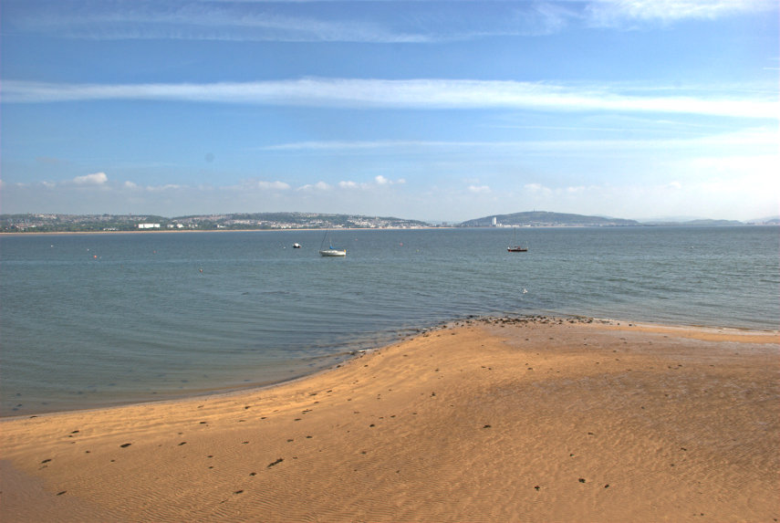
Today we are going back to the bus station and catching the same bus again but we are going a little farther this time; a 20 minute journey. We alight at the first bus stop after the bus turns away from the coast road in Oystermouth which is part of Mumbles. Both names are said to be corruptions of welsh names. We walk, for just a few minutes, back to the coast. Looking straight across Swansea Bay we can see Swansea on the other side.

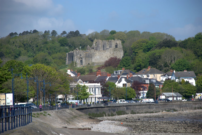
Looking to our left we can see buildings in Oystermouth. That rather prominent stone building on the hill is Oystermouth Castle.

Looking to our right we can see Mumbles Pier which is where we're headed. Mumbles seems to be quite a busy little place with plenty of shops and cafes and we have a slow, pleasant walk along the pedestrian/cycle path which follows the shoreline. It isn't very long before we arrive at Mumbles Pier.

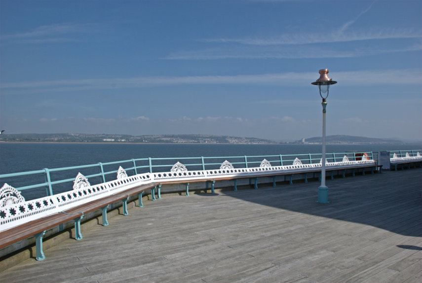
Mumbles Pier is Victorian, as most piers are in this country, and is apparently privately owned. Access is free and we walked out to the decking at the outward end. That part of the pier between the shore and this deck at the outward end is in a bit of a state but it is apparently being renovated as this outer part shows.

The pier buildings on the shore are also Victorian and the left-hand end is a cafe where we had our morning coffee. It is a nice little cafe which also serves food but we didn't try that. The cafe seems to have preserved many of the original Victorian features including the chandeliers and fans.

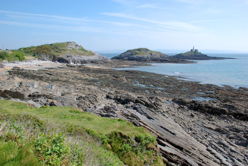
After our brief rest we climbed the obvious steps to the top of the cliff and walked south-west past Middle Head and Mumbles Head and then looked back to this view. Mumbles Head is the one with the lighthouse on it and Middle Head is the one behind it.The lighthouse was completed in 1794 and initially two open coal fire lights were displayed which were difficult to maintain and were soon replaced by a single oil-powered light within a cast-iron lantern. The lighthouse is now unmaned.

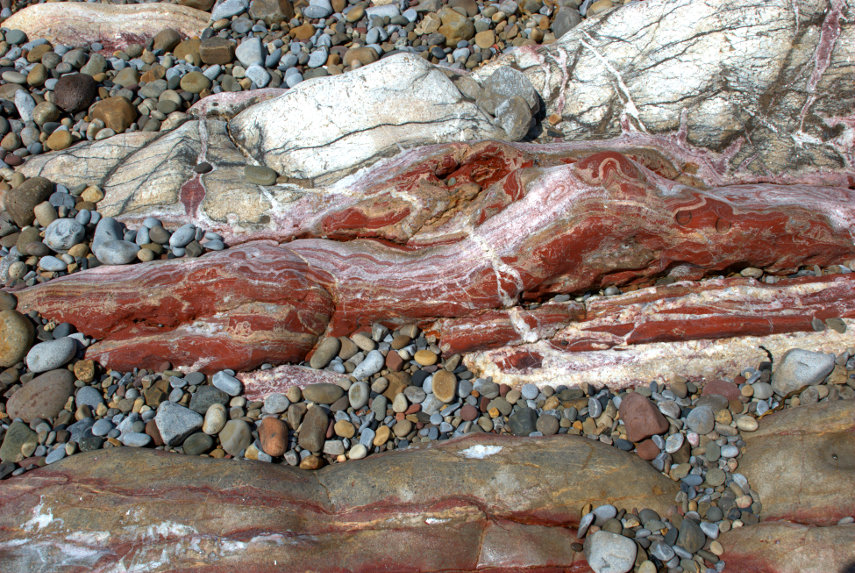
We walked as far as Limeslade Bay and went down onto the beach where we rumaged around looking at the rocks. The rocks on the Mumbles promontory are steeply inclined and from the Carboniferous period being limestone at the seaward end and coal measures at the landward end. We found this among some of the bedrock and I don't profess to know what process would have caused it but it is very striking.

It was at this point that we made another mistake. Looking at the map it was obvious that if we went back the way that we came we would be travelling in a semi-circle whereas cutting through the side streets would be a straight line. Well it would have been if the ground had been flat so we ended up travelling in a semi-circle, but vertically, as we went up and over the hill. I should have looked more closely at the contours shouldn't I? The road down turned out to be interesting as it was obviously an old road, very narrow in places and winding all over the place.

We got there in the end and ended up at Oystermouth Castle. The castle is Norman, probably built around 1220, and is the responsibility of the local authority but is run by a volunteer group called 'The Friends of Oystermouth Castle'. The entry charge is £3.50 for adults and £2.50 for us oldies. I have to say it is certainly worth it.

One of the unusual features is a glass bridge about 30 feet up and, yes, we did walk over it and back again. The fun part is going up and down the spiral stairway and there are a number of those in this castle.

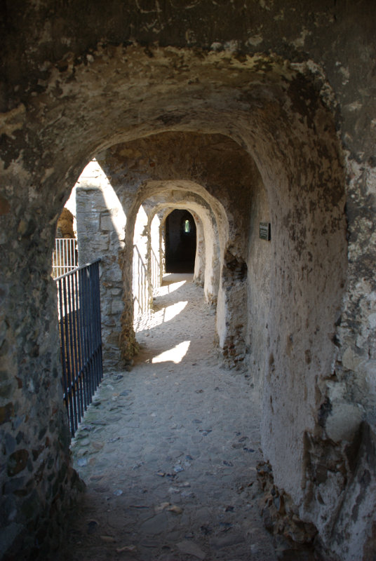
There are lots of features in this castle including wall walks, intricate passages running hither and thither and various halls and rooms. One could become quite disorientated with little effort but that's part of what makes it interesting.

There are also good views from the upper parts.

We left the castle early afternoon to get the bus back to Swansea as we wanted to visit the Tram Museum by the Marina. This museum is open only on Wednesday and Saturday and as today was Wednesday now was our chance. I suggested to Amanda that we go back to the bus stop then start to research bus times in case one comes along. When we got to the road a bus came along with 'Swansea City Centre' on its indicator board so we had to run for it. The doors shut just as we got there but the driver did notice us and re-opened the doors. Nice chap.

But, there had to be a but didn't there, this turned out to be one of those buses which diverts from the short route to make a circuit of the suburbs. Luckily it wasn't as long as happened yesterday but I did say then that we learn from our mistakes; we obviously don't. We may have been more fortunate if we had missed that particular bus. We still got back in time for the Tram Museum except for one minor point; it wasn't open. I enquired in the Swansea Museum nearby to be told that only one of the two required volunteers had turned up that morning so they weren't allowedto open it. Bother!

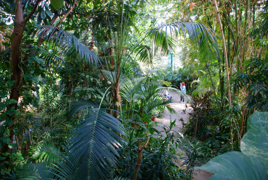
A quick change of plan saw us heading back north in the direction of the railway station to a shopping centre called 'Parc Tawe Shopping Centre' just north-east of Castle Square. No, we weren't going shopping but we were planning to visit 'Plantasia'. The local council describe it thus:

'We decided to create a Rainforest in the middle of the City to highlight the need and importance of looking after and protecting the World we live in. So come in and walk around our Tropical Paradise, take time to learn about the plants and animals which call the beautiful Rainforests their home.'

The entry charge is £3.95 for adults and £2.95 for us oldies. Not a lot.

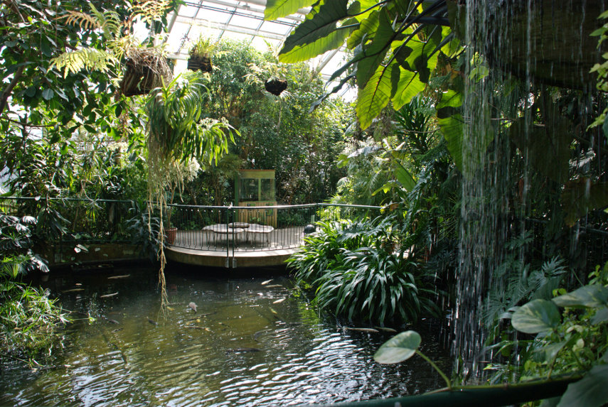
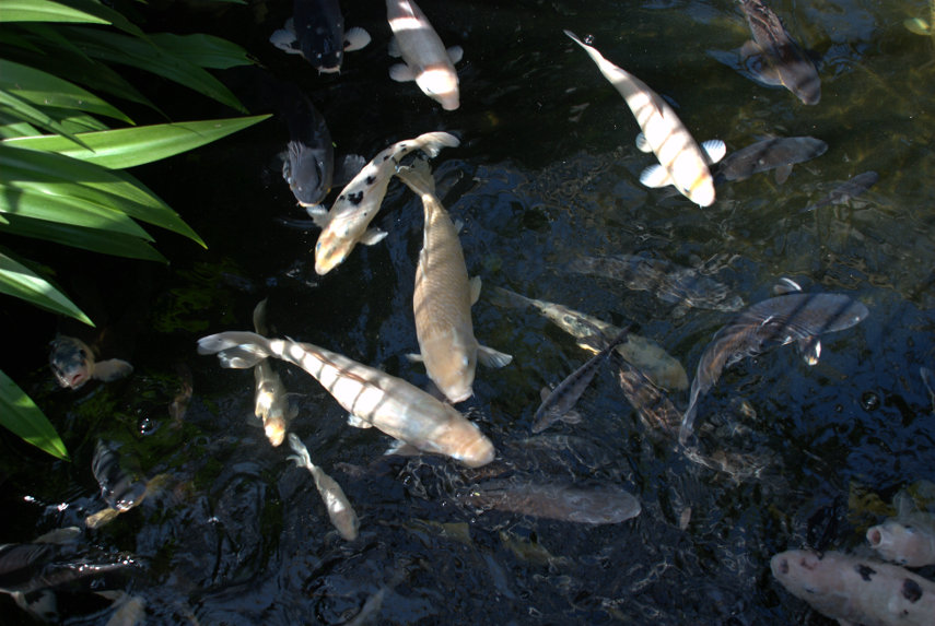
Lots of interesting plants and there is a large pond with a waterfall together with a lot of large fish. When we leaned over the rail to get a better look the fish came rushing over to have a look at us. We saw a notice later which mention packs of fish food to buy so I think that they must be used to visitors giving them food. They were out of luck this time.

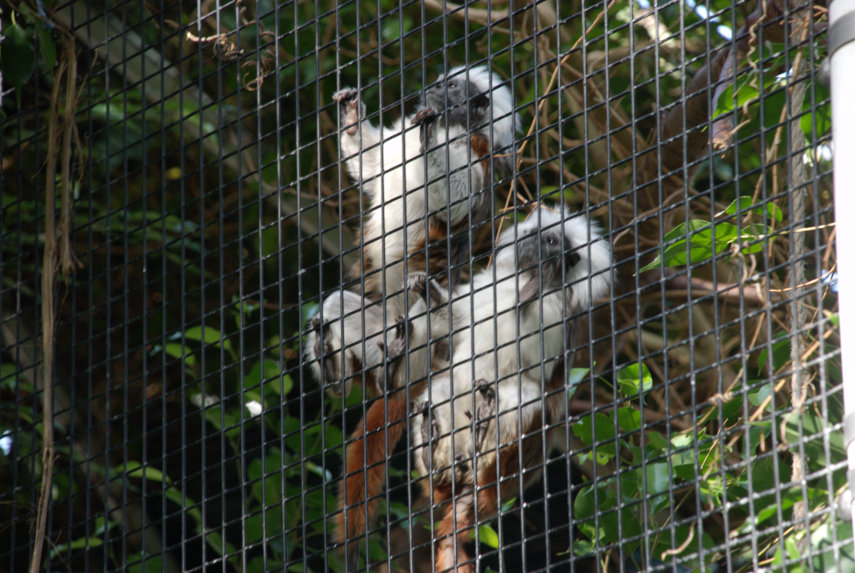
They also had two Cotton Top Tamarin monkeys which are among the most endangered primates in the world with a population of somewhere around 2500 individuals and which were apparently rescued from a zoo that was closing down. So they now have a home here in a wired off enclosure that appears to be the full hieight of the building.

They normally hide in the densest undergrowth which is what they were doing when we arrived but a bit of patience paid off when they eventually appeared. They are about the size of a domestic cat and rather cute with it.

There is also a separate section where some tropical birds can fly freely although not this particular one. It does know a few words but wasn't at all communicative when we were there. I seem to have that effect on people.

These Lorikeets were able to fly around and at one point I felt the draught as they flew close over my head. Cheeky little blighters. They are capable of talking and are also good whistlers. We didn't hear any of them say anything but their whistles were piercing.

The end of another perfect day so back to the hotel for a meal and, hopefully, a good nights sleep. So I'll wish you all a good knight and, luckily, we have one to spare courtesy of Oystermouth Castle.

Sorry but I couldn't resist.

More sightseeing tomorrow – our last day.
Cow Gap

Cow Gap

Day One

The weather forecast for the next 3 days was cloudy but dry. Well, we can handle that so off we went to Eastbourne. Why Eastbourne? We'll get to that later.

We decided to travel by train. We don't have to drive and we don't have to find somewhere to park (the hotel doesn't have its own car park) – can't be bad.

I looked at the train status on my smartphone and saw, with some dismay, that an empty train had derailed earlier and would be causing a delay on our journey. Bummer! smilies The delay was reported to be 20 minutes and we had 45 minutes to walk across to Stratford International Station to make the connection. We were going to Stratford International not because Eastbourne is considered to be exotic but because we can use the high-speed line to get to Ashford and thence a local train to Eastbourne. That delay would still leave us with 25 minutes for the change which should be plenty.

We caught our 'usual' train, which was on time, from our local station and although there was a small delay we arrived only 10 minutes later than planned leaving us oodles of time for the connection. Having alighted at Stratford, in Greater London, we walked across to the International Station with plenty of time to spare. The train arrived on time and 30 minutes later, after an uneventful journey, we arrived at Ashford in Kent.

The Eastbourne train was waiting in the platform and we were soon headed for Eastbourne where we arrived at around 12:40 and after a short walk we were at our hotel at lunchtime.

Driving time would have been about two and a half hours and the train journey, including waiting times, was 3 hours so not really much difference.

Having arrived at lunchtime we had a brilliant idea – we could have lunch and so we did. After lunch we wandered off towards the pier. The last time that we were on Eastbourne Pier the steps up to the Camera Obscura level were closed off and I was hoping we might be able to get up there this time but, no, the steps were closed off. That's two bummers in the same day. smilies

We didn't do a lot today and went back to our hotel to prepare for dinner. Tomorrow is the big day.

Day Two

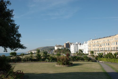
After breakfast at about 9:30 AM we left the hotel and walked down to the seafront. This view is looking in the direction in which we are headed.

We followed the coast road westward until it reach the grass downland where it bends sharp right. We bent sharp left along a track going towards the cliffs. When we reached to edge of the cliffs we could see back to Eastbourne.

You may just be able to see the end of Eastbourne Pier sticking out beyond the promentary where the beach disappears from sight. The weather is better than forecast this morning but the sun is watery and it's not very clear. There is also a strong wind of about 15 mph gusting to 21 mph which we could do without. Looking in the opposite direction we can see our first target – the shore. Do you think that the sign is trying to tell us something?

You may notice that the shore is covered in rock fragments caused by erosion and we are planning to walk on that. smilies

We still have a way to walk along the top of the cliffs yet. We follow the footpath until we see a path forking off to the left and we follow that fork.

We start heading down. That shore looks nearer but it doesn't look any better. More steps to go down.

Can you read the name on the sign? It says 'Cow Gap'. 'Gap' around here is a point in the cliffs which is low enough for it to be practical to build some steps down to the shore. There aren't many gaps. We have visited the other two and have been waiting for an opportunity to visit this one so we've made it at last.

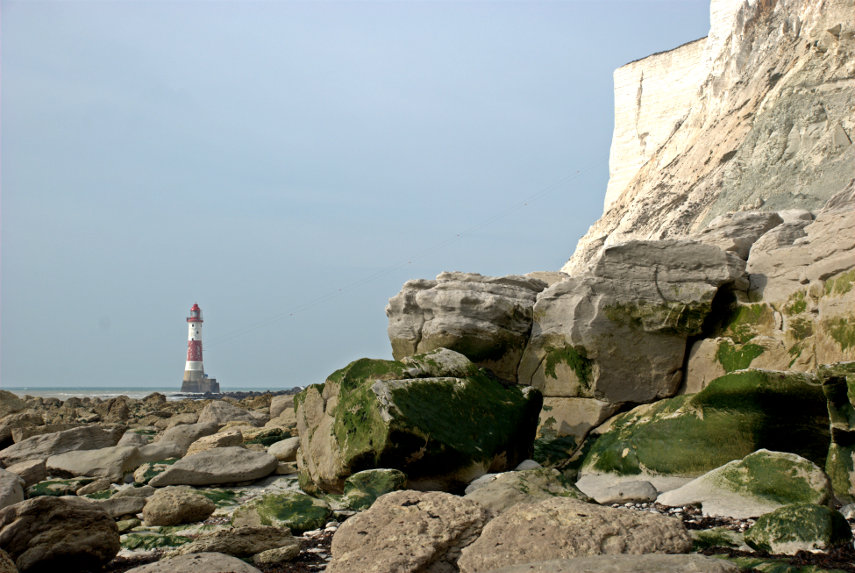
There is Amanda at the foot of the steps and we are now on the shore. Take a look at the shore because we are proposing to walk over a half mile on that. After a while of scrambling it was nice to reach some solid rock to walk on for a while and just showing at the foot of the cliffs on the horizon is our second target – Beachy Head Lighthouse.

We eventually ran out of solid rock but after yet more scrambling we came across a nice large patch of sand. Woo Hoo! That was a welcome relief.

Unfortunately that nice flat sand didn't last for long and we were back to scrambling once again. We did reach another relatively small area of flat rock but there was more loose rock ahead.

The next picture shows how the shore looked further on. That's not going to be easy to walk on.

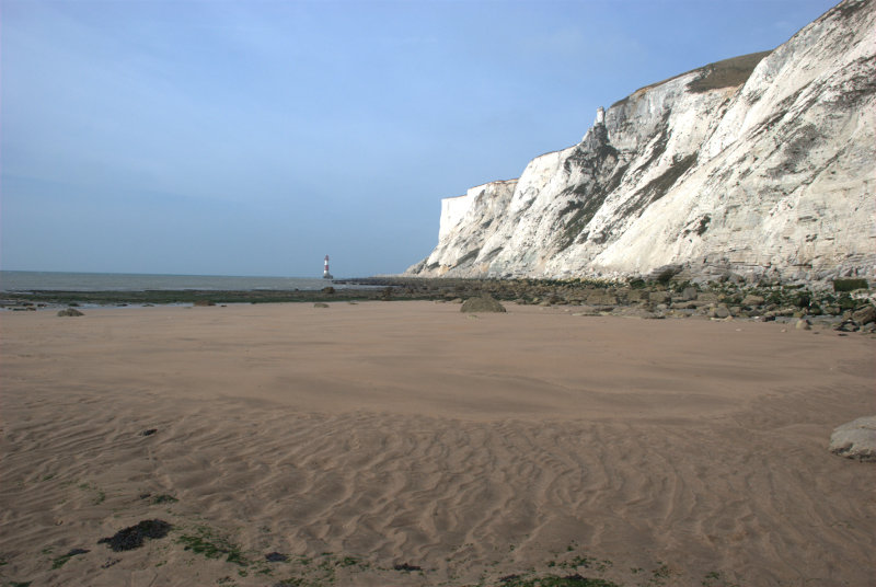
That cliff on the right is Beachy Head. We realised at this point that we wouldn't make it to the lighthouse because the tide had now turned and was coming back in so this is as near as we got. smilies This is not a good place to be caught by the tide.

On the way back to Cow Gap we had a good look at the rocks and saw many old fossils. (Waits for obvious comments. smilies )


The pictures above, in order, starting from the top are:

Ammonite shell impression
Turitella type shellfish
Section of a Brain Coral
Section of a sponge

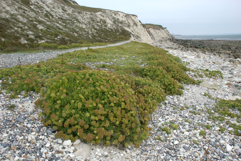
We also came across two plants which are typical of this environment.

Sea Kale which looks rather like cabbage.

 and Rock Samphire which looks like, well, Rock Samphire.

On the way back to Eastbourne I managed to sneak up on this Speckled Wood butterfly.

We went back to our hotel to change and were out again in time for afternoon tea. Yum yum. Tomorrow I'm doing another walk and Amanda is going to a museum.

Day Three

Amanda decided after yesterday's walk that she didn't want to do more walking today so she is going to visit the 'How we lived then' museum, packed with nostalgic items from the past, and I am getting on the bus.

My bus, the number 126, leaves from a stop near the railway station at about 9:45 and I walk up to the stop with time to spare. Whilst I'm waiting a lady asks me if the 126 goes to Alfriston. I explain that I hope it does because that's where I'm planning to go. We share a seat on the bus and chat. It turns out that her name is Nicky (Nicola) and she is on holiday from Switzerland and someone here suggested that she would probably like visiting  Alfriston.

We arrive in Alfriston after about 30 minutes and she decides to join me on a visit to the Clergy House. Amanda and I have stayed in Alfriston before but were unable to visit the Clergy House because it opens only on some days and wasn't open when we were last there.

The Clergy House is a 14th-century Wealden hall-house and is owned by the National Trust. It was their first ever purchase in 1896 and cost the princely sum of £10.00.

This picture shows why it is called a hall-house.

It has a hall-like room which goes right up into the roof. Very impressive but, I would imagine, a devil to heat in the winter.

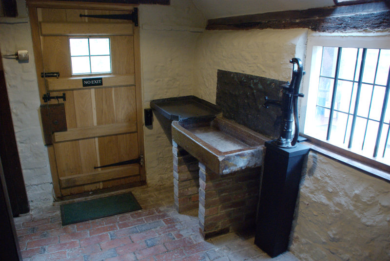
This shows the kitchen with all mod. cons. Well it does have a sink and water pump.

There were also some nice gardens.

Nicky was apparently going to spend the whole day looking around Alfriston so I said goodbye and made my way to the river.

Not much of a river I grant you; more like a stream at this point. However I plan on following the river down to Exceat where I hope to catch a bus back to Eastbourne so I set off.

I soon came across a group of locals having a meeting and there's one on the extreme right that's right on my path.

We shall see what she will do when I get closer. Well I walked close by her right-hand side and apart from a brief glance at me she got on with her eating. They must be used to seeing people.

I passed the little village of Littlington part of which is shown here. Pity the weather isn't better.

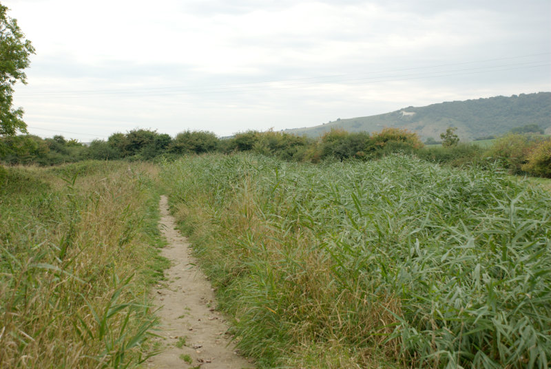
Soon after I passed littlington I had my first glimpse of the white horse, on High and Over, seen across the reeds on the edge of the river to the right.

A little further on and there is a better view of the river with the white horse beyond.

The banks of the river look muddy because the river is tidal at this point and the tide is low so the river level is down. Incidentally High and Over is the name of a hill between Alfriston and Seaford and is the hill directly ahead.

This is about as close as I got to the white horse then following the river takes me further away.


At one point I walked past these Canada Geese who seemed to be honking away most of the time. There were also some other white birds in the distance which I couldn't identify. They all sounded as though they were having a honking good time.

It didn't take much longer to get to the bus stop at Exceat and a little while later along came my bus back to Eastbourne.

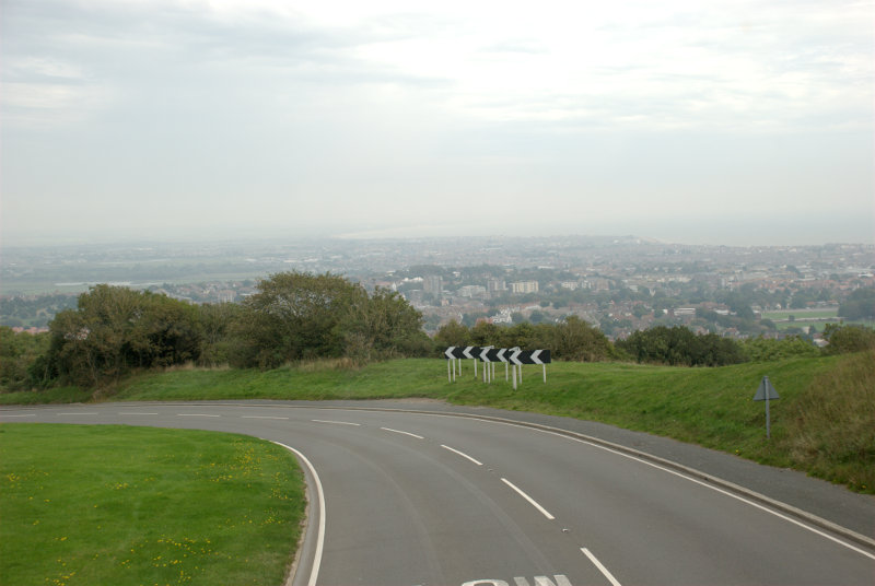
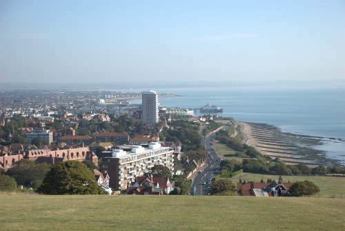
After an uneventful ride (front seat, top deck) we reached the top of the hill down to Eastbourne with a good view of the town laid out below. That probably would have looked nice in good weather.

I got off the bus at Eastbourne Station where Amanda was waiting for me with our luggage and we got the train back home. It was a short but enjoyable trip. We will probably be back.


Lynn – Day 3

Lynn – Day 3

Another day, another sunny morning.

Today we are going further north to the coast at Hunstanton known colloquially as 'Sunny Hunny'. It's about 40 years since I was there last and we are going once again to look at the cliffs. It was a straightforward, uneventful journey and we reached the old lighthouse in about 30 minutes. We went into the obvious, very large car park to find that the charges were approximately £1.80 per hour with a small reduction for longer stays. We turned round and left.

We drove along the road past the car park entrance and found space further down to park in the road at £0.00 per hour unrestricted. No contest really.

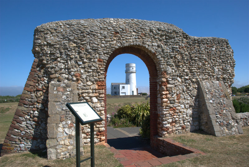
We were now going to walk back the way we came, along the top of the cliffs, until we can access the beach. A short way after leaving the car we came across the only remaining part of St. Edmund's Chapel built in 1272.

Hunstanton has long been associated with Sir Edmund who, as King of East Anglia, led a small army against the invading Vikings, was captured and, after refusing to give up his Christian faith, was tied to a tree and shot by Danish archers. Legend has it that when St Edmund first came from Saxony in AD855 he landed near Hunstanton cliffs.

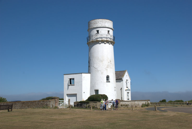
Then of course there's the old lighthouse.

There has been a Lighthouse here since 1665 which was built of wood with an iron basket of burning coals as a light. Hunstanton had the world's first parabolic reflector, built here in 1776, and the current lighthouse was built in 1840. There is no access inside as it is now a private residence.

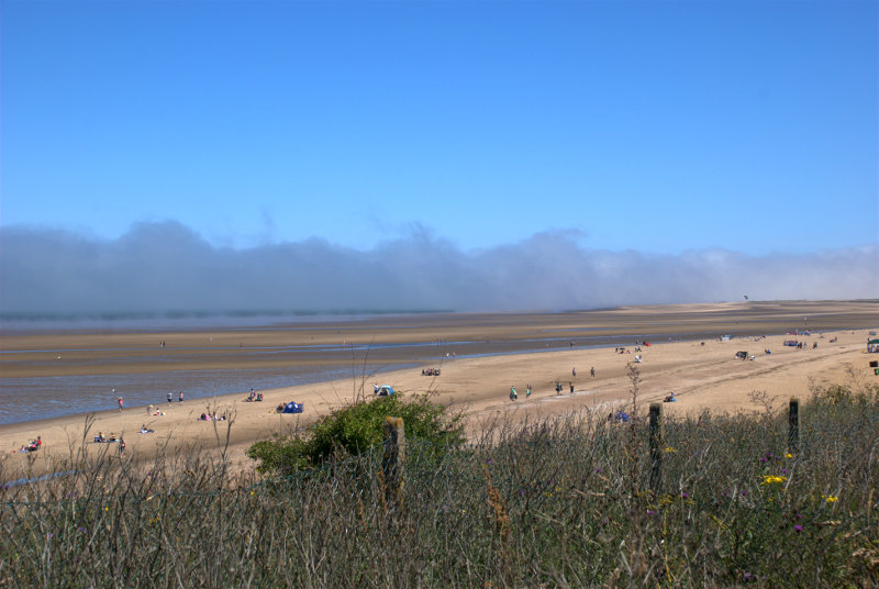
We went on past the lighthouse down towards the beach as the cliffs became lower and lower. We could see a large expanse of beach and, further out to sea, a bank of mist touching the water.

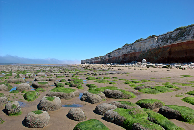
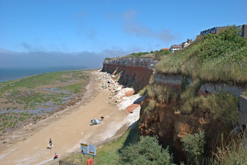
Having reached the beach we reversed our direction so that we were now walking back along the beach, instead of the cliff top, in the direction of our parked car. The cliff here comprises three layers of which the bottom layer is Carstone. This is a type of sandstone and shows a distinct pattern of raised, rounded blocks here when eroded by the sea.

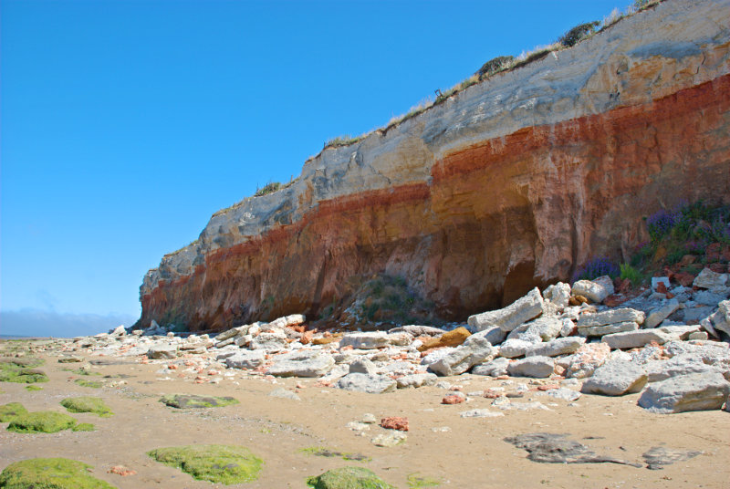
The cliffs themselves are the striped cliffs I mentioned in the Prologue and you should be able to see three distinct colour bands. The youngest rock at the top is bog standard white chalk laid down during the Upper Cretaceous then below that is what is known as Red Chalk laid down during the Lower Cretaceous. Both of these layers are limestone. At the base is the Carstone which is brown in colour and which we saw protruding above the beach as rounded blocks in the previous picture.

For those of you who prefer to work in years these sediments are around the 100 million year mark – a teensy bit older than I am.

We walked a little further on until we found some steps and a path to take us back to the top of the cliffs. You can probably see that these cliffs are subject to significant erosion.

After that final look at the cliffs we found a nice little cafe at the top of the cliffs overlooking the sea where we had lunch. After lunch we walked back to the car and headed back to King's Lynn.

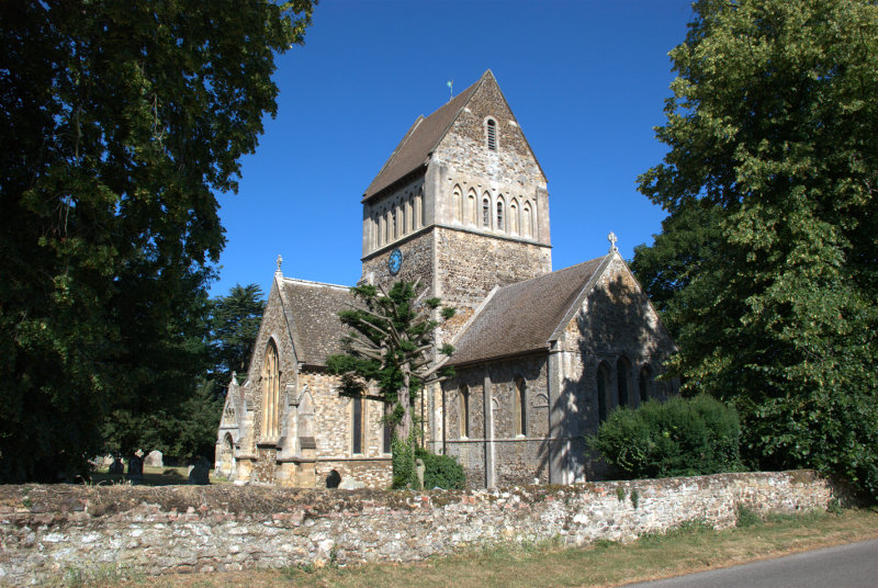
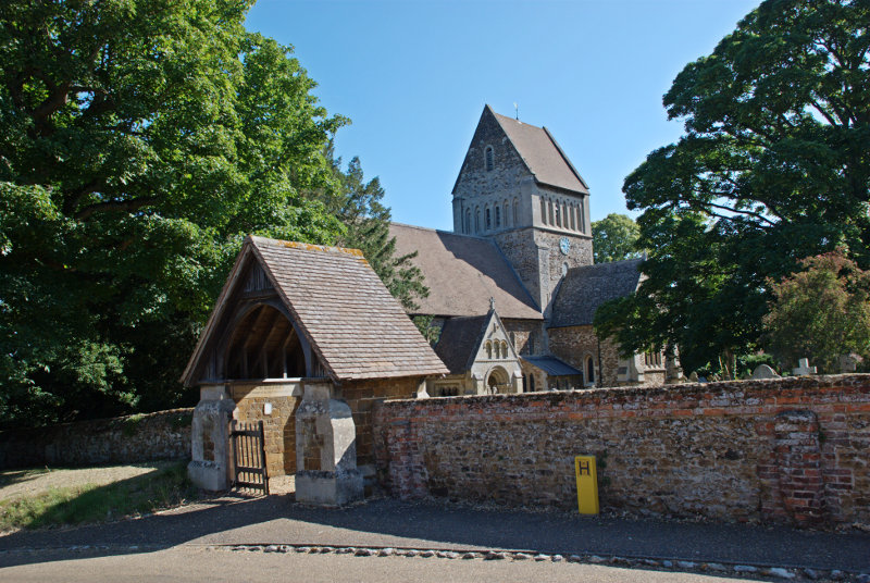
About 5 miles this side of King's Lynn is a small village called Castle Rising where we expected to find, as you've probably guessed, a Norman castle. What we didn't expect to find was an imposing Norman church.


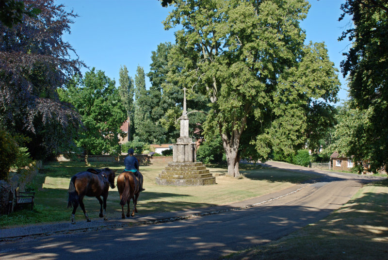
On the other side of the church is the old market cross dating from the 15th century which we thought was in a rather nice setting.

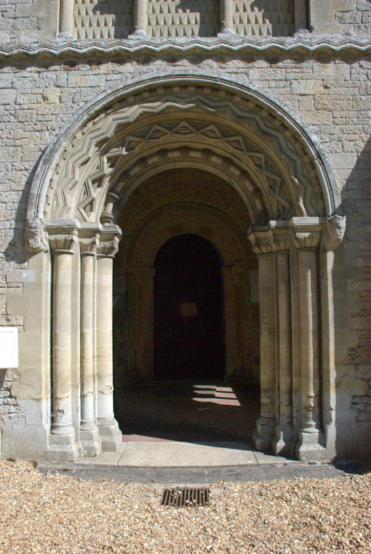
The church itself had a rather spendid, and typical, Norman doorway.

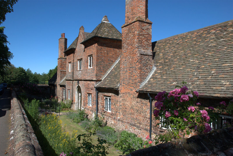
Opposite the church was the Tudor Trinity Hospital founded by the Earl of Northampton in 1614 and although the roof is now tiled the original roof was thatched. The term 'hospital' in Tudor times was applied to almshouses.

The inhabitants, known as 'Sisters', were expected to be "of an honest life and conversation, religious, grave and discrete, able to read, a single woman, 56 years of age at least, no common beggar, harlot, scold, drunkard, or haunter of taverns" and had to attend chapel every day.

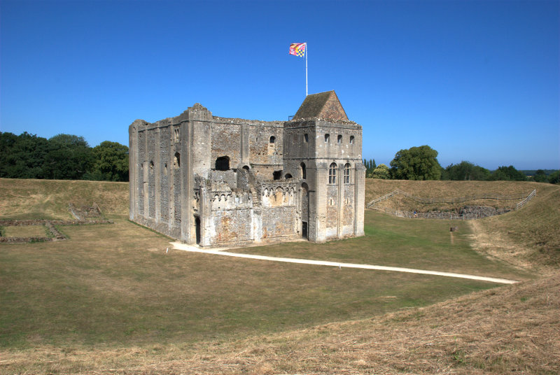
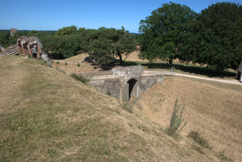
Finally we got round to seeing what we came here to see – the 12th century castle.


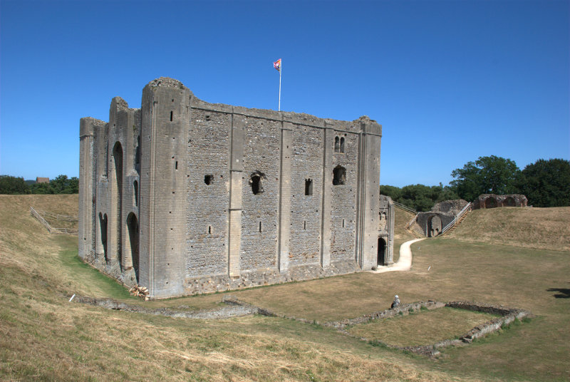
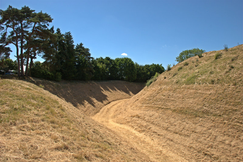
I'm standing on the high earthwork bank which completely surrounds the castle with a very, very deep ditch on the outer edge. That's Amanda teetering on the edge in the second picture.


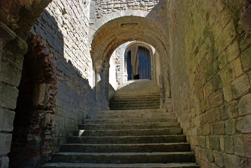
The main stairway into the castle is quite impressive and it was meant to look that way to impress visitors.

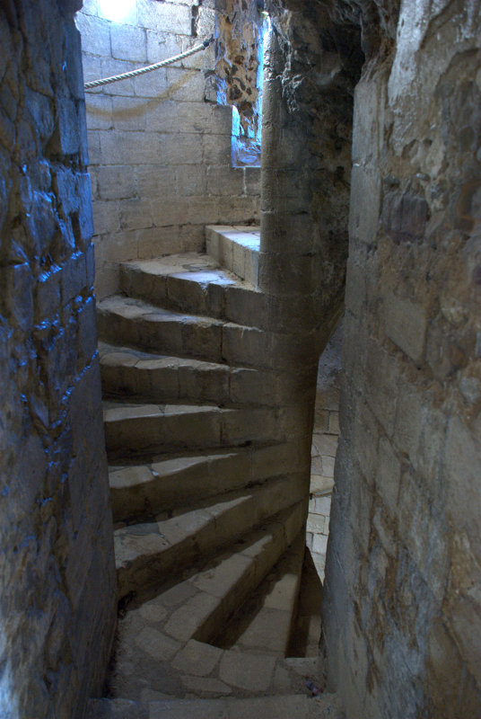
The rest of the castle, however, is accessed via the more traditional medieval spiral stairways and passages.


When we came to leave we realised that we were the only people in the castle. An interesting experence.

It's worth a visit if you're ever that way.

The end of another day and tomorrow we go home – but …..


Down South – Day 2 – Friday 25th Sept.

Down South – Day 2 – Friday 25th Sept.

We woke to another sunny day so the prospects for today's planned walk look good! After breakfast we walked out of our hotel at 9:15 and down to the seafront by the Wish Tower where we turned west. We had about a mile to walk along the seafront before we reached the footpath on the Downs, going past The Grand Hotel on the way and you don't know what grand is until you've seen 'The Grand'. Rooms start at around 190 GBP per night; a little more than we would want to pay. smilies The Grand is the white building and you can see the Downs in the distance where we are headed.

The seafront road climbs quite gently such that it doesn't really notice but after a while when looking back we could see that we'd already gained some height. We soon reached the footpath and started up the Downs towards Beachy Head and now it was noticeably steep. Part the way up I stopped to take a picture of the view which was a good excuse for a brief rest.

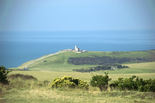
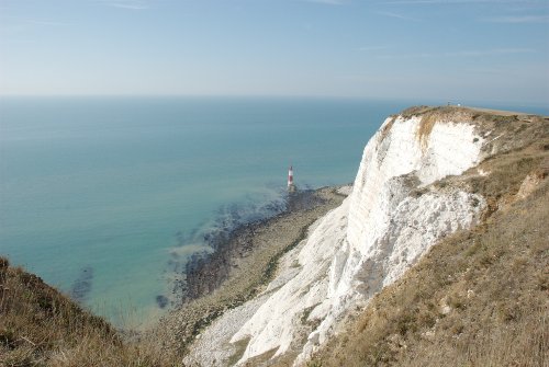
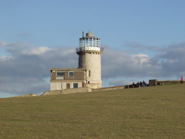
Some way further on (and up) we spotted a bench seat so we stopped there for about ten minutes to let a party of noisy school children go past and the noise faded as they disappeared into the distance. We eventually reached the Beachy Head area and had travelled two and a half miles so far. From this point we could see the Belle Tout Lighthouse where we were headed next and from the edge of the cliff the Beachy Head Lighthouse was also visible.

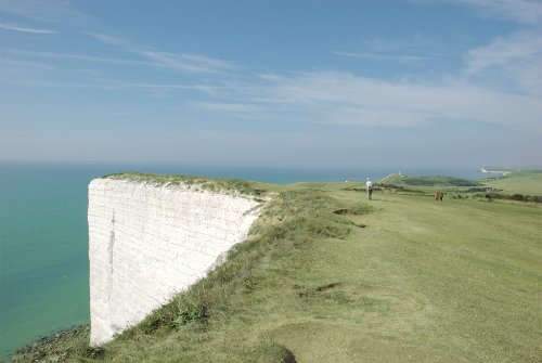
My – tha's a long way down. Walking along the top of the cliffs the views include the sea, the downs and glimpses of the chalk cliffs – absolutely wonderful. The little figure ahead is Amanda and the white headland on the horizon is Seaford Head. Immediately this side of Seaford Head is Cuckmere Haven almost at the end of our walk and in between here and Seaford Head you may just be able to make out the Belle Tout Lighthouse just to the right of Amanda's head.

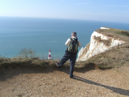
A little further on and a bit nearer the Beachy Head Lighthouse Amanda photographed me photographing the lighthouse just before I fell over the edge. :shock:

Don't for a minute think that we are walking on level ground. It's all either up or down, some of it quite steep as you should be able to appreciate in this view.

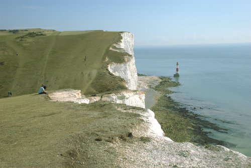
You may notice that the the bottom of the next dip is out of sight down the steep slope but at least the Belle Tout Lighthouse is a bit nearer although there are two of these troughs to negotiate before we reach it. Looking back towards Eastbourne the Beachy Head Lighthouse is still visible and how do you like the look of that last slope we've come down not to mention the one we've just had to climb.

On the way along the cliff tops we saw a number of Clouded Yellow butterflies which was very nice but none of them would stop still long enough for me to take a photograph. We (that's Amanda in front) are about to negotiate the last trough before the Belle Tout Lighthouse.

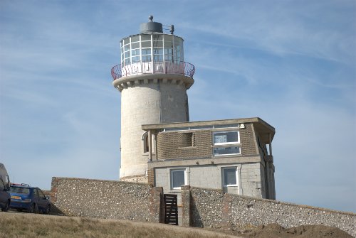
Hooray! We've finally reached the Belle Tout Lighthouse. Next stop is Birling Gap and that's not very far now.

The lighthouse was moved 56 feet further inland in 1999 to save it from going over the cliffs as erosion progresses and it apparently is now being prepared for opening to the public.

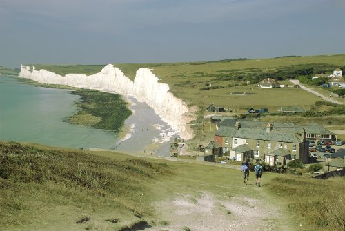
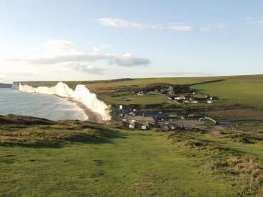
After walking down the slope from the Belle Tout Lighthouse Birling Gap is within sight. Total distance from our hotel to Birling Gap is about five miles.

It is now 12:15 so this is where we break for lunch. After lunch we head up the track visible on the right-hand edge of the picture and on to the Seven Sisters.

It was about this time that I realised that my pedometer was under reading slightly so I'm going to wait until the end of the walk and compare the pedometer reading with the distance I know the walk to be having measured it accurately on an Ordnance Survey map.

After lunch Amanda decided her legs weren't up to going over the Seven Sisters with their many ups and downs, especially with some of them being rather steep, so she caught the bus round to Exceat where we arranged to meet and I set off up the track towards the Seven Sisters at 1:15 PM.

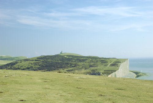
The walk up to the first hump wasn't too bad at all and the view looking back, showing the Belle Tout Lighthouse from this side, wasn't bad either.

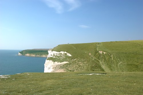
The walk over the Seven Sisters was really quite pleasant with some amazing views and I soon found myself on the last but one hump looking at the top of the next, Haven Brow. But oh my goodness – look at the steepness of that final upward slope to the top.

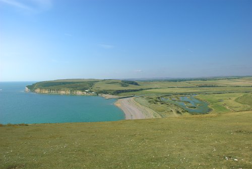
I did make it, however, and here I am on top of Haven Brow, the most westerly of the Seven Sisters, looking down on Cuckmere Haven with Seaford Head beyond and only one and a half miles to the tearooms.  :smile:

I finally arrived at the road in Exceat at 3:15 PM to find Amanda waiting by the gate. That was a total distance of eight and a half miles from our hotel with five hours of actual walking and most of that route is part of the South Downs Way.

We went over to the tearooms for afternoon tea and caught the bus back to Eastbourne. An exceptionally nice day with regard to both the weather and the scenery. I'd love to do it again sometime.

Tomorrow, I think, will be an easy day.

Ups and Downs – Day 2.

Ups and Downs – Day 2.

The weather forecast for our our second day was cloudy but dry and we woke to a clear blue sky and it stayed sunny all day. So much for English weather forecasts.

After breakfast we drove the few miles to Friston Forest where we parked the car in one of the two official car parks. This one is on the west side of the forest about 2 miles south of Littlington.

After paying our 1.50 GBP for a day’s parking, the only option there is, we walked off into the forest heading for the little village of West Dean about a half mile away.

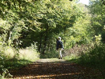
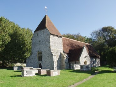
In spite of stopping here and there along the way to look at plants we arrived in West Dean fairly quickly and decided to have another look, we’ve been before, at the little church.

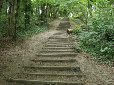
Through the village to the path through the forest to the Seven Sisters Country Park Visitor Centre. Ah yes – that path. Not quite as innocuous as it might sound.

That’s the one. It wasn’t as strenuous and didn’t take as long as you might imagine to get to the top. The next section of path was gently downhill all the way to the visitor centre and we had then walked about mile from the car. We had a brief stop here for coffee in the Exeat Farmhouse Restaurant which I mentioned on the Cuckmere Haven page from our previous trip.

So crossing the A259, Seaford to Eastbourne Road, we headed towards Cuckmere Haven.

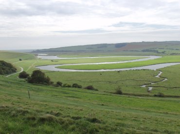
Here you can see the Cuckmere River meandering across it’s flood plain towards the sea with the path on the left-hand edge of the picture. You can just about see the sea on the left edge of the horizon.

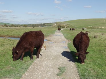
On our previous visit there was no livestock to be seen but this time there was. This pair were grazing contentedly each side of the path and we had just walked between them when I turned and took this photograph.

Cattle are usually nervous enough that they will move away from people if they get too near but these were obviously used to people and didn’t so much as twitch when we walked between them.

So after walking another mile we soon arrived at the beach at Cuckmere Haven.

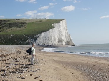
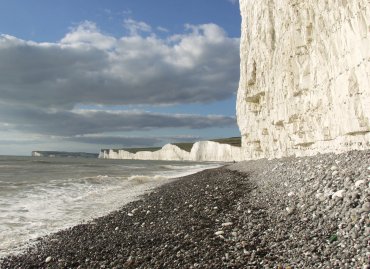
Don’t be mislead by the sandy beach – most of it is pebbles and it’s hard work walking on them. I wanted to get some more pictures of the chalk cliffs so we walked further along the beach. Here I am taking my life in my hands, well I could have got seriously wet feet, to get the sort of pictures you see on the web site.

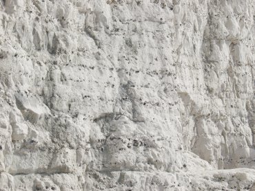
You will notice that, in this close-up of part of the chalk cliff, there are rows of small dark blobs. These are flints formed in the chalk and, when the cliff is eroded by the sea and the weather, they are washed out and rolled by the waves to form the rounded pebbles of which the beach is comprised.

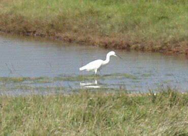
As we started back towards the visitor centre at Exceat we saw a Little Egret in one of the lagoons.

We were back at Exceat in time for a late lunch at the Exeat Farmhouse Restaurant and then walked back through the forest, via West Dean, to our car.

As we still had some time left in the day we drove to Birling Gap and parked in the free car park there. Birling Gap is so called not because there is a complete gap in the cliffs but because the cliffs there are only about 30 feet high whereas the cliff heights either side are measured in hundreds of feet.

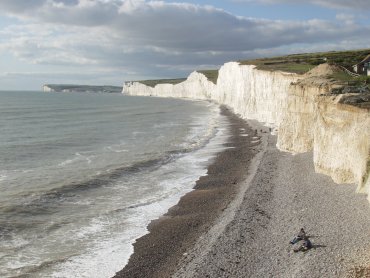
There is a metal stairway from the top of the cliff to the beach and this picture was taken from the top of the stairway looking west at the Seven Sisters chalk cliffs.

We did, of course, go down the stairway to the beach and walked east in the hope of seeing Beachy Head round the next corner but we reached a point where the sea was still lapping against the cliffs so were not able to go any further.

I did, however, take this picture after we’d turned round to walk back to the stairway.

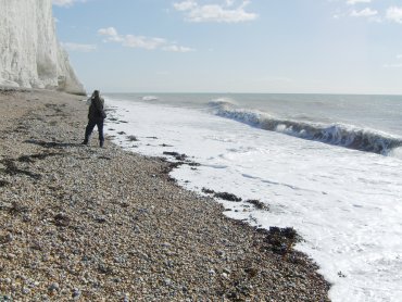
On the way along the beach one could not avoid the noise of the surf. The waves crashed noisily on to the beach and, as the water withdrew, the sound of pebbles grinding as they were rolled could easily be heard. Standing there listening to that noise one could imaging how the rough lumpy flints were transformed into smaller rounded pebbles.

When we got back to the car park there was still time for another short expedition so I walked east up onto the cliff tops whilst Amanda stayed down below. Until I reached the top of the cliffs I hadn’t realised that the Belle Tout Lighthouse was so close so I had to go at least that far.

Just before I got there a long thin strip of cloud obscured the sun and I ended up waiting 15 minutes for it to clear – but what a beautiful place to have to wait. The sparkling sea to the south, the Seven Sisters white cliffs beyond Birling Gap to the west and East Dean and Friston Forest to the north.

Coming back down from the lighthouse I saw this view of Birling Gap

The sun was getting noticeably low and it would be dark within 2 hours so we made our way back to the hotel after a very pleasant day.

Tomorrow will be mostly ups and downs.