Browsed by
Tag: Roads

Ross and Moss – Day 1

Ross and Moss – Day 1

Our travelling this year has been severely curtailed because of Covid-19 so no surprises there. When Covid-19 first appeared and the country went into lockdown we were able to only walk locally. Then restrictions on driving eased a little, although we weren’t able to travel far, but eventually those restrictions were also eased to the point that we considered going away for a few days. So when a few days of sunny weather were forecast we decided to bite the bullet and off we went.

We booked accommodation in the Forest of Dean and set off in the sunshine.

Our first port of call was Ross-on-Wye in Herefordshire just a short way from our final destination. I had been to Ross-on-Wye about 65 years ago and could remember nothing at all about it so it was like a first visit.

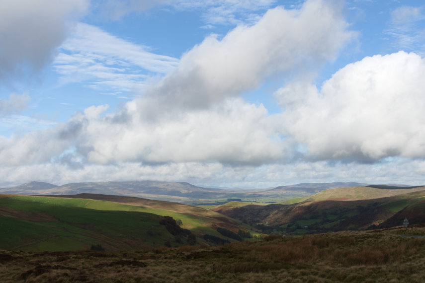
This next picture shows a general view of the town taken from the banks of the River Wye with the famous church spire showing well above the rest of the buildings. There is, of course, a riverside walk here.

When we arrived we parked in a car park in Edde Cross Street then walked back to the junction with High Street . A short distance along High Street brought us to the Old Market Hall at the top of Broad Street. This was built around 1650, and replaced what was probably an earlier wooden building, and markets are still held in it today. It does look rather impressive.

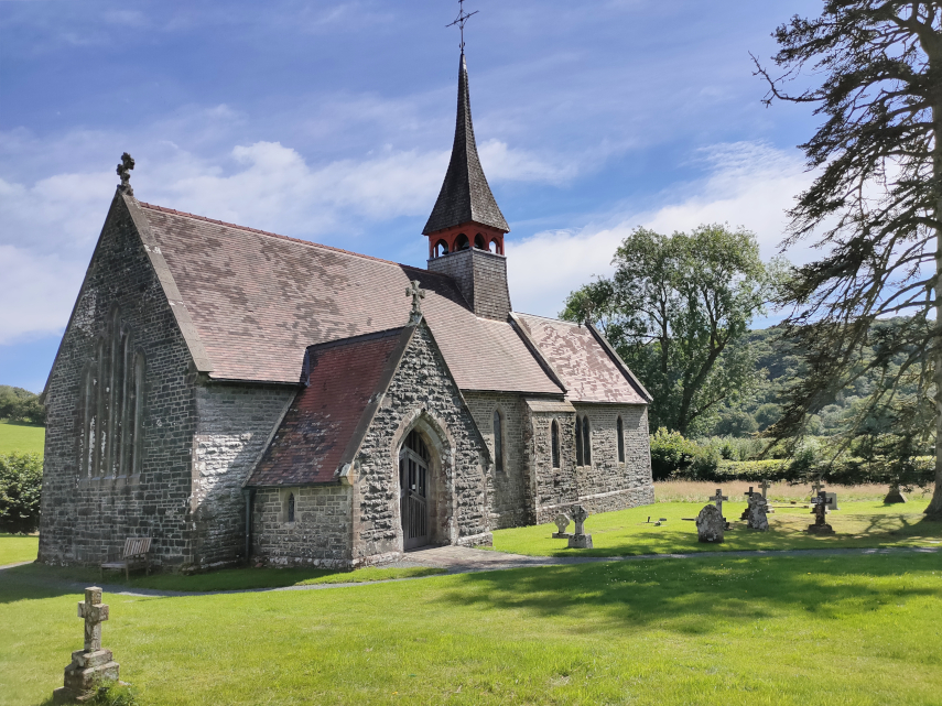
Having had a good look around the Market Place we walked the short distance to the church and, at 205 feet, that is what I call a spire! Although the spire was rebuilt in 1721 the church itself was built in 1316 and is one of the largest churches in Herefordshire.

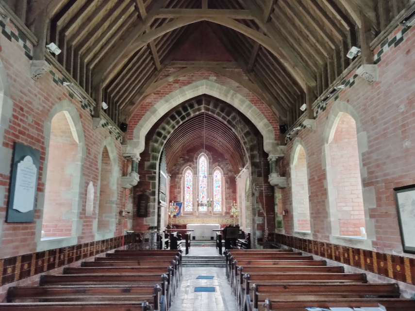
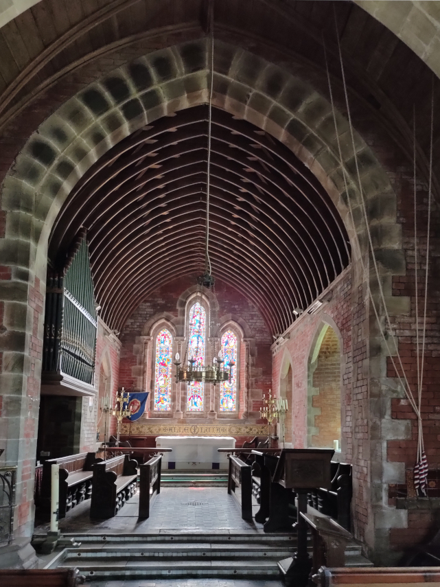
The attractive interior is certainly spacious and features a number of monuments.

Outside in the churchyard is the Plague Cross which was erected to mark the graves where the three hundred or more townsfolk were buried by night and without coffins during an outbreak of the plague in 1637.

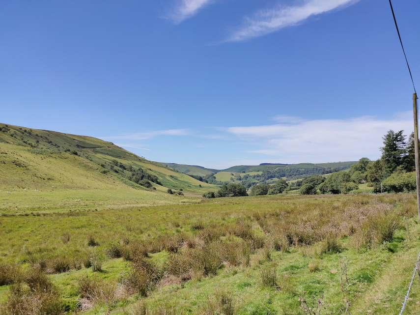
To one side of the church is a small, but beautiful, public park called ‘The Prospect’ which includes some fine trees and also provides an impressive view looking down over the River Wye and the surrounding countryside.

After looking around the church we wanted some lunch so, going back to the Market Square to look round, we found a nice little cafe at the top of Broad Street quite close to the Old Market Hall.

There is a small outside sitting area, seen in the picture below, but we ate inside. We had a small but satisfying, and very tasty, lunch.

After lunch we spotted a few more items of interest on our way back to the car. A rather quaint alley, some old almshouses and a very ancient timber-framed building now used as an antiques shop.

After leaving Ross-on-Wye we drove the 8 miles to our hotel which was not in any town or village but in the middle of the Forest of Dean.

Having registered we moved in to our room, unpacked and went outside to explore the forest .

I took this photograph of the Speech House Hotel before we started walking.

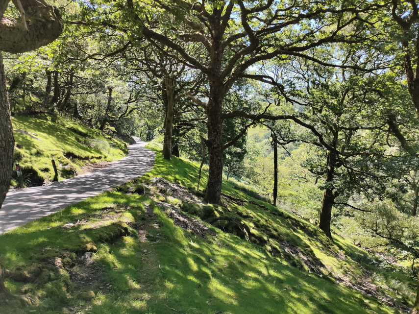
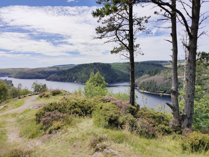
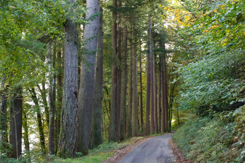
There was a path nearby called Spruce Ride so we started with that and noticed on the map that it went past a lake and decided to walk as far as the lake and back. The forest off to the side of the track looked very pleasant.

We spotted a little stream where the water was very brown. This area, surprisingly, had a lot of mines in the past, some of which were for iron, so it’s not surprising to find water coloured by the iron ore in the ground.

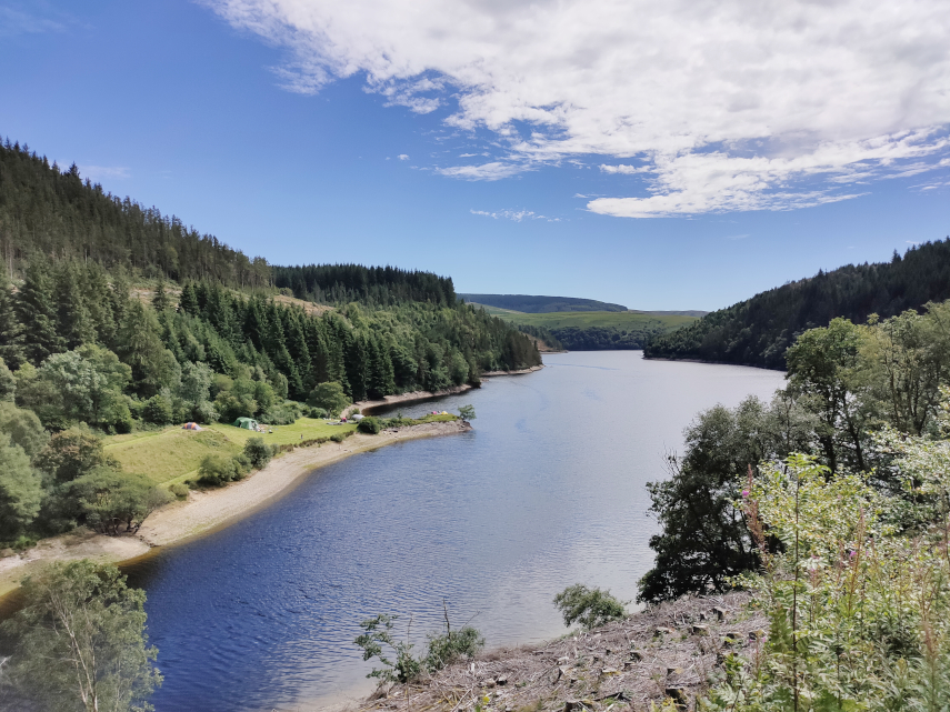
It didn’t take very long to reach the lake which looked very picturesque in the sunshine and it was lovely and quiet.

We were on the lookout for things other than trees and lakes and eventually came across a number of interesting fungi.

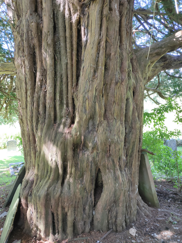
On our way back we saw this tree which was covered in moss. Not something one sees every day. A ‘Moss Tree’ perhaps.

The marker on the map below shows our path to the lake and the light area by the junction is the Speech House Hotel. You can zoom in and out using the plus and minus icons.

After returning to the hotel it was time to freshen up and go down to dinner. We had a choice of restaurant and this evening we chose the more formal dining room which, I have to say, was rather nice.

We started off, before ordering our meal, with cocktails. Amanda had an Espresso Martini which was coffee flavoured, which she rather liked, and mine was a Passion Fruit Cocktail. If Amanda’s head looks a little odd it’s the ultra wide angle lens I used to take this photograph.

Our meal turned out to be very nice and afterwards we retired for the night.

Ross -on-Wye was a lovely little town and we do like the Forest of Dean. So there endeth our first day. I wonder what tomorrow will bring?

On the road to nowhere

On the road to nowhere

In April 2017 we traversed the Cambrian Mountains, on our way to Devil’s Bridge, on one of only two roads which go over the Cambrian Mountains. This is the blog that covers that trip. https://www.beenthere-donethat.org.uk/deoprrssw/?p=2428

We now decided that it was time to explore that second road. We weren’t going to a particular destination but purely to see what that road was like (Have you ever had a premonition that you are about to make a mistake?).

We headed off, on a warm sunny day, towards Beulah. Yes, I know, you’ve never heard of it. Well it’s a small village about 8 miles south-west of Newbridge-on-Wye in Powys. This is where the mountain road starts and having turned on to it, and before we’d left Beulah, we spotted a nice little church which we had to explore. The original path into the churchyard went over this cute little bridge but the current path bypasses the bridge.

And this is the little church. It is not very old, having been built in 1867, but it is very attractive.

Having had a quick look round ( what else can you do with a church that small?) we set off again along the road. This road is just one car’s width and does have passing places but you can bet that you won’t be near one when you meet a car coming the other way.

The first part of this road is mainly wooded but eventually after a gentle climb of some miles we came out into the open. We continue to head upwards through that valley round to the left.

We carried on to the village of Abergwesyn where we’d heard there was a ruined church. We couldn’t find the ruined church, if it still exists, but we did find the old churchyard with a mega Yew tree.

We carried on and soon went into another wooded section of the road with an unprotected steep slope on one side. No barrier to stop you driving off the edge and you do have to drive relatively near the edge because the road is so narrow.

I was quite pleased when that was over. Next we reached the Devil’s Staircase – a steep bit of read with some hairpin bends. The name is more worrying than the actual road and we successfully negotiated that section without problems. We reached another open area and we are still climbing but the views were getting better.

The road was beginning to get interesting now. It was bending in three dimensions and they tended to be sharp bends. When the bend was in the vertical plane the road beyond the top of the hill couldn’t be seen until the car was beginning to tip down the other side so one couldn’t see which way the road was going to go and there was always the possibility of a car coming the other way. Travelling was slow and if there was a short stretch where one could attain 20 MPH then that would be considered very fortunate. The same applied to bends in the horizontal plane – it meant driving really quite slowly. Don’t pick an argument with a rock – you won’t win.

Having reached the top we took a 7 mile detour to have a look at a reservoir we had heard about, Llyn Brianne, and it turned out to be a worthwhile detour. But it certainly increased our bend count.

Our road was now going downhill again but the bends didn’t get any better.

We finally reached the end of the road in a small town called Tregaron which was a relief from the bends – but not for long. We now had to return home which meant travelling the same route in the opposite direction. I was really looking forward to doing all those bends again. :(

I can tell you that by the time we reached Beulah again I was rather tired and we still had an hour to go to reach home. However we did reach home without incident and I don’t intend doing that journey again in a hurry!

Somewhere Else

Somewhere Else

Now that some of the Covid-19 restrictions in Wales have been relaxed we can go somewhere else – anywhere – so we did just that.

We headed 60 miles due west and found ourselves in Aberystwyth, Ceredigion. It took us about one hour and fortyfive minutes to do those 60 miles because most Welsh roads are anything but wide and straight. The last 10 miles was particularly wiggley but we got there.

We parked in a large car park on Park Avenue and were expecting to pay £1.70 for the day but all the pay machines were covered with large bags and there was no explanation so we ended up paying nothing.

We headed fo the sea front and soon after leaving the car park we walked past the Vale of Rheidol Railway Terminus which is a Heritage Steam Railway that runs to Devil’s Bridge. The last time we went to Devil’s Bridge we saw the other end of this line and took some photographs when a train arrived from Aberystwyth.

This time the terminus in Aberystwyth was closed with no signs of life anywhere so we continued past. Probably because of Covid-19. Pity really.

We headed for the harbour and were then planning to walk north along the sea front as far as the Funicular Railway at the far end of the bay. Where we parked was an obviously new area including a retail park but the buildings and streets suddenly changed when we reached the old part of the town.

This was one of the streets in the area of New Street and the hill in the distance could be Constitution Hill and the funicular railway runs up that.

It was a short walk further on to the harbour which includes the River Rheidol just before it runs into the sea. Both pictures are taken from the same viewpoint but in different directions.

A short walk from the harbour brought us to the sea front. This view is looking south and shows the wall at the entrance to the harbour.

Walking on South Marine Terrace along the sea front we passed these colourful houses and could see the castle in the distance.

Then an equally colourful plant bed.

A short way on we reached Aberystwyth Castle built by Edward I in 1289 but by 1343 the castle was in a bad state of repair. In 1649 Oliver Cromwell ordered the castle to be slighted, i.e. rendered unusable, hence its current condition.

We finally left the castle after having a really good look round and went back down to the sea front onto the New Promenade which was completed in the early 1900s.

On Constitution Hill in the distance, on the left of the next picture, there is a straight line visible running from the top to the bottom – this is the funicular railway of which more later.

In 1795 John Nash built the Old College buildings on the right, with George Jones as the architect, in Gothic style. It was later sold to the University of Wales who turned it into a college for higher education and it later became the University of Aberystwyth. It remained as the main part of the university until the 1960s when the university open a new campus near the National Library of Wales.

A short way on and we found two things – an ice cream kiosk and the pier. We had some ice cream, to help the local economy you understand, and had a look at the pier. It has to be said that this is the shortest seaside pier that we have ever seen. It does have amusements inside and a restaurant at the outer end which has a sun deck visible at the far end. We didn’t have time to visit the restaurant so we moved on.

When we reached this point along the sea front there was a turning off to the right which, having previously looked at the map, I knew led a short distance to the Tourist Information Centre. Having previous looked at some web sites which gave opening times I thought we’d pop in to see if there was anything we should visit that we might have missed. Needless to say it was closed with no signs of life. It was, however, a pleasant part of the town.

We went back to the seafront which has, as you can see, a rather fine beach. This beach runs all the way along the seafront promenade and has a greyish sand but sand nevertheless and there were plenty of people enjoying themselves.

We continued on towards the Funicular Railway passing some colourful, fine looking houses on the way.

We finally arrived at the bottom station of the funicular railway expecting it not to be running because of the current virus problems but it was so we decided to make use of it and take the easy way up.

We were asked to wear masks whilst on the ‘train’, which they supplied at a small charge, and the single fare was £7 for two.

We boarded the coach and, after a short time, it started to move. As with all funiculars there are two sets of rails and two coaches. When one coach is going up the other is coming down so that each coach acts as a counter-weight for the other.

This funicular is interesting in that the rails start up steeply then level off a little then go up an even steeper slope. When we reached the top I took a photograph from the station looking down.

You will be pleased to hear that there is a cafe at the top -we certainly were. They had a good selection of items on the menu including cake so we had to try some. We both had some cheesecake (very nice) and a cup of coffee each. The view from this level is really quite amazing.

The second picture was taken with a telephoto and is of the castle area with the war memorial on the right and parts of the castle showing on the left. You can also see the sundeck on the pier.

Once we had finished our cake and coffee we had to walk back down but just before we did that we had a look at the view north of Aberystwyth towards Clarach Bay. Beautiful.

This is the start of the footpath down but it isn’t that wide all the way.

We are almost at the bottom now.

On the way down we saw a number of wild flowers including Sea Campion, Thyme and Quaking Grass.

Finally back to sea level we now have to walk back to where we parked the car but we did pass through some more interesting parts of Aberystwyth.

We finally staggered back to the car and set off home but this time we are going home via the mountain road rather than the main road which brought us here.

We first go from Aberystwyth to Devil’s Bridge where we join the mountain road.

The next picture, which is just before we reach Rhayader, will be of particular interest to our friend Marie because she has been there. It shows one of the reservoirs in the Elan Valley and we brought Marie this way on that little road in the bottom right corner.

We reached home without incident although Amanda was feeling a little travel sick by this time. It took her about an hour to recover.

I wonder where we’ll go next time!

FORE!

FORE!

Let’s make this clear. We are not golfers and we do not play golf. This ‘Golf Ball’ is not really a golf ball and is somewhat larger than a golf ball.

Let’s start at the beginning. It was going to be a lovely day and, as we are in Wales, we should not travel more than about 3 miles under lockdown rules. However in England there are now no such travel restrictions so we drove a half mile to our station which is in England and were then free to travel as far as we like.

So we drove for about 45 minutes to Titterstone Clee Hill near Ludlow.

That is an impressive hill wouldn’t you say? We intend going to the very top but we are, of course, going to cheat.

Titterstone Clee Hill used to be quarried, although the quarries closed in the early twentieth century, and that means that there is an access road almost to the top. The view below is from the level of the car park looking back along the road the way that we came.

This is the car parking area looking towards one of the old quarry faces which is slowly being taken over by nature and doesn’t look anything like as raw as when it was a working quarry.

Time to start up to the top. We climb a moderately steep path and soon come across this view of another quarry face, again softened by nature, with two very strange devices looking rather like giant golf balls showing over the quarry edge.

These devices are radar domes. The largest is part of the National Air Traffic Services radar network and covers one of 30 overlapping regions of UK airspace. This one on Titterstone Clee monitors all aircraft within a 100-mile radius and the smaller of the two is a Meteorological Office weather radar which is part of a network of 16 radars across the country used to detect rain. I usually just put my hand out of the window.

As we climbed higher we passed these tiny flowers which turned out to be Thyme so it was nice to know that we had plenty of Thyme.

Continuing upward we reached a point where we could see one of the old quarries below us. This is the opposite view from the one I took from the car park looking into this old quarry. That fairly obvious light area on the left is the car park, with our car showing on the left, and just to right of centre those little dark blocks are the remains of some of the old quarry buildings.

The path that we are following is actually part of the Shropshire Way and the post in the picture below is a waymarker post for that path.

The shropshire Way long distance footpath covers some 200 miles crossing, as well as Titterstone Clee Hill, the Stiperstones and many other Shropshire towns and villages going as far north as Whitchurch.

We finally reached our furthest point which was the trigonometry point and Amanda tried to hide behind it without much success.

The hill in the distance, to the left of the trigonometry point, is Brown Clee Hill which is the highest hill in Shropshire and is a little higher than Titterstone Clee. The second picture is a closer view of Brown Clee.

This next picture shows the relationship of the trigonometry point and the radar domes.

The views from this height, about 1700 feet, are stupendous and not only that but they were accompanied by the sounds of Skylarks above us.

We started back down and passed these foxgloves on the way.

Have reached the car park we decided to have a look around the old derelict buidings. There was one on the left with two large cavities underneath and one, with legs, just above Amanda’s head. The building with the cavities underneath was used for loading railway trucks with quarried stone.

In one of the buildings there was some ‘Street Art’ (Graffiti). It certainly shows some artistic talent but I do wonder if any of the people that do this put it to good use. I have no idea what the symbolism means.

Finally we found something we had hoped to find – the Titterstone Incline. This was part of the narrow gauge (3 ft) railway used for transporting quarried stone which carried the stone from up here in the quarry downhill to the nearest road or railway.

All in all a very interesting trip. We had been here once before in 2005 when we stayed in Ludlow but we missed a lot of the interesting bits on Titterstone Clee Hill then. We have now rectified that.

A Knighton Walk – We’re on edge!

A Knighton Walk – We’re on edge!

Another sunny day – time for another walk. This time we are starting at Offa’s Dyke Centre and walking to just past Nether Skyborry and back on a circular route.

We started from the Offa’s Dyke Centre and this shows the park at the back of the Centre. We set off along the visible path which is actually part of the Offa’s Dyke Path.

Just as we entered the park we saw this rather fine Chestnut Tree in flower.

A little further along the path (still In the park) the grass on the left-hand side was covered in Buttercups and Daisies.

We soon reached the point at which the path divides, the left-hand path leads to a section of Offa’s Dyke, should you want to see that, but we wanted the right-hand fork which follows Offa’s Dyke Path down to the River Teme.

That right-hand path leads to the top of these steps so down we go.

The path levels off briefly, crossing a grassy area, and the bank on the left is the section of dyke mentioned earlier

The path then goes downhill again for a short while to where we turn left still following Offa’s Dyke Path.

We then leave the wooded section into the open where we walk alongside the River Teme for a short while. The hill in the distance is Panpunton Hill.

Leaving the riverside we cross the River Teme on this footbridge

and cross the railway line. There is very good visibility on this crossing as the line is straight for quite a good length and it is very easy to see a train if there is one.

On the other side of the railway line we go through a gate and continue on the path.

The signpost at this point is pointing along the Offa’s Dyle Path, back the way that we have come and off to the right to continue on Offa’s Dyke Path. We, however, are taking a different direction. You should be able to see a very small figure (another walker) in the centre of the picture which is where we are heading. On the left of that figure you may be able to see a patch bare of grass which is the path we are following.

The path continues slightly uphill past a trough and goes through the gate ahead. The gate is held closed by a chain which can be unclipped and, after passing through, do not forget to shut the gate and clip the chain back together.

This section of path passes through this meadow and heads for the far right corner of the field where there is another gate which is very similar to the one we have just passed through..

On the way we passed a number of Hawthorn Trees in blossom. There were also some Bluebells below right.

On the far side of the second field we pass close to the River Teme and start uphill again.

This uphill section is neither long nor steep.

We do, however, soon reach this point where the path appears to go through a tree. That is because the path does go through a tree. When we had a lot of rain earlier in the year it was enough to cause part of the bank on our left to collapse taking the tree with it so that the tree has ended up at an angle although it still appears to be growing. We had to detour around the tree on the right.

On the other side of the tree the path runs along the top of a cliff and you may be able to see that there is quite a drop down to the river. Bearing in mind that we have just seen evidence that this ground is unstable you can see why we were on edge in both senses of the word.

A short way on we saw a number of bright blue Speedwell flowers. Very pretty.

The path continues for some time at about this level. Do you get the impression that Amanda is trying to lose me?

Then we saw some rather attractive Red Campion flowers. There are a lot of wild flowers of various types along this route.

We reach a point where a small stream cuts across the path but what you can’t see is that the path this side is very steeply angled towards the stream but you’ll be sorry to hear that we both made it without getting our feet wet.

Shortly after we saw this splendid example of a coppiced tree and coppicing should not be confused with pollarding.

At this point amanda saw a strange old geezer suffering from OldBufferitis trying to get over a low, very simple stile and making a real meal of it. This is the start of a short section of path which we have named the Assalt Course as there are a number of obstacles to be negotiated.

Just the other side Amanda spotted this Jews Ear fungus (Auricularia auricula-judae) which I had missed comletely. The latin name translates to “Judas’s Ear” and is also known as Wood Ear or Jelly Ear.

The strange old geezer made a second appearance when we had to clamber over a fallen tree and made a miserable attempt at making it appear difficult.

There aren’t many choices with this one. Either you clamber over it or crawl under it. We chose the former.

Finally we reached this gate where we left the wooded part and emerged into the open. This gate has an interesting closing mechanism which I haven’t seen before. I won’t attempt to explain it but I managed to work it out so you should also be able to if you attempt the walk.

You may just be able to see a gate in the far hedge in the right half of the picture. It’s above and just left of the left-most sheep. That’s our current target.

On our way to the gate we passed quite close to one of the locals.

When we finally reached the gate we stopped to look back at the view. That hill on the left with the mast on the top is Garth Hill and we have walked on Garth Hill a number of times.

We left the field via a gate and emerged onto the road. The route we are going to take now is from that gate towards and behind the camera which is back towards Nether Skyborry and, thence, Knighton.

It was a bit of a puff going uphill to Nether Skyborry but we managed and the gate on the left had a nameplate on it which read ‘ Nether Skyborry’.

A little further along the road we had this rather nice view of Knighton.

Eventually we reached the point at which Offa’s Dyke Path crosses the road. This view is looking back the way we have come and the gate on the right gives access to Offa’s Dyke Path up Panpunton Hill. The gate on the left takes us back towards Knighton to the point at which, earlier on the route, we branched off the Offa’s Dyke Path.

There is a choice here of going through the gate back to Knighton which will mean the total length of the walk will be three miles or of continuing along the road to Knighton Station and then right along Station Road back into town which would mean a total length of four miles.

We went back home after a delightful walk with a lot of interesting features. We have done it before and we’ll probably do it again.

A Fortuitous Trip

A Fortuitous Trip

We have had a lot of rain here recently and we were very surprised to see that the weather forecast for Monday (yesterday) was that it would be sunny. We couldn’t miss this opportunity to do something that we had planned to do some while ago so we set off from Knighton for the little hamlet of Chapel Lawn in Shropshire about 6 miles from us.

As we leave Knighton and cross the River Teme we are now in Shropshire and after the long and arduous 10 minute journey (well, Ok, I like to exaggerate sometimes) we parked in the Village Hall car park and prepared to set off on our walk.

That walk is to be to the top of the hill in the photograph below. We don’t intend to go straight up the side as it’s just too steep so we’ll be going off to the the right and, eventually, back left to the top. It may be longer that way but the gradient is far more manageable.

Just off to the right of the car was the village sign which I though was nice enough to warrant a photograph.

You’ll remeber that earlier I said we had had a lot of rain and because of that we found ourselves walking along the lane which was awash with water.

We pressed on, however, and soon spotted something interesting in the form of some large fungi on the roadside verge which we have yet to try and identify. Perhaps it’s Fungus biggus. :-))

We started going uphill very shortly after leaving the car park and the views from the lane were starting to get impressive.

After walking about three quarters of a mile up the lane we found the start of the footpath and a short while after leaving the lane I stopped to take this photograph looking back along the footpath to the gate in the hedge.

About 15 minutes later I stopped to take another photograph looking back along the footpath because the moon was showing high above in the sky. You should be able to see it not far from the top of the picture.

There were, of course, the inevitable sheep about.

And we stopped soon after for this rather nice view of Chapel Lawn where we had started from. If you can spot the church then our car is parked immediately to its left. It now looks a long way down and we haven’t yet stopped going uphill.

Now this sign looks as though it has been there a very long time and it is pointing to the place we are going to – Caer Caradoc. It is a hill about 1300 feet high and it’s not just a hill but we’ll get to that later.

We spotted some more fungi along the way which isn’t surprising at this time of year and, again, we have yet to identify them.

Soon after, with much puffing and blowing, we reached our destination – the Caer Caradoc Hill Fort which turned out to be the most impressive hill fort we’ve seen so far. This photograph is taken at the eastern entrance and shows a well defined ditch with a bank on both sides.

The next picture shows Amanda going through this entrance and you may notice that although we have reached the fort we have not yet stopped going uphill. You can see that the bank beyond Amanda stops for the entrance opening and in the foreground is the drop into the ditch with the left-hand bank above it.

Just inside the fort we find yet another little fungus, about the size of a little fingernail, which Amanda is fairly sure is a Wax Cap.

We walked across the inside of the fort and I am relieved to say that we have reached the highest point at around 1300 feet. Whew!

We are now approaching the west entrance seen just in front of Amanda having moved further into the interior of the fort.

Oh no, not another one! Oh yes, I’m afraid so, yet another fungus which, so far, remains unidentified.

At the west entrance to the fort we find that the banks and ditches are much more well defined compared with the east entrance. These next two photographs show two of the three parallel banks and a ditch seen from the top of one of the banks plus another very well defined ditch.

The views from up here are phenomenal and, as the sun at this time of year is very low, you can see my shadow.

Amanda is at the bottom of one of the ditches and it gives a good idea of the scale of this place. The distance from the top of a bank to the bottom of the adjacent ditch is quite considerable. I can’t imagine how long it would have taken to build something like this especially with the tools which were available at the time.

There were beautiful views in every direction and on a warm, dry summer’s day one could look for hours. We are now on our way back to the eastern entrance and you should be able to see the gap in the outer bank and the view beyond.

We made our way back to the lane and on the way down towards Chapel Lawn we saw these Hawthorn trees with a multitude of red berries.

That was a really enjoyable walk, if a little strenuous but one has to ask why did these iron age people go to such lengths to fortify their living enclosures? Who were they protecting themselves from? We probably may never know.

Incidentally there is another Caer Caradoc in Shropshire, near Church Stretton, but I gather that the Hill Fort on that one is not as good. Don’t get the two confused.

If you’d like to see it on a map then look here https://is.gd/yfd5Ox

Until next time.

The Island in the Sky – Day 3

The Island in the Sky – Day 3

The weather forecast for today was cloudy but dry so I opened the curtains with a little trepidation, especially after yesterday, to find this.

If that’s the sort of cloudy they meant I’m all for it. Today we go home but not straight home. We plan to go to Lake Bala for a ride on the Lake Bala Railway and to do that we have to go over the Hellfire Pass. We first have to drive along the edge of the lake and passed these rather fine, large trees.

We did notice that there are a goodly number of these very tall, very straight trees in various places around the lake. Nice to see.

We reached the start of the backroad which leads us up to the Hellfire Pass and found that it was a typical Welsh backroad – one car’s width and rather bendy both laterally and vertically.

We were climbing along the side of a valley to our left which Amanda could get a good look at, I didn’t want to take my eyes off the road, and she said it looks really beautiful with a stream running along the bottom and, apparently, waterfalls every few yards.

We managed that road easily enough especially as we didn’t meet any other vehicles (makes life easier) and we eventually turned right on to the Hellfire Pass road. Very soon after a short climb this came into view. There are very, very few places where one could stop off road so, to take this photograph, I just stopped where I was in the road. Again there were no other vehicles and that view is rather dramatic.

We went on a short way to the point at which we could see around that left-hand bend in the valley and I had to stop in the road again for this view.

What a view!

Soon after this we reached the top of the pass where there was a car park – the only one we encountered since we left Lake Vyrnwy so I had to take some more photographs of the views. Incidentally this is the second highest pass in Wales. I mentioned in a previous blog post that we had been over the highest pass in Wales – the Gospel Pass. I wonder where the third highest is?

Now we started down the other side which proved interesting. At times there was level ground either side of the road and at times there wasn’t. There was a very steep slope on the left and there was sometimes a crash barrier and sometimes there was nothing. This, remember, is on a road which is just wide enough to take one car. We did make it down safely and made our way to the Lake Bala Railway terminus.

The train above, waiting in the station, was the one we caught but not before we had a good look around.

This is our rather cute little locomotive called ‘Winifred’. It apparently wasn’t the intended locomotive for today but had to be used because the other one developed a fault this morning.

You may notice that it does not have a cab, so no protection from the elements for the crew, and there isn’t exactly a lot of room on the footplate.

The seating in the carriage wasn’t exactly plush but comfortable enough for a short journey – 30 minutes each way.

This is ‘Maid Marion’ the locomotive that was going to be used today until she got the hump. At least the crew would have had some protection from the weather in that little cab.

This train rockets along at about 10 miles per hour so I was able to take this next photograph of Lake Bala on the move without being joggled about too much. Pretty ain’t it?

When we reached the far end of the line, and the lake, the locomotive had to be uncoupled and moved round the train to the other end which is what’s happening below.

It looks cosy on that small footplate and it’s a good job that it wasn’t raining hard – they don’t even have an umbrella.

I apologise for this next video. It stops prematurely because storage on the camera had filled up. Bother!

That was the end of our trip so it’s time to go home. That was a rather short trip but we didn’t have any idea what the area was like or what the hotel was like so it was a trial trip really. We did like the area and the hotel very much so we would certainly like to re-visit Lake Vyrnwy again, if we can. Until next time!