Browsed by
Tag: Cobbled Streets

The view from Platform 1

The view from Platform 1

It is true that when we travel to London by train we use platform 1 at our local railway station but that's not the one I'm talking about. We'll get to that later.

We decided to go to London on Wednesday but we weren't going to visit any, what might be called, 'meaty' sites but ones which would require only a relatively short visit. It turned out to be interesting nonetheless and I'm pleased that you have decided to join us on this trip.

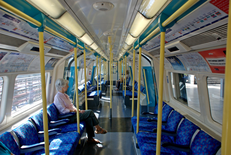
We got off our local train at Stratford, as we do sometimes, and changed onto the Picadilly underground line which is the starting point of the line at this end and, consequently, the train was virtually empty when we got on. I don't think that I have ever seen an underground train this empty.

It didn't stay that way for long and eventually took us to London Bridge Station which is where we wanted to get off. London Bridge Station is, rather obviously, near London Bridge and just south of the River Thames but you didn't know that did you? There's no doubt that you'd get lost if you were on your own so you'd better stay close.

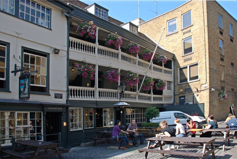
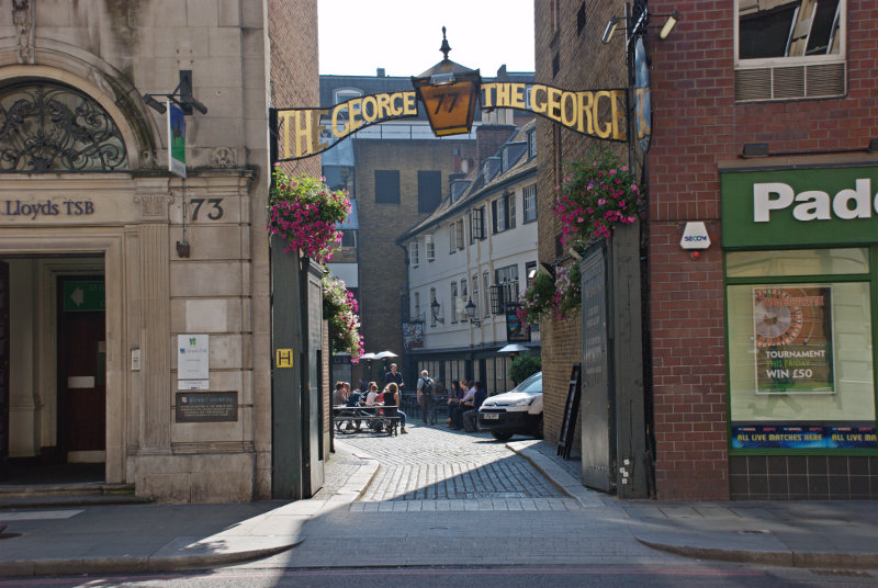
We left London Bridge underground station at the St. Thomas Street entrance and turned left to reach Borough High Street where we turned left again and, after a very short walk, we arrived at our first destination. This is the entrance, on Borough High Street, to the George pub courtyard.

Inside the courtyard we see the only remaining original galleried pub in London dating from the 1600s. There is another 'galleried pub' in St. Catherine's Dock near Tower Hill but that is a reconstruction and not a genuine original.

The timbers aren't very straight now are they? It is now only half the size it originally was as the Victorians demolished half of it to make way for new warehouses. Nice people!

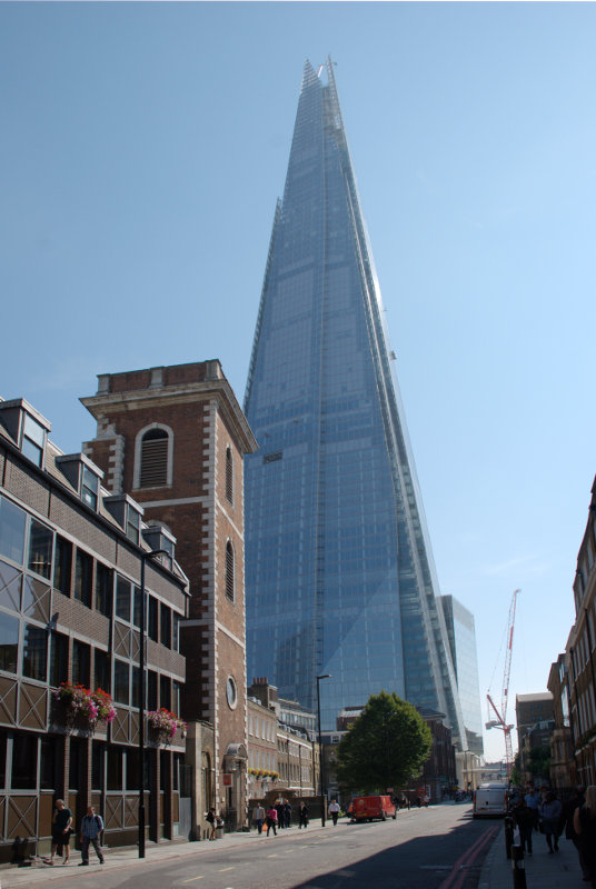
We went back to St. Thomas Street a little past the underground station where we saw this view.

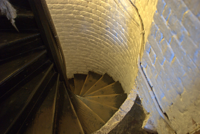
We were looking for a tower. No, no, no not that ghastly Shard thing at the back but the brick tower. Going through the doorway we see another small door over to the left which leads us up a small (very small) spiral stairway.

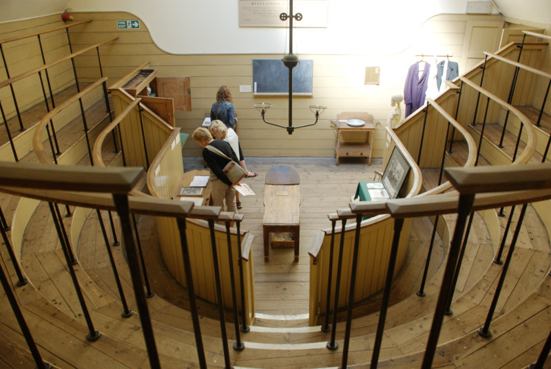
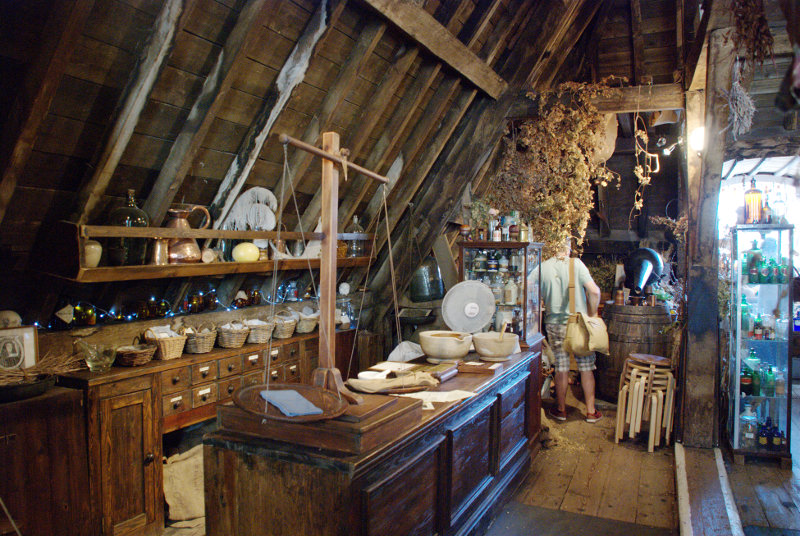
When we reach the top we are in the Old Operating Theatre and Herb Garret Museum. This was part of the old St. Thomas Hospital and is the oldest operating theatre in Europe. It is, oddly, found in the roof space of an English Baroque Church. It makes a little more sense when you realise that the wards of the old hospital were built around the church. The Operating Theatre would have been built in the first half of the 19th century when operations were still being carried out without anaesthetics.

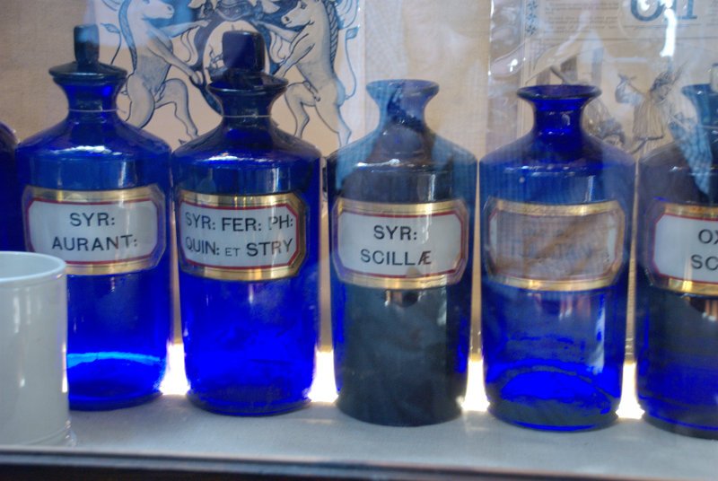
The rest of the roof space was used by the St Thomas's Apothecary to store and cure herbs which is all they had in lieu of drugs.


There were a lot of displays relating to medecine and surgery of old including some of the old surgical instruments.

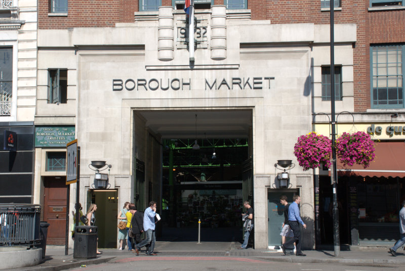
After having had a good look round we went back to Borough High Street and crossed the road to this archway.

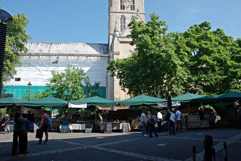
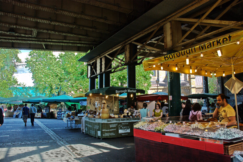
Borough Market and Southwark Cathedral are immediate neighbours. There was a small outside market when we were there and although it looks as though the stalls are up against the cathedral they are not on cathedral property.


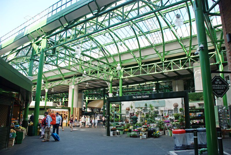
The covered part of the market is really quite spacious with lots of stalls some of which weren't open when we were there. Our only disappointment here was that it really was too early for lunch.

Traders in the 13th century started the market in Borough High Street although it was then closed by parliament in 1755. However a group of Southwark residents raised £6,000 to buy a patch of land known locally as The Triangle, once the churchyard of St Margaret's, and reopened the market. It has been going ever since and is renowned as a food market.

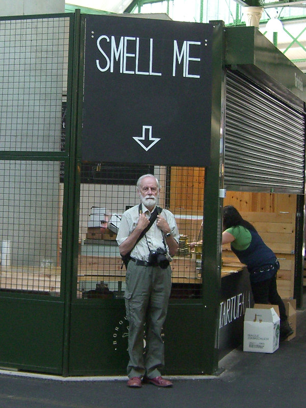
I should warn you that there are some funny people around.

I'm saying nothing.

We left Borough Market going past Southwark Cathedral and along Clink Street.

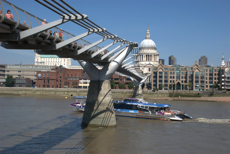
At the end of Clink Street we reached the Thames with the Golden Hinde nearby. Along the riverside past Southwark Bridge and the Millenium Bridge.

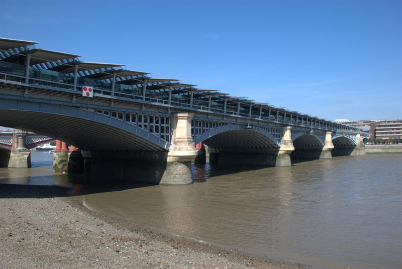
It wasn't long before we were in sight of the Blackfriars railway bridge. A few years ago it was decided that Blackfriars Station (the overground railway not the underground) needed an upgrade. The problem was that where could a new station be built in such a crowded area? The answer was, of course, that you build it across the river so that the station replaces the bridge and that is what happened.

You can probably see a small part of the road bridge through the nearest arch.

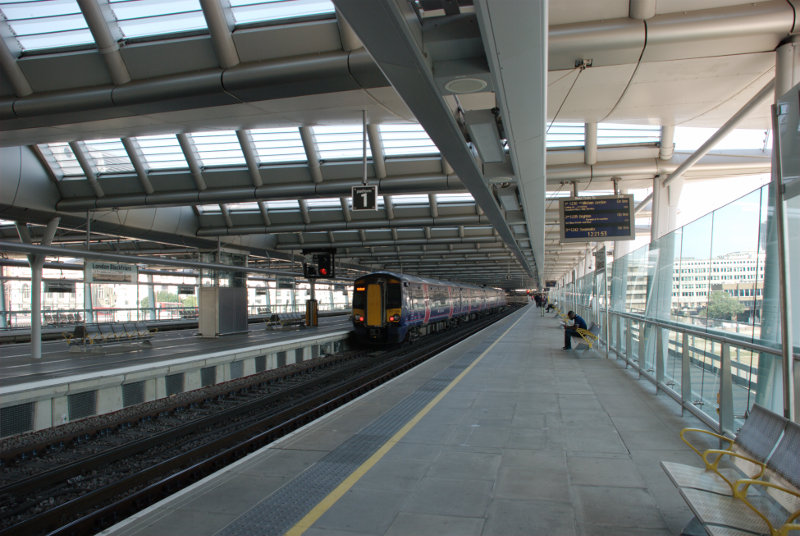
As one can use the normal overground railways in London with a travel card for travelling within the London Zones our travel cards let us through the barrier and into the station. We went up the stairs onto Platform 1.

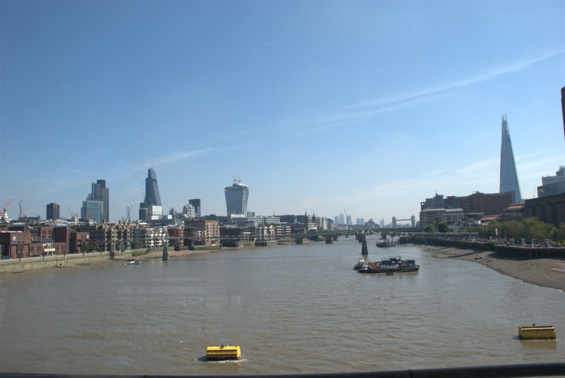
We are walking from south to north and you'll notice that the railway lines are to our left and on the right instead of the usual wall there is a glass screen. This is the view from Platform 1 looking east through that screen.

Just out of the left of the picture we could see the dome of St. Paul's together with the top part of the two towers. The nearest bridge downriver is the Millenium Bridge but, unfortunately, it does tend to merge into the background.

We went out at the north end of Platform 1 and down into the Underground where we caught a train to South Kensington.

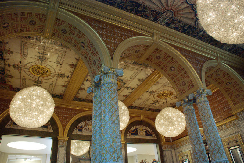
We went into the Victoria and Albert Museum just to have lunch. Amanda didn't enjoy hers as much as she did on the previous visit but mine was nice. Whilst we were sitting at the table I took this picture of the rather ornate Gamble Room in which we were having lunch.

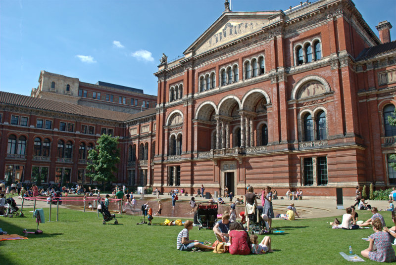
After lunch we took a short cut out via the courtyard which today seemed more like the local swimming pool except that the water is only ankle deep but the children were certainly enjoying it.

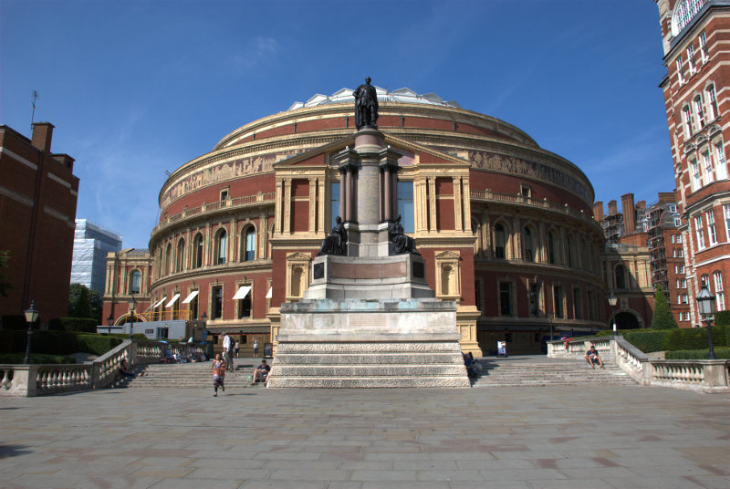
We left the museum and headed north along Exhibition Road then turned left into Prince Consort Road. It wasn't long before we caught site of our next locatioon.

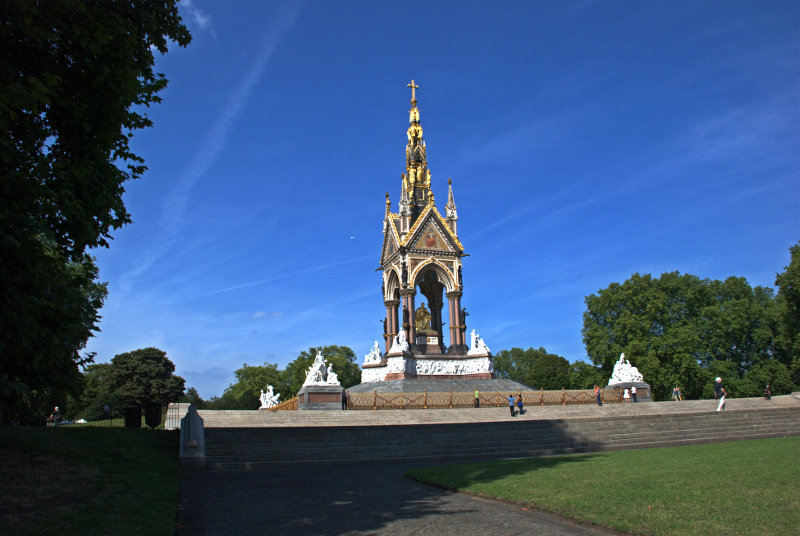
You may recognise it as the Albert Hall. Walking round one side of the building we came out opposite the Albert Memorial in Hyde Park/Kensington Gardens and I must say it was an astonishing site with all the gilding glowing in the sunlight.

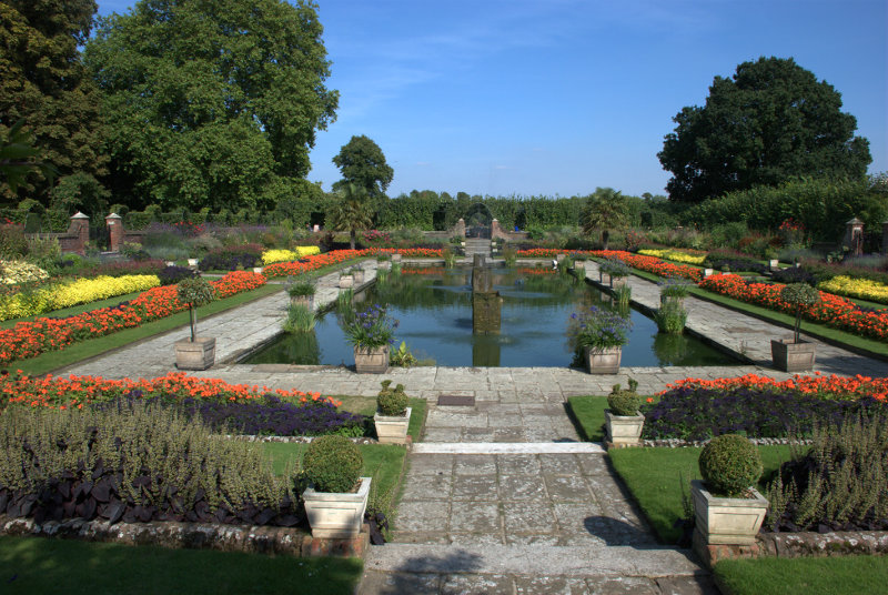
We walked across Kensington Gardens towards the Round Pond and Kensington Palace. We had no intention of going into the palace but we did have a look at this.

The Sunken Garden in Kensington Palace grounds. The grounds, including this garden, seem to be freely accessible.

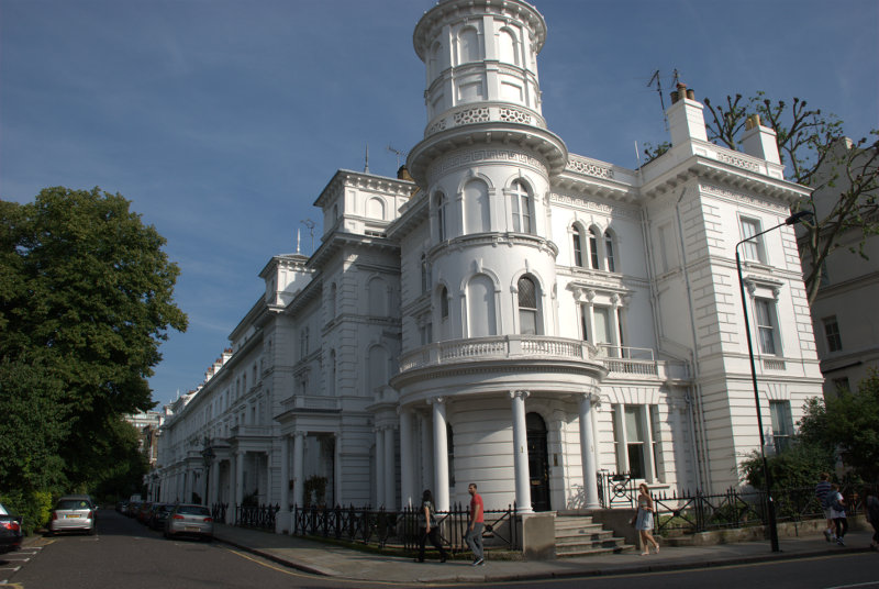
We were about ready now to head home so we aimed for Gloucester Road underground station, being the nearest, and we went via some of the backstreets.

Kensington is the sort of place where one sees roads lined with large, grand and very expensive properties.

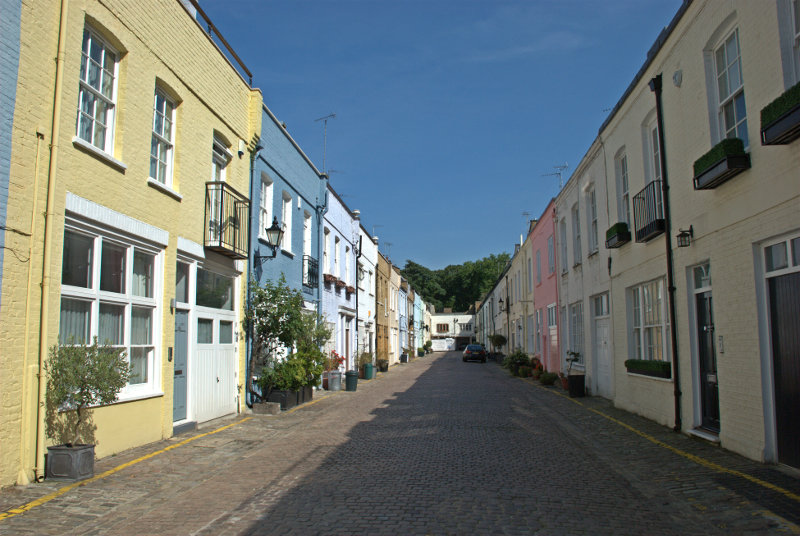
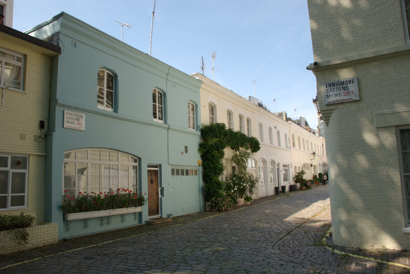
This means that, as they were built in Victorian times, there would also be some mews nearby where the coach and horse were kept together with the coachman and his family.

So it proved to be.

That was a few of the mews we found and we were now worn out. I hope you enjoyed your trip – we certainly did and now it's time once again to go home.
 

Lynn – Day 2

Lynn – Day 2

Another hot, sunny day dawned although I wasn't awake to see that part. We went down to breakfast and very nice it was. We both had a cooked breakfast followed by toast and marmalade, of course, then it was time for some serious tourism.

Wherever we went in Lynn we went via The Walks past the Red Mount Chapel. It wasn't because we liked it so much but it was the most convenient route into the old part of the town.

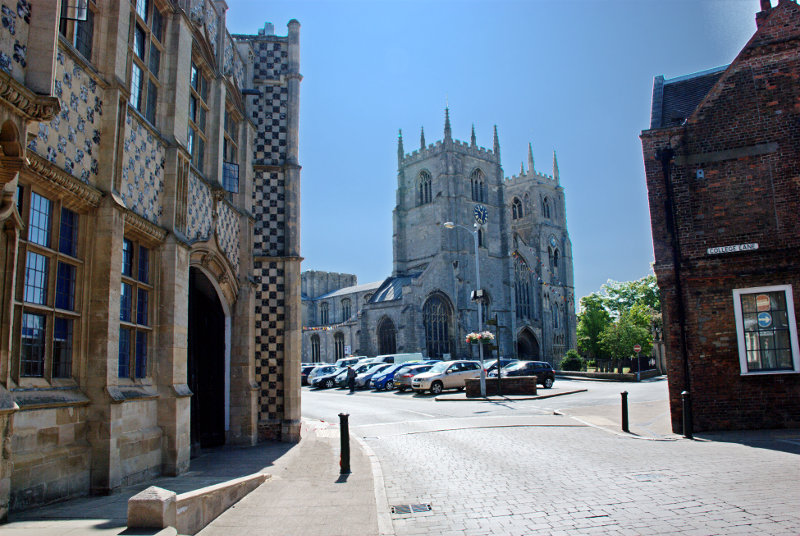
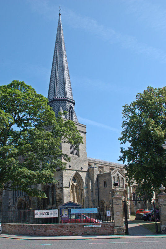
We were headed for St. Margaret's Church, or the Minster as it is known, and Saturday Market Place. King's Lynn was originally two towns so it has two churches, two guildhalls and two market places. We will be seeing the other market place later.

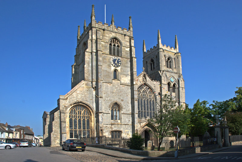
For a parish church the minster is big.


The space on the left where there are some parked cars is Saturday Market Place which is used as a car park when there isn't a market being held.

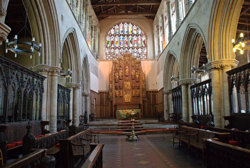
Parish churches don't normally have two towers and especially towers that large and you can probably see in the top picture that there is a sizeable tower, although not as high, further back over the crossing.

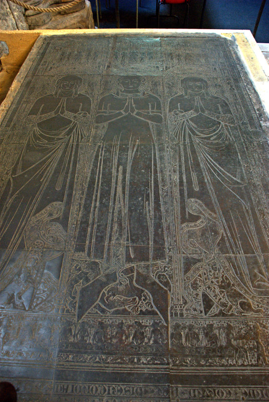
This church also contains the largest monumental brasses in the country dating from the 14th century and the figures depicted must be near life-size. This is one of the pair.

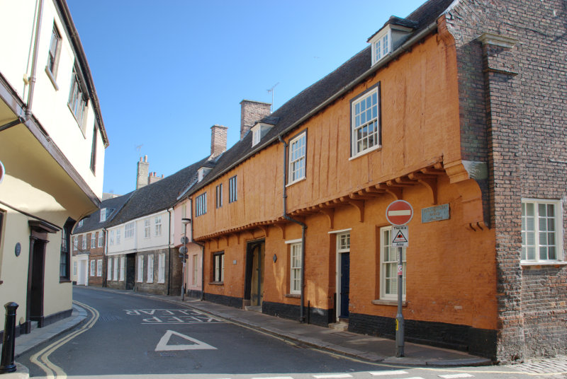
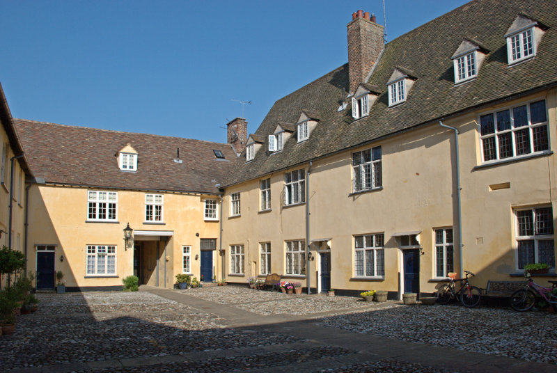
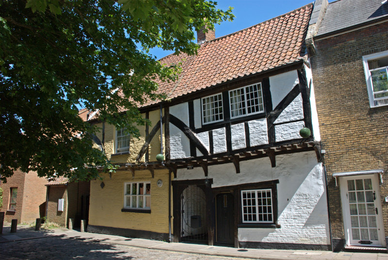
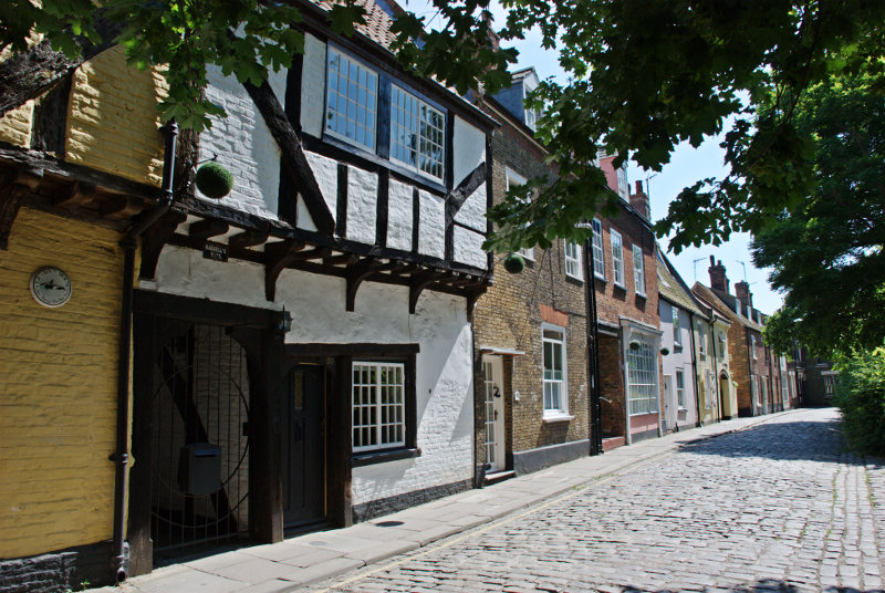
Just south of the minster is Nelson Street and Hampton Court. This is not Hampton Court Palace in London but it is pretty spectacular all the same. The whole building was formed over a period of 300 years.

The South Wing was constructed first, consisting mainly of a 14th-century merchant's hall house and is thus the earliest surviving section.

The West Wing was constructed towards the end of the 15th century, probably as a warehouse which was later converted into a house. The East Wing was also constructed at the end of the 15th century.

The North Wing completed the courtyard a century later.

In the picture above the doorway into this courtyard is visible in the far wall.

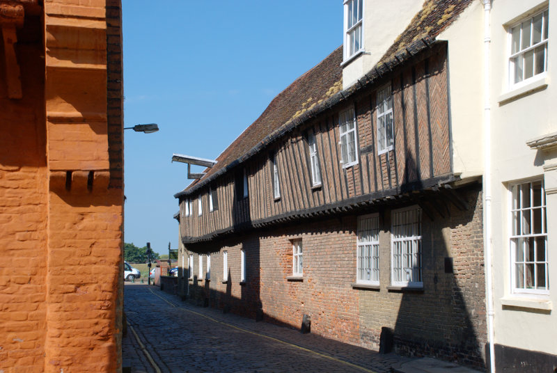
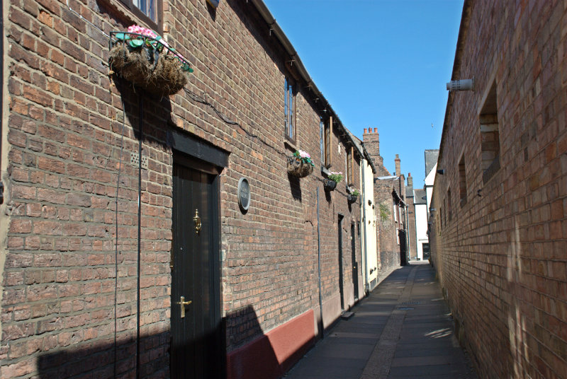
Next to the north wall of Hampton Court is St. Margaret's Lane with the 15th century Hanse House, a Hanseatic Warehouse, along one side. The Hanseatic League was a trading confederation which existed from the 13th to the 17th centuries.

Running eastward from the junction of St. Margaret's Lane and Nelson Street is Priory Lane.

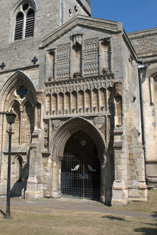
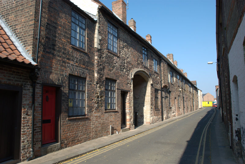
St. Margaret's Church, the Minster, was originally part of a medieval Benedictine Priory until the Reformation when the priory was disbanded by Henry VIII but the church was saved as a parish church. Priory Lane includes buildings in the medieval priory range. Note the rather imposing archway.

It was rather nice walking around this area with its old narrow streets because it offered plenty of cool shade.

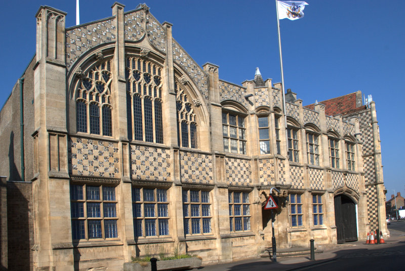
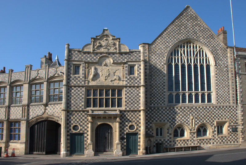
We walked back past the church to the north side of Tuesday Market where we found the town hall complex which included the 15th century Trinity Guildhall.

The guildhall includes the facade with the doorway in the centre of the picture and the gabled building to its right. The part on the left is the town hall shown below.

The town hall is an extension built in a similar style in 1895. You can see the Guildhall jutting out at the far end.

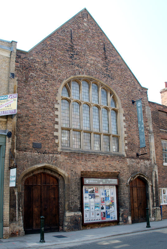
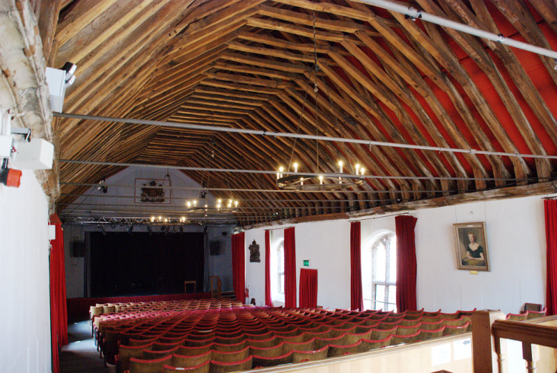
We were now heading further north along Queen Street and then King Street to see St. George's Guildhall. The largest surviving 15th century guildhall in England.


The guildhall ha since been converted for use as a theatre and the second picture shows the structure of the original roof.

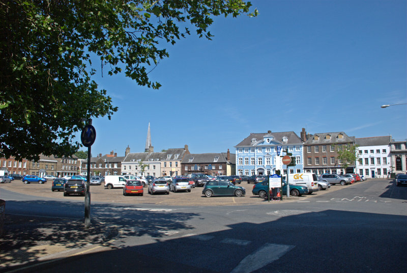
We now travelled the short distance to the larger Tuesday Market Place. As is the case with Saturday Market Place when a market is not beig held this market place is also used as a car park.

The prominent blue and white building is the Dukes Head Hotel and the spire poking up above the rooves to the left is St. Nicholas' Chapel. I think that I can say, without exaggeration, that this is the largest chapel that I have ever seen.

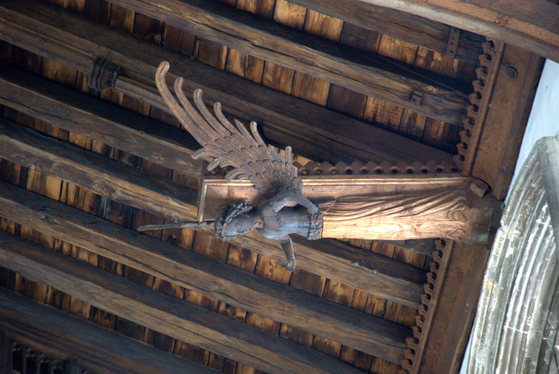
Apparently it can't be called a church because it isn't a parish church and that honour goes to St. Margarets so it must be a chapel. Built in the 15th century it has a very fne porch and some of the best carved wooden angels in the roof that we have seen.


To the south of the chapel by a side entrance to the churchyard was the Exorcist's House. The position of Exorcist in past enturies was one which a Catholic priest could hold as he progressed up the church career ladder. It has a side entrance that leads directly into the churchyard and has the reputation of being haunted.

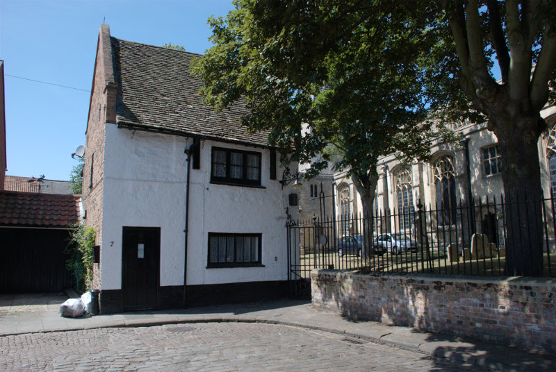
Behind the chapel is Pilot Street where we spotted these nice timber-framed buildings.


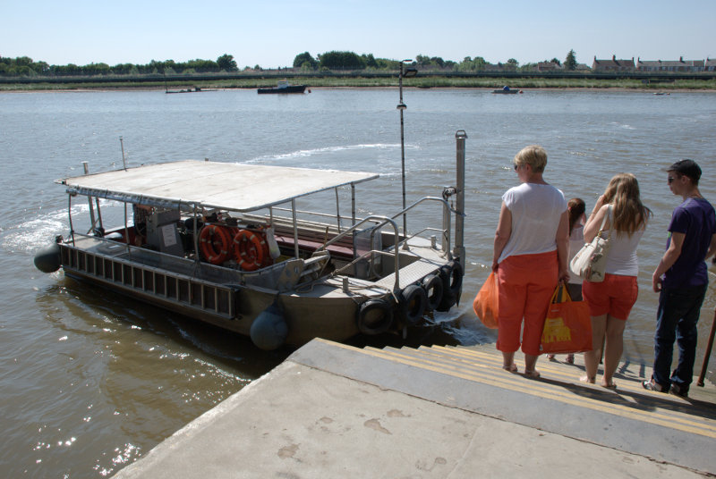
We now headed for the river down Ferry Lane. You won't be able to guess where we're going.


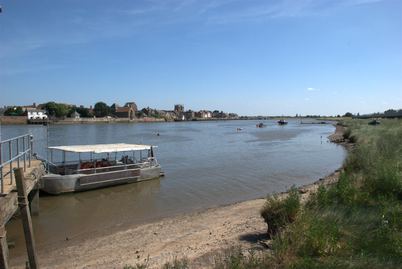
It was a strange looking little boat but eminently suited for its purpose.

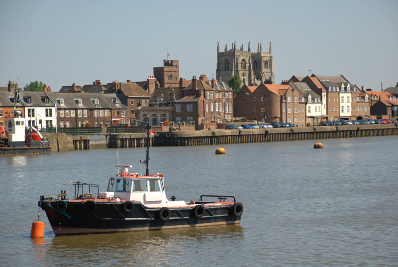
Here we are on the other side of the river in West Lynn looking back at the King's Lynn waterside.

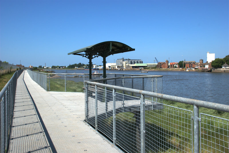
We walked along the boardwalk which runs along the bank and had some good views of King's Lynn.


Somewhere back there is where we got off the ferry and we have to walk back again. We had worn our legs down to short stumps by now so that is what we did. We went back to the ferry and went 'home'.

We're off somewhere different tomorrow.


The Republic of Texas

The Republic of Texas

Just in case you wondered, the subject heading is relevant and we'll get to it later.

Days where the sun has been out for most of the day have been few and far between this year and, we are told, this summer has been the wettest for 100 years so we couldn't afford to miss the opportunity of a sunny day. We woke on Friday morning to a clear sky and made preparations to go to London. Having arrived at our local railway station a good ten minutes before the train was due to leave we thought that we had plenty of time until, that is, we saw the queue for the ticket office. We have never seen such a long queue here. Normally we wouldn't expect to see more than 3 people queuing at most and very often there is no one waiting at all. We assumed that it must be people going to the Paralympics as Stratford is the last stop before Liverpool Street Station. Our train was due to depart at 09:23 and we were worriedly watching the clock as we moved all too slowly towards the ticket office which we reached about 09:23,  although our train hadn't arrived yet, and bought our tickets. The train came in about two minutes late – phew!

The train stopped at Stratford and the Olympic Park didn't seem to be very busy at this time of day and we continued to Liverpool Street Station arriving about 10:20. On the western side of Liverpool Street Station there is a row of doorways each of which has a bus stop by it and one of those buses is the number 11 which we were going to catch.

The No. 11 is quite a good sightseeing route so we went to the upper deck and found a seat at the front. The bus leaves Liverpool Street Station along Sun Street, crosses London Wall into Old Broad Street and thence along Threadneedle Street to Bank. From there we go down Victoria Street, fork right into Cannon Street and eventually pass this:

Do I need to tell you where we are? I don't think so.

Along Ludgate Hill, Fleet Street and past the Royal Courts of Justice:

Along Strand to Aldwych where we got off. The bus goes on to Fulham Broadway via Trafalgar Square and Westminster which would be the last of the sightseeing route. Who needs a tour bus?

We now walked north up Kingsway, turned right into Portugal Street then eventually left into Portsmouth Street which runs up towards Lincolns Inn Fields. The building in Portsmouth Street that we came to see was this:

The Old Curiosity Shop with its jettied upper storey and wooden beams dates from the 16th century and is probably the oldest shop in central London. It has been suggested that this was the inspiration for Dickens' novel but there is no evidence to support this idea. Made using the wood from old ships the building miraculously survived the the Great Fire of 1666 and the bombs of the Second World War.

From there we walked through the side streets and made our way towards Trafalgar Square passing through Covent Garden Market on the way.

There were two noticeable differences compared with when I was here last. There are Olympic flags suspended under the roof (no surprises there) and there seemed to be few people. When I was last here it was positively seething.

We eventually entered Trafalgar Square at a point right next to St. Martin-in-the Fields. As it was now 11:00 we decided to go into the crypt cafe for some coffee. There are also toilets down there and there is nothing to stop you walking in off the street and using them like public toilets. However, as we discovered, there is a prominent notice in the toilets which explains that it costs £32,000 annually to maintain them and although they have no objection to you using them in that way they do hope that you will either buy something in the cafe or shop or at least leave a donation in their donations box. Pretty generous I thought.

We left Trafalgar Square via Pall Mall and part way along Pall Mall we had a look in the Royal Opera Arcade. Just ignore the strange woman looking in the window.

Where Pall Mall turns into St. James's Street we saw the main gate of St. James's Palace which is the gatehouse from the palace of Henry VIII and is, of course, Tudor.

We turned up St. James's Street and on the corner of St. James's Street and Pall Mall we saw this old shop.

Berry Bros. & Rudd is one of Britain's oldest wine and spirit merchants and in 1698, the building dates from that time, opened its doors for the first time at 3 St. James's Street, London and it still  trades from the same premises.

Note the alleyway on the left-hand side. That is Pickering Place and at the far end is a small very attractive courtyard. This is the view down the passageway with the courtyard showing at the far end. The timber construction of Berry's old shop can be seen in the wall.

Before we go into the courtyard can you see that little metal plaque on the wall? Well this is what it says:

It's amazing what one can find in London. And so we go into the courtyard.

Having left the courtyard, and the Republic of Texas, we went a little further along St. James's Street to Blue Ball Yard on the opposite side of the street.

Those buildings, apparently, are stables built in 1742 which have now been converted into living accommodation. I imagine that originally the stables would have been at ground level and accommodation for the staff above.

Further up St. James's Street we came across a modern development called the Economist Plaza. It wasn't really of interest to us but we wandered across it and went down some steps on the other side which were made of some very obviously fossiliferous polished limestone which was absolutely stuffed with fossils.

Having emerged into Bury Street we walked up into Jermyn Street where a little further along we first came to this statue of Beau Brummel.

One of the reasons this statue is here is that Jermyn Street is stuffed with tailors shops and, further along still, we came to this shop.

It is, I have to admit, a rather boring shop but they make and supply my shirts. I thought you might like to know that. :cool: Beau Brummel eat your heart out.

We then went up into Piccadilly and shortly after came to Hatchards Bookshop.

It is known world-wide among those who like books and bookshops and the other reason I mention it is because Amanda's maiden name was Hatchard. You may notice that I'm standing in the road in order to take the photograph and Piccadilly is a very busy road but I managed to take this one picture just before I was run over by a bus.

A few yards along is the Fortnum and Mason department store and opposite is Burlington Arcade. If you have more money than you know what to do with then these are good places to shop.

We walked further west along Piccadilly until we reached Albemarle Street and walked north up there until we reached the Royal Institution.

The Royal Institution is an independent charity dedicated to connecting people with the world of science and this building houses the Faraday Museum. They are most famous for their Christmas Lectures which were started by Michael Faraday in 1825.

Michael Faraday (1791 – 1867) was an English scientist who contributed to the fields of electromagnetism and electrochemistry. His main discoveries include that of electromagnetic induction, diamagnetism and electrolysis. The Faraday Museum details some of his experiments.

The Royal Institution also has a nice little cafe, where we had lunch, and toilets and if you are lucky enough to visit on a day when there are no lectures being held, as we were, then you may visit the lecture theatre where Faraday gave his first Christmas Lecture.

Impressive!

We moved on further west towards Shepherd Market passing through Berkeley Square on the way but didn't hear any nightingales. :lol: Shepherd Market is a small village-like area with a maze of narrow streets and lanes. Running parallel to White Horse Street is Half Moon Street where the fictional Bertie Wooster (the perfect upper-class Mayfair resident and his faithful valet Jeeves of P.G. Wodehouse's novels) lived.

In the 1920s Shepherd Market was considered to be London's most fashionable and opulent district by the city's bourgeois social elite. Shepherd Market remains a peculiar and curious collection of charming alleyways, eclectic cuisine, 18th century pubs and discreet residences.

Leaving Shepherd market and moving further west we arrive at Hyde Park Corner with the Wellington Arch.

We decide that we will now catch a No. 9 bus to the Royal Albert Hall as our last port of call which we do.

You may notice that the cloud has increased somewhat. It was forecast to increase by about 6:00 PM but it has arrived a bit earlier so the sun is fading fast and so are we. We decide to call it a day and head back to the station first on the No. 9 as far as Aldwych and then the number 23 to Liverpool Street.

We go back through Hyde Park Corner, Piccadilly, St. James's Palace and Pall Mall, Trafalgar Square, Aldwych, Fleet Street and past the Old Exchange thence to Liverpool Street Station and home.
An enjoyable day.
 

The Prospect of Whitby, Captain Kidd and the Town of Ramsgate

The Prospect of Whitby, Captain Kidd and the Town of Ramsgate

Another Thursday – another trip to Wapping.

Let me explain to our various overseas visitors that Wapping is not pronounced the way it is spelled but instead it's pronounced 'Wopping'. Now that we've got that sorted I'll remind you that at the end of the last report I said:

"Perhaps we'll get better weather next time. We want to do that same walk again to see some things that we missed but I'm not going to tell you what they were and to, hopefully, get some better photographs."

Well we did get better weather, sun all day and temperatures around 70-72F, and we did that same walk again (it was in Wapping) – but with added ingredients. The name comes from the Saxon meaning "the place of Waeppa's people"

So what connection does the title of this post have with Wapping? They are all pubs and they are all in Wapping High Street and they all back on to the River Thames.

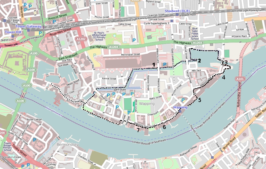
Lets start at the beginning. I'm going to use the same map as last time with our new route added.

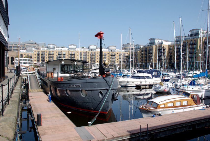
Last time we went as far as '2' which we also did this time but we went on to complete a circular route. We started, as last time, from St. Catherine's Dock.

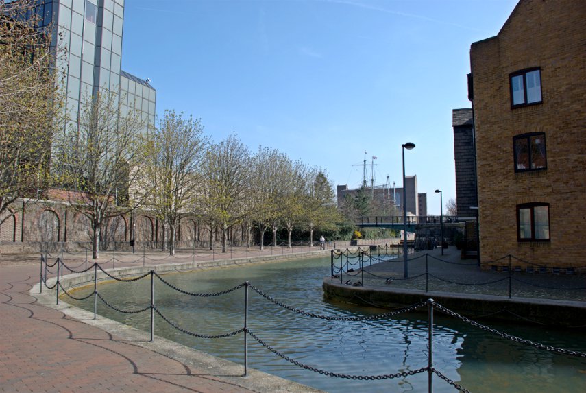
We walked along the same canal – you can see the masts of those two replica sailing ships (No. 1 on the map) sticking up into the sky in the distance.

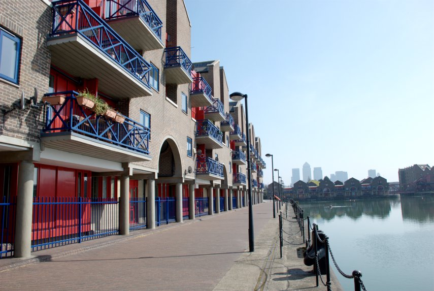
Then onwards to Shadwell Basin (No. 2 on the map). This time we walked round the north side of the basin past the new housing towards the eastern end of the basin with the tall buildings of Canary Wharf visible in the distance.

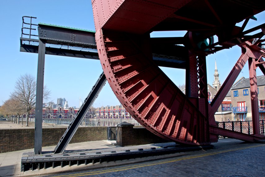
At the far end is one of the old lifting bridges and this next picture is taken from the bridge (location 3)  looking back across Shadwell Basin.

We then walked eastward to the edge of the Thames and along the Thames Path for a short way

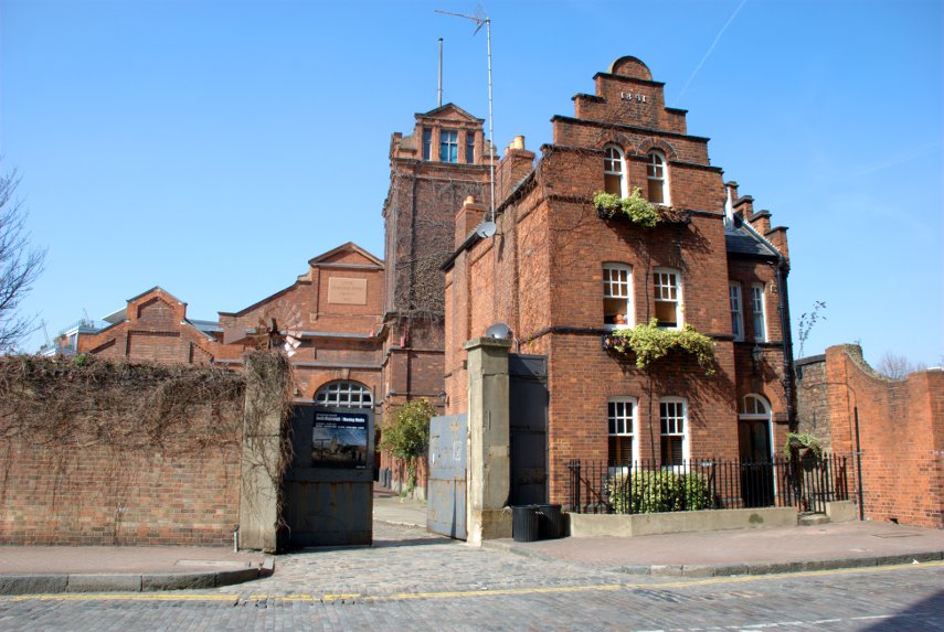
and came out opposite this.

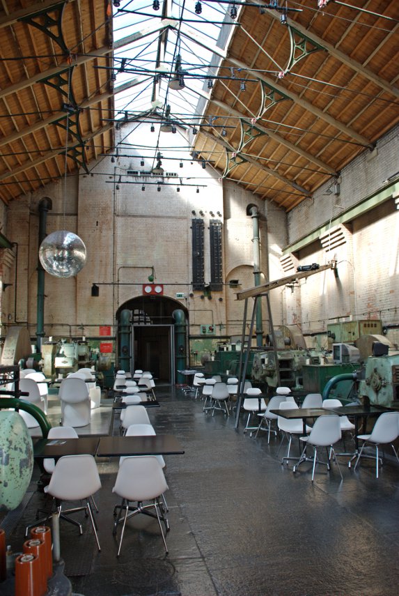
So what is it?  It is the Wapping Hydraulic Power Station, built in 1890, and was originally operated  using steam and later converted to use electricity. It was used to power machinery across London, using hydraulic power including bridges, lifts and cranes etc. The Tower Subway was used to transfer the power, and steam, to districts south of the river.

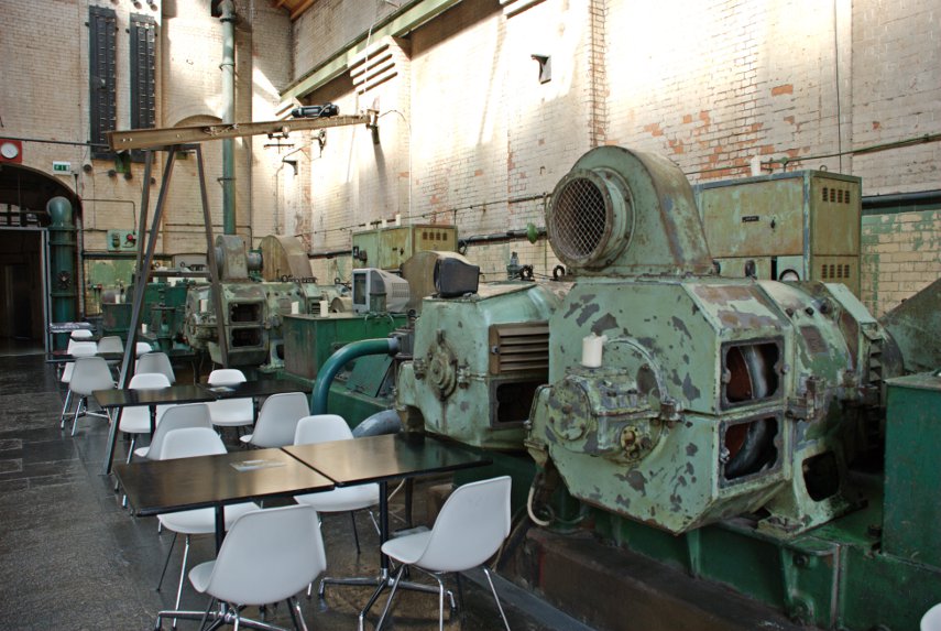
It was used as a model for power stations in Argentina, Australia, New York and Europe. When electricity became cheaper it lost popularity and eventually closed. It is now used as a cafe with the tables and chairs dotted around among the old machinery which is a novelty. They serve cups of tea and coffee together with lunch etc.

Pass the oil please.

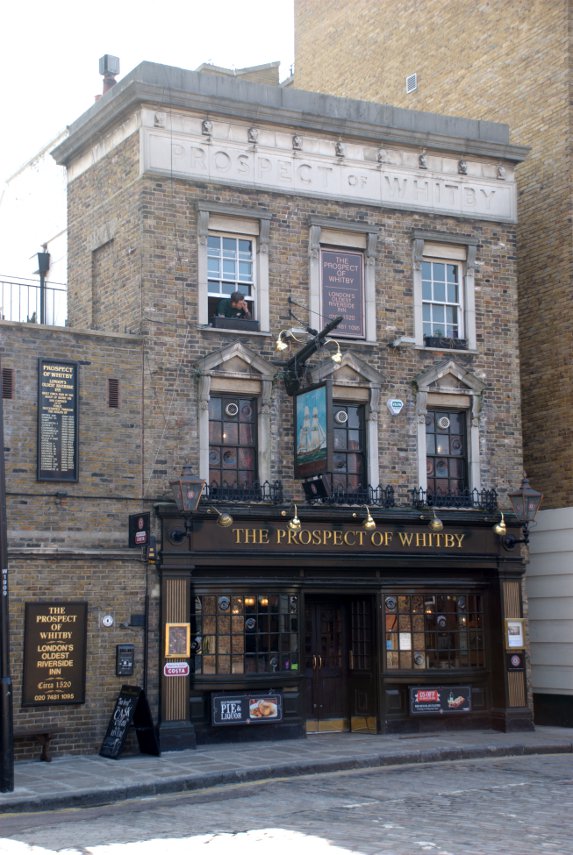
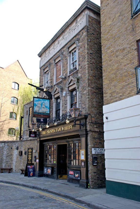
Opposite the old power station is the first of our pubs – The Prospect of Whitby. No. 4 on the map.

The Prospect of Whitby lays claim to being one of the oldest riverside taverns in London and dates from around 1520 during the reign of Henry VIII. At one time it was one of the most notorious pubs in London being a meeting place for sailors, smugglers, cut-throats and footpads but now it seems to be a pretty nice pub.

It was formerly known as the Devil's Tavern, on account of its dubious reputation and before that it was officially called "The Pelican". The stone steps, alongside the pub and going down to the foreshore, are the "Pelican Steps"

All that now remains from the building's earliest period is the 400 year old stone floor.

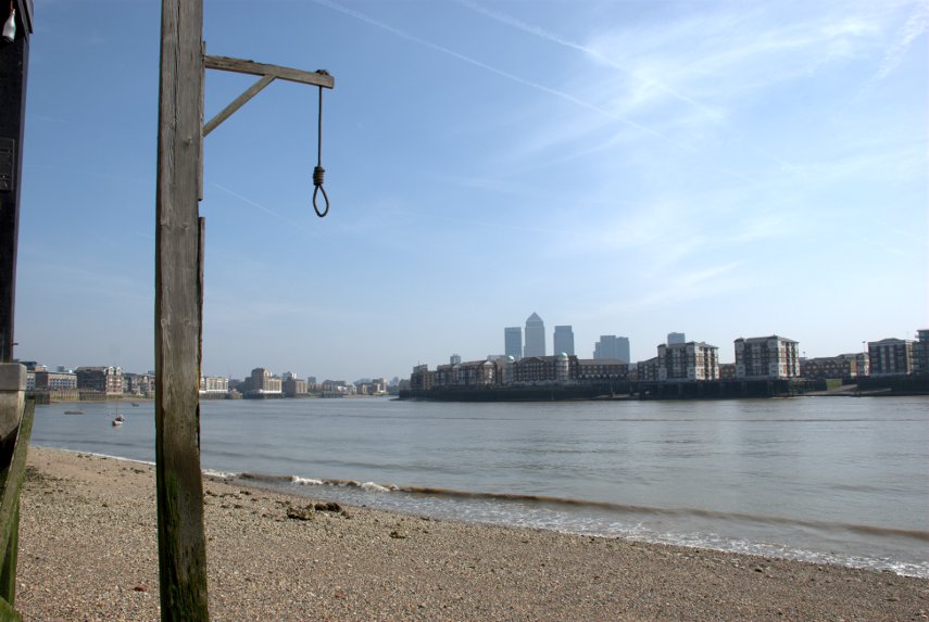
In the 17th century, it became the hostelry of choice of Judge Jeffreys, known as "The Hanging Judge, who lived nearby and a noose hangs by a window, commemorating his custom. According to legend, criminals would be tied up to the posts at low tide and left there to drown when the tide came in.

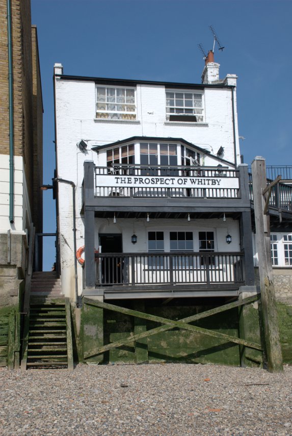
You'll be wanting to see the noose then? Taking our lives in our hands we went down Pelican Steps on the the Thames foreshore to see the riverside view of the pub. Luckily it was low tide otherwise we may have got our feet wet. Possibly even our eyebrows.

You can see Pelican Steps and the noose is hanging from that tall post on the right. There is a better picture of the noose below.

Following a fire in the early 19th century, the tavern was rebuilt and renamed "The Prospect of Whitby", after a Tyne collier, a type of boat, that used to berth next to the pub.

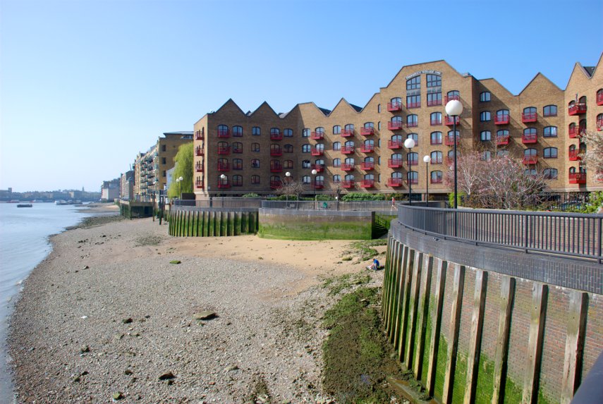
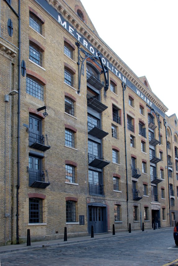
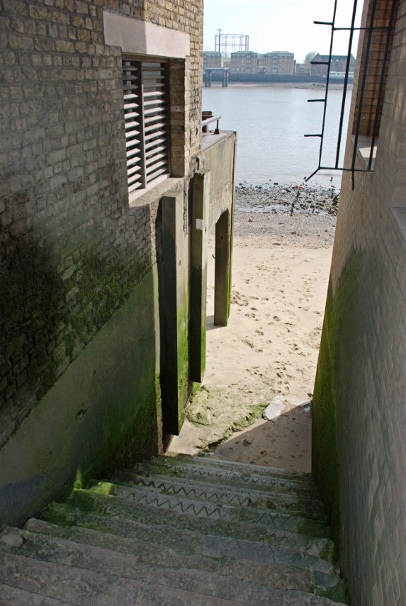
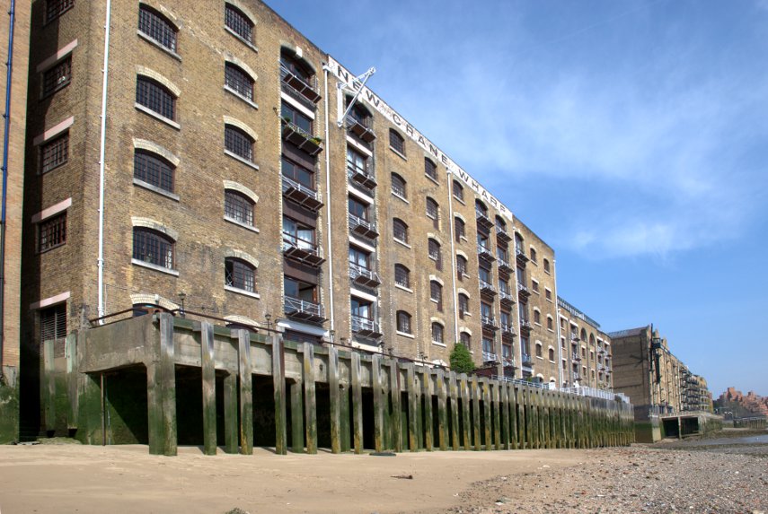
Walking westward along Wapping Wall we went past numerous old wharves now converted to luxury appartments such as Metropolitan Wharf shown here and, after going down New Crane Steps, New Crane Wharf shown below. No. 5 on the map.

Notice that nice sandy beach along New Crane Wharf.

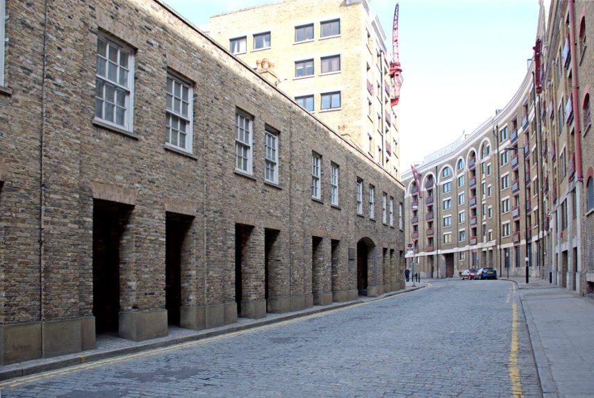
Having walked the length of Wapping Wall we joined Wapping High Street where the old dock buildings have all been renovated and converted to housing and it's been done very nicely. This is a view along Wapping High Street.

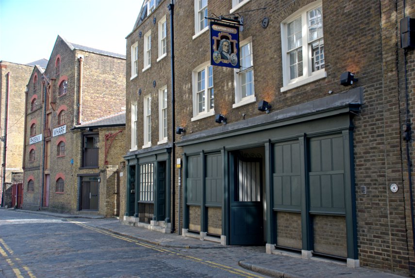
Further along Wapping High Street we reach our second pub – the Captain Kidd. No. 6 on the map.

Somewhere around here in 1701 the pirate, Captain Kidd, was executed by hanging on Execution Dock hence the name of the pub. The exact location of Execution Dock appears to be unknown except that it was near one of the local docks or wharves. His remains were gibbeted by the river Thames at Tilbury for more than twenty years.

Execution Dock was used for more than 400 years to execute pirates, smugglers and mutineers that had been sentenced to death by Admiralty courts. The "dock", which consisted of a scaffold for hanging, was located near the shoreline of the River Thames at Wapping. Its last executions were in 1830.

A short rope was often used for exceptionally nasty pirates which meant that, when they were dropped from the gallows, the rope didn't break their neck and they were then slowly asphyxiated. Customarily, these corpses were left hanging on the nooses until at least three tides had washed over their heads.

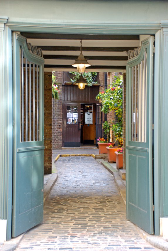
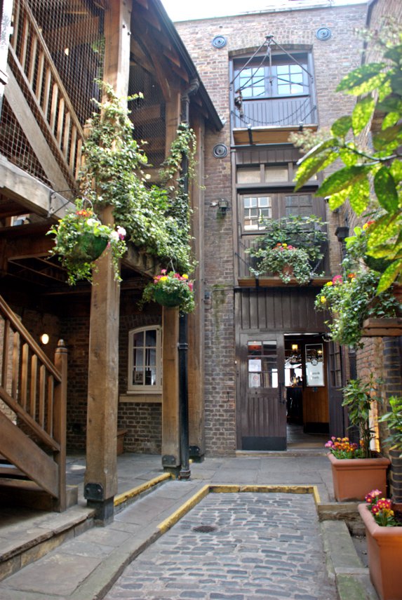
The Captain Kidd pub was established as a pub only in 1980 but the building itself is 18th century. The entrance visible on the street leads into a small, rather attractive courtyard which then gives access to the pub proper.

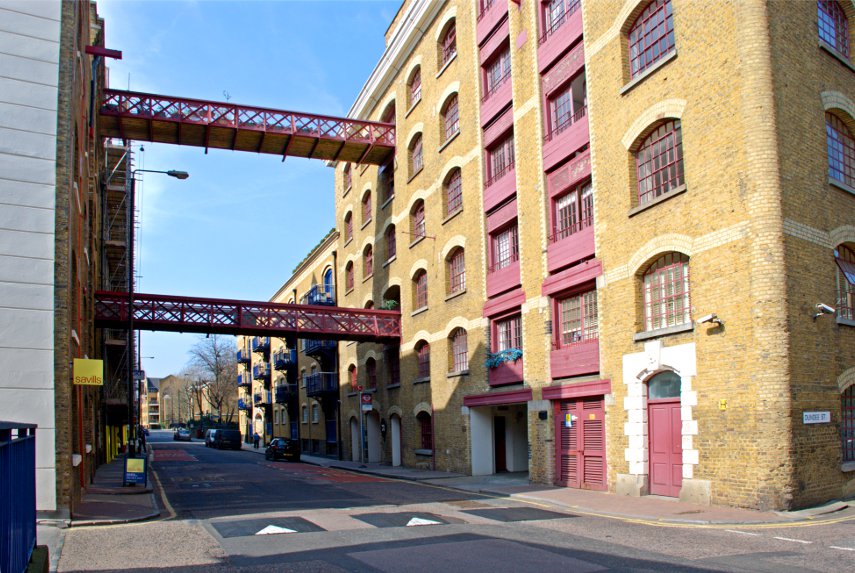
A short way further along Wapping High Street we saw yet another interesting warehouse conversion on the corner of Dundee Street.

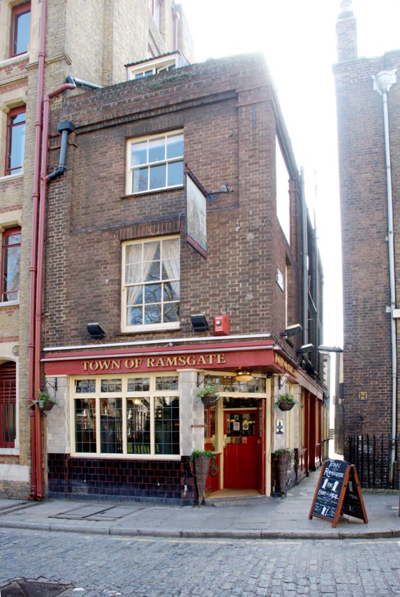
A little further beyond that we encountered our third pub – the Town of Ramsgate with Wapping Old Stairs next to it. No. 7 on the map.

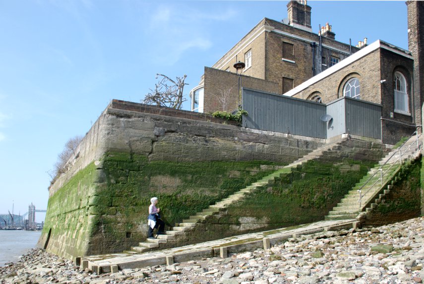
This shows Wapping Old Stairs. Amanda is on a set of stairs that just stop in front of a wall – very useful. The stairs to the right of those give access to and from the foreshore. The Town of Ramsgate pub is just out of the right edge of the picture and you may have noticed part of Tower Bridge showing in the distance.

The Town of Ramsgate was originally known as the Red Cow and then the Prince of Denmark with the origins of the pub claiming to go back as far as 1543.

We went back up to Wapping High Street and, after a short distance, turned onto the Thames Path along the edge of the river.

We eventually reached Readmead Lane which was where we turned off when we started this circuit and so have come full circle. We can recommend this area for some interesting exploring especially if you can manage a day when low tide is around the middle of the day which will enable you to go down some of the old steps onto the river foreshore.

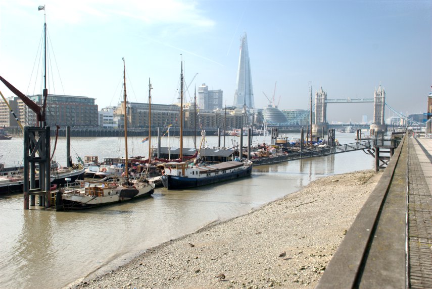
We headed back to Tower Bridge and crossed to the south side of the river, along Shad Thames to Pea Pod for a late (2:15 PM) lunch. We have been here before and on our last visit had Old Guy USA (Jerry) with us.

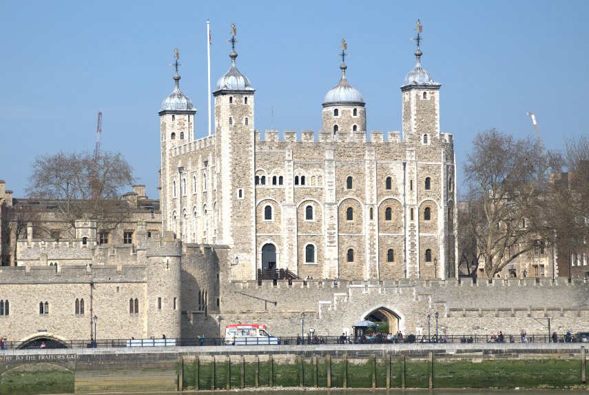
After lunch we walked west along the Thames until we were opposite the Tower of London where I took this photograph of the White Tower. The last time I tried it was covered in scaffolding.

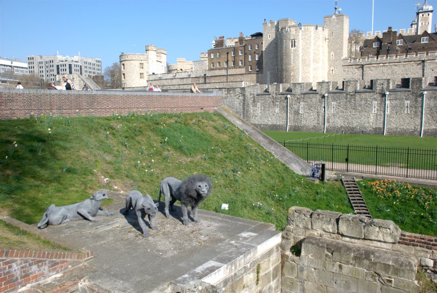
We went back across Tower Bridge, now heading for Tower Hill Station, and went past these in the Tower of London grounds.

They look remarkably life-like but they are made from multiple layers of wire netting moulded to shape.

So our legs are tired and we are tired – time to go home methinks. We covered an awful lot of interesting history today and we found that when we got home we were covered in it and had to rinse some of it off. :lol:
 

A Mere diversion – Day 3

A Mere diversion – Day 3

Sunday, 2nd October 2011

Today we are going to foreign climes – yes, we are leaving Wiltshire and venturing into Somerset. Today is Frome day! Frome (pronounced 'froom') is a small market town about 10 miles from Mere, to the north, and about the same distance east of Wells.

Needless to say it didn't take us long to get there and we quickly found a car park. This car park is a short stay (max. 2 hours) and is Pay & Display. The good news is that the restrictions and charges don't apply on Sundays so we parked free and the car stayed there for our whole stay.

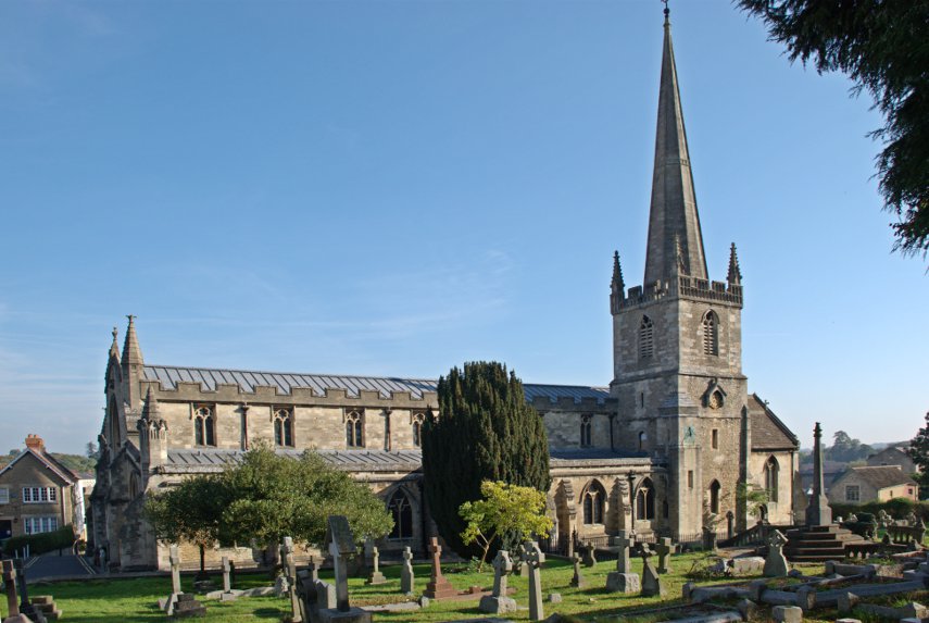
As luck would have it the car park chanced to be very near the Church of St. John the Baptist which would be difficult to miss.

The original Saxon church was built in 685 AD but was replaced by the current building which was constructed between the late 1100s and the early 1400s and was further restored around 1860.

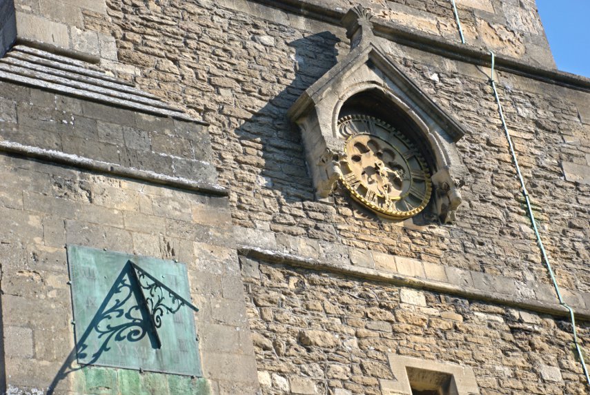
An interesting external feature is the unusual clock face together with a nearby sundial.

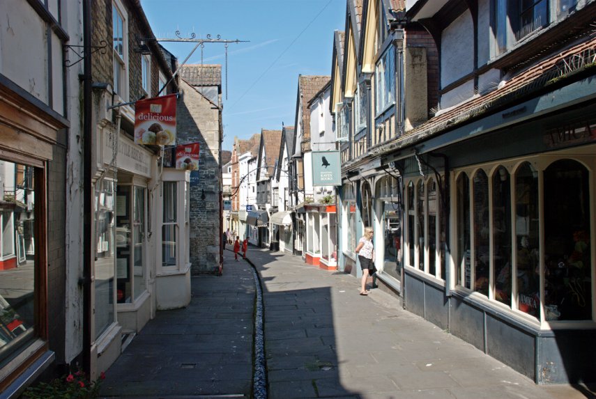
There is a spring in the churchyard which is fed into a channel in nearby Cheap Street, one of Frome's medieval streets, which runs the length of the street before disappearing underground. There is a good flow of water in this channel so be careful where you put your feet.

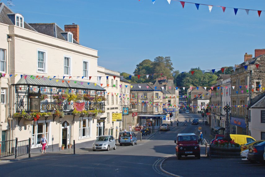
Cheap Street runs from near the church down to meet the Market Place near the Market Cross, also known as Boyle Cross, in the shadow on the right.

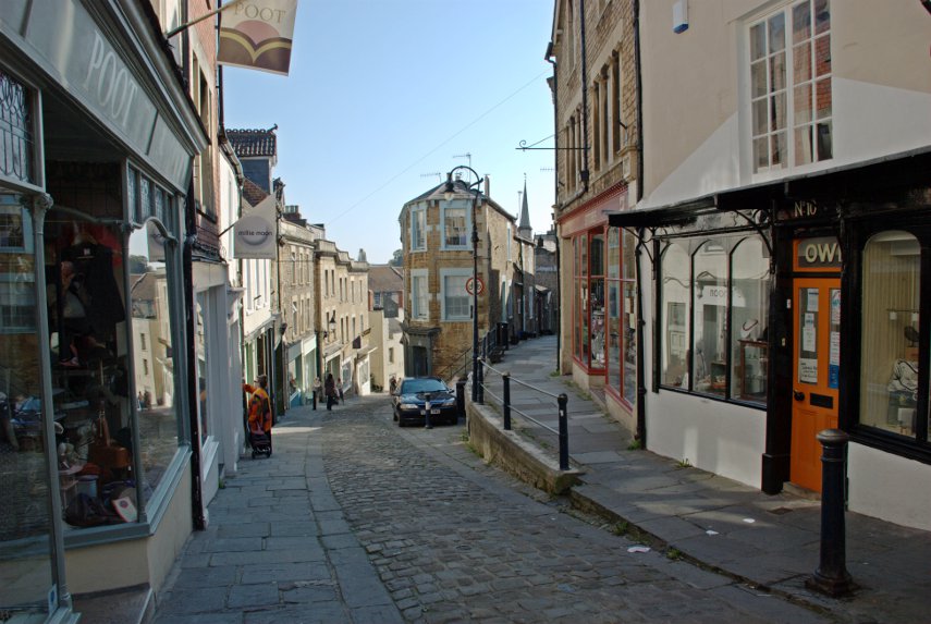
Leading uphill from the Market Place is Stoney Street which leads into Catherine Hill. This view is near the top of Catherine Hill looking down towards Stoney Street.

This footpath, Paul Street, curving off to the right in the picture above, cuts across to Palmer Street.

Near the top of Catherine Hill is an attractive little side lane called Sheppards Barton accessed via some steps.

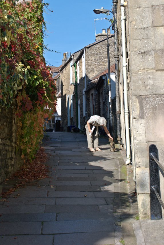
Part way along Paul Street Amanda stopped to discuss the weather with one of the locals.

We wandered back towards our car going back up Cheap Street and at the top, on the corner, was a small cafe called La Strada where we had a light lunch.

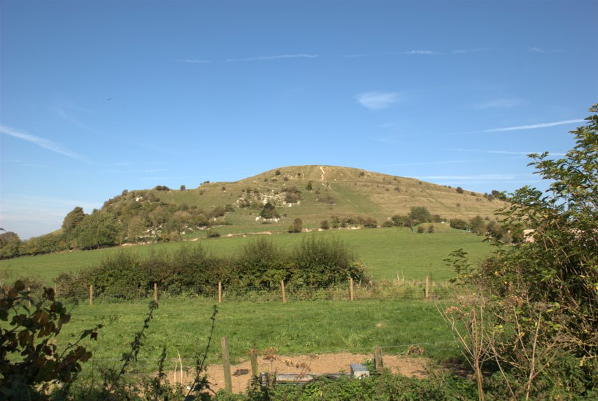
After lunch we drove out of Frome, south east, towards Warminster and just outside Warminster we stopped near Cley Hill.

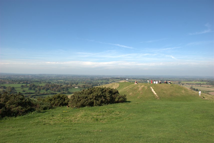
Hmm, looks a bit lumpy. "Surely", I hear you say, "you're not silly enough to climb another hill?" but, unfortunately, yes, we are silly enough. Besides there's a Triangulation Point up there somewhere and Amanda collects them – remember? The climb wasn't as bad as it looked and it didn't take long before the summit was in sight.

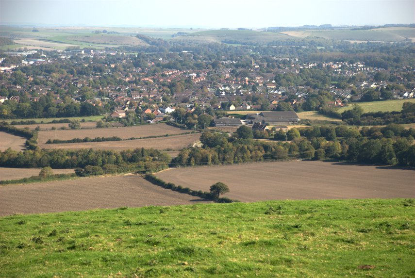
And that's Warminster down there.

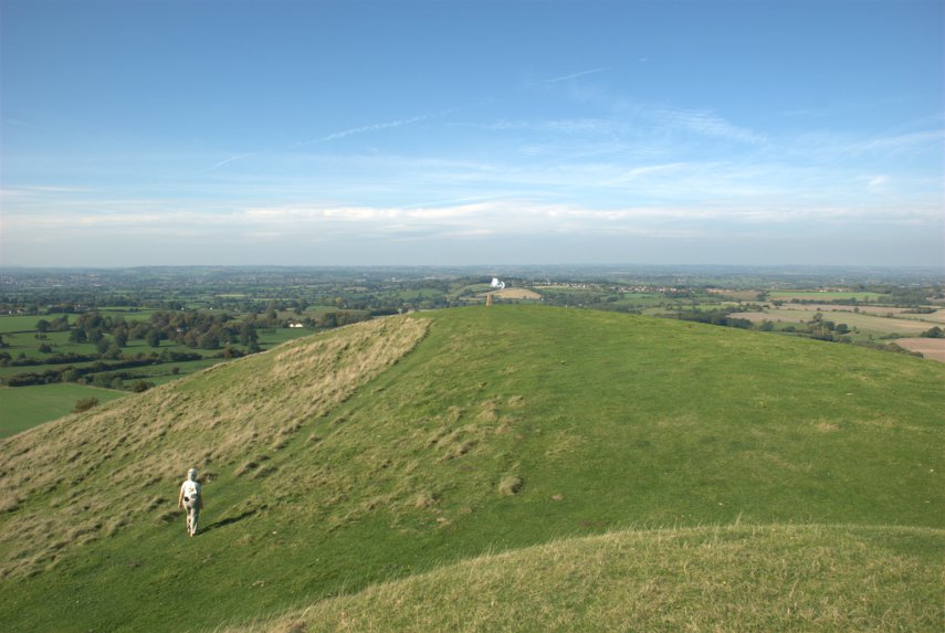
Amanda was still heading purposefully for that triangulation point which can just be seen on the top of the rounded hump ahead.

So now we can say that we've been there and done that. Back to the car, easier on the way down, and off on a very short drive to a car park between King's Bottom (Sorry your majesty) and Hitcombe Bottom. We are now near a well known estate so a short walk through the forest reveals this:

Longleat House, a stately home owned by the Marquis of Bath, a somewhat eccentric gentleman, and open to the public. We sat here for a while looking at the view and then decided it was time to go back to Mere. Tomorrow we go home but not without another diversion.
 

A later date.

A later date.

At the end of my last post I said "we plan to return for more at a later date" – this is that later date on a Sunday.

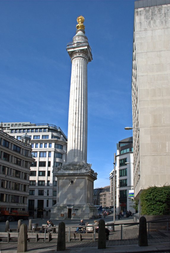
We came back to the City of London, as distinct from the City of Westminster and the West End, and started from the Monument this time.

We were last here when we went up to London to meet Jerry, 'Old Guy USA' on the forum, and this is where we parted at the end of our day together. Jerry went off to his hotel and we went home. The day had been cloudy with showers then but today it was sunny.
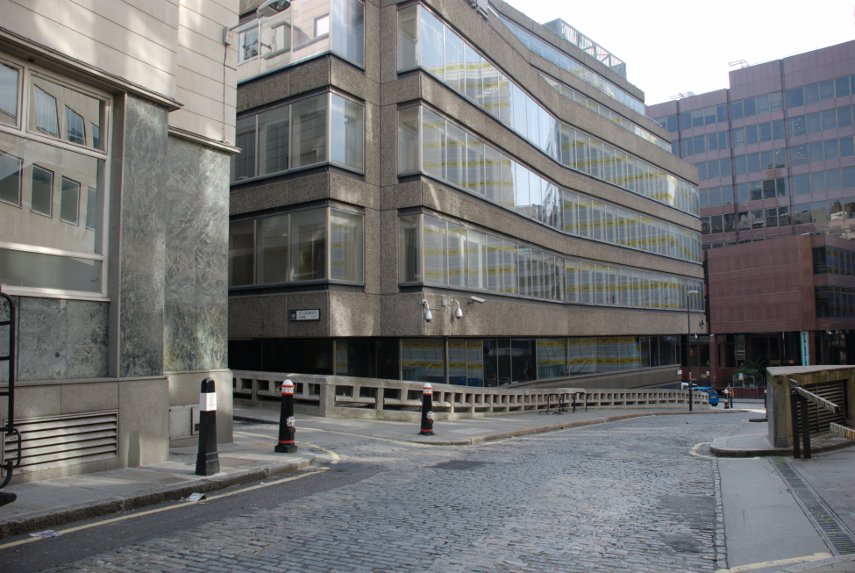
From the Monument we went into Pudding Lane where the Great Fire of London started, and no, we didn't start it – not even by accident.

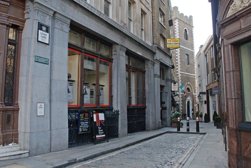
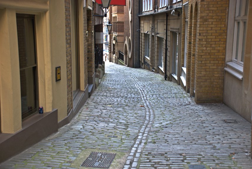
Pudding Lane looks totally different now, although it is still cobbled, compared to how it was in 1666 but nearby is Lovat Lane which gives an idea of how Pudding Lane might have looked at the time. Lovat Lane slopes down towards the Thames.
The top picture of the two is the top end of the lane where it joins Eastcheap and just out of sight past the church is the view in the second picture. Note how the sides of the cobbled surface slope towards the centre forming a central drainage channel. That is how all the roads at the time of the fire were constructed and that is where all the sewage would have been thrown. Nice! :yuck:
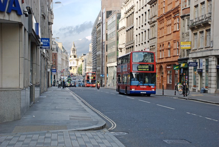
Pudding Lane is east of the Monument and Lovat Lane is east of Pudding Lane so we turned around and walked back west to Cannon Street which was really quiet, being Sunday, compared with a weekday. There are, as you can see, still buses around although we weren't here to look at buses.

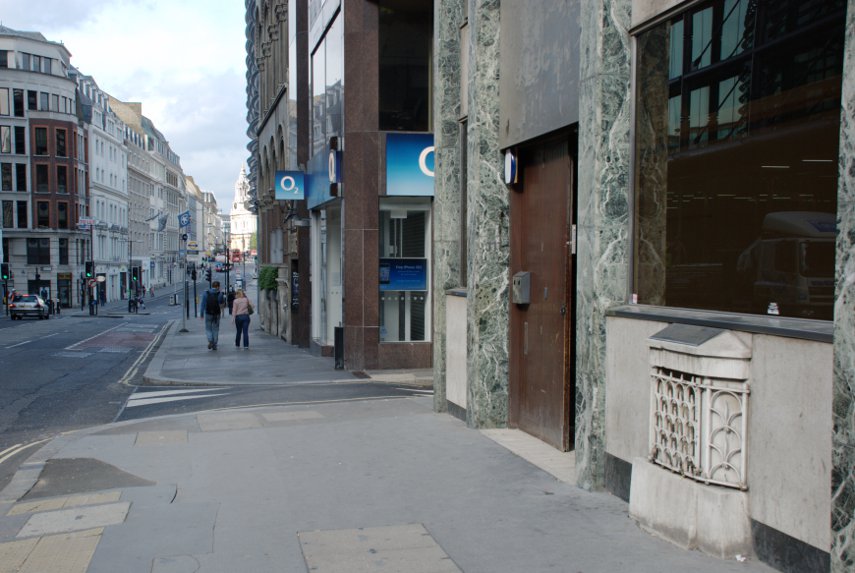
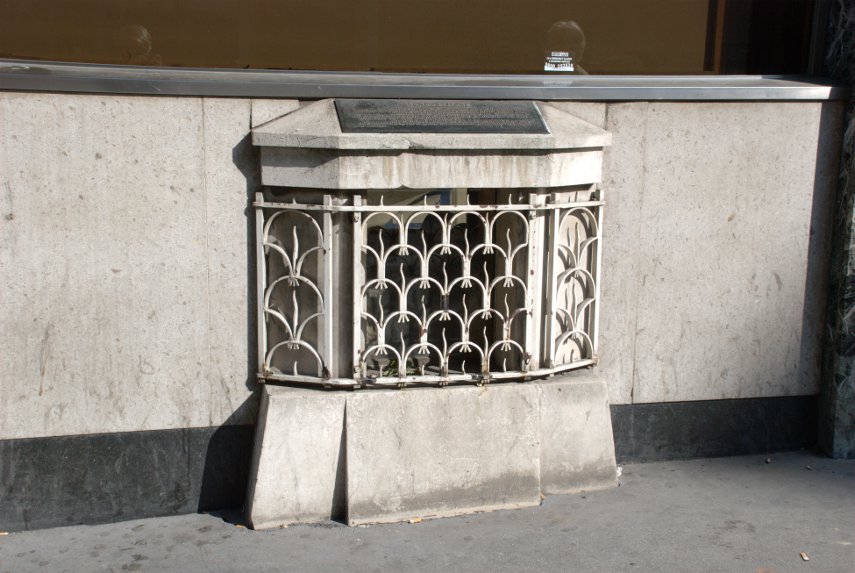
Just opposite Cannon Street Station is a small grille near pavement level which would be very easy to ignore. But if you did ignore it (You did didn't you?) you'd be missing part of London's history.

It is virtually impossible to photograph beyond that grill because there is a sheet of glass behind it which is covered in reflections from the bright light outside and behind that, just visible, is the London Stone. This is the stone from which the Romans measured all their distances from London.

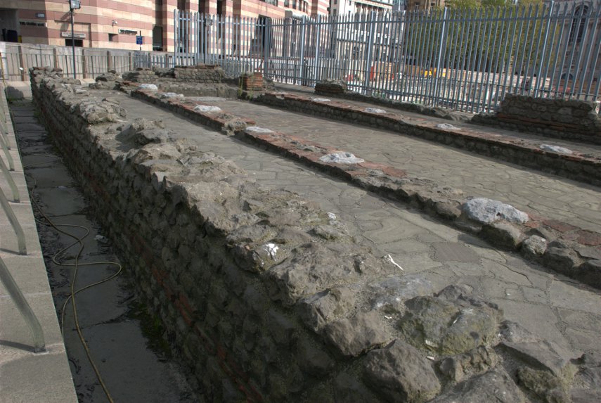
We then walked a little further along Cannon Street, turned right into Walbrook, left into Bucklersbury then left into Queen Victoria Street. A short way along on the lefthand side are the foundations of the Temple of Mithras.

This foundation was discovered during rebuilding work in 1954 and is, perhaps, the most famous of all twentieth-century Roman discoveries in the City of London. This temple was built in the mid-3rd century and, during excavation, various artifacts were discovered and are now in the Museum of London.

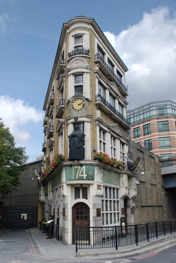
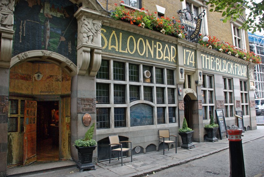
We continued along Queen Victoria Street as far as the junction with Black Friars Lane where we found this wedge shaped pub which as you can see in the lower picture is The Black Friar.

This pub was built on the site of a thirteenth century Dominican Priory, hence the name, but it is the interior, an Art-Nouveau masterpiece created in 1905 by the Royal Academy sculptor Henry Poole, that makes this pub so interesting. If you want to see the inside then you know where to go (they do provide cooked meals).

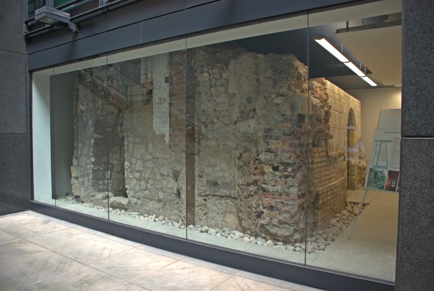
We went right into New Bridge Street and crossed over into Tudor Street, along Tudor Street then right into Whitefriars Street. We were looking for Magpie Alley/Ashentree Court along on the lefthand side of Whitefriars Street and spotted the narrow entrance to the alley. This led us into an obvious courtyard of all modern buildings, some with steps down to basement level. At the bottom of one of these basement steps is this:

It is all that remains of a Carmalite 13th century crypt.The crypt lay buried for centuries until it was unearthed in 1895 but it was not restored until the 1920s. It is protected by plate glass but is available to view at any time by going down the steps from the courtyard above.

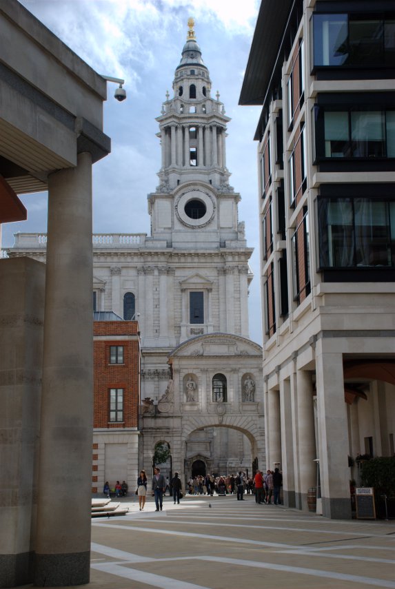
From here we made our way into Fleet Street and Ludgate Hill towards St. Paul's cathedral and into Paternoster Square with this view of Temple bar and one of the towers of St. Paul's Cathedral.

We had lunch, which was quite good and reasonably priced, in the St. Paul's Crypt cafe. There are also publicly accessible toilets down there.

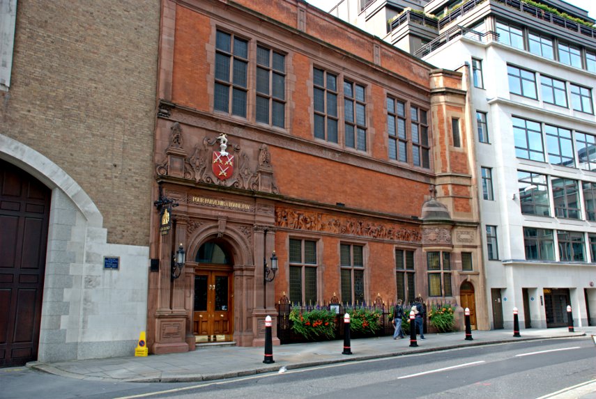
After lunch we walked up Warwick Lane seeing Cutler's Hall on the way.

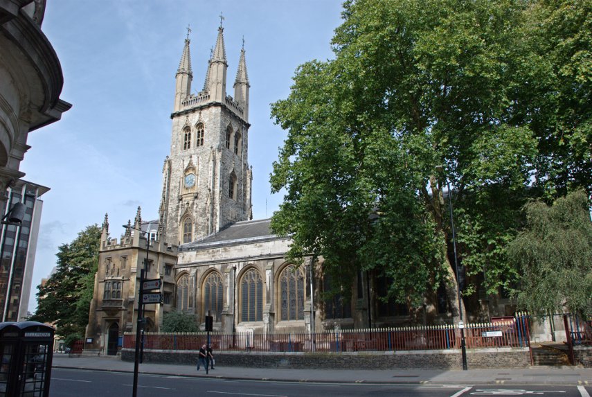
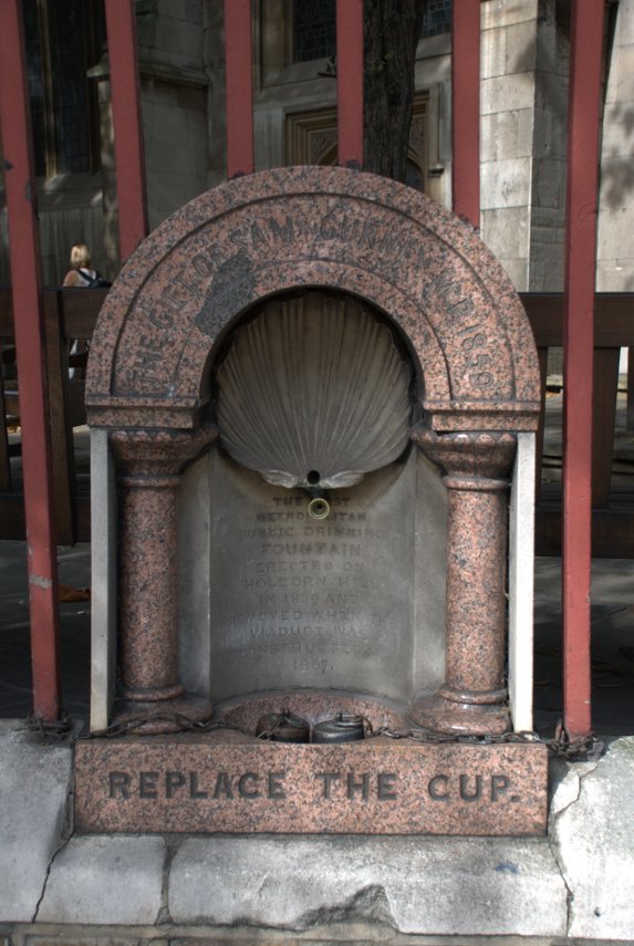
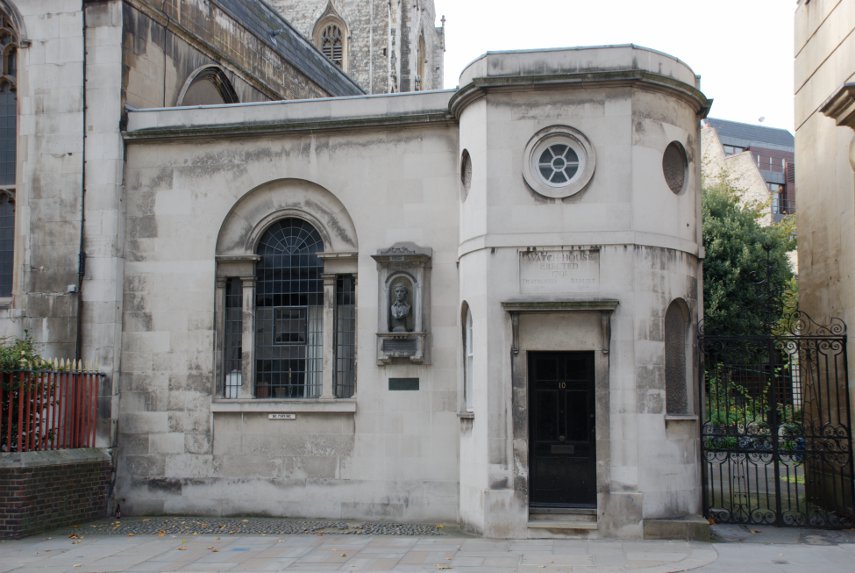
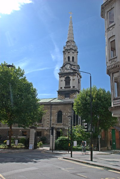
Then left along Newgate Street where we saw St. Sepulchre's Church on the corner of Giltspur Street. Built into the railings of the churchyard is London's first ever public drinking fountain (shown in the second picture) and round the corner in Giltspur Street is the Watch House (shown in the third picture).

The Watch House was built to deter grave robbers which were rather prevalent in those times as freshly dead bodies were in great demand for surgeons to practise on and fetched a high price.

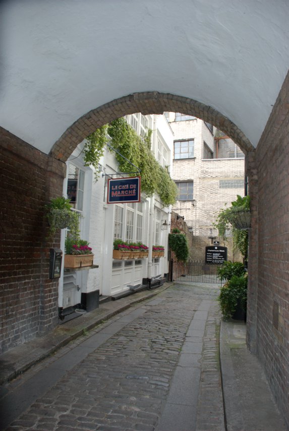
We went up past Smithfield Market to Charterhouse Square and saw this attractive little alley nearby.

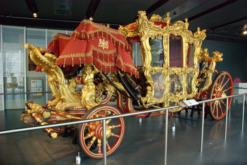
Then back to Barbican to revisit the Museum of London where, this time, we saw the Lord Mayor's Coach (and had a cup of coffee).

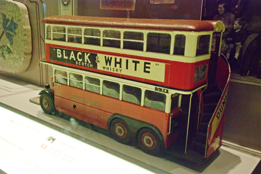
We also saw this model of an old London bus with an external stairway to the upper deck. I hate to have to admit this but I can remember going to school on one of those exact buses as a child. :oops:

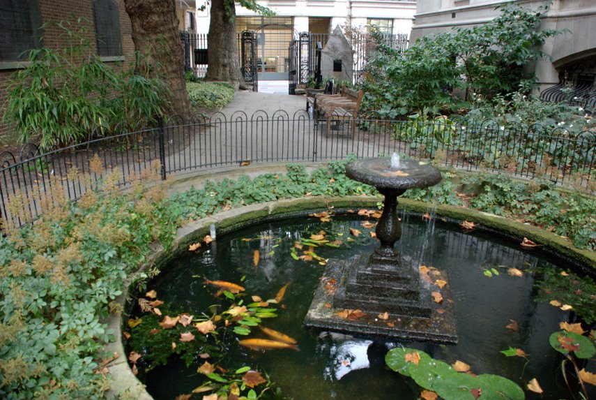
Just round the corner from the Museum of London we made a quick visit to Postman's Park. A small, little known but interesting little park.

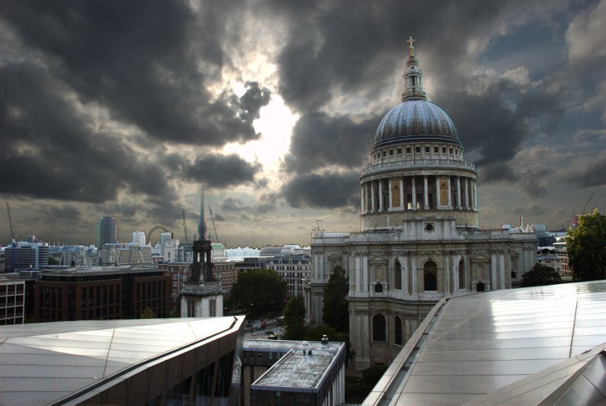
Last, but not least, we went back to St. Paul's and at the east end walked into One New Change. New Change is the name of the street and One is the address/name of a very modern, covered shopping centre. If you like shopping then you will probably like this and there are lots of places providing food of various kinds.

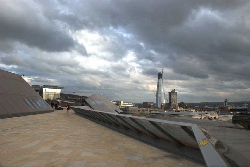
We didn't go in for either of those things. There are lifts which are made of glass and run on the outside of the building and if you go up to the 6th floor you will find a roof terrace which is freely accessible to the public and that is where we went.

The first picture, looking directly into the sun, gives quite a good view past St. Paul's across London with the top part of the London Eye just visible on the horizon.

The second picture shows just part of the actual roof terrace.

That was the end of our second day trip to the City of London.
 

Cucumber Alley

Cucumber Alley

As I said in my previous post on Monday last the weather forecast for tuesday was good then the following morning they changed their minds and it was to be not good. On that Tuesday the weather for Wednesday was to be mostly cloudy then this morning, Wednesday, they changed their minds again and it was going to be good. Today looks like a last minute emergency trip day.

Last weekend Amanda pulled a muscle in her back which was fairly painful and it had started to improve and she didn't want to do a lot of walking as it might aggravate the problem so it was me on my own this time.
I got off the Tube (Central Line) at Tottenham Court Road as I was headed for the Covent Garden area. A hundred yards along New Oxford Street and round the corner into St. Giles High Street and there was St. Giles-in-the-Fields.

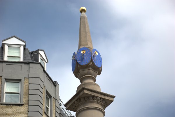
Along the footpath past St. Giles church, along St. Giles Passage and then Mercer Street I found myself at Seven Dials. Seven Dials is a small circular area where seven roads meet and in the centre is a pillar bearing six sundials. The original plan, in the 1600s, was to have six roads converging but that was later altered to seven. The design of the pillar, however, was not altered which is why it has only six dials (someone has blundered). After this area was built it gradually deteriorated until by the 1800s it was one of the most notorious slums in London. However it is now a prosperous and attractive area including lots of interesting shops and, despite some redevelopment, many of the original buildings remain.

This shows three of the seven converging roads.

And, of course, we must not forget the six sundials.

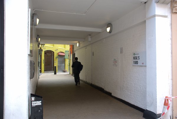
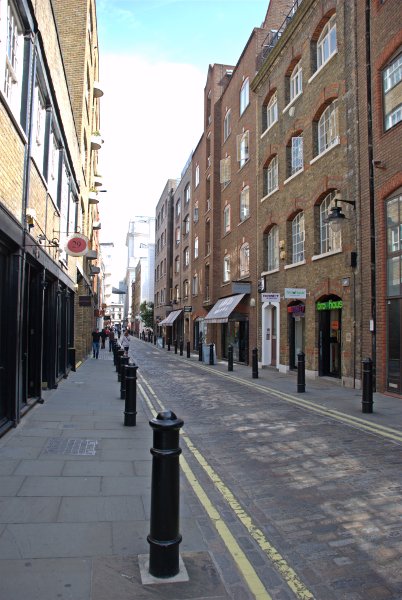
The Covent Garden area is full of narrow cobbled streets and even narrower alleyways. It would be very easy to take a couple of steps and miss something really quite interesting. Look at this picture for example:

This covered alley off Monmouth Street, one of the seven roads that converge on Seven Dials, could be easily passed with a quick glance as something not worth investigating but that would be a mistake because what you'd be missing is this:

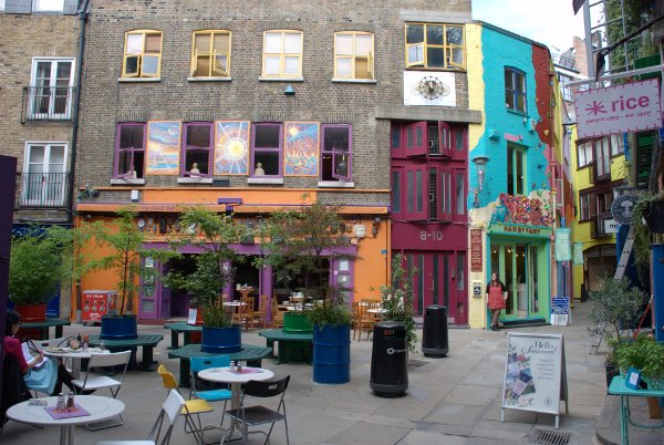
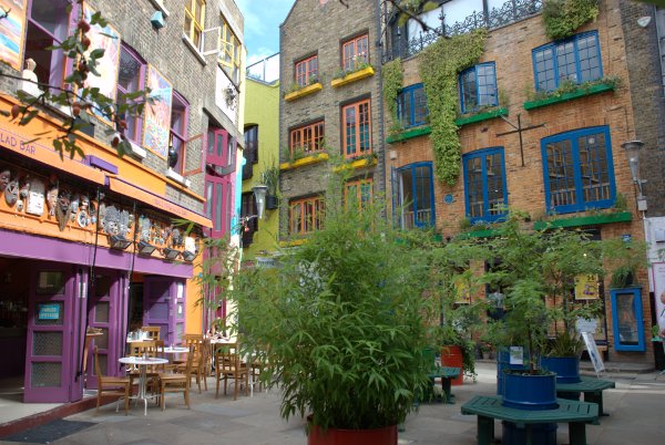
Do you need a little colour in your life? Then a visit to Neals Yard is for you. Not very large but certainly very colourful and is named after the 17th century developer Thomas Neale.
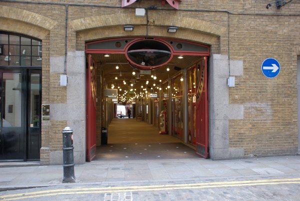
Coming out of Neals Yard into Shorts Gardens and looking across the road to the left is another opening in the wall.
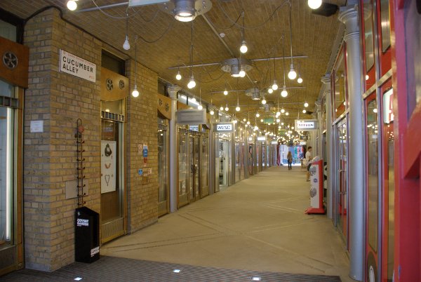
Taking a closer look we see:

This is Cucumber Alley. What I suspect has happened here is that the original buildings have been demolished to make way for a new building but Cucumber Alley already existed as a public right of way so had to be retained. The builders have incorporated it as a shopping arcade that runs through from Shorts Gardens to Shelton Street.

I don't know why it is called Cucumber Alley although being in the Covent Garden area  there may be a conection there.

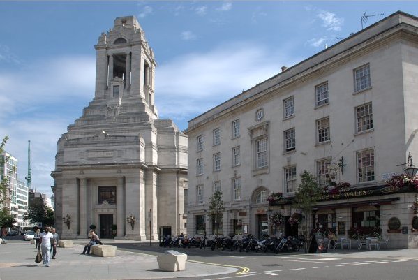
I was wandering towards my next planned destination when I popped out into Long Acre and saw this building in the distance – well you couldn't really miss it could you?

It turned out to be Freemasons Hall. On the front of the building there is a legend which reads 1717-1967 but that early date isn't when the hall was built but rather the date when the Freemason's Society was started. This hall is the third on this site and is in the Art Deco style having been built in 1927. An impressive and distinctive building.

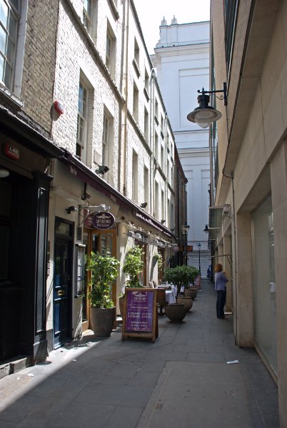
I went back to my original route and from Long Acre I went through yet another narrow alley:

and popped out into Floral Street.

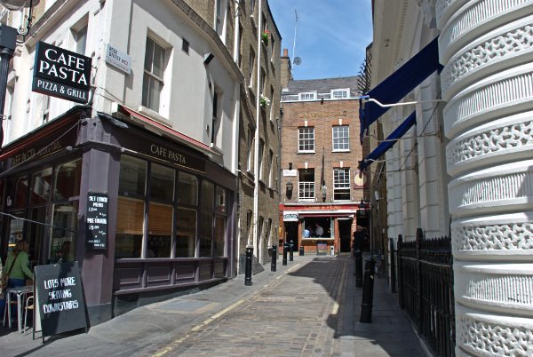
Floral Street is, as you can no doubt see, a narrow cobbled street (is there any other sort around here?) which runs parallel to Long Acre. There are a number of narrow streets and alleyways off Floral Street one of which is Rose Street and includes the Lamb and Flag Inn where the street turns sharp left.

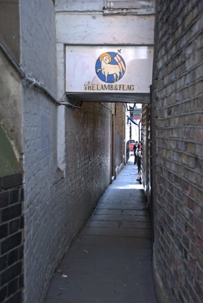
First licensed in 1623, it's the oldest pub in Covent Garden and possibly one of the oldest in London. You may think that Rose Street is narrow but where it turns sharp left in front of the pub an alleyway continues straight on back into Floral Street.

It is wide enough for two people to pass but only if they turn partly sideways.

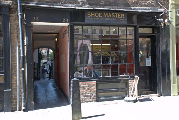
From the southern end of Rose Street I went along Garrick Street, right into New Row and left into Bedfordbury where I was looking for the entrance to Goodwins Court:

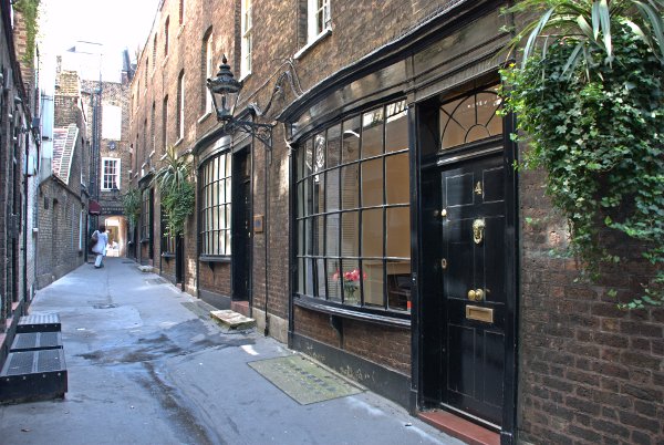
Now come on, own up. You would have walked straight past wouldn't you? Well, wouldn't you?  :roll: This is what you would have missed:

These buildings date from the 1600s and must have survived the Great Fire of London and you were going to walk past. :unhappy:

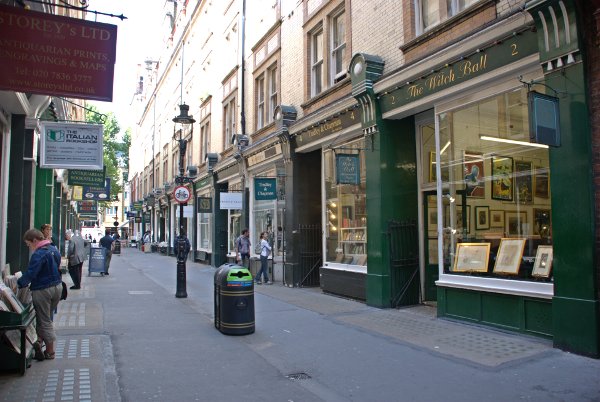
Out of the far end of Goodwins Court into St. Martin's Lane then right into Cecil Court.

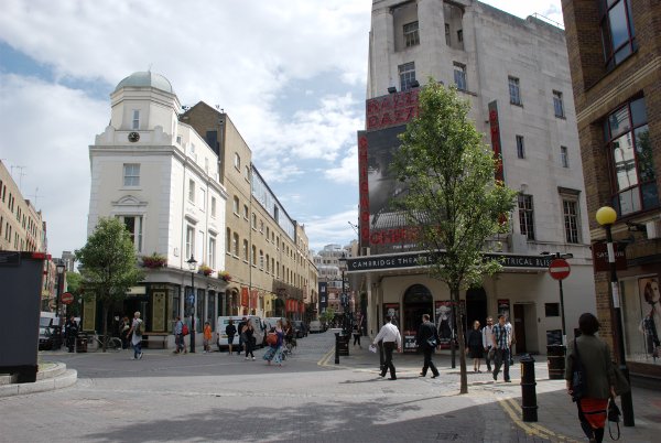
This is supposedly the street that gave someone the idea for Diagon Alley in the Harry Potter films. It is full of interesting little shops some of which I noticed were book shops. Now onward to the entrance to Inigo Place and thence to my final destination, the old Covent Garden Market.

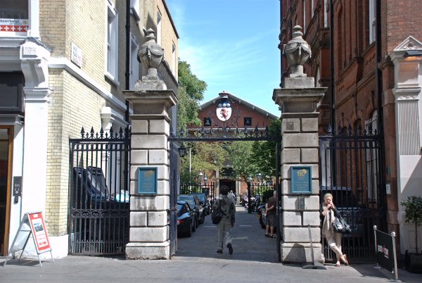
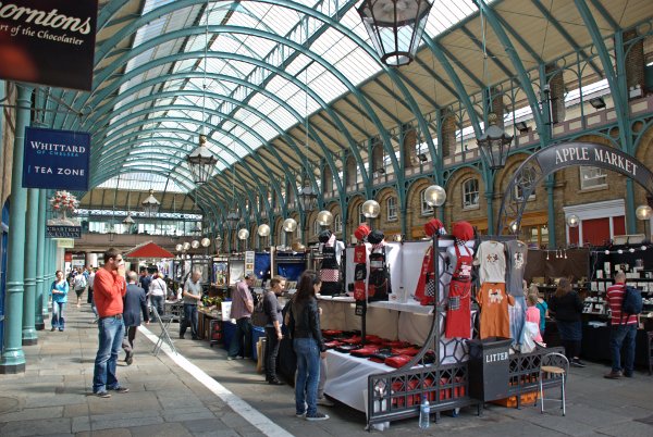
This is full of stalls, little shops and you'll be tripping over places to eat but the old market buildings are just a small part of what there is to see in the Covent Garden area and I can't help wondering how many visitors come here and think that have 'done' Covent Garden.

Wandering through the maze of narrow streets and alleyways was an enjoyable experience and I hope you enjoyed it as much as I did. :cool:
 

If you want to see a map with the locations marked then look here Covent Garden Map

The locations are:

001 Tottenham Court Road Station

002 St. Giles-in-the-Fields

003 Seven Dials

004 Neal's Yard

005 Cucumber Alley

006 Freemason's Hall

007 Floral Street

008 Rose Street

009 Goodwin's Court

010 Cecil Court

011 Inigo Place

012 Covent Garden Market