Browsed by
Tag: Cafes & Restaurants

Up and Down and Round and About.

Up and Down and Round and About.

Two for the price of one! You lucky people!

Work on the house is still progressing satisfactorily and this coming week will be a significant stage as the scaffolding around the house is coming down. smilies

We are, however, still managing to make a few trips and this time we did a half day walk followed a day later by a trip to Leominster ( pronounced Lemster ).

Trip 1. (Powys)

We walked from the top of Panpunton Hill at Knighton along the ridge to Cwm Sanaham Hill near Knucklas. We have walked up Panpunton Hill before and I even took a photograph of Knucklas Viaduct from the top but we didn't get anywhere near Cwm Sanaham Hill that time.

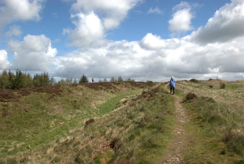
It was a fine warm day, which is unusual this summer smilies, and we set off towards Cwm Sanaham Hill with Amanda in the lead; quite a bit in the lead actually (that's her on the skyline).

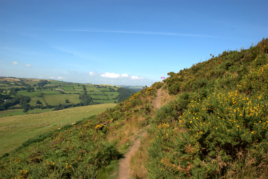
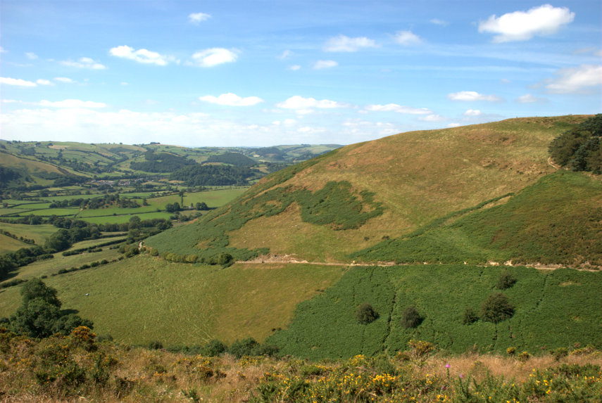
You can see that there is plenty of Gorse in flower at this time of year and you should be able to see that we are still going up. Then we get our first sighting of Cwm Sanaham Hill; the one dead ahead.

As we cross another path we can see Knucklas down below and if you look carefully you should be able to see the railway viaduct.

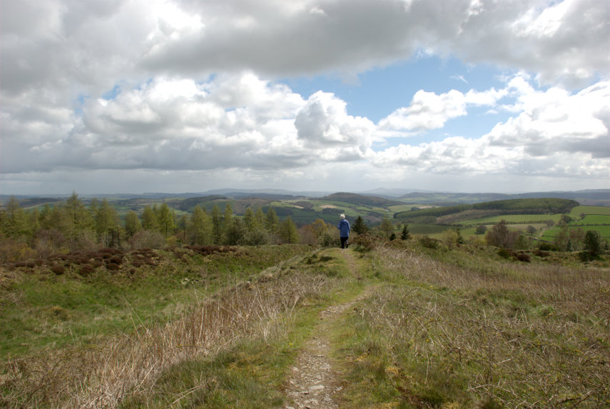
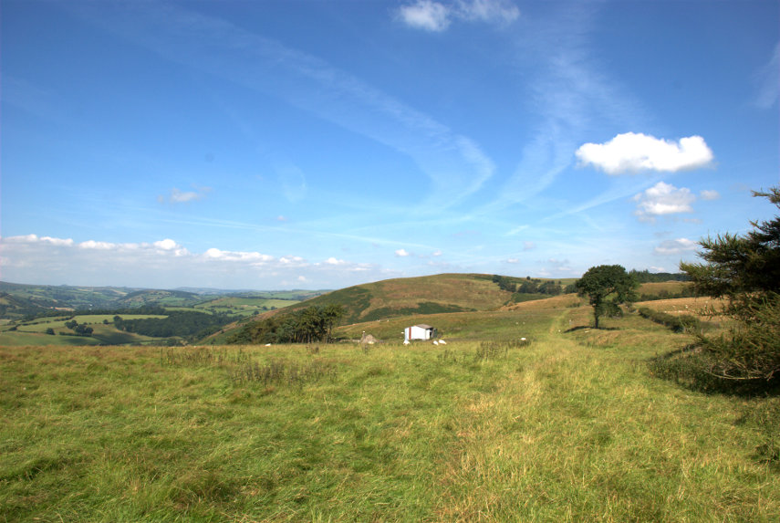
Cwm Sanaham Hill is getting nearer and, on the extreme right of the next picture, you can see our path curving round the edge of the trees just below the horizon.

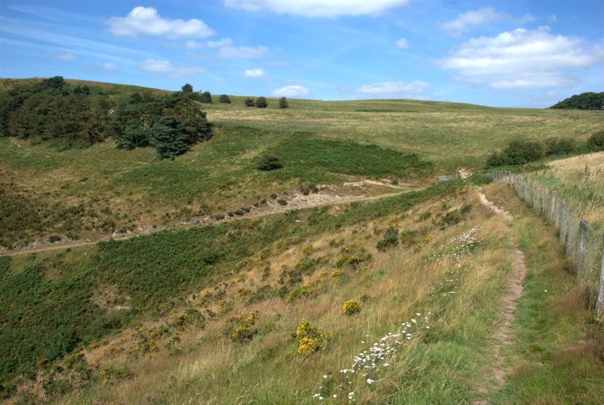
We have been following undulating ground all the way along this route but this is the final undulation. We are now going downhill into a small valley and then we start our final climb along the path which passes just below the trees on the left.

We finally reach the summit to be rewarded with some tremendous views and Amanda tries to stop the trigonometry point from falling over.

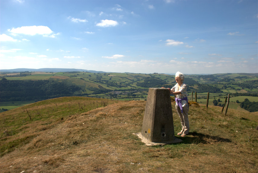
We didn't stop here for long as we were soon accosted by a big buzzy fly which we suspected was some sort of biting fly looking for a free meal and we didn't intend to supply it. So with much wild waving of arms we descended below the summit and, luckily, the fly didn't follow.

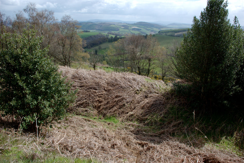
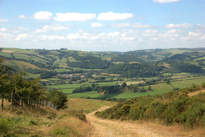
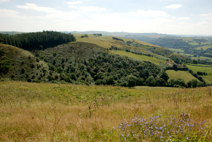
I took this photograph just below the top looking homeward as we set off back. The total distance travelled out and back was 4 miles and for most of that time the only sounds were sheep bleating in the distance and the breeze rustling in the trees. Wonderful!

We returned home without incident.

Trip 2. (Herefordshire)

We weren't able to go out the following day (building work y'know) but the day after we set off in the car to Leominster which is just under 30 miles from us. We hadn't been there before so we were looking forward to exploring.

The weather forecast for today was sunny and clear skies. There was, of course, about 80% cloud cover and little sun when we arrived and it stayed like that until the afternoon when the amount of sun did increase.

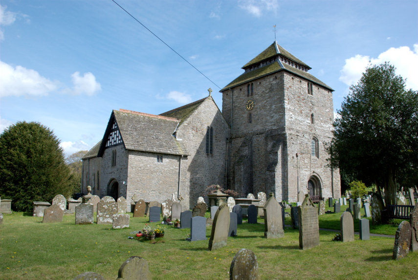
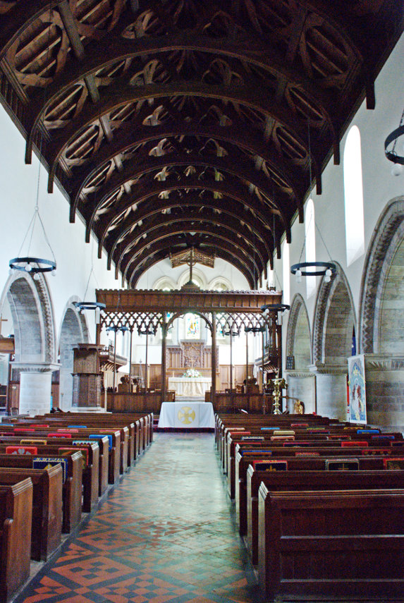
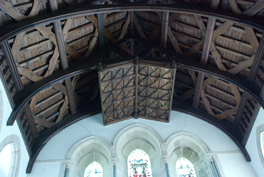
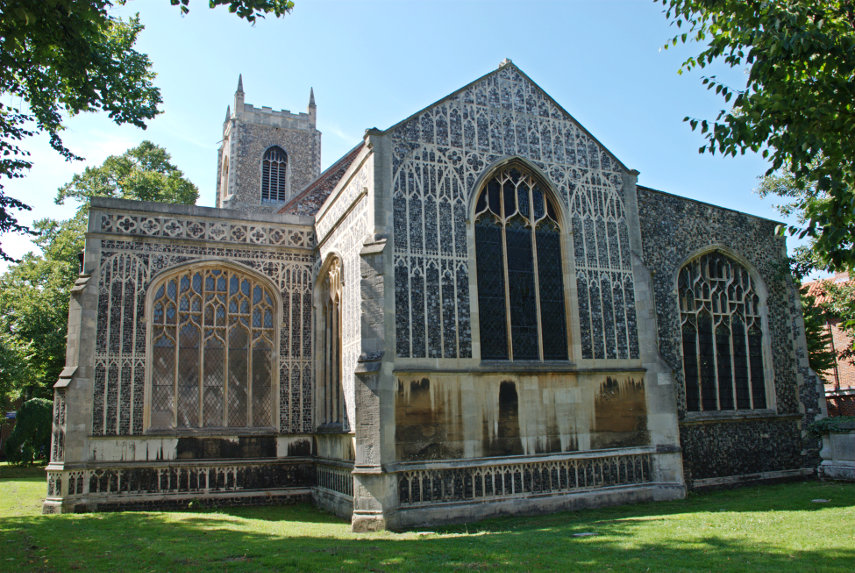
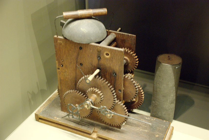
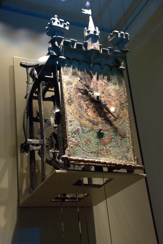
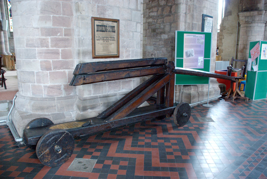
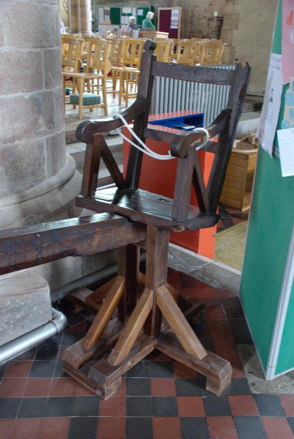
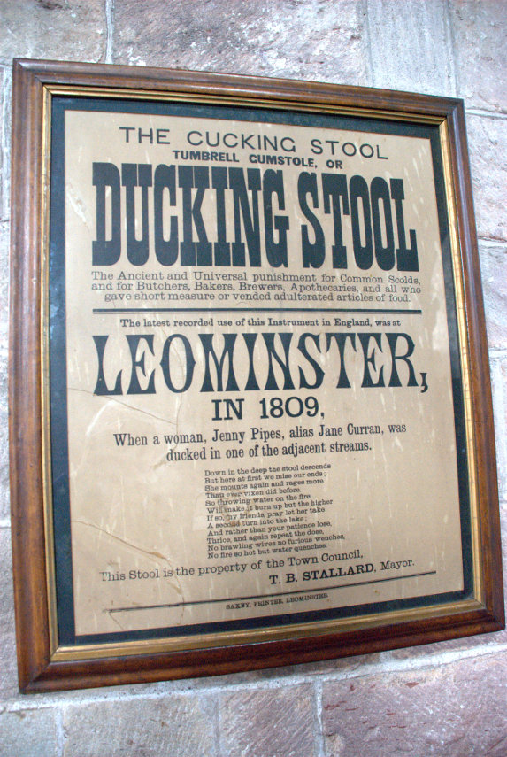
Our nearest point of interest was the church so we went there first. The church was once part of Leominster Priory, which no longer exists, and it was huge. There were three naves the earliest of which was Norman but there was also an interesting object now stored in the church.


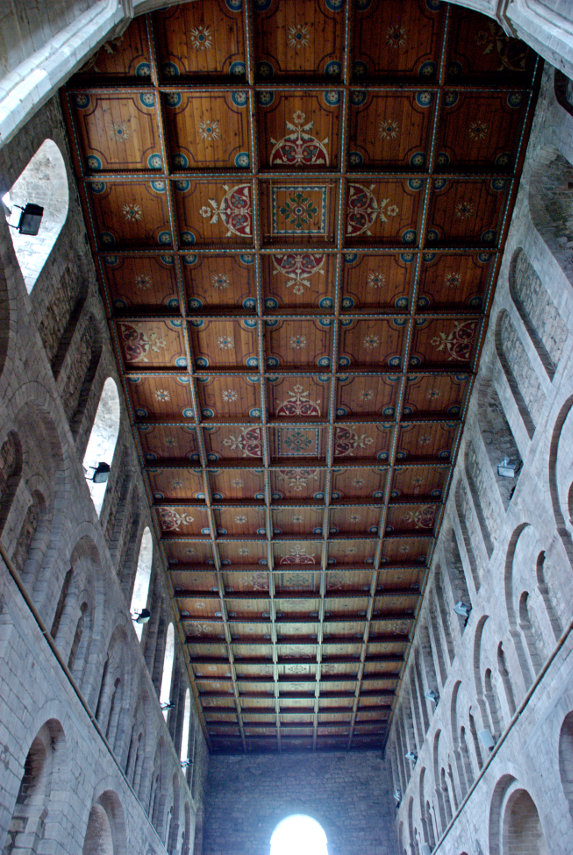
Although the church was Norman and was very large it didn't really have much of interest although the roof over the earliest of the three Naves was nicely decorated.

I didn't take any photographs of the exterior of the church because of the lack of sun and because we will go to Leominster again hopefully on a better day.

By this time it was actually getting near lunchtime so we found somewhere for lunch and after lunch, when the sun appeared, we wandered off to see Grange Court.

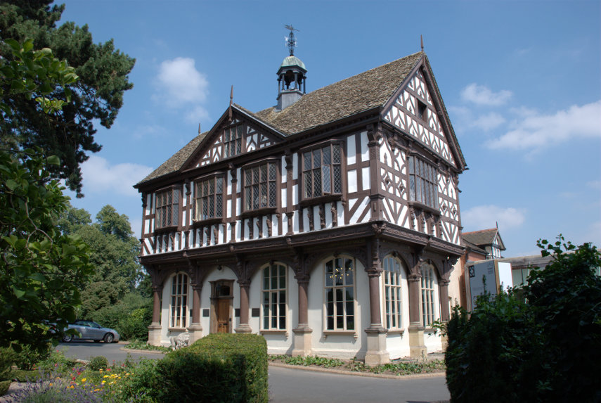
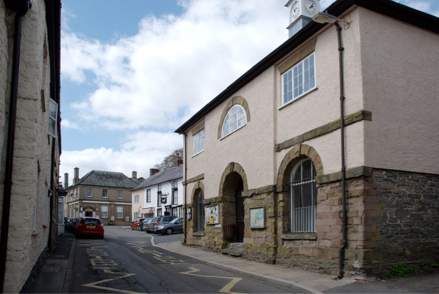
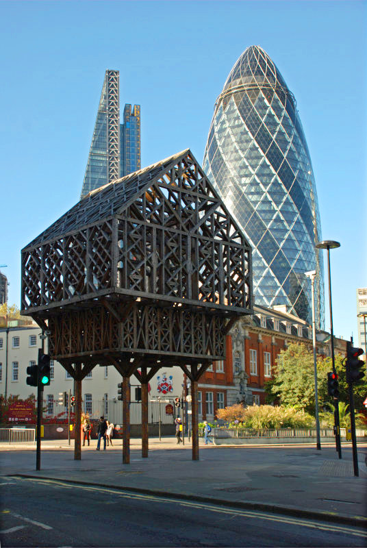
Built in 1633 it is the last surviving market house, built by John Abel a local master carpenter, which originally stood at the top of Broad Street and housed the weekly butter market, selling chickens, eggs, and butter. It was then known as the Butter Crosse.

By the mid nineteenth century the market hall was proving to be a traffic hazard so the building was dismantled and lay in pieces in a builder's yard until 1859 when the building was bought and then rebuilt on the park known as the Grange.

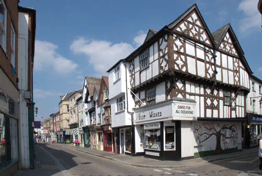
This is Broad Street.

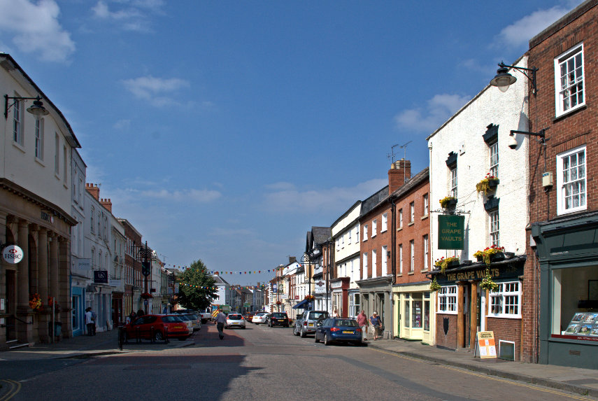
Although it is perhaps wider than usual it's not that wide and I'm sure a building like Grange Court plonked in the middle of the road would have been a significant traffic hazard.

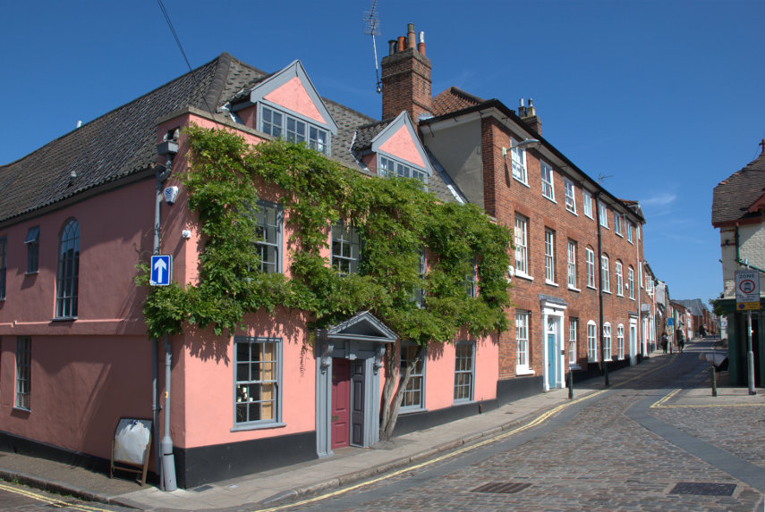
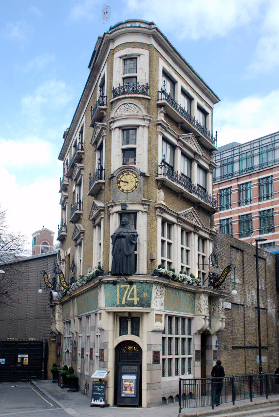
This view of Corn Street which is like a little square shows where we had our lunch in the Merchant's House. The Merchant's House is the black and white timber-framed house on the left-hand edge of the picture.

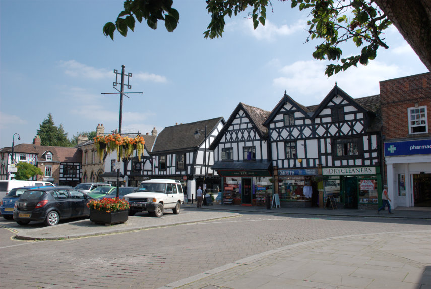
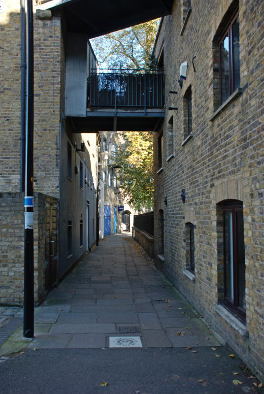
There is an alley running down the left-hand side of the Merchant's House which leads to Grange Court and in the centre of the picture you should be able to see a small gap in the buildings which is the entrance to a little lane called School Lane. This is School Lane:

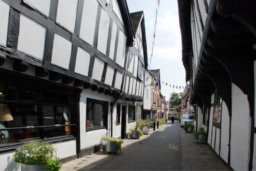
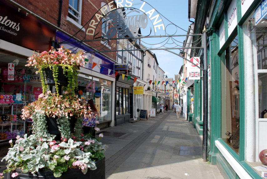
Another nice little lane is Drapers Lane.

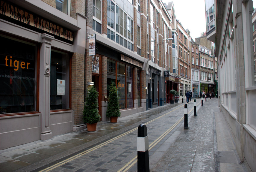
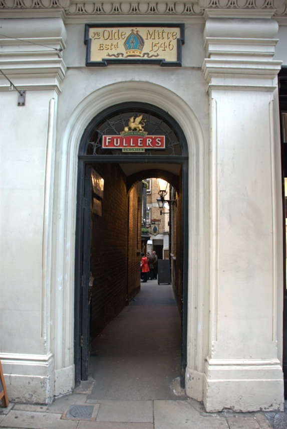
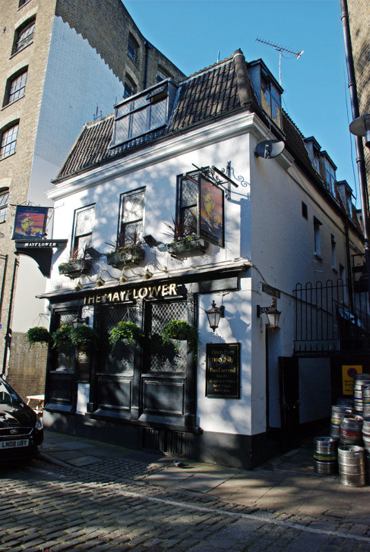
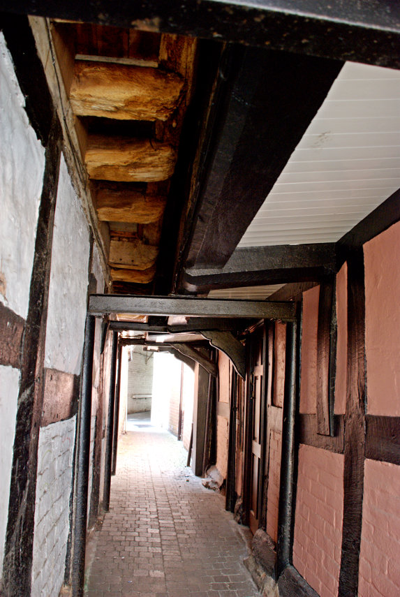
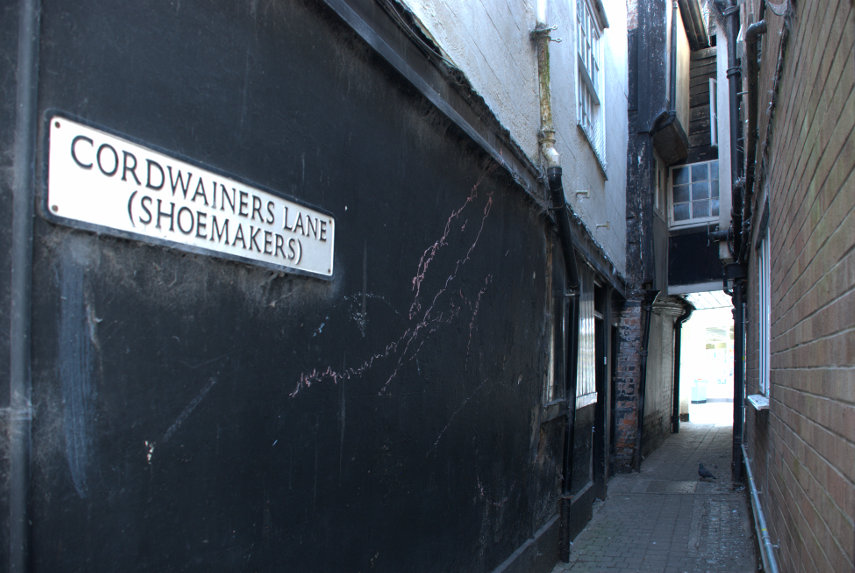
There were also a number of alleyways of which these are two:


We'll leave you with this view of High Street.

As I said above we will be back for further explorations.
 

The quietest place under the sun

The quietest place under the sun

Clunton and Clunbury,
Clungunford and Clun,
Are the quietest places
Under the sun.

 (A. E. Houseman)

Of those four places, mentioned by A E Houseman in his poem, we visited Clun.

On our outward journey we didn't actually stop in Clun but drove straight through to Clunton where we turned north past Radnor Wood and Steppleknoll to Sunnyhill. We parked our car in a free car park provided by the Forestry Commission which was very handy otherwise we couldn't have stopped because the lane was so narrow (one car's width). We set off up the track where Sunnyhill didn't live up to its name – it started raining. smilies

Luckily the rain didn't last long and we started to see some sunny spells although the wind was still cold. After a short walk we arrived at Bury Ditches.

Bury Ditches is a British Iron Age Hill Fort dating from about 500 BC and one of the best preserved in the country. In the picture above Amanda is standing on one of the banks with a ditch to the left and another bank to the left of the ditch with another figure on the top. The main area enclosed by the defences is to the right.

You may notice that the views from up here are pretty spectacular.


This is how the fortified village would have looked when it was in use.

Having had a thorough look round we went back to the car and headed back to Clun.

Clun is a small, attractive market town in Shropshire just over 7 miles from us. This photograph shows the Market Hall and the square beyond.

The 2011 census recorded a population of 680 and research by the Campaign for the Protection of Rural England suggests that Clun is one of the most tranquil locations in England.

We arrived at lunchtime and liked the look of the Maltings Cafe next to the Sun Inn. So, based on that, we went in. It was a good decision. They had an amazing range of food for a small cafe and the food turned out to be excellent. We would recommend it without hesitation.

After lunch it was back to the hard work of looking round. We wandered along one of the narrow back streets looking at the old buildings and liked what we saw.

At the end of this lane we stumbled on the Hospital of the Holy and Undivided Trinity which is a well preserved example of courtyard-plan almshouses. This was founded in 1607 and in this case the term 'Hospital' is another name for 'Almshouses'. The pretty gardens and the chapel are open to the public but the inner courtyard is not. We had a look at the garden and the chapel.


A rather attractive and peaceful garden. Clun is not exactly a bustling metropolis and this is right on the outer edge of this quiet town so it was, well, very quiet.

Back towards the 'town centre' we started looking for the castle ruins. We knew Clun had a castle so all we had to do was find it. I remembered that it overlooked the river and we knew where the river was so we headed in that direction. We spotted some pinnacles of wall ruins and soon found the castle.

It has to be said that there isn't much of it left; the largest part being the remains of the Keep but up close that Keep looks fairly impressive. The whole thing was built on a grassy knoll high above the town and the surrounding countryside.


You can just see a small part of the river way below at the bottom of the top picture. All we have to do now is find our way down to that river and cross it. We walked across the top of the motte and were rewarded with this view.

That bridge is our way across so we scrambled down and it was pretty steep in places. There is the main road bridge, of course, but that route would have been slightly more circuitous. You can probably see the car park, which is free, and entry to the castle is free. However, having got down there, we walked towards the main bridge because I wanted to photograph it. It is an old packhorse bridge built in 1450.


It's not very wide as you can probably see (it was built for packhorses) but it is one vehicle's width so traffic can, and does, use it.

Our final destination was the church. The oldest part of the building appears to be the tower which was built around 1200 AD. The Nave is 12th century; the Chancel is actually 19th century.


That is a pretty impressive 14th century roof.

We were both feeling a bit tired by now so decided to call it a day and headed for home. The weather could have been better, but wasn't, and in any case it's only 7 miles from home so we can, and probably will, come back to Clun any time we like. smilies


mTicket to Ride

mTicket to Ride

No, it isn't a typographic error it's meant to be 'mticket'.

I discovered something rather useful recently. It is that we can buy railway tickets on our railway line via a mobile phone and after paying for them they are then downloaded and stored on the mobile 'phone. These tickets can then be shown on the phone's screen to anyone who may need to see them. We then don't need to visit the ticket office or get tickets from a machine. So I decided to try it.

It has been a long time since we have been on any sort of trip which was because either the weather was bad or because domestic commitments got in the way. For example we have just had the outside of our house painted which was quite a long job but we now seem to be clear of domestic tasks so we were just waiting for a sunny day.

The weather forecasts don't help. A few days ago the weather forecast for Saturday was sunny all day. Then it changed to some sun and some sunny spells. Then it changed again to mainly sunny spells plus the chance of some showers in the afternoon. Then on Friday the forecast for Saturday was mostly sun so we took the chance.

We don't like generally travelling on a weekend because that's when everybody else does but this time the weather dictated when we travelled so on Friday I bought two mtickets and on Saturday 22nd August we caught a train to Norwich for the day.

It cost us less to travel to Norwich than it does to London even though Norwich is a bit further. We boarded a train at our one horse local station, where we have never had to show our tickets, and got off two stops later at Colchester where we caught the London to Norwich train. We were doing quite well until we were just south of Diss where the train slowed down and stopped. Signals I thought but then an announcement was made to the effect that there was a fault on the locomotive. It said that the driver was in contact with the service department and they were hoping to fix the fault within 15 minutes.

About 12 minutes later the train began to move – phew – and we eventually arrived in Norwich about 12 minutes late. I was expecting to show our mtickets on the train at some stage but, no, nobody wanted to see them. I did, however have to show them at the station barrier.

We caught a No. 26 bus in the station forecourt which took us to the Roman Catholic Cathedral. I bet you didn't know that Norwich has two cathedrals did you? This cathedral is no where near as old as the Anglican Cathedral, having been built in the late 1800s, but it is still a very impressive cathedral. When we were in Norwich last, 9 years ago, I did take one photograph of the outside but didn't have time to do any more.

This is another outside view that I took this time from the Cathedral Garden.

We went into their visitor centre, called the Narthex, where we encountered our first dragon. From 21st June until 5th September there are 184 dragons scattered around Norwich which they call an 'Art Sculpture trail'.

We were very kindly given a cathedral tour by one of the Deacons who retired a short while ago but who still obviously loves 'his' cathedral. It was a very interesting tour and we learned a lot that we would not have otherwise known about.

This shows the view along the Nave towards the East End.

There are lots of individual stone sculptures at the base of the pillars, at the top of the pillars and above them showing a great variety of forms and shapes. This is one on the base of a pillar.

This next photograph was taken from the East End looking under the crossing and along the Nave and the one after shows the Crossing.


We finished up having a cup of tea/coffee and a sausage roll in the cathedral refectory and, I must say, their sausage rolls are particularly nice; cooked that day I was told. They do have other food here which I suspect is just as good so if you want a light lunch this is the place to go.

We left the cathedral and decided a quick visit to the Plantation Garden was in order. We photographed it thoroughly last time but the weather was decidedly better this trip and I took another couple of photographs.


If you look, in the second picture, just above the steps on the left you will see Amanda sitting behind the bench under the tree playing her part as an 'extra'.

We made our way back onto the streets of Norwich and headed for the river. In doing so we crossed Pottergate.

Norwich really does have some nice streets. We wound our way through numerous narrow back streets to the river bridge which took us north of the river; an area which we hadn't visited before. Our first point of interest was the 16th century Church of St. Michael Coslany at the junction of Oak Street and Colegate.

It was locked so we weren't able to go inside but it was yet another building with some fine flushwork.

We saw a number of churches which I won't picture or describe here but we finished at St. Georges back in Colegate where we found another dragon.

The view of the church from the eastern part of Colgate was rather nice together with that very attractive timber-framed building which was built by Henry Bacon who became sheriff of Norwich in 1548.


We continued along Colegate and turned right into Fye Bridge Street and along to the River Wensum. Over the bridge we found two more dragons.


We then turned left along Quay Side and thence onto the riverside walk. From there we went a short distance to the church of St. Martin at Palace Plain where I left Amanda to rest whilst I crossed back over the river and found yet another dragon.

I walked along the north bank of the river on the riverside path to try and get a photograph of Cow Tower across the river. When we were last in Norwich I took some photographs of Cow Tower from the same side of the river as the tower and now I have it surrounded.

I walked back to the churchyard to find Amanda and there she was with a 'friend'. It was a Sparrow Hawk which had killed a pigeon and was eating it on the grass a short distance away. When I arrived it stopped eating and glared at me but didn't move away.

After watching it for a while we both moved slowly away and it remained, apparently, undisturbed. We headed back to Quay Side along to Wensum Street then right into Elm Hill. This is Elm Hill.

A well preserved medieval street. Looking in the opposite direction we can see the Britons Arms, the white building, where we are hoping to get afternoon tea.

Amanda had Darjeeling Tea, I had coffee and we both had Raspberry, Cream and Hazelnut Meringue Roulades which were the size of tea plates. On our last visit to Norwich we had lunch here and we both had their home-made pork pie. You just cannot get better anywhere.

After our late afternoon blowout we caught a bus nearby down to the railway station and caught the train home.

A good day.

P.S. Apparently the temperature around our tea time was in the low eighties – too hot. smilies

Following the stones

Following the stones

We started today with a little trepidation because 4 weeks ago to the day we were also going on a day trip, although to a different destination, and immediately after finishing breakfast I had a heart attack and was carted off to hospital where I spent the next 4 days. It turned out to be a minor heart attack but it is, apparently, going to take 6 weeks to get back to normal (another 2 weeks to go from now).

We were not really expecting any problems today, and there weren't any, so we set off for the railway station.

We were headed for London, change at Stratford onto the DLR for Woolwich Arsenal then just two more stops on South-Eastern Trains to Abbey Wood Station. A short walk and here we are. But where exactly?

This is Lesnes Abbey Woods in the London Borough of Bexley just two miles south of the River Thames at Cross Ness or two and a half miles east of Woolwich Ferry. In the picture above the pointed skyscraper of Canary Wharf is visible near the centre line of the image with the top of the Shard showing more to the left.

The ruins at the bottom of the picture above is one of the features we've come to see. The abbey was built during the 12th century and  the first inmates probably came from the Holy Trinity Priory in Aldgate.

Although there is not a lot of structure left above ground the ruins are quite extensive. The area below was obviously the abbey church showing the bases of the columns in the church nave and the second picture shows its position relative to the other parts.


There are some parts with a significant amount showing above ground as shown here.


The inhabitants were known as Augustinians or Black Cannons and they used to meet every day in the Chapter House to discuss the business of the day and here Amanda is trying to pretend to be one of the  Cannons sitting on the bench. She doesn't seem to have much of an audience (perhaps they were warned that we were coming). smilies

It is interesting to speculate how they aquired, and organised the delivery of, all the stone needed for such a large building especially as there is no stone like it locally. The River Thames, as I said previously, is 2 miles away so the stone could have been delivered by sea – but from where? How would they have contacted the people who could supply the stone.

The abbey ruins are situated next to a wood which we wanted to explore next. Just bear in mind that it isn't flat around here and you will, like us, be going up and down some hills but the wood is really lovely and covers some 217 acres.


We were also looking for some geological deposits known as the Blackheath beds which are very fossiliferous and which I visited about 55 years ago. They were easy to find then, I have the fossils to prove it, but we couldn't find them this time. That was a little disappointing but I'd like to try again sometime.

The abbey was demolished around 1525, partly because of the dissolution of the monastaries by Henry VIII and partly because it was then already in a rather neglected state, and some of the stone was used to build Hall Place (Tudor) about 3 miles away measured in a straight line. We decided to follow the stones to Hall Place and so jumped on a number 229 bus which would take us very near Hall Place. The journey took around 50 minutes because the bus goes a rather long way round but it does make the journey simple.

The walk from the bus stop to Hall Place, which is still in the London Borough of Bexley, was quite short and we had our first glimpse of Hall Place from the road.

It certainly looked interesting so we hurried round to the entrance. Entry to the grounds is free and there is a lot to see but to go into the house requires an entrance fee of £8 per adult, £6 pounds for oldies (us) and a further discount of 50% for National Trust members (also us) so we paid £3 each for the house. If you have a National Art Pass from the ArtFund then entry to the house is free.

However it was now lunchtime so before we got to the house we found their cafe by the River Cray and had some lunch. I had seen some reviews of the cafe on the internet and they tended to be rather disappointing so we were not expecting much. However things must have improved as my soup and bread roll was really tasty and Amanda's bacon sandwich, she said, was exceptionally good. We also had no complaints about our coffee and tea. We sat outside on the river terrace and could watch the ducks and geese swiming about including Mrs Canada Goose and family.


After lunch we crossed the river over the bridge next to the cafe to see the Rock Gardens and it was certainly worth the short walk. You can see the house, with the cafe this side of it, in the second picture which will give an idea of distance.

There was a great variety of plants including some that were of particular interest to Amanda and lots of different colours which made a really attractive display.


Back across the river we turned away from the house towards the greenhouses where we found a large conservatory which was free entry so we went in. There was a rectangular path with the centre taken up with a pond surrounded by lush vegetaion and around the outside of the path were benches covered in various plants, flowers and cactuses.


We then made our way towards the western end of the grounds which had some beautiful areas of parkland together with lots of colour from numerous Azaleas which are in bloom at this time of year.


Walking towards the colour we were soon to realise just how many Azalea blossoms and colours there were and these pictures show just a few.


There was another bridge here over the river which was partly festooned with Wisteria.

The only downside to this part of the grounds is the traffic noise from a very busy road nearby. We turned round here and started to head back towards the house passing through the 'Really Useful Garden' on the way. Yes, that really is the name. It appears to be a herb garden with, yes, really useful herbs and I must say the Box hedges look really neat.

Next we went into this garden with flower beds divided into compartments by rather neatly trimmed wavy hedges. We expected to walk out the far end but discovered that the way in was the only way out.

As we neared the house we encountered the Queen's Beasts – a set of ten brilliantly executed topiary heraldic animals which were planted to celebrate our current queen's coronation. They've grown into big beasts.

At the far end of the Queen's Beasts is this turret on the house demonstrating some pretty impressive flushwork.

In architecture  flushwork is the decorative combination of flint and stone on the same flat plane. Flushwork begins in the early 14th century, but the peak period was during the wool boom between about 1450 and the English Reformation of the 1520s. Flushwork, and flint architecture in general, is usually found in areas with no good local building stone. Although the labour cost of creating flushwork was high, it was still cheaper than importing the large quantity of stone necessary to build or face the entire structure. The dark squares are flint and the light squares are stone.

The same technique has been used on the front of the house to good effect.

We finally went in to this Tudor house built in 1537 although the brick part was added in the 17th century and started our visit in the Great Hall with the Minstrel's Gallery.

Just off the Great Hall is the Kitchen.

One of the other rooms has this ornate ceiling.

Hall Place is one of London's hidden gems and, in our opinion, one that shouldn't be missed. I'm surprised that it isn't better known but I'm glad it isn't. smilies

I am supposed to be taking things easily but I don't think that I did that today. Consequently by this time I was feeling tired and so was Amanda so we decided to call it a day. We caught a bus, from the same stop from which we alighted when we arrived, to Bexley Station and then a train to London Cannon Street and thence to Liverpool Street Station and home.


Tunnels, tribulations and lots of time.

Tunnels, tribulations and lots of time.

Late last year I mentioned Brunel’s tunnel under the Thames in our Return from Rotherhithe trip but I wasn’t able to show you the actual tunnel. We can now rectify that omission. Isambard Brunel was nearly drowned whilst building this tunnel and you can read the story  here should you be interested.

We travelled to London although not as far as Liverpool Street Station this time. We changed at Stratford onto the Piccadilly Line and travelled to Canada Water where we changed once more onto the Overground.

Naturally, at this point, the Overground is underground and why not? The Underground runs overground in places so why shouldn’t the Overground run underground? It’s all very logical. When you’ve re-organised your thinking processes we’ll continue.

We then travelled one stop to Rotherhithe. This is the southern end of Brunel’s tunnel and it’s where we encountered the first tribulation.

I was hoping that, as this tunnel is of particular historical interest, the tunnel lights would be on most of the time but no, all was dark. The southern end of Brunel’s tunnel is some way from the station platform so I could see no sign of it. Bother!

Nothing for it but to get on the next train and proceed to the northern end, Wapping Station, to find out what we can see there. There appears to be a train every three minutes on this stretch of the Overground network so not long to wait.

We soon arrived at Wapping and were pleased to discover that we could see this end of Brunel’s tunnel. One thing I had noticed was that the platforms at both Rotherhithe and Wapping were very narrow – not more than six feet I should say. Just enough for two people to pass without going too near the edge.

There are two separate tunnels running parallel and this is the view from Wapping Station platform.

You should be able to see that the tunnel is horseshoe shaped which makes it quite distinctive. The next picture shows the view looking along one of the two tunnels. You should be able to see that the tunnel floor slopes downward and then upward with the two railway lines reflecting light in the far distance.

Time to move on so it’s back on the train northwards one stop to Shadwell to get the DLR to Tower Gateway which is where we find our next tribulation – it’s raining. There wasn’t any rain in the weather forecast. Oh gosh they can’t have got it wrong can they?

We wait a short time for it to stop and walk the short distance to Tower Hill Station on the District Line where we travel to Embankment. When we did our Strand-ed walk I photographed Watergate Walk but omitted to photograph the actual Watergate so here it is.

When it was built in 1626 it was on the shoreline of the River Thames with those steps going down into the water and was intended for visitors to the Duke of Buckingham’s house but then later the Embankment was built making the shoreline much further south.

Back on to the Underground we travel back east to Blackfriars. We were on our way to Blackfriars Lane and passed The Blackfriar pub which I have photographed before but I had the opportunity this time to include the whole building showing its shape rather well.

Very soon after that we were walking along the narrow Blackfriars Lane.

We passed Apothecaries Hall where The Worshipful Society of Apothecaries of London is based. The hall was originally part of the Dominican priory of Black Friars but was purchased by the Society of Apothecaries in 1632. The original building was destroyed in the Great Fire of London in 1666 and a new hall was built on the same site and completed in 1672.

We continued along Blackfriars Lane until we reached Carter Lane which we turned into. It is interesting to note that this was, at one time, one of London’s main thoroughfares.

Part the way along Carter Lane we arrived at the junction with Burgon Street where there were a number of little narrow lanes round about.


A little further along Carter Lane we spotted this YHA building (hostel) with interesting decoration on it and it turns out that the building was originally the St. Paul’s Choir School, built in 1874, hence the latin inscription and the ecclesiastical motifs on the facade.

A short way on and we were opposite St. Paul’s Cathedral and as it was lunch time a visit to St. Paul’s Crypt Cafe was in order and that was where we hit our next tribulation – it was manic. The place seemed to be full of school parties so we turned round and left. The best thing to do seemed to be to go straight to the British Museum, our next port of call anyway, and get some lunch there and that is what we did.

Their Gallery Cafe was much more civilised. Afterwards we went up to the upper floor where we had plenty of time.

There was a variety of clocks and watches here from the very old to the relatively modern including this early wooden clock and it is all wood even the gear wheels.

There was a rather fine watch dating from 1625 which shows the date, the age and phase of the moon, the seasons, month, day of the week, quarter hours, the time and alarm setting. Anything else you want to know?

There was even a clock dating from the early 1500s.

We moved on to the the dead body department (Egyptian Mummies) where we saw Gebelein Man dating from 3500 BC. He looks as though he could do with feeding up a bit. Just in case you are a little confused his legs are on the left and his arms on the right.

After looking at many Egyptian mummies we had had enough and headed for home but we went the long way. Walking from the British Museum to Holborn Station we continued walking along Holborn to just past Chancery Lane station and thence to Hatton Garden. We weren’t there for the jewellery but for this:

Easily bypassed as ‘just another doorway’ but a closer look produces this:

It’s one of those intriguing narrow alleyways. Walking a short way in we reach Ye Olde Mitre pub built in 1546 and extended in 1782. Henry VIII was married in St.Ethelredas near by and his daughter, Queen Elizabeth, is said to have danced around the cherry tree at the pub door with Sir Christopher Hatton.

Well that’s it for today. A walk back to Chancery Lane Station and thence home. Do keep reading these posts as I’m sure one day an interesting one will come along when I’ve had enough practice.

Return from Rotherhithe

Return from Rotherhithe

It all started so well too. We arrived, as usual, at Liverpool Street Station after an uneventful journey and walked down to Aldgate where, by chance, we discovered something that we weren't anticipating.

This is a modern wooden monument which is standing on the site of one of the old London gates, namely, Aldgate. It is thought that there was a gate already spanning the road to Colchester in the Roman period, when the City wall itself was constructed and it was always an obstacle to traffic. It was rebuilt between 1108-47, again in 1215, reconstructed completely between 1607-09 and finally removed in 1761.

Geoffrey Chaucer occupied appartments above the gate in the late 1300s when he was employed as a customs official.

It's amazing what can be found just wandering around London. However we set off once again along Minories and soon arrived at our first intended destination – the Tower of London. This is where things started to go pear-shaped or, to be precise, people-shaped.

We have been to this area many times but have never seen so many people and, so it turned out, they were all around the Tower. One of the factors was probably that it was half-term and children were on holiday this week and also that it was a beautifully sunny day and not at all cold.

The other factor which may explain the numbers of people was this:

You have probably heard about these ceramic poppies. There is supposed to be one for every British life lost in the first world war but I'm not going to count them. They are around all four sides of the Tower and so are the people trying to view them. The crowds were so dense that one could only shuffle along and, consequently, it took a long time to get round.

We did, eventually, get all the way around the Tower and here are a few of the photographs that I took to prove it.


When we decided to leave we went along the pavement on the north side of the Tower and even that was shuffle, shuffle, shuffle as far as Tower Bridge Road. Walking along Tower Bridge Road to cross Tower Bridge wasn't easy. We wouldn't really want to experience that again and we probably won't because the poppies are to be removed in the early part of November.

I managed to get a quite nice photograph of the Tower, once we had reached the other side, and a nice picture of Tower Bridge.


We turned round and headed east along Shad Thames. As it was now 12:15 we decided to stop in Peapod for an early lunch. Although it's small and the range of offererings is also small the soup, whatever the flavour, is alway delicious.

After lunch we headed further along Shad Thames until we could access the riverside walk. Staying close to the riverside we had some interesting views of the Thames, one of the old docks and some of the converted old warehouses.


Then the riverside path diverts inland to the narrow streets of Bermondsey. We found that here, as we found in Wapping on the north side, a lot of the old warehouses have been converted to expensive accomodation some with rather splendid river views.

We followed Bermondsey Wall (that's a road not a wall) and again, as in Aldgate, we came across something totally unexpected.

This is all that remains of King Edward III's manor house, built over 650 years ago, on what was then a small island surrouned by marshland.

These remains are in Bermondsey Wall East near the Angel Pub which dates from around 1830 and the pub is therefore Victorian.

Just a short way on we found King's Stairs Gardens which leads to Southwark Park. We did expect to find this and it was an attractive garden but we didn't have time to explore the relatively large park.

Along more narrow streets to St. Mary's Church, Rotherhithe.


The present church replaces the previous 12th century building and was completed in 1716. It was designed by John James, an associate of Sir Christopher Wren.

Shortly after this we passed the Mayflower pub.

The original pub was built in the 16th century but was substantially rebuilt in the 18th century and has associations with the Mayflower which took the settlers to America. Christopher Jones was Master of the Mayflower and he lived in Rotherhithe and is buried in an unmarked grave in the churchyard of St. Mary's Church. The Mayflower (ship) , apparently, was moored nearby before it left on its journey to America via Portsmouth and Plymouth.

Just past the Mayflower pub was what I can only describe as a 'garden gantry'.

This view is looking back after we had passed under it. You should be able to see the Mayflower pub on the right and, a little further back, St. Mary's Churchyard on the left.

We were now at our next planned point of interest.

This was the pumping house built for pumping excess water from Brunel's tunnel under the Thames which was started in 1825 and opened in 1843. This was the world's first tunnel to pass under a river and if I were to say that it was an arduous project it would be an understatement particularly when one realises that the Thames was like an open sewer at the time. I should also mention that it was Marc Brunel, Isambard Kingdom Brunel's father, who oversaw this project although Isambard did join the project much later.

The chimney which carried the steam engine exhaust is rather obvious.

The pumping house is now a small museum and to one side is the original shaft from where the tunnels were started. It is possible to access the shaft on guided tours which take place only on some days. Check the web site if you're interested. The chairs on the floor of the shaft are for visitors when they are listening to the guide.


We walked on a little further staying close to the river until we reached Surrey Water where we turned towards the river along the very short canal to see an old obsolete bascule bridge similar to that which we saw at Shadwell.

That's a chunky bit of machinery and so back to Surrey Water with a view towards Canary Wharf.

Walking to the far end of Surrey Water we found the entrance to the canal, with its little bridge, easily enough and followed the canal which heads for Canada Water. It reminded us very much of the canal we followed from Wapping to Shadwell Basin on a previous trip.


The canal is old but the housing alongside is relatively new. An attractive environment.

We finally arrived at Canada Water which we found to be rather boring. A small lake surrounded by shops. However we could get a number 47 bus which dropped us outside Liverpoool Street Station for the train back home.

We haven't, however, finished with the Rotherhithe peninsula yet. We intend to go again but possibly not until next year. You can come again next time if you like. smilies


Today I was at Liberty to do as I liked.

Today I was at Liberty to do as I liked.

Amanda had a lunch appointment today with her sister and, at the moment, it's not easy to find a day where the sun is out for a good part of the day but today was one of those days so I just had to go. Amanda really didn't mind.

I started, as usual, at Liverpool Street Station and caught the number 23 bus which starts here and goes past a number of interesting locations such as the Bank of England and Mansion House:

Then on to St. Paul's Cathedral and Ludgate Hill which seems to have cornered the market in buses. I counted at least twelve.

Going along the Strand I took this photograph which I thought would interest Marie and anyone else who has stayed there.

The funny colour in the top right hand corner is on the window of the bus. Next, Trafalgar Square. Well, Nelson's Column at least. The rest of the square is obscured by traffic.

On the other side of the square is Admiralty Arch which, as you know, leads into The Mall and thence to Buckingham Palace.

Then up Regent Street

to Oxford Street. No I didn't take a photograph of Oxford Street.

At Bond Street Station in Oxford Street I got off the bus  – into mayhem. smilies That's how Oxford Street always strikes me on a normal weekday. God knows what it's like on a Saturday. Perhaps 4:00 AM on a Sunday would be a good time.

Having crossed to the north side of the road, a short walk from the bus stop in the same direction as the bus was travelling, there is a very narrow entrance to Gee's Court which is easy to miss and, to prove it, I managed to miss it but went up James Street instead and the open area on the right into St. Christopher's Place is very easy to spot.

This is Gee's Court looking towards Oxford Street:

and it narrows significantly where it joins Oxford Street. Gee's Court runs into St. Christopher's Place which is tucked behind Oxford Street and would be very easy to miss.


The network of narrow paved streets or alleys harbours an eclectic mix of shops and restaurants with a very pleasant atmosphere.

After looking around St. Christopher's Place I turned south, crossed Oxford Street and turned down Duke Street passing through Grosvenor Square along Carlos Place (keep going straight where the road curves left) past the Connaught Hotel to here:

This gateway could easily be regarded as the entrance to a churchyard especially with the end of a church showing at the back but that assumption would be wrong. This is one ot the entrances to Mount Street Gardens a small public garden/park also known as St. George's Gardens. Because it is so sheltered there are plants growing here that you might not expect. For example there is a Canary Islands Date Palm.


You wouldn't find it worth while to make a special trip to see it however it is worth a vist  if you are in the area.

I now headed east along Grosvenor Street and Maddox Street and on my way passed this impressive church on the corner of Maddox Street and St. George's Street.

It is St. George's Church built in the early part of the 18th century and Mount Street Gardens used to be the burial ground for this church but that usage ceased in the middle of the 19th century.

Continuing across St. George's Street to the other part of Maddox Street I soon arrive in Regent Street with Great Marlborough Street opposite and that is where I go to find this:

Although it looks like an ancient timber-framed building it is actually Victorian. The perfectly straight timbers should give it away. Have you been there? Do you recognise it? There is a name above the door on the angled part but it isn't easy to read. Does this view give you a clue?

Yes, it's Liberty's of London. They give their address as Regent Street but the majority of the building is in Great Marlborough Street shown here. In 1924 this building was constructed, in the Tudor style, from the timbers of two ships: HMS Impregnable and HMS Hindustan and the frontage on Great Marlborough Street is the same length as the Hindustan. It is a Grade II listed building.

Liberty sells a wide range of luxury goods including women's, men's and children's fashion, cosmetics and fragrances, jewellery, accessories, homeware, furniture, stationery and gifts. Liberty is known for its floral and graphic prints. Let me give you some advice. If you go into Liberty's with your credit cards you could come out bankrupt so don't say you weren't warned.

The inside of the building is a delight and is worth visiting even if you don't intend to buy anything. There are light wells like these which run from the ground floor to the roof.


Even the stairs are nice (there are also lifts).

It is a veritable Aladdins Cave in here. You know you can't afford it.

Time to move on – but not very far. Travelling east along Great Marlborough Street, away from Regent Street, to the end of the Liberty building where I immediately turned right to enter Carnaby Street and I'm in Soho.


Carnaby Street does seem popular and it's certainly busy but I pass through and out the far end. There are plenty of interesting streets in Soho as evidenced by Great Windmill Street, Rupert Street and others.


I eventually turned south down Wardour Street and crossed Shaftesbury Avenue to Chinatown. This really consists of just a few streets – the southern end of Wardour Street together with Gerrard Street, Lisle Street etc.


Colourful init? Even the street names are in English and Chinese.

All I have to do now is find my way through the maze of back streets to the western end of Long Acre via Leicester Square.

Well it's simple enough as far as the junction of Cranbourn Street and Charing Cross Road but then, when I reach Charing Cross Road, I expect to see Long Acre on the other side. But no! On the other side is the continuation of Cranbourn Street. The bit on my map shows Cranbourn Street that I'm in, then a short length of un-named road before Long Acre. I take a chance and go along Cranbourn Street and it does lead into Long Acre.

Why Long Acre? I'm looking for Stanford's the map and guide book shop. Stanford's moved into the shop in 1873 so it must have been built before that.

They have just about every map and guide book that there is and I want to try and find the London AZ Super Scale Street Map (scale: 9 inches to 1 mile) which has every little alleyway marked on it but covers only the central portion of London.

One thing that you can't fail to notice is the floor.


A map of the world on the Ground Floor and a street map of London in the Basement. Fascinating!

I did find my map so that was a worthwhile visit but I'm getting tired so it's once again time to go home. I walk down to the Strand and get an 11 bus to Liverpool Street Station.

I expect we'll be back – both of us next time.