Browsed by
Tag: Timber-framed Buildings

Cow Gap

Cow Gap

Day One

The weather forecast for the next 3 days was cloudy but dry. Well, we can handle that so off we went to Eastbourne. Why Eastbourne? We'll get to that later.

We decided to travel by train. We don't have to drive and we don't have to find somewhere to park (the hotel doesn't have its own car park) – can't be bad.

I looked at the train status on my smartphone and saw, with some dismay, that an empty train had derailed earlier and would be causing a delay on our journey. Bummer! smilies The delay was reported to be 20 minutes and we had 45 minutes to walk across to Stratford International Station to make the connection. We were going to Stratford International not because Eastbourne is considered to be exotic but because we can use the high-speed line to get to Ashford and thence a local train to Eastbourne. That delay would still leave us with 25 minutes for the change which should be plenty.

We caught our 'usual' train, which was on time, from our local station and although there was a small delay we arrived only 10 minutes later than planned leaving us oodles of time for the connection. Having alighted at Stratford, in Greater London, we walked across to the International Station with plenty of time to spare. The train arrived on time and 30 minutes later, after an uneventful journey, we arrived at Ashford in Kent.

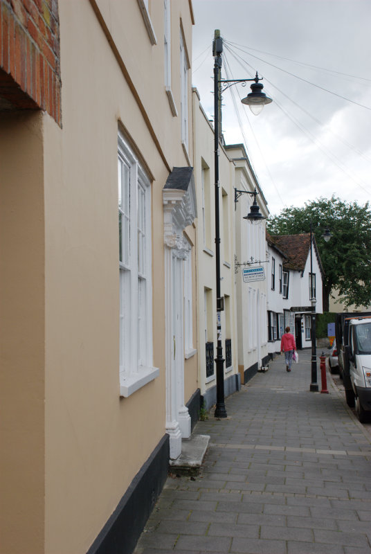
The Eastbourne train was waiting in the platform and we were soon headed for Eastbourne where we arrived at around 12:40 and after a short walk we were at our hotel at lunchtime.

Driving time would have been about two and a half hours and the train journey, including waiting times, was 3 hours so not really much difference.

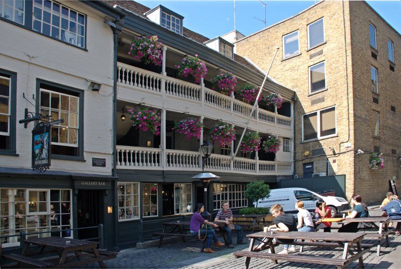
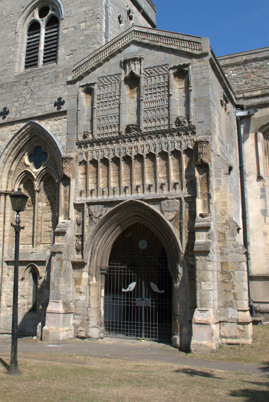
Having arrived at lunchtime we had a brilliant idea – we could have lunch and so we did. After lunch we wandered off towards the pier. The last time that we were on Eastbourne Pier the steps up to the Camera Obscura level were closed off and I was hoping we might be able to get up there this time but, no, the steps were closed off. That's two bummers in the same day. smilies

We didn't do a lot today and went back to our hotel to prepare for dinner. Tomorrow is the big day.

Day Two

After breakfast at about 9:30 AM we left the hotel and walked down to the seafront. This view is looking in the direction in which we are headed.

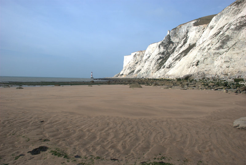
We followed the coast road westward until it reach the grass downland where it bends sharp right. We bent sharp left along a track going towards the cliffs. When we reached to edge of the cliffs we could see back to Eastbourne.

You may just be able to see the end of Eastbourne Pier sticking out beyond the promentary where the beach disappears from sight. The weather is better than forecast this morning but the sun is watery and it's not very clear. There is also a strong wind of about 15 mph gusting to 21 mph which we could do without. Looking in the opposite direction we can see our first target – the shore. Do you think that the sign is trying to tell us something?

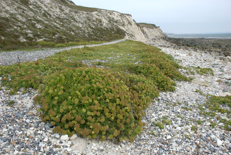
You may notice that the shore is covered in rock fragments caused by erosion and we are planning to walk on that. smilies

We still have a way to walk along the top of the cliffs yet. We follow the footpath until we see a path forking off to the left and we follow that fork.

We start heading down. That shore looks nearer but it doesn't look any better. More steps to go down.

Can you read the name on the sign? It says 'Cow Gap'. 'Gap' around here is a point in the cliffs which is low enough for it to be practical to build some steps down to the shore. There aren't many gaps. We have visited the other two and have been waiting for an opportunity to visit this one so we've made it at last.

There is Amanda at the foot of the steps and we are now on the shore. Take a look at the shore because we are proposing to walk over a half mile on that. After a while of scrambling it was nice to reach some solid rock to walk on for a while and just showing at the foot of the cliffs on the horizon is our second target – Beachy Head Lighthouse.

We eventually ran out of solid rock but after yet more scrambling we came across a nice large patch of sand. Woo Hoo! That was a welcome relief.

Unfortunately that nice flat sand didn't last for long and we were back to scrambling once again. We did reach another relatively small area of flat rock but there was more loose rock ahead.

The next picture shows how the shore looked further on. That's not going to be easy to walk on.

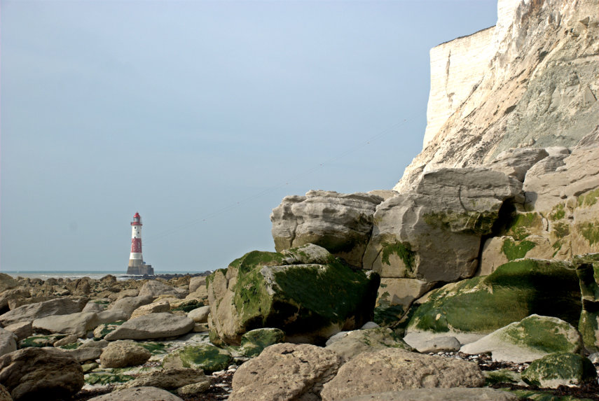
That cliff on the right is Beachy Head. We realised at this point that we wouldn't make it to the lighthouse because the tide had now turned and was coming back in so this is as near as we got. smilies This is not a good place to be caught by the tide.

On the way back to Cow Gap we had a good look at the rocks and saw many old fossils. (Waits for obvious comments. smilies )


The pictures above, in order, starting from the top are:

Ammonite shell impression
Turitella type shellfish
Section of a Brain Coral
Section of a sponge

We also came across two plants which are typical of this environment.

Sea Kale which looks rather like cabbage.

 and Rock Samphire which looks like, well, Rock Samphire.

On the way back to Eastbourne I managed to sneak up on this Speckled Wood butterfly.

We went back to our hotel to change and were out again in time for afternoon tea. Yum yum. Tomorrow I'm doing another walk and Amanda is going to a museum.

Day Three

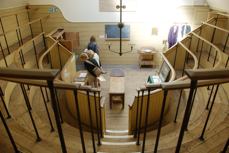
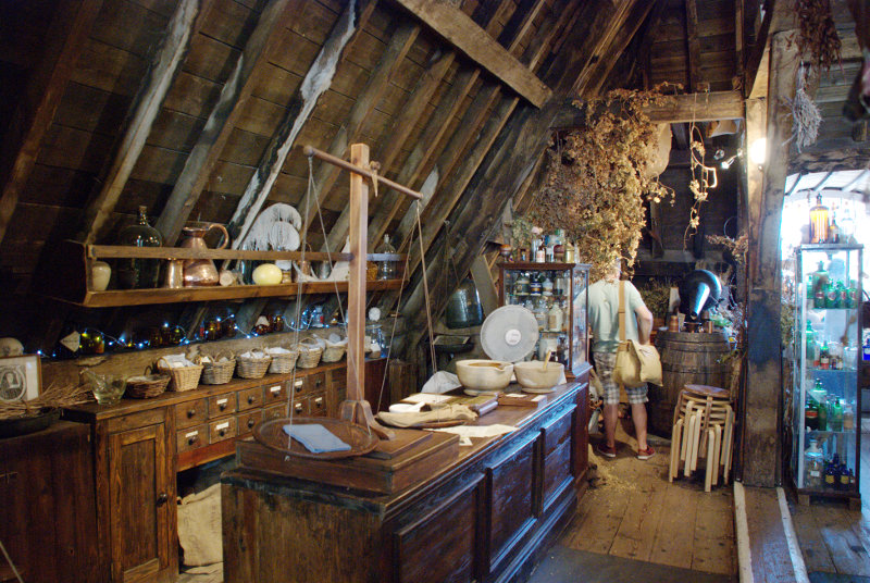
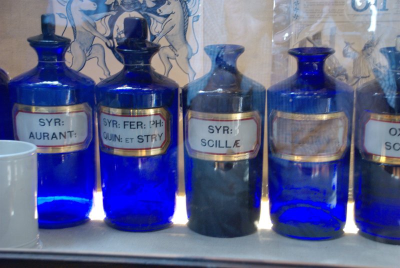
Amanda decided after yesterday's walk that she didn't want to do more walking today so she is going to visit the 'How we lived then' museum, packed with nostalgic items from the past, and I am getting on the bus.

My bus, the number 126, leaves from a stop near the railway station at about 9:45 and I walk up to the stop with time to spare. Whilst I'm waiting a lady asks me if the 126 goes to Alfriston. I explain that I hope it does because that's where I'm planning to go. We share a seat on the bus and chat. It turns out that her name is Nicky (Nicola) and she is on holiday from Switzerland and someone here suggested that she would probably like visiting  Alfriston.

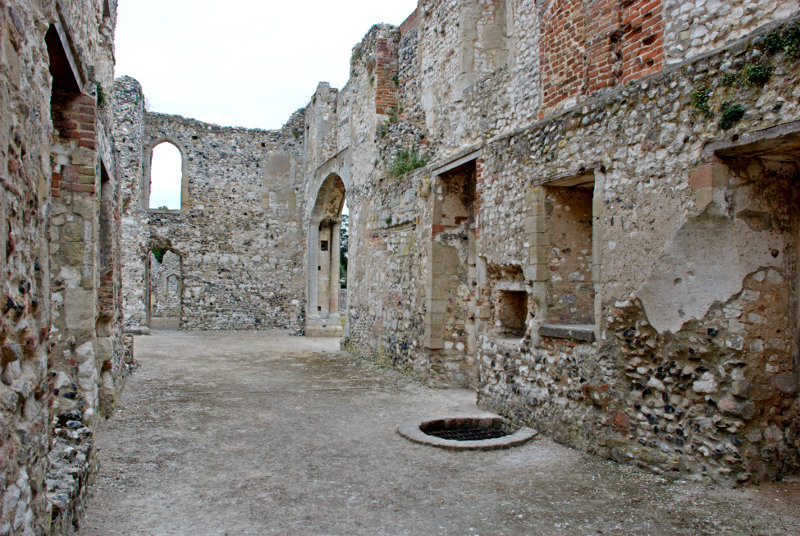
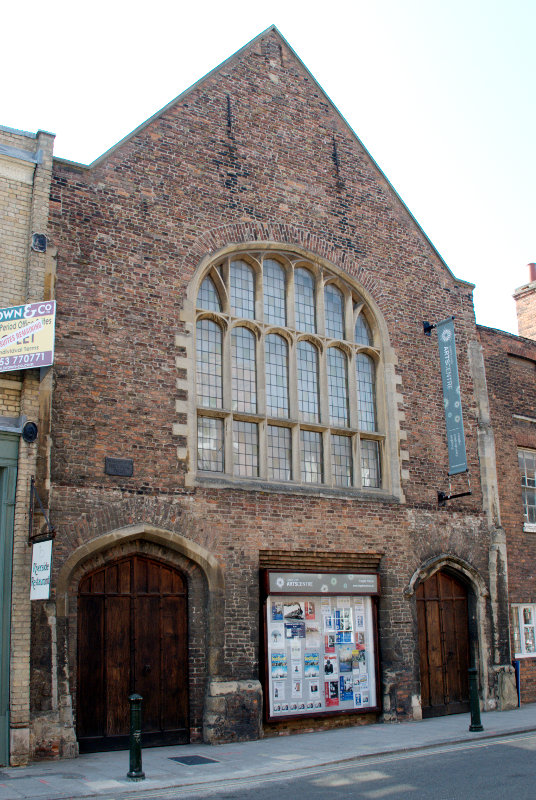
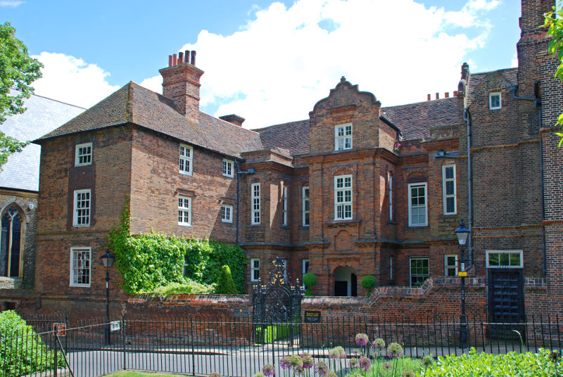
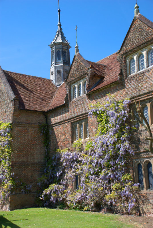
We arrive in Alfriston after about 30 minutes and she decides to join me on a visit to the Clergy House. Amanda and I have stayed in Alfriston before but were unable to visit the Clergy House because it opens only on some days and wasn't open when we were last there.

The Clergy House is a 14th-century Wealden hall-house and is owned by the National Trust. It was their first ever purchase in 1896 and cost the princely sum of £10.00.

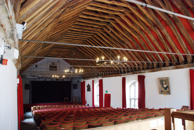
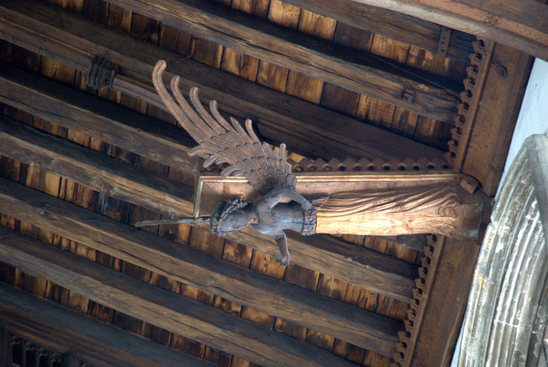
This picture shows why it is called a hall-house.

It has a hall-like room which goes right up into the roof. Very impressive but, I would imagine, a devil to heat in the winter.

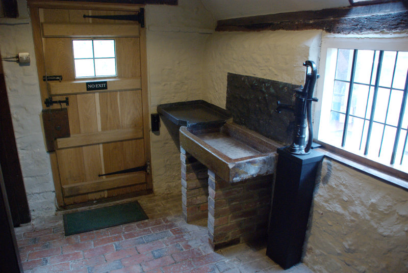
This shows the kitchen with all mod. cons. Well it does have a sink and water pump.

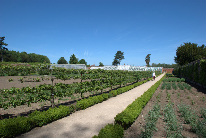
There were also some nice gardens.

Nicky was apparently going to spend the whole day looking around Alfriston so I said goodbye and made my way to the river.

Not much of a river I grant you; more like a stream at this point. However I plan on following the river down to Exceat where I hope to catch a bus back to Eastbourne so I set off.

I soon came across a group of locals having a meeting and there's one on the extreme right that's right on my path.

We shall see what she will do when I get closer. Well I walked close by her right-hand side and apart from a brief glance at me she got on with her eating. They must be used to seeing people.

I passed the little village of Littlington part of which is shown here. Pity the weather isn't better.

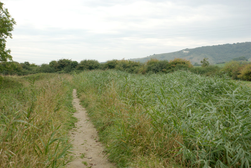
Soon after I passed littlington I had my first glimpse of the white horse, on High and Over, seen across the reeds on the edge of the river to the right.

A little further on and there is a better view of the river with the white horse beyond.

The banks of the river look muddy because the river is tidal at this point and the tide is low so the river level is down. Incidentally High and Over is the name of a hill between Alfriston and Seaford and is the hill directly ahead.

This is about as close as I got to the white horse then following the river takes me further away.


At one point I walked past these Canada Geese who seemed to be honking away most of the time. There were also some other white birds in the distance which I couldn't identify. They all sounded as though they were having a honking good time.

It didn't take much longer to get to the bus stop at Exceat and a little while later along came my bus back to Eastbourne.

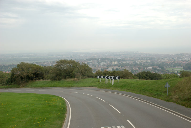
After an uneventful ride (front seat, top deck) we reached the top of the hill down to Eastbourne with a good view of the town laid out below. That probably would have looked nice in good weather.

I got off the bus at Eastbourne Station where Amanda was waiting for me with our luggage and we got the train back home. It was a short but enjoyable trip. We will probably be back.


A Musical Soiree

A Musical Soiree

Pamela has been a very good friend of ours for many years and she has a birthday coming up which will mark yet another decade so she decided that a celebration was in order which she described as 'A musical soiree'. She lives in Bury St. Edmunds in Suffolk and plays the bassoon.

So it was that last Saturday we headed 50 miles north to Bury St. Edmunds first on the A12 then the A14. The A14 approaches Bury St. Edmunds from the east and about 7 miles east of Bury St. Edmunds is the small village of Woolpit where we decided to stop to have lunch and a look around.

Woolpit's history goes back at least two thousand years and this shows the centre of the village with some of the ancient, timber-framed buildings and the church tower showing over the top.

This is a closer view of the old village water pump shown on the left in the previous picture.

There were other rather nice buildings scattered around the village.

After our walk round we went into the Teacups Tearooms, the red building, in the next photograph, partly hidden by a silver car. They provide light lunches such as salads and sandwiches, which can be toasted, as well as tea, coffee and cold drinks.

Amanda had a savoury flan salad which she said was very nice and I had a toasted sandwich which I liked very much. We followed that with some cake which was delicious.

There were cars parked everywhere in the village today which may be partly due to it being the weekend when a lot of the residents will be at home and also because there was an art and crafts exhibition in the church. Under those circumstances it wasn't really worth me taking photographs inside as the interior was covered in stands of various types.

It didn't, however, stop me taking a few pictures outside.

Woolpit is a very small village with an extraordinarily large and impressive church with what must have been some very expensive features. Take the porch as an example.

That chequered pattern on the side wall is known as Flushwork and must have been expensive to create. Look at the numerous carvings and embellishments on the porch and the top of the tower. They wouldn't have been cheap. Just below the roof line there are small windows using flushwork again. Here is a closer look.

This money would probably have come from the very wealthy wool merchants which were prevalent in Suffolk during the medieval period. The roof inside was also exceptionally well decorated but we will have to make a return visit to photograph that.

Having had lunch Amanda decided that she would like to have a look around the art and crafts exhibition in the church and I decided to walk to Drinkstone to see if I could find the two windmills.

The walk entailed going down Rag Lane to the end, along a public footpath across some fields then along a country road. This is the veiw I had going across the fields.

Can you see the post mill on the right (without sails) and the smock mill on the left (also without sails)? I was obviously on the right track. Those black cows with a white band round their middle are Belted Galloways.

I was, eventually, able to get this close to the smock mill.

The post mill was further back on private property so the best I could do was this.

Not quite so good. It's a shame that neither mill has its sails. I started back for Woolpit and as I came back along Rag Lane I caught these two views.

We decided to head for Bury St. Edmunds but instead of taking the easy route along the A14 we chose to meander through the country lanes. As we were passing through Beyton we saw this church and so stopped.

We could see inside that it had obviously been renovated, probably in Victorian times, and decided that there was not much of interest. WRONG!

It turns out that, for example, although all the quire stalls look fairly modern some of them are actually medieval and some are modern reproductions. In the next photograph the stalls on the left are medieval and the one on the right is a Victorian reproduction. There is a noticable, although not marked, difference in colour.

We moved onward and stopped again in the village of Rougham. They also had a large imposing church although not quite of the same standard as Woolpit.

There was some noticable decoration around the top of the tower. That panel in the centre appears to be text but we couldn't read it. Latin perhaps?

We decided to move on to Bury St. Edmunds. Pamela was holding her soiree at the Manor House, Nowton Court on the outskirts of Bury St. Edmunds and we were also staying the night at the same place which was very convenient.

It turned out to be a lovely 19th century building in large grounds with some exceptional trees. It was also very quiet.

In the second picture above we had our breakfast the next day in the lower part of the two storey bay window on the right so that we were looking out into these grounds.

However back to today. We were shown to our room which was very nicely appointed, settled in and then went outside for a quick look round.

It'll do.

An hour or so later we went down the rather imposing staircase, which I suspect they had built especially for us, to join the reception.

There was champagne which I tried (it's a long time since I had any) and it confirmed my previous memory of it – I can't see why anyone would get excited about it.

After a lot of chatting we moved off to the function room. I should point out that Pamela, being a musician, has a lot of musician friends so she had arranged a group of her friends to form a small orchestra of about 20 instruments which was the musical part of the soiree. The main piece was a serenade by Brahms in five movements, which I hadn't heard before and was very nice indeed.

I was very interested, as I'd never sat quite so close to an orchestra before, to see how the musicians played each of their instruments. There were violas, cellos, a double bass, flutes, oboes, bassoons and french horns. Amanda and I both thought that it really was very good.

There was then a long break where we all descended on the buffet like a plague of locusts which we did very well. One thing about this place is that they do know how to produce good food.

By now some of the musicians had had to leave but there were enough left to form a 'wind' octet of pairs of flutes, oboes, bassoons and french horns. We were then treated to two short pieces the last of which was the Teddy Bears Picnic.

It was now about 11:00 PM and the Soiree had now ended so we went to our room and went to bed after a very, very enjoyable evening.

Next morning we had our breakfast looking out of the window onto the sunny lawn – super.

Our plans were that after breakfast we would set off for home going via Sudbury where we would stop to have a look round. By the time we'd arrived in Sudbury the sun had gone and we found that we were both feeling rather lethargic so we cut our visit short. We'll go again another time. I did take a few photographs as a taster.


The last picture is the Mill Theatre.

We'll take you another time.


The view from Platform 1

The view from Platform 1

It is true that when we travel to London by train we use platform 1 at our local railway station but that's not the one I'm talking about. We'll get to that later.

We decided to go to London on Wednesday but we weren't going to visit any, what might be called, 'meaty' sites but ones which would require only a relatively short visit. It turned out to be interesting nonetheless and I'm pleased that you have decided to join us on this trip.

We got off our local train at Stratford, as we do sometimes, and changed onto the Picadilly underground line which is the starting point of the line at this end and, consequently, the train was virtually empty when we got on. I don't think that I have ever seen an underground train this empty.

It didn't stay that way for long and eventually took us to London Bridge Station which is where we wanted to get off. London Bridge Station is, rather obviously, near London Bridge and just south of the River Thames but you didn't know that did you? There's no doubt that you'd get lost if you were on your own so you'd better stay close.

We left London Bridge underground station at the St. Thomas Street entrance and turned left to reach Borough High Street where we turned left again and, after a very short walk, we arrived at our first destination. This is the entrance, on Borough High Street, to the George pub courtyard.

Inside the courtyard we see the only remaining original galleried pub in London dating from the 1600s. There is another 'galleried pub' in St. Catherine's Dock near Tower Hill but that is a reconstruction and not a genuine original.

The timbers aren't very straight now are they? It is now only half the size it originally was as the Victorians demolished half of it to make way for new warehouses. Nice people!

We went back to St. Thomas Street a little past the underground station where we saw this view.

We were looking for a tower. No, no, no not that ghastly Shard thing at the back but the brick tower. Going through the doorway we see another small door over to the left which leads us up a small (very small) spiral stairway.

When we reach the top we are in the Old Operating Theatre and Herb Garret Museum. This was part of the old St. Thomas Hospital and is the oldest operating theatre in Europe. It is, oddly, found in the roof space of an English Baroque Church. It makes a little more sense when you realise that the wards of the old hospital were built around the church. The Operating Theatre would have been built in the first half of the 19th century when operations were still being carried out without anaesthetics.

The rest of the roof space was used by the St Thomas's Apothecary to store and cure herbs which is all they had in lieu of drugs.


There were a lot of displays relating to medecine and surgery of old including some of the old surgical instruments.

After having had a good look round we went back to Borough High Street and crossed the road to this archway.

Borough Market and Southwark Cathedral are immediate neighbours. There was a small outside market when we were there and although it looks as though the stalls are up against the cathedral they are not on cathedral property.


The covered part of the market is really quite spacious with lots of stalls some of which weren't open when we were there. Our only disappointment here was that it really was too early for lunch.

Traders in the 13th century started the market in Borough High Street although it was then closed by parliament in 1755. However a group of Southwark residents raised £6,000 to buy a patch of land known locally as The Triangle, once the churchyard of St Margaret's, and reopened the market. It has been going ever since and is renowned as a food market.

I should warn you that there are some funny people around.

I'm saying nothing.

We left Borough Market going past Southwark Cathedral and along Clink Street.

At the end of Clink Street we reached the Thames with the Golden Hinde nearby. Along the riverside past Southwark Bridge and the Millenium Bridge.

It wasn't long before we were in sight of the Blackfriars railway bridge. A few years ago it was decided that Blackfriars Station (the overground railway not the underground) needed an upgrade. The problem was that where could a new station be built in such a crowded area? The answer was, of course, that you build it across the river so that the station replaces the bridge and that is what happened.

You can probably see a small part of the road bridge through the nearest arch.

As one can use the normal overground railways in London with a travel card for travelling within the London Zones our travel cards let us through the barrier and into the station. We went up the stairs onto Platform 1.

We are walking from south to north and you'll notice that the railway lines are to our left and on the right instead of the usual wall there is a glass screen. This is the view from Platform 1 looking east through that screen.

Just out of the left of the picture we could see the dome of St. Paul's together with the top part of the two towers. The nearest bridge downriver is the Millenium Bridge but, unfortunately, it does tend to merge into the background.

We went out at the north end of Platform 1 and down into the Underground where we caught a train to South Kensington.

We went into the Victoria and Albert Museum just to have lunch. Amanda didn't enjoy hers as much as she did on the previous visit but mine was nice. Whilst we were sitting at the table I took this picture of the rather ornate Gamble Room in which we were having lunch.

After lunch we took a short cut out via the courtyard which today seemed more like the local swimming pool except that the water is only ankle deep but the children were certainly enjoying it.

We left the museum and headed north along Exhibition Road then turned left into Prince Consort Road. It wasn't long before we caught site of our next locatioon.

You may recognise it as the Albert Hall. Walking round one side of the building we came out opposite the Albert Memorial in Hyde Park/Kensington Gardens and I must say it was an astonishing site with all the gilding glowing in the sunlight.

We walked across Kensington Gardens towards the Round Pond and Kensington Palace. We had no intention of going into the palace but we did have a look at this.

The Sunken Garden in Kensington Palace grounds. The grounds, including this garden, seem to be freely accessible.

We were about ready now to head home so we aimed for Gloucester Road underground station, being the nearest, and we went via some of the backstreets.

Kensington is the sort of place where one sees roads lined with large, grand and very expensive properties.

This means that, as they were built in Victorian times, there would also be some mews nearby where the coach and horse were kept together with the coachman and his family.

So it proved to be.

That was a few of the mews we found and we were now worn out. I hope you enjoyed your trip – we certainly did and now it's time once again to go home.


Lynn – Day 4

Lynn – Day 4

Today we wake to a cloudy sky. This does not come as a surprise as it was forecast and we still decide to stop off in Thetford on the way home as neither of us knows much about it. We finish breakfast, pack and set off.

We parked near the 18th century Nuns' Bridges which took their name from the nearby nunnery and they carry the ancient trackway known as the Icknield Way over the Little Ouse River and the River Thet in Thetford.

The first picture shows one of the bridges and the second picture shows the other two bridges; there being three in all and they are only one car width.


Not far the other side of the bridges we found the 17th century Dolphin Inn. A typically patterned frontage involving flints much used in Norfolk.

There were quite a lot of signs in Thetford but …

A bit further on and we found the old Medieval Motte and earthworks. This huge motte, or artificial mound, is sunk into a deep surrounding ditch, and protected on the north site by two sets of complex ramparts, which were probably part of the original Iron Age fortifications. At  64 feet high (72 feet from the base of the ditch) this is the second largest man-made mound in England the largest being Silbury Hill in Wiltshire. This would have had a castle on the top.

You can see Amanda wondering if we can actually get up there, the only way up is straight up the slope, will we get down alive?

Well we did and we are as this picture testifies. The building on the centre line of the picture is the back of the Dolphin Inn.

Further into the town we saw the Ancient House which dates from the late 15th century, making it Tudor, and it is now a museum.

Soon after we found the Charles Burell Museum which tells the story of a local factory which was once the major employer in the town making steam traction engines and steam rollers. I WANT ONE!

The company became known for producing reliable and good-looking steam-powered engines which were always built to customers' requirements.

Finally we went to see the remains of the Cluniac Priory.  Founded in the early 12th century these extensive remains were one of the most important East Anglian monasteries, the Cluniac Priory of Our Lady of Thetford and the burial place of the earls and dukes of Norfolk for 400 years.

Those parts remaining include the lower walls of the church and cloister, along with the impressive shell of the priors' lodging and, reached by a pathway from the main site, an almost complete 14th century gatehouse.


That was the end of our trip and, from there, we went home.


Lynn – Day 2

Lynn – Day 2

Another hot, sunny day dawned although I wasn't awake to see that part. We went down to breakfast and very nice it was. We both had a cooked breakfast followed by toast and marmalade, of course, then it was time for some serious tourism.

Wherever we went in Lynn we went via The Walks past the Red Mount Chapel. It wasn't because we liked it so much but it was the most convenient route into the old part of the town.

We were headed for St. Margaret's Church, or the Minster as it is known, and Saturday Market Place. King's Lynn was originally two towns so it has two churches, two guildhalls and two market places. We will be seeing the other market place later.

For a parish church the minster is big.


The space on the left where there are some parked cars is Saturday Market Place which is used as a car park when there isn't a market being held.

Parish churches don't normally have two towers and especially towers that large and you can probably see in the top picture that there is a sizeable tower, although not as high, further back over the crossing.

This church also contains the largest monumental brasses in the country dating from the 14th century and the figures depicted must be near life-size. This is one of the pair.

Just south of the minster is Nelson Street and Hampton Court. This is not Hampton Court Palace in London but it is pretty spectacular all the same. The whole building was formed over a period of 300 years.

The South Wing was constructed first, consisting mainly of a 14th-century merchant's hall house and is thus the earliest surviving section.

The West Wing was constructed towards the end of the 15th century, probably as a warehouse which was later converted into a house. The East Wing was also constructed at the end of the 15th century.

The North Wing completed the courtyard a century later.

In the picture above the doorway into this courtyard is visible in the far wall.

Next to the north wall of Hampton Court is St. Margaret's Lane with the 15th century Hanse House, a Hanseatic Warehouse, along one side. The Hanseatic League was a trading confederation which existed from the 13th to the 17th centuries.

Running eastward from the junction of St. Margaret's Lane and Nelson Street is Priory Lane.

St. Margaret's Church, the Minster, was originally part of a medieval Benedictine Priory until the Reformation when the priory was disbanded by Henry VIII but the church was saved as a parish church. Priory Lane includes buildings in the medieval priory range. Note the rather imposing archway.

It was rather nice walking around this area with its old narrow streets because it offered plenty of cool shade.

We walked back past the church to the north side of Tuesday Market where we found the town hall complex which included the 15th century Trinity Guildhall.

The guildhall includes the facade with the doorway in the centre of the picture and the gabled building to its right. The part on the left is the town hall shown below.

The town hall is an extension built in a similar style in 1895. You can see the Guildhall jutting out at the far end.

We were now heading further north along Queen Street and then King Street to see St. George's Guildhall. The largest surviving 15th century guildhall in England.


The guildhall ha since been converted for use as a theatre and the second picture shows the structure of the original roof.

We now travelled the short distance to the larger Tuesday Market Place. As is the case with Saturday Market Place when a market is not beig held this market place is also used as a car park.

The prominent blue and white building is the Dukes Head Hotel and the spire poking up above the rooves to the left is St. Nicholas' Chapel. I think that I can say, without exaggeration, that this is the largest chapel that I have ever seen.

Apparently it can't be called a church because it isn't a parish church and that honour goes to St. Margarets so it must be a chapel. Built in the 15th century it has a very fne porch and some of the best carved wooden angels in the roof that we have seen.


To the south of the chapel by a side entrance to the churchyard was the Exorcist's House. The position of Exorcist in past enturies was one which a Catholic priest could hold as he progressed up the church career ladder. It has a side entrance that leads directly into the churchyard and has the reputation of being haunted.

Behind the chapel is Pilot Street where we spotted these nice timber-framed buildings.


We now headed for the river down Ferry Lane. You won't be able to guess where we're going.


It was a strange looking little boat but eminently suited for its purpose.

Here we are on the other side of the river in West Lynn looking back at the King's Lynn waterside.

We walked along the boardwalk which runs along the bank and had some good views of King's Lynn.


Somewhere back there is where we got off the ferry and we have to walk back again. We had worn our legs down to short stumps by now so that is what we did. We went back to the ferry and went 'home'.

We're off somewhere different tomorrow.


A high speed trip.

A high speed trip.

The high speed railway route from St. Pancras Station in London runs down through Ashford in Kent, under the English Channel, and thence to foreign climes. On its way it also passes through Stratford International Station in Greater London and, as I have mentioned before, the rail route from our local station goes through Stratford on its way into London.

Part of that high speed route can also be used to get to other places in Kent so on Saturday we went, by high speed train, to meet two friends of ours, Ian and Carole, in Kent who live very near Rochester and that is where we all met.

We caught our usual train from our usual station and travelled to Stratford then walked for 10 minutes to Stratford International Station and caught the train to Rochester. The run to Ebbsfleet, the next station, is on the high speed line but it is mostly underground having to pass under the River Thames. We were obviously travelling fast but I've no idea what our actual speed was although these trains have a maximun speed of 140 MPH. It took us 30 minutes to get to Rochester where Ian and Carole were waiting for us at the station.

Walking out of the station we crossed a road or two and very soon found  ourselves in High Street.

You can see that the town was expecting us because of the bunting hung across the street. A short distance along and we came across this building – notice the legend just above the doorway in the second picture.


The building is late 16th century and was once a town house but has been converted to three shops. This building was used by Dickens as the model for Pumblechook's home.

The Kent countryside near Gad's Hill Place, Dickens's last home, is the setting for Pip's childhood in Great Expectations, and Rochester is the model for the 'nearest town'.

Mr. Pumblechook was charged with escorting Pip to Miss Havisham's house for the first time. Because of this, Mr. Pumblechook believes forevermore that he had a big hand in helping Pip to his fortune.

A little further on we saw Eastgate House dating from around 1590.


The second picture is the rear view showing the Swiss Chalet, where Dickens wrote some of his greatest works, which was given to him by the French actor Charles Fechter and it arrived on Christmas Eve 1864. It was originally located opposite Dickens' house on Gads Hill.

There are two rather dubious looking Dickensian characters sitting on the wall and some even more dubious characters over to the left. Amanda on the right, Carole in the centre and Ian on the left. This is the middle of June and you'll notice that we are all wearing jackets. We are still waiting for a proper summer.

Leaving Eastgate House we hopped up Crow Lane to the Vines. The Vines used to be the vinyard of the local monks but now it's a small park and a very nice one.

Just opposite the Vines in Crow Lane is Restoration House where Charles II stayed on his return to England in 1660 to be crowned (the restoration of the monarchy). The building is the amalgamation of two medieval houses.

We left the Vines at the far end and emerged into Minor Canon Row. These Canons are not the BOOM BOOM sort but the eclesiastical sort, you understand, and they needed somewhere to live so this row of 7 Georgian townhouses were built for them between 1722 and 1735.

Walking round the corner at the far end and we get our first view of the cathedral.

It didn't take us long to get to the west end and the main entrance where we went in. Entrance is free.

There are more photographs of the interior but you'll have to wait for those to appear on the main web site.

Back in the High Street we stopped for lunch in a nice little restaurant called the Atrium with plenty of wooden beams. Service turned out to be a bit slow but the food was very nice. Well, of course I had the Chocolate Truffle Torte for dessert – I mean, do I look silly?

Whilst we were having lunch we could see, out of the window, this building across the street.

It was the Poor Travellers' House dating from the late 16th century. It was endowed under the terms of Richard Watts' will of 1579 providing a night's board and lodging for six poor travellers. More pictures will appear on the web site later.

A little further along High Street next to Two Post Alley is this rather interesting Tudor building and it really is that wonky.

You may notice a small bit of the castle beyond the end of the alley.

The weather was deteriorating by this time with a very strong wind so we went for a quick look at the castle and I managed this photograph in a quick flash of sunlight.

It looked very impressive but we didn't want to hang around in this weather so we'll have to make a return visit.

Ian and Carole took us back, in their car, to their house for some tea. We had strawberries and cream with some coffee and walnut sponge to follow which was very nice indeed. I'm desparately trying to make you envious here; I hope it's working.

When it was time for us to leave Ian and Carole drove us back to Rochester Station where we caught our train to Stratford and thence another train home.

Rochester was a very pleasant town packed with interest and just 40 minutes from London making a nice day trip destination.


Our trip is at an end.

Our trip is at an end.

… and to be more precise it's at Audley End. As you all probably know (Who am I kidding?) 'end' is the Saxon word for 'home' and this was Thomas Audley's home.

Not a bad home eh? These Jacobean piles are two a penny around here (Essex and Suffolk) and this one is on the outskirts of Saffron Walden in Essex about a 70 minute drive from us.

There are also a number of other 'ends' around here. I remember coming past Cole End on the way; there is Sparrows End a little south of here near Wendens Ambo (of which more later) and there is a Duck End in Finchingfield.

Audley End was originally the site of a Benedictine monastery (Walden Abbey), granted to the Lord Chancellor Sir Thomas Audley in 1538 by Henry VIII but was later converted to a domestic house for him, known as Audley Inn. That dwelling was later demolished by his grandson, Thomas Howard (the first Earl of Suffolk and Lord Treasurer), and a much grander mansion was built, primarily for entertaining King James I.

The layout reflects the processional route of the King and Queen, each having their own suite of rooms. It is reputed that Thomas Howard told King James he had spent some £200,000 on creating this grand house, and it may be that the King had unwittingly contributed. In 1619, Suffolk and his wife were found guilty of embezzlement (oops!) and sent to the Tower of London. However, a huge fine secured their release, but Suffolk died in disgrace at Audley End in 1626.

Sir John Griffin, later fourth Baron Howard de Walden and first Baron Braybrooke, introduced sweeping changes in 1762, in particular, the commissioning of Capability Brown to landscape the parkland.

The house is now only a third of the size of the original and is in the ownership of English Heritage although the contents are owned by the current Lord Braybrooke.

We arrived about 10:30 in the morning on a fine sunny day. The first thing that we noticed was this astonishing topiary hedge grown from Yew and Box. It's really quite, er, lumpy.

I don't know why it's been trimmed this way but I'm certainly glad that I don't have to maintain it.

As the sun was at the back of the house we decided to start there. Those bright blue flowers are Forget-me-not and, I assume, a cultivated variety rather than the wild one as the wild ones are a paler blue.

On the high ground behind the house is the Temple of Concord built in 1790 in honour of George III.


After coming down off the high ground we went back to the front of the house and beyond into the parkland then down to the River Cam, which runs through the estate, where we saw the Adam Bridge designed by Robert Adam who also remodelled a number of the reception rooms in the house. Ducks? What ducks? Oh, those ducks. They were making their way towards a lady with a pram hoping that she might be a provider of food. They were out of luck. They obviously didn't like the look of me.

At this point we were very close to the Old Stables and yet another bridge.

That person lurking on the very right-hand edge of the picture is Amanda. She does a very good lurk. You may also notice that there is a black swan nibbling grass on the bank.

These are the Old Stables. Quite fancy for stables.


We continued along by the river until we reached the Victorian Kitchen Gardens and they were vast.

That is Amanda disappearing rapidly into the distance being 'pulled' by the attraction of two very large greenhouses.

See, I told you, she couldn't wait to get inside but I managed to get to the larger of the greenhouses first with its pretty amazing display of Schizanthus (the poor man's orchid).


Ater leaving the Kitchen Garden we found ourselves in the Pond Garden.

That figure is Amanda trying to get away from me as usual. Is she trying to tell me something?

There are two rectangular ponds with, in the dark shadows at the end, a large vertical rockery of ferns and shamrocks. There was also a solitary duck in the far pond and the water level was quite low down and we did wonder if the duck would be able to take off and fly as there wasn't much room but we were also sure that the staff would be used to that sort of occurance and would rescue the duck if need be.

After leaving this garden we emerged into the Elysian Garden with a number of very large trees of which this mighty specimen was one. Amanda thought it was an Oriental Plane.

The little building over the stream is the Tea House Bridge designed by Robert Adam.


We had managed to choose a day, unknowingly, when entrance to the house was by guided tour only. They apparently also have what they call 'free flow' entry which means that you can wander round at your own pace but not today. In either case photography in the house is prohibited and, needless to say, that annoyed me greatly.

It will probably annoy many other people as well. We got just 30 minutes for our tour which is not a lot for the entry charge. At one time it was possible to pay to enter the gardens only but that does not now seem to be available so bear in mind that almost half the charge was for the house and you may get only 30 minutes for your money. There is nothing on the English Heritage web site, that I can see, about Audley End that mentions the two types of access to the house.

So once again we have no interior photographs.

After we left Audley End we travelled the few miles to Wendens Ambo. The name originates from the joining of two villages, Great Wenden and Little Wenden to form Wendens Ambo where Ambo means both Wendens. There is a railway station within the village, Audley End, which is the nearest station to Audley End House two miles away and habitation here dates back to Roman times.

This is the view from just inside the churchyard.

and this is the church. A rather cute little church and quite old. It seems to have been built about the time Domesday Book was written (1086 A.D.) with later additions in the 13th, 14th, 15th and 19th centuries.

There was a fragment of a wall painting dating from about 1330 in the Chancel.

The church organ casing dates from the late 1700s

and the Chancel Screen dates from the 15th century.

Amanda, shown on the other side of the screen, does not date from the 15th century.

We went home.