Browsed by
Tag: Rivers

Rock and Water – Day 4

Rock and Water – Day 4

Amanda and I aren't talking to each other this morning! That's because we are each going to different places, me back to Great Asby Scar and Amanda to the small market town of Kirkby Stephen.

Amanda is catching a heritage (rather old) bus into Kirkby Stephen and she actually took a photograph of the inside whilst she was going along. This bus had a platform entrance at the rear and a conductor!

The stairs to the upper deck started from the rear platform.

The roads around here can be very steep and Amanda said the bus made a bit of a meal of them and, at one point, she was afraid that the driver would run out of gears but they arrived safely in Kirkby Stephen.

Meanwhile I had driven up to Great Asby Scar again but to the west side this time. I had heard that the limestone pavements on that side had a distinctly different appearance so I parked the car and set off over the moors. One and a half miles later I could see my destination in the distance.

It didn't take long to get there and find that it was much the same as the pavement on the eastern side.

Perhaps I wasn't in the right place but I didn't have any more time and it would take hours looking around an area like this so I made my way back to the car and thence to Kirkby Stephen. Nice scenery though.

I met up with Amanda in Kirkby Stephen and we had some lunch before venturing out into the little town. We first visited Frank's Bridge; a 17th century corpse lane bridge across which coffins were carried on their way to the church.

In the town we saw this old signpost with distances marked in miles and furlongs and for those of you that don't know there are 8 furlongs to a mile.

We then chanced to walk over a bridge, looked over the edge, and this is what we saw.

There was obviously a serious amount of water there making quite a lot of noise. It was now getting late in the day so we went back to our hotel to prepare for dinner. Tomorrow is our last whole day before we leave for home.
 

Rock and Water – Day 3

Rock and Water – Day 3

Today was our first full day in the area and we set off eastwards into the Yorkshire Dales towards Keld and Muker along the B6270 road. Don't take the 'B' classification as an indication that it is a reasonably fast road because this road is only one car wide, bends left and right and goes up and down all over the place. Luckily there are places where one can squeeze past other vehicles although we saw few of those (vehicles not passing places) but the scenery is really wonderfully dramatic.

Looking at the road in the picture above you will see that it disappears over a hump in the distance and then, if you look carefully, you can see the road re-appear over to the left about halfway between this section that we're on and the left edge of the picture. It really does wander all over the place. Ocasionally one can find an area big enough to pull off and stop which is what we did around Hollow Mill Cross by Tailbrigg Hill and look what we found – another limestone pavement.

One of the interesting features of this limestone area is that the soil is mostly acid which seems to be a contradiction on limestone but there is so much rain up here that all the calcareous content has been leached from the soil.

This pavement is very well weathered and you'll notice the little tarn (lake) in the distance which is only there because the acid soil is relatively impermeable and just to the right of that tarn is the tiny figure of Amanda who is just about to make an interesting discovery.

She is heading for that row of humps to the right of her figure and this is what she found.

It's what is known as a Shake Hole. These are often 60-80 feet deep or more and can be caused by the collapse of part of a cave system below, fracturing the limestone, and allowing water to seep down and dissolve the limestone to form these shafts.

We decided to move on and eventually came down off the high ground into a very small village called Keld. We found a place to park and walked down to the river where there were a couple of nice little waterfalls.

You may have noticed that on this trip the weather is rather changeable but it hasn't actually rained yet and we have had a little sun. We moved on to Thwaite where we had lunch and I now have a little tale to tell.

We had been to this area before, about 35 years ago, and on one night we stayed in a small pub in a small village and Amanda and I couldn't remember exactly where it was but she was keen to try and find out.

She remembered that it was called either The Queens Head or The Kings Head and we both remembered that it was run by an old lady. We both remembered that it was next to a small river which was thundering along because of all the rain at that time (nothing much changes does it?).

One of the people where we had lunch though, after hearing our tale, suggested that it may well have been in Gunnerside a few miles further along the road. So after lunch we set off and very soon caught a glimpse of Gunnerside.

Arriving in the village we soon found the Kings Head. This view of it is across the bridge over a small river. We went in and spoke to the people who now run it and had a brief look around and Amanda thinks that this could be the one. So one mystery solved.

Our next destination was the Buttertubs up on the Buttertubs Pass at around 1700 feet. Now that was an interesting road with a steep drop on one side and, again, rather narrow. There was a flimsy looking barrier along the edge which I remember wasn't there when we came this way before. They do seem to pander to motoring wimps these days.

We arrived at the Buttertubs and found space (there isn't much) to park. It was also raining and I was trying to take photographs and keep the camera dry. This is one of those Buttertubs.

Needless to say you wouldn't want to fall into one of those and here is Amanda doing her "let's look down a big deep hole but don't go too near the edge" thing by another of the Buttertubs.

Where does the name come from? It is said that the name of the potholes came from the times when farmers would rest there on their way to market. During hot weather they would lower the butter that they had produced into the potholes to keep it cool. I can't say I'm thoroughly convinced by that but I can't offer an alternative explanation.

We decided to call it a day at this point, having seen an awful lot of rock and water, and returned via that same hairy road to our hotel. More tomorrow.


The Prospect of Whitby, Captain Kidd and the Town of Ramsgate

The Prospect of Whitby, Captain Kidd and the Town of Ramsgate

Another Thursday – another trip to Wapping.

Let me explain to our various overseas visitors that Wapping is not pronounced the way it is spelled but instead it's pronounced 'Wopping'. Now that we've got that sorted I'll remind you that at the end of the last report I said:

"Perhaps we'll get better weather next time. We want to do that same walk again to see some things that we missed but I'm not going to tell you what they were and to, hopefully, get some better photographs."

Well we did get better weather, sun all day and temperatures around 70-72F, and we did that same walk again (it was in Wapping) – but with added ingredients. The name comes from the Saxon meaning "the place of Waeppa's people"

So what connection does the title of this post have with Wapping? They are all pubs and they are all in Wapping High Street and they all back on to the River Thames.

Lets start at the beginning. I'm going to use the same map as last time with our new route added.

Last time we went as far as '2' which we also did this time but we went on to complete a circular route. We started, as last time, from St. Catherine's Dock.

We walked along the same canal – you can see the masts of those two replica sailing ships (No. 1 on the map) sticking up into the sky in the distance.

Then onwards to Shadwell Basin (No. 2 on the map). This time we walked round the north side of the basin past the new housing towards the eastern end of the basin with the tall buildings of Canary Wharf visible in the distance.

At the far end is one of the old lifting bridges and this next picture is taken from the bridge (location 3)  looking back across Shadwell Basin.

We then walked eastward to the edge of the Thames and along the Thames Path for a short way

and came out opposite this.

So what is it?  It is the Wapping Hydraulic Power Station, built in 1890, and was originally operated  using steam and later converted to use electricity. It was used to power machinery across London, using hydraulic power including bridges, lifts and cranes etc. The Tower Subway was used to transfer the power, and steam, to districts south of the river.

It was used as a model for power stations in Argentina, Australia, New York and Europe. When electricity became cheaper it lost popularity and eventually closed. It is now used as a cafe with the tables and chairs dotted around among the old machinery which is a novelty. They serve cups of tea and coffee together with lunch etc.

Pass the oil please.

Opposite the old power station is the first of our pubs – The Prospect of Whitby. No. 4 on the map.

The Prospect of Whitby lays claim to being one of the oldest riverside taverns in London and dates from around 1520 during the reign of Henry VIII. At one time it was one of the most notorious pubs in London being a meeting place for sailors, smugglers, cut-throats and footpads but now it seems to be a pretty nice pub.

It was formerly known as the Devil's Tavern, on account of its dubious reputation and before that it was officially called "The Pelican". The stone steps, alongside the pub and going down to the foreshore, are the "Pelican Steps"

All that now remains from the building's earliest period is the 400 year old stone floor.

In the 17th century, it became the hostelry of choice of Judge Jeffreys, known as "The Hanging Judge, who lived nearby and a noose hangs by a window, commemorating his custom. According to legend, criminals would be tied up to the posts at low tide and left there to drown when the tide came in.

You'll be wanting to see the noose then? Taking our lives in our hands we went down Pelican Steps on the the Thames foreshore to see the riverside view of the pub. Luckily it was low tide otherwise we may have got our feet wet. Possibly even our eyebrows.

You can see Pelican Steps and the noose is hanging from that tall post on the right. There is a better picture of the noose below.

Following a fire in the early 19th century, the tavern was rebuilt and renamed "The Prospect of Whitby", after a Tyne collier, a type of boat, that used to berth next to the pub.

Walking westward along Wapping Wall we went past numerous old wharves now converted to luxury appartments such as Metropolitan Wharf shown here and, after going down New Crane Steps, New Crane Wharf shown below. No. 5 on the map.

Notice that nice sandy beach along New Crane Wharf.

Having walked the length of Wapping Wall we joined Wapping High Street where the old dock buildings have all been renovated and converted to housing and it's been done very nicely. This is a view along Wapping High Street.

Further along Wapping High Street we reach our second pub – the Captain Kidd. No. 6 on the map.

Somewhere around here in 1701 the pirate, Captain Kidd, was executed by hanging on Execution Dock hence the name of the pub. The exact location of Execution Dock appears to be unknown except that it was near one of the local docks or wharves. His remains were gibbeted by the river Thames at Tilbury for more than twenty years.

Execution Dock was used for more than 400 years to execute pirates, smugglers and mutineers that had been sentenced to death by Admiralty courts. The "dock", which consisted of a scaffold for hanging, was located near the shoreline of the River Thames at Wapping. Its last executions were in 1830.

A short rope was often used for exceptionally nasty pirates which meant that, when they were dropped from the gallows, the rope didn't break their neck and they were then slowly asphyxiated. Customarily, these corpses were left hanging on the nooses until at least three tides had washed over their heads.

The Captain Kidd pub was established as a pub only in 1980 but the building itself is 18th century. The entrance visible on the street leads into a small, rather attractive courtyard which then gives access to the pub proper.

A short way further along Wapping High Street we saw yet another interesting warehouse conversion on the corner of Dundee Street.

A little further beyond that we encountered our third pub – the Town of Ramsgate with Wapping Old Stairs next to it. No. 7 on the map.

This shows Wapping Old Stairs. Amanda is on a set of stairs that just stop in front of a wall – very useful. The stairs to the right of those give access to and from the foreshore. The Town of Ramsgate pub is just out of the right edge of the picture and you may have noticed part of Tower Bridge showing in the distance.

The Town of Ramsgate was originally known as the Red Cow and then the Prince of Denmark with the origins of the pub claiming to go back as far as 1543.

We went back up to Wapping High Street and, after a short distance, turned onto the Thames Path along the edge of the river.

We eventually reached Readmead Lane which was where we turned off when we started this circuit and so have come full circle. We can recommend this area for some interesting exploring especially if you can manage a day when low tide is around the middle of the day which will enable you to go down some of the old steps onto the river foreshore.

We headed back to Tower Bridge and crossed to the south side of the river, along Shad Thames to Pea Pod for a late (2:15 PM) lunch. We have been here before and on our last visit had Old Guy USA (Jerry) with us.

After lunch we walked west along the Thames until we were opposite the Tower of London where I took this photograph of the White Tower. The last time I tried it was covered in scaffolding.

We went back across Tower Bridge, now heading for Tower Hill Station, and went past these in the Tower of London grounds.

They look remarkably life-like but they are made from multiple layers of wire netting moulded to shape.

So our legs are tired and we are tired – time to go home methinks. We covered an awful lot of interesting history today and we found that when we got home we were covered in it and had to rinse some of it off. :lol:
 

Yesterday we walked four feet

Yesterday we walked four feet

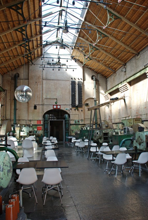
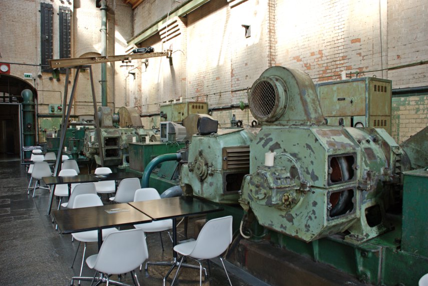
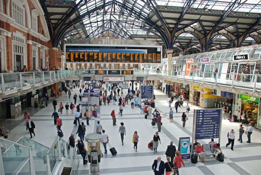
… (the ones on the end of our legs that is) and we walked them from Westminster to Liverpoool Street Station. Why Liverpool Street Station? Because that's where our train to London terminates and we will be going back home from there.

We saw Westminster Palace, the London Eye in close up, the Millenium Bridge, some old churches, Tower Bridge, the old Billingsgate Fish Market, a Saxon Arch, the Gherkin, a hidden treasure, lots of alleys, the Royal Exchange, the Bank of England, the Mansion House and a Turkish Bath House. We also visited the area where Charles Dickens wrote some of his novels.

We'd better get started then, there's a lot to do. Don't forget that clicking on a picture will give you a larger version.

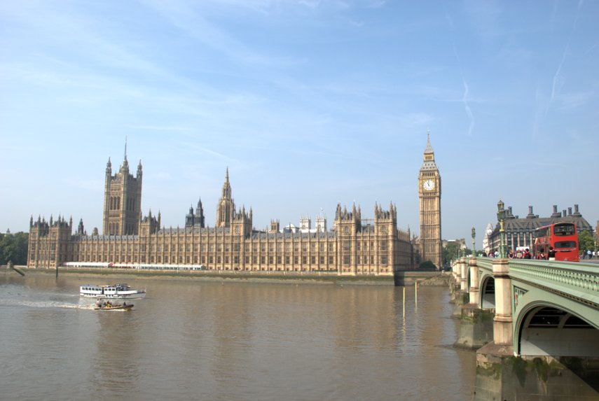
Friday was a sunny day and, after travelling to London, we took the tube to Westminster and walked across Westminster Bridge to the south side of the Thames. There's a good view of the Palace of Westminster (Houses of parliament) from there.

We turned east along the riverside path and in a very short time reached the London Eye. I have to say that it looks an impressive bit of engineering in close-up. There were longish queues but not excessive and we weren't planning a ride.

There are a number of visitor attractions along this stretch of the path, including the London Aquarium, together with various cafes which give the area a holiday atmosphere. There are also a number of street entertainers and snack bar trailers along here and we decided to have an early lunch. We bought ourselves some snacks and sat on a riverside bench to eat them whilst watching the world go by. There were a lot of tour boats and we saw a restaurant boat which looked rather like a rather long floating greenhouse.

After lunch we continued along the path with views like this:

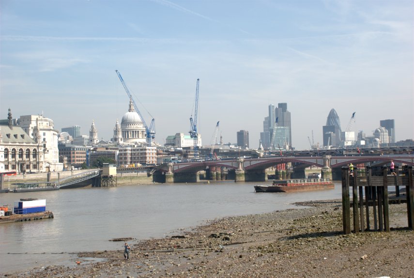
I'm sure you don't need me to point out St. Paul's but the bridge is Blackfriars Bridge which we intend to use to go back across the river to the north side. The cranes are part of the building works apparently being carried out on the railway bridge. I don't know what they are doing but they are doing a lot of it.

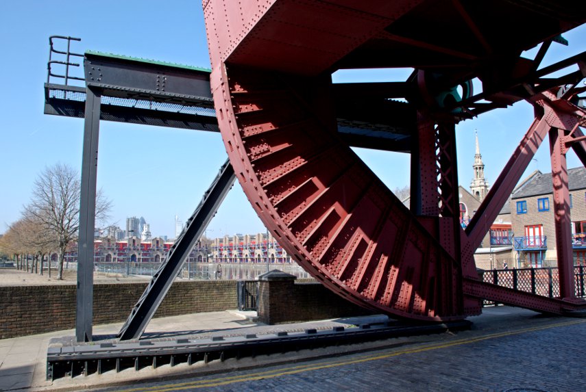
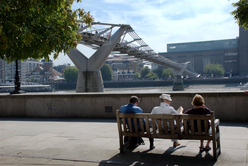
After crossing Blackfriars Bridge, to get to the riverside walk, one has to do one of two things. Although we want to head east the easiest way to the path is to turn left (west) and go down to the Embankment, on to the path, then turn back east along the path. The alternative is to turn east but that means you can't access the path until you reach the Millenium Bridge then go down the steps either side.

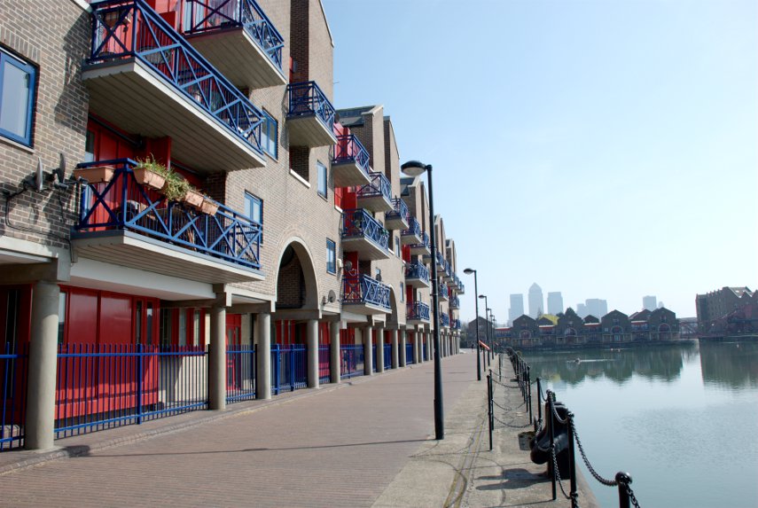
The path on this side, the north side, is very nice and we soon reached the Millenium Bridge.

We continued past the bridge to Broken Wharf where one has to walk inland up to High Timber Street, along High Timber Street for a short distance, then back down Queenhithe to the river. Somewhere between Southwark Bridge and Cannon Street Station we reached a point where the river path continued on but there was a passage to the left which we wanted to explore. This is what we found:

Known as Fruiterers Passage the walls and ceiling are all tiles and the framed images are old engravings of London. We followed the passage round and came out on the river path again and a little further on the path goes through a sort of cage.

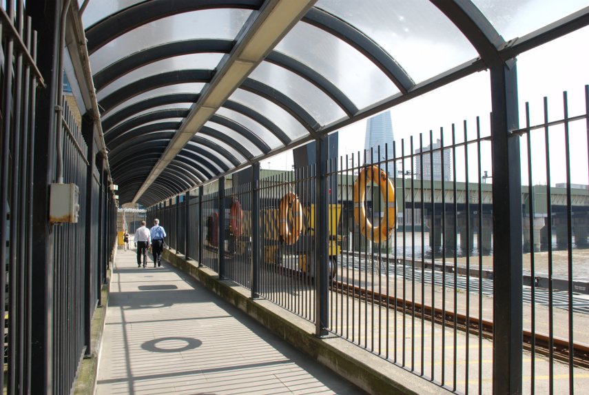
The bridge on the right takes the railway from Cannon Street Station across the river and when we reached the edge of Cannon Street Station on Cousin Lane we saw these, rather appropriate, items:

At this point you could be forgiven for thinking that the path stops here but you'd be wrong. On the other side of Cousin Lane there is a black cavernous opening which looks like the entrance to a goods warehouse or similar but it is Steelyard Passage and it will take you underneath Cannon Street Station and on to the continuation of the path.

As we walked along the path I noticed this view to my left. The pillar with the golden top is, of course, the Monument and you should just about be able to see people on the top platform.

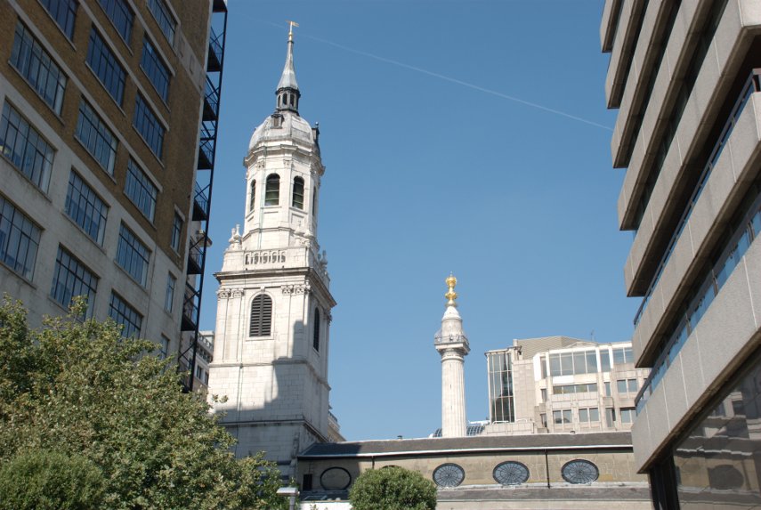
The church, of which only the roof and tower is showing, is St. Magnus the Martyr, a Wren church, and we detoured very slightly to look inside. The original church was one of the first casualties of the Great Fire of London and was subsequently rebuilt by Sir Christopher Wren. The roof was destroyed in 1760 by another fire and a smaller fire in 1995 caused more minor damage. It was badly damaged by a bomb in 1940 and was repaired once again.

Back onto the riverside path we continue onward.

That large overhanging balcony on the left above the path is a public viewing gallery accessed by steps just this side of it so we went up. There was absolutely nobody up there, except us, and there is also no seating of any kind. This is the view:

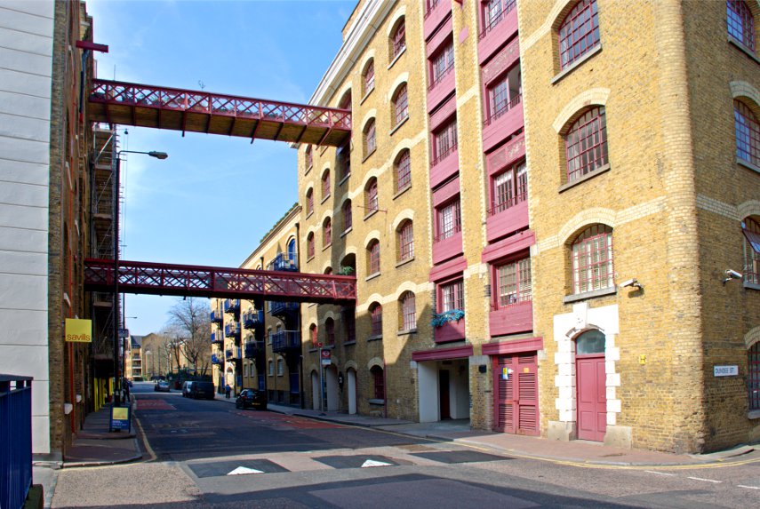
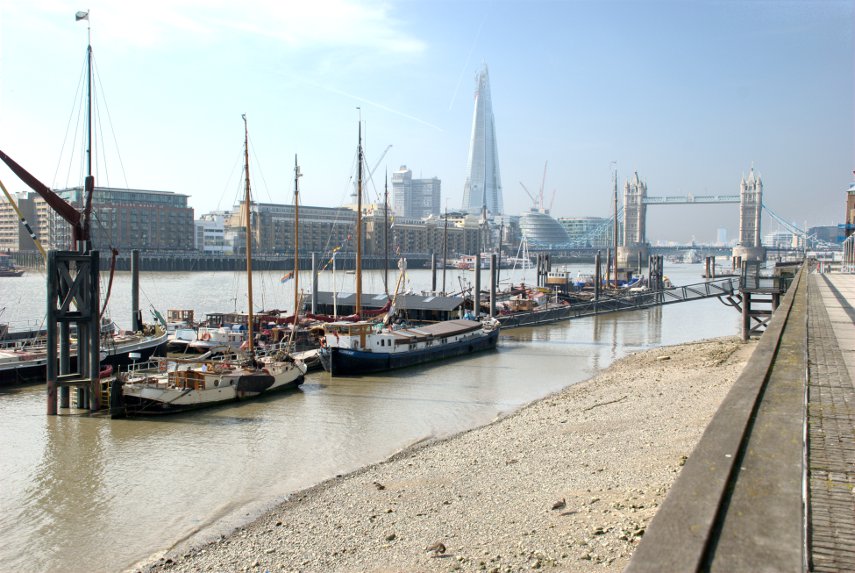
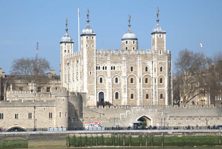
The building on the left is the old Billingsgate Fish Market with Tower Bridge in the distance. Soon after this we reached the Tower of London and this is where our riverside jaunt ends because from here, being only early afternoon, we branch off in a north-westerly direction into the City of London to continue our explorations.

Leaving the environs of the Tower of London we walked along Gloucester Court until we spotted the church of All Hallows by the Tower and went inside.

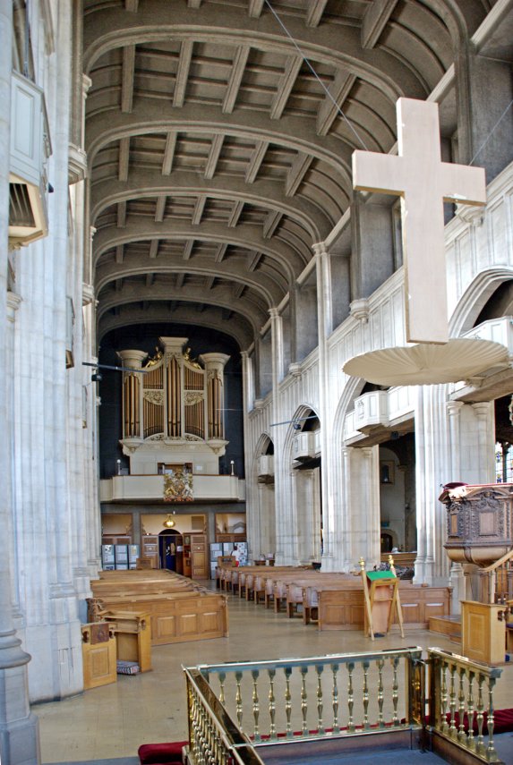
This church is the oldest church in the City of London having been founded in the year 675 but only an archway from that original church remains above ground.

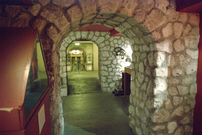
There is a crypt, part of the original Saxon church, which has part of a Roman tessellated pavement exposed. This is the Saxon Crypt.

This was a very interesting church and is well worth a visit. John Quincy Adams, sixth president of the USA, was apparently married in All Hallows in 1797.

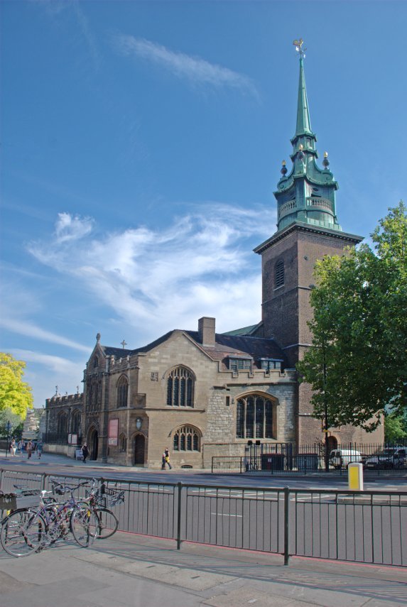
After leaving the church we crossed Byward Street where I took this exterior photograph of the church.

We turned north up Seething Lane which has a nice little garden with bench seats but nothing special so we went on. Up to Hart Street, turned left and along to Mark Lane where we turned right (still going north) to look for Star Alley. We found Star Alley easily enough and what should we see peeking at us through a gap in the buildings but the Gherkin (proper address 30, St Mary Axe).

Nearby was a solitary stone tower. This apparently is all that remains of a church called 'All Hallows Staining', where 'staining' means 'stone', which distinguished it from the other 'All Hallows' wooden churches round about. It was built in 1320, which makes it medieval, and is maintained by the Worshipful Company of Clothworkers.

Off we went up Star Alley and popped out on Fenchurch Street. There are two alleys going north from Fenchurch Street through to Fenchurch Avenue and neither of us can remember which one we took although I suspect that it was Billiter Square.

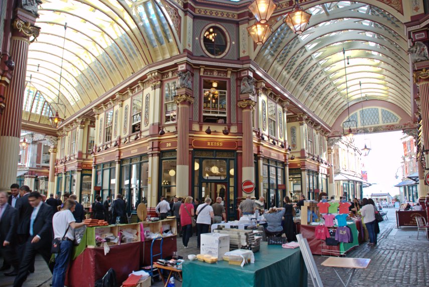
Anyway we turned left (west) along Fenchurch Avenue towards the Lloyds of London building then right into Leadenhall Place – and were really surprised to see this:

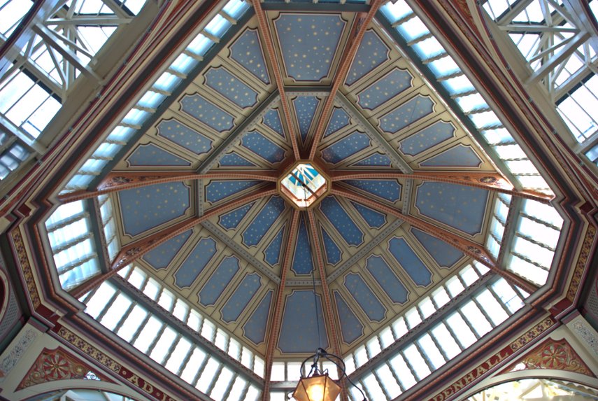
The entrance to Leadenhall Market with part of the ultra-modern Lloyds building on the right. This is something we weren't expecting as neither of us can remember hearing of Leadenhall Market before. It was a meat, game and poultry market and has now had a change of use as Covent Garden has. There are various shops, stalls, cafes, pubs, restaurants and the like and what a wonderful old building it is.

We eventually left the market via Whittington Avenue, turned right along Leadenhall Street and spotted this little church near the corner with St. Mary Axe.

The church of St Andrew Undershaft is rather dwarfed by the Gherkin but is a rare example of a City church that has managed to escape both the Great Fire of London in 1666 and the Second World War bombing. The first church to occupy this site was certainly there by 1147 but that church was rebuilt in the 14th century and was replaced by the current church in 1532.

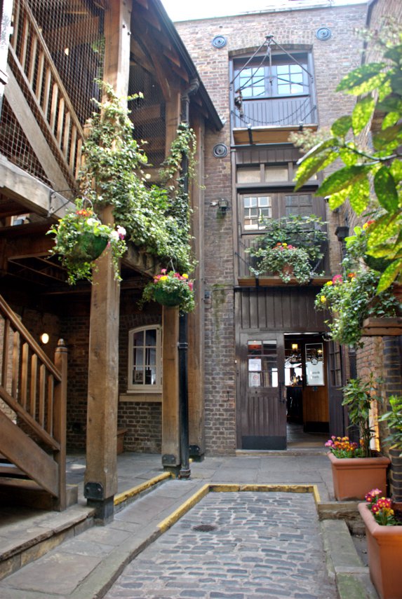
We went back along Leadenhall Street and left into Gracechurch Street looking for the alleys along the west side of this street. There is a bit of a maze of alleys in this area including St. Peter's Alley, Corbett Court, George Yard, St. Michael's Alley, Castle Court and Bengal Court.

We spent a while wandering back and forth and discovered that somewhere around St. Michael's Alley was where Charles Dickens had a study in which he wrote some of his novels. These are some of the pictures I took whilst getting lost in the alleyways.

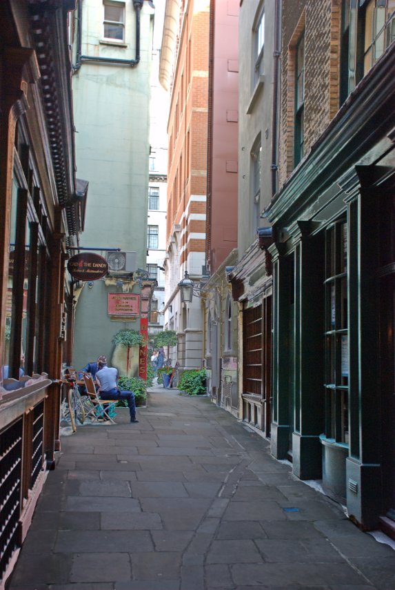
That last picture is the junction between St. Michael's Alley and Bengal Court so somewhere close to Charles Dickens Study.

We went through Bengal Court and across Birchin Lane into Change Alley and found our way through to Cornhill where we saw the Royal Exchange.

We crossed over to Threadneedle Street, Forked left up Old Broad Street then crossed London Wall to the northern part of Old Broad Street heading for Liverpool Street Station where we were to catch our train home.

So was that the end of our trip? Well not quite. To get to Liverpool Street Station from Old Broad Street we cut through an alley called Bishopsgate Churchyard and came across this little curiosity:

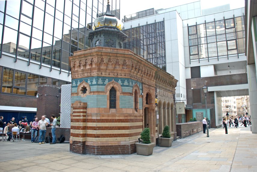
This is a Victorian Turkish Bath dating from 1895 now converted to a restaurant. It's not quite as small inside as it appears outside because a lot of it is underground. Needless to say, because it's still here, it survived the London bombings during World War II.

So now we have finished our trip so it's back home via Liverpool Street Station.

We haven't finished with this area in the City yet as there's more to explore a bit further north-west from where we've been today.

Until next time.
 

Kew 2 – The route march!

Kew 2 – The route march!

Monday 25th July was forecast to be a fine day. Just one fine day in a run of unsettled weather so we grasped it, so to speak, with both hands. We used our Senior Railcards to get a third off the fare to London, £15.80 each, and as that includes a Travelcard (Zones 1-6) we then get to go right across London to Kew at no extra cost. Bargain! We present our 2For1 voucher when we get to Kew Gardens and get in for £12 for the two of us. Can't be bad.

On this, our second, visit Amanda is going to give the Princess of Wales Conservatory and the nearby Rock Garden a thorough going over while I have decided to march all the way round the perimeter, with diversions of course. It's a lovely sunny day, pleasantly warm with temperatures in the low seventies.

But first we both visited the Palm House to go up on the high level walkway and this is how we got up there.

It seems that, after a while, the spiral staircase was going to go on for ever but we got there in the end. The walkway is quite narrow but feels very sturdy and there's comforting steel railings to stop one falling off.

Looking out through the glass gave us a nice view.

Then looking the other way gives us a different view.

You may notice that it is quite a long way up and it's HOT and humid up here. Phew!

This Palm is the tallest 'house plant' in the world. You may be able to see that its fronds are touching the roof and the tree can be seen only as far down as the level of the walkway so there's a lot more of it below. We eventually came back down to earth, luckily without a bump, and went to see the view from the Temple of Aeoleus that is indicated as a viewpoint on the map of Kew Gardens. It wasn't really worth it. Most of it is now obscured by trees.

We decided to go for an early lunch which would then gives us a long afternoon for our separate projects. So we went back to the Victoria Gate to the cafe there. After lunch we split up and I turned left (south) and started my route march. If you want to follow my progress you can do so on this map: http://www.kew.org/ucm/groups/public/documents/document/ppcont_008324.pdf If you right click on the link you should be able to open it in a new window so that you can refer to it whilst reading.

My first diversion was to the Temperate House and up yet more spiral stairs to the high level walkway here.

It is rather similar to the walkway in the Palm House but with different plants of course. There is a very good view of the trees from up here and there is a person on the ground in the next picture if you can spot them in the shadows.

There is an excellent aerial view of the big fish in the pond from up here and I'll bet that they didn't even suspect that they were being spied on satellite style.

Out of the Temperate House and back to the perimeter path and onward towards the Pagoda.

This pagoda is not a small structure and there appear to be ten fairly substantial storeys – quite impressive. Having reached the first corner, south-east, I turned west and a little way further on I came across the Japanese Gateway.

I remember on our last visit when we crossed the lake on the Sackler Crossing that we'd missed seeing the Lily Pond so this time I made another diversion to see it. I needn't have bothered! It may have been nice had the water been visible but the whole pond was covered in some sort of floating water weed. Oh well, back to the perimeter track and Queen Charlotte's Cottage. On the way I came across some of these:

Back to Queen Charlotte's Cottage. It's not that easy to find as it is well surrounded by trees but I managed it eventually. The date it was built doesn't seem to be known but the earliest mention of it is in the 1700s.

After this I reached the next corner, south-west, where I turned right (north) and had a glimpse of the River Thames. The river is still tidal at this point and the water level was low with mudbanks both sides so the overall view wasn't particularly picturesque.

On my way along the west side, towards the Brentford Gate, I saw this rather attractive display:

From Brentford Gate I cheated a bit. On our last visit we saw Kew Palace so I cut the corner off and headed straight for the Princess of Wales Conservatory as it was in that area I had arranged to meet Amanda.

A quick call on my mobile 'phone and we met up outside the conservatory and Amanda took me to see the Secluded Garden she had already visited.

Then we went in to the Duke's Garden which was very colourful. By this time I could hear my legs muttering to themselves so I though it was time to let the poor old things rest. We made our way back to Victoria Gate where we had a cup of tea then we went home.

Two long visits and we still haven't seen everything that there is to see.

Here today, not gone tomorrow

Here today, not gone tomorrow

Sunday 12th September

After 4 hours and 210 miles we arrived at two o'clock this afternoon. Most of the journey was in sunshine but it started raining just as we arrived. Luckily it didn't stay that way.

Where are we?

Monday 13th September

We bin 'ere:

and 'ere:

Cloudy all day today and it rained all the way from the Minster to the Railway Museum.

Well done Old Guy – you got it in one. It may be York rain Tudor but it's just as wet as any other.  Annecy we'll give you the low down later.

Tuesday 14th September

More tramping today. This trip is turning into a Shambles.

Eventually we got the hump!

We had our longest, hardest, wettest shower this morning. We'll be leaving tomorrow.

Wednesday 15th September

Weather cool grey and very windy. Left York at 9:30 AM home by 1:30 PM. :bawl:

Taking the bull by the horns.

Taking the bull by the horns.

Yesterday, Tuesday, we had to go to Rayleigh, Essex and, as it was a sunny day, decided to include a little sightseeing and the obvious place to start was Rayleigh itself. The town was nothing special but it does have one of these:


A rather nice brick built tower mill with an interesting platform above the door which goes all the way round the outside. Unfortunately it doesn't work any more and the inside has been converted to a museum (not open when we were there). It's not very old either, having been built in the 1800s, making it no more than 200 years old.


Next to the windmill is what was once Rayleigh Castle. All that remains is the Motte and Bailey. The Motte is the large mound on which the keep would have been built, in this case during the 1100s, and would have been built using wood and so nothing now remains. It is surrounded by a defensive ditch and would originally have been enclosed by a wooden fence; the resultant enclosure being the Bailey.


There is a bit of a view to be had from the Motte but nothing terribly exciting.


After descending from the lofty heights of Rayleigh Castle we found our way to Dutch Cottage. The name stems from the 17th century Dutch immigrants who constructed many of the sea walls along the south Essex coast. The interesting thing is that above the door a date of 1621 is inscribed in the wooden frame. However 'experts' who have studied the building are convinced that it was built in the 1700s so take your pick.


Because it's so small it's hard to believe that someone lives there but they do.


That was about the limit of interest in Rayleigh so we travelled about five miles south to Hadleigh. This is Hadleigh in Essex and not to be confused with Hadleigh in Suffolk. It lies on the northern edge of the Thames and, like Rayleigh, doesn't boast much of interest but it does have some Norman castle ruins.


We parked in one of the suburban streets and planned to walk to the castle from there. This is how it looked from the start of the walk. You can just see a tower on the horizon near the centre of the picture.


It was quite a pleasant walk across the fields and, after climbing over a stile, we found ourselves sharing a field with cows. We started off across the field and then noticed a very large, very muscular cow with a funny looking udder and realised that we were looking at a bull. A farmer wouldn't put a bull in a field with a public footpath running through it unless he was sure that the bull wouldn't cause problems and we had also heard that bulls kept on their own, i.e. without cows, are the stroppy ones. That was the theory so we decided to 'take the bull by the horns', not literally you understand, and continue on our way. We passed within about twenty feet of the bull and he was really more interested in grazing than he was in us.


A little further along the path and I took this photograph of mother and daughter.


As we had been climbing on this last section of path we were begining to get some good views even though it was rather hazy.


As we approached the castle ruins we began to see the overall structure and the remains of the tower on the right really was leaning that much.


Looking back from this point we could see Leigh-on-Sea, where we had parked, and the River Thames albeit a rather hazy view. All those little white marks below the horizon are small boats left high and dry because the tide is out.


All we have to do later is walk all that way back to the car but for now – back to the castle.


The castle was built in the 1300s and this shows the best remaining tower with part of its internal structure visible. It is certainly a good vantage point for a defensive structure.


This picture shows that heavily leaning tower about to squash Amanda who seems quite unperturbed by that possibility.


This was the end of our sightseeing for the day and we'll leave you with this final picture where Amanda, the little figure on the left, had decided that sitting below the leaning tower wasn't such a good idea after all or was she just curious about what I was getting up to?


Oh, and yes, we did have to walk past that bull again but lived to tell the tale.