Browsed by
Category: Trip Reports

I went 220 miles to Devon for 30 minutes – Tuesday.

I went 220 miles to Devon for 30 minutes – Tuesday.

I got out of bed this morning and tried to encourage my legs to move and by the time I'd got down to breakfast they were just about usable again (but only just smilies ).

Breakfast is fairly late here, at eight o'clock, so I first wandered out into the town towards the church. It was very quiet as I passed through the back streets and emerged near the church.


The church is quite old with parts dating back to Saxon times. The interesting part is in the churchyard on the seaward edge.

That wire fence is to stop people from dropping off the edge of the cliff and you can see that the path shown goes nowhere. This church, when it was built, was a long way from the cliff now it can't be more than 50 feet. It is hoped that the new sea defences below will stop the erosion.

Back for breakfast then onward.

I'm going to hop on the same bus again this morning but I'll be going through Chideock to Burton Bradstock this time which is about a 60 minute journey.

I get off the bus just the other side of Burton Bradstock and walk down Beach Road. High tide was about an hour ago so the tide is going out and it's safe for me to walk along the beach as far as West Bay. I say 'safe' because there are high cliffs on my right all the way.

The cliffs, as you can see, are made up of alternating bands of hard and soft rock giving them a striped appearance. The rocks are Inferior Oolite and Fullers Earth from the Middle Jurassic.

As I walked along the beach I could hear a sound which might be described as a cross between a crack and a knock. This sound occurred regularly at intervals all the way to West Bay and was definitely coming from the cliffs. It sounded rather ominous but there were no rock falls whilst I was there. I can only assume that it was the hard bands expanding and contracting with changes in temperature.

These cliffs are dangerous and rock falls are not uncommon. This shows a recent fall and that crack in the cliff above doesn't look particularly safe. Staying away from the cliff, as I am, is the safest thing to do and needs to be done when the tide is going out so that more of the beach is exposed.

The hard rock bands are certainly fossiliferous as this picture of one of the fallen slabs shows. There are many molluscs and belemnites.

I continued along the beach towards West Bay until I reached the River Bride. That means I either paddle or go inland a little way to use the bridge.

I decided to do as the person in the picture did. The water at its deepest didn't reach my ankles nor was it particularly cold and to prove that I did get to the other side:

There are other people on the far side, who were behind me, preparing to do the same.

I finally reach West Bay which is the seaside part of Bridport.


The Bridport Arms used to be the Ship Inn and dates from the late 17th century and is partly thatched. The town of Bridport is a bit of a long walk from here so I decided to catch the bus which set me down in the town centre. The main roads in Bridport, West Street, East Street and South Street form a 'T' with South Street being the leg of the 'T'. This is from the top end of South Street looking south.

A short way down South Street is the town museum housed in this Tudor building.


Further down South Street is the parish church of St. Mary dating from the 13th century.

In the lower part of South Street is the Chantry; the oldest building in Bridport dating from before 1300.

Further on by the River Brit is Palmer's Brewery dating from 1794 and the water wheel, forged in 1879 at a Bridport foundry, does still turn.

From Easter to the end of October a guided tour starts at 11.00 am on every weekday (excluding Bank Holidays) and lasts for about two hours. No I didn't.

I made my way back up South Street to West Street where, after a tiring day, I caught the bus to Lyme Regis. Tomorrow I leave Lyme Regis. smilies

(Tomorrow, Wednesday: I leave for home – or do I?)


I went 220 miles to Devon for 30 minutes – Monday.

I went 220 miles to Devon for 30 minutes – Monday.

Today is the big day! My most ambitious day of the whole trip. I plan to get the bus to Chideock (pronounced 'Chidock') and walk back to Lyme Regis via Golden Cap. What's Golden Cap? It's the highest point on the south coast – that's what. smilies

After breakfast I walked a couple of hundred yards to the bus stop to wait for the bus which is supposed to arrive about 9:35 which it did. Thirty minutes later I was standing by the roadside in Chideock looking for Mill Lane on the opposite side of the road. As it was close to the bus stop even I couldn't get it wrong and I was soon walking down the lane towards Seatown.


You can probably see that the sun is out but that there is plenty of cloud. It was only about three quarters of a mile to Seatown so it didn't take long to get there and I walked a little in the wrong direction so that I could get a view of Seatown.

I don't know why it's called Seatown because it's not even big enough to be a village let alone a town. smilies

This view from the beach shows Golden Cap ( the big lump in the centre of the picture) and I don't have to tell you why it's called Golden Cap do I?

I am foolish enough to start from here, at sea level, and climb to the top of that lump and then walk on over the hill to Lyme Regis. That's the plan anyway. So I set off the short distance up Mill Lane to find the start of the footpath and here it is.

The figure is probably difficult to read but it says 'Golden Cap 1 1/2' (1.5 miles) and 4.5 miles to Charmouth. Here we go.

It starts off inocuously enough to lull one into a false sense of security along a gently climbing path then, when it thinks it's got you into a good mood, it starts to get steeper. The path is now steep enough that steps have been cut into it. This is done to alleviate erosion by walkers and to deliberately aggravate my old leg muscles smilies . The steps are cut into the ground then wooden risers are set at the front of each step to stop them collapsing. Here the steps are quite far apart so it's step up then walk a few steps and step up again.

You can see a couple of steps in the photograph above and you can also see that I have gained some height since leaving the lane. smilies

A bit higher now with the summit visible some way ahead. You may not be able to read the distances on the signpost but it says 'Seatown 3/4' and 'Golden Cap 1/2' (miles). So far I've walked 3/4 of a mile from Chideock to Seatown and another 3/4 of a mile from Seatown to this point – a total of just 1.5 miles and I'm already puffing and blowing. Still, the views are nice.

That's Seatown down there. It looks a long way down. I have still a good way to go yet and all of it steep. There are long stretches of path with lots of steps packed close together that seem to go on for ever. I finally get to a steep grassy slope with a bench seat at the top. Just what I need but I have to get there first. I didn't make it in one go and had to stop and rest part way but I did eventually make use of that seat.

Then there is another short uphill stretch, with steps, until I arrive at the summit at last. The top view below is to the east and the bottom picture is to the west.


In the bottom picture Lyme Regis is the cluster of buildings in the centre of the picture with Charmouth on the right. Charmouth is my next target.

After a short sitdown to eat lunch I set off again and pass some locals who are admiring the view.

 So is it now all downhill? If only! The path goes steeply down hill to the bottom of a valley and just as steeply up again to the next ridge and then down and up again ad infinitum. I am, however, slowly leaving Golden Cap behind.

These repetitive steep slopes are making me very, very weary and I'm beginning to realise that I'll be lucky to make it to Charmouth let alone Lyme Regis so I decide I'll have to stop at Charmouth and get the bus back. smilies smilies smilies So much for ambition.

I had walked about six miles but the ups and downs would effectively double that in terms of energy used. What a wimp! Perhaps I should modify that a little. What an old wimp!

I finally reach Stonebarrow Lane and set off down towards Charmouth.

I finally reach the village but still have to walk uphill for some distance to reach the bus stop where I took this photograph looking back to where I'd come from.

I clambered wearily onto the bus and finally arrived back at my hotel for a rest. I'm going to need that rest for tomorrow.

(Tomorrow, Tuesday: Musical cliffs, a water wheel and a Tudor museum.)


I went 220 miles to Devon for 30 minutes – Sunday.

I went 220 miles to Devon for 30 minutes – Sunday.

I was on my own because Amanda was unable to come with me this timesmilies but she drove me to our local station where I was to catch the train to London but we were greeted with the news that the train was cancelled. Brilliant!  smilies  smilies

The next train was in half an hour which meant there would be little margin between getting to London Waterloo and catching the train to Axminster. Missing that train would mean an hour's wait for the next one.

I did get the next train and changed at Stratford onto the Jubilee line bound for Waterloo. When we were about halfway to Waterloo I decided I'd get to Waterloo at the time my train was due to leave and so probably wouldn't get it. As we travelled nearer to Waterloo the time/distance between stations seemed to be getting shorter. Was there hope yet? smilies

We finally arrived at Waterloo about ten minutes before my train left so I had a chance and finally reached the entrance to the platform with five minutes to spare. I did, after all, catch my intended train at 11:15 AM. smilies

This train, on the Waterloo-Axminster line, is the sort of train I travelled on:

After an uneventful journey of 2 hours and 45 minutes we arrived at Axminster in Devon. My bus was waiting outside the station and we set off south for the coast shortly after.

What I really wanted to do was to go to Lyme Regis in Dorset which is where I'm staying for the next few days. The bus soon reached the Devon/ Dorset border and I'd left Devon about 30 minutes after I'd reached it.

It was an interesting 30 minute ride on roads which were often only just wide enough for the bus and, at last, we were on the downhill stretch into Lyme Regis where I got off. After a very short walk I arrived at the Royal Lion Hotel which was to be my base for the next three nights.

Very friendly and efficient staff here and I was soon shown to my room. Note that the sea is just at the bottom of High Street.

It was a triple room with the single bed that I used just out of sight on the right (You can actually just see the corner). The entrance to the room was at a higher level hence the few steps down with part of the banister rail showing. The bathroom was also at the higher level. There was also a small outside terrace accessed using the door at the far end where a small part of the sea was visible.

A nice room in, what turned out to be, a nice hotel. It was, at one time, a coaching inn and dates from around 1610.

I telephoned Amanda to let her know that I had arrived safely and then made myself a cup of coffee. Having settled in I wound up my legs and set off to explore. I have a feeling that I should have had a larger spring fitted.

At the bottom of High Street is the Square and you can see that the time is now about 3:15 PM.

I headed west along Marine Parade which was lined with chip shops and ice cream shops together with an amusement arcade at the far end. This proved to be the tackiest part of the town but very popular.

I reached the harbour and just HAD to walk out on one of the harbour walls known as the Cobb.

This harbour wall features in Jane Austen's novel 'Persuasion', and in 'The French Lieutenant's Woman', a novel by British writer John Fowles, as well as the 1981 film of the same name, which was partly filmed in Lyme Regis.

Do you think I'd make a film star?

Lyme Regis is mentioned in the Domesday Book of 1086 and in the 13th century developed as a major port. The first record of the Cobb is in 1328 and it has been destroyed or severely damaged by storms several times. It was swept away in 1377 when 50 boats and 80 houses were also destroyed.

The next (top) picture is Lyme Regis seen from the outer end of the Cobb and the second picture looking across the harbour shows the western most part of Lyme Regis, like a small detached village, which is also known as the Cobb. Confusing ain't it?


A 15 minute walk further west along the beach with a low tide and I reached some exposed slabs of rock which were obviously very fossiliferous.


Each of those circular shapes are Ammonites which are about 200 million years old (at last I've found something which is older than me). In the second photograph erosion has effectively sectioned an ammonite showing the internal septa.

I walked back along the beach and, at this juncture, I have to admit that sandals were not the best choice of footwear (sand and gravel gets between feet and sandals) but I didn't want to wear boots for the whole time so I was stuck with them.

From the Cobb village I went up into Lister Gardens which is mostly grass and trees with a good view of the harbour.

A little further towards the town it changes to Langmoor Gardens which features a number of flowering plants and is, consequently, more colourful.

Back in town I found the Riverside Walk.

The River Lym, down in the gully on the left, is really quite small except when it's in flood and is only 3 miles long from source to sea although there were as many as thirteen mills using the energy provided by this short river before the steam engine was invented.

There are plenty of narrow lanes and streets here and I eventually emerged on one opposite the Guildhall.

Back to the hotel in plenty of time for dinner.

(Tomorrow, Monday: I take a ride, go up in the world and suffer abject failure)


A Rampart surprise

A Rampart surprise

Some time ago (March 2012) I did a little walk which involved passing an ancient earthwork called the Rampart (See this post).

I did the same walk this morning and, to my great surprise, I found the Rampart ditch was full of water. Admittedly the water couldn't be seen because it was covered in Duckweed but it was there all the same.

It is very dry here at the moment so I suppose that the water is left over from all the rain we had last winter.

For those that don't know Duckweed is a small, floating, aquatic plant that has a small root hanging in the water below and 2 or 3 leaves and it propagates very quickly hence the total cover.

It was a nice walk with no other surprises. smilies


More of the same but more of the difference.

More of the same but more of the difference.

A week ago I said we planned to return to Hampstead one day; well this is one day! Same place – different bits.

It all started so well. Today (Tuesday) was forecast to be this week's sunny day and, surprisingly, that is how it turned out; right to the very end. We went to Hampstead Station (Northern Line) via the tube and emerged into the sunlight.

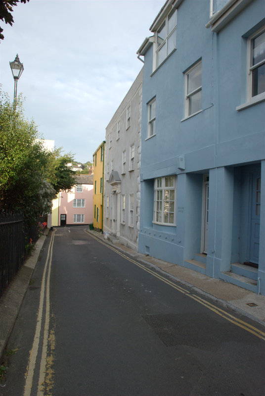
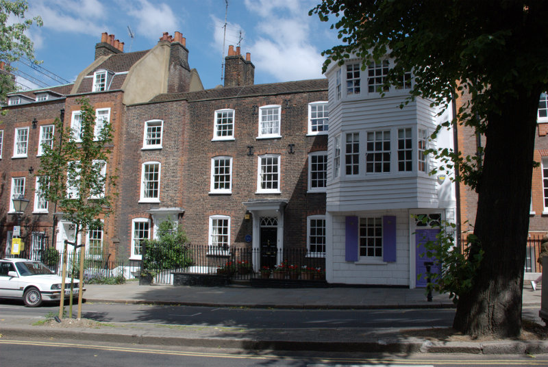
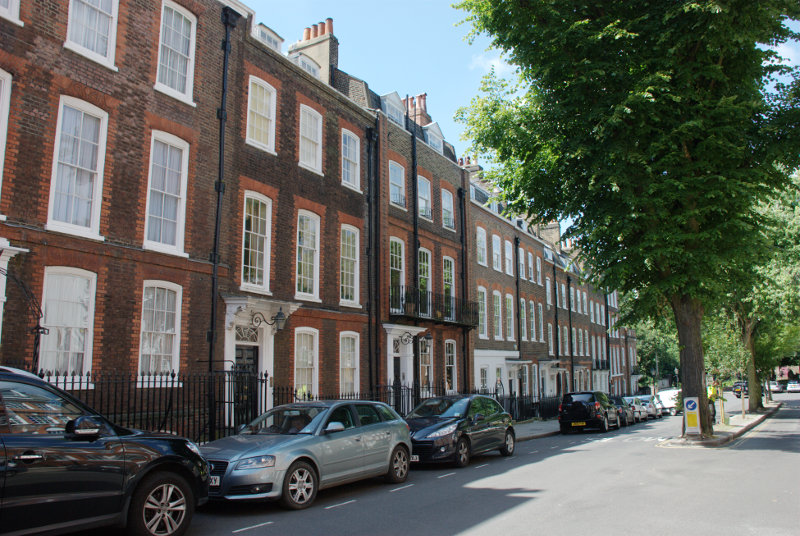
We turned south along Heath Street (You can go north along Heath Street as well) and then right into Church Walk. A very pleasant street with lots of Georgian Houses. It turned out that this part of Hampstead was mainly Georgian so not very old at around 200 – 300 years.


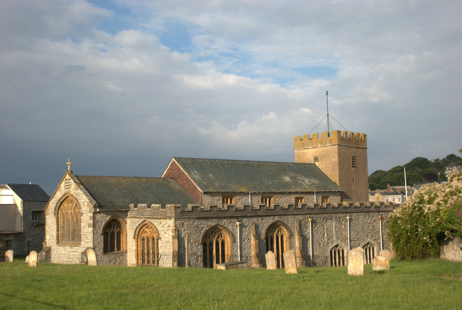
And it wasn't called Church Walk for nothing you know.

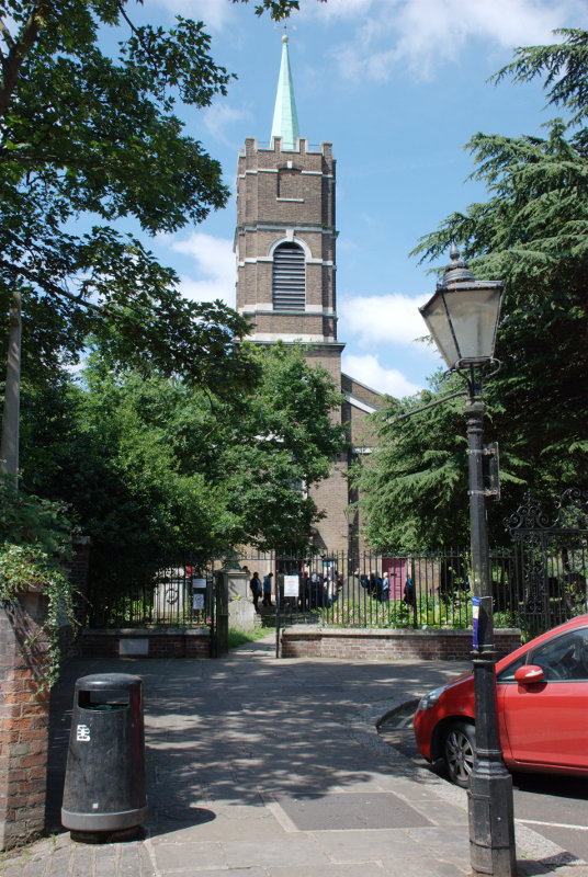
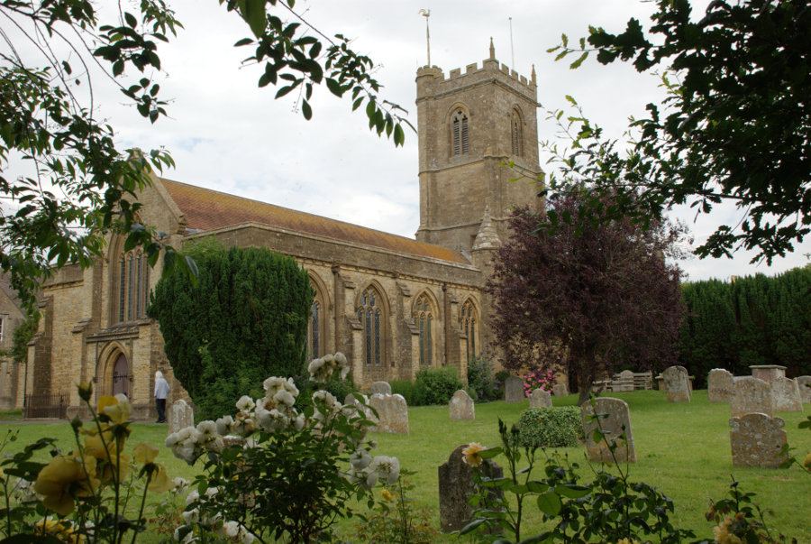
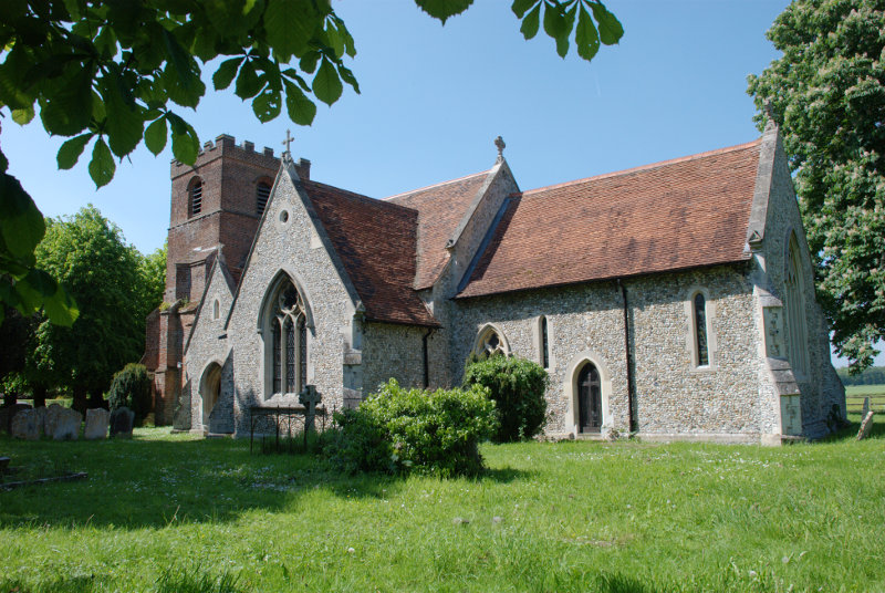
It was a Georgian church and we didn't go inside as it was about to be invaded by a large party of what appeared to be visitors on a tour of Hampstead. We didn't see them again.

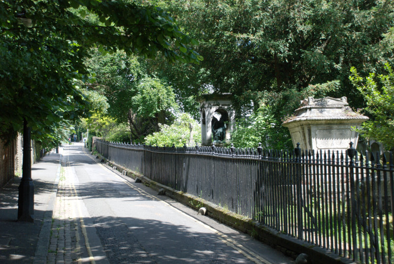
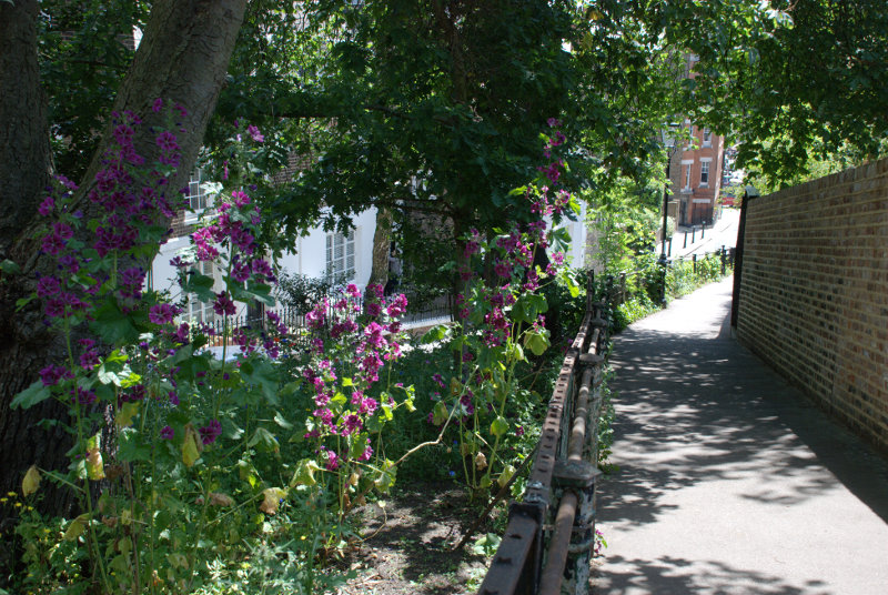
We turned right further along into Holly Walk which runs alongside a separate piece of ground used as the churchyard and you should notice a couple of large memorials just behind the railings in the next picture.

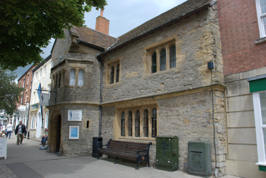
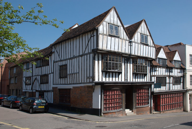
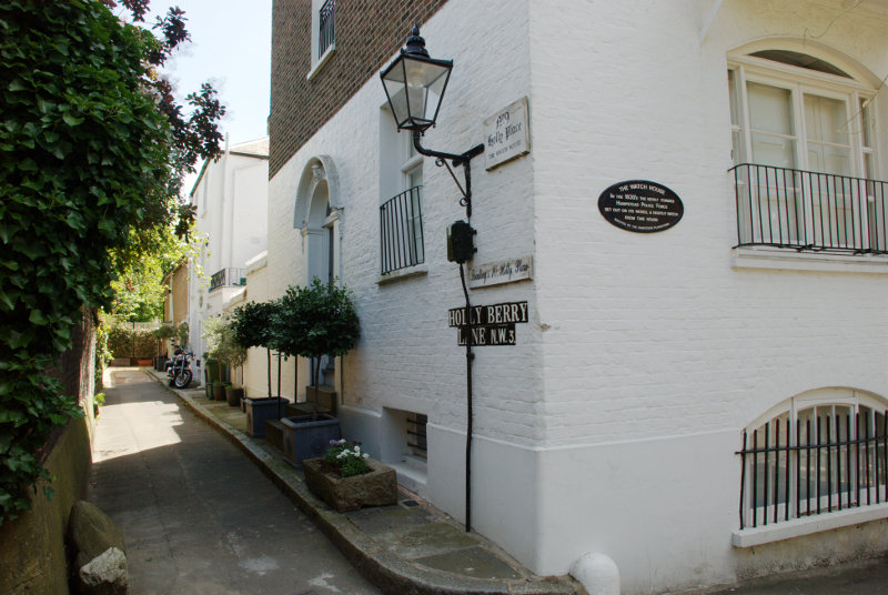
That lane led us up to Mount Vernon where we noticed this house together with another rather nice little lane called Holly Berry Lane. The plaque on the wall says:

"The Watch House – In the 1830s the newly formed Hampstead Police Force set out on its patrol & nightly watch from this house"

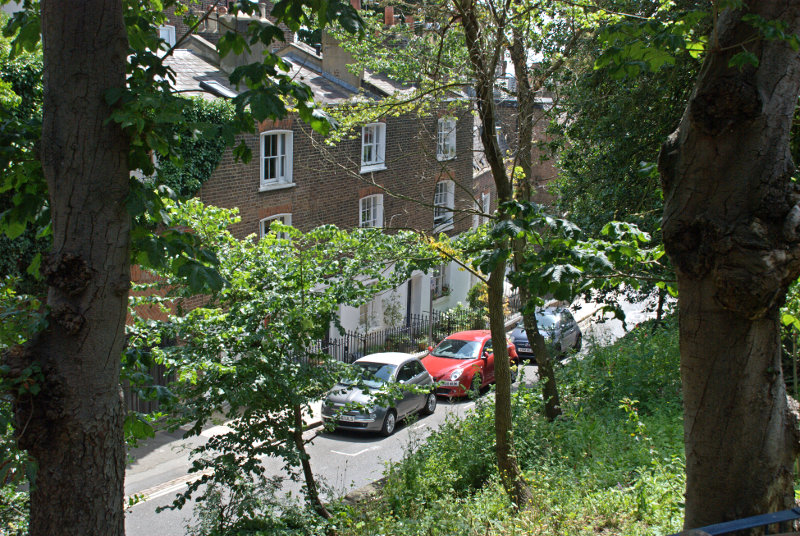
It was an arresting sight and so was looking back down Church Walk from the top.

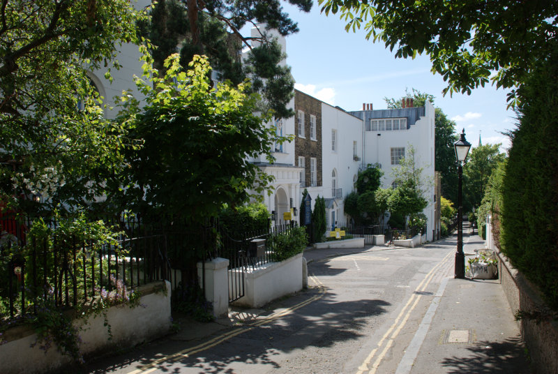
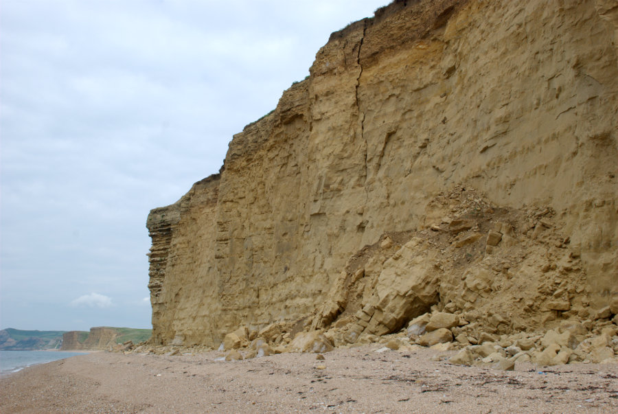
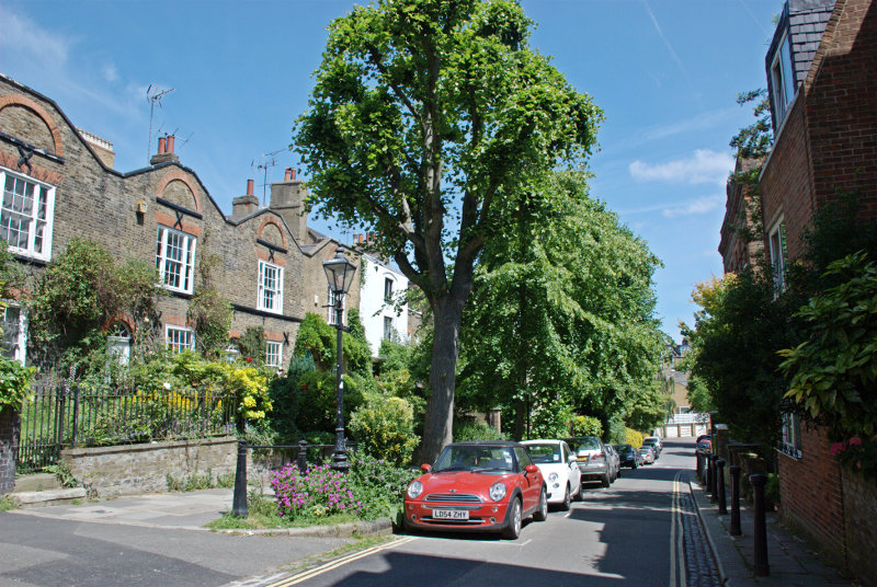
There are plenty of nice little corners in this part of Hampstead and it is hilly.


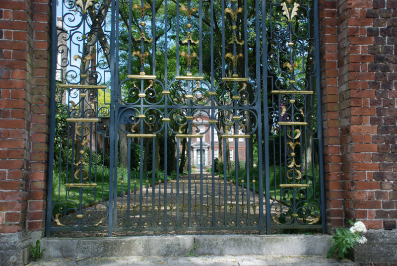
One of the things we had planned to do on our next visit to Hampstead was to see two National Trust properties – 2 Willow Road and Fenton House. We discovered before we left home that they are both closed Mondays and Tuesdays and, of course, this weeks sunny day was Tuesday so we didn't even go near 2 Willow Road but Fenton House was in this area so we caught a glimpse of it behind its rather fancy gates. Next time perhaps?

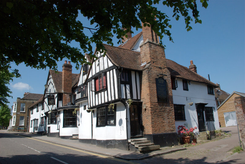
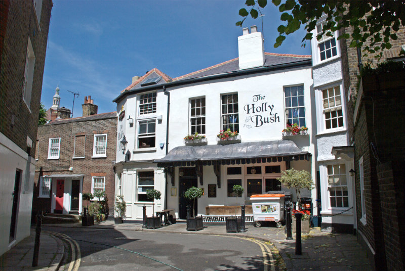
We saw the Holly Bush Inn which is Georgian and a mere 200 years old. It did, however, have a menu posted outside and the various dishes did sound nice but it was too early for lunch so we passed by.

We were on top of a hill here and we wanted to head for Flask Walk and Well Walk which were on the other side of Hampstead High Street so we needed to head down the hill. From High Street we turned into Back Lane

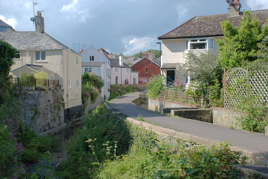
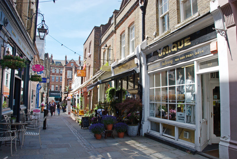
which led us into Flask Walk. Flask Walk displays two distinct aspects. The top alleyway part with its shops and the lower part with its leafy residential aspect.


Why 'Flask' Walk? It recalls the centuries-old practice of Londoners climbing up to the two villages, Hampstead and Highgate, to fill leather flasks with pure spring water rather than risk the cholera-riddled infected waters of London.

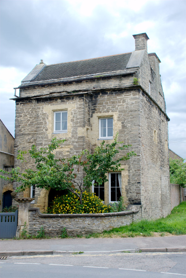
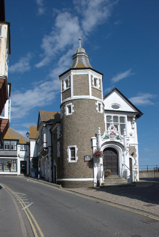
On the way down Flask Walk we came across this building. Since many of the worker's homes in Victorian Hampstead had no running water, this public building provided both drinking water and facilities for bathing.

I don't need to tell you the date because it's on the building.

On our route we were going past Burgh House and Hampstead Museum and we thought we'd have a look round but, no, closed Mondays and Tuesdays. They seem to have a thing in Hampstead about closing on Mondays and Tuesdays but we did at least see the outside. It is, like a lot of Hampstead, Georgian.

We joined Well Walk and went past one of the original Chalybeate wells originally promoted for the medicinal value of the chalybeate waters (water impregnated with iron). Keats, the poet, and Constable, the painter, both lived in this area for a time.

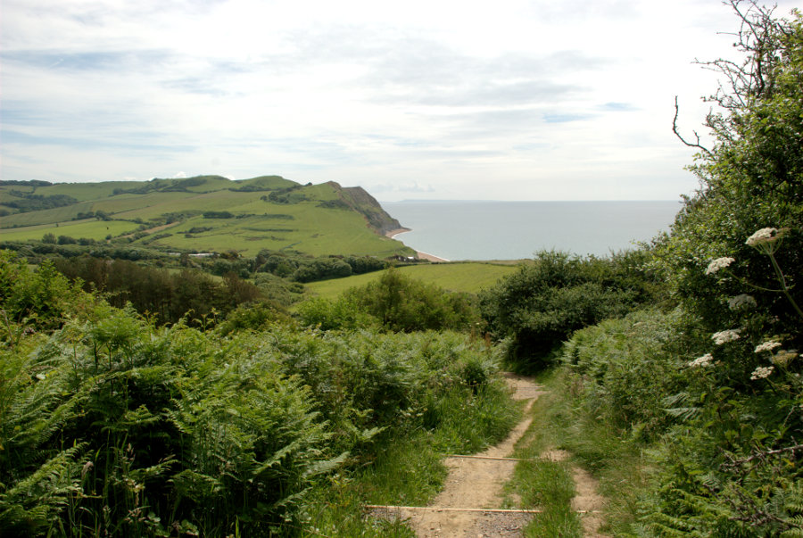
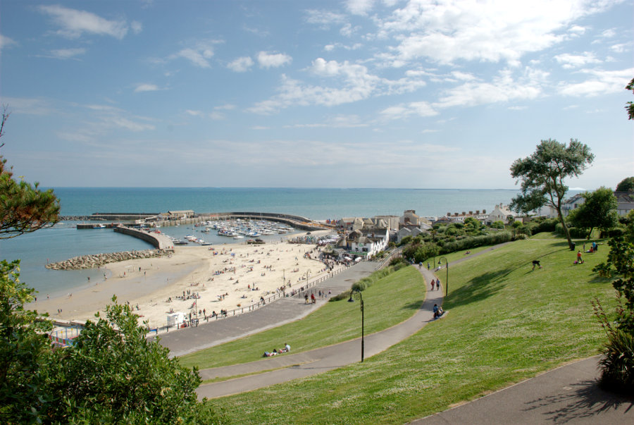
We eventually joined East Heath Road on the edge of the 791 acres of Hampstead Heath. We were headed for one of the places we missed last time because we became lost on the heath and eventually ran out of time. So will we get lost this time? Of course not. *cough*

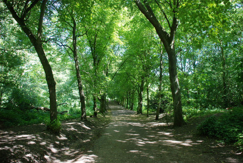
We started off along a well marked path in a wooded part of the heath.

We were looking for an obvious junction which we found and where we turned left arriving, eventually, at Viaduct Pond. See, I told you we wouldn't get lost.

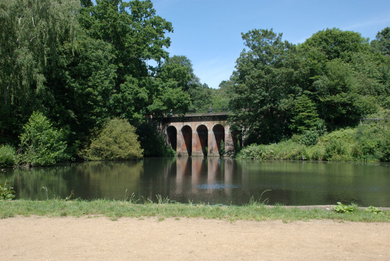
The viaduct carries another path across the pond. We made our way up the side of the pond onto that very path then took a smaller path through the woods ahead and finally emerged onto a larger path. We knew where we were now so turned left and headed for our next destination. Just to be safe we asked some people coming from the opposite direction who told us that we were indeed going the wqrong way. Whoops! Lost again. If you do go to Hampstead Heath no matter how many maps you take you will get lost. It is a nice place to get lost though.

They did gives us some directions which we managed to follow and finally arrived on the path we wanted.

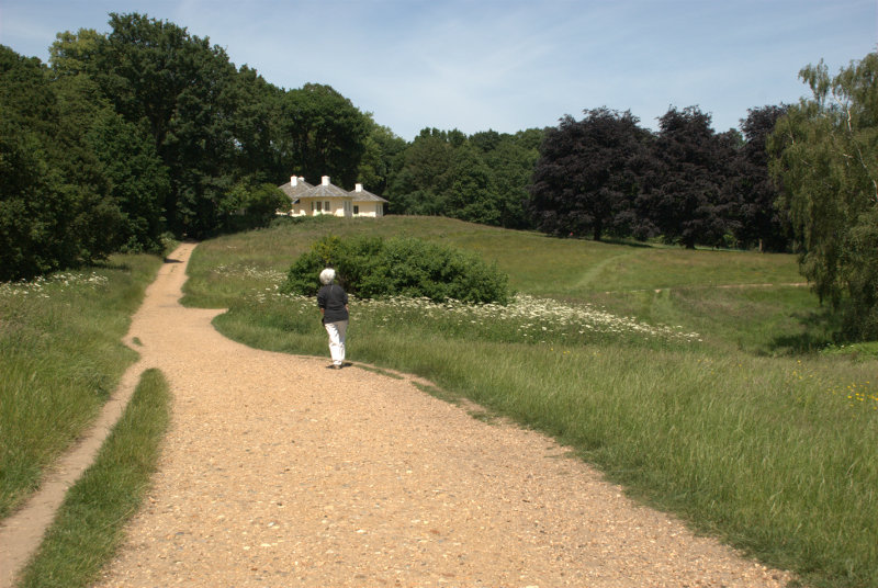
That's Amanda on the path and just ahead of her is a right turn which we need to take. This is what we were looking for.


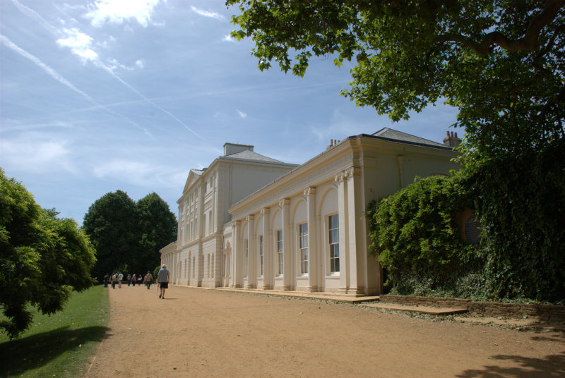
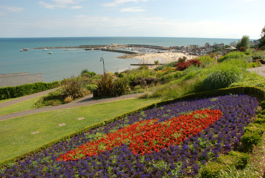
It is Kenwood House run by English Heritage and, best of all, entry is free. They have a place for refreshments called the Brewhouse Cafe which is where we now repaired to have lunch. The food turned out to be very good. I had poached salmon with roast new potatoes and cous cous and Amanda had free-range pork sausages with apricot chutney and roast new potatoes. Can't you just picture those little sausages gambolling around in a big field? Lovely! The main courses were just £9.50 each. Good value.

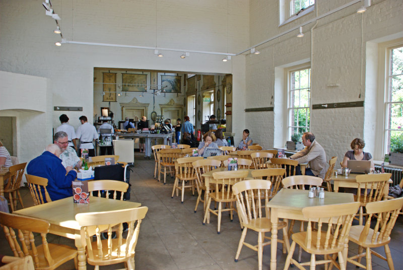
There is also a very nice outdoor area where you can choose to eat your meal or refreshments if you so choose.

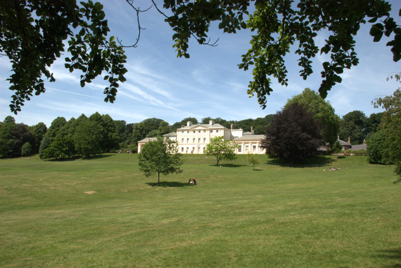
After lunch we went into the house which, you may remember, is free.

The original house dates from the early 17th century and the orangery was added in about 1700. In 1754 it was bought by William Murray, 1st Earl of Mansfield who commissioned Robert Adam to remodel it from 1764-1779. Adam added the library (one of his most famous interiors) to balance the orangery, and added the Ionic portico at the entrance. In 1793-6 George Saunders added two wings on the north side, and the offices and kitchen buildings and brewery (now the restaurant) to the side.

The house does not contain much furniture but it does have an extraordinary collection of paintings including a self-portrait by Rembrandt and paintings by Vermeer, Gainsborough and Landseer to name but a few.


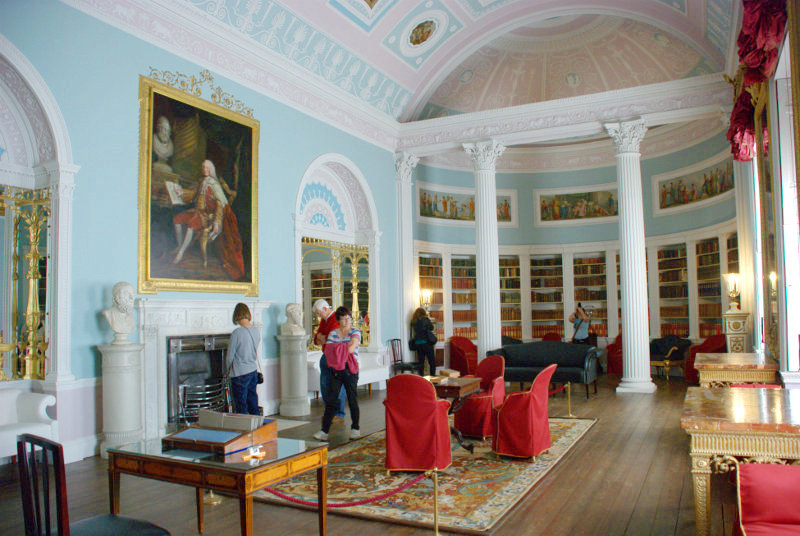
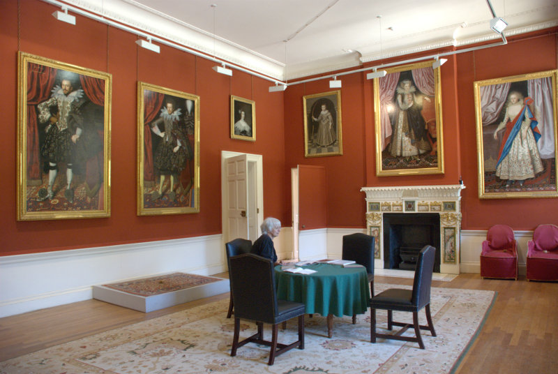
The first picture above is the Library, added by Robert Adam, and the second picture is the Upper Hall with Amanda sitting at the table waiting for dinner. I didn't have the heart to tell her it probably wouldn't arrive.

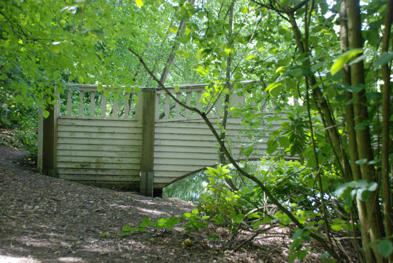
Out in the grounds is this rather grand bridge.

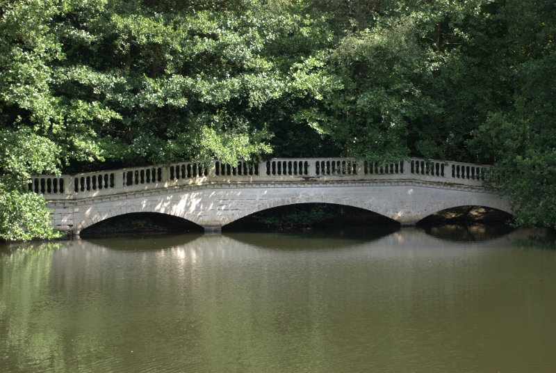
Except it isn't anything of the sort. It's a fake. Just a wooden facade painted to look like a real bridge. The back looks quite different.

It was created around 200 years ago. Don't believe everything you see.

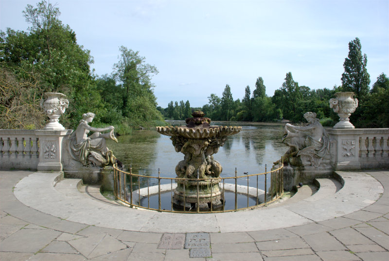
That was our Hampstead trip for the day but we had a little more time so we went, via the tube, to Lancaster Gate and into Hyde Park/Kensington Gardens. Just inside the gate is the Italian Gardens.

I was looking forward to photgraphing the fountains – but – no fountains. Sorry fountains are closed on Monday and Tuesday. I don't actually know if that is true but they definitely weren't running. Not one little drop. I don't know why but it was disappointing.

However there was something unusual.

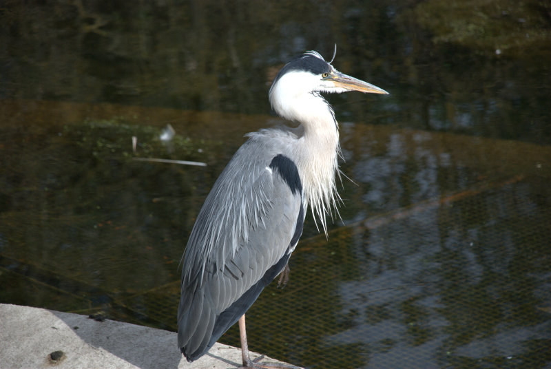
No not the non-fountain but what's behind it. Oh! You can't see it? I'll move round a bit then.

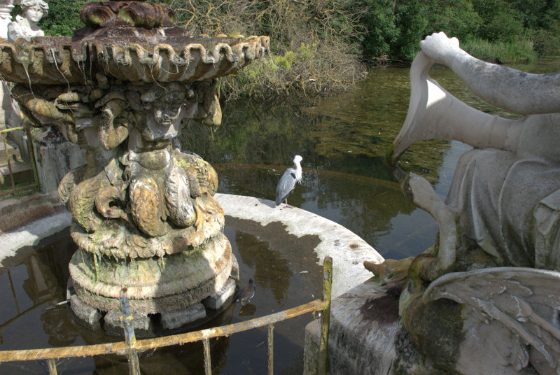
Can you see the Heron perched on the edge of the bowl now? This one is obviously hoping for a fish dinner and, because it's so used to all the visitors, it hasn't taken fright as it would do normally and flown away.

So that was the end of our day – or was it?

We caught the Central Line to Liverpool Street Station for our train home except that there wasn't one. No trains running on the main line to Norwich. There were hundreds of people standing around on the main concourse all looking at the departures board. I've never seen so many 'Cancelled' and 'Delayed' indicators. Who do they think they are – an airport?

We had planned to get a train somewhere between 6:00 and 6:30. So much for planning.

We eventually learned that a train had damaged the overhead power lines which supply electricity to the trains motors and that this was just north of Chelmsford (one of the places our train goes through). This left just one track operating for trains going both ways so all trains were having to take turns to share this section.

Then just before 7:30 there was an announcement that a train was leaving for our neck of the woods but that induced a torrent of people and by the time we got to the train we would have needed a shoe horn to get in. We didn't bother.

Then, shortly after, another announcement said that a train going to Harwich International (north of our station) which wasn't going to stop at our station was having two additional stops which did include our station. We got to the train to find that there was room but only if we were prepared to stand. We had no idea how long we'd have to wait if we didn't get this one so we decided to take a chance.

It did actually leave on time, about 7:40, and we crawled for 30 minutes to the next stop. When we started again we picked up speed and we going quite well for some time until we stopped and waited – and waited – and waited. We must have waited there for about an hour then started a stop-start journey through various stations until we finally arrived at ours. After we'd been standing for 1 and a half hours two younger people offered us their seats and we collapsed into them before they changed their minds.

That journey took a total of 2 hours 45 minutes instead of the normal 55 minutes.

We were very glad to arrive home especially as it was 10:30. What an end to an otherwise nice day!

Time for a Change, some Oxo and a secret!

Time for a Change, some Oxo and a secret!

The change in question is New Change and if you want to be precise – 1 New Change. For those of you that don't know, New Change is a short street on the eastern edge of St. Paul's Churchyard in London and there is a large shopping centre there that takes up the whole street. As it is the only building in the street it's number must be 1 mustn't it?

A sunny day saw us arrive at Liverpool Street Station from where we walked the short distance to Wormwood Street to catch the number 100 bus. That was a surprise because it turned out to be a single deck bus which is unusual in London. We alighted near St. Paul's Underground Station and walked the short distance to 1 New Change.

We have been here once before (A Later Date), late in the day, when the weather wasn't so good and the sun was in the wrong place. This time the weather was good and the sun was in the right place.

A lot of people don't realise that 1 New Change has a roof terrace which is freely available to the public. There is a restaurant up there too but you aren't obliged to use it. There are lifts up to the terrace and they are outside the building and the walls are made of glass. Why would the lift walls be made of glass? Because you get a nice view of St. Paul's Cathedral on the way up and down together with some interesting reflections.


The roof terrace is quite large and you get a good view of the dome of St. Paul's Cathedral and the London Eye is just visible on the left-hand edge.

You can even see visitors on the Golden Gallery at the top of the dome.

Looking in the opposite direction the Shard is rather obvious.

It was now time to move on so we went down in the lift and back to the bus stop where we caught the 100 bus once again to continue our journey across Blackfriars Bridge to the south side of the River Thames. This is where we were going.


The Oxo Tower is another shopping centre on the edge of the Thames and it has a publicly accessible viewing gallery looking out over the river on the sixth floor. This is the view east towards St. Paul's.

This is the view west up river showing the restaurant terrace on the left over looking the river.

This interesting view shows the river apparently choc-a-bloc with boats and the bridge choc-a-bloc with buses. I've never seen so many London buses in one place before.

We left the viewing platform and went back down to earth. Just behind the Oxo Tower is a nice little park.


Back on the 100 bus and we're off to Barbican for lunch. Reasonably good food for a very reasonable price – a main course for £9.50. After lunch we walked to Finsbury Square to catch the number 271 bus north. At Archway we changed onto the 210 bus for the last leg of our journey to visit somewhere secret.

As it's secret I'm not going to tell you anything about it except to say that it's on Hampstead Heath near Inverforth Close and it's known as London's Hidden Garden. It is actually called Hill Garden or the Hampstead Pergola but it's called the Hidden Garden because so few people seem to know about it even though it's free. There were only relatively few visitors there when we were there.

There is a lovely ornamental pond.


Then there is the Pergola.

We thought 'goodness that's a long pergola' as we could just see the cupola at the very end. We wandered along slowly until we reached the little building.

Amanda reached it just before I did and that is her silouette in the doorway. I can remember, as I was climbing the steps, that I thought that the pergola was very long indeed until I reached that doorway. Then I realised that there was more – lots more.

The house beyond the pergola is Inverforth House once a single private residence it is now converted to apartments. The original house was built in 1807 but was rebuilt in 1905 which  greatly altered the original structure.

The pergola went on ahead to a junction where it branched both left and right. We looked back to the cupola.

The branch to our left was a cul-de-sac but the branch to our right went on, and on.

What an extraordinary place this is. We left, finally, back past the ornamental pond. This garden is one that you really should not miss especially as there is no entry charge.

Oh, I forgot. It's a secret and I haven't told you anything about it so you won't be able to go after all. What a pity! You don't know what you're missing.

We headed off across Hampstead Heath with a printed copy of a nice map available on the Hampstead Heath web site showing the various paths which criss-cross over the heath. Unfortunately the paths on the ground don't always match the paths on the map and you will get lost especially in the wooded parts which are extensive and plentiful. Now that's an order. We got lost so I don't see why you shouldn't.


We did, eventually, find our way to the Highgate Ponds of which this is Highgate Men's Pond.

Now that we actually knew where we were we were able to successfully navigate to the top of Parliament Hill for the view. We could see the top of the Gherkin, the dome of St. Paul's and the Shard.


It was getting late and we had yet to find our way back to Liverpool Street Station and thence to home so we called it a day. One thing we've learned is that there is a lot more to see here so we plan to return some day.


The Good, the Bad and the Ugley

The Good, the Bad and the Ugley

Yesterday we were thinking of going on a day trip but in the end we decided not to. Why did we not go? Because we had worn ourselves out the day before on another day trip.

We had decided to go shopping. We wanted a mower lift, a coiled hose that stretches to 100 feet and a drill bit sharpener plus some other items. Those every day items that everyone needs. smilies

These were to be purchased from a shop in Bishop's Stortford, Hertfordshire. It was only 33 miles from us so it didn't take long to get there and we duly purchased our items and stuffed them in the car.

We walked off into Bishop's Stortford to have a look around. As we were walking away from the shop we noticed the unusual roof.

Shops don't normally have what appear to be strange tapering chimney pots. The reason for those is that the building used to be used for malting. Malting is a process that converts the starch in cereal grain, usually barley, to alternative forms of sugar used in brewing. The conical chimneys of these distinctive buildings emitted a rich aroma of roasted malt, a smell not unlike that of roasting coffee, that permeated the air for miles around.

Those days have long gone but the buildings remain and this one has now been converted to a shop.

We were now in Bridge Street with the 16th century Black Lion Inn just ahead and to our left. This looked to be a fine timber-framed building. There were other nice old buildings in this street.


After walking up Bridge Street we found ourselves in the Market Square with the Corn Exchange on the right and the church tower and steeple showing above the buildings in the distance.


 We wanted to see more of the church so headed in that direction. The continuation of Bridge Street westward is High Street and we spotted a very nice timber-framed building.

This local tailors was one of the oldest businesses in the world until 2013 when it closed. Part of the building dates from about 1360, with modern additions around 1545.

A little way up from here, near to where High Street changes to Windhill, we found the church. A rather large, impressive building in a rather small churchyard making photography difficult. It is unusually long at 170 feet with a spire 180 feet high.

Although there was probably a Saxon, and later, a Norman church on the site, the only surviving fragment of those times is the font. The church seems to have been completely rebuilt in the early fifteenth century and it was altered and restored in both the seventeenth and nineteenth centuries.

Immediately opposite the church is the Boars Head Inn dating from around 1420 (Tudor).

Samuel Pepys frequented this inn and is recorded as having dined here on 26 May 1668.

Just above this point High Street changes to Windhill a wide and attractive street tree-lined on one side.

You can see evidence of the malting industry again in the form of that tapering chimney and the fact that the house is called 'Oast House'.

So, back down Windhill then High Street to this junction where we turned left into Basbow Lane.

We had spotted some colour-washed houses at the far end when we were on our way up the hill and decided to investigate on the way back. This is what we found.

A nice group of old, pretty houses. At the end of the lane there were some steps down to Hadham Road and an interesting building at the bottom of the steps. The building is, apparently, timber-framed covered in plaster and dates from the 17th century with alterations in the 18th and 19th centuries.

We went back down Bridge Street and crossed the road into Castle Gardens where we saw all that's left of Waytemore Castle – the mound on which it was built.

The River Stort runs through the park and the southern part is navigable.

We followed the riverside path for a while and saw yet more evidence of malting in the form of those tapered chimneys.

We had had enough walking by now so headed back to the car having seen most of the interesting parts of Bishop's Stortford and it wasn't until we were headed out of town that we realised we had missed a bit. A group of old buildings on the junction of Dunmow Road and Stansted Road. Oh well, next time perhaps. That was the 'good'.

We headed north into Essex, through Stansted Mountfitchet, and this is when our situation turned Ugley. In fact it was precisely at this point.

Ugley is a very small village just a few miles south of Widdington. It has a lovely little church which unfortunately was locked.

The road to the church was narrow and they don't come much narrower than this. No hope of seeing out to the sides either.

There was a group of attractive thatched cottages and a few modern houses round about and that was 'Ugley'.

We decided to travel the few miles to Widdington. Remember Widdington? We visited that village in July 2010 and wrote a blog report. We saw a medieval barn there but were unable to see inside because it wasn't open but today it was open.

Now is that impressive or is that impressive?

We had come to the end of our day out and so headed home. Most of the journey back is on the A120, a fast dual carrigeway that is rarely busy, but suddenly we found ourselves being diverted off the road near Braintree with no signs to offer an explanation. We had to make our way through Braintree town centre and eventually to home. That was the 'bad'.

The other day trip I mentioned at the top of this post will happen another time. Wait and see. smilies