Browsed by
Tag: Cathedrals

Rock and Water – Day 6

Rock and Water – Day 6

We were hoping originally to stop overnight on the way back but were unable to get accommodation on the Friday night so we had no choice but to do the journey in one day and decided on a break about halfway. We had breakfast, packed and set off, with Amanda driving, about 10 o'clock. Up through Kirkby Stephen to Brough and onto the A66 towards Scotch Corner and the A1.

Everything was fine until we joined the A1 and not long after we joined the end of a slow moving queue. After about 30 minutes of this we passed a lorry at the bottom of  a deep gully leaning drunkenly at about 45 degrees on the gully side with numerous police officers around it. That must have been the accident that caused the queue as the traffic returned to normal after that.

A little later it started raining very, very hard to the extent that even with the windscreen wipers on high speed it was difficult to see. The rain didn't stop until we were near our halfway point, Southwell in Nottinghamshire, a little west of the A1. We chose that because it would give us a couple of hours break and a look at Southwell Minster which we hadn't seen before. Amanda was pleased that she was at the end of her turn at driving.  :???:

We went into the Minster Refectory and had some lunch and a rest then we went into the Minster.

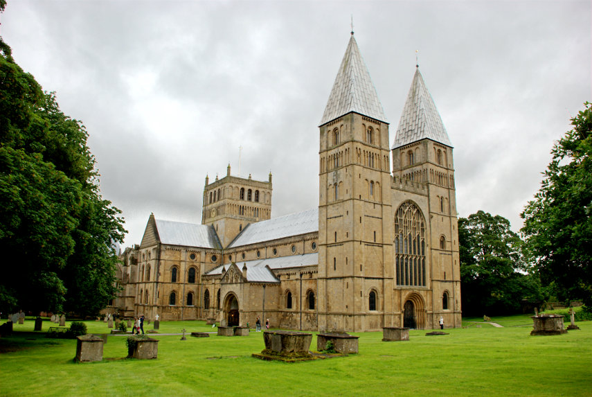
Southwell Minster is typically Norman and building was started in 1108. It is considered to be an outstanding example of Norman and Early English architecture.

There was an earlier Saxon church here when construction began and many of the stones of this earlier Saxon church were reused in the construction of the Norman one. The tessellated floor and late 11th century tympanum in the North Transept are the only pieces of the earlier Saxon building remaining intact.

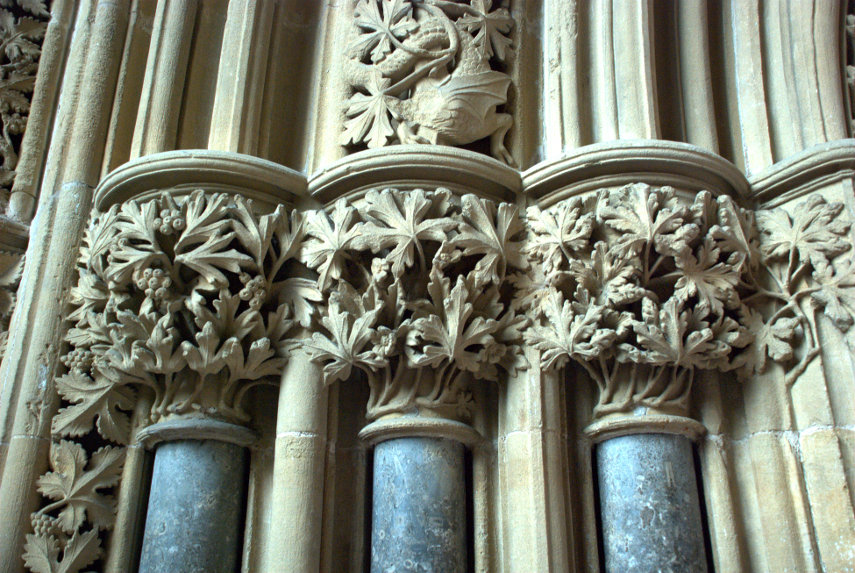
The Chapter House wasn't built until around 1300 but is well known for its carved stone 'leaves'. These carved leaves are very acurate representations of real leaves and there are many different species. They are very intricate and very fragile and one does wonder how on earth these craftsmen managed it.

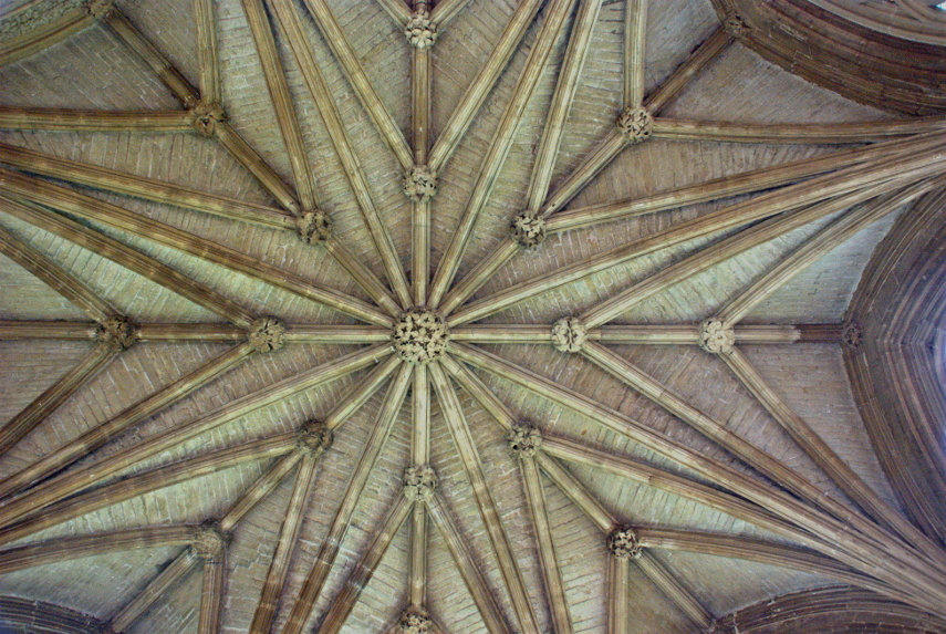
The ceiling of the Chapter House is also nicely decorated.

There will be lots more photographs when Southwell Minster goes on the main web site.

We spent about 2 hours at Southwell, including lunch, so it was about time we continued our homeward journey. It was my turn to drive and Amanda plotted a route back to the A1 on the map but we'd gone only about a half mile when we joined a queue where nothing was moving. We could see a police car in the distance so assumed the road was blocked for some reason. Amanda could see an alternative so we took a side road only to find that that was also blocked. In the end Amanda spotted yet another, rather longer, alternative and that worked. We had wasted about 30 minutes but were once again on our way to the A1.

It started raining again once we were on the A1 and, eventually, we joined yet another queue where we crawled for another 30 minutes before traffic speeded up again. When we were only about 20-30 miles from home we ran into an absolute deluge and, again, the wipers couldn't cope so we had to slow right down.

We finally arrived home after a journey from Southwell of 4 and a half hours which should have taken no more than 3. I hope we don't have too many journeys like that. :unhappy:
 

Rock and Water – Day 1

Rock and Water – Day 1

After a relatively easy drive of one hour and 45 minutes, 15 minutes less than Google's estimate, we arrived in Peterborough. We had booked one night at a Premier Inn near the Ferry Meadows Country Park so we parked our car there and caught a bus into Peterborough City Centre. This is a photograph from the front seat on the top deck of the bus just as we were about to cross the bridge over the River Nene. Peterborough Cathedral is visible in the distance with the old Customs House on the right of the bridge.

I'm surprised that it's as sharp as it is as I was being severely joggled by the bus bouncing about. The cathedral,of course, was what we were here to see. The stone from which it is made is limestone which was quarried from the old medieval quarries at Barnack.

Just outside the cathedral close is the large Market Square and at the far end is the 17th century Guildhall. The Guildhall is a typical example of Anglo-Dutch architecture and there is almost an exact copy of the Guildhall in Amsterdam. Just beyond and to the right of the Guildhall is the medieval church of St. John. When we arrived in the Market Square there was a group of elderly people playing traditional jazz in the Guildhall and they were playing very well indeed.

Looking in the opposite direction we see the entrance to the cathedral close – so that is were we go.

Once through the arch we are presented with this view of the West Front.

Just look at the size of those three arches compared with the people just in front of them on the central path. To describe them as impressive seems to be a bit of an understatement.

Time to go inside and the first thing we see is, of course, the nave.

The painted ceiling dates from around 1250 and is the only medieval painted wooden ceiling surviving in Britain today. The carved marble font is also medieval dating from the 13th century.

This next view from the east end of the nave is looking through the Quire, under the tower crossing and into the Sanctuary.

Walking through the quire stalls to stand directly under the central tower and then looking up we see the tower ceiling.

There are lots more interesting parts of this cathedral which will feature on the main web site at a later date.

After looking round the cathedral we wandered over to the terminus station of the Nene Valley Railway, a heritage railway, in the hope of seeing a steam train. We waited 20 minutes and saw the last train of the day hauled, very appropriately, by a  locomotive named the 'City of Peterborough'.

We took the bus back to our hotel at the end of the day and after our evening meal we prepared for the longer journey that we would be making tomorrow.
 

A later date.

A later date.

At the end of my last post I said "we plan to return for more at a later date" – this is that later date on a Sunday.

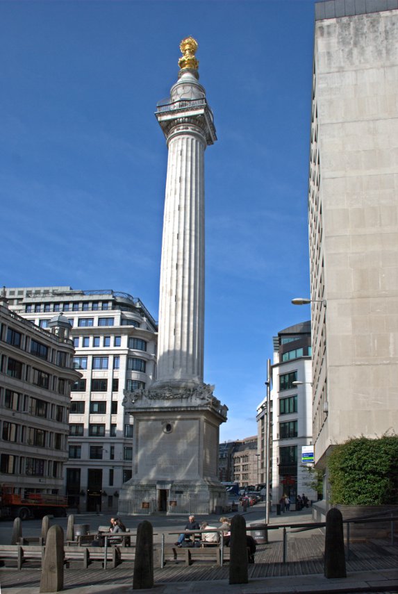
We came back to the City of London, as distinct from the City of Westminster and the West End, and started from the Monument this time.

We were last here when we went up to London to meet Jerry, 'Old Guy USA' on the forum, and this is where we parted at the end of our day together. Jerry went off to his hotel and we went home. The day had been cloudy with showers then but today it was sunny.

From the Monument we went into Pudding Lane where the Great Fire of London started, and no, we didn't start it – not even by accident.

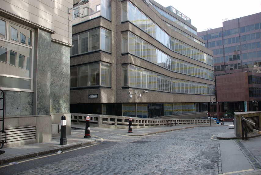
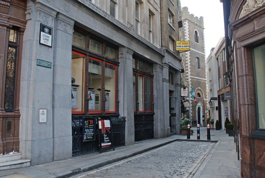
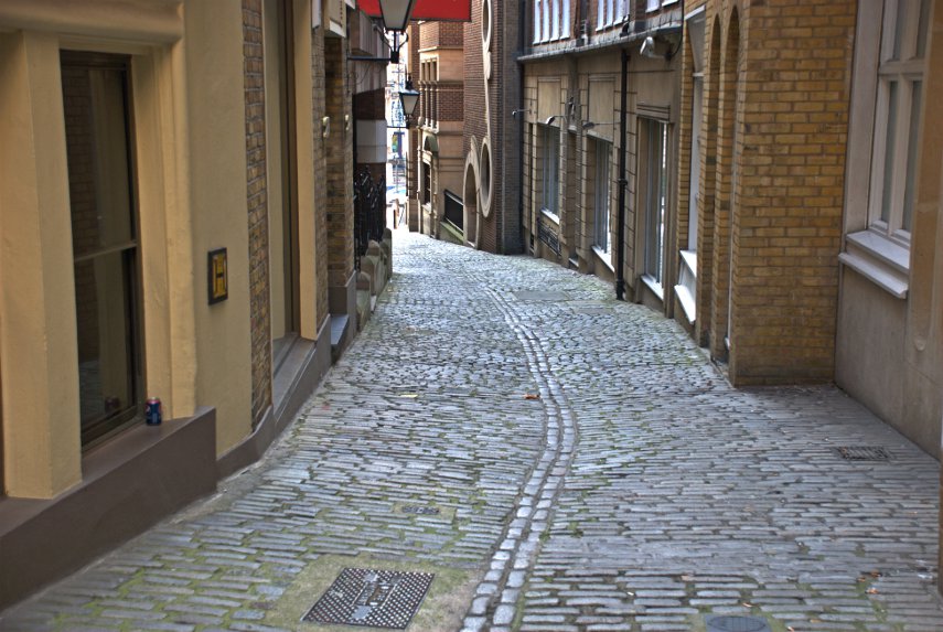
Pudding Lane looks totally different now, although it is still cobbled, compared to how it was in 1666 but nearby is Lovat Lane which gives an idea of how Pudding Lane might have looked at the time. Lovat Lane slopes down towards the Thames.

The top picture of the two is the top end of the lane where it joins Eastcheap and just out of sight past the church is the view in the second picture. Note how the sides of the cobbled surface slope towards the centre forming a central drainage channel. That is how all the roads at the time of the fire were constructed and that is where all the sewage would have been thrown. Nice! :yuck:

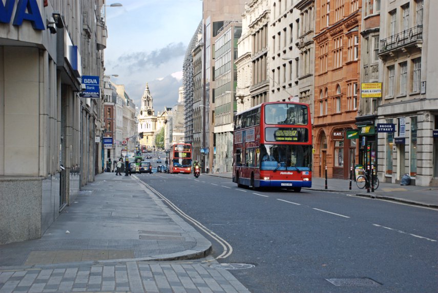
Pudding Lane is east of the Monument and Lovat Lane is east of Pudding Lane so we turned around and walked back west to Cannon Street which was really quiet, being Sunday, compared with a weekday. There are, as you can see, still buses around although we weren't here to look at buses.

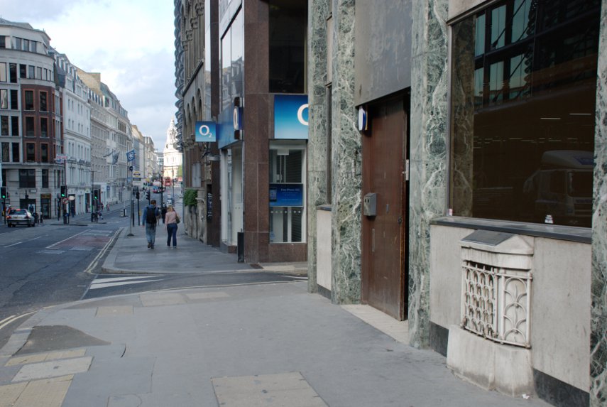
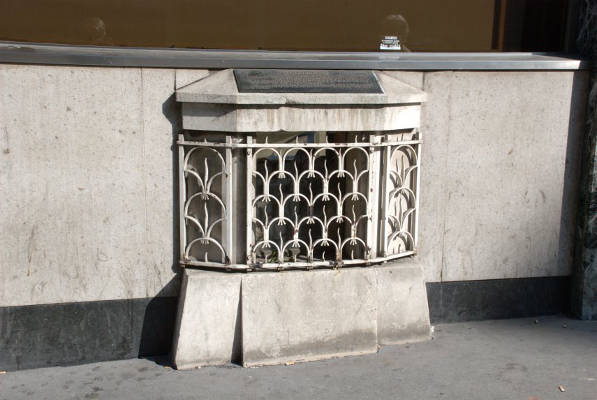
Just opposite Cannon Street Station is a small grille near pavement level which would be very easy to ignore. But if you did ignore it (You did didn't you?) you'd be missing part of London's history.

It is virtually impossible to photograph beyond that grill because there is a sheet of glass behind it which is covered in reflections from the bright light outside and behind that, just visible, is the London Stone. This is the stone from which the Romans measured all their distances from London.

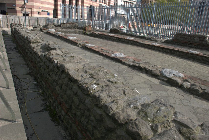
We then walked a little further along Cannon Street, turned right into Walbrook, left into Bucklersbury then left into Queen Victoria Street. A short way along on the lefthand side are the foundations of the Temple of Mithras.

This foundation was discovered during rebuilding work in 1954 and is, perhaps, the most famous of all twentieth-century Roman discoveries in the City of London. This temple was built in the mid-3rd century and, during excavation, various artifacts were discovered and are now in the Museum of London.

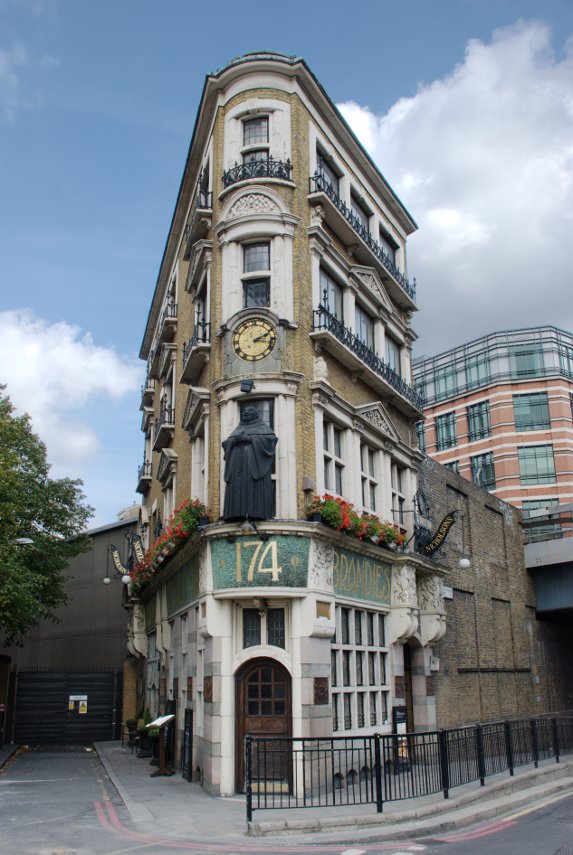
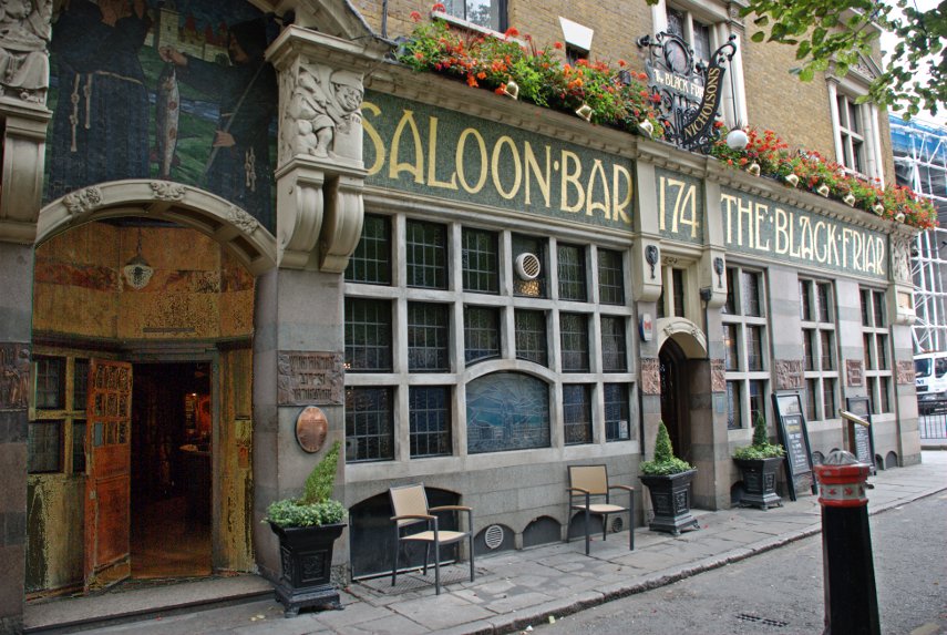
We continued along Queen Victoria Street as far as the junction with Black Friars Lane where we found this wedge shaped pub which as you can see in the lower picture is The Black Friar.

This pub was built on the site of a thirteenth century Dominican Priory, hence the name, but it is the interior, an Art-Nouveau masterpiece created in 1905 by the Royal Academy sculptor Henry Poole, that makes this pub so interesting. If you want to see the inside then you know where to go (they do provide cooked meals).

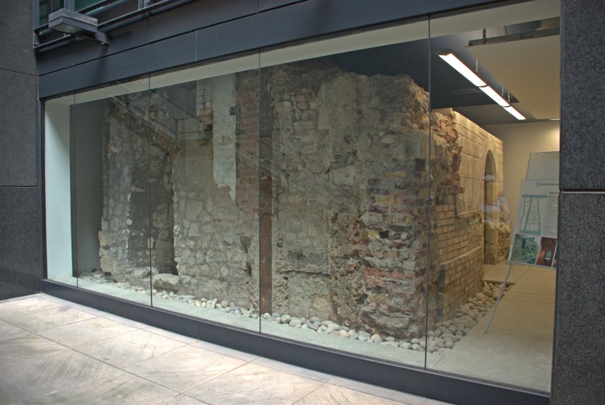
We went right into New Bridge Street and crossed over into Tudor Street, along Tudor Street then right into Whitefriars Street. We were looking for Magpie Alley/Ashentree Court along on the lefthand side of Whitefriars Street and spotted the narrow entrance to the alley. This led us into an obvious courtyard of all modern buildings, some with steps down to basement level. At the bottom of one of these basement steps is this:

It is all that remains of a Carmalite 13th century crypt.The crypt lay buried for centuries until it was unearthed in 1895 but it was not restored until the 1920s. It is protected by plate glass but is available to view at any time by going down the steps from the courtyard above.

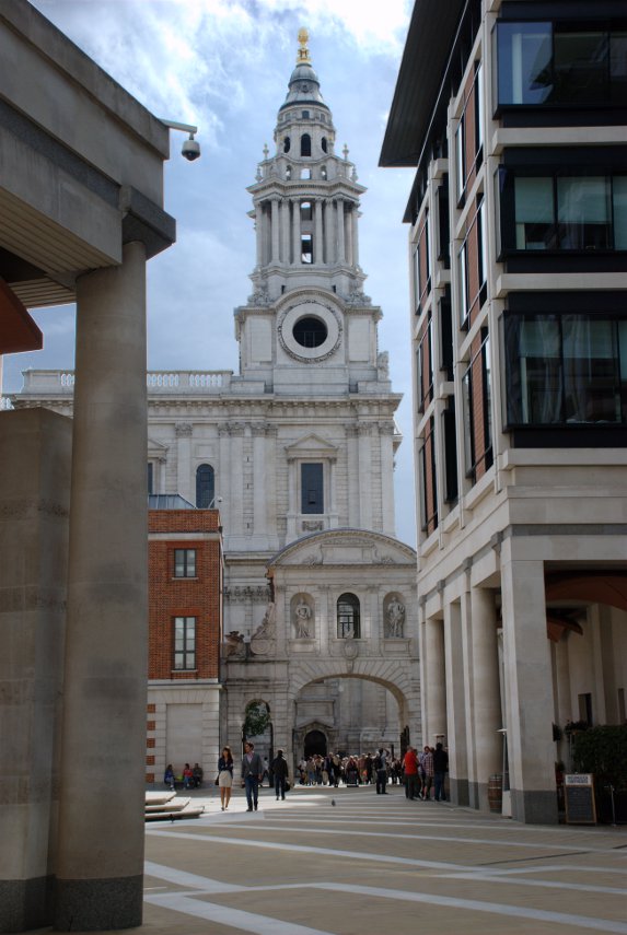
From here we made our way into Fleet Street and Ludgate Hill towards St. Paul's cathedral and into Paternoster Square with this view of Temple bar and one of the towers of St. Paul's Cathedral.

We had lunch, which was quite good and reasonably priced, in the St. Paul's Crypt cafe. There are also publicly accessible toilets down there.

After lunch we walked up Warwick Lane seeing Cutler's Hall on the way.

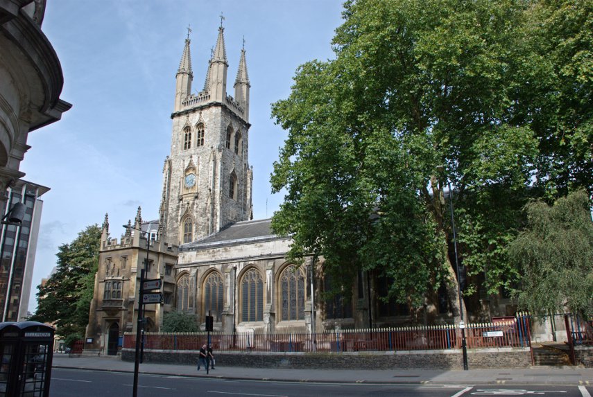
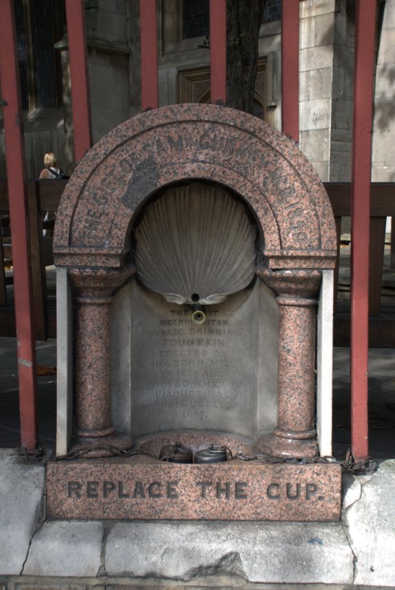
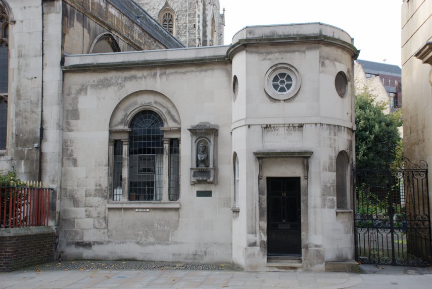
Then left along Newgate Street where we saw St. Sepulchre's Church on the corner of Giltspur Street. Built into the railings of the churchyard is London's first ever public drinking fountain (shown in the second picture) and round the corner in Giltspur Street is the Watch House (shown in the third picture).

The Watch House was built to deter grave robbers which were rather prevalent in those times as freshly dead bodies were in great demand for surgeons to practise on and fetched a high price.

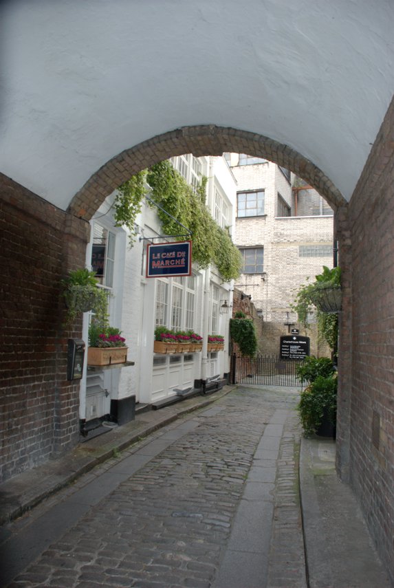
We went up past Smithfield Market to Charterhouse Square and saw this attractive little alley nearby.

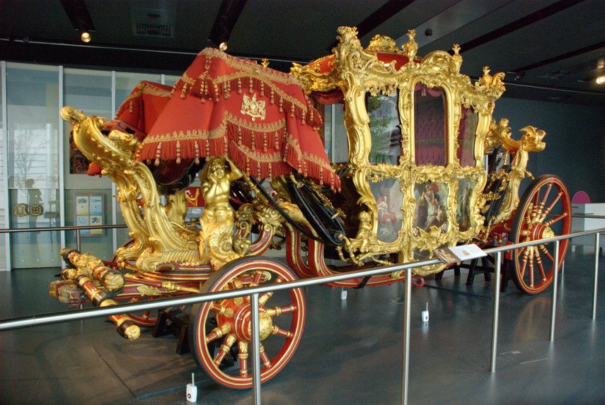
Then back to Barbican to revisit the Museum of London where, this time, we saw the Lord Mayor's Coach (and had a cup of coffee).

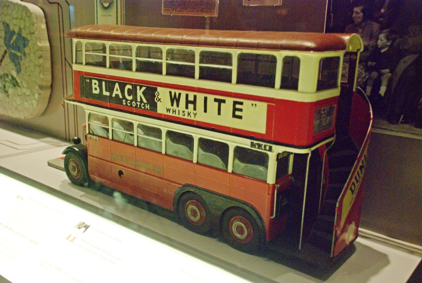
We also saw this model of an old London bus with an external stairway to the upper deck. I hate to have to admit this but I can remember going to school on one of those exact buses as a child. :oops:

Just round the corner from the Museum of London we made a quick visit to Postman's Park. A small, little known but interesting little park.

Last, but not least, we went back to St. Paul's and at the east end walked into One New Change. New Change is the name of the street and One is the address/name of a very modern, covered shopping centre. If you like shopping then you will probably like this and there are lots of places providing food of various kinds.

We didn't go in for either of those things. There are lifts which are made of glass and run on the outside of the building and if you go up to the 6th floor you will find a roof terrace which is freely accessible to the public and that is where we went.

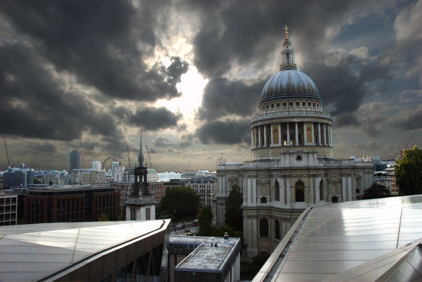
The first picture, looking directly into the sun, gives quite a good view past St. Paul's across London with the top part of the London Eye just visible on the horizon.

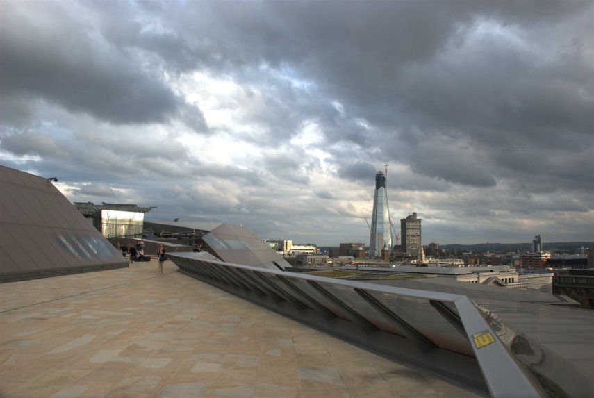
The second picture shows just part of the actual roof terrace.

That was the end of our second day trip to the City of London.
 

Yesterday we walked four feet

Yesterday we walked four feet

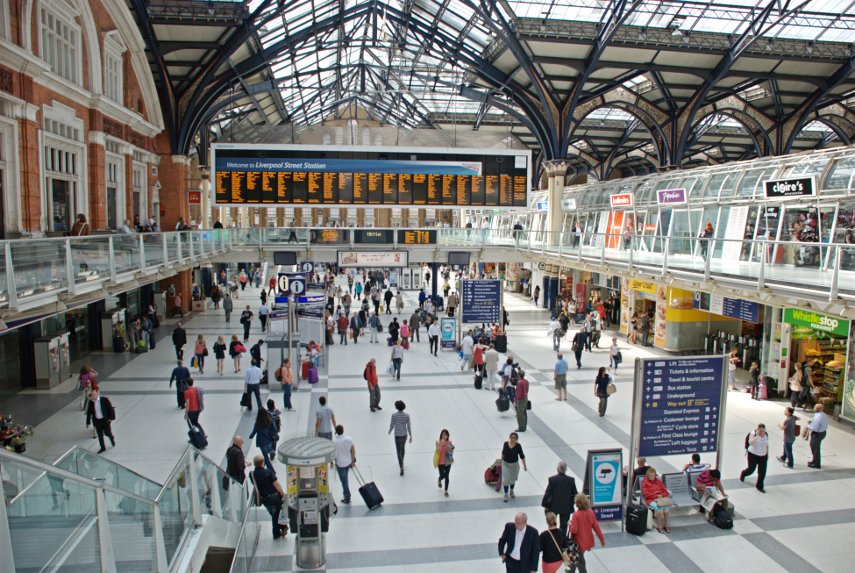
… (the ones on the end of our legs that is) and we walked them from Westminster to Liverpoool Street Station. Why Liverpool Street Station? Because that's where our train to London terminates and we will be going back home from there.

We saw Westminster Palace, the London Eye in close up, the Millenium Bridge, some old churches, Tower Bridge, the old Billingsgate Fish Market, a Saxon Arch, the Gherkin, a hidden treasure, lots of alleys, the Royal Exchange, the Bank of England, the Mansion House and a Turkish Bath House. We also visited the area where Charles Dickens wrote some of his novels.

We'd better get started then, there's a lot to do. Don't forget that clicking on a picture will give you a larger version.

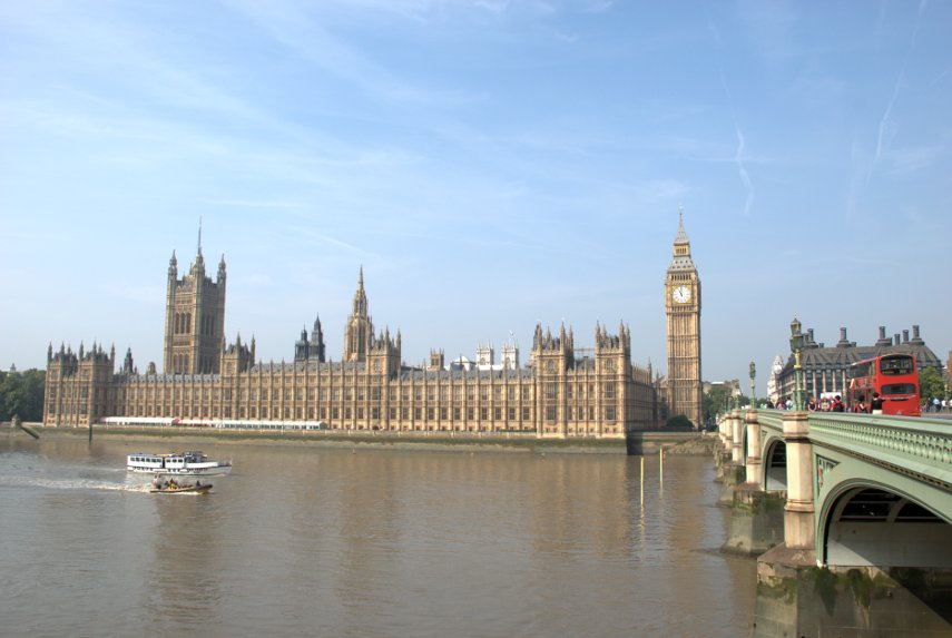
Friday was a sunny day and, after travelling to London, we took the tube to Westminster and walked across Westminster Bridge to the south side of the Thames. There's a good view of the Palace of Westminster (Houses of parliament) from there.
We turned east along the riverside path and in a very short time reached the London Eye. I have to say that it looks an impressive bit of engineering in close-up. There were longish queues but not excessive and we weren't planning a ride.

There are a number of visitor attractions along this stretch of the path, including the London Aquarium, together with various cafes which give the area a holiday atmosphere. There are also a number of street entertainers and snack bar trailers along here and we decided to have an early lunch. We bought ourselves some snacks and sat on a riverside bench to eat them whilst watching the world go by. There were a lot of tour boats and we saw a restaurant boat which looked rather like a rather long floating greenhouse.

After lunch we continued along the path with views like this:
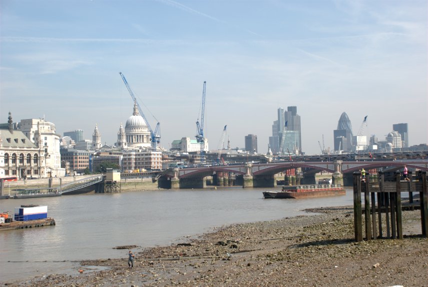
I'm sure you don't need me to point out St. Paul's but the bridge is Blackfriars Bridge which we intend to use to go back across the river to the north side. The cranes are part of the building works apparently being carried out on the railway bridge. I don't know what they are doing but they are doing a lot of it.

After crossing Blackfriars Bridge, to get to the riverside walk, one has to do one of two things. Although we want to head east the easiest way to the path is to turn left (west) and go down to the Embankment, on to the path, then turn back east along the path. The alternative is to turn east but that means you can't access the path until you reach the Millenium Bridge then go down the steps either side.

The path on this side, the north side, is very nice and we soon reached the Millenium Bridge.
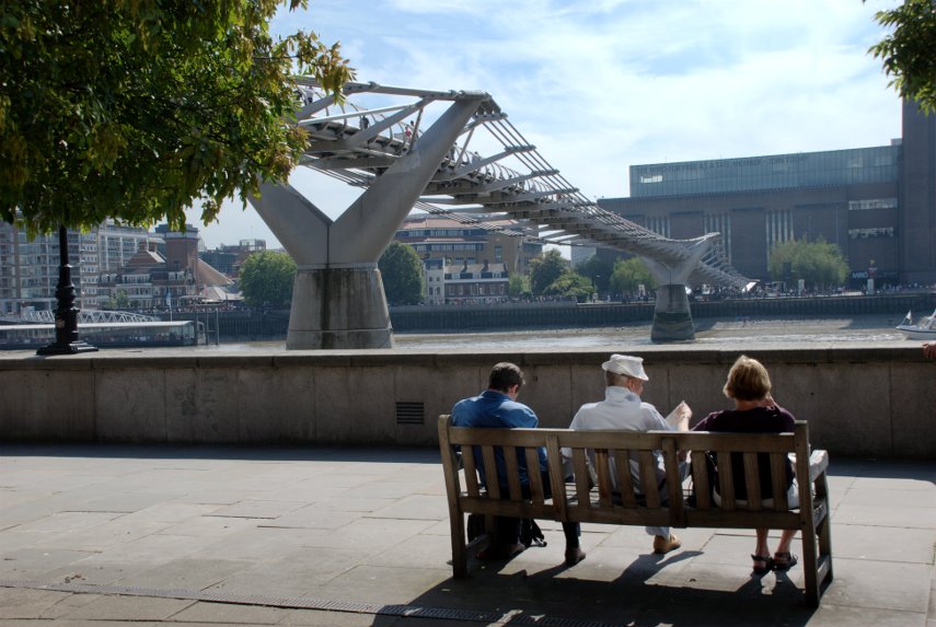
We continued past the bridge to Broken Wharf where one has to walk inland up to High Timber Street, along High Timber Street for a short distance, then back down Queenhithe to the river. Somewhere between Southwark Bridge and Cannon Street Station we reached a point where the river path continued on but there was a passage to the left which we wanted to explore. This is what we found:

Known as Fruiterers Passage the walls and ceiling are all tiles and the framed images are old engravings of London. We followed the passage round and came out on the river path again and a little further on the path goes through a sort of cage.
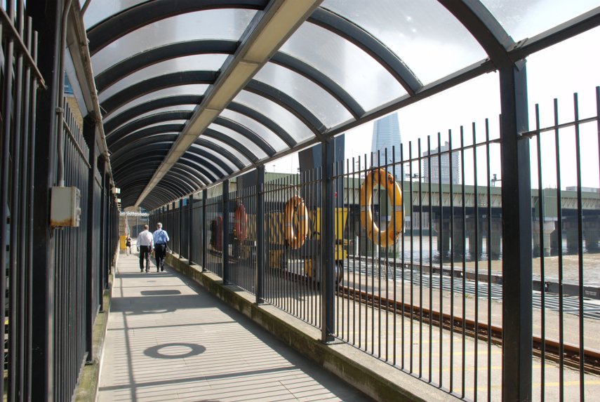
The bridge on the right takes the railway from Cannon Street Station across the river and when we reached the edge of Cannon Street Station on Cousin Lane we saw these, rather appropriate, items:

At this point you could be forgiven for thinking that the path stops here but you'd be wrong. On the other side of Cousin Lane there is a black cavernous opening which looks like the entrance to a goods warehouse or similar but it is Steelyard Passage and it will take you underneath Cannon Street Station and on to the continuation of the path.

As we walked along the path I noticed this view to my left. The pillar with the golden top is, of course, the Monument and you should just about be able to see people on the top platform.
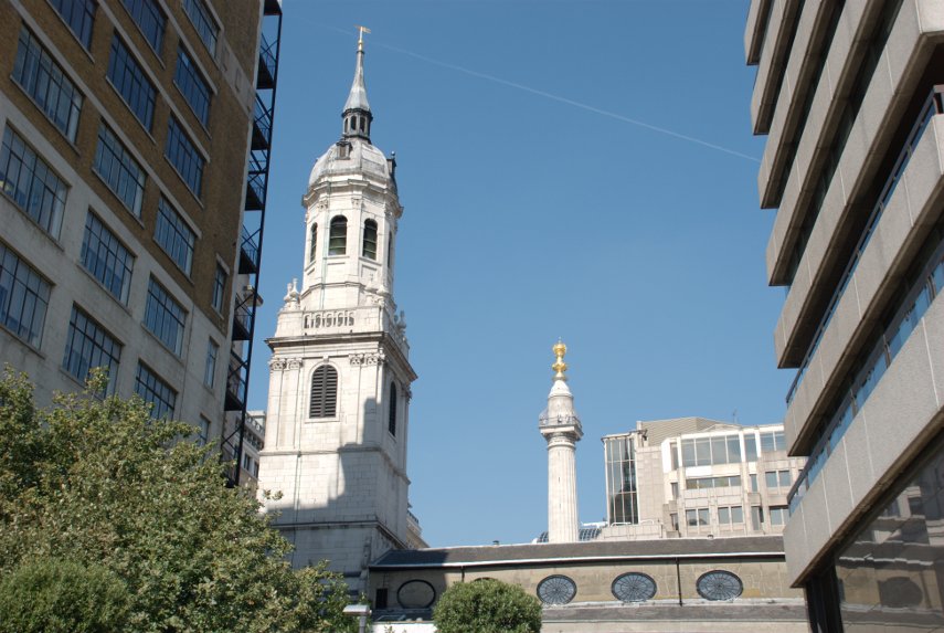
The church, of which only the roof and tower is showing, is St. Magnus the Martyr, a Wren church, and we detoured very slightly to look inside. The original church was one of the first casualties of the Great Fire of London and was subsequently rebuilt by Sir Christopher Wren. The roof was destroyed in 1760 by another fire and a smaller fire in 1995 caused more minor damage. It was badly damaged by a bomb in 1940 and was repaired once again.

Back onto the riverside path we continue onward.

That large overhanging balcony on the left above the path is a public viewing gallery accessed by steps just this side of it so we went up. There was absolutely nobody up there, except us, and there is also no seating of any kind. This is the view:

The building on the left is the old Billingsgate Fish Market with Tower Bridge in the distance. Soon after this we reached the Tower of London and this is where our riverside jaunt ends because from here, being only early afternoon, we branch off in a north-westerly direction into the City of London to continue our explorations.

Leaving the environs of the Tower of London we walked along Gloucester Court until we spotted the church of All Hallows by the Tower and went inside.
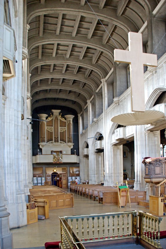
This church is the oldest church in the City of London having been founded in the year 675 but only an archway from that original church remains above ground.

There is a crypt, part of the original Saxon church, which has part of a Roman tessellated pavement exposed. This is the Saxon Crypt.
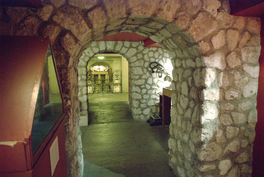
This was a very interesting church and is well worth a visit. John Quincy Adams, sixth president of the USA, was apparently married in All Hallows in 1797.

After leaving the church we crossed Byward Street where I took this exterior photograph of the church.
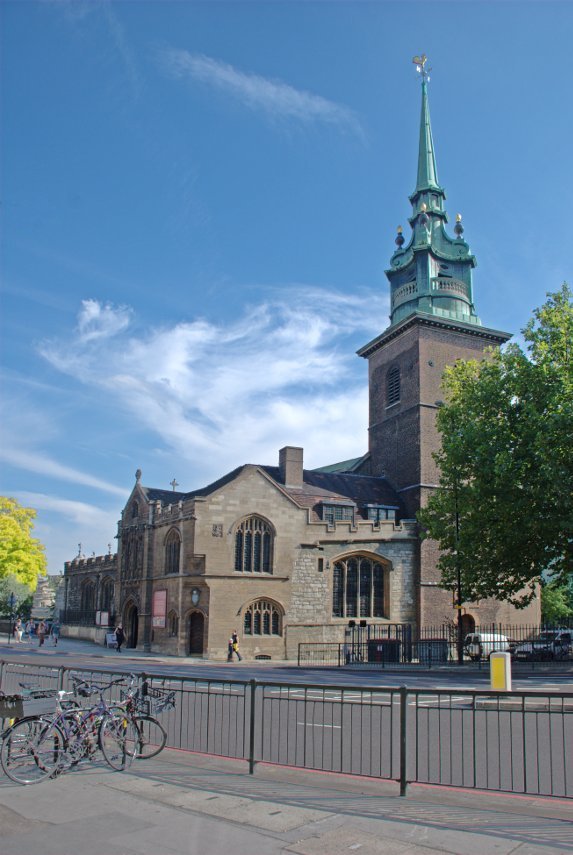
We turned north up Seething Lane which has a nice little garden with bench seats but nothing special so we went on. Up to Hart Street, turned left and along to Mark Lane where we turned right (still going north) to look for Star Alley. We found Star Alley easily enough and what should we see peeking at us through a gap in the buildings but the Gherkin (proper address 30, St Mary Axe).

Nearby was a solitary stone tower. This apparently is all that remains of a church called 'All Hallows Staining', where 'staining' means 'stone', which distinguished it from the other 'All Hallows' wooden churches round about. It was built in 1320, which makes it medieval, and is maintained by the Worshipful Company of Clothworkers.

Off we went up Star Alley and popped out on Fenchurch Street. There are two alleys going north from Fenchurch Street through to Fenchurch Avenue and neither of us can remember which one we took although I suspect that it was Billiter Square.

Anyway we turned left (west) along Fenchurch Avenue towards the Lloyds of London building then right into Leadenhall Place – and were really surprised to see this:

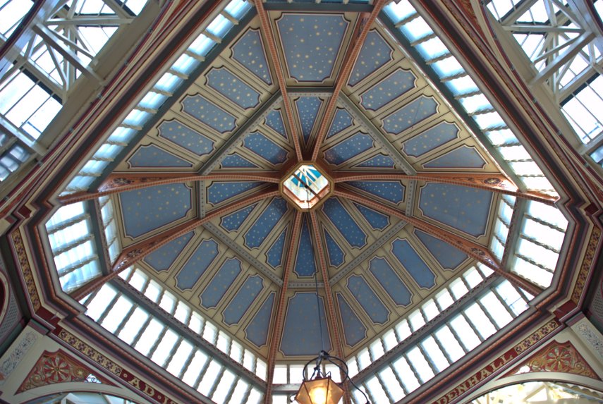
The entrance to Leadenhall Market with part of the ultra-modern Lloyds building on the right. This is something we weren't expecting as neither of us can remember hearing of Leadenhall Market before. It was a meat, game and poultry market and has now had a change of use as Covent Garden has. There are various shops, stalls, cafes, pubs, restaurants and the like and what a wonderful old building it is.
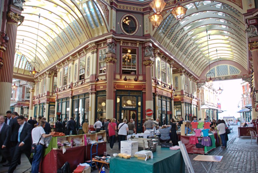
We eventually left the market via Whittington Avenue, turned right along Leadenhall Street and spotted this little church near the corner with St. Mary Axe.

The church of St Andrew Undershaft is rather dwarfed by the Gherkin but is a rare example of a City church that has managed to escape both the Great Fire of London in 1666 and the Second World War bombing. The first church to occupy this site was certainly there by 1147 but that church was rebuilt in the 14th century and was replaced by the current church in 1532.

We went back along Leadenhall Street and left into Gracechurch Street looking for the alleys along the west side of this street. There is a bit of a maze of alleys in this area including St. Peter's Alley, Corbett Court, George Yard, St. Michael's Alley, Castle Court and Bengal Court.

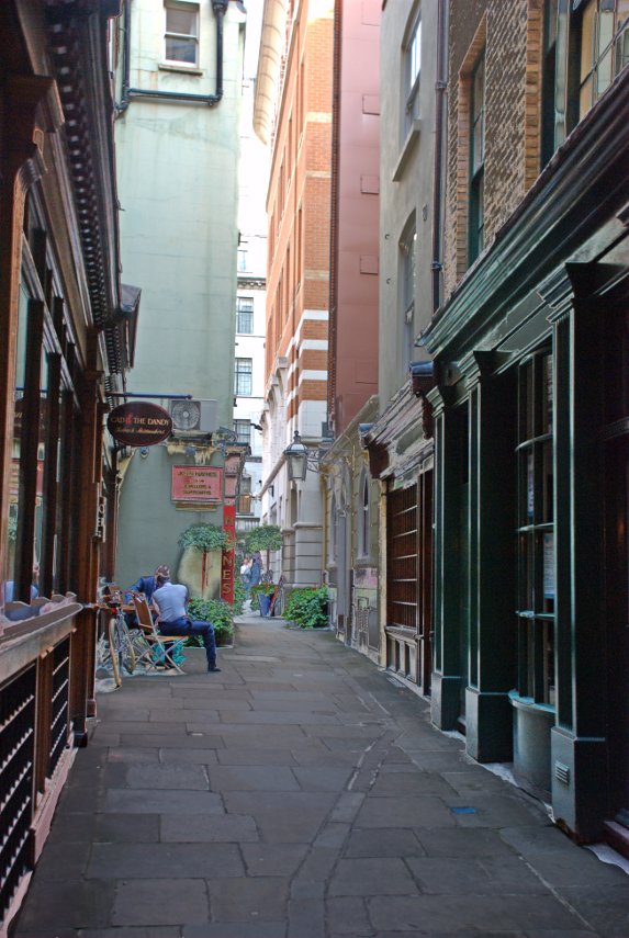
We spent a while wandering back and forth and discovered that somewhere around St. Michael's Alley was where Charles Dickens had a study in which he wrote some of his novels. These are some of the pictures I took whilst getting lost in the alleyways.

That last picture is the junction between St. Michael's Alley and Bengal Court so somewhere close to Charles Dickens Study.

We went through Bengal Court and across Birchin Lane into Change Alley and found our way through to Cornhill where we saw the Royal Exchange.

We crossed over to Threadneedle Street, Forked left up Old Broad Street then crossed London Wall to the northern part of Old Broad Street heading for Liverpool Street Station where we were to catch our train home.

So was that the end of our trip? Well not quite. To get to Liverpool Street Station from Old Broad Street we cut through an alley called Bishopsgate Churchyard and came across this little curiosity:
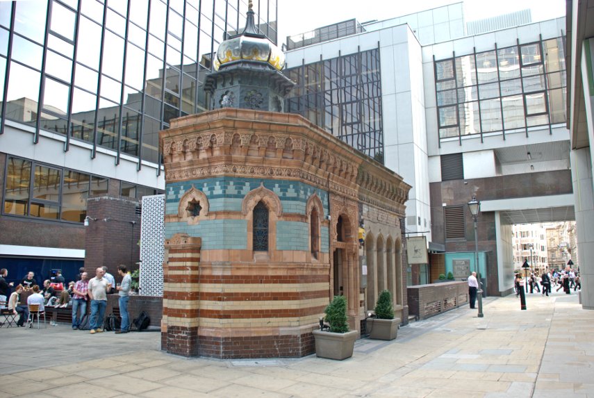
This is a Victorian Turkish Bath dating from 1895 now converted to a restaurant. It's not quite as small inside as it appears outside because a lot of it is underground. Needless to say, because it's still here, it survived the London bombings during World War II.

So now we have finished our trip so it's back home via Liverpool Street Station.
We haven't finished with this area in the City yet as there's more to explore a bit further north-west from where we've been today.

Until next time.
 

Two big buildings and a steep hill

Two big buildings and a steep hill

The Prologue.

Just back from a five day trip to here:

Any ideas? :cool:

No ideas eh? You've now seen one of the big buildings so here's the second big building:

Any more wonderful ideas like the previous ones (0)? :roll:

You've now had both big buildings so now for the third clue – the Steep Hill:

There are two clues there, one in the photograph and one not. :shock:

Annecyborn finally got it but not until the 'give it away' clue.

The clues work like this:

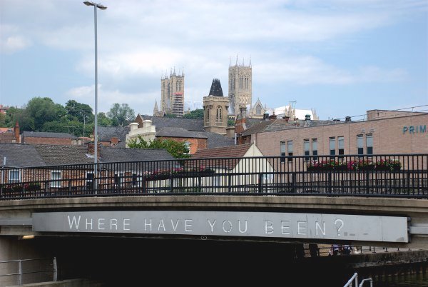
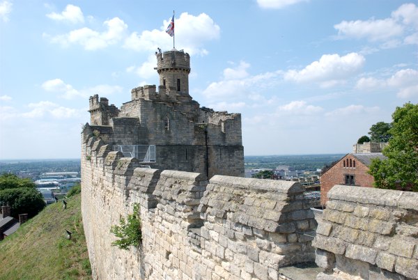
First picture shows a cathedral on the hill which immediately limits the number of towns to 30.

The second picture shows a castle which must limit it even more. You are looking for a place with a cathedral and a castle.

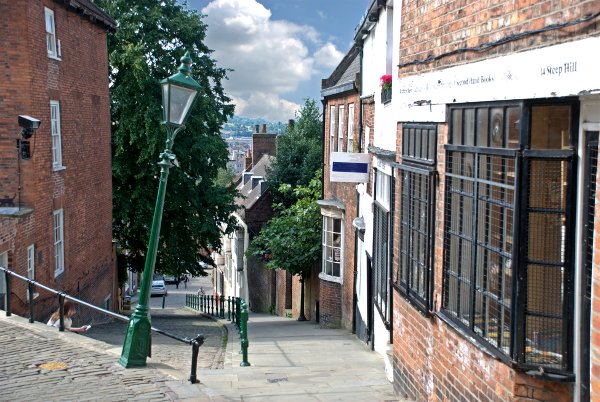
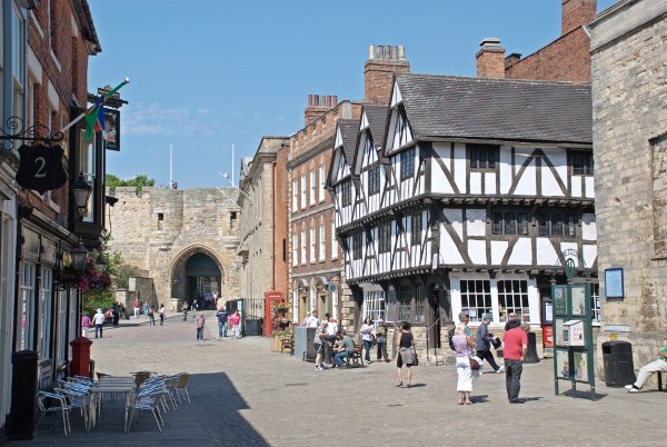
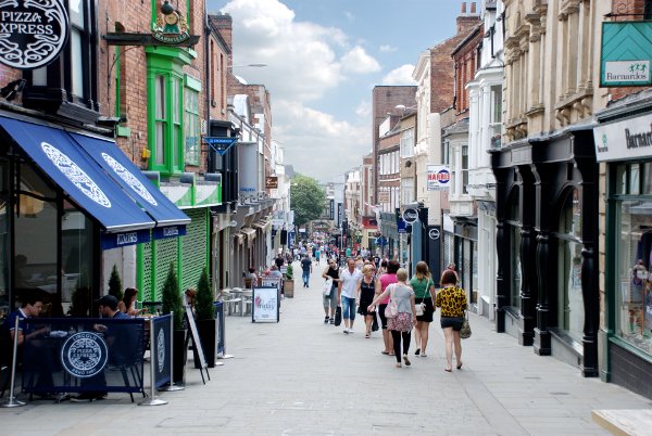
The third and final picture I described as 'the Steep Hill'. Note the capital letters on the words. That is because it is the name of the street and there is a further clue to that effect in the picture in the address painted on the right of the shop.

A judicious search might then have provided the answer but only for those bright enough to work it out. :devil:

The give away clue was, of course, Abraham Lincoln.

The Trip.

We left home on Saturday morning heading north up the A1 for Lincoln but we were intending to stop overnight in Stamford and that is what we did. We arrived at our B&B at 11:30 AM so we had the rest of the day to wander round Stamford again (we had been there before).

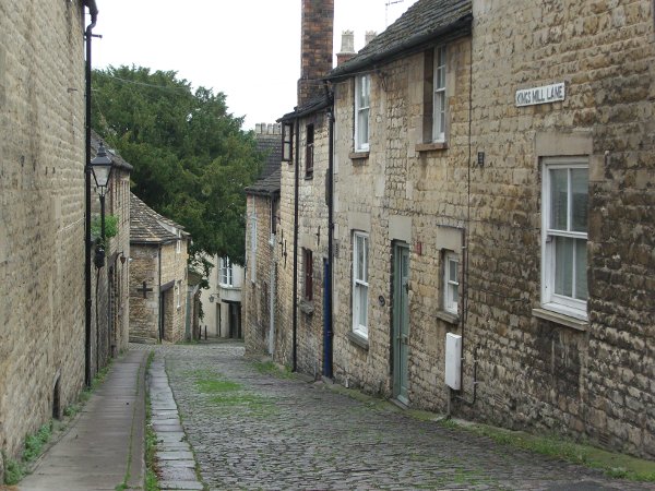
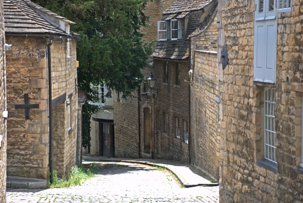
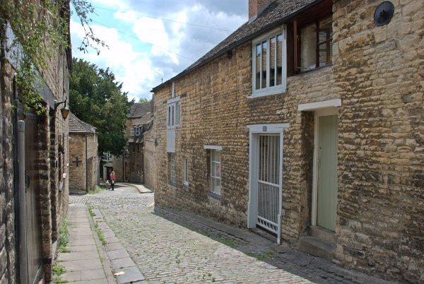
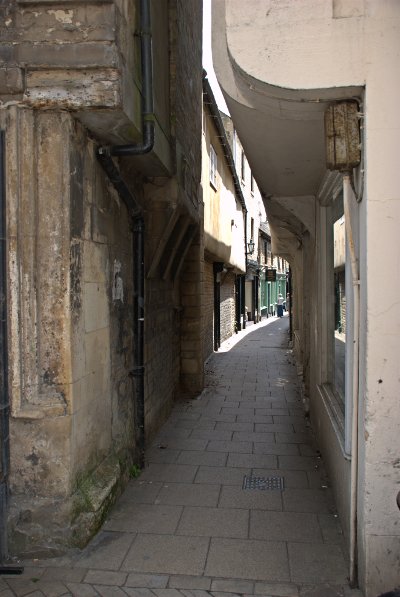
When we were there last I photographed a street called King's Mill Lane in what was very gloomy weather so I took some more this time in the sun.

This is the original in cloudy weather:

and these are the new ones:

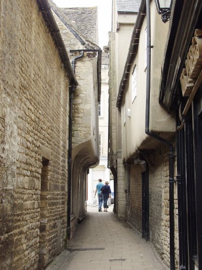
I did the same with Cheyne Lane. First the original cloudy weather one:

then the new sunny one:

Do you think that the sunny ones are better?

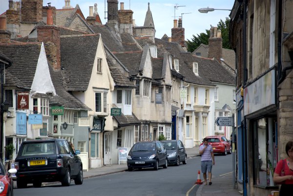
I also took a new view this time which I rather liked. I think it's the jumble of rooves which make it interesting. I could do without the parked cars though. :yuck:

We also found time to re-visit the Barnack wildlife reserve, a few miles from Stamford, where we saw this Burnet Moth on a Pyramidal Orchid. Amanda decided, looking at the photograph, that it's a Narrow-Bordered 5-spot Burnet so if the identification is wrong it's all her fault.

Then later we saw a better specimen of a Pyramidal Orchid:

In the evening we had dinner at Mr. Pang's Chinese Restaurant in Cheyne Lane. We 'discovered' it on our last visit and thought that it was easily the best chinese restaurant that we had visited from the food, service and ambience point of view. We haven't changed our minds.

Next morning, after a good night's sleep we set off for Lincoln.

Sunday saw us back on the A1 heading north for an hour to Lincoln. So where did we stop first? Our hotel? The cathedral? The castle? Nope none of those! We stopped, naturally, in the local crematorium. We didn't stop there because we felt that one of us might be needing it soon but because we could get a good distant view of the cathedral on the hill and that photograph will appear in the main web site in due course.

Lincoln is like most modern cities with an old central part surrounded by a more modern area of housing and industry. It's no better or worse than any other city in this country but we, and probably you, won't be interested in anything other than the old central part. The old part was built around the hill and, consequently, going from the cathedral level to the river level is quite a stiff climb.

Luckily there is a little bus which shuttles between the two levels at 20 minute intervals to make it easy for the wimps out there. We didn't use it.

The main part on top of the hill consists of a large, cobbled market square with the cathedral and its precincts on one side and the Norman castle on the other giving the area a distinctly Norman feel.

The popular route up and down the hill is via Steep Hill and it is aptly named. A narrow cobbled road, mostly devoid of motor vehicles, leading into High Street at the bottom which is a pedestrian precinct. Lots of shops from the quaint and curious at the top to chain stores at the bottom in High Street.

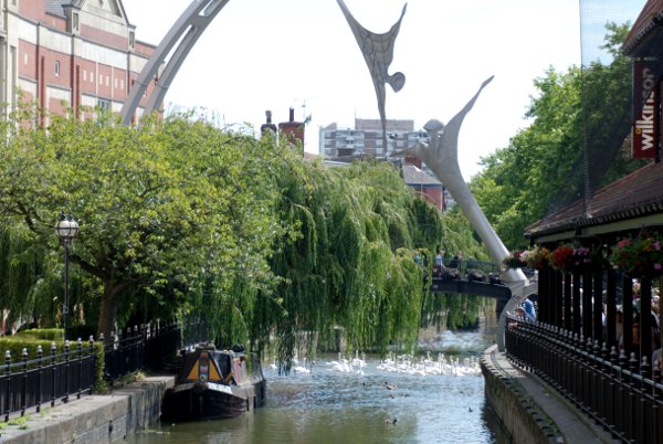
A little further on, through the Guildhall Arch, High Street crosses the River Witham where steps lead down to the waterside. There are a lot of swans on the river as you can, perhaps, see from this picture.

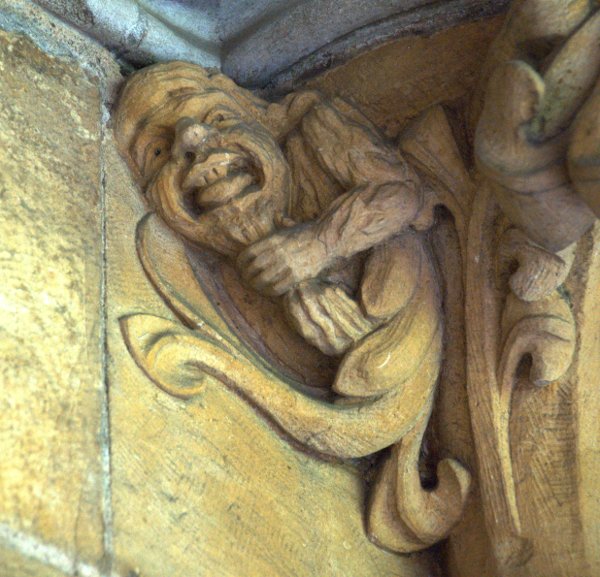
There are plenty of things to see in Lincoln including museums, an arboretum and, of course, the castle and cathedral plus the occasional oddity:

Full details of Lincoln will appear on the web site proper in due course.


Hungry? Time for a Sandwich.

Hungry? Time for a Sandwich.

We are off on our travels again and, on our way to somewhere, we called in to somewhere else.

This is what somewhere else looks like:

Note the Mote (That's a clue).

This is one of the rooms:

So where do you think it is? I'll give you another clue – it's within a 70 mile radius of where we live.

After seeing that we drove on to where we are as I write this – 'somewhere'. More of that tomorrow and I've given you a clue to that too.
 

I can see that nobody, thus far, is prepared to hazard a guess about where we are now. This is two of the various locations we have visited.

We came through a well known cathedral city to get here and we have worn our legs down to the knees walking around. So, where are we. You'll have to hurry we're leaving tomorrow.

Well you people aren't much good are you? I'll spell it out for you.

We left home on Sunday and travelled to Ightham Mote in Kent then moved on to Sandwich, also in Kent, where we stayed until Tuesday morning.

It's amazing what the Royal Mail will deliver these days.

We went home via the cathedral city mentioned above i.e. Canterbury.

That's the Quire.

We are back home and I now have more pages to construct for the web site – some for Sandwich and Ightham Mote and some additional pages for Canterbury.

No peace for the wicked. :evil:

Here today, not gone tomorrow

Here today, not gone tomorrow

Sunday 12th September

After 4 hours and 210 miles we arrived at two o'clock this afternoon. Most of the journey was in sunshine but it started raining just as we arrived. Luckily it didn't stay that way.

Where are we?

Monday 13th September

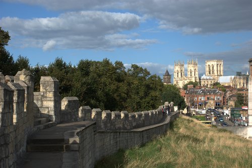
We bin 'ere:

and 'ere:

Cloudy all day today and it rained all the way from the Minster to the Railway Museum.

Well done Old Guy – you got it in one. It may be York rain Tudor but it's just as wet as any other.  Annecy we'll give you the low down later.

Tuesday 14th September

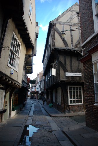
More tramping today. This trip is turning into a Shambles.

Eventually we got the hump!

We had our longest, hardest, wettest shower this morning. We'll be leaving tomorrow.

Wednesday 15th September

Weather cool grey and very windy. Left York at 9:30 AM home by 1:30 PM. :bawl: