Browsed by
Tag: Geology

A devil of a walk

A devil of a walk

When Amanda was a child she used to read books by Malcolm Saville some of who's stories were situated around the Stiperstones in Shropshire and she had always wanted to vist them. The Stiperstones are on a ridge a little west of the Long Mynd near Church Stretton and is about a 45 minute drive from us so, of course, we had to go.

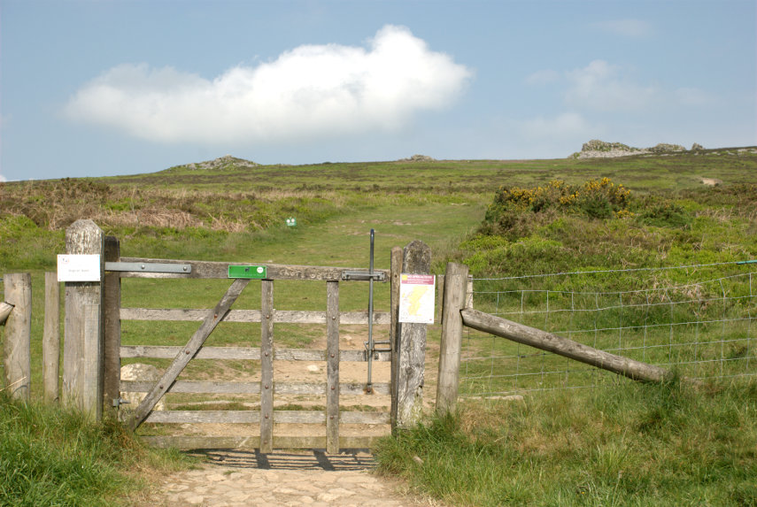
There is a car park at the bottom of the eastern flank of the Stiperstones ridge and that is where we parked. We found the start of the footpath up to the ridge easily enough and could see some of the rocky outcrops on the summit of the ridge from the car park.

The slope wasn't too bad but the distance is longer than it appears in the photograph. This area is designated as an NNR (National Nature Reserve) and has lots of interesting wildlife including lizards and adders (venomous snakes) to mention but a few.

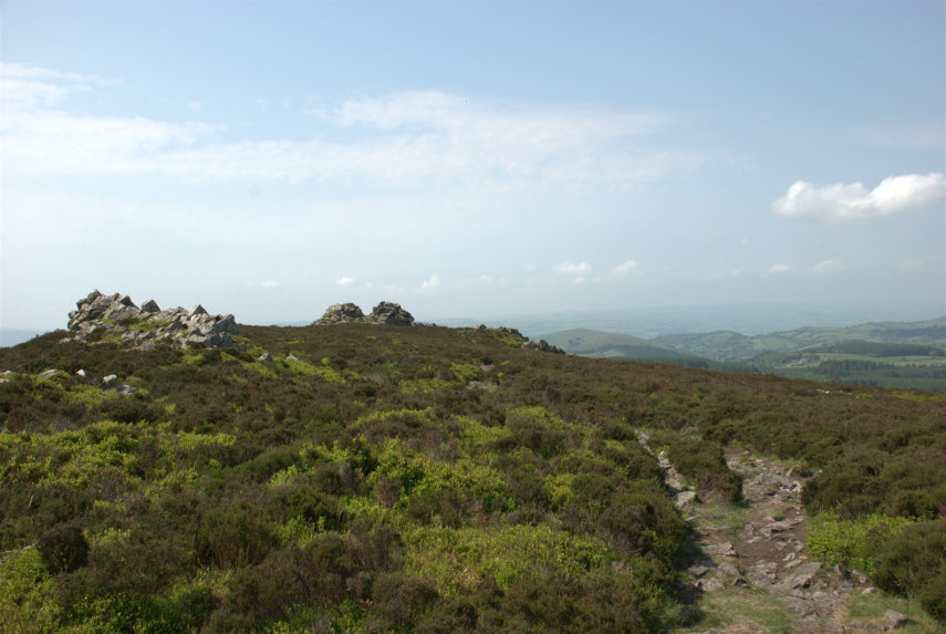
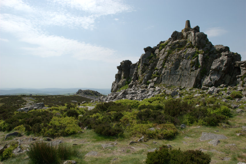
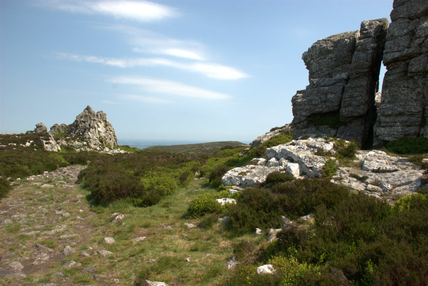
We reached the ridge after a not too strenuous walk to be greeted by this view.

It was unfortunate that we picked a hazy day which meant that, although it was a lovely day, the distant views were partly obscured. The views still looked amazing though and we started along the ridge which meant that, from this point, we were still climbing.

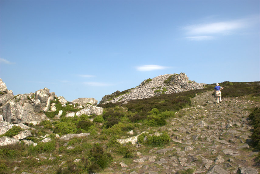
You'll never guess who that is ahead.

This ridge was formed about 480 million years ago from quartzite and during the last ice age these rocky outcrops stood above the glaciers and were subject to constant freezing and thawing which shattered the quartzite into a mass of jumbled rock as we were to discover.

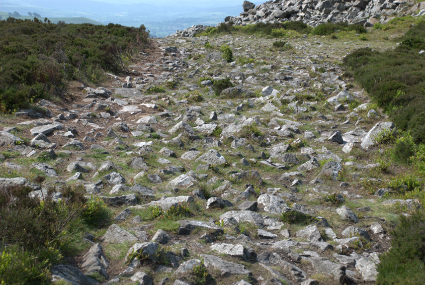
That jumbled rock was eventually covered in vegetation but when people walk over it the vegetation wears away and, if it's popular (which it is), the soil is worn away too leaving the exposed rock. This is what the path looks like:

Let me tell you that is very awkward and uncomfortable to walk on. It is very unwise not to look at the ground whilst walking and, if you want to look at the view, then stop walking first.

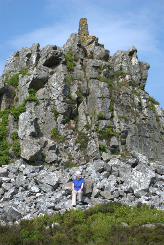
A number of the various rock outcrops along the ridge have names and this was the second one we reached. This is called Manstone Rock and has an Ordnance Survey trigonomentry point on it which you should be able to see. Amanda 'collects' these so that was one to add to the list.


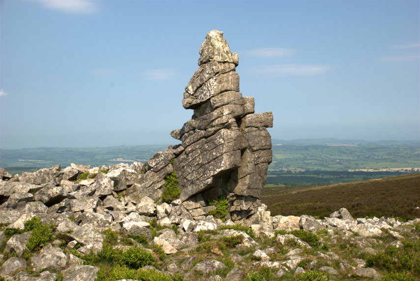
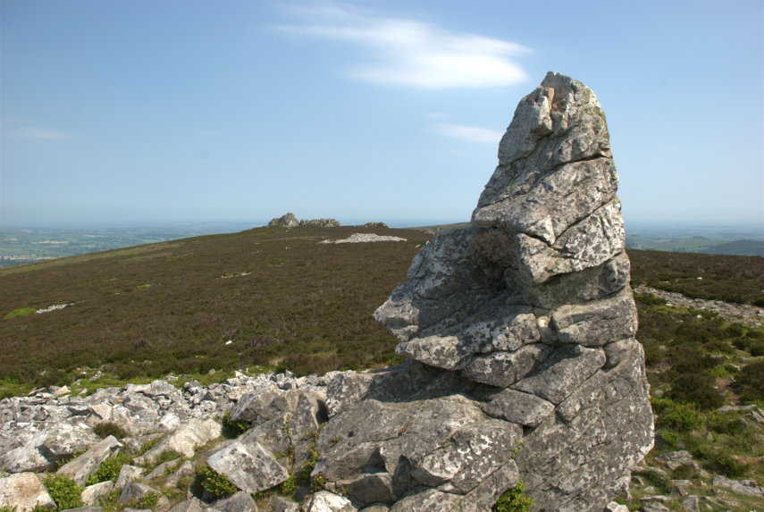
At the far end of Manstone Rock was this interesting rock pillar formation:


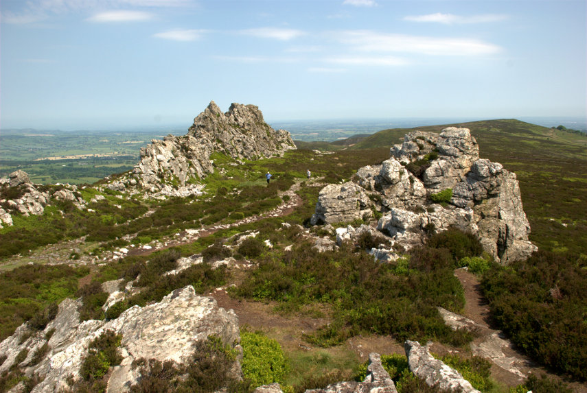
So on we went towards that distant outcrop in the picture above, the Devil's Chair, which is the one on the right below.

Luckily (or otherwise) there was a little devil in situ:

I hope it doesn't put you off going there. At this point we must be near, or at, the maximum height of 1759 feet as you may be able to see from the view in this next picture.

The two figures on the path between the rock outcrops give an idea of scale and they were two of the few other people we saw on this walk. We did hear, and see, some skylarks singing in the sky above our heads and we also saw two lizards although they quickly scuttled off into the heather but, sadly, no adders.

We turned around and made our way back along that dreadful path although once we reached the downward turn the surface was much better and we soon arrived back at the car park.

We drove down to The Bog, as you do, which is a visitor centre for the area and we had a light lunch before moving on to our next, and final, destination. It was a short drive on normal roads then a short, slow, very bumpy drive up a track to a small parking area and this is what we came to see:

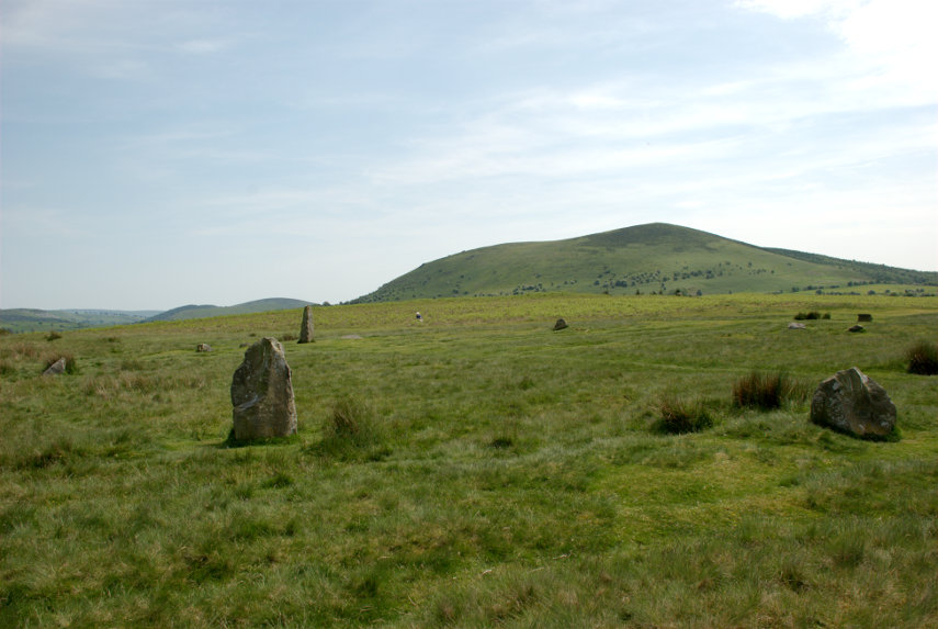
It is Mitchell's Fold Stone Circle. Not quite as spectacular as Stonehenge, smilies, but it is possible to walk among, and touch, the stones. They appear to vary in size because a number of them have fallen and have been left in that position.

This view shows Corndon Hill in the background and also a little Amanda sitting on the grass on the far side.

Have you ever had that feeling that you're being watched?

This is a Bronze Age stone circle in Shropshire situated at a height of 1083 feet and is a Scheduled Ancient Monument in the guardianship of English Heritage. As with most sites of this type, its true history is unknown but the doleritic stones came from nearby Stapeley Hill.

In the beginning there may have been some thirty stone pillars and the survivors that still stand range in height from 10 inches to 6 feet 3 inches and stand in an ellipse 89 feet NW-SE by 82 feet.

That was our day! Two quite interesting (we thought) locations and just a shortish drive home.

Getting bored with all these Welsh/English borders views yet? smilies


First find

First find

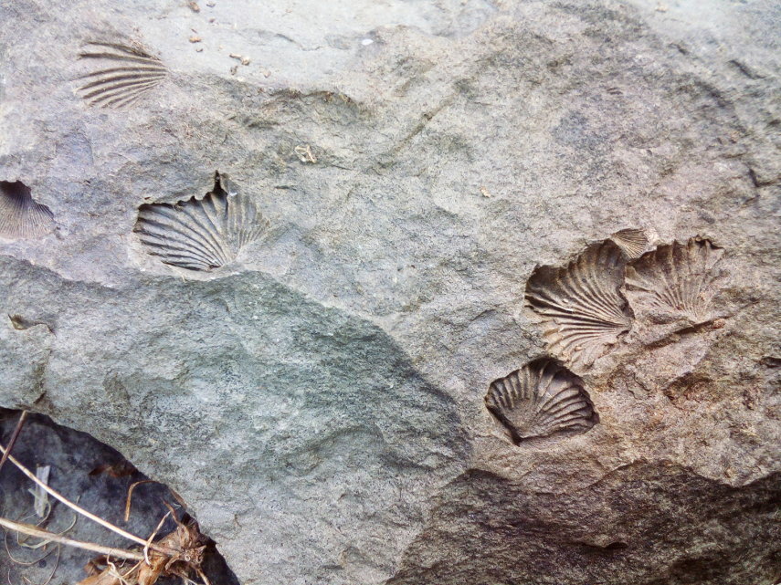
When we moved to this area we expected to find fossils at some stage but not quite so soon and so easily. Amanda turned over a rock in the garden and there they were.

These are brachiopods; a form of shellfish. We haven't identified the rock yet let alone the brachiopods. That will have to come later.

Is there Much Wenlock?

Is there Much Wenlock?

Is there Much Wenlock? There is actually Little Wenlock!

Confused? I'll explain. Little Wenlock is a village, a little south of the town of Wellington in Shropshire, and Much Wenlock is a small market town also in Shropshire. The 'Much' part indicates that it is larger than Little Wenlock. We stayed in Much Wenlock for three nights at the Talbot Inn in High Street. High Street is only one vehicle wide which may give you an idea of the size of the place.

It is a nice little inn with a courtyard accessed through the arch.


The accommodation was basic but comfortable with the bedroom and bathroom ensuite and the food was good.

Immediately opposite the Talbot Inn was Raynald's Mansion dating from the early 1400s. A very impressive building but privately owned and not open to the public.

Near the end of High Street is The George pub and next to that is an alley.

An alley in the Shropshire dialect is a 'shut'. The name, apparently, comes from old english.

Opposite the far end of High Street in Wilmore Street is the 16th century Guildhall another impressive timber-framed building with an interesting interior. The Guildhall is open to the public between April and October on Friday, Saturday, Sunday and Monday.


A little further along Wilmore Street is the church built in 1150 by the Cluniac monks of Wenlock Priory.

A little further along the same road we found this rather interesting old police station. Victorian I imagine.

The following day we drove to Church Stretton and into Carding Mill Valley owned by the National Trust. This valley forms part of the Long Mynd which is a heath and moorland plateau and is, itself, part of the Shropshire Hills. The Long Mynd geology is mostly Pre-Cambrian and the high ground is designated as an Area of Outstanding Natural Beauty.

I realised at this point that I had left my camera back at the inn. Bother! (or something like that). So for this walk I had to use my smartphone camera.

We set off walking up the valley alongside the small stream.


You may have noticed that there is plenty of heather about. We reached the Lightspout Waterfall which may be  only 12 feet high but attractive nevertheless.

I'm sorry about the strange lady but she just wouldn't get out of the way. At this point we decided that we'd had enough and went back the same way to the car. Driving back to Much Wenlock we stopped en-route to try and get a view from Wenlock Edge.

It was tricky finding a place where trees were not completely obscuring the view and that was the best that we could do.

The following day we went to Ludlow where we've been twice before and there are plenty of pictures of that town already on the web site so I didn't take any more especially as it was dull and cloudy.

From Ludlow we went to Bishops Castle; a little town near the Welsh border and this time I remembered to take my camera.


It was a nice little town but we felt that it had an odd atmosphere. We later decided it was because there were so few people around. I don't know why that would have been as there were plenty of shops and it was only late afternoon. Perhaps they had wind of our visit.

The following, and last, day we went to Shrewsbury on the bus. This is Shropshire's county town and I had been here once before about 60 years ago but could remember nothing about it and Amanda had not been here before.

We both liked Shrewsbury and it had plenty of interesting buildings, many of them timber-framed, and many interesting streets. We got off the bus in the Square right near the Old Market Hall (Elizabethan); the stone building on the left in the next photograph.

This next view is a short way from the bus stop.

Shrewsbury has plenty of narrow alleyways or 'shuts' as they are known in the local dialect although in the last of these three pictures the alley is labelled 'Compasses Passage'. I suppose that alley may have been built or renamed at a date when the term 'shut' had fallen into disuse.


Those steps in the corner of the next picture are Bear Steps named supposedly after a pub called The Bear which no longer exists. These steps take you through the 15th century building, part of which is visible to the left of the steps, and into St Alkmund's Place shown in the second picture below.


The next photograph is Henry Tudor House, in Barracks Passage, built in the early 15th century.

We walked to Shrewsbury Castle and had a brief look from the outside. The original castle was Norman but very little of that remains and the current building, in red sandstone, looks much more modern so we didn't go in.

However we did see this lovely timber-framed building by the castle entrance but I haven't been able to find out anything about it.

Shrewsbury was our last day so after returning to Much Wenlock for the night we travelled back home, without incident, the next day.


We have a Tate à Tate and Barry goes to heaven.

We have a Tate à Tate and Barry goes to heaven.

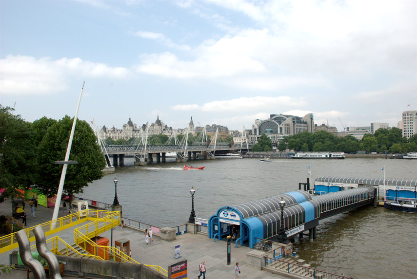
Wednesday. Train from our local station to Stratford. Change on to the Jubilee Line and thence to Waterloo Station where we once again emerged into daylight. We headed north and found ourselves on the approach to Waterloo Bridge over the Thames and then, off to our left we saw this.

The Royal Festival Hall with the London Eye and Big Ben in the background. However we weren't looking for the Royal Festival Hall but it does act as a guide. What we were looking for was the Queen Elizabeth Hall which is next to it.

Amanda spotted some steps which appeared to be going up into Queen Elizabeth Hall so we hopped up those. Well I was speaking figuratively and we didn't actually hop, you understand, as it would have been difficult going up stairs on one leg and old legs at that. Then I spotted an open door with some greenery beyond. Going through the door we weren't surprised to find a garden because that is what we had come here to see.


The top picture shows the path we came in on to this point and the second picture shows the way on. This is on the roof of the Queen Elizabeth Hall and there are even tables and chairs where you can sit awhile and buy a snack and a drink from that grey/green shed at the back if you so choose.


From the far end of the roof we had this view over the river showing one of the piers where you can get on the Thames Clippers and there is also Hungerford Bridge which, although a railway bridge, has pedestrian walkways on each side.

If you happen to be in this area then the roof garden is worth a visit.

Turning to our left gave us this view of the other end of the Royal Festival Hall.

We had heard that people can just pop in to the the foyer area and use the facilities so we put it to the test. We went down, on a bright yellow spiral stairway, to riverside level and walked in. Easy Peasy so far. There seemed to be a good number of people sitting around in comfortable seating chatting or just using their laptops and, what is more, there were toilets.

There were different levels and we didn't feel like interlopers so it does seem to be open to the public. There is also a snack bar.

Time to move on. We walked east along the Thames-side path, past the Oxo Tower which we visited last time, to the Tate Modern. We have been here before but didn't see much more than the old Turbine Hall so we were going to look round the galleries this time.

We looked round a number of the galleries and I list below photographs of everything that has merit.

Oh! Just the Turbine Hall then. Enough said.

We left via the Turbine Hall and walked a short way further east. Time to catch the bus – but not one of those red double deck buses as we are going on a river bus to Tate Britain. The 'buses' have different routes and different designations e.g. the one we wanted was the 'Tate to Tate' and its designation was RB2. There are electronic displays on each pier which give arrival times for the next buses and their designations. If you have a Travel Card or an Oyster Card then showing them when you pay will get you a 33% discount. If you have a London Bus Pass (London Residents only) then that will get you a 50% discount.

Our fare was £4.50 each with the discount. We didn't have long to wait and we were off. The seats are comfortable and this photograph shows only a quarter of the accommodation as there is just as much off to the right hidden by the structure and as much again behind me.

We had a good view of the Tate Modern on the way upstream.

We passed under the Millenium Bridge then Blackfriars Station/Bridge


We were there in what seemed like no time at all and watched our 'bus' leave for its final stop at Vauxhall.

We left the pier and walked the short distance to Tate Britain.

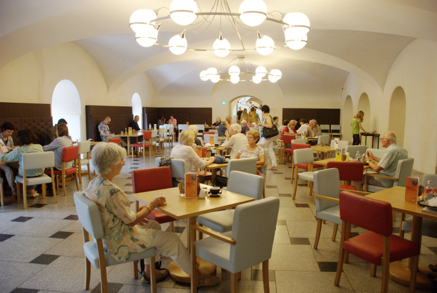
It is a nice building, and entry is free, but before we started to look round we wanted lunch, it was 1 o'clock, so we found the restaurant.

A pleasant place for a meal and the food was good BUT the portions were very small. I, for example, had Fishcake with Mushy Peas (£8) and that is all that was on my plate – nothing extra such as salad or potatoes. Amanda had Crispy Lamb (£7) with Radicchio Salad and Goats Cheese and Potato Crumble. There was not much of the salad and the crumble was little more than a sprinkling of garnish. Choice of desserts were limited but we had a slice of cake each.

Having finished lunch we ventured forth to look around. It is a nice building and the main rotunda is quite spectacular featuring a rather interesting staircase.


We found another interesting staircase in another part of the building.

We weren't going to be able to look at everything so we chose a particular period which included John Constable.


I've chosen to show that particular Constable because we used to have a print of it hanging in our sitting room which we had inherited from my parents but it wasn't a very good one so we disposed of it. This version is much better. smilies

Time was getting on and we had some more places to visit yet so we left the Tate and walked north-west up to Victoria Street and Westminster Cathedral. Do not confuse this with Westminster Abbey. The foundation stone was laid in 1895 and the fabric of the building was finished in 1903. The design was of the Early Christian Byzantine style by the Victorian architect John Francis Bentley. It still isn't finished although it would appear so with a cursory glance. It is a striking building and certainly worth a visit. Entry is free.


Whilst we were in there I asked if I could go up to heaven and an angel in the guise of a young lady from the gift shop agreed to take me up in the lift. She left me there and returned to earth. I could tell I was in heaven because of the views.


There a number of well known landmarks in that last picture – can you spot them.

Unfortunately the authorities in heaven decided that I couldn't stay because I hadn't been good enough so I was sent back to earth for some more practice. You can't win them all.

As we were getting ready to leave for our next destination we chanced to see a young man with a hawk which was used for scaring the pigeons away from the area which it certainly did. It was a Harris Hawk.

We caught a No. 11 bus in Victoria Street and made the short journey to Westminster Abbey where we were hoping to see a part of the abbey where entry was free after 4:30 PM and we arrived there just after half past four. Walking towards the West Front we turned right under an arch into the Dean's Yard. This is it:

Turning sharp left inside the yard there is an open doorway with an attendant on guard whom you should ask to visit the Cloisters and he should let you pass.


Note the difference in the roof profile on different sides of the quadrangle. If you follow the signs you may also visit the College Gardens. I have also heard that you can get in to the Cloisters free on weekends after 2:30 PM but we haven't tested that yet. You can try it if you like and do let me know if you get in.

We decided that we were getting tired and chose to head home. We walked to St. James's Park Station and on the way saw this.

A number of visitors seem interested in seeing this rotating sign, I don't know why, so I thought I'd include it. I hope that you are suitably interested.

Time to go home.

I went 220 miles to Devon for 30 minutes – Tuesday.

I went 220 miles to Devon for 30 minutes – Tuesday.

I got out of bed this morning and tried to encourage my legs to move and by the time I'd got down to breakfast they were just about usable again (but only just smilies ).

Breakfast is fairly late here, at eight o'clock, so I first wandered out into the town towards the church. It was very quiet as I passed through the back streets and emerged near the church.


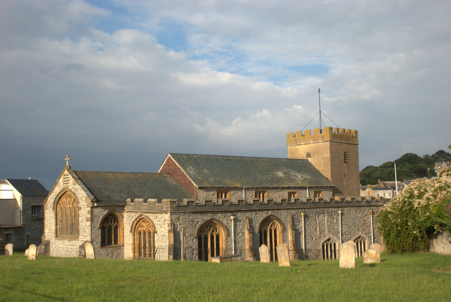
The church is quite old with parts dating back to Saxon times. The interesting part is in the churchyard on the seaward edge.

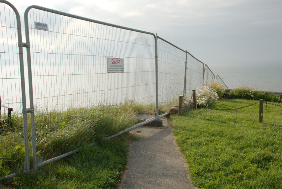
That wire fence is to stop people from dropping off the edge of the cliff and you can see that the path shown goes nowhere. This church, when it was built, was a long way from the cliff now it can't be more than 50 feet. It is hoped that the new sea defences below will stop the erosion.

Back for breakfast then onward.

I'm going to hop on the same bus again this morning but I'll be going through Chideock to Burton Bradstock this time which is about a 60 minute journey.

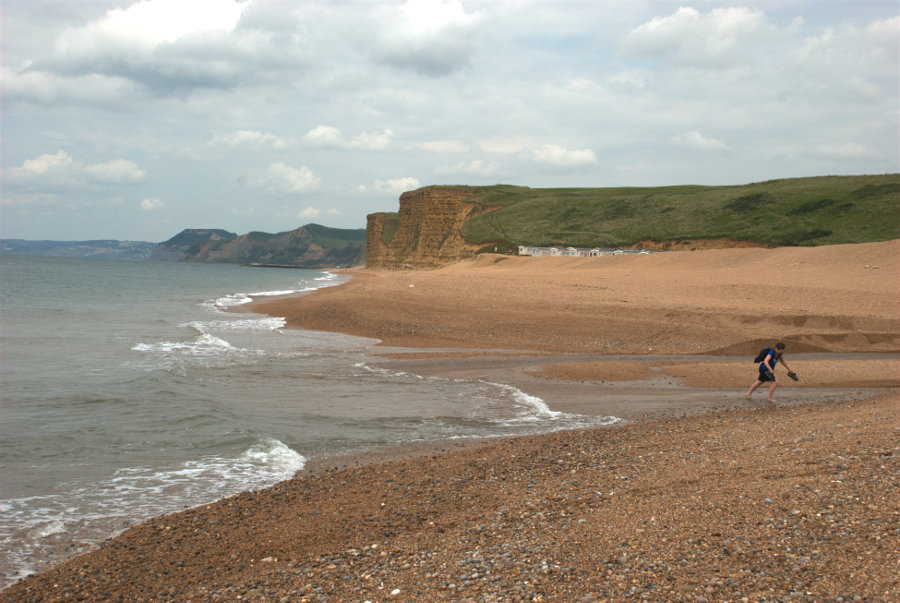
I get off the bus just the other side of Burton Bradstock and walk down Beach Road. High tide was about an hour ago so the tide is going out and it's safe for me to walk along the beach as far as West Bay. I say 'safe' because there are high cliffs on my right all the way.

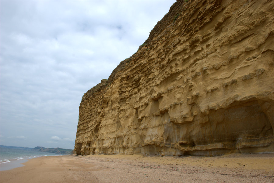
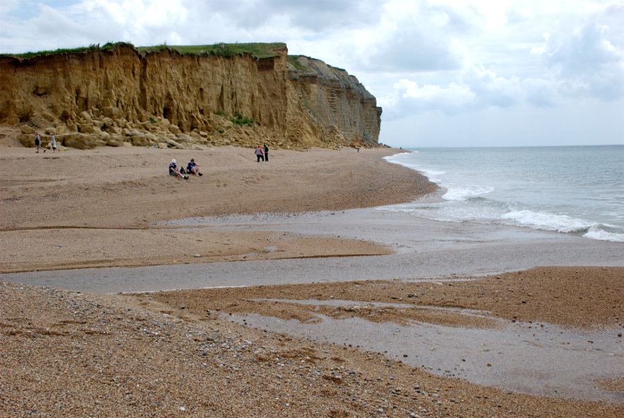
The cliffs, as you can see, are made up of alternating bands of hard and soft rock giving them a striped appearance. The rocks are Inferior Oolite and Fullers Earth from the Middle Jurassic.

As I walked along the beach I could hear a sound which might be described as a cross between a crack and a knock. This sound occurred regularly at intervals all the way to West Bay and was definitely coming from the cliffs. It sounded rather ominous but there were no rock falls whilst I was there. I can only assume that it was the hard bands expanding and contracting with changes in temperature.

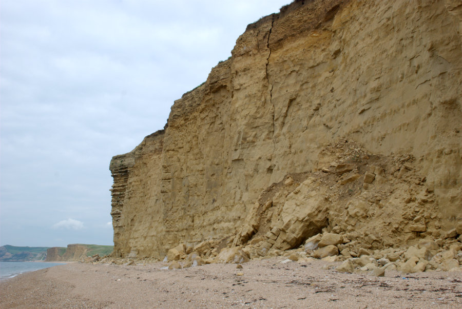
These cliffs are dangerous and rock falls are not uncommon. This shows a recent fall and that crack in the cliff above doesn't look particularly safe. Staying away from the cliff, as I am, is the safest thing to do and needs to be done when the tide is going out so that more of the beach is exposed.

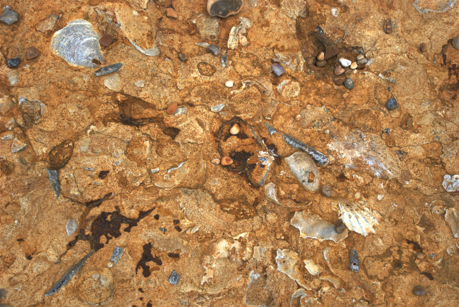
The hard rock bands are certainly fossiliferous as this picture of one of the fallen slabs shows. There are many molluscs and belemnites.

I continued along the beach towards West Bay until I reached the River Bride. That means I either paddle or go inland a little way to use the bridge.

I decided to do as the person in the picture did. The water at its deepest didn't reach my ankles nor was it particularly cold and to prove that I did get to the other side:

There are other people on the far side, who were behind me, preparing to do the same.

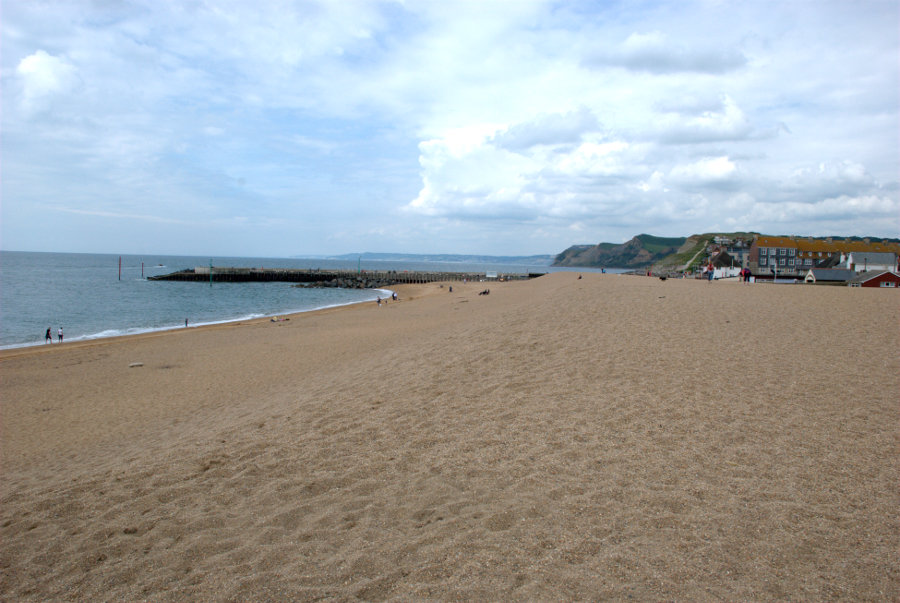
I finally reach West Bay which is the seaside part of Bridport.


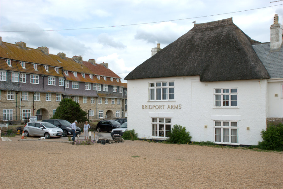
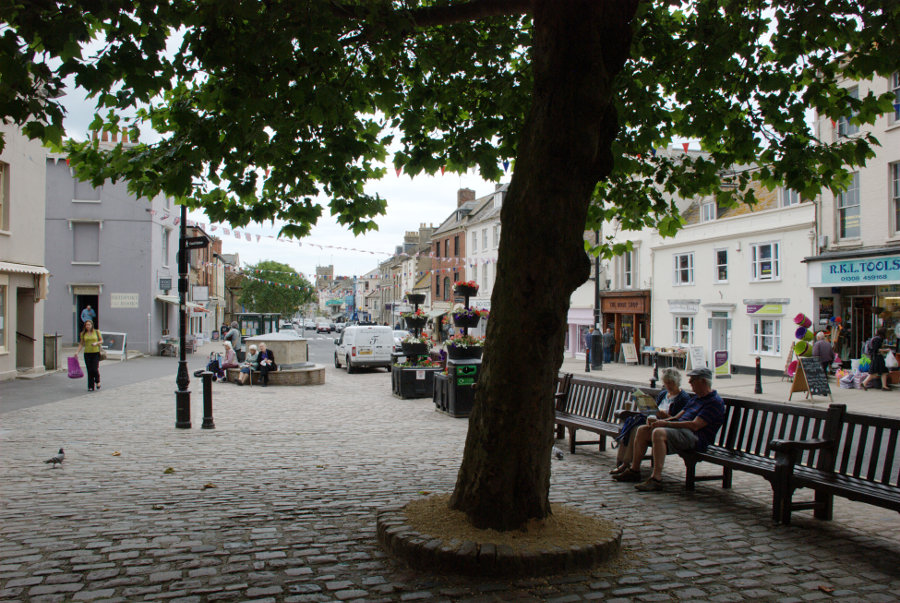
The Bridport Arms used to be the Ship Inn and dates from the late 17th century and is partly thatched. The town of Bridport is a bit of a long walk from here so I decided to catch the bus which set me down in the town centre. The main roads in Bridport, West Street, East Street and South Street form a 'T' with South Street being the leg of the 'T'. This is from the top end of South Street looking south.

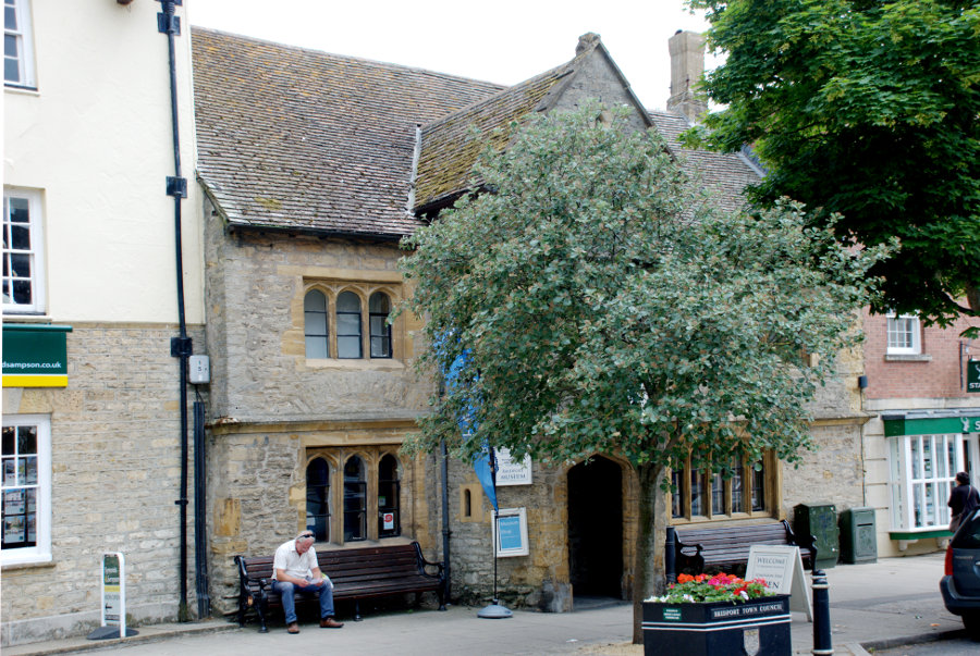
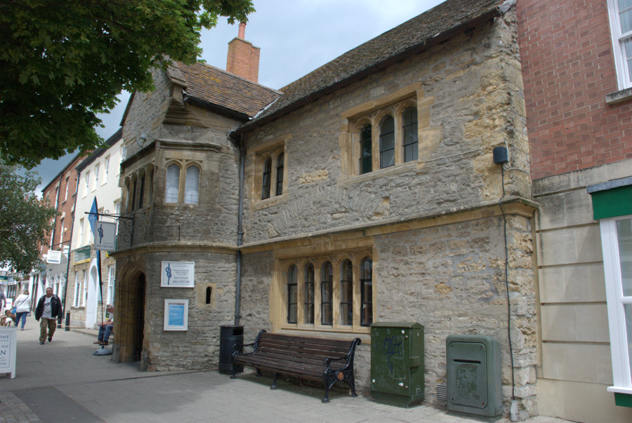
A short way down South Street is the town museum housed in this Tudor building.


Further down South Street is the parish church of St. Mary dating from the 13th century.

In the lower part of South Street is the Chantry; the oldest building in Bridport dating from before 1300.

Further on by the River Brit is Palmer's Brewery dating from 1794 and the water wheel, forged in 1879 at a Bridport foundry, does still turn.

From Easter to the end of October a guided tour starts at 11.00 am on every weekday (excluding Bank Holidays) and lasts for about two hours. No I didn't.

I made my way back up South Street to West Street where, after a tiring day, I caught the bus to Lyme Regis. Tomorrow I leave Lyme Regis. smilies

(Tomorrow, Wednesday: I leave for home – or do I?)


I went 220 miles to Devon for 30 minutes – Monday.

I went 220 miles to Devon for 30 minutes – Monday.

Today is the big day! My most ambitious day of the whole trip. I plan to get the bus to Chideock (pronounced 'Chidock') and walk back to Lyme Regis via Golden Cap. What's Golden Cap? It's the highest point on the south coast – that's what. smilies

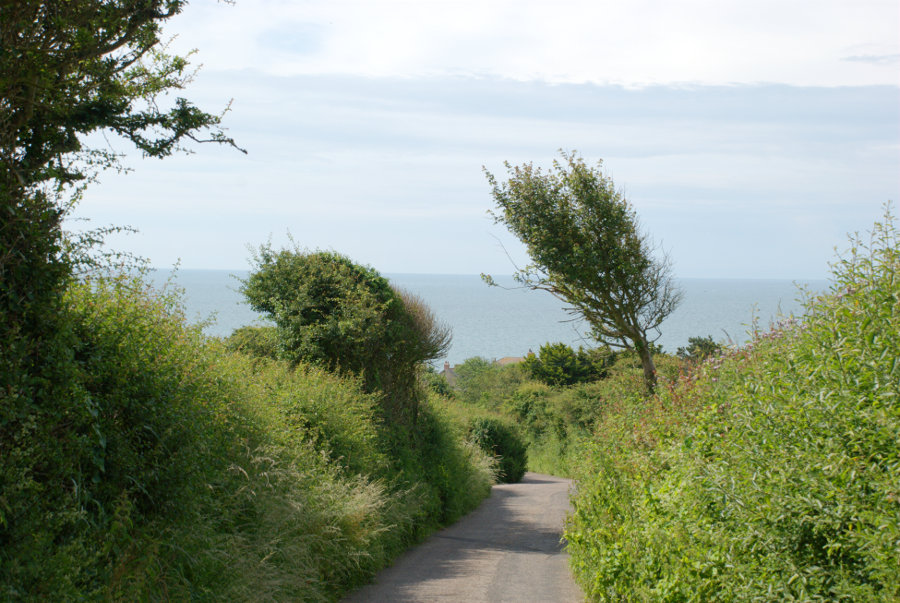
After breakfast I walked a couple of hundred yards to the bus stop to wait for the bus which is supposed to arrive about 9:35 which it did. Thirty minutes later I was standing by the roadside in Chideock looking for Mill Lane on the opposite side of the road. As it was close to the bus stop even I couldn't get it wrong and I was soon walking down the lane towards Seatown.


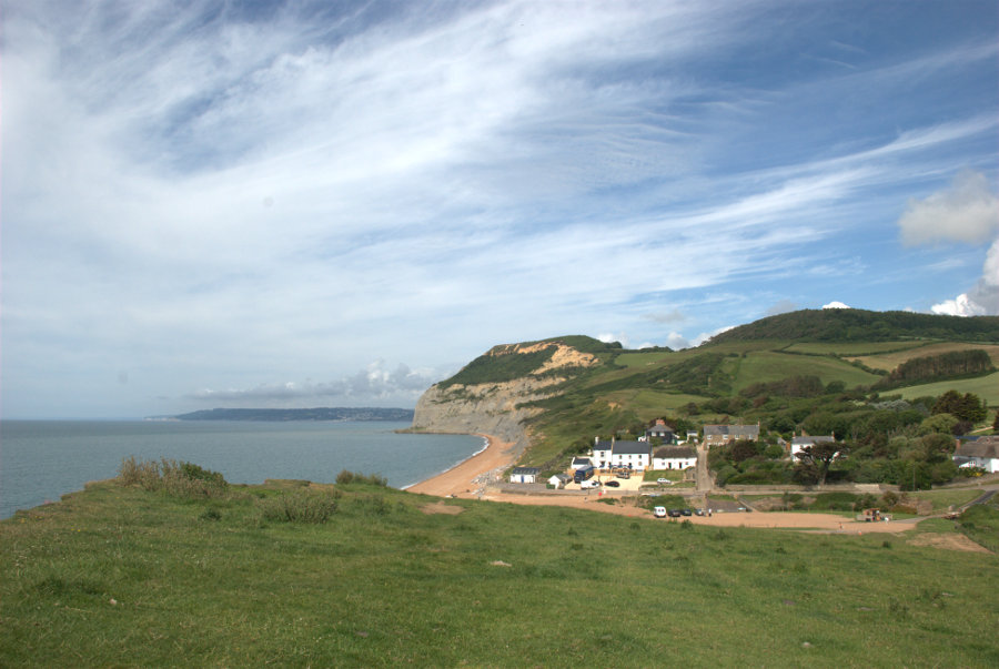
You can probably see that the sun is out but that there is plenty of cloud. It was only about three quarters of a mile to Seatown so it didn't take long to get there and I walked a little in the wrong direction so that I could get a view of Seatown.

I don't know why it's called Seatown because it's not even big enough to be a village let alone a town. smilies

This view from the beach shows Golden Cap ( the big lump in the centre of the picture) and I don't have to tell you why it's called Golden Cap do I?

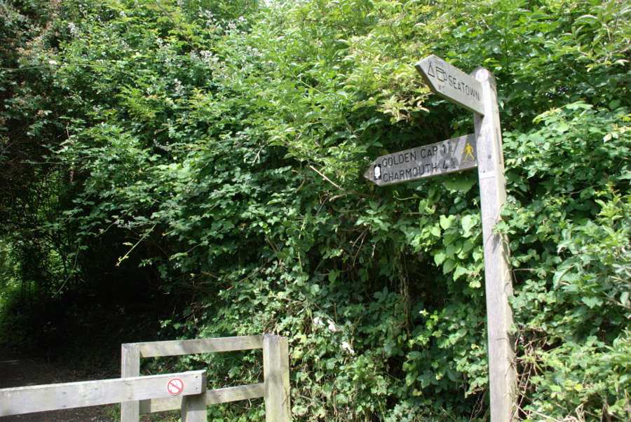
I am foolish enough to start from here, at sea level, and climb to the top of that lump and then walk on over the hill to Lyme Regis. That's the plan anyway. So I set off the short distance up Mill Lane to find the start of the footpath and here it is.

The figure is probably difficult to read but it says 'Golden Cap 1 1/2' (1.5 miles) and 4.5 miles to Charmouth. Here we go.

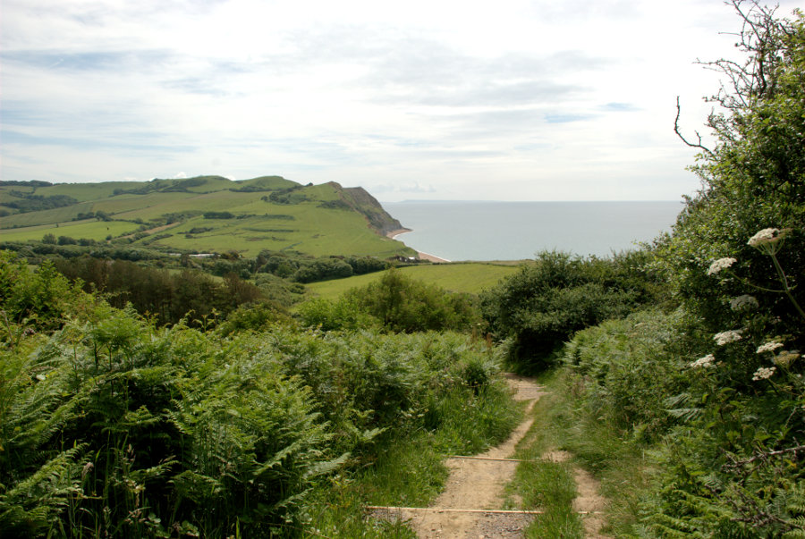
It starts off inocuously enough to lull one into a false sense of security along a gently climbing path then, when it thinks it's got you into a good mood, it starts to get steeper. The path is now steep enough that steps have been cut into it. This is done to alleviate erosion by walkers and to deliberately aggravate my old leg muscles smilies . The steps are cut into the ground then wooden risers are set at the front of each step to stop them collapsing. Here the steps are quite far apart so it's step up then walk a few steps and step up again.

You can see a couple of steps in the photograph above and you can also see that I have gained some height since leaving the lane. smilies

A bit higher now with the summit visible some way ahead. You may not be able to read the distances on the signpost but it says 'Seatown 3/4' and 'Golden Cap 1/2' (miles). So far I've walked 3/4 of a mile from Chideock to Seatown and another 3/4 of a mile from Seatown to this point – a total of just 1.5 miles and I'm already puffing and blowing. Still, the views are nice.

That's Seatown down there. It looks a long way down. I have still a good way to go yet and all of it steep. There are long stretches of path with lots of steps packed close together that seem to go on for ever. I finally get to a steep grassy slope with a bench seat at the top. Just what I need but I have to get there first. I didn't make it in one go and had to stop and rest part way but I did eventually make use of that seat.

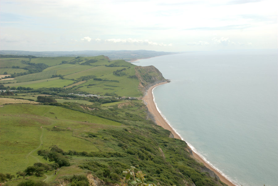
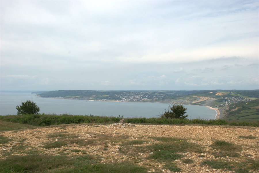
Then there is another short uphill stretch, with steps, until I arrive at the summit at last. The top view below is to the east and the bottom picture is to the west.


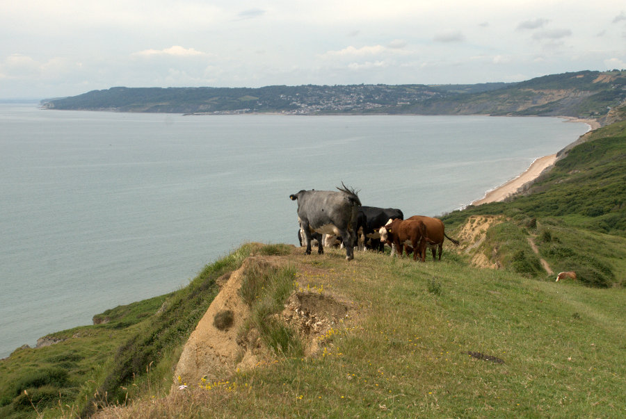
In the bottom picture Lyme Regis is the cluster of buildings in the centre of the picture with Charmouth on the right. Charmouth is my next target.

After a short sitdown to eat lunch I set off again and pass some locals who are admiring the view.

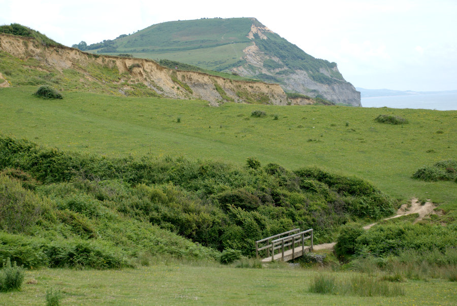
 So is it now all downhill? If only! The path goes steeply down hill to the bottom of a valley and just as steeply up again to the next ridge and then down and up again ad infinitum. I am, however, slowly leaving Golden Cap behind.

These repetitive steep slopes are making me very, very weary and I'm beginning to realise that I'll be lucky to make it to Charmouth let alone Lyme Regis so I decide I'll have to stop at Charmouth and get the bus back. smilies smilies smilies So much for ambition.

I had walked about six miles but the ups and downs would effectively double that in terms of energy used. What a wimp! Perhaps I should modify that a little. What an old wimp!

I finally reach Stonebarrow Lane and set off down towards Charmouth.

I finally reach the village but still have to walk uphill for some distance to reach the bus stop where I took this photograph looking back to where I'd come from.

I clambered wearily onto the bus and finally arrived back at my hotel for a rest. I'm going to need that rest for tomorrow.

(Tomorrow, Tuesday: Musical cliffs, a water wheel and a Tudor museum.)


I went 220 miles to Devon for 30 minutes – Sunday.

I went 220 miles to Devon for 30 minutes – Sunday.

I was on my own because Amanda was unable to come with me this timesmilies but she drove me to our local station where I was to catch the train to London but we were greeted with the news that the train was cancelled. Brilliant!  smilies  smilies

The next train was in half an hour which meant there would be little margin between getting to London Waterloo and catching the train to Axminster. Missing that train would mean an hour's wait for the next one.

I did get the next train and changed at Stratford onto the Jubilee line bound for Waterloo. When we were about halfway to Waterloo I decided I'd get to Waterloo at the time my train was due to leave and so probably wouldn't get it. As we travelled nearer to Waterloo the time/distance between stations seemed to be getting shorter. Was there hope yet? smilies

We finally arrived at Waterloo about ten minutes before my train left so I had a chance and finally reached the entrance to the platform with five minutes to spare. I did, after all, catch my intended train at 11:15 AM. smilies

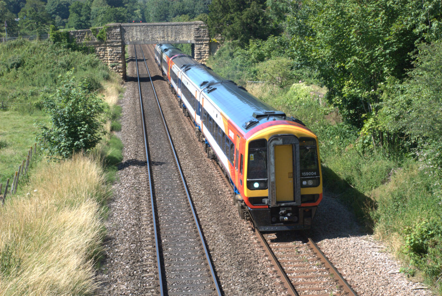
This train, on the Waterloo-Axminster line, is the sort of train I travelled on:

After an uneventful journey of 2 hours and 45 minutes we arrived at Axminster in Devon. My bus was waiting outside the station and we set off south for the coast shortly after.

What I really wanted to do was to go to Lyme Regis in Dorset which is where I'm staying for the next few days. The bus soon reached the Devon/ Dorset border and I'd left Devon about 30 minutes after I'd reached it.

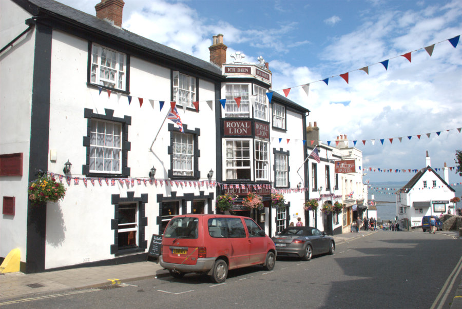
It was an interesting 30 minute ride on roads which were often only just wide enough for the bus and, at last, we were on the downhill stretch into Lyme Regis where I got off. After a very short walk I arrived at the Royal Lion Hotel which was to be my base for the next three nights.

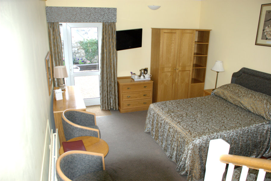
Very friendly and efficient staff here and I was soon shown to my room. Note that the sea is just at the bottom of High Street.

It was a triple room with the single bed that I used just out of sight on the right (You can actually just see the corner). The entrance to the room was at a higher level hence the few steps down with part of the banister rail showing. The bathroom was also at the higher level. There was also a small outside terrace accessed using the door at the far end where a small part of the sea was visible.

A nice room in, what turned out to be, a nice hotel. It was, at one time, a coaching inn and dates from around 1610.

I telephoned Amanda to let her know that I had arrived safely and then made myself a cup of coffee. Having settled in I wound up my legs and set off to explore. I have a feeling that I should have had a larger spring fitted.

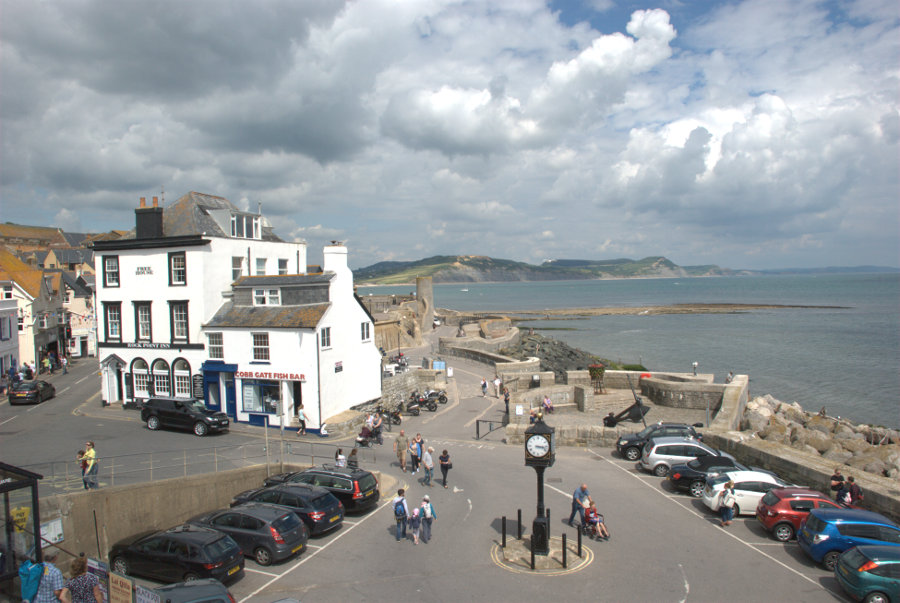
At the bottom of High Street is the Square and you can see that the time is now about 3:15 PM.

I headed west along Marine Parade which was lined with chip shops and ice cream shops together with an amusement arcade at the far end. This proved to be the tackiest part of the town but very popular.

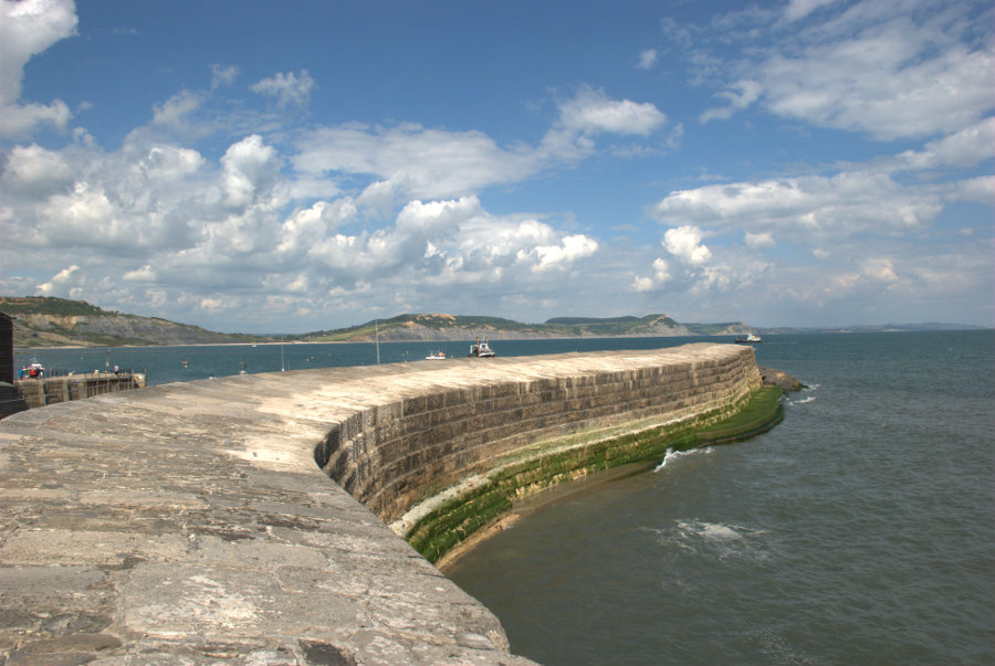
I reached the harbour and just HAD to walk out on one of the harbour walls known as the Cobb.

This harbour wall features in Jane Austen's novel 'Persuasion', and in 'The French Lieutenant's Woman', a novel by British writer John Fowles, as well as the 1981 film of the same name, which was partly filmed in Lyme Regis.

Do you think I'd make a film star?

Lyme Regis is mentioned in the Domesday Book of 1086 and in the 13th century developed as a major port. The first record of the Cobb is in 1328 and it has been destroyed or severely damaged by storms several times. It was swept away in 1377 when 50 boats and 80 houses were also destroyed.

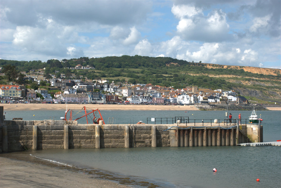
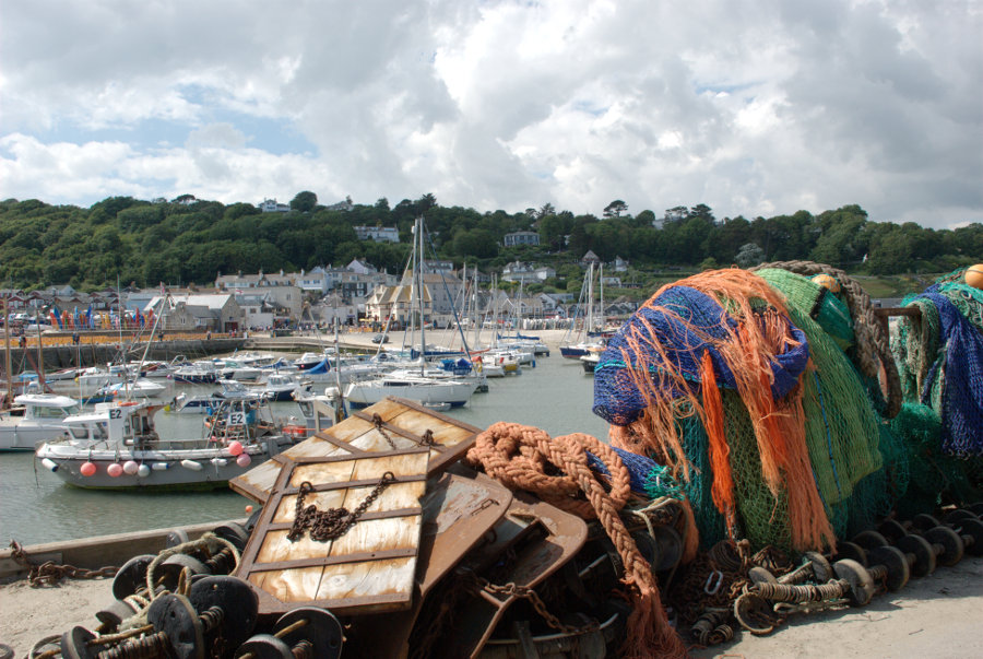
The next (top) picture is Lyme Regis seen from the outer end of the Cobb and the second picture looking across the harbour shows the western most part of Lyme Regis, like a small detached village, which is also known as the Cobb. Confusing ain't it?


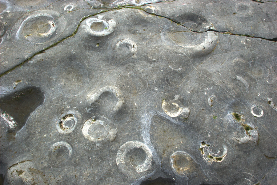
A 15 minute walk further west along the beach with a low tide and I reached some exposed slabs of rock which were obviously very fossiliferous.


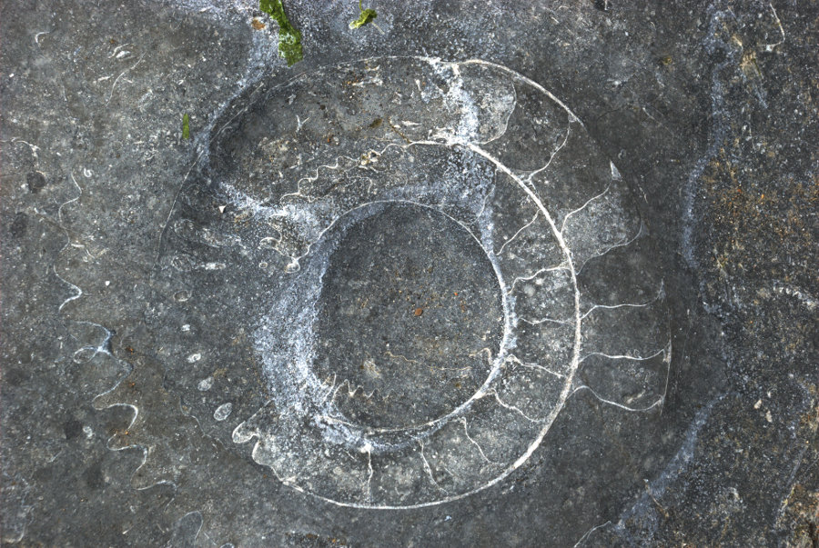
Each of those circular shapes are Ammonites which are about 200 million years old (at last I've found something which is older than me). In the second photograph erosion has effectively sectioned an ammonite showing the internal septa.

I walked back along the beach and, at this juncture, I have to admit that sandals were not the best choice of footwear (sand and gravel gets between feet and sandals) but I didn't want to wear boots for the whole time so I was stuck with them.

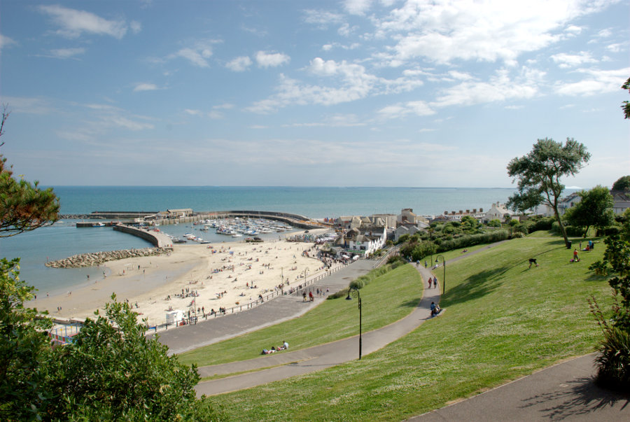
From the Cobb village I went up into Lister Gardens which is mostly grass and trees with a good view of the harbour.

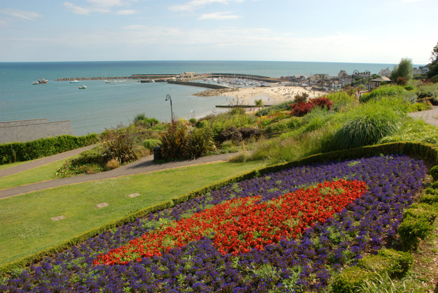
A little further towards the town it changes to Langmoor Gardens which features a number of flowering plants and is, consequently, more colourful.

Back in town I found the Riverside Walk.

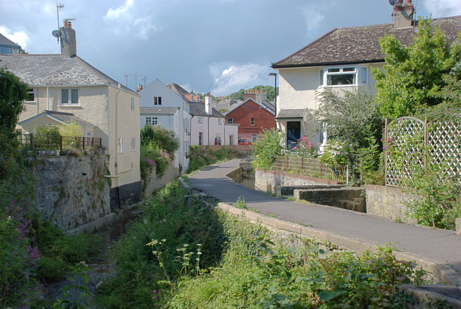
The River Lym, down in the gully on the left, is really quite small except when it's in flood and is only 3 miles long from source to sea although there were as many as thirteen mills using the energy provided by this short river before the steam engine was invented.

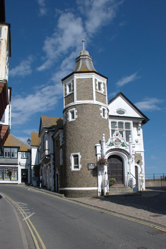
There are plenty of narrow lanes and streets here and I eventually emerged on one opposite the Guildhall.

Back to the hotel in plenty of time for dinner.

(Tomorrow, Monday: I take a ride, go up in the world and suffer abject failure)