Browsed by
Tag: Harbours

The Prospect of Whitby, Captain Kidd and the Town of Ramsgate

The Prospect of Whitby, Captain Kidd and the Town of Ramsgate

Another Thursday – another trip to Wapping.

Let me explain to our various overseas visitors that Wapping is not pronounced the way it is spelled but instead it's pronounced 'Wopping'. Now that we've got that sorted I'll remind you that at the end of the last report I said:

"Perhaps we'll get better weather next time. We want to do that same walk again to see some things that we missed but I'm not going to tell you what they were and to, hopefully, get some better photographs."

Well we did get better weather, sun all day and temperatures around 70-72F, and we did that same walk again (it was in Wapping) – but with added ingredients. The name comes from the Saxon meaning "the place of Waeppa's people"

So what connection does the title of this post have with Wapping? They are all pubs and they are all in Wapping High Street and they all back on to the River Thames.

Lets start at the beginning. I'm going to use the same map as last time with our new route added.

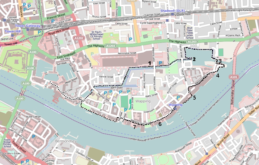
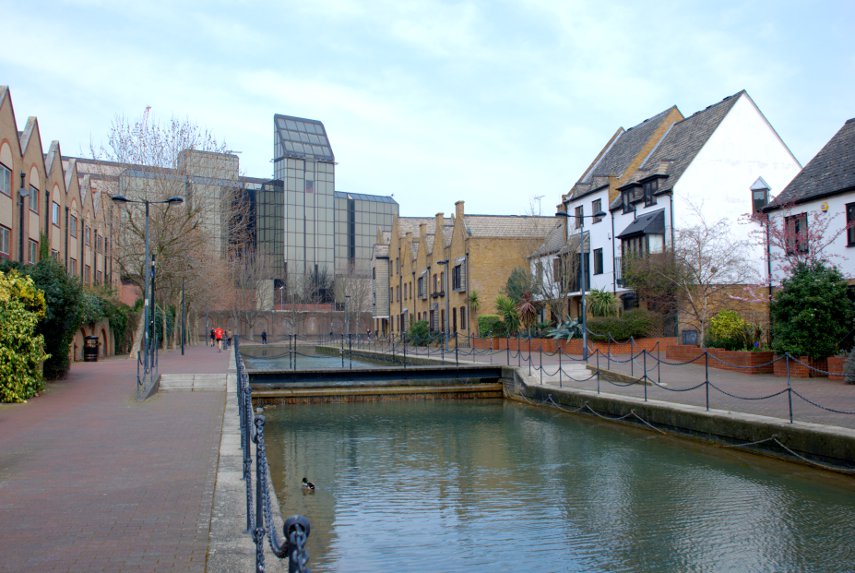
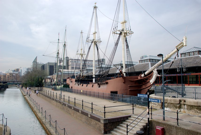
Last time we went as far as '2' which we also did this time but we went on to complete a circular route. We started, as last time, from St. Catherine's Dock.

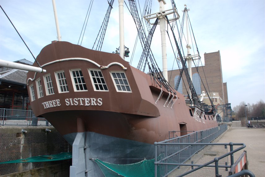
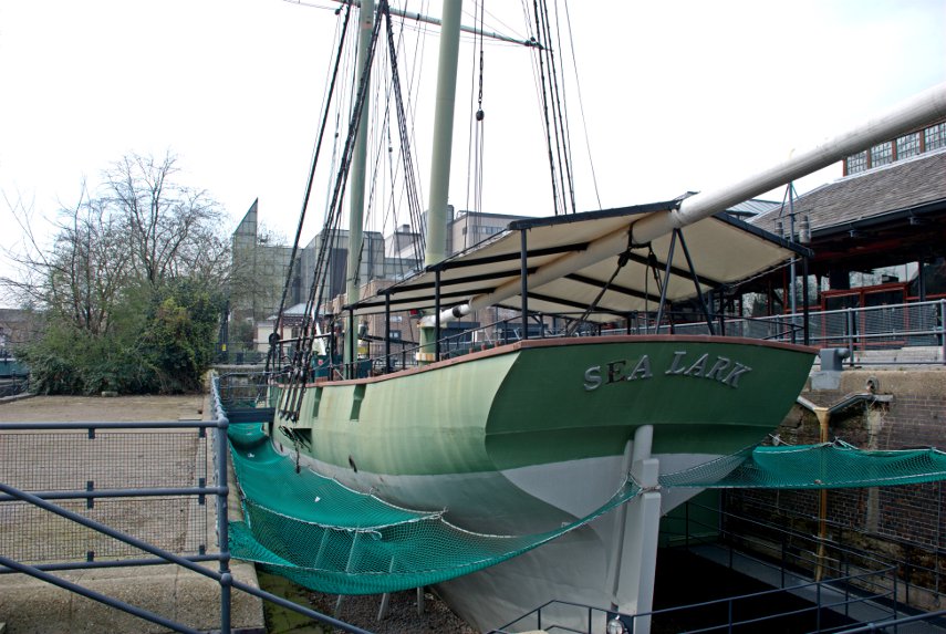
We walked along the same canal – you can see the masts of those two replica sailing ships (No. 1 on the map) sticking up into the sky in the distance.

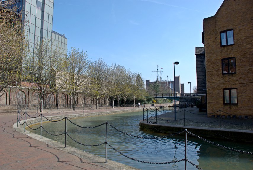
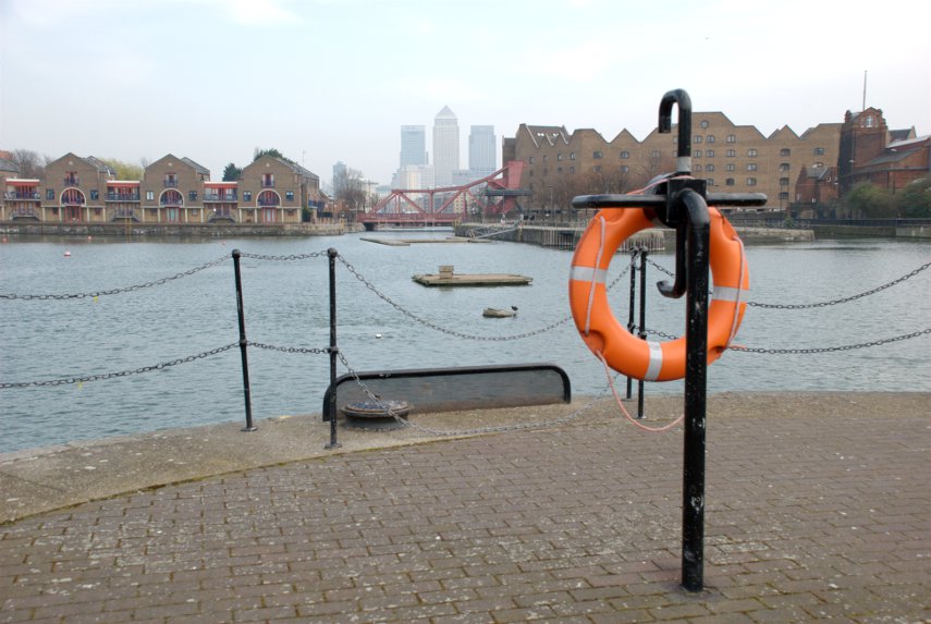
Then onwards to Shadwell Basin (No. 2 on the map). This time we walked round the north side of the basin past the new housing towards the eastern end of the basin with the tall buildings of Canary Wharf visible in the distance.

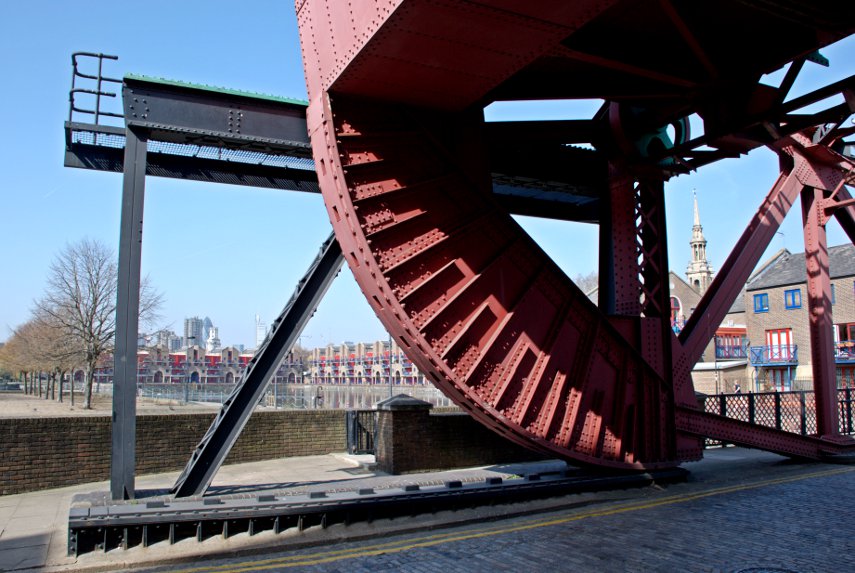
At the far end is one of the old lifting bridges and this next picture is taken from the bridge (location 3)  looking back across Shadwell Basin.

We then walked eastward to the edge of the Thames and along the Thames Path for a short way

and came out opposite this.

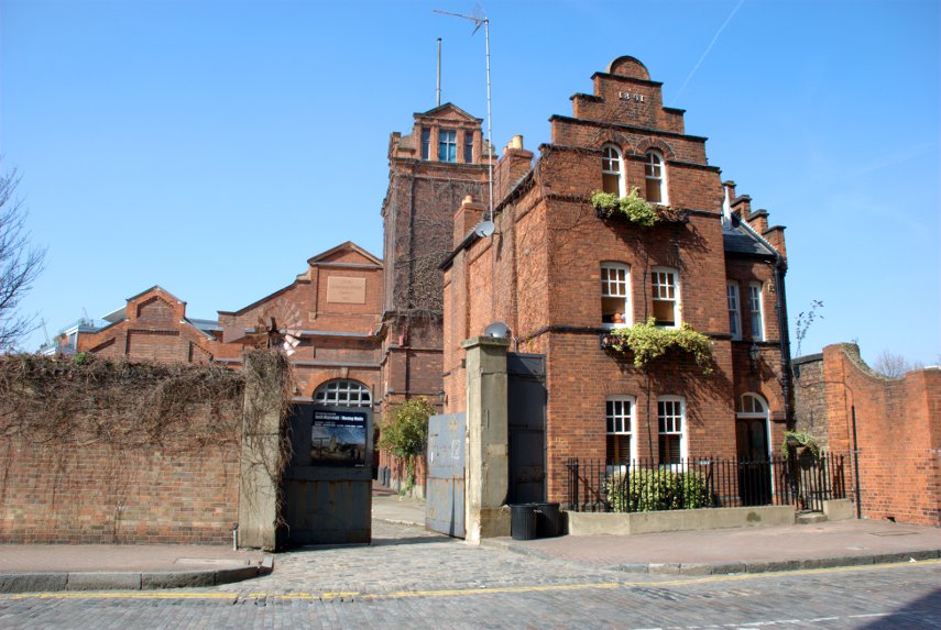
So what is it?  It is the Wapping Hydraulic Power Station, built in 1890, and was originally operated  using steam and later converted to use electricity. It was used to power machinery across London, using hydraulic power including bridges, lifts and cranes etc. The Tower Subway was used to transfer the power, and steam, to districts south of the river.

It was used as a model for power stations in Argentina, Australia, New York and Europe. When electricity became cheaper it lost popularity and eventually closed. It is now used as a cafe with the tables and chairs dotted around among the old machinery which is a novelty. They serve cups of tea and coffee together with lunch etc.

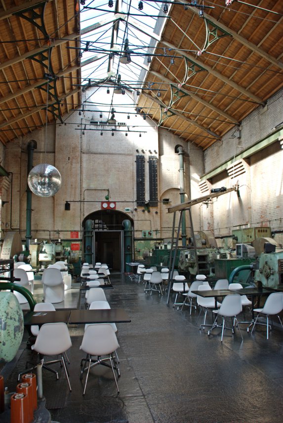
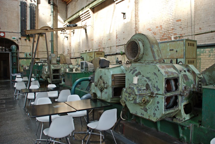
Pass the oil please.

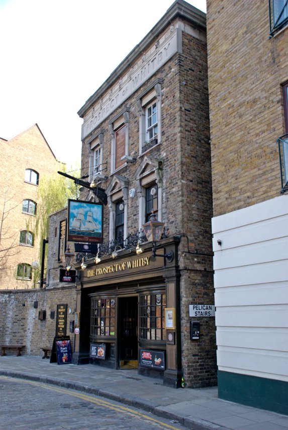
Opposite the old power station is the first of our pubs – The Prospect of Whitby. No. 4 on the map.

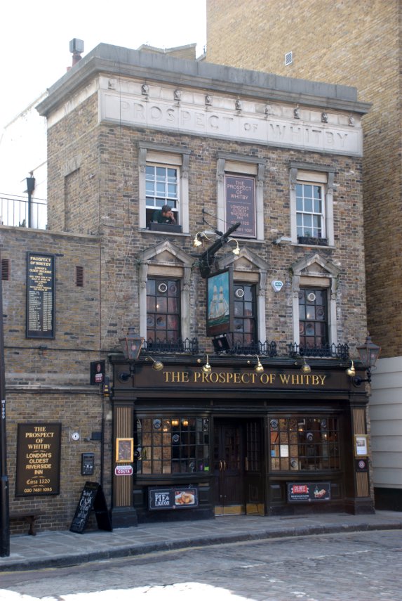
The Prospect of Whitby lays claim to being one of the oldest riverside taverns in London and dates from around 1520 during the reign of Henry VIII. At one time it was one of the most notorious pubs in London being a meeting place for sailors, smugglers, cut-throats and footpads but now it seems to be a pretty nice pub.

It was formerly known as the Devil's Tavern, on account of its dubious reputation and before that it was officially called "The Pelican". The stone steps, alongside the pub and going down to the foreshore, are the "Pelican Steps"

All that now remains from the building's earliest period is the 400 year old stone floor.

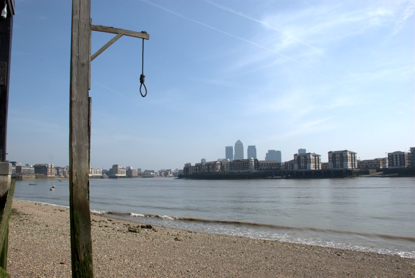
In the 17th century, it became the hostelry of choice of Judge Jeffreys, known as "The Hanging Judge, who lived nearby and a noose hangs by a window, commemorating his custom. According to legend, criminals would be tied up to the posts at low tide and left there to drown when the tide came in.

You'll be wanting to see the noose then? Taking our lives in our hands we went down Pelican Steps on the the Thames foreshore to see the riverside view of the pub. Luckily it was low tide otherwise we may have got our feet wet. Possibly even our eyebrows.

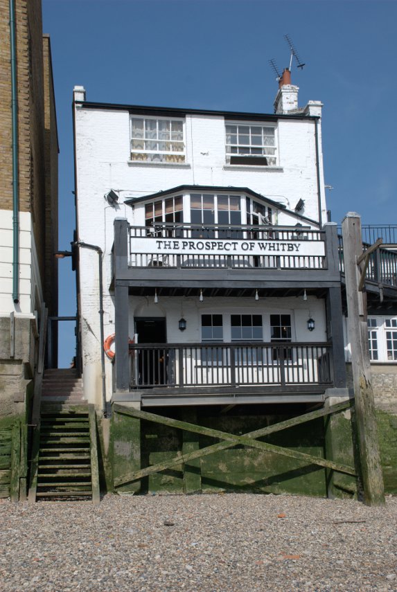
You can see Pelican Steps and the noose is hanging from that tall post on the right. There is a better picture of the noose below.

Following a fire in the early 19th century, the tavern was rebuilt and renamed "The Prospect of Whitby", after a Tyne collier, a type of boat, that used to berth next to the pub.

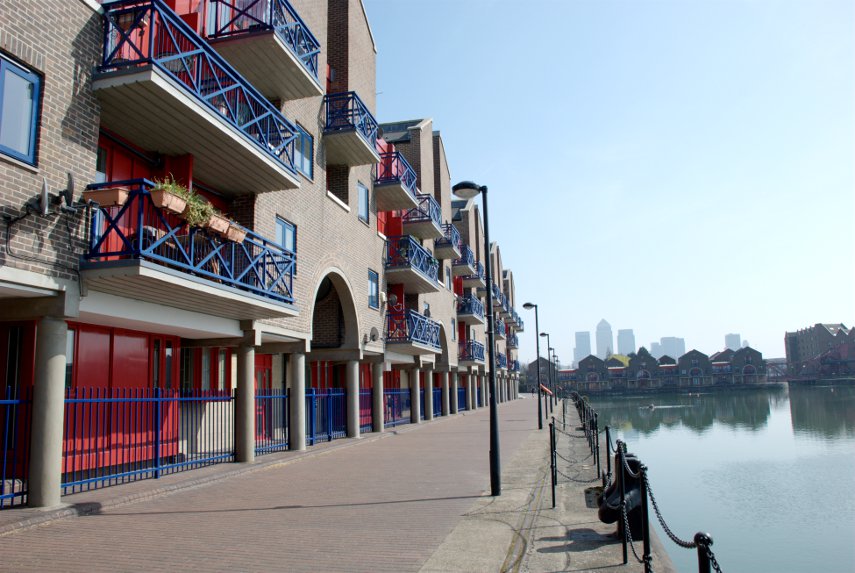
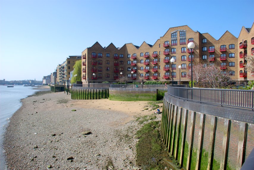
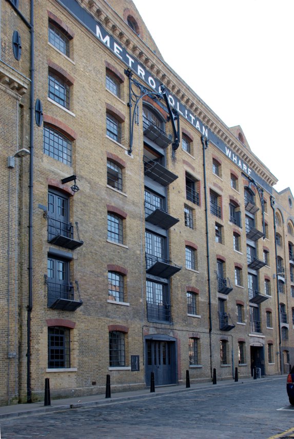
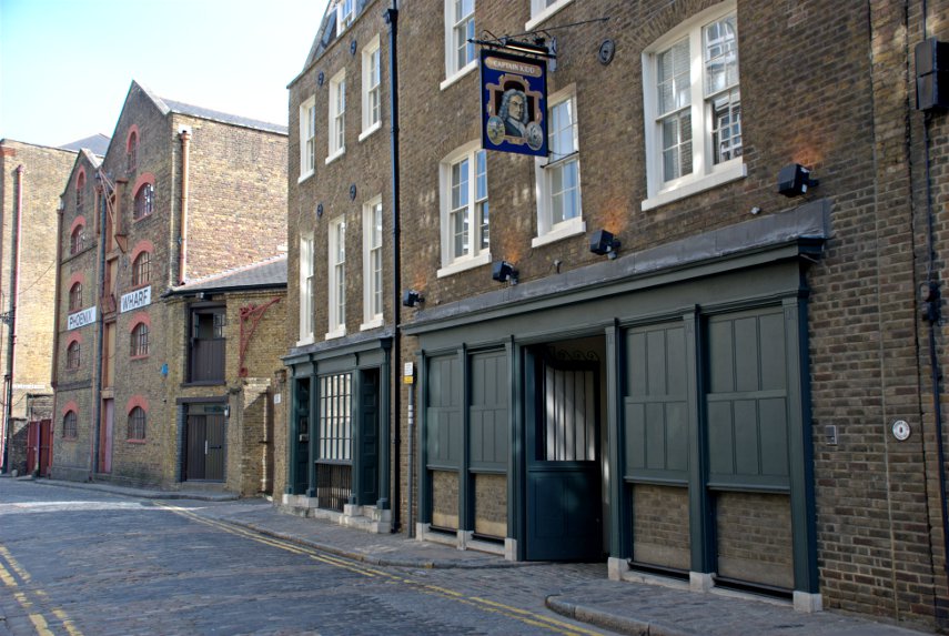
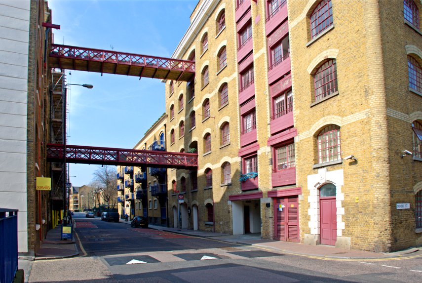
Walking westward along Wapping Wall we went past numerous old wharves now converted to luxury appartments such as Metropolitan Wharf shown here and, after going down New Crane Steps, New Crane Wharf shown below. No. 5 on the map.

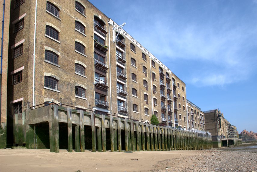
Notice that nice sandy beach along New Crane Wharf.

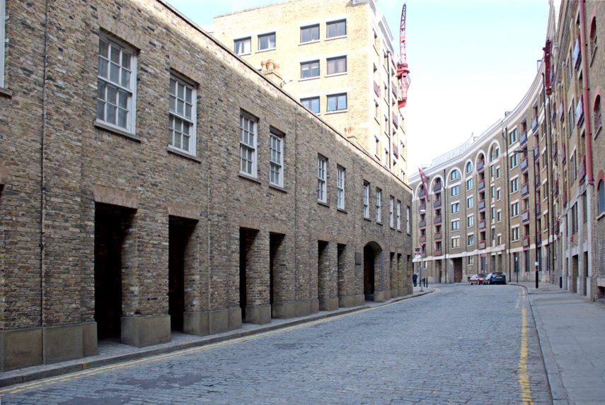
Having walked the length of Wapping Wall we joined Wapping High Street where the old dock buildings have all been renovated and converted to housing and it's been done very nicely. This is a view along Wapping High Street.

Further along Wapping High Street we reach our second pub – the Captain Kidd. No. 6 on the map.

Somewhere around here in 1701 the pirate, Captain Kidd, was executed by hanging on Execution Dock hence the name of the pub. The exact location of Execution Dock appears to be unknown except that it was near one of the local docks or wharves. His remains were gibbeted by the river Thames at Tilbury for more than twenty years.

Execution Dock was used for more than 400 years to execute pirates, smugglers and mutineers that had been sentenced to death by Admiralty courts. The "dock", which consisted of a scaffold for hanging, was located near the shoreline of the River Thames at Wapping. Its last executions were in 1830.

A short rope was often used for exceptionally nasty pirates which meant that, when they were dropped from the gallows, the rope didn't break their neck and they were then slowly asphyxiated. Customarily, these corpses were left hanging on the nooses until at least three tides had washed over their heads.

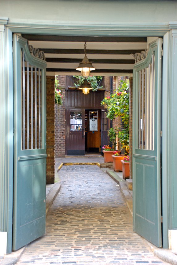
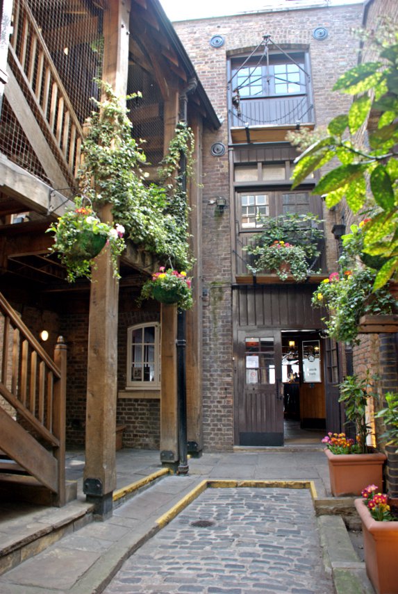
The Captain Kidd pub was established as a pub only in 1980 but the building itself is 18th century. The entrance visible on the street leads into a small, rather attractive courtyard which then gives access to the pub proper.

A short way further along Wapping High Street we saw yet another interesting warehouse conversion on the corner of Dundee Street.

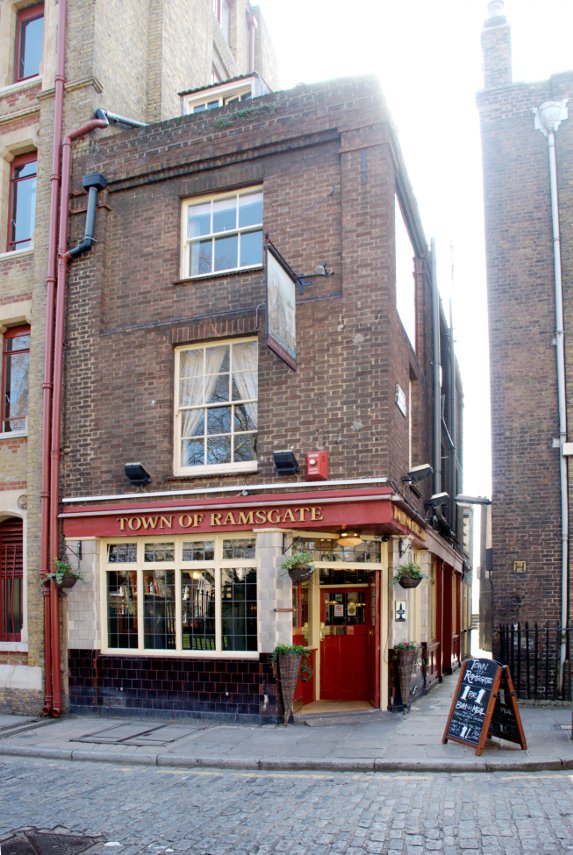
A little further beyond that we encountered our third pub – the Town of Ramsgate with Wapping Old Stairs next to it. No. 7 on the map.

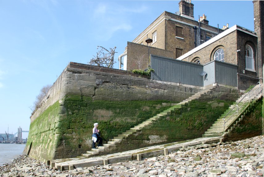
This shows Wapping Old Stairs. Amanda is on a set of stairs that just stop in front of a wall – very useful. The stairs to the right of those give access to and from the foreshore. The Town of Ramsgate pub is just out of the right edge of the picture and you may have noticed part of Tower Bridge showing in the distance.

The Town of Ramsgate was originally known as the Red Cow and then the Prince of Denmark with the origins of the pub claiming to go back as far as 1543.

We went back up to Wapping High Street and, after a short distance, turned onto the Thames Path along the edge of the river.

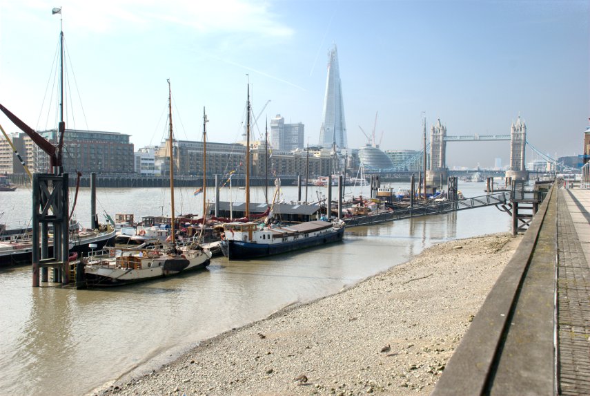
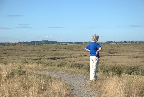
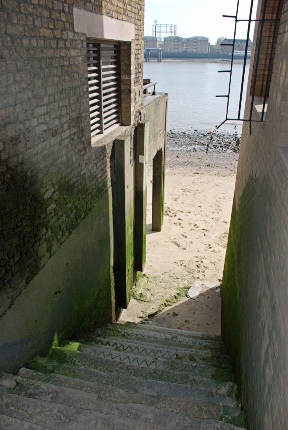
We eventually reached Readmead Lane which was where we turned off when we started this circuit and so have come full circle. We can recommend this area for some interesting exploring especially if you can manage a day when low tide is around the middle of the day which will enable you to go down some of the old steps onto the river foreshore.

We headed back to Tower Bridge and crossed to the south side of the river, along Shad Thames to Pea Pod for a late (2:15 PM) lunch. We have been here before and on our last visit had Old Guy USA (Jerry) with us.

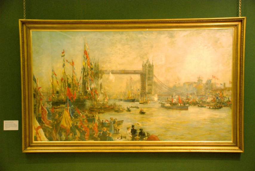
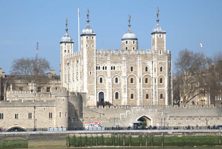
After lunch we walked west along the Thames until we were opposite the Tower of London where I took this photograph of the White Tower. The last time I tried it was covered in scaffolding.

We went back across Tower Bridge, now heading for Tower Hill Station, and went past these in the Tower of London grounds.

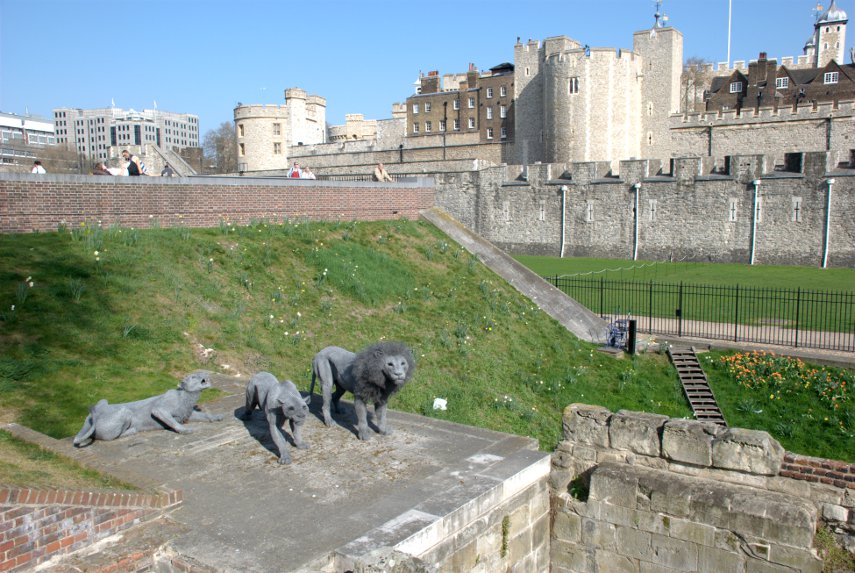
They look remarkably life-like but they are made from multiple layers of wire netting moulded to shape.

So our legs are tired and we are tired – time to go home methinks. We covered an awful lot of interesting history today and we found that when we got home we were covered in it and had to rinse some of it off. :lol:
 

The trip that nearly wasn’t.

The trip that nearly wasn’t.

Wednesday 21st March

The London weather forecast from the Meteorological Office for tomorrow (Thursday) is sunny all day and we believe them don't we? A trip to London tomorrow sounds possible.

Thursday 22nd March

Up early ready for our trip to London and Amanda listens to the travel news on the radio. Oh oh! There is overhead wire damage on the railway south of us so there are no trains for part of our journey and buses are being used as a substitute. There is also an accident on the A12 causing considerable congestion and, guess what, the buses are using the A12.

A bulletin a little later says that the overhead wires should be repaired by 7:30 AM. We don't think that there's much chance of that so we prepare to cancel our trip but are still listening to the travel bulletins.

About 30 minutes before we'd normally leave for the station we see that our usual train has been cancelled but, surprise surprise, the trains are starting to run again after that with possible delays of up to 1 hour on the journey. We decide to chance it and go for the train after our normal one which leaves 30 minutes later.

We arrive on the platform of our local station 15 minutes before our train is due to arrive and five minutes later a train arrives. An extra train has been put into service and it gets us to Liverpool Street Station without any delays. Hoorah, we made it after all.

We walk, in sunshine, to the Guildhall Art Gallery (entry is free) where we descend into darkness, well very nearly darkness. We are going to see the remains of the Roman Amphitheatre discovered when the Art Gallery was being built. These remains are from the eastern entrance to the amphitheatre.

It was long suspected that Londinium must have had an amphitheatre but it wasn't until 1988 that these remains were discovered during excavations prior to building the new Guildhall Art Gallery. Excavations of the remains continued until 1996 when it was declared an Ancient Monument and the designs for the Art Gallery had to be revised to preserve the remains in situ.

This was our first view of the remains. The green pattern of lines at the back is meant to represent rows of bench seating in the amphitheatre proper – we are in the eastern entrance remember.

Having wandered along to the far end where the amphitheatre would have been we looked back to see this view.

Having had a good look round the amphitheatre remains we went back upstairs to look at the Art Gallery. It is very nicely laid out and has some amazing pictures some of which are shown here together with Amanda looking out from a gallery at a mega-picture of her illustrious ancestor.

This is that very picture and he's the chappie on the horse – General George Elliot, defender of Gibralter when the spanish tried, and failed, to lay siege to it. Amanda's grandmother was an Elliot.

I thought that this painting was particulary interesting as it was of the grand opening of Tower Bridge. Looks to be quite a celebratory affair.

We left the Guildhall Art Gallery and emerged into the sunshine. Yes it was still sunny. We now headed south for the River Thames and St. Catherine's Dock. We had been to St. Catherine's Dock before and there are pictures on the web site to prove it but this time it was just a starting point for our planned route.

As we went past the Old Stock Exchange we went in for a quick look. It has now been converted to an upmarket shopping centre and Cafe.

We continued on to St. Catherine's Dock by Tower Bridge and set off on our route shown on the map below as a black dotted line. The green area on the left edge is the Tower of London.

Most of that route, you may notice, is along what used to be a canal but is now no longer navigable because it is blocked at both ends and has new housing along its length which does make a nice setting and probably isn't cheap.

Remember the weather forecast? Sunny all day. Notice that although there are a few patches of blue sky there is now some significant cloud appearing.

Part the way along that route we came to the location marked '1'. You couldn't really miss it because there are what appear to be two large, old sailing ships parked next to the canal. They are full size replicas of real ships.

The Three Sisters is a replica of a 330 ton ship built at Blackwall Yard in 1788, which traded until 1854, taking manufactured goods to the East & West Indies and returned with tobacco & spices.

The Sea Lark is a copy of an 18th century American built schooner, which ran the blockade and was captured by the Admiralty during the Anglo-American War in 1812-14. The public cannot get on to these ships.

So what is this place? It is:

We noticed by now that the sun was covered in a layer of thin cloud. It was possible to see where the sun was because of the very bright patch in the sky but the light was very diffuse. Meteorological Office weather forecasts – don't make me laugh.

The story of Tobacco Dock hasn't finished yet. When this area was originally developed in early nineteenth century the site covered 30 acres and specialised in high-value luxury goods such as ivory, spices, coffee and cocoa as well as wine, tobacco and wool, all stored in elegant warehouses and cellars. Tobacco Dock was one part of this scheme.

In 1990, after investing 47 million pounds converting the old warehouse, it was re-opened as a shopping centre. Soon after it was hit by a recession and soon went into receivership and closed. Over 20 years later it is still closed although properly maintained. You can see the building to the right of the ships beyond the gates. The old warehouse which comprises the main part of the shopping centre is now a grade 1 listed building.

We left Tobacco Dock and continued our route to location '2' on the map. This is Shadwell Basin the largest area of open water remaining from the old London Docks.

You can see the towers of Canary Wharf in the distance. This is another old dock which has been converted to upmarket accommodation.

There are two old lifting bridges at each end of the basin and this is the one nearest the River Thames. You can see that Canary Wharf, the tall tower blocks, are really not far away.

We turned round and started back and noticed this view which we hadn't noticed on the way out. Looks quite imposing doesn't it?

We also saw this old water level gauge which runs from 16 to 24 feet – you do speak Roman don't you?.

On the way back along St. Catherine's Way we saw Alderman's Steps but have been unable, so far, to find out why they are so called.

So that was the end of our trip that nearly wasn't. Perhaps we'll get better weather next time. We want to do that same walk again to see some things that we missed but I'm not going to tell you what they were and to, hopefully, get some better photographs.
 

We do some boring things don't we?


Bank Holiday

Bank Holiday

Today, in Britain, is a Bank Holiday (Public Holiday) and we woke up to a cloudy sky. However by mid-morning the sun had started to break through and by lunch time it was a really beautiful day with blue sky and a few puffy clouds. After lunch we decided that although it was a Bank Holiday and the whole world and his dog will be out and about we should go out for a short walk.

Having driven the few miles to Tollesbury (We last went there with Marie when she was over here) we arrived just as the sun went in behind a large bank of cloud which had appeared from nowhere. In spite of that we started our walk to Shinglehead Point and although it was cloudy it was quite warm. It took us about an hour to get to the point and then walk a short way across the marsh to get on the shingle bank out in the river. The bank is covered at high water but it was about 3 hours after high water and the tide was still going out.

After waiting for about 30 minutes the cloud dissipated and the sun returned.

Here is a picture showing Amanda jostling for space on the beach and trying to work out where the North Sea is. :shock:

There were a few people about but it wasn’t exactly crowded out here. This is a view of the same shingle bank looking up river.

We turned round and walked back along the sea wall eventually passing the Marina with the boats moored in tidy rows.

Along the sea wall by the marshes with the familiar sight of the lightship across the marshes.

Finally here is a shot of Amanda on the sea wall fighting her way through the crowds as we made our way back to the car.

A nice little walk.

Back again

Back again

We returned yesterday from our latest trip having been to Brecon and the Brecon Beacons, Carreg Cennen Castle, the City of St. David's, the Pembrokshire coast and finally Marlborough in Wiltshire which included the Avebury Stone Circle. I took about 400 photographs in all but not all of these will appear on the site.

Here are some sample pictures:

Brecon

One of the views from our hotel bedroom window showing Brecon with the Brecon Beacons (the hills) in the background.

Carreg Cennen Castle

Carreg Cennan Castle perched on it's rocky crag.

Solva Harbour on the Pembrokeshire coast

Solva Harbour on the Pembrokeshire coast.

Avebury Stone Circle

Avebury Stone Circle. Unlike Stonehenge you can walk around where you like and touch the stones. It's older than Stonehenge as well.