Browsed by
Tag: Churches

The Republic of Texas

The Republic of Texas

Just in case you wondered, the subject heading is relevant and we'll get to it later.

Days where the sun has been out for most of the day have been few and far between this year and, we are told, this summer has been the wettest for 100 years so we couldn't afford to miss the opportunity of a sunny day. We woke on Friday morning to a clear sky and made preparations to go to London. Having arrived at our local railway station a good ten minutes before the train was due to leave we thought that we had plenty of time until, that is, we saw the queue for the ticket office. We have never seen such a long queue here. Normally we wouldn't expect to see more than 3 people queuing at most and very often there is no one waiting at all. We assumed that it must be people going to the Paralympics as Stratford is the last stop before Liverpool Street Station. Our train was due to depart at 09:23 and we were worriedly watching the clock as we moved all too slowly towards the ticket office which we reached about 09:23,  although our train hadn't arrived yet, and bought our tickets. The train came in about two minutes late – phew!

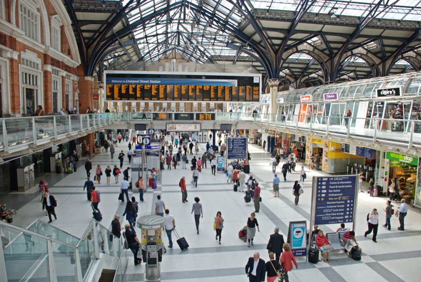
The train stopped at Stratford and the Olympic Park didn't seem to be very busy at this time of day and we continued to Liverpool Street Station arriving about 10:20. On the western side of Liverpool Street Station there is a row of doorways each of which has a bus stop by it and one of those buses is the number 11 which we were going to catch.

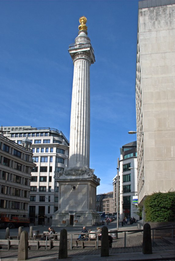
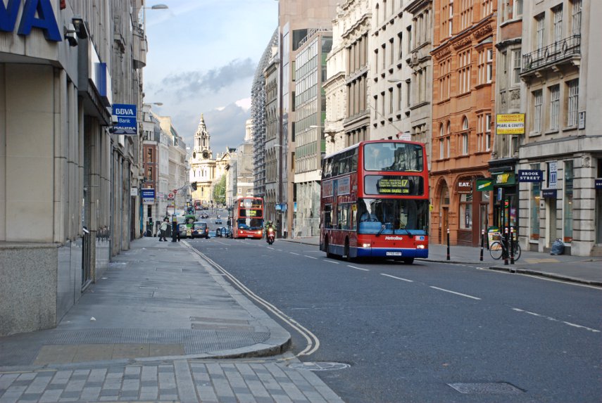
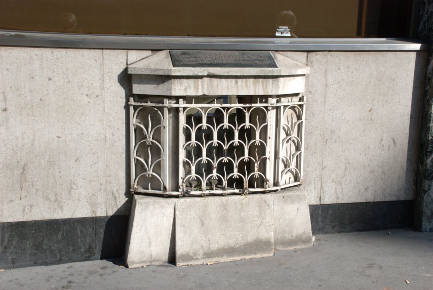
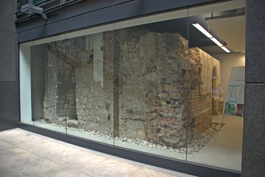
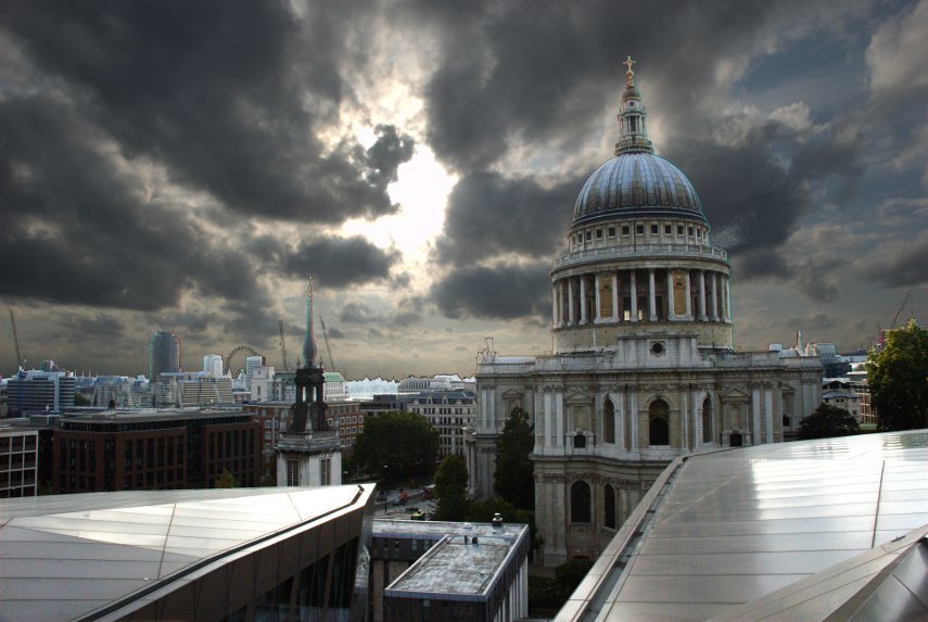
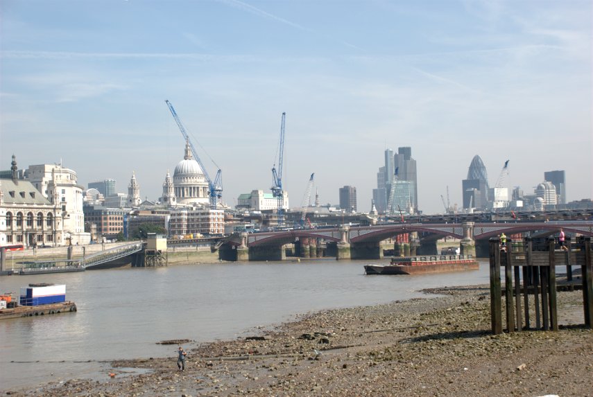
The No. 11 is quite a good sightseeing route so we went to the upper deck and found a seat at the front. The bus leaves Liverpool Street Station along Sun Street, crosses London Wall into Old Broad Street and thence along Threadneedle Street to Bank. From there we go down Victoria Street, fork right into Cannon Street and eventually pass this:

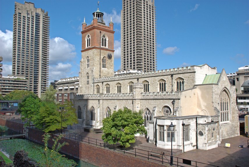
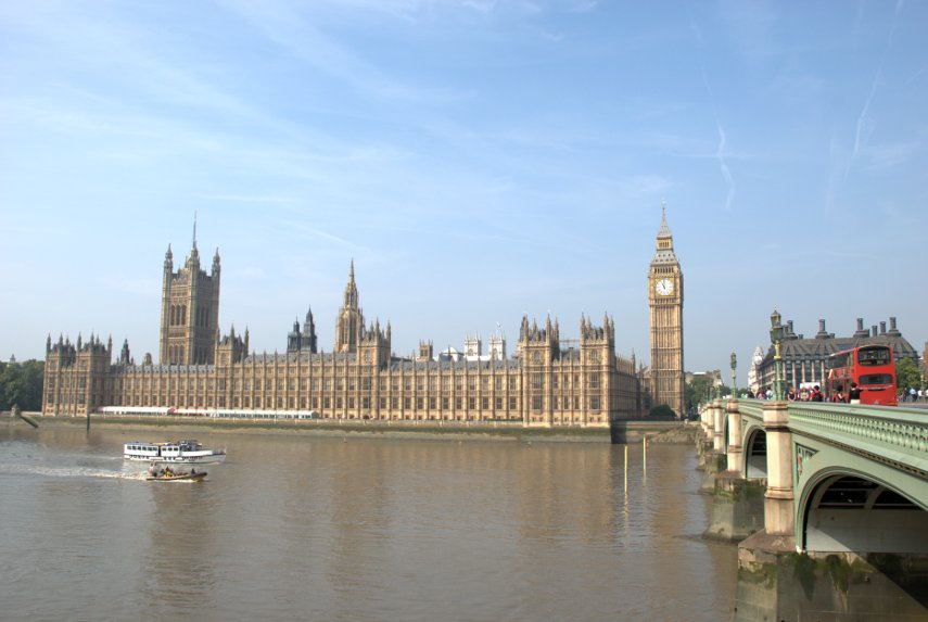
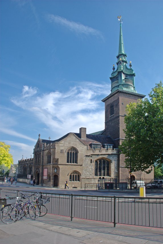
Do I need to tell you where we are? I don't think so.

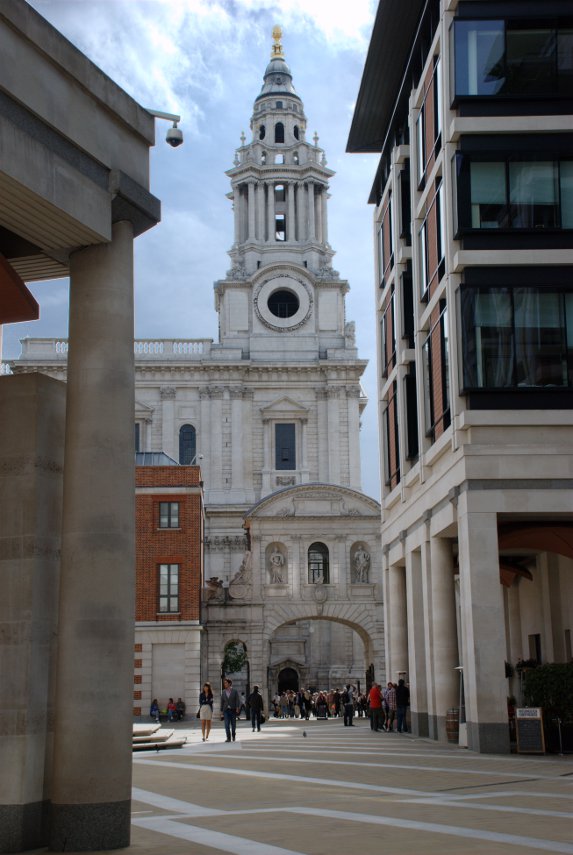
Along Ludgate Hill, Fleet Street and past the Royal Courts of Justice:

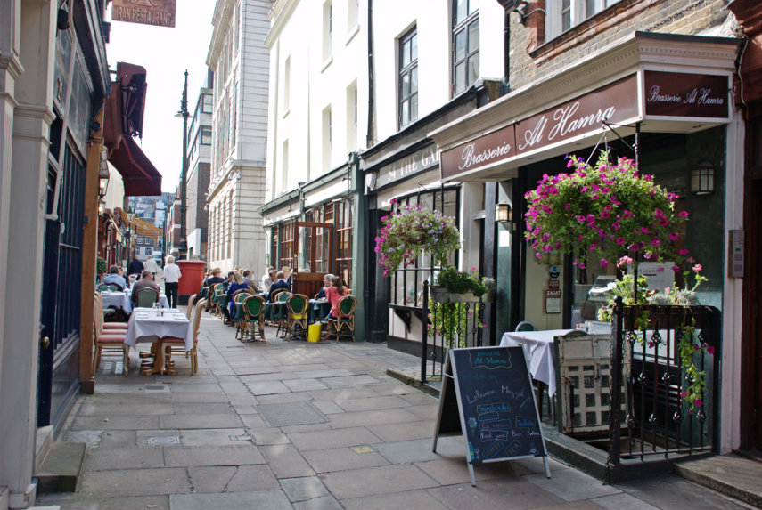
Along Strand to Aldwych where we got off. The bus goes on to Fulham Broadway via Trafalgar Square and Westminster which would be the last of the sightseeing route. Who needs a tour bus?

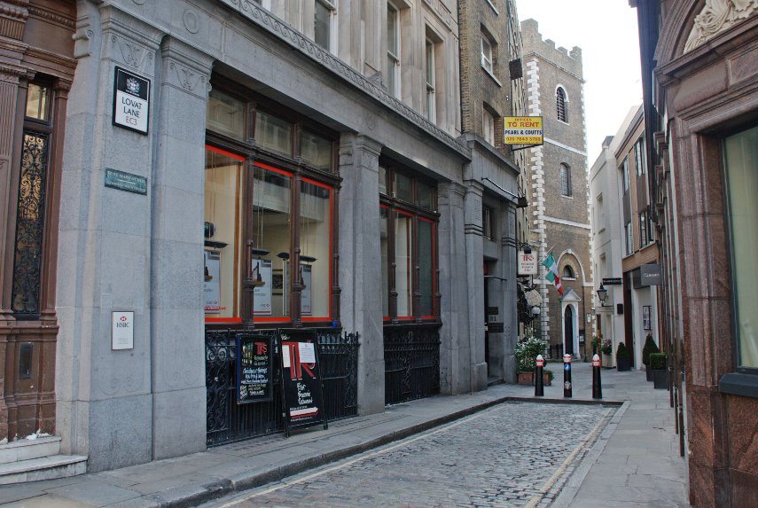
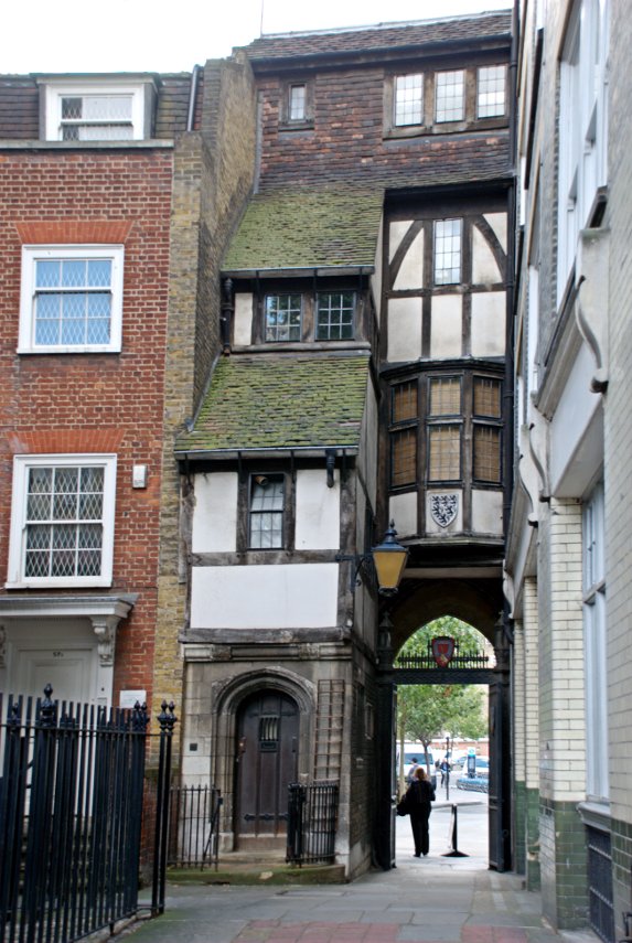
We now walked north up Kingsway, turned right into Portugal Street then eventually left into Portsmouth Street which runs up towards Lincolns Inn Fields. The building in Portsmouth Street that we came to see was this:

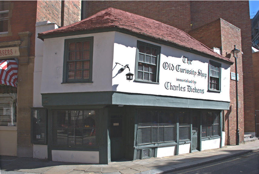
The Old Curiosity Shop with its jettied upper storey and wooden beams dates from the 16th century and is probably the oldest shop in central London. It has been suggested that this was the inspiration for Dickens' novel but there is no evidence to support this idea. Made using the wood from old ships the building miraculously survived the the Great Fire of 1666 and the bombs of the Second World War.

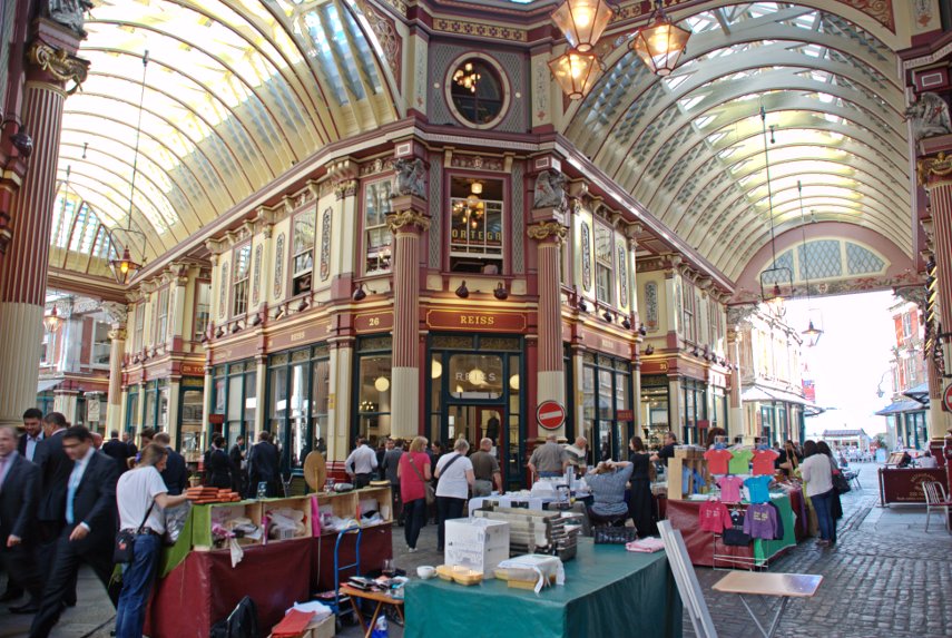
From there we walked through the side streets and made our way towards Trafalgar Square passing through Covent Garden Market on the way.

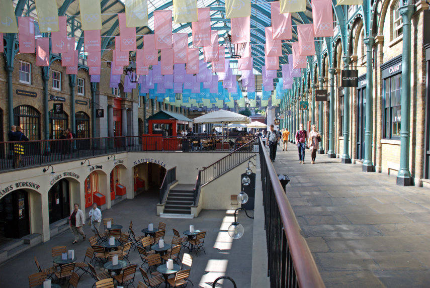
There were two noticeable differences compared with when I was here last. There are Olympic flags suspended under the roof (no surprises there) and there seemed to be few people. When I was last here it was positively seething.

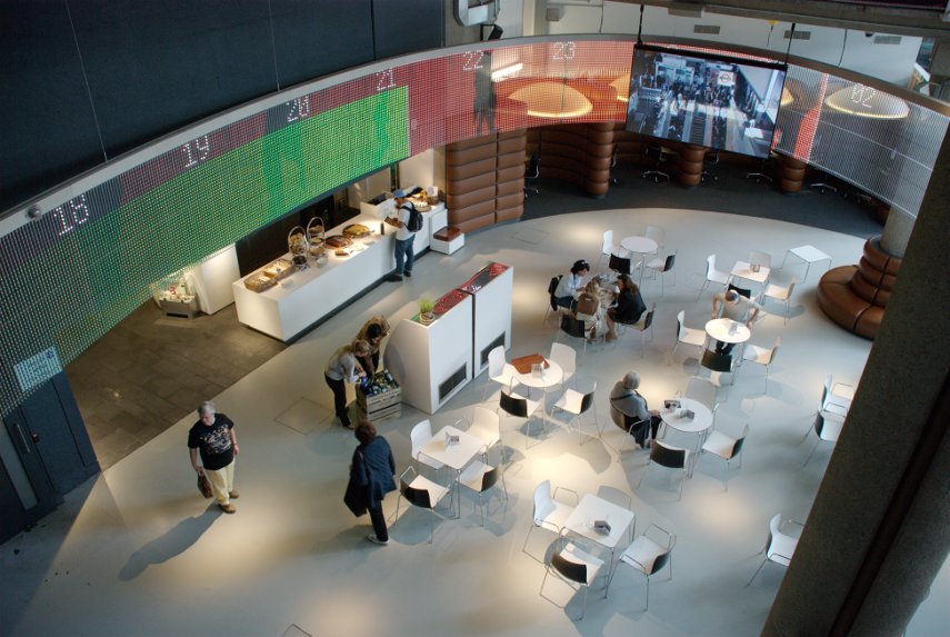
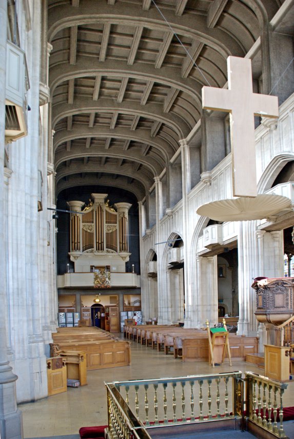
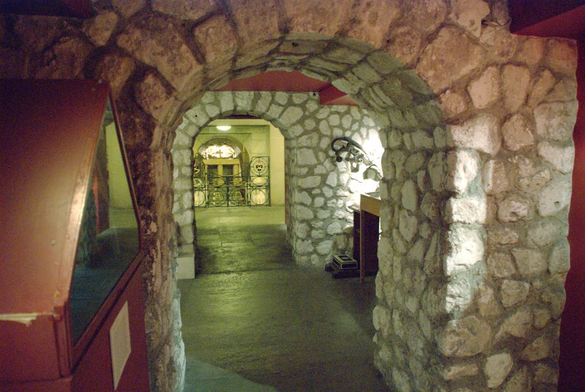
We eventually entered Trafalgar Square at a point right next to St. Martin-in-the Fields. As it was now 11:00 we decided to go into the crypt cafe for some coffee. There are also toilets down there and there is nothing to stop you walking in off the street and using them like public toilets. However, as we discovered, there is a prominent notice in the toilets which explains that it costs £32,000 annually to maintain them and although they have no objection to you using them in that way they do hope that you will either buy something in the cafe or shop or at least leave a donation in their donations box. Pretty generous I thought.

We left Trafalgar Square via Pall Mall and part way along Pall Mall we had a look in the Royal Opera Arcade. Just ignore the strange woman looking in the window.

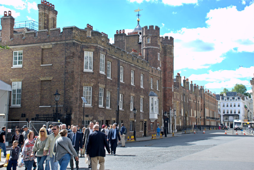
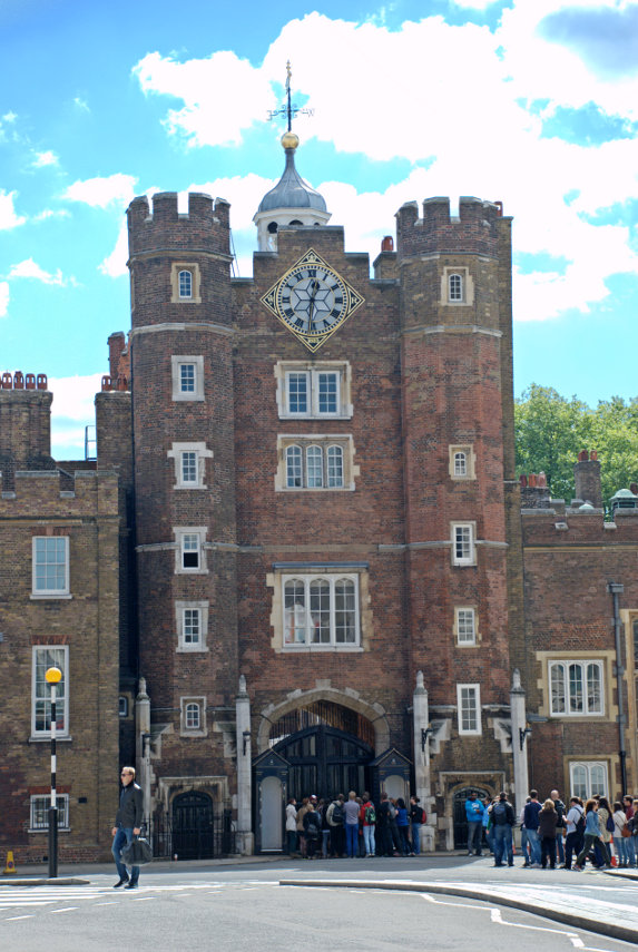
Where Pall Mall turns into St. James's Street we saw the main gate of St. James's Palace which is the gatehouse from the palace of Henry VIII and is, of course, Tudor.

We turned up St. James's Street and on the corner of St. James's Street and Pall Mall we saw this old shop.

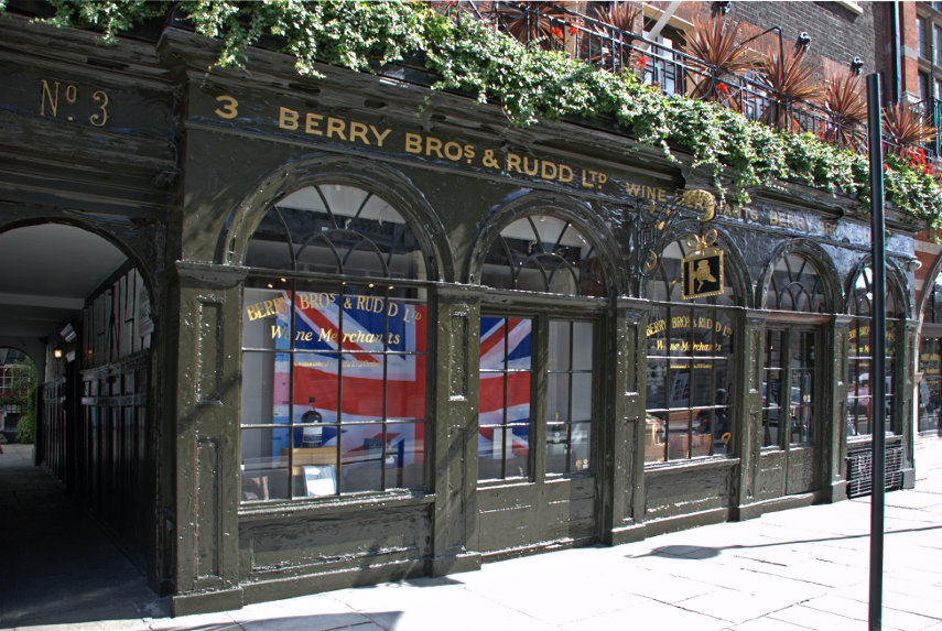
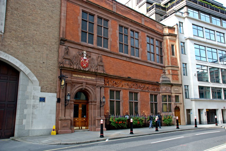
Berry Bros. & Rudd is one of Britain's oldest wine and spirit merchants and in 1698, the building dates from that time, opened its doors for the first time at 3 St. James's Street, London and it still  trades from the same premises.

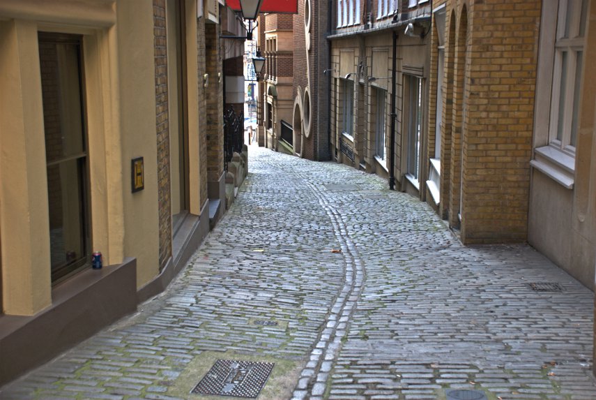
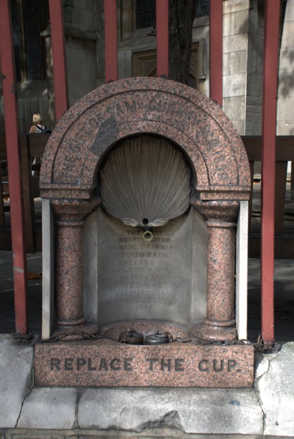
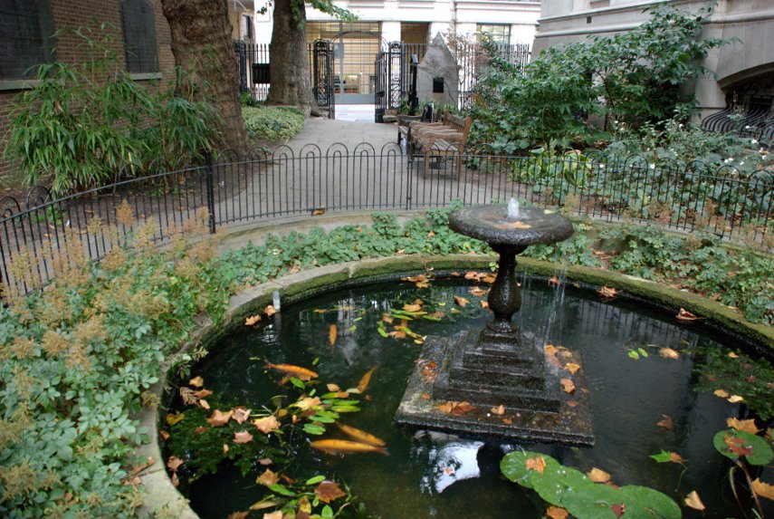
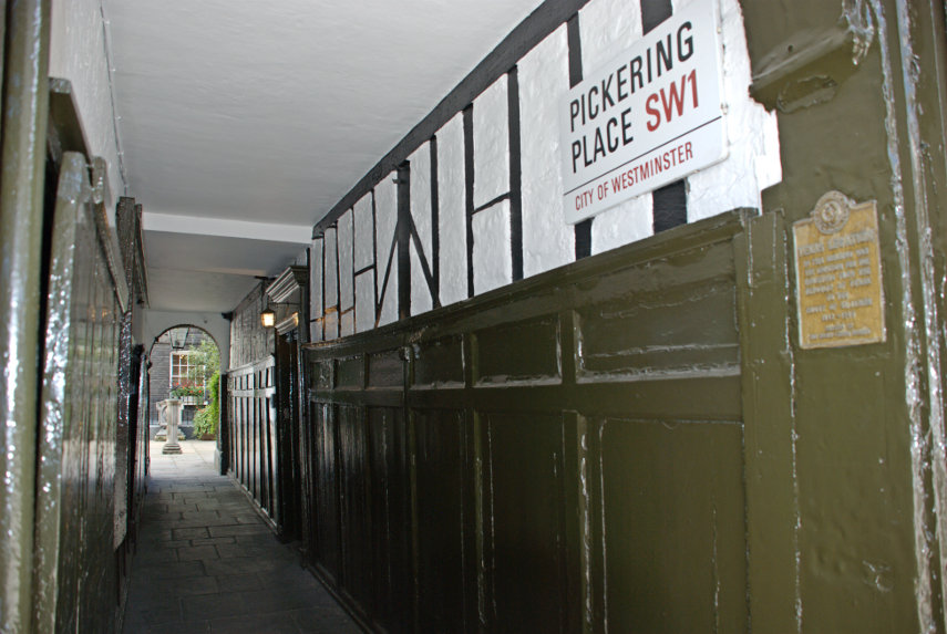
Note the alleyway on the left-hand side. That is Pickering Place and at the far end is a small very attractive courtyard. This is the view down the passageway with the courtyard showing at the far end. The timber construction of Berry's old shop can be seen in the wall.

Before we go into the courtyard can you see that little metal plaque on the wall? Well this is what it says:

It's amazing what one can find in London. And so we go into the courtyard.

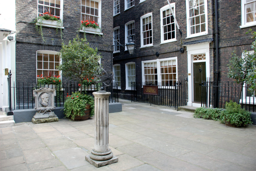
Having left the courtyard, and the Republic of Texas, we went a little further along St. James's Street to Blue Ball Yard on the opposite side of the street.

Those buildings, apparently, are stables built in 1742 which have now been converted into living accommodation. I imagine that originally the stables would have been at ground level and accommodation for the staff above.

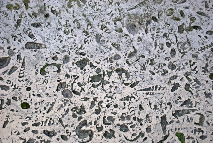
Further up St. James's Street we came across a modern development called the Economist Plaza. It wasn't really of interest to us but we wandered across it and went down some steps on the other side which were made of some very obviously fossiliferous polished limestone which was absolutely stuffed with fossils.

Having emerged into Bury Street we walked up into Jermyn Street where a little further along we first came to this statue of Beau Brummel.

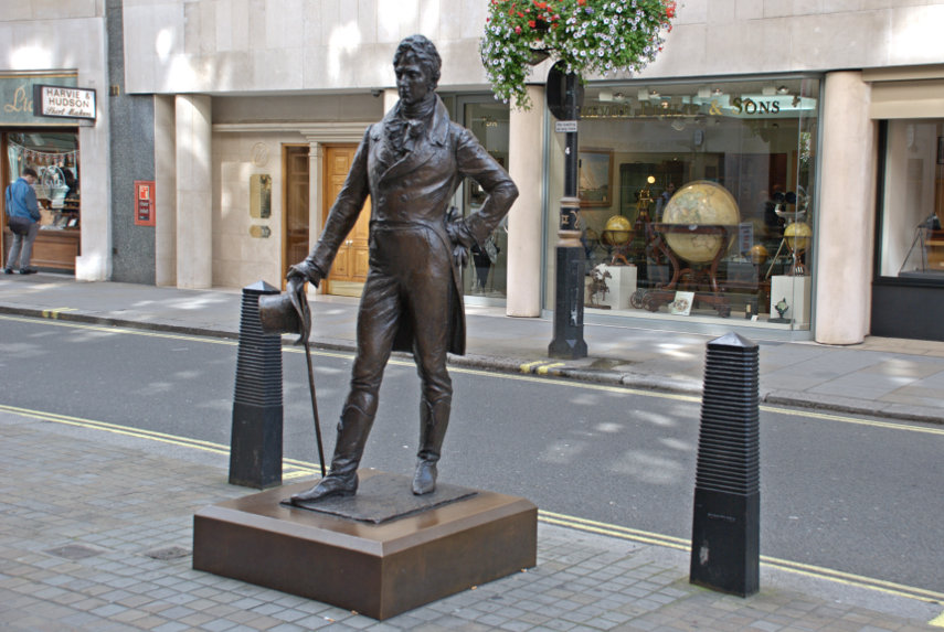
One of the reasons this statue is here is that Jermyn Street is stuffed with tailors shops and, further along still, we came to this shop.

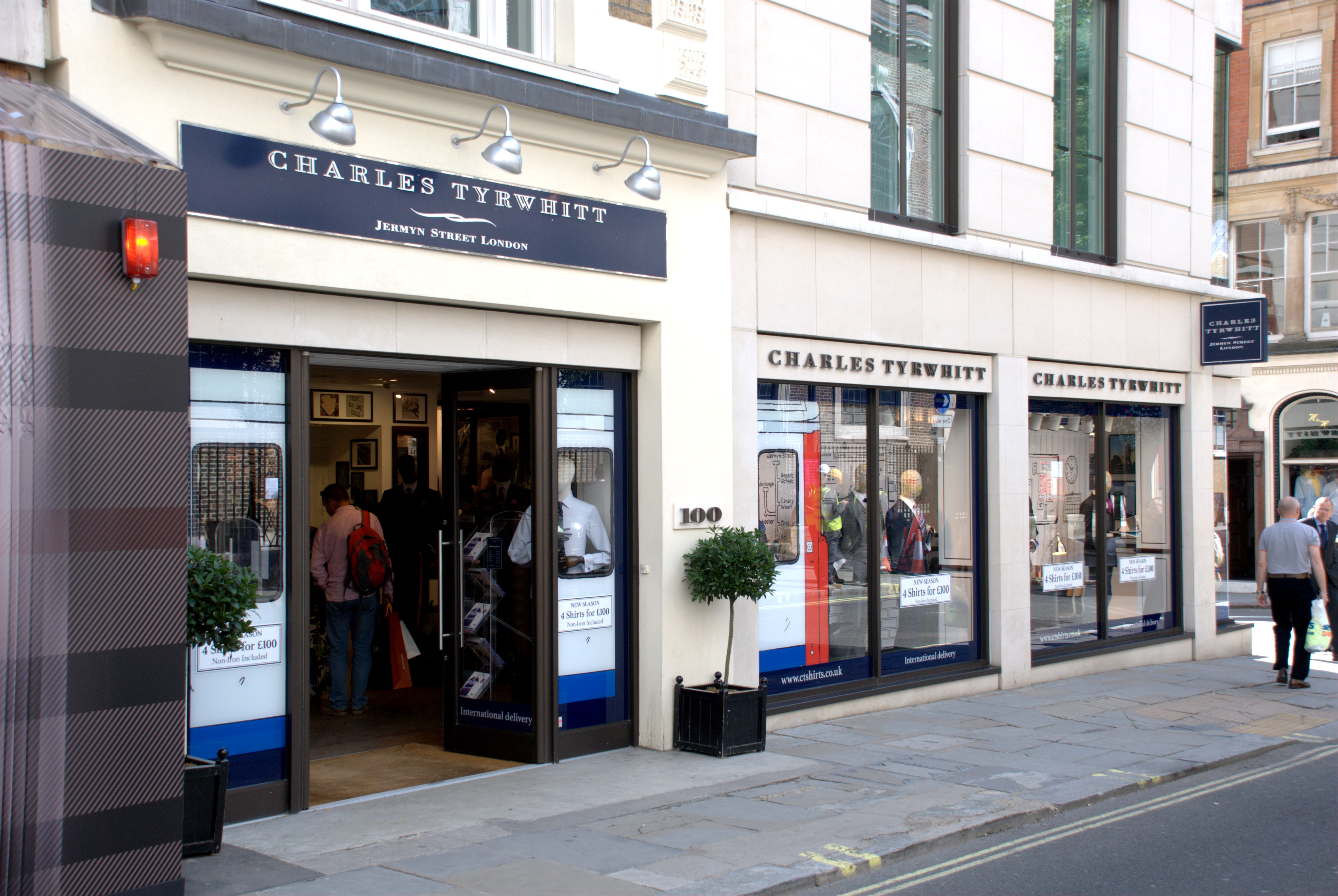
It is, I have to admit, a rather boring shop but they make and supply my shirts. I thought you might like to know that. :cool: Beau Brummel eat your heart out.

We then went up into Piccadilly and shortly after came to Hatchards Bookshop.

It is known world-wide among those who like books and bookshops and the other reason I mention it is because Amanda's maiden name was Hatchard. You may notice that I'm standing in the road in order to take the photograph and Piccadilly is a very busy road but I managed to take this one picture just before I was run over by a bus.

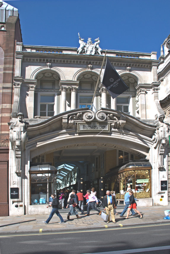
A few yards along is the Fortnum and Mason department store and opposite is Burlington Arcade. If you have more money than you know what to do with then these are good places to shop.

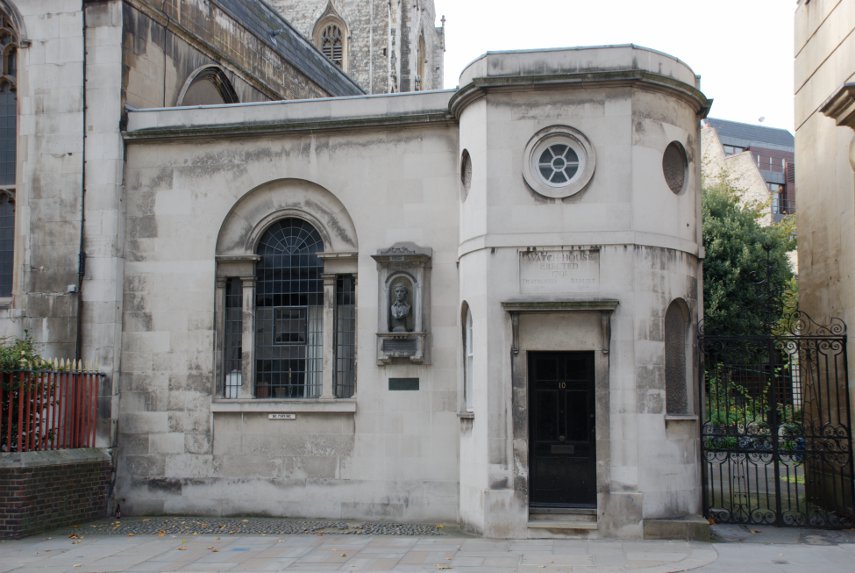
We walked further west along Piccadilly until we reached Albemarle Street and walked north up there until we reached the Royal Institution.

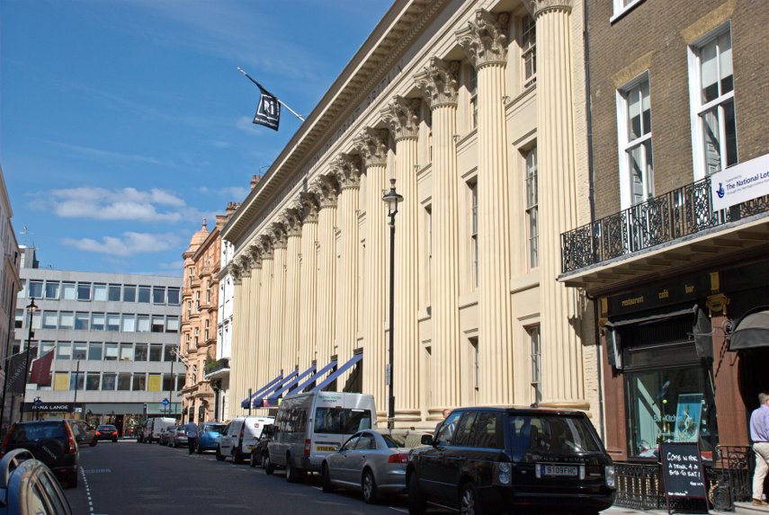
The Royal Institution is an independent charity dedicated to connecting people with the world of science and this building houses the Faraday Museum. They are most famous for their Christmas Lectures which were started by Michael Faraday in 1825.

Michael Faraday (1791 – 1867) was an English scientist who contributed to the fields of electromagnetism and electrochemistry. His main discoveries include that of electromagnetic induction, diamagnetism and electrolysis. The Faraday Museum details some of his experiments.

The Royal Institution also has a nice little cafe, where we had lunch, and toilets and if you are lucky enough to visit on a day when there are no lectures being held, as we were, then you may visit the lecture theatre where Faraday gave his first Christmas Lecture.

Impressive!

We moved on further west towards Shepherd Market passing through Berkeley Square on the way but didn't hear any nightingales. :lol: Shepherd Market is a small village-like area with a maze of narrow streets and lanes. Running parallel to White Horse Street is Half Moon Street where the fictional Bertie Wooster (the perfect upper-class Mayfair resident and his faithful valet Jeeves of P.G. Wodehouse's novels) lived.

In the 1920s Shepherd Market was considered to be London's most fashionable and opulent district by the city's bourgeois social elite. Shepherd Market remains a peculiar and curious collection of charming alleyways, eclectic cuisine, 18th century pubs and discreet residences.

Leaving Shepherd market and moving further west we arrive at Hyde Park Corner with the Wellington Arch.

We decide that we will now catch a No. 9 bus to the Royal Albert Hall as our last port of call which we do.

You may notice that the cloud has increased somewhat. It was forecast to increase by about 6:00 PM but it has arrived a bit earlier so the sun is fading fast and so are we. We decide to call it a day and head back to the station first on the No. 9 as far as Aldwych and then the number 23 to Liverpool Street.

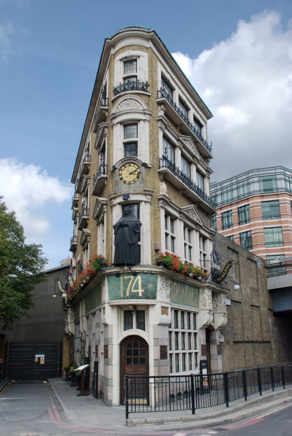
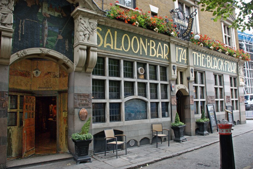
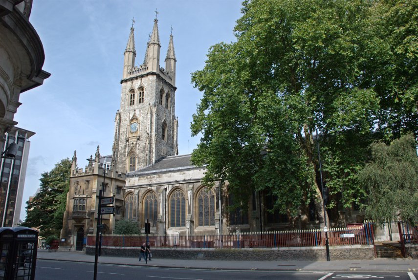
We go back through Hyde Park Corner, Piccadilly, St. James's Palace and Pall Mall, Trafalgar Square, Aldwych, Fleet Street and past the Old Exchange thence to Liverpool Street Station and home.

An enjoyable day.
 

A Mere diversion – Day 3

A Mere diversion – Day 3

Sunday, 2nd October 2011

Today we are going to foreign climes – yes, we are leaving Wiltshire and venturing into Somerset. Today is Frome day! Frome (pronounced 'froom') is a small market town about 10 miles from Mere, to the north, and about the same distance east of Wells.

Needless to say it didn't take us long to get there and we quickly found a car park. This car park is a short stay (max. 2 hours) and is Pay & Display. The good news is that the restrictions and charges don't apply on Sundays so we parked free and the car stayed there for our whole stay.

As luck would have it the car park chanced to be very near the Church of St. John the Baptist which would be difficult to miss.

The original Saxon church was built in 685 AD but was replaced by the current building which was constructed between the late 1100s and the early 1400s and was further restored around 1860.

An interesting external feature is the unusual clock face together with a nearby sundial.

There is a spring in the churchyard which is fed into a channel in nearby Cheap Street, one of Frome's medieval streets, which runs the length of the street before disappearing underground. There is a good flow of water in this channel so be careful where you put your feet.

Cheap Street runs from near the church down to meet the Market Place near the Market Cross, also known as Boyle Cross, in the shadow on the right.

Leading uphill from the Market Place is Stoney Street which leads into Catherine Hill. This view is near the top of Catherine Hill looking down towards Stoney Street.

This footpath, Paul Street, curving off to the right in the picture above, cuts across to Palmer Street.

Near the top of Catherine Hill is an attractive little side lane called Sheppards Barton accessed via some steps.

Part way along Paul Street Amanda stopped to discuss the weather with one of the locals.

We wandered back towards our car going back up Cheap Street and at the top, on the corner, was a small cafe called La Strada where we had a light lunch.

After lunch we drove out of Frome, south east, towards Warminster and just outside Warminster we stopped near Cley Hill.

Hmm, looks a bit lumpy. "Surely", I hear you say, "you're not silly enough to climb another hill?" but, unfortunately, yes, we are silly enough. Besides there's a Triangulation Point up there somewhere and Amanda collects them – remember? The climb wasn't as bad as it looked and it didn't take long before the summit was in sight.

And that's Warminster down there.

Amanda was still heading purposefully for that triangulation point which can just be seen on the top of the rounded hump ahead.

So now we can say that we've been there and done that. Back to the car, easier on the way down, and off on a very short drive to a car park between King's Bottom (Sorry your majesty) and Hitcombe Bottom. We are now near a well known estate so a short walk through the forest reveals this:

Longleat House, a stately home owned by the Marquis of Bath, a somewhat eccentric gentleman, and open to the public. We sat here for a while looking at the view and then decided it was time to go back to Mere. Tomorrow we go home but not without another diversion.
 

A Mere peregrination – Day 2

A Mere peregrination – Day 2

Saturday, 1st October 2011

After yesterday's walk we decided to have an easy morning looking round Mere. Our B&B is a very short distance from the High Street and the first thing we see is the 16th century George Inn which is the (apparently) timber-framed building in the foreground. I say 'apparently' because the George is actually stone built with a facing of timber and plaster. The stone building dates from 1580 but I don't know when the facing was added. King Charles II visited the inn in 1651 when he was fleeing after his defeat at the Battle of Worcester.

Beyond the George, on the opposite side of the road, is the Old Ship Inn with the large rounded archway. Originally built as a house in the 17th century it was reputedly converted into a coaching inn in 1785.

A short distance away is the Church of St. Michael the Archangel, dating from 1091, although little of that original church remains. A lot of the changes, including the tower and nave, were made in the 15th century.

That 15th century tower, as I mentioned yesterday, is massive. Someone in the 15th century had money to throw around.

The South Chapel had a rather nice stained-glass window which threw a coloured pattern on the lower wall and also put some blue spots on the brass of John Bettesthorne who was the benefactor of this chapel in the 14th century.

We left the church (there will be more interior photographs when we add Mere to the main web site) and made our way back to the Clock Tower by the George Inn.

We had a snack lunch then drove to Alfred's Tower which is part of the Stourhead Estate but has seperate access and its own car park.

This brick tower, also known as Stourton Tower, was built in 1772 on the north-western edge of the Stourhead Estate and is a folly: it is a building that arguably serves no purpose. It is 160 feet high with a spiral staircase of 205 steps which we duly climbed for the view from the top.

They didn't provide parachutes so we had to climb all the way down again. We then drove the short distance to the edge of Whitesheet Down, which we saw from Castle Hill yesterday, and promptly started climbing again. Will we never learn?

This is part way up, near the top, but we are aiming for that distant plateau because there is an Ordnance Survey Triangulation Point there and Amanda 'collects' them. There is also an Iron Age hill fort.

There are also sheep and people using hang-gliders. I don't think it's the sheep on the hang-gliders although it's difficult to see at this distance.

And there in the near distance, just poking up above  that spur, is Castle Hill again.

We eventually made our way down to our car and went back to Mere. The end of another interesting day.
 

A Mere jaunt – Day 1

A Mere jaunt – Day 1

Friday, 30th September 2011

This turned out to be a trip to anywhere! The current spell of fine weather was forecast to start from Tuesday 27th September, which it did, and to go on for about 7 days. Unfortunately we had a funeral to attend on Tuesday and I had a long standing dental appointment on the Wednesday so those two days were out. We didn't trust the forecast anyway because 'they' had got it wrong so many times recently so we waited until Wednesday to see how the forecast changed.

We were originally planning to go go up to the Yorkshire Dales but by Wednesday the forecast for the north had changed for the worse so we thought we had better stick to the southern half of the country. Our next choice was going to be Great Malvern in Worcestershire but it looks as though most of the country had the same idea as us, to go away while the weather was fine, and we couldn't find any suitable accommodation.

Next choice was Swanage in Dorset. Same problem – no accommodation available. We were beginning to run out of ideas and Amanda said, as an aside, that she would like to stay in Mere in Wilshire sometime. We had stopped in Mere once, to have lunch, on our way to Porlock Weir in Somerset and she was rather taken with the little town so I though that I'd try there to see if they had any available accommodation. They did and so here we are after an amazingly clear run from home even though it involved a lengthy spell on the M25 which is often called the largest car park in the country.

As we came over the hill at Amesbury we saw the familiar sight of Stonehenge in the distance. If you can mentally ignore the A303 stretching out in front of you then you can imagine how it once looked with Salisbury Plain spreading out all around it. We didn't stop because we had other plans for this afternoon.

We arrived in Mere just before 1 o'clock, booked in to our B&B, had a snack lunch and set off. We were headed for Stourhead Gardens (National Trust) and we were going to walk 2.75 miles each way plus whatever we walked around the garden.

From Mere we headed out via Castle Hill.

It was a very easy climb (Translation: Puff, Wheeze, Gasp. I hope nobody sees me on my hands and knees.).

There used to be a castle here, hence the name, but all the stone has long since been removed probably to build the town down below. This is Mere from castle Hill.

That church tower, as we discovered later, is absolutely massive. Having got this far we continued along the ridge admiring the views over the surrounding countryside.

Just beyond the tractor in the foreground you should be able to see the A303, the road which goes past Stonehenge and which brought us here. On the other side of the A303 is the high ground of Whitesheet Downs and its Iron Age hill fort. We are headed out of that view to the left.

Back down off Castle Hill we reach ground level once again, cross the A303 on a footbridge, and head off across the fields. But wait, what's this? Amanda wearing shorts? Well it was hot, somewhere in the low 80s, and that footpath stretches a long way into the distance with Whitesheet Down off to our right.

Looking back we get a good view of Castle Hill (did we really go up there?) and can even see the Union Flag flying on the top.

We finally stagger, hot and thirsty, into the cafe at Stourhead for a brief respite then on into the garden.

The lighting looked amazing at this time of year together with the fact that the sun was getting noticeably low by 3:30 PM. The last time we were here was August 2008, and in the morning, so on that occasion the sun was lighting the opposite side of the bridge.

The Temple of Apollo was also beautifully lit compared with the photograph taken on our previous visit.

You can see those previous photographs on the main web site.

After walking about 1.5 miles around the lake we decided we'd better start for 'home' and set off again on the footpath back to Mere. The sun was getting quite low by this time and the views across the fields to Castle Hill were quite dramatic with the long shadows.

We arrived back at our B&B rather tired but very satisfied with our afternoon having walked a total of 7 miles. Tomorrow is another day.
 

A later date.

A later date.

At the end of my last post I said "we plan to return for more at a later date" – this is that later date on a Sunday.

We came back to the City of London, as distinct from the City of Westminster and the West End, and started from the Monument this time.

We were last here when we went up to London to meet Jerry, 'Old Guy USA' on the forum, and this is where we parted at the end of our day together. Jerry went off to his hotel and we went home. The day had been cloudy with showers then but today it was sunny.

From the Monument we went into Pudding Lane where the Great Fire of London started, and no, we didn't start it – not even by accident.

Pudding Lane looks totally different now, although it is still cobbled, compared to how it was in 1666 but nearby is Lovat Lane which gives an idea of how Pudding Lane might have looked at the time. Lovat Lane slopes down towards the Thames.

The top picture of the two is the top end of the lane where it joins Eastcheap and just out of sight past the church is the view in the second picture. Note how the sides of the cobbled surface slope towards the centre forming a central drainage channel. That is how all the roads at the time of the fire were constructed and that is where all the sewage would have been thrown. Nice! :yuck:

Pudding Lane is east of the Monument and Lovat Lane is east of Pudding Lane so we turned around and walked back west to Cannon Street which was really quiet, being Sunday, compared with a weekday. There are, as you can see, still buses around although we weren't here to look at buses.

Just opposite Cannon Street Station is a small grille near pavement level which would be very easy to ignore. But if you did ignore it (You did didn't you?) you'd be missing part of London's history.

It is virtually impossible to photograph beyond that grill because there is a sheet of glass behind it which is covered in reflections from the bright light outside and behind that, just visible, is the London Stone. This is the stone from which the Romans measured all their distances from London.

We then walked a little further along Cannon Street, turned right into Walbrook, left into Bucklersbury then left into Queen Victoria Street. A short way along on the lefthand side are the foundations of the Temple of Mithras.

This foundation was discovered during rebuilding work in 1954 and is, perhaps, the most famous of all twentieth-century Roman discoveries in the City of London. This temple was built in the mid-3rd century and, during excavation, various artifacts were discovered and are now in the Museum of London.

We continued along Queen Victoria Street as far as the junction with Black Friars Lane where we found this wedge shaped pub which as you can see in the lower picture is The Black Friar.

This pub was built on the site of a thirteenth century Dominican Priory, hence the name, but it is the interior, an Art-Nouveau masterpiece created in 1905 by the Royal Academy sculptor Henry Poole, that makes this pub so interesting. If you want to see the inside then you know where to go (they do provide cooked meals).

We went right into New Bridge Street and crossed over into Tudor Street, along Tudor Street then right into Whitefriars Street. We were looking for Magpie Alley/Ashentree Court along on the lefthand side of Whitefriars Street and spotted the narrow entrance to the alley. This led us into an obvious courtyard of all modern buildings, some with steps down to basement level. At the bottom of one of these basement steps is this:

It is all that remains of a Carmalite 13th century crypt.The crypt lay buried for centuries until it was unearthed in 1895 but it was not restored until the 1920s. It is protected by plate glass but is available to view at any time by going down the steps from the courtyard above.

From here we made our way into Fleet Street and Ludgate Hill towards St. Paul's cathedral and into Paternoster Square with this view of Temple bar and one of the towers of St. Paul's Cathedral.

We had lunch, which was quite good and reasonably priced, in the St. Paul's Crypt cafe. There are also publicly accessible toilets down there.

After lunch we walked up Warwick Lane seeing Cutler's Hall on the way.

Then left along Newgate Street where we saw St. Sepulchre's Church on the corner of Giltspur Street. Built into the railings of the churchyard is London's first ever public drinking fountain (shown in the second picture) and round the corner in Giltspur Street is the Watch House (shown in the third picture).

The Watch House was built to deter grave robbers which were rather prevalent in those times as freshly dead bodies were in great demand for surgeons to practise on and fetched a high price.

We went up past Smithfield Market to Charterhouse Square and saw this attractive little alley nearby.

Then back to Barbican to revisit the Museum of London where, this time, we saw the Lord Mayor's Coach (and had a cup of coffee).

We also saw this model of an old London bus with an external stairway to the upper deck. I hate to have to admit this but I can remember going to school on one of those exact buses as a child. :oops:

Just round the corner from the Museum of London we made a quick visit to Postman's Park. A small, little known but interesting little park.

Last, but not least, we went back to St. Paul's and at the east end walked into One New Change. New Change is the name of the street and One is the address/name of a very modern, covered shopping centre. If you like shopping then you will probably like this and there are lots of places providing food of various kinds.

We didn't go in for either of those things. There are lifts which are made of glass and run on the outside of the building and if you go up to the 6th floor you will find a roof terrace which is freely accessible to the public and that is where we went.

The first picture, looking directly into the sun, gives quite a good view past St. Paul's across London with the top part of the London Eye just visible on the horizon.

The second picture shows just part of the actual roof terrace.

That was the end of our second day trip to the City of London.
 

A tale of two mugs

A tale of two mugs

The mug on the left dates from 1630 and the mug on the right dates from 1936.

We are just back from our day trip today but where have we been? :cool:

We started our walk as soon as we got off the train, at Liverpool Street Station, so you may guess that our destination was London. We walked west towards Finsbury Circus, which is a small, oval shaped park/garden, with the intention of having a look at it but we were thwarted by CrossRail. CrossRail is a new project which will enable normal overground trains to run from places east of London to places west of London, or vice versa, by means of an underground route through tunnels. The building project will last for years! Finsbury Circus will, eventually be restored to its former condition but that is years away.

We walked around the road (I say 'around' because it's oval in shape) which passes the garden heading towards Moorgate with the intention of crossing Moorgate to head further west but that was thwarted by CrossRail too. We had to go south, not very far, to London Wall, along London Wall, not very far, and turn north again to get back on our intended track. We hoped that the word 'thwarted' wasn't going to appear too often.

After a short distance we found ourselves at the start of Moorfields Highwalk at the south-eastern corner of the Barbican. The Barbican is situated in an area of London which was severely bombed in World War II and consists of housing and the largest performing arts centre in Europe all designed in the Brutalist style. The whole area was planned with pedestrian thoroughfares above ground level, hence the term 'Highwalks', and was opened in 1982.

The building with the white blocks on the right in the lower picture is the Arts centre. This place is a maze of walkways on different levels although there are boards with maps scattered around including the all important 'you are here' legend.

This old stone tower is part of the original Roman wall around London

and this is a section of the Roman Wall with that same tower at the far end. You probably wouldn't expect to find something like that in a development like this.

Still within the Barbican complex we found the church of St. Giles-without-Cripplegate. The name means that the church was without (outside of) the Cripplegate – one of London's old gates. The church is dedicated to St Giles, patron saint of beggars and cripples and is one of the few medieval churches, dating from 1394, left in the City of London having survived the Great Fire of 1666.

A little further on and still within the Barbican we found this:

Ironmongers Hall is an Elizabethan building which, although scorched, escaped the Great Fire of London.

We were now in the south-west corner of the Barbican and we left the Barbican at this point and headed north-west to Cloth Fair where we found the Tudor Gatehouse of the church of St. Bartholemew the Great with the church just visible through the gateway in the top picture.

The church is Norman and, although large, is only a part of the original priory church. There is an entrance fee of £4.00 and I have to say it is really not worth that much. I would say £2.00 is nearer the mark especially as one has to pay another £1.00 to take photographs.

This shows all that is left of the Cloisters and it is now used as a cafe where we had lunch. We both had Lentil and Ham Soup with some bread and although the soup was substantial and very nice it was only just warm enough and service was very slow.

Just around the corner from St. Bartholemews is Cloth Fair. Cloth Fair is a rather narrow street with a Tudor house which escaped the fire of London and whose bay windows are said to be even older.

From the end of Cloth Fair we look across Long Lane to Smithfield Market. Smithfield is not as nice as Covent Garden or Leadenhall Market and part of it is still a wholesale market but it is worth a look if you happen to be nearby. There is some very nice structural ironwork to be seen along Grand Avenue, shown here, but no stalls or shops.

We walked through Smithfield along Grand Avenue then along St. John's Lane, still going north, to reach our next destination – St. John's Gate. This archway was built in 1504 as the entrance to the Priory of the Knights of Saint John – the Knights Hospitallers. There is a small,free, museum inside run by St. John's Ambulance.

A little further north, but only a few hundred yards, is the Priory Church of St John, dating from 1504, with its 12th century crypt which is certainly worth a visit.

The strange thing about the church is that although it is 16th century it has little atmosphere and has the appearence of being quite recent.

We had now reached our northern-most point so we turned round and headed back. So was this the end of our trip? Well, no it wasn't as we still have quite a bit to see (We haven't seen the mugs yet). From St. Johns Gate we went back through Smithfield Market, past the end of Cloth Fair and down Giltspur Street. Here, by the junction with Cock Lane, we saw the Golden Boy of Pye Corner.

The inscription reads "This Boy is in Memmory Put up for the late Fire of London Occasion'd by the Sin of Gluttony 1666". The spelling and the use of capital letters is theirs not mine.

As you probably know the Great Fire of London started in Pudding Lane and was finally stopped here at Pye Corner. That appeared to the people of the time as significant and they assumed that God was punishing them for Gluttony (Pudding Lane, Pye Corner – get it?).

We headed due east from here and arrived at our next planned stop.

You may notice that we are above ground level here and that's because we are back on the Highwalks of the Barbican. The entrance to the Museum of London is on this higher level.

This explains the 'mug' reference at the start of this post because this is where that photograph was taken. There is an awful lot of stuff here and we didn't have time to see it all but we did wander around a number of the galleries.

One of the exhibits which reminded me of the Golden Boy was this painting featuring the Great Fire of London:

It must have seemed like the Apocalypse to someone standing there at the time.

We also noticed yet another piece of the old London Wall through a window on one of the higher level galleries.

When I first saw this Roman mosaic I assumed it must be a reproduction as it appeared to be perfect but, no, it's the real thing discovered and excavated by the Victorians.

After wandering round for quite some time we realised that time was passing and we had still more to see outside the museum but we were also feeling thirsty so we stopped for a coffee/tea in the Sackler Hall, one of the two cafes in the museum.

We left the Museum of London via Bastion Highwalk which runs east parallel to London Wall and turned down Wood Street, across Gresham Street into the lower part of Wood Street until we got to Comptor Passage.

Before we go any further have a look at this web page about Mitre Court:

http://www.ianvisits.co.uk/london-alleys/page20.php#Mitre%20Court%20EC2

We were looking for that structure labelled 'The Wood Street Comptor" in Mitre Court which was supposedly the entrance to the old debtors prison. It appeared that Comptor Passage was approximately where Mitre Court should have been.

We wandered through Comptor Passage into Milk Street and Russia Row but no sign of Mitre Court. To cut a long story short we couldn't find it and gave up. After we returned home a bit more research revealed that there was indeed some sort of structure under Mitre Court but archaeological investigation revealed that it was nothing more than some Victorian wine cellars which, at some stage, someone had tried to promote as a venue for parties describing it as the old Wood Street Comptor which it wasn't. They probably erected that structure and its signs.

Mitre Court has been demolished to make way for new development because there was nothing of historic interest there so no wonder we couldn't find it. In other words the whole debtor prison thing, including the structure over the entrance,  was a complete fake. There was a real Wood Street Comptor but it had burned down long ago.

We headed back to Gresham Street and the Guildhall.

This is the oldest lay (non-eclesiastical) building in London built between 1411 and 1440. We went from here just around the corner into Basinghall Street to look at these strange stone carved animals/demons on the upper part of the Guidhall.

It was now time we headed for Liverpool Street Station so we turned into Masons Avenue which, in spite of its grand name, is a very narrow alley.

Through there, then Great Bell Alley into Telegraph Street and after lots of twists and turns we eventually arrive back at the station to catch our train. There is lots more to see in the area we have just visited so we plan to return for more at a later date.
 

Yesterday we walked four feet

Yesterday we walked four feet

… (the ones on the end of our legs that is) and we walked them from Westminster to Liverpoool Street Station. Why Liverpool Street Station? Because that's where our train to London terminates and we will be going back home from there.

We saw Westminster Palace, the London Eye in close up, the Millenium Bridge, some old churches, Tower Bridge, the old Billingsgate Fish Market, a Saxon Arch, the Gherkin, a hidden treasure, lots of alleys, the Royal Exchange, the Bank of England, the Mansion House and a Turkish Bath House. We also visited the area where Charles Dickens wrote some of his novels.

We'd better get started then, there's a lot to do. Don't forget that clicking on a picture will give you a larger version.

Friday was a sunny day and, after travelling to London, we took the tube to Westminster and walked across Westminster Bridge to the south side of the Thames. There's a good view of the Palace of Westminster (Houses of parliament) from there.

We turned east along the riverside path and in a very short time reached the London Eye. I have to say that it looks an impressive bit of engineering in close-up. There were longish queues but not excessive and we weren't planning a ride.

There are a number of visitor attractions along this stretch of the path, including the London Aquarium, together with various cafes which give the area a holiday atmosphere. There are also a number of street entertainers and snack bar trailers along here and we decided to have an early lunch. We bought ourselves some snacks and sat on a riverside bench to eat them whilst watching the world go by. There were a lot of tour boats and we saw a restaurant boat which looked rather like a rather long floating greenhouse.

After lunch we continued along the path with views like this:

I'm sure you don't need me to point out St. Paul's but the bridge is Blackfriars Bridge which we intend to use to go back across the river to the north side. The cranes are part of the building works apparently being carried out on the railway bridge. I don't know what they are doing but they are doing a lot of it.

After crossing Blackfriars Bridge, to get to the riverside walk, one has to do one of two things. Although we want to head east the easiest way to the path is to turn left (west) and go down to the Embankment, on to the path, then turn back east along the path. The alternative is to turn east but that means you can't access the path until you reach the Millenium Bridge then go down the steps either side.

The path on this side, the north side, is very nice and we soon reached the Millenium Bridge.

We continued past the bridge to Broken Wharf where one has to walk inland up to High Timber Street, along High Timber Street for a short distance, then back down Queenhithe to the river. Somewhere between Southwark Bridge and Cannon Street Station we reached a point where the river path continued on but there was a passage to the left which we wanted to explore. This is what we found:

Known as Fruiterers Passage the walls and ceiling are all tiles and the framed images are old engravings of London. We followed the passage round and came out on the river path again and a little further on the path goes through a sort of cage.

The bridge on the right takes the railway from Cannon Street Station across the river and when we reached the edge of Cannon Street Station on Cousin Lane we saw these, rather appropriate, items:

At this point you could be forgiven for thinking that the path stops here but you'd be wrong. On the other side of Cousin Lane there is a black cavernous opening which looks like the entrance to a goods warehouse or similar but it is Steelyard Passage and it will take you underneath Cannon Street Station and on to the continuation of the path.

As we walked along the path I noticed this view to my left. The pillar with the golden top is, of course, the Monument and you should just about be able to see people on the top platform.

The church, of which only the roof and tower is showing, is St. Magnus the Martyr, a Wren church, and we detoured very slightly to look inside. The original church was one of the first casualties of the Great Fire of London and was subsequently rebuilt by Sir Christopher Wren. The roof was destroyed in 1760 by another fire and a smaller fire in 1995 caused more minor damage. It was badly damaged by a bomb in 1940 and was repaired once again.

Back onto the riverside path we continue onward.

That large overhanging balcony on the left above the path is a public viewing gallery accessed by steps just this side of it so we went up. There was absolutely nobody up there, except us, and there is also no seating of any kind. This is the view:

The building on the left is the old Billingsgate Fish Market with Tower Bridge in the distance. Soon after this we reached the Tower of London and this is where our riverside jaunt ends because from here, being only early afternoon, we branch off in a north-westerly direction into the City of London to continue our explorations.

Leaving the environs of the Tower of London we walked along Gloucester Court until we spotted the church of All Hallows by the Tower and went inside.

This church is the oldest church in the City of London having been founded in the year 675 but only an archway from that original church remains above ground.

There is a crypt, part of the original Saxon church, which has part of a Roman tessellated pavement exposed. This is the Saxon Crypt.

This was a very interesting church and is well worth a visit. John Quincy Adams, sixth president of the USA, was apparently married in All Hallows in 1797.

After leaving the church we crossed Byward Street where I took this exterior photograph of the church.

We turned north up Seething Lane which has a nice little garden with bench seats but nothing special so we went on. Up to Hart Street, turned left and along to Mark Lane where we turned right (still going north) to look for Star Alley. We found Star Alley easily enough and what should we see peeking at us through a gap in the buildings but the Gherkin (proper address 30, St Mary Axe).

Nearby was a solitary stone tower. This apparently is all that remains of a church called 'All Hallows Staining', where 'staining' means 'stone', which distinguished it from the other 'All Hallows' wooden churches round about. It was built in 1320, which makes it medieval, and is maintained by the Worshipful Company of Clothworkers.

Off we went up Star Alley and popped out on Fenchurch Street. There are two alleys going north from Fenchurch Street through to Fenchurch Avenue and neither of us can remember which one we took although I suspect that it was Billiter Square.

Anyway we turned left (west) along Fenchurch Avenue towards the Lloyds of London building then right into Leadenhall Place – and were really surprised to see this:

The entrance to Leadenhall Market with part of the ultra-modern Lloyds building on the right. This is something we weren't expecting as neither of us can remember hearing of Leadenhall Market before. It was a meat, game and poultry market and has now had a change of use as Covent Garden has. There are various shops, stalls, cafes, pubs, restaurants and the like and what a wonderful old building it is.

We eventually left the market via Whittington Avenue, turned right along Leadenhall Street and spotted this little church near the corner with St. Mary Axe.

The church of St Andrew Undershaft is rather dwarfed by the Gherkin but is a rare example of a City church that has managed to escape both the Great Fire of London in 1666 and the Second World War bombing. The first church to occupy this site was certainly there by 1147 but that church was rebuilt in the 14th century and was replaced by the current church in 1532.

We went back along Leadenhall Street and left into Gracechurch Street looking for the alleys along the west side of this street. There is a bit of a maze of alleys in this area including St. Peter's Alley, Corbett Court, George Yard, St. Michael's Alley, Castle Court and Bengal Court.

We spent a while wandering back and forth and discovered that somewhere around St. Michael's Alley was where Charles Dickens had a study in which he wrote some of his novels. These are some of the pictures I took whilst getting lost in the alleyways.

That last picture is the junction between St. Michael's Alley and Bengal Court so somewhere close to Charles Dickens Study.

We went through Bengal Court and across Birchin Lane into Change Alley and found our way through to Cornhill where we saw the Royal Exchange.

We crossed over to Threadneedle Street, Forked left up Old Broad Street then crossed London Wall to the northern part of Old Broad Street heading for Liverpool Street Station where we were to catch our train home.

So was that the end of our trip? Well not quite. To get to Liverpool Street Station from Old Broad Street we cut through an alley called Bishopsgate Churchyard and came across this little curiosity:

This is a Victorian Turkish Bath dating from 1895 now converted to a restaurant. It's not quite as small inside as it appears outside because a lot of it is underground. Needless to say, because it's still here, it survived the London bombings during World War II.

So now we have finished our trip so it's back home via Liverpool Street Station.

We haven't finished with this area in the City yet as there's more to explore a bit further north-west from where we've been today.

Until next time.