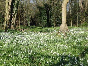
Tomorrow we leave for Rye and the day after that we meet, for the first time, our forum friend from the U.S.A. – Marie. After that anything could happen.  I am hoping that when the hotel says it has Internet access it actually works. We shall see. If it does work I'm hoping to update this report on the day that we arrive and, subsequently, on other days. When I got up this morning it was snowing hard and continued like that for a few hours but, I'm glad to be able to report, it has now stopped and what snow there was on the ground has melted. The weather forecast for tomorrow is sleet with sunny intervals and for Tuesday and Wednesday it's light rain. With weather at this time of year anything could happen.
  Watch this space!
================================
Well, Ok, it didn't happen – the blog posting I mean not the trip. It turned out that because we had so much to do the only time I would have had to write the blog would have been late after dinner in the evening and, to be quite honest, I really didn't feel like it. However, here is the report a little late.
The Rye Trip Day 1 – Monday (Rye)
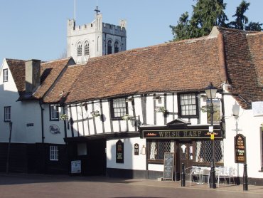
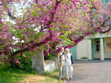
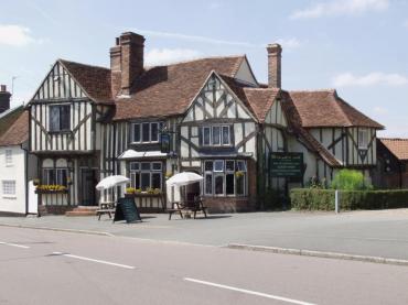
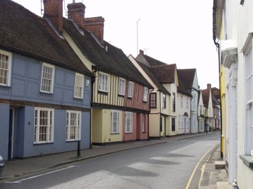
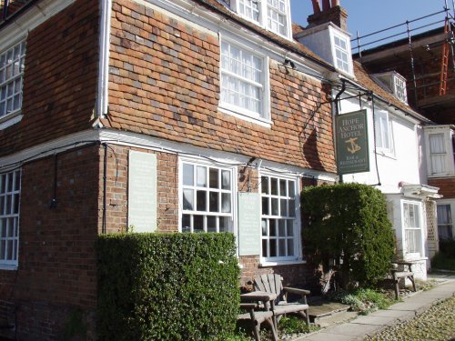
We arrived in Rye, after an uneventful 2 hour drive, at about lunchtime. Driving through the narrow, cobbled streets around Church Square and into Watchbell Street, where our hotel was, was fun! The streets are not wide enough for two cars to pass and some of the corners were pretty tight but we got there. Our hotel was very nice and rather quaint. This shows the side of the hotel in Watchbell Street.
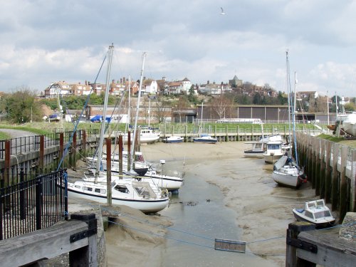
This part of Rye is on the top of the old sea cliff and gives a super view over the harbour and marshes. This view of the hotel is from the bottom of the cliff near the harbour.

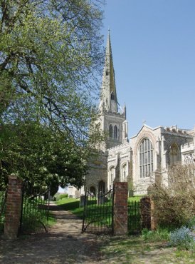
This last picture, taken from the bridge on the Rye Harbour road, gives an overall view of the town on the hill with the church tower and spire showing on the right-hand side and our hotel is the building on the extreme left.
We had lunch in the hotel and afterwards went for a walk around the town. The weather was a bit cloudy with some sun but there was a very cold wind. We didn't stay out for long because it felt so chilly and went back to the hotel to organise our belongings and prepare for dinner. Tomorrow, Tuesday, we plan to go to Hastings Old Town by bus and meet up with Marie on our return.
Day 2 – Tuesday (Hastings)
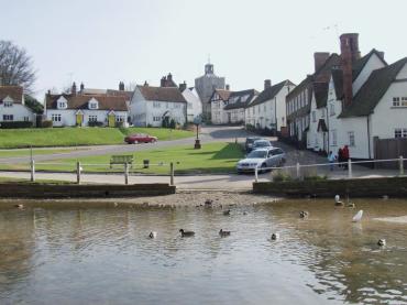
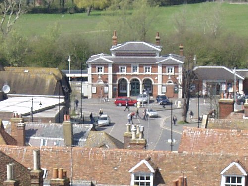
The day dawned with a cloudless sky, not that I was awake at dawn to see it, and as there was no wind it felt a lot warmer altogether. We had breakfast and, as we were planning to go by bus, collected our rucksacks with clothing for all eventualities. We caught the number 100 bus outside Rye Railway Station. The bus stops are arranged in laybys either side of the road running toward the camera with the station at the back and you can see part of the layby on the right-hand side where we caught our bus.
This bus starts from Dover goes through Folkestone to Rye then onward to Hastings where it terminates. It is a double decker so, on those narrow little roads, it sometimes felt like riding in a small house. The bus journey took about 40 minutes and we got off in Hastings Old Town. The first building we saw looked very interesting and was a hint of things to come.

The road the bus used through the old town was a fairly ordinary town road but the streets we wanted to see run off to each side of this. Just opposite us was a narrow interesting looking little lane which we followed and came out in the High Street.

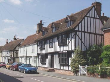
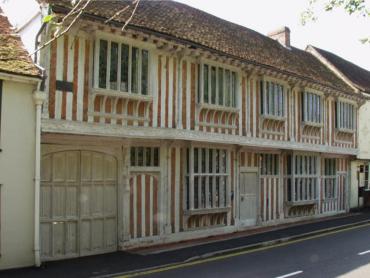
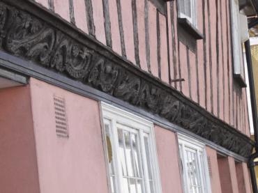
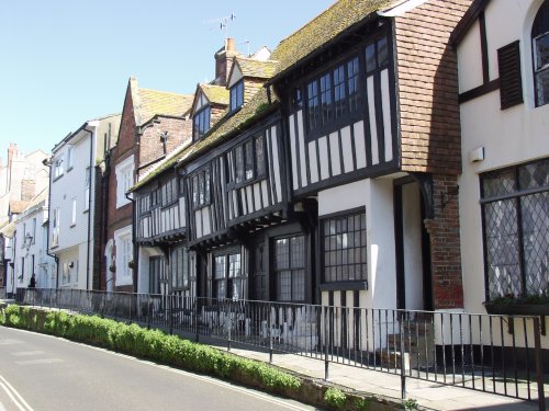
What a fascinating and picturesque street this is with it's ancient buildings and high pavement which runs for quite a long way. You can see on the right of the picture where some steps take the pavement up to an even higher level. I don't know the reason for this, especially as it occurs only on one side of the street, but I would like to find out. This is All Saints Street which runs parallel to High Street but on the opposite side of the bus route. Here the pavement is returning to around road level and there are still plenty of ancient timber-framed houses along here.
There are lots of narrow side alleys which connect these various streets which are great fun to explore. Here is an example.

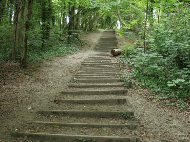
You should be able to see, in the dark patch ahead, a small slit of light which is where the alley goes through the houses and continues on. We found many others like this, all different, but then spotted one with a sign pointing to 'The Castle and Caves' so, of course, we had to follow it.

This eventually, after a bit of a steep climb, came out onto a large open grass area with amazing views over the old town. This is West Hill.

The view above is looking across the old town to East Hill which we climbed up later. We found the ruins of Hastings Castle on the top of West Hill. There is not an awful lot of it left but what does remain is interesting. There are some old dungeons cut into the sandstone below the castle and they are so confined that a photograph would have shown very little so I didn't take any down there but I did take some of the ruins.

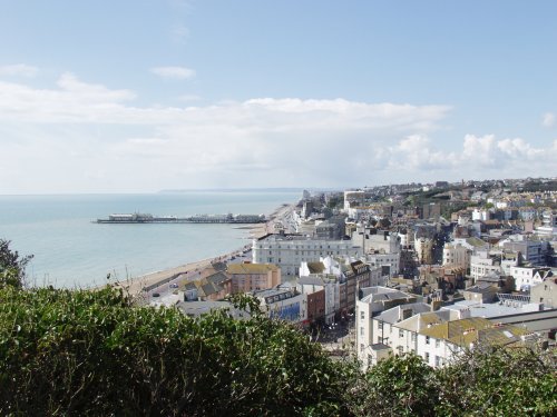
This view is of the modern part of Hastings which is on the west side of West Hill. Just to try and make things clearer – first when coming from the east is the high ground of East Hill then the valley with Hastings Old Town in it. Next is the high ground of West Hill with the castle and caves and finally beyond and below West Hill is the newer part of Hastings including the pier. This is what you see from the castle.
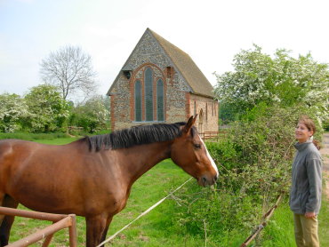
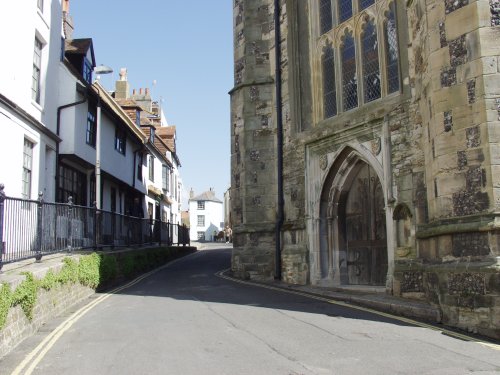
There is a cafe on West Hill where we had lunch before returning to Hastings Old Town. On the way down to the High Street we came across this narrow road by an old chuch.
Yes cars can drive through there but only just. Notice those high pavements again. Having reached sea level once again we climbed up East Hill using the steps which climb next to the funicular which, incidentally, was undergoing maintenance and so was not in use.

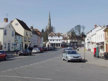
Lets face it – if you want to go anywhere in the old town you go either up or down. Level? What's that? After coming down from East Hill it was time to catch the bus back to Rye and while we were walking to the bus stop my mobile 'phone rang and it was Marie to say that she had arrived. We got off the bus outside the Railway Station and walked along to the 15th century cottage that Marie was renting for a week. Marie invited us in and we spent about an hour chatting before returning to our hotel. We had arranged for Marie to come up to the hotel the following morning when we planned to drive to Bodiam Castle, Battle Abbey and Birling Gap. The saga continues on Wednesday.
Day 3 – Wednesday – The three 'B's (Bodiam, Battle and Birling Gap)
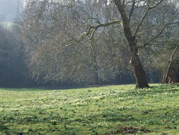
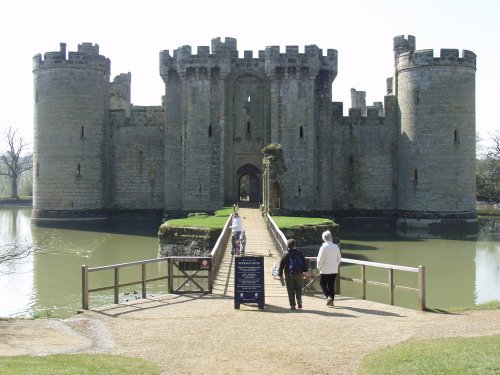
I forgot to mention in the previous section that the many little alleyways in Hastings Old Town are known as Twittens. This is an Anglo Saxon word related to the German Twiete meaning a narrow lane. The old English plural 'en' at the end of a word rather than 's' probably means that Twitten is actually a plural i.e. 'lanes'. However, back to the saga. Marie came up to the hotel whilst we were having breakfast and had a cup of tea with us until we had finished our breakfast. I gather she's a bit of an early bird and gets up at a time I would regard as the middle of the night. We set off for Bodiam spotting wild flowers (Wood Anemones and Bluebells) as we drove through the countryside and arrived at Bodiam Castle at just about opening time, parked the car, and walked to the castle. What a picturesque setting and with a cloudless sky!

We had to walk round the moat to the other side which is where the very impressive entrance was. This picture shows the bridge across the moat and Amanda and Marie about to step on it.
We had a look in one of the towers where the wooden floors no longer exist and so it's not possible to go up.
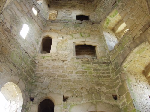
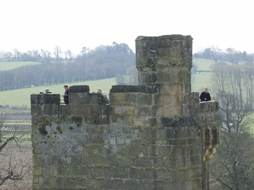
After a bit more wandering about we found the way to the really interesting bits – the top of the two towers where visitors can get access.

Medieval spiral stone stairways are definitely not built for two-way traffic. Before starting up it's advisable to listen for people coming down and vice versa. In spite of her dodgy knee Marie was hopping up and down the stairways like a good'un. This picture, taken from 'our' tower, shows people on another tower – just like us. We later went up that one too.
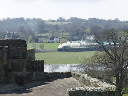
Good views from up there over the surrounding countryside especially if a steam train just happens to be passing.
And in the other direction we could see what appeared to be a Hop field complete with Oast Houses.

Then in the 'other' direction i.e. down, we could see the layout of the inside of the castle although I wasn't able to include it all.
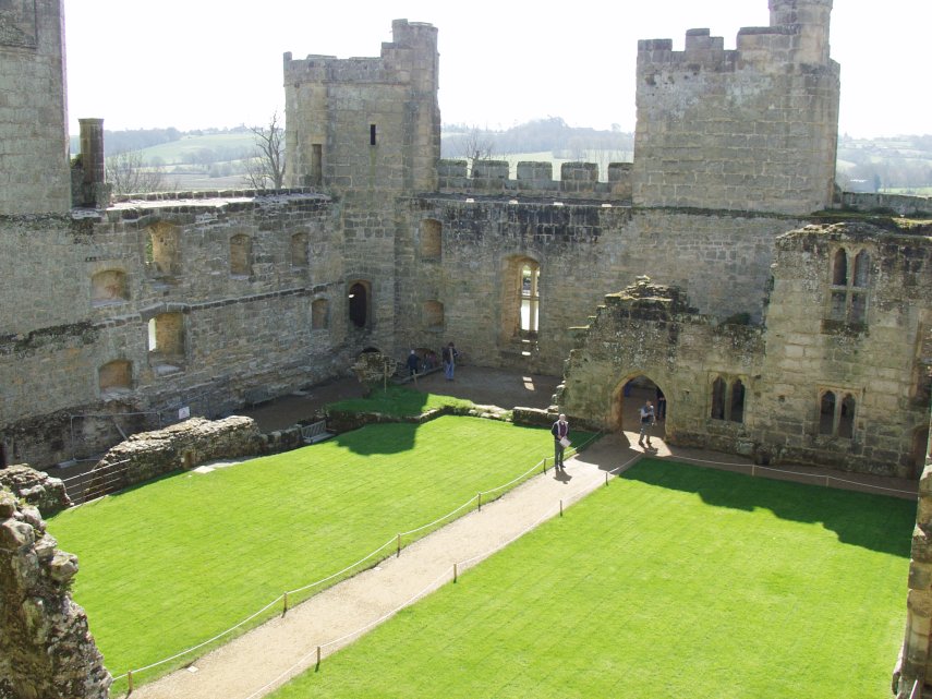
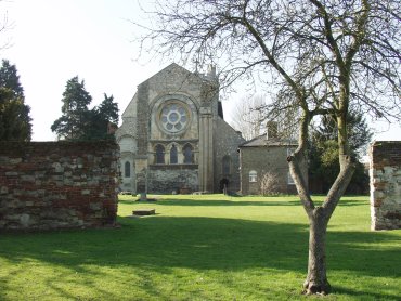
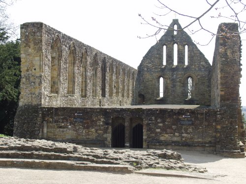
The doorway on the path is the entrance from the bridge over the moat. It appears that they weren't all that primitive in those days when it came to creature comforts. In many of the rooms we saw there would be another little room off to one side which inevitably turned out to be a Garderobe (Toilet). I even volunteered to photograph one of the ladies sitting on one but they both declined. Perhaps that's what is known as 'toilet humour'? That is where we leave Bodiam Castle and sally forth to Battle (so to speak). It was but a short drive to Battle and we soon found the Abbey and parked in their own car park which, at £3.00 a go, I thought was a bit steep. Quite by chance it turned out that we didn't have to pay – but more of that when we've finished our visit. The main abbey gatehouse is probably the most complete building left in the abbey and does look quite impressive.

There are other ruined buildings botted about the place of which this is but one:
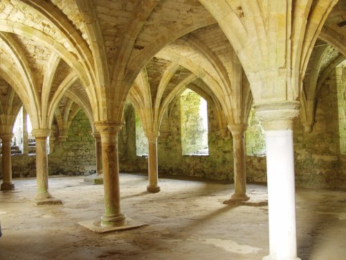
It's always worth hunting around for the odd doorway or two because one never knows where it may lead and the most interesting part of this building is not what you can see from here but what is underneath:
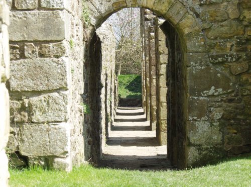
At the far end of this building I found this interesting little view. I don't remember what it was but I believe Marie found out at the time and if she can remember perhaps she will jog my memory.
This part of the abbey was next to the original battlefield which is just over the fence to the left where there are 'battle walks'.
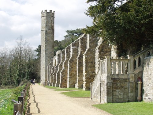
Finally the whole abbey complex used to be surrounded by a substantial wall complete with walkway.
Having finished our tour we went back to the car. In this car park there is an automatic barrier at the exit where one is supposed to pay however when it was time to leave there was a car parked on the outside of the barrier which was down. There was a lady talking to one of the English Heritage staff and another lady sitting inside the barrier on the kerb. There must have been some sort of problem/incident although I don't know what it was but another member of staff was waving cars out of the 'in' gate so we didn't have to pay. This part of Battle village I saw through one of the gatehouse windows:
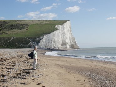
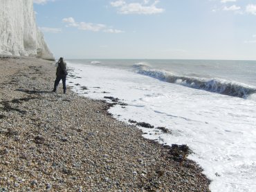
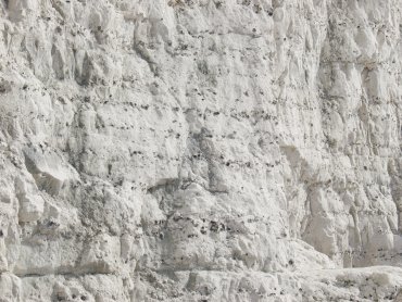
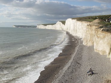
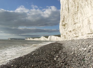
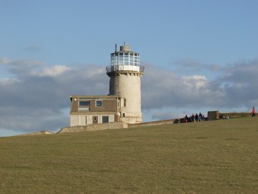
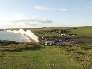
Just outside Battle Abbey was a small teashop which provided us with a lunch stop after which we moved on to Birling Gap and the white chalk cliffs. Amanda was doing the map reading and navigating and we discovered that at Polegate, only a few miles from Birling Gap, some swine had changed the road layout and it no longer matched our map. Howver after a short circular tour we did get back on the right road and arrived at Birling Gap. There is a set of steps here to get down the relatively low point in the cliffs to the beach. We have been here before, of course, and there are pictures on the main web site to prove it. This time we were here so that Marie could see the white cliffs. We walked east along the beach to where the cliffs started to get higher and let Marie have a close look at the stuff. These chalk cliffs are rather friable and bits, large and small, can fall off at any time but they didn't, I'm glad to say, whilst we were there. We went back up the steps and walked on top of the cliffs for a while getting a good view of Birling Gap from the higher ground.

Our car was parked down there somewhere and so, after an enjoyable day, we made our way back to the car and thence back to Rye. So that was Wednesday. Tomorrow, Thursday, will be our last day together as we leave both Rye and Marie on Friday morning. The saga continues on Thursday.
Day 4 – Thursday (Camber Castle and Rye)
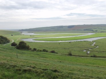
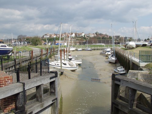
Thursday morning and it was dry, bright but cloudy. After breakfast Amanda and I walked down to Marie's cottage and the three of us set off through the town for Romney Marsh and Camber castle. This involved following the Winchelsea Road for a short distance and turning down Rye Harbour Road, across the River Brede at the lock gates and onto the public footpath across the marsh. This shows the view back to Rye from that bridge over the river and you can even see part of the lock gates.
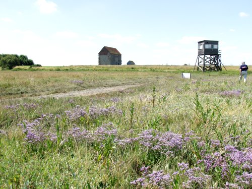
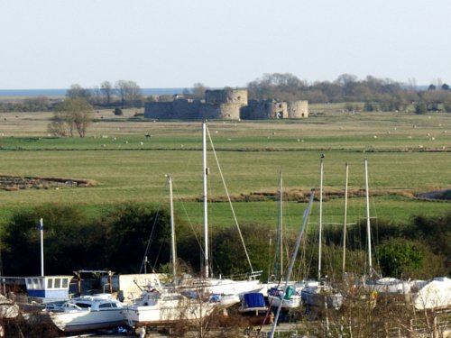
It wasn't long before we could see Camber Castle in the distance – it is pancake flat out here after all. This castle was built by Henry VIII – well he didn't actually build it himself but paid other people to do it for him. It was original very close to the shoreline but a few hundred years later it was abandoned because the sea had receded so far. It is probably around one and a half miles inland now. This picture was taken from our hotel window.
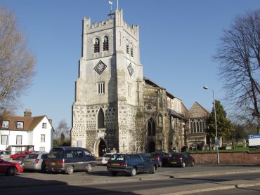
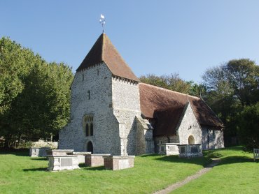
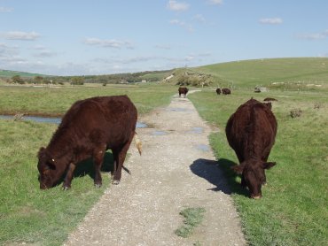
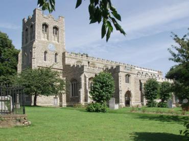
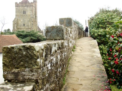
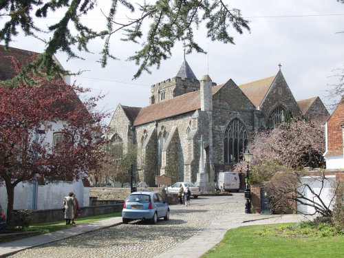
More pictures of Camber Castle can be seen on the Rye pages from our previous trip. After wandering around the castle we continued on a circular route back to rye passing many sheep and lambs and back in Rye we headed for the lunch shop. After lunch we continued our explorations of Rye and ended up at the church. This is the church seen from near the Ypres Tower.
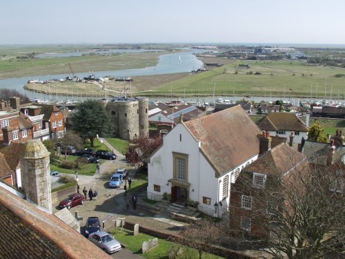
I threatened to go up the tower as the sun was shining and the last time I went up and took some photographs it was cloudy. Marie decided she didn't want to struggle up more steps but when I decided I was going up she just didn't want to be left out of the adventure and changed her mind and so we all went up. This is one of the views from the top showing the Ypres Tower down below and the view across the marshes towards the sea.
After coming back down to earth we took Marie along to see the Ypres Tower.
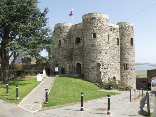
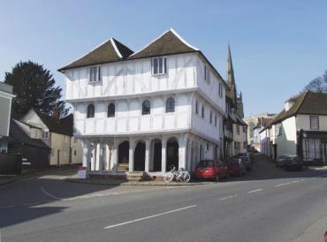
Built in 1249 this tower is one of Rye's oldest buildings. Going down some steps to the street below we somehow ended up by the Strand Quay and all the antique shops – I'm not sure how I let that happen. Do I need to say that Amanda and Marie disappeared inside pronto? No of course I don't. When they did re-appear some days later we went back to the hotel. At about 6:00 PM Marie went off to her cottage and we prepared for dinner. Tomorrow we say goodbye to Rye and Marie.
Day 5 – Friday Marie came up to the hotel this morning and had a cup of tea with us at breakfast. She was all togged up for her planned walk to Winchelsea. After breakfast we, reluctantly, said goodbye to Marie and she then went off to start her walk and we did all our packing, loaded the car and had a relatively straightforward trip home. Can't wait for the next trip.