Browsed by
Tag: Architecture

The Sky Indoors.

The Sky Indoors.

Recently we drove to Bromfield with the intention of walking to Ludlow and discovered that Bromfield had a few surprises up its sleeve.

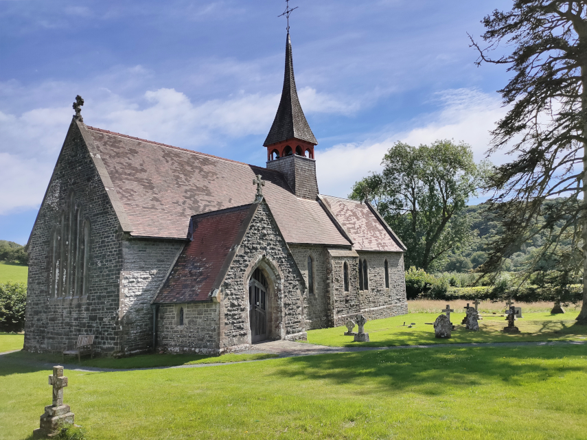
We first went to see the church and the entrance to the churchyard is through a delightful Lych Gate.

This was a priory church rebuilt in the 12th century. We walked through the churchyard and entered the church, shut the door behind us, and turned around. That was when we had a big surprise.

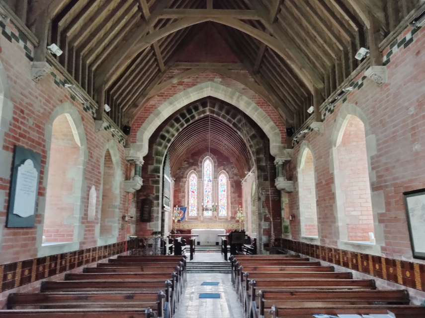
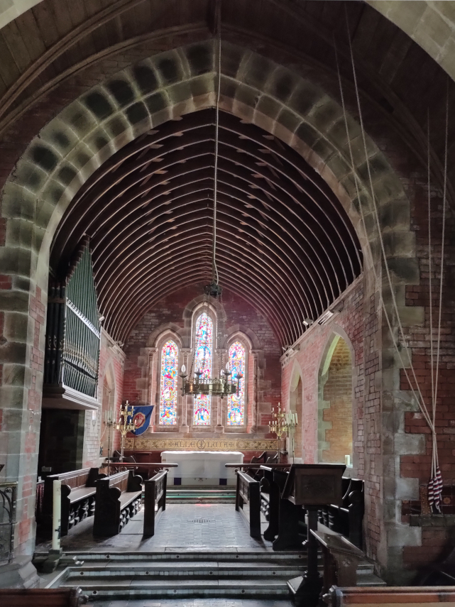
Wow! What a sight. The ceiling of the Chancel was painted in 1672 and the Reredos was painted in 1880. Standing underneath the Chancel ceiling is like looking up into the sky. The number of times we have passed through Bromfield and we had no idea what we were missing.

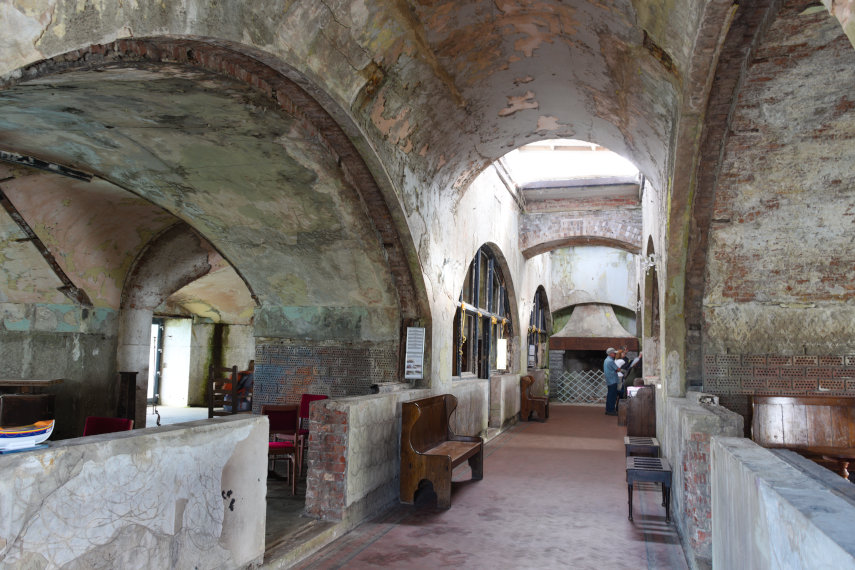
Following the Dissolution of the Monasteries in 1541 the church and priory were leased to Charles Foxe, who then purchased the property in 1558. He converted parts of the church into a house but in the 17th century the house was damaged by fire, and Foxe’s descendants moved away.

The remains of Foxe’s house are still present, attached to the south side of the church.

Next to the church is the medieval timber-framed gatehouse to the priory now owned by the Landmark Trust and let as a holiday property.

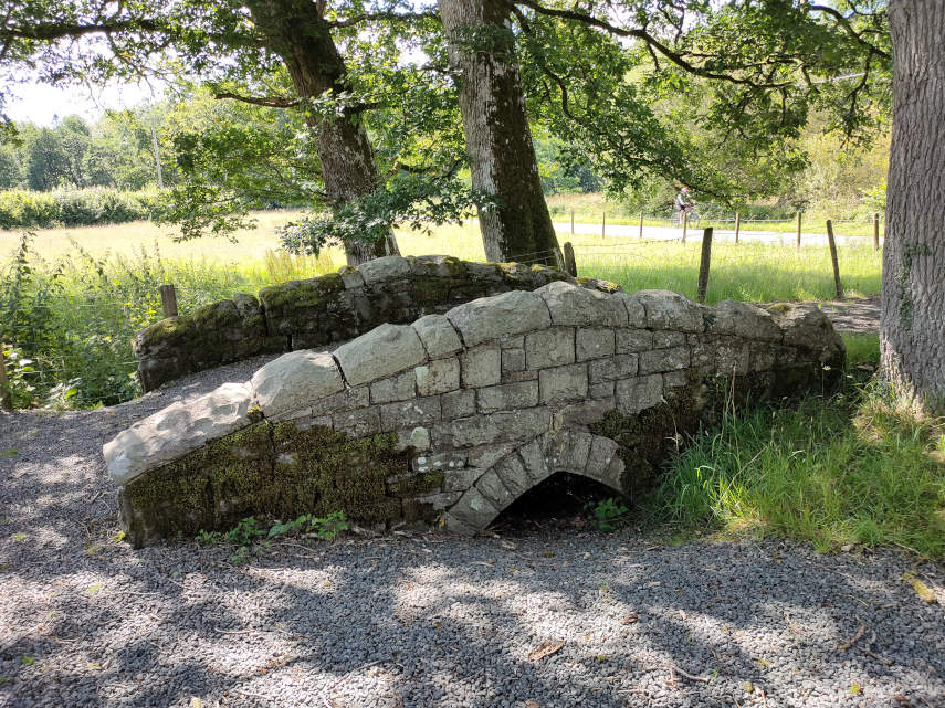
We started off along the footpath towards Ludlow but hadn’t gone very far when we came across this old mill.

It is, apparently, a water powered corn mill, dating from the mid 1800s, although the water wheel is now missing.

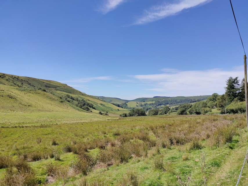
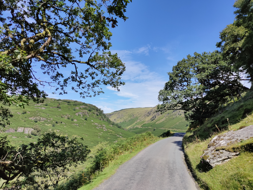
We continued our walk following a tarmac lane through a private estate, although the lane was a public footpath, with some nice views.

After about a mile we branched left across a potato field (yes, I know, we do all the really exciting stuff).

This section eventually led us to a very large cornfield and it was here that I started to feel a little unwell and reached the point where I decided to lay down in the corn before I fell down. I have to admit that I had two cups of coffee after getting up but nothing to eat at all. A contributing factor perhaps?

I felt a bit better after a while so we continued for at least another mile when we arrived at Dinham Bridge.

We still had to walk up into town, I still felt somewhat fragile, so we continued (no other choice really) and eventually arrived in Castle Square.

After having some lunch I was back to normal (which isn’t saying much). Draw your own conclusions.

We caught a bus back to Bromfield where we’d left the car.

A Hole New Adventure 1

A Hole New Adventure 1

We decided on a trip to the Yorkshire Dales in October and the theme turned out to be a little unusual.

Day 1 – Getting there.

It was a rather long drive for us of about four hours so we decided to break the outward trip into two segments with a stop about 4.5 miles south-west of Congleton, Cheshire at Little Moreton Hall. This is a National Trust property and a stunning one at that.

The people that built this were obviously working on the premise “If you’ve got it, flaunt it.”

The first part of this building was built between 1504 and 1508 the Long Gallery on the top floor was added later. You may notice that the Hall is rather wonky. That is probably because the original foundations were not designed to cope with the additional weight of the Long Gallery extension.

The house is surrounded by a moat.

One of the many interesting features of this house is this conjunction of these three staircases as, at first glance, it rather boggles the mind but, with care, it can be visually sorted out.

One of the other main features is, of course, the Long Gallery on the top floor which was added about 1554. The last major extension was added in 1610.

This is a truly astonishing building and more detail is available on the main web site.

We then drove on to Settle in the Yorkshire Dales which was to be our base on this trip.

What a carry on!

What a carry on!

We had to go to Ludlow recently and Amanda wanted to see what Christmas Cards were available in the parish church. We have been to this church before and it is featured on the web site in the Ludlow pages. However on our last visit I posted only one picture of the Misericords in the Quire so I thought that I would improve upon that this time.

The Church of St. Laurence in Ludlow is the largest parish church in Shropshire and the photograph below gives an idea of its size looking along the Nave, through the crossing and Quire to the East Window. It is, basically, huge! Walking around this church is like walking around a cathedral.

The Crossing looks very impressive as one passes under it to reach the Quire and the tower is 157 feet high and was rebuilt between 1433 and 1471.

After passing through the Crossing we reach the Quire entrance which, itself, is pretty impressive.

The Quire has stalls along each side which is where one will find the Misericords.

Misericords, as you will know, are small folding seats, just a simple flap of wood that folds down, and there are 28 of them of which there is a good sample below. Each one has carving on the underside and they are 26 inches long, 12 inches deep and 6 inches thick. 16 of the misericords are older than the rest dating from around 1425. Eight have an unusual carvers mark in the form of an uprooted plant and a distinctive profile to the moulding running round the edge of the corbel. The remainder were carved around 1447.

Finally we get to the title of this piece. There used to be a phrase ‘What a carry on’, used in the vernacular, which was used to describe a commotion or loud noise and this is where the gadget below becomes relevant. It is a Carillon which is a device for automatically ringing the church bells and, as it is french, the pronunciation is very similar to ‘Carry On’ which is what the ordinary people thought it was. The carillon consists of a huge wrought iron cylinder which is turned by the church clock mechanism and the projecting pins cause hammers to strike the church bells rather like a giant music box. It has been used in this church since 1683.

Well, that was an interesting visit and Amanda did get her Christmas Cards.

On the road to nowhere

On the road to nowhere

In April 2017 we traversed the Cambrian Mountains, on our way to Devil’s Bridge, on one of only two roads which go over the Cambrian Mountains. This is the blog that covers that trip. https://www.beenthere-donethat.org.uk/deoprrssw/?p=2428

We now decided that it was time to explore that second road. We weren’t going to a particular destination but purely to see what that road was like (Have you ever had a premonition that you are about to make a mistake?).

We headed off, on a warm sunny day, towards Beulah. Yes, I know, you’ve never heard of it. Well it’s a small village about 8 miles south-west of Newbridge-on-Wye in Powys. This is where the mountain road starts and having turned on to it, and before we’d left Beulah, we spotted a nice little church which we had to explore. The original path into the churchyard went over this cute little bridge but the current path bypasses the bridge.

And this is the little church. It is not very old, having been built in 1867, but it is very attractive.

Having had a quick look round ( what else can you do with a church that small?) we set off again along the road. This road is just one car’s width and does have passing places but you can bet that you won’t be near one when you meet a car coming the other way.

The first part of this road is mainly wooded but eventually after a gentle climb of some miles we came out into the open. We continue to head upwards through that valley round to the left.

We carried on to the village of Abergwesyn where we’d heard there was a ruined church. We couldn’t find the ruined church, if it still exists, but we did find the old churchyard with a mega Yew tree.

We carried on and soon went into another wooded section of the road with an unprotected steep slope on one side. No barrier to stop you driving off the edge and you do have to drive relatively near the edge because the road is so narrow.

I was quite pleased when that was over. Next we reached the Devil’s Staircase – a steep bit of read with some hairpin bends. The name is more worrying than the actual road and we successfully negotiated that section without problems. We reached another open area and we are still climbing but the views were getting better.

The road was beginning to get interesting now. It was bending in three dimensions and they tended to be sharp bends. When the bend was in the vertical plane the road beyond the top of the hill couldn’t be seen until the car was beginning to tip down the other side so one couldn’t see which way the road was going to go and there was always the possibility of a car coming the other way. Travelling was slow and if there was a short stretch where one could attain 20 MPH then that would be considered very fortunate. The same applied to bends in the horizontal plane – it meant driving really quite slowly. Don’t pick an argument with a rock – you won’t win.

Having reached the top we took a 7 mile detour to have a look at a reservoir we had heard about, Llyn Brianne, and it turned out to be a worthwhile detour. But it certainly increased our bend count.

Our road was now going downhill again but the bends didn’t get any better.

We finally reached the end of the road in a small town called Tregaron which was a relief from the bends – but not for long. We now had to return home which meant travelling the same route in the opposite direction. I was really looking forward to doing all those bends again. :(

I can tell you that by the time we reached Beulah again I was rather tired and we still had an hour to go to reach home. However we did reach home without incident and I don’t intend doing that journey again in a hurry!

A Knighton walk – what a rush!

A Knighton walk – what a rush!

It was nice and sunny this morning with the forecast that it would cloud up around lunchtime so we decided on a little walk before that happened. It was cool with a cold wind but still pleasant enough.

We left our house and went via the secret path (I’m not telling you where that is because it’s secret) onto Larkey Lane and thence to Ffrydd Road where we turned right, away from the town. After a short walk we turned up the little lane that goes up to Knighton Golf Course but only for a few yards when we turned right along a public footpath through Great Ffrydd Wood.

That’s when we encountered the rush. Wood Rush in fact. All that ‘grass’ in the picture below isn’t – it’s all Wood Rush.

In the next two pictures you can see the flower heads lit up in the sun.

We followed the current path to a point where it doubles back the way we came but traverses diagonally uphill. At this point we hopped over a stile into a field to try and photograph the Victorian Elan Aqueduct which used to carry carry water from the Elan Valley in Wales to Birmingham. The aqueduct, built in 1896, is difficult to see because of so many surrounding trees and in these next views one of the arches is visible plus part of the horizontal stone structure.

We then went back on to the path through Great Ffrydd Wood and continued uphill. It is a pleasant but long and winding path through the wood and eventually leads back onto the Knighton Golf Course road which, incedentally,is a private road but is also a public right of way.

We finally emerged onto open ground above Knighton. The far hill in the top picture is Kinsley Wood and the open ground on the very left is Panpunton Hill.

The next view, from the same viewpoint is of the Teme Valley running toward Ludlow. The red tree at the foot of the slope appears in both pictures.

Finally a rather nice view of St. Edwards Church, Knighton. This is a Victorian Gothic rebuilding of an earlier church of which the medieval west tower is the only surviving part.

That was the end point of our little walk so we went home.

Judge for yourself.

Judge for yourself.

Yesterday we went to Presteigne a small market town about 10 miles from us. We also went there back in the summer and photographed this ochre coloured building which is known as “The Judges Lodging”.

It is open as a tourist attraction and entry is by payment of a small fee. However this Saturday was an open day (free entry) and there was also coffee and cake available at a very modest cost and if there is anything that will pique my interest it’s the availability of cake.

This building consisted of a police station, cells, court room and judges apartment all rolled into one and was built in 1829. It was once called ‘the most commodious and elegant apartments for a judge in all England and Wales’ by Lord Chief Justice Campbell in 1855).

We first visited the Dining Room because of its opulence and splendour (or was it because that’s where we were given coffee and cake?)

After finishing our refreshments we went through to the Parlour (literal meaning – talking place) where there was a large christmas tree. There were no christmas tree lights because they did not exist in Victorian times. In both these rooms there were proper wood fires burning in the fireplaces; vey cosy. All lighting was either by oil lamps or gas and this building has both.

After seeing these rooms we went upstairs and the decor in the stairwell was typical of the times.

Needless to say the bedroom was furnished as befits a judge.

This was, after all, a place of work and this shows the court room with the public stalls right at the back. The judge, naturally, had his own entrance direct from his lodgings.

After dark the court room was lit by gas and the next picture shows the ‘Gasolier’; rather like a chandelier but with gas instead of candles. At this time incandescent gas mantles hadn’t been invented so the light came solely from the flames and I can tell you that that makes it very uncomfortable because the flickering flames act almost like a stroboscope.

The servants quarters were in the rather dingy basement together with some cells for the prisoners.

I have not included all that we saw here but more will make its way onto the web site at some stage. It was a very interesting visit.

Sun, Sea and Sand – Day Two

Sun, Sea and Sand – Day Two

That is the view from our hotel room this morning and it’s a beautiful start to a beautiful day. This is the outside of our hotel,

this is the inside of our room

and this is part of the hotel’s gardens which go down to the beach.

We were on our way into the town once again but we weren’t going via the beach mainly because the tide is only now going out and I think our passage along the beach would be blocked by the sea until later. This next view is a short way along the road from the hotel. You can see that the tide is still relatively high and that lump of rock from yesterday is showing on the right.

On our way we went past yet another of Tenby’s interesting narrow lanes.

We were on our way to see the ancient medieval town walls. Not all of the wall remains but there are some remaining substantial sections of which this is one. Couldn’t really miss it could you?

These next two pictures show one of the old town gates – first from the outside and then from the inside.

This gate looks heavily fortified to me. I wonder who they were expecting. We soon found ourselves walking along yet another of those attractive narrow lanes.

We were heading for Castle Hill and, as it is a relatively large lump, we thought that it would be obvious but it was so well masked by the surrounding buildings that we had to resort to looking at the map. That put us on the right road.

Here you can see Amanda staggering up the hill. That doesn’t imply that I wasn’t staggering it’s just that I was staggering slightly faster than she was.

Well here we are at the top showing the only remaining tower of the medieval castle, the cannon trained at the French coast and a rather good view of the town.

Our next target was St. Catherine’s Island. It’s an island only at high tide but now the tide was out enough for us to walk across the beach to reach it. That tower on the left in the picture below is part of the old town walls.

One does have to pay a small entrance fee but we thought it would be worth it so we set off passing through this archway, a remnant of the old town wall, to reach the beach.

We paid our fee to a young lady on the beach at the foot of the stairway that gives access to the island and started up the steps.

Then along a short path.

At the end of that path we have to cross a small bridge over a chasm in the rock and Amanda couldn’t help bragging by stopping above the chasm to have her photograph taken.

We did get to the top and found this rather large Victorian fort built to counter a perceived threat of invasion by Napoleon.

We left the fort and St. Catherine’s Island and decided that that was the end of our day so we went back to the hotel.