Browsed by
Tag: Rivers

A Grave Incident

A Grave Incident

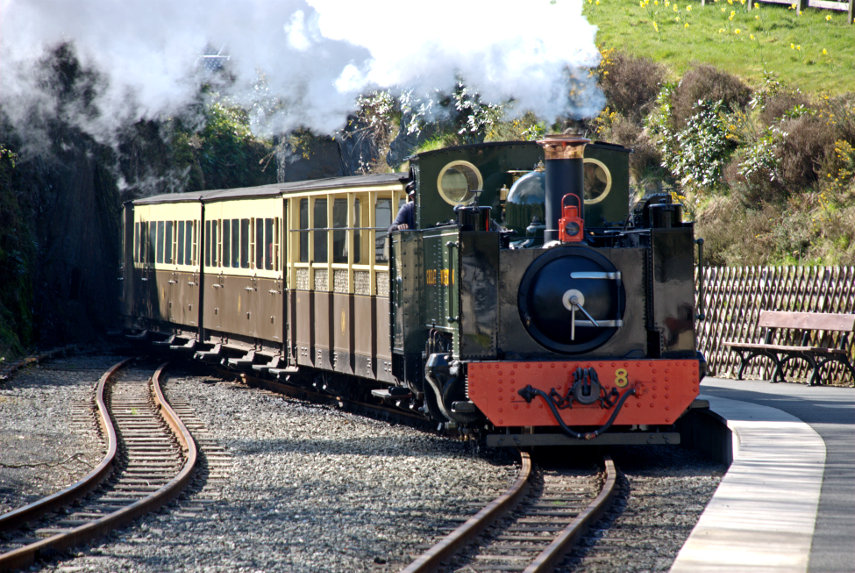
Today was forecast to have sunny intervals. I'm hoping that at least one of those intervals will be longer than 5 seconds as we have decided to re-visit Shrewsbury using our little train.

We came out of Shrewsbury Station and up some steps on to a high level walkway which took us over the railway and down to The Dana. The Dana is an old prison dating from medieval times although the medieval building is long gone.

There has been a prison on the site since 1793, the original building being constructed by Thomas Telford, although the present prison was constructed in 1877. The name 'Dana' is still often used for the prison, as well as being the name of the road to one side of the prison and the pedestrian route that runs from near the front of the prison into the town centre via a footbridge over the station which is the route we used but in reverse.

There are prison tours available but we didn't avail ourselves of that option but opted to walk onward. We made our way down to the River Severn and walked along the riverside path away from the town centre. There was supposed to be some sort of weir further down river so we though we'd have a look at it.

As we walked along we could hear a background noise which we decided might be the weir. Perhaps bigger than we though then! As we progressed the noise became louder and when we reached the weir we could see why. It was bigger than we thought.

I wouldn't like to go over that in a small boat.

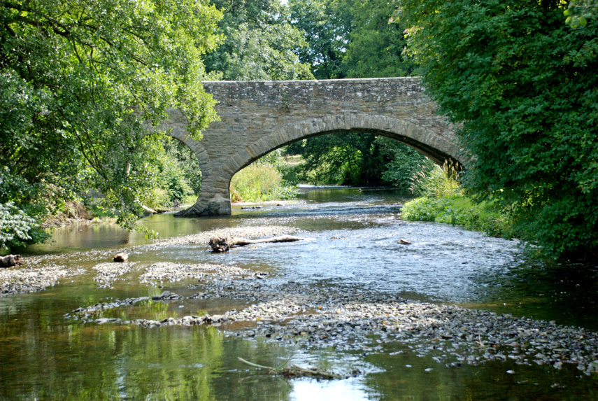
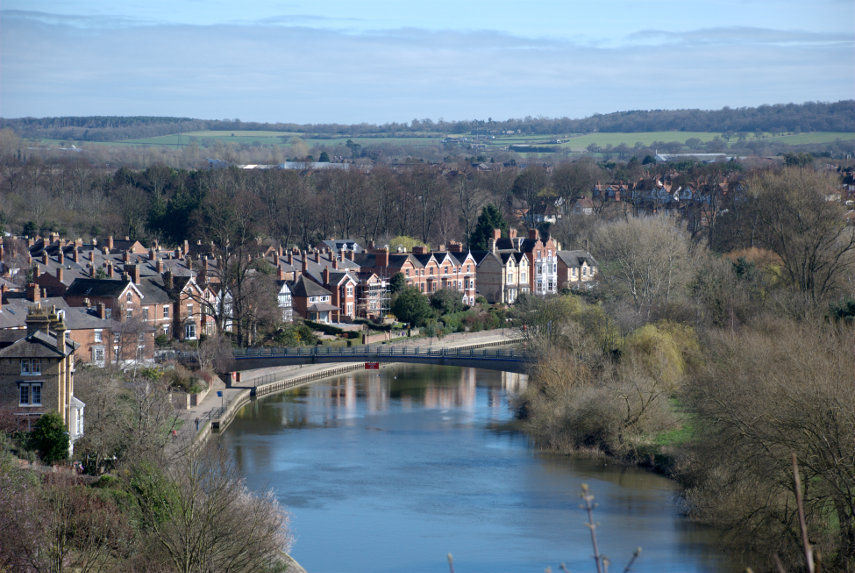
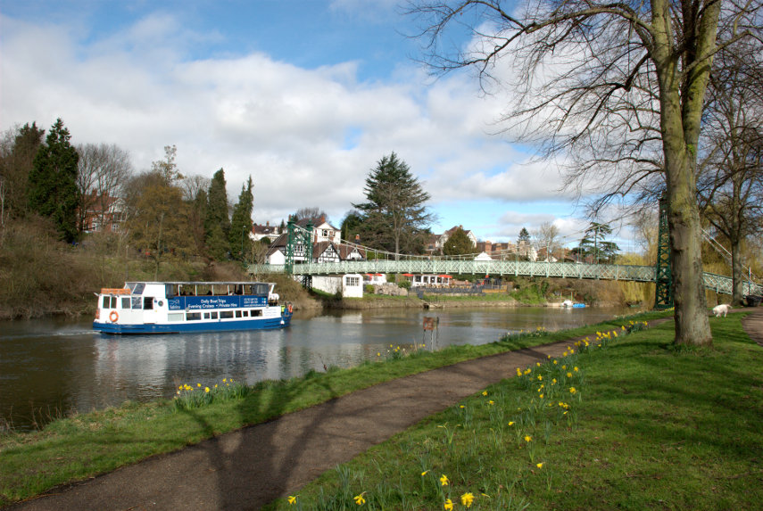
We turned round and walked back towards the town. When we reached the footbridge shown in the next picture we went up onto it and looked down river. We could just see the change in texture of the water surface which indicated where the weir was. You can probably see it more easily in the larger version of the second picture.

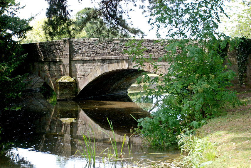
We walked along the riverside until we reached the next road bridge over the river. One thing I noticed immediately was that there were trees growing out of the water like the one on the left. Amanda tells me that it is a Willow and that it is not unusual for a piece of willow to float down stream and get stuck in the mud where it promptly takes root. So now you can see the result.

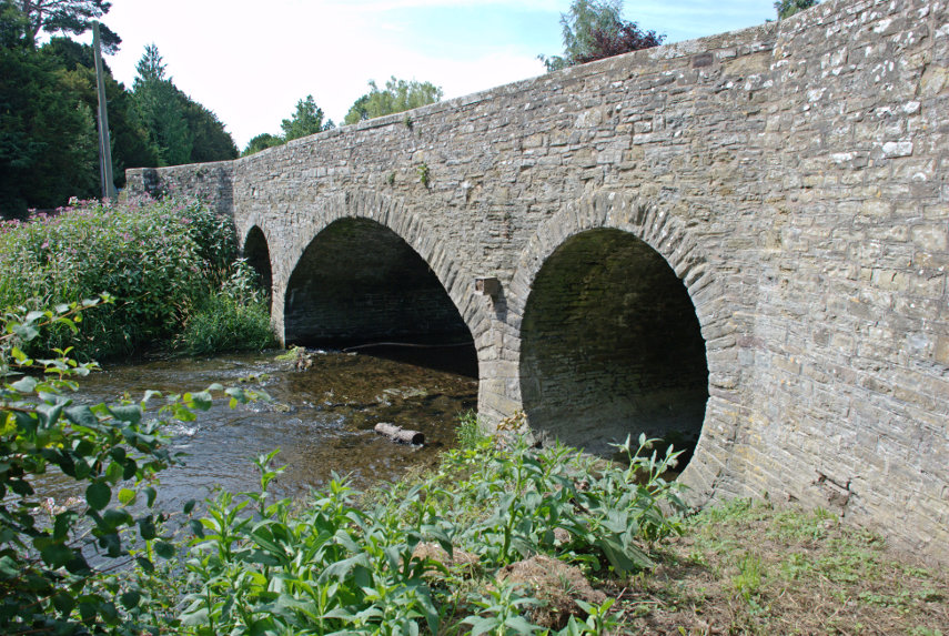
I also took this next photograph of the same bridge because I rather like the effect the low sun was procucing as it shone through the arches. I imagine it's being reflected off the water.

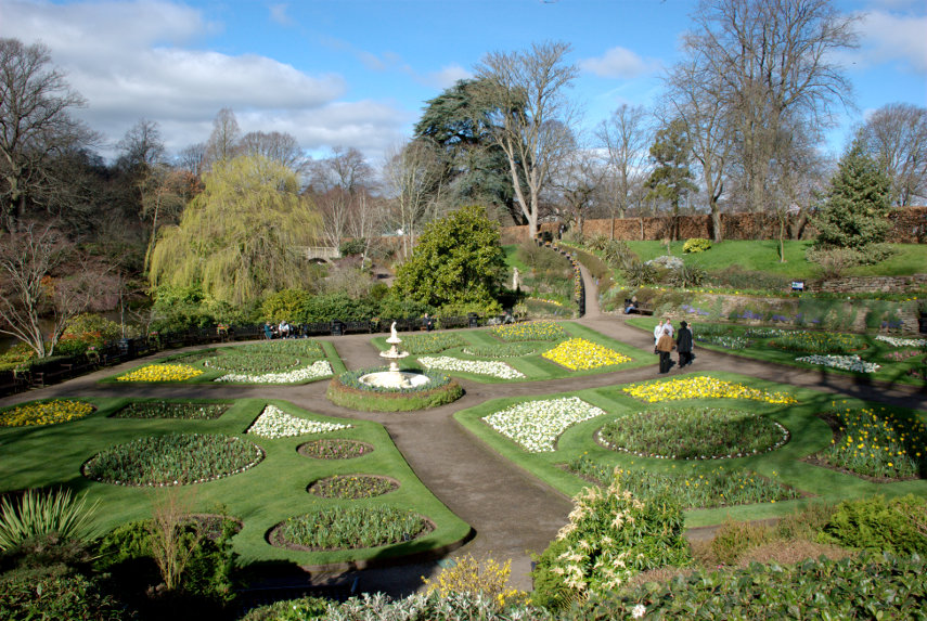
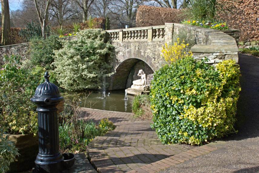
We continued walking and eventually reached the lower edge of the large park known as The Quarry which we visited on our previous trip. The riverside walk looked really nice in the sunlight.

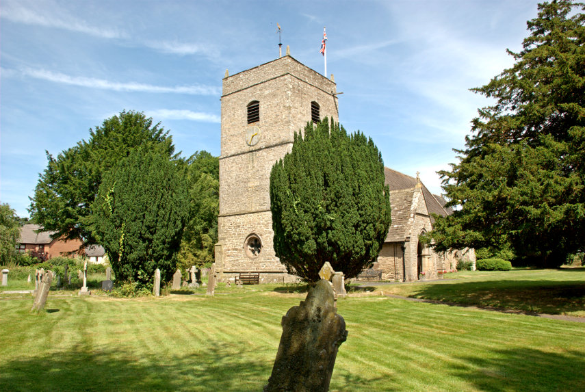
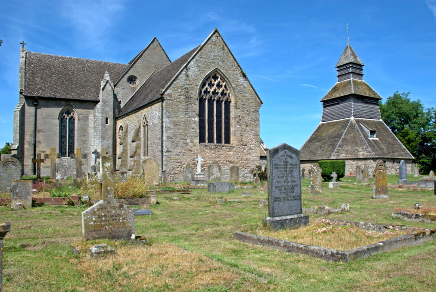
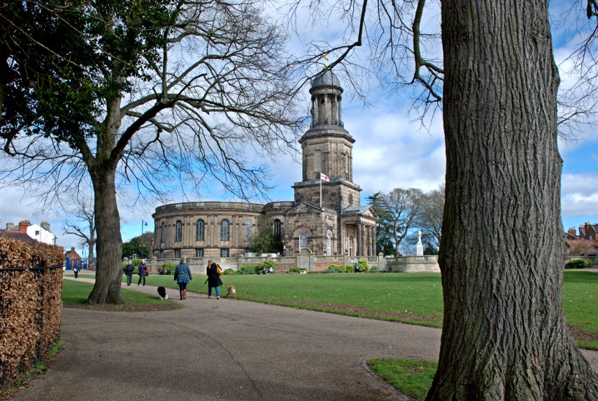
At the top edge of the park is St. Chads Church which I also mentioned in the blog post of our previous trip ( Sun, Signals and Sabrina ) when I wrote:

"I was hoping to get a photograph of Ebeneezer Scrooge's gravestone in the churchyard but we couldn't find it. Yes we know that Scrooge was a fictional character but the churchyard was used in the making of the film and the gravestone was left when filming was finished. It is still there somewhere."

So we walked up to St. Chads and into the graveyard and this time I found it.

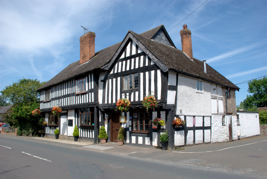
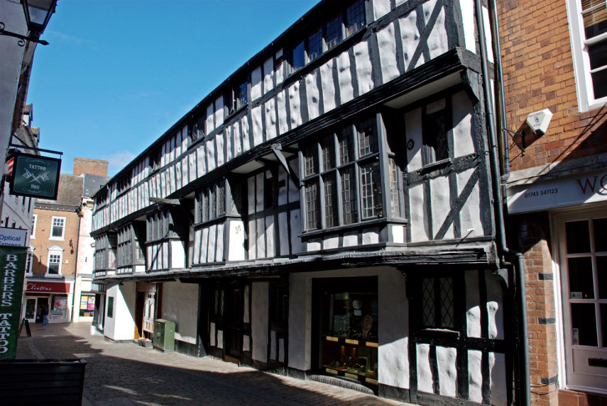
On the way back into town we saw Rowley's House which was built in the late 16th century by the wool merchant Roger Rowley. It is believed to be the earliest building in Shrewsbury to use bricks as part of its construction.

That was the end of another interesting, at least to us, walk. So back home on the train for us.

Black and White Villages and an Arrow – Part 2.

Black and White Villages and an Arrow – Part 2.

We drove the 2.5 miles from Pembridge to Eardisland and, as in Pembridge, we crossed the River Arrow again although, this time, it was on the far side of the village for us. The bridge dates from around 1800.

Once again there is a free visitors car park on the main road through the village almost opposite the Dovecote and there were plenty of spaces but, unlike Pembridge, no public toilets. The Dovecote, dating from the late 17th/early 18th century is shown below and is open to the public. It functions as an information and exhibition centre for the village offering interesting historical displays and information on the area alongside a shop selling local produce. There is no entry charge.

Moving to the right of the Dovecote we can see the side of the Manor House with a front view below.

The Manor House dates from the 17th century with what appears to a a geogian extension added to the front. Turning to our left, away from the side view of the Manor House, we look back past the Dovecote towards another road bridge.

If we go into the Dovecote we see at the back of the interior a small staircase and going to the bottom of the stairs and looking up will show a small part of what we could see if we went upstairs.

Arriving upstairs we can see the whole point of the place; a huge number of nesting places for the doves and I understand that they numbered well over 600 although there are no doves there now.

Amanda is trying to asses, from the depth of water, what would happen if she fell in. In the background is the 17th century Millstream Cottage and the water is, naturally enough, the mill stream.

Dating from the early 13th century is the Church of St Mary the Virgin. Some parts such as the Chancel and South Porch were built in the 14th century. The original Tower, of probable 15th Century origin, collapsed in 1728 and was replaced by the present one in 1760. The whole church was restored in 1864.

Eardisland turned out to be very pretty little village and well worth a visit. Unlike the church we haven't been restored so we will now have to return home for a rest.


Black & White Villages and an Arrow – Part 1.

Black & White Villages and an Arrow – Part 1.

There is an area in Herefordshire known as the Black and White Villages and there is also a Black and White Villages Trail which is meant for motoring not walking. We last visited about 12 years ago on a day trip from Ludlow and the results from that are already on the web site. That previous visit was before the blog was started so there is no blog entry for it. This time it was a 30 minute drive from home so we were able to have a much more leisurely look round especially as we were re-visiting only two of the villages.

Both villages, Pembridge and Eardisland, are situated on the River Arrow.

Part 1.

We started in Pembridge and we had to cross the River Arrow to get into the village and this is the bridge we used. It is not very old having been built in the 19th century but is attractive nevertheless.

There is a small, free, car park with access down the roadway next to the King's House in East Street and there was plenty of room. There is a small sign, easily missed, pointing to it from the main road and there are also public toilets in the car park which had disabled facilities and were nice and clean.

The entrance to the public car park can be seen on the right. The King's House is a restaurant, not open on a Monday when we were there of course, and dates from the 15th century. This building is a sign of things to come. This next picture is in East Street looking towards West Street and showing the front corner of the King's House on the right. You should be able to see a number of black & white timber-framed buildings.

I think we'll need to do a bit of exploring don't you?

How's that for a start? The building on the right is the New Inn so called because it was new when it was built in the 17th century. Can you think of a better reason?

A market charter was granted to Pembridge in 1239 and just behind the New Inn is the early 16th century Market Hall.

Standing in the Market Square it doesn't look like a hall as it isn't enclosed but that's because the upper storey was removed at an unknown date. Pity really as it would have looked pretty impressive with an upper storey.

Although these villages are known as the black and white villages, with good reason, not all of the buildings are black and white. This next picture shows a row of black and white buildings broken by one cream washed, jettied building.

The picture above shows a timber-framed building with red brick infill and the one to its right, an early 15th century hall house known as West End Farm, has a pinkish cream wash on the walls. This was one of the earliest domestic buildings in Pembridge. The multitude of other timber-framed buildings in Pembridge date to the 15th century.

The church here is also unusual in that it has a separate bell tower which dates from the 13th century. The current church dates from the 13th century with alterations in the 14th century century.

The bell tower has to be seen to be believed. The main timbers are enormous and from the look of them they are whole trees squared off.

The church also has some very interesting interior features. There are mason's marks in the picture below – can you spot them?

There are also some medievel wall paintings. One on the wall behind the organ and one on the wall of the nave. Not in the best of condition but they are visible in spite of being around 600 years old.

Just outside the church door is a delightful view across the churchyard to the village and the hills beyond.

That is the end of part one covering Pembridge. Part two will be Eardisland.


The Other End – Day 4

The Other End – Day 4

Today is our last day in Swansea and we wake this morning with wall to wall cloud.. Are they trying to tell us something? The cloud wasn't a surprise as it was foretold in the weather forecast and we always belive those don't we? We planned for this so it was going to be museum day. We packed our things after breakfast, paid the bill and left our one case with reception until we were ready to leave Swansea.

Each day we had come out of the hotel and turned left to start our adventures so we turned right instead. We could see on the map that in this direction the road went down to the river so we went to explore. We found a nicely designed footbridge and something we didn't expect. Whenever we were in the Marina area we often saw the pointed top of something white poking up above the buildings in the distance and now we know what it was.

We didn't stay here for long because we had plenty to do so we moved off towards the Swansea Museum; our next stop. You might notice that I didn't take this next photgraph today. Because of its situation the front of the museum faces almost north and the only time the front is in sunlight is around 7:00 AM so I was up early yesterday to get this photograph. This is the oldest museum in Wales and the building was built for the Royal Institution of South Wales in 1841 in the neo-classical style. Entrance is free.

This horizontal duplex steam engine from a lead rolling mill in the Lower Swansea Valley, built 1901, was outside in the grounds.

Back inside one of the galleries was dedicated to the first world war. It had this simulation of a trench together with many other related exhibits.

Another gallery was dedicated to pottery from South Wales. The display cases run along each side of the gallery and across the end showcasing many varied exhibts.

There was a small room on the first floor containing this mummy plus related items. This is Hor who was a clothier priest and scribe of the God Atum.  In the daily ritual of the temple it was his duty to change the clothing on the holy statue of the God.  He lived in Akhmim in Upper Egypt between 250-200 B.C. during the Ptolemaic Dynasty and was named after the God Horus. The mummy was gifted to Swansea Museum in 1888 by Field-Marshal Lord Francis Grenfell who was born in the St. Thomas area of Swansea in 1841.

This typical Victorian display must contain a great number of invertebrates, most of which appear to be butterflies, with an obvious large spider in the centre.

We moved on a short distance to the National Waterfront Museum. This is a large modern building on the edge of the Marina next to the Tram Shed. This is part of the National Museum Wales whereas the previous museum and the Tram Shed are part of the Swansea Museum as are the two old vessels floating in the Marina outside the Waterfront Museum.

You wouldn't get me up in this thing. It reminds me of a flying bycycle.

Built in Maindy, Cardiff, between 1907 and 1909, Charles Horace Watkins claimed to have flown the Robin Goch on several occasions during 1910, but sadly no official record of the flights exist. What is irrefutable is that the Robin Goch was the first wholly Welsh-built aeroplane, and probably the earliest working monoplane in Britain.

Watkins himself designed the 40 HP motor, and it was forged from bits of steam engine, in the Great Western works in Roath, Cardiff.
The fuselage is hard wood, the wings are canvas and piano wire, and inside the cockpit there is a dining chair to sit on, a spirit level to check you're straight, a ball in a tube to make sure you're the right way up. Pretty primitive stuff.

This is a Benz 'Duc' Motor Car. This particular model was first registered in Monmouthshire in 1904.

This is a replica of Trevithick's Penydarren tramway locomotive. The original was built in 1803-1804 and on the 21st February 1804 it made its first 9 mile journey hauling a load of ten tons of iron together with around 70 people who hitched an unofficial ride. This was the first journey made by a steam locomitive on rails and started a world-wide revolution in railway transport.

Apparently this replica is fully working and is steamed up once a year. Typically this year it was the Saturday just before we arrived. I would certainly liked to have seen that. We did watch a video but it's not quite the same as the real thing. Next visit maybe.

Well that was the end of our visit to Swansea. We went back to our hotel to collect our case and trundled it up to the station to catch a train at about 2:30 PM. We arrive home just over 3 hours later.

SUMMARY:

I have to be honest here and say that in the past I wouldn't have given Swansea a second thought with regard to a tourist destination and it was only because our railway line ended up there that we did too. The fact that the line did go to Swansea encouraged me to do a little research on the place and I began to realise that if offered the visitor quite a lot of options. Many other potential visitors probably take my initial view and don't even consider it which is their considerable loss.

We had a lovely time and really liked the place. We would recommend it without hesitation and do intend, sometime, to go back because there is still plenty of interest that we didn't have time to see. There is a good bus service around the city and its environs so one doesn't really need a car (We didn't bring one).

There are a number of well known tourist destinations that don't have as much to offer as Swansea does and visitors flock to those but not to Swansea. I'm baffled.

I hope that there will be people out there who read this report and realise what they're missing. Swansea deserves better recognition.

Reservoirs, Roads and Rails

Reservoirs, Roads and Rails

The online weather forecast for today was chilly and cloudy up to about 5:00 PM when we would have some sunny intervals for a couple of hours then back to cloudy for the rest of the day. Knowing how completely wrong the online forecasts had been over the past two or three days we decided to go out for the day.

We set off about 9:30 AM and followed a route we had used a number of times already which led us west to Crossgates where we would turn left for Llandrindod Wells but this time we went straight on towards Rhayader (pronounced 'raider') and as we were heading for Rhayader the sun started to break through. cool

When we reached Rhayader we wanted to continue west but there was a slight problem although perhaps I should describe it as a mountainous problem. Between us and where we wanted to go were the Cambrian Mountains; a large wild and mountainous area with few roads and some of those roads stopped part the way across. However we were lucky that there was one road going in the direction we wanted which went up, over and down the other side. So we left Rhayader and started up, and up, and up. This is part of that road not long after we'd left Rhayader.

We stopped by a stream to look at the view and a little further along we stopped again to look at the Craig Goch Reservoir in the Elan Valley (second picture below). Had we turned off onto the road along the Elan Valley, which we didn't, we would have found six large reservoirs. Perhaps we will have to do that one day.

We traversed these uplands on a road that was often not wide enough for two vehicles to pass, although there were plenty of passing places, and many sharp blind bends. There were also places where there were very steep slopes next to the road and no guard rails. We did, eventually, reach the other side of the uplands and started to go down. This was the view from the top looking down through the pass that we were about to go through. One thing that is noticeable about this area is that there are no trees.

We did make it to the bottom and then onwards to Pontrhydfendigaid (I suggest we pause for a short time whilst you untie your tongue). The name apparently means 'the bridge of the blessed ford'. We turned out of Pontrhydfendigaid and soon found ourselves at Strata Florida Abbey, which was our destination, after a journey of 2 hours. This ruin is owned and maintained by CADW – the welsh equivalent of English Heritage. The name Strata Florida is a corruption of the Welsh Ystrad Fflur, meaning Valley of (the river of) Flowers.

This gateway is the highest part of what is left. The abbey does have a wonderful backdrop as you can see in the second picture below.

There is also a large area of medeival tiles dating from the 14th century which makes them around 700 years old. Is your bathroom going to last that long?

Strata Florida Abbey is interesting but it is not worth making a special (long) journey for simply because there is really not that much to see but if you are in the area or passing through then it is worth stopping off. I doubt that we spent an hour there before continuing to our next destination further north – Devil's Bridge.

Devil's Bridge is actually three stacked bridges as each time that a new bridge has been built to replace the old bridge the new bridge has been built above the previous bridge. There is an old tale that the first bridge was built by the Devil but actually it is probable that it was built by the monks of Strata Florida Abbey. The original bridge is thought to have been built between 1075 – 1200. The bridge is at a point where the River Mynach drops 300 feet in five steps down a steep and narrow ravine.

The next photograph was taken from the newest bridge looking down into the ravine. It is possible, on payment of a small fee, to climb down into the ravine via the steps seen in the picture. We didn't have time to do that on this trip but we do intend to come back.

Th other ting we came to see was the Vale of Rheidol Railway which runs from Aberystwith, on the west coast, to Devil's Bridge and back. The journey takes an hour each way. When the train pulls in to the station it uncouples from the carriages and moves past a set of points then reverses to the other end of the carriages to pull the train back to Aberystwith.

We had a light lunch at the station in the Two Hoots Cafe. I had soup with bread and Amanda had a sandwhich and we each pronounced our food to be very good indeed.

That was the end of our day except for the drive back and the return journey took just 90 minutes as we didn't keep stopping to admire the scenery. Can't wait to go back.

Sun, Signals and Sabrina

Sun, Signals and Sabrina

We have been to Shrewsbury twice before and I have blogged both trips as you may remember. On each of those occasions it was cloudy but today was forecast to be sunny intervals. We have experienced forecasts like that before where we have two minutes of sun followed by two hours of cloud so we weren't hopeful but decided to risk it. So we started off on our third trip to Shrewsbury on the train and it turned out to be third time lucky.

I have shown you pictures of our little one carriage train before, but from the outside, so here's a picture of the inside.

You may notice that it is very popular, especially at this time of year as between 1st October and 31st March old people like us who have bus passes may travel free. This covers the whole line from Swansea in the south to Shrewsbury in the north; a total trip of around four hours. Our part of the trip from Knighton to Shrewsbury is only 50 minutes.

This is a picture of the signal box outside Shrewsbury Station. I took it from the train as we flashed past inasmuch as our little train can flash past anything. "But wait", I hear you cry, "why are you showing us pictures of a signal box.? We don't want to see pictures of signal boxes." Well, you do, but you just don't realise it yet.

This signal box was built in 1903 and is the largest mechanical signal box in the world which is still working. There, you can't fail to be impressed by that can you? When I first saw it I thought it was big but I didn't think it was THAT big.

We emerged from the station into a sunny Shrewsbury and headed south east along Castle Gates. We hadn't gone far when we realised that we had just passed some some steps and we thought 'I wonder where they go?'. Well we had to find out didn't we? The steps led us up to a higher level walkway and I spotted this view.

What do you think that building is? A stately home, a museum perhaps or even a prison. Nope! None of those. It is, in fact, Shrewsbury Railway Station. Quite impressive for a railway station eh? Built in 1848 it is now designated a grade II listed building.

We went back down the steps and after a short walk entered Shrewsbury Castle grounds. Bearing right along a path which was sloping upward we eventually arrived here at the top of a knoll. This is Laura's Tower built by Thomas Telford, in 1790, for Laura, the daughter of Sir William Pulteney, as a summer house.

There are some impressive views to be had from the top of this knoll although some of them are obscured by trees. Luckily for us it was March and there were no leaves on the trees so we had some lovely clear views such as this one along the River Severn. Incidentally the steps and walkway we decided to follow earlier would have taken us across that footbridge but we didn't want to spend time going that far today.

After a surfeit of views over the town we went back down to ground level and continued our walk through the town along Castle Street then Pride Hill where we turned into Butcher Row and saw this fine timber-framed building.

The timber-framed building shown below is at the south-east end of Butcher Row and on the corner of Fish Street which runs across the top of Grope Lane which I have mentioned in previous posts. This particular building still has its original frontage with the deep window sills on which the merchants would have displayed their wares.

We went back along Butcher Row and turned left along Pride Hill heading south-west. We eventually reached St. Chad's Terrace where we found (you've guesssed it) St. Chad's Church. Built in the 1700s, so not that old, but quite an impressive and unusual church. It created a stir at the time because it had a circular nave. 

I was hoping to get a photograph of Ebeneezer Scrooge's gravestone in the churchyard but we couldn't find it. Yes we know that Scrooge was a fictional character but the churchyard was used in the making of the film and the gravestone was left when filming was finished. It is still there somewhere.

The circular nave is unique, with pews arranged like a maze and Charles Darwin was baptised in St Chad’s Church.

Just across the road is the Quarry park which incorporates the Dingle. Dingle, apparently, is another name for a Dell. Either way it's a very attractive garden and there were plenty of blooms in spite of it being the middle of March.

This view shows St. Chad's Church, with its very tall tower, in the background.

This statue of Sabrina was created in 1846 by Peter Hollins of Birmingham for the Earl of Bradford. A folk etymology developed, deriving the name from a mythical story of a nymph, Sabrina, who drowned in the River Severn nearby and Sabrina is also the goddess of the River Severn in Celtic mythology.

That, however, is not the only Sabrina, as there is a boat called Sabrina which takes visitors for a cruise around Shrewsbury on the river. It was very convenient that it happened to come along as I was photographing the river.

After our last two visits Amanda wasn't particularly enamoured of Shrewsbury but she says now that she is really beginning to like it. We are, of course, planning to come again in the warmer weather when the leaves are on the trees.

We caught the train back home where we arrived without incident.

I suppose that that was our first 'proper' trip of the year. More trips to come I hope.

Ludlow and Leintwardine

Ludlow and Leintwardine

We went to Ludlow recently to do some shopping. We had visited Ludlow twice before we moved to Wales and, as we were staying at a hotel both times, we had free parking provided by the hotel. When we were walking around the town we noted that there was some free roadside parking although limited to around 2 hours at a time. This time we noted that if there was a space big enough to park a car then Ludlow will make you pay for it.

We didn't have to pay for parking as the supermarket had their own parking and so did the other shop we went to. Did you know that my middle name is 'Scrooge'? cheeky

On ther way to Ludlow we noticed many places where there were Snowdrops flowering on the road verges so on the way back, near Leintwardine, we stopped to take photographs.

The hill in the centre of the horizon partly masked by the small tree is Titterstone Clee Hill which we climbed when we first visited Ludlow. Amanda tells me that these Snowdrops will have gone by the end of the month.

A little further towards home we stopped in Leintwardine to photograph the bridge.

It's a lovely old bridge so I took a view of each side. I shall take some more photographs when the sun is shining.

Incidentally Leintwardine is pronounced Lent-war-deen.