Browsed by
Tag: Villages

Messing about

Messing about

Yesterday afternoon was nice and sunny with a little cloud about so we thought a short walk would be in order. We drove to ConyField Wood where we intended to walk through it to a little village on the far side. Cony, or Coney, is the old word for Rabbit in case you didn’t know.

At this time of the year the sun is getting quite low in the afternoon which does give some nice lighting effects.

Messing

Messing

Messing

Near the far side of the wood is a tumulus which we saw although I didn’t take a photograph of it because the Bracken growing all over it together with the wood all around seemed to make it look rather insignificant.

Having emerged from the other side of the wood the footpath continued across fields with the village, especially the church tower, now visible below. The shadow from the hedge on our left is quite dark and noticeable because of the height, or lack of it, of the sun.

Messing

We soon arrived in the village which, believe it or not, is called Messing and here is a photograph of the village sign to prove it.

Messing

Just opposite the sign is the village inn, The Old Crown, which has a reputation of providing good food although, as yet, we haven’t sampled it.

Messing

I took this next view from the edge of the village because it was a nice view but primarily because of the clouds. They form rows and are sharply cut off at the bottom giving the lower edges a very flat appearance. They might even interest the Cloud Appreciation Society.

Messing

We walked back the same way, across the fields and through the woods, to our car and drove home. A short, but very pleasant, walk.

Towering over Tollesbury.

Towering over Tollesbury.

We had a decent bit of sunny weather this afternoon which coincided with Tollesbury Church’s annual tower open day so off we toddled to Tollesbury.

We hadn’t been up this church tower before and it turned out to be a little tricky. The first part, a long set of wooden steps with a handrail as far as the floor below the belfry, was fairly straight forward. The next stage, in the belfry, was where it started to get tricky.

We had to go up another set of steps to the next floor then turn round and make our way, one by one, back across the hatch we had just come through. This was done by holding onto the the hefty frame that held the bells and shuffling sideways along a narrow plank, to one side of the open hatch, and thus reach the other side without falling through.

Finally up a few more very narrow stairways and out through the door at the top. It was worth it though.

The village square:

Some houses below:

The River Blackwater can be seen in the distance:

I hope the next one isn’t quite so tricky.

Stone, stone and more stone.

Stone, stone and more stone.

Well we’re back from the Cotswolds. We had mixed weather with Monday, Tuesday and Wednesday being sunny and warm and Thursday and Friday overcast with some showers.

We drove from home to Chipping Campden, where we were staying for two nights, but stopped off at the Rollright Stones, just over the Gloucestershire border into Oxfordshire, on the way. These 77 stones form a perfect circle 104 feet across and stand on a prehistoric trackway at the edge of a ridge.

We continued on to Chipping Campden arriving at around lunchtime. It is a proper working town, not having to survive on tourism alone, but has a lot to offer the tourist. There were many typical cotswold golden stone buildings including the Market Hall.

The following day we walked up Dover’s Hill on the edge of the town which gave some stupendous views over the surrounding countryside.

There were plenty of sheep and lambs about and this lamb seemed pretty ingrigued by us.

A little way north of Chipping Campden is Hidote Manor Gardens – one of the National Trust’s properties. We spent a half day here and what an amazing place it is.

We also had a trip to Broadway as it’s one of those well known picturesque Cotswolds places. Neither of us liked it very much. It is attractive in that it has the typical Cotswold buildings of golden stone but that was it really. It seemed that most of the people there were tourists and most of the businesses lining the main street were aimed at relieving tourists of their money – not a proper working village at all.

Broadway Tower was a bit different. Set out in the middle of nowhere on the top of a hill it’s an interesting feature. We didn’t go up the tower but the views from the top of the hill were amazing.

Thursday turned out to be a cloudy day with showers so we thought that ‘indoors’ would be good and so Snowshill Manor it was. I don’t know quite what to think of it. It’s certainly an extraordinary place with every room crammed with a whole range of artifacts from furniture to bicycles. Apparently the chap who owned it lived in a separate cottage next to the manor and used the manor to store his collection. You’d have to see it to believe it and, no, I didn’t take any photographs because it’s not permitted.

This trip was a good one and more details will appear on the web site pages in due course.

Ups and Downs – Day 1.

Ups and Downs – Day 1.

At the beginning of September last we visited Alfriston in Sussex which, apart from being a lovely little village in the middle of the Sussex Downs, is also only about 5 miles from the coast. We liked the area so much that, 5 weeks later, we went again staying at the Star Inn in the centre of the village on both trips and have just returned from that second visit.

Pictures from the first visit are already on the web site and can be accessed from the Sussex page – South Downs.

The day that we started our second visit was cloudy with rain at times but that was not unexpected as the weather forecast had foretold cloud and rain for that day. We arrived in Alfriston around lunchtime, by which time the weather had improved a little, and decided that lunch would be our next step. Instead of having lunch in The Star, as we did last time, we decided to try 'The Singing Kettle' a few hundred yards down the road. We last visited that Tea Room about 19 years ago and wanted to see what it was like now.

It was taken over by new owners about 6 years ago and now has a very good selection of items on the menu. We had a light lunch here and were very impressed.

The Singing Kettle is the centre one of the block of three buildings facing the camera at the far end of Waterloo Square.

By this time the weather had improved considerably to the point that there were patches of blue sky appearing together with a bit of sun. We thought that a little afternoon walk would be good so decided to walk alongside the River Cuckmere that flows through Alfriston. We walked across the footbridge and turned left, up river, to look at the little brick bridge that carries a small lane over the river. We had gone only a short way along the river when we saw a heron standing by the river looking for fish.

Because the bricks in the bridge were fairly large we thought that it was probably Victorian and, therefore, not very old. We used that bridge to cross the river to the footpath on the other side and headed back towards Alfriston, past the church, and on, down river, towards Littlington.

After passing Alfriston we looked back to this view of Alfriston Church in the hazy autumn sunshine.

The heron that we had seen on the way to the bridge we had disturbed on the way back and it had flown off down stream the way that we were going so it was inevitable that we surprised it again. I managed to get a photograph of it in flight

and another as it landed on the far side of the river.

Herons are, as you can probably see, fairly large birds.

Having reached the footbridge at Littlington we crossed the river and headed back to Alfriston stopping to take this last picture of cattle grazing by the river.

That easy, flat, walk covered about 3 miles in total and back at The Star Inn we relaxed and prepared for dinner. Tomorrow was going to be a longer walk involving Friston Forest and Cuckmere Haven.

Yorkshire and the Great North Road

Yorkshire and the Great North Road

As I said in my posting entitled ‘Mid-summer Madness’ I went up to the North Yorkshire Moors on Friday 27th July and returned on Thursday 2nd August.

I went via the M11, A14, the A1 (The Great North Road), A168 and the A19 and the drive up was moderately awful. The traffic from near the end of the M11 until the junction with the western leg of the A14 was very dense which slowed everything down. Then, once on the A1, it seemed that there was a two and a half mile traffic queue at every roundabout on the A1 and there are 4 or five on that stretch. After I eventually turned off on to the A168/A19 I though that my troubles were over but, no, roadworks on the A19 caused yet another queue.

The journey took 7 hours instead of 5 or less – not a good start.

I did eventually arrive at Baysdale Abbey where I was staying and before you get excited let me explain that in spite of its name it is not an abbey. There was once an abbey there but it has long gone.

Baysdale Abbey is the long building that looks a bit like a military barracks, rather plain outside but comfortable enough inside and sleeps 17. The setting though is very nice. One has to drive up a single track road that winds up to the top of the moors and back down again into Baysdale. That road is the only entrance and exit.

There weren’t actually 17 of us but only 14 and that was quite enough. There was a small beck (stream) running past and fish could be seen in the clear water. Footpaths radiated out from Baysdale and up about 600 feet onto the moors above.

My first trip out was the next day, Saturday, to Robin Hood’s Bay about 6 miles south along the coast from Whitby. We didn’t go straight to Robin Hood’s Bay but headed to Boggle Hole where we intended to park and then walk along the cliff top to Robin Hood’s Bay.

Robin Hood’s Bay is the name for both the bay itself and also the little village near the top of the bay. The snag with this walk is that the car park at Boggle Hole is level with the top of the cliffs and one has then to walk down the lane to sea level and then climb steeply back to the top of the cliffs again. At the Robin Hood’s Bay end one has to go back down to sea level again. Ah well it’s good exercise!

This view is from the top of the village, yes that’s another climb, looking back towards Boggle Hole with Ravenscar on the headland in the distance.

The village has some really picturesque cobbled narrow back lanes which vehicles could not possibly access.

The following day, Sunday, we all went for a round-trip walk onto the moors with quite a lot of stopping and looking. It was only 4 miles, but through dramatic moorland scenery, and we arrived back in time for a late lunch.

On Monday we all went to Whitby which is about 10 miles along the coast from Staithes. Whitby is arranged around the mouth of the River Esk so not only does it have river scenes but also coastal scenes.

Tuesday I went with my younger brother to Staithes on the coast to the east. My first visit to Staithes was about 50 years ago when one could drive down the steep, cobbled village street and park by the roadside. There were also a few elderly women still wearing traditional local dress. I re-visited about 6 years later and not much had changed. Tourism in Staithes was unheard of at that time.

Things have changed a bit since then but the village is just as quaint and charming although the traditional dress is no longer to be seen. The only people permitted to drive down into the village are people who need access such as residents, delivery vehicles, etcetera and there is a large car park at the top of the hill where visitors must park.

On Wednesday we all went back to Robin Hood’s bay via Boggle Hole because some of the group missed the first trip and the following day I returned home.

The drive back was not as bad as the drive up but there was one seven and a half mile queue at one point which delayed me by about 45 minutes.

New pages of the places I visited together with photographs will appear on the web site in due course.

Salami and chips

Salami and chips

Yesterday, Sunday 22nd July, I left home at 9:30 AM and drove to Thaxted where I had arranged to meet Antonello from Florence in Italy. He had been staying in Thaxted for 3 nights, having already been to Rye in Sussex, and was moving on to Long Melford in Suffolk to stay there for 3 nights before travelling up to Northumberland.

This was the first time that we had met and probably won't be the last as he comes over to Britain 2 to 3 times each year. I was going to drive him to Long Melford with a few stops on the way and we were going to make a day of it.

He was sitting outside Thaxted Guildhall in the sun when I arrived and I recognised him because I'd seen a picture of him on the web.

We weren't going straight to Long Melford and Antonello suggested Kersey so Kersey it was. We found our way through the back roads with a few stops to look at the map and, no, we weren't lost!

We stopped in the main street, 'The Street', as there isn't anywhere else. You cannot really 'walk round' Kersey as there are no other streets – it's a small village. It is really picturesque with the village running down each side of the small valley to the stream at the bottom which runs across the road to form a ford.

The church, quite a big one for such a small village, is perched on the valley top on one side of the village. There are plenty of pictures of Kersey already on the site.

After looking around, sorry, along Kersey we moved on to Lavenham. There are also pictures of Lavenham on the web site.

As the car park is near the church we started with the church then walked down Church Street into High Street and up to Market Lane on the corner of which is an old house where the gable end leans out in a most alarming way. Up Market Lane into The Square where we couldn't possibly miss The Guildhall and Little Hall.

We stopped for a light lunch in 'Sweetmeats' in Water Street after which we went on to Long Melford.

We first had to find Antonello's B&B and so asked a local, there seemed to be very few about on a Sunday, who didn't know where the road was. Nothing for it but to resort to technology! Out came the GPS navigation thingy and after entering the name of the village and road it gave us a street map with the relevant street shown – hooray!

After Antonello had put his luggage inside we went for a walk around Long Melford including the rather impressive church on the hill and Melford Hall (Tudor).

After this it was time for me to head back home so we said our goodbyes with the expectation that we would meet again. I certainly hope that we do. Antonello is a very pleasant young man and we both have a strong interest in Britain's heritage. Antonello took a couple of pictures of the two of us and has promised to let me have copies which I shall then post here.

A very good day.

Water, water and more water.

Water, water and more water.

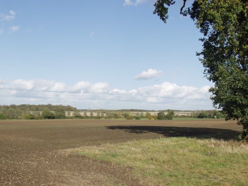
We headed north, today, over the county border, and the River Stour, and into Suffolk. Our destination was Pin Mill – a small waterside community on the River Orwell.

We drove as far as the village of Chelmondiston where we parked in the small, free, village car park. The walk down Pinmill Road was an easy one and we arrived at the riverside close by the Butt and Oyster Inn.

The tide was out when I took this picture and I imagine that with a very high tide this inn only just manages to keep it’s feet dry!

It was about time for morning coffee so we went in to the pub for coffee. The view from inside the bar across the river was very picturesque. Whilst we were drinking our coffee we noticed that their lunch menu had a very good range of dishes which sounded positively delightful but, unfortunately, we would have to leave before lunch for our next intended destination. I don’t know how good the food is but it certainly sounded nice.

After finishing our coffee we walked along the small hard which you can see next to the stream in the picture above and looked back to the Butt and Oyster.

After a walk round we set off up the lane back to the car but, part the way up, we met this fella walking by the side of the lane.

Isn’t he lovely? This is Britain’s largest beetle, a male Stag Beetle (Lucarnus cervus) which you won’t see very often. If this chap gives you the creeps then there is another piece of information which you should know – they can fly and do – frequently.

Amanda decided that he wasn’t terribly safe right next to the lane so she picked him up and put him on the verge.

We arrived back in Chelmondiston and set off in the car for our next waterside destination – Mistley back over the border in Essex.

The half mile stretch of road between Manningtree and Mistley runs alongside the River Stour and it is possible to stop anywhere by the roadside so that one can get out and look at the river which is over a half mile wide at this point.

The interesting point about this part of the river is the swans and it’s not just a few swans it’s a lot of swans. This is just some of them but there are more.

I spoke briefly to an Australian lady who said she’d never seen so many and why were they there? I wasn’t able to answer that question at the time but I can now. There are malting buildings by the river in Mistley where barley is malted in preparation for making beer and up to at least fifty years ago the barley was unloaded from barges at the quayside. The local swans soon realised that the barley which was spilled during this process was a constant source of food and there was obviously enough of it to support a large number of swans and so their numbers increased to form the colony here today.

We walked further into Mistley to look around and then made our way back to the car only to find an impolite lout strutting along the pavement as though he owned it!

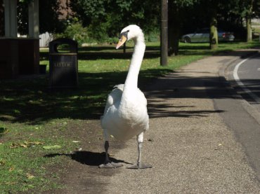
He looked a bit put out when we walked past without so much as a ‘by your leave’.

Back to the car and we leave for our next, and last, destination – Harwich.

Harwich used to be a bustling, working port and a little on the rough side I think. Now, however, all the big stuff such as the international container ships and passenger liners have been moved around the corner to Parkeston Quay and Harwich has become a quiet, picturesque and interesting little town. If you are interested in things maritime then Harwich is the place for you and even if maritime history doesn’t hold you spellbound there is still plenty of interest.

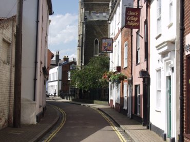
There is remarkably little traffic in the town and there are narrow backstreets with many old buildings. There is lots to see on the waterfront including the Ha’penny Pier, Lighthouses and a Mayflower exhibition – the Mayflower was built in Harwich. This is me being friendly with a young lady I met inside the Mayflower Exhibition.

After Harwich it was back home. We enjoyed today very much and lots more photographs from this trip, together with many new pages, will eventually appear on the web site in due course. If you want to be notified about updates as soon as they appear then see the updates page.