Browsed by
Category: Shropshire

The Saggar Maker’s Bottom Knocker

The Saggar Maker’s Bottom Knocker

We had been waiting for a sunny day and were beginning to think that it would never happen and then, suddenly, today it was sunny. Time for a trip methinks.

We set off for Ironbridge which is just over an hour by car from us going via St. Milburga's Well in the village of Stoke St Milborough. The well is actually a spring which was first mentioned in 1321 and is said to be unfailing and good for sore eyes. Our eyes weren't sore so we are unable to verify that. cool Villagers would rinse their clothes in the well and beat them on a flat stone nearby. It has been going for over 700 years and it hasn't stopped yet.

You can see from the picture that the flow of water is very strong.

Onward to Ironbridge.

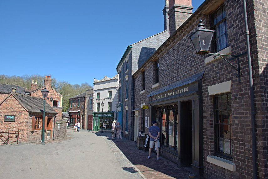
Ironbridge has nine museums not counting the Iron Bridge itself and we drove to Blists Hill first which is set up as a Victorian town. This is a typical Victorian street.

There was a Fish & Chip Shop in this street where we bought a single portion of fish and chips, wrapped in paper, to share as our lunch and there was more than enough for the two of us. I can also tell you that it was very tasty indeed having been cooked in the Victorian way i.e fried in beef dripping (fat). The chips were crisp on the outside and soft inside – perfect.

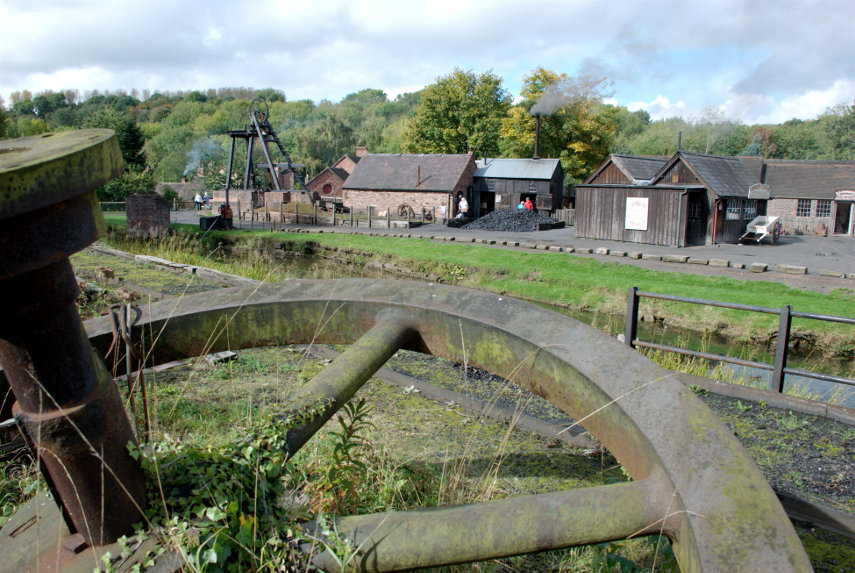
There are a lot of Victorian buildings here including industrial, commercial and domestic together with lots of machines. The view below shows an old mining area with headgear above the shaft and the small brick building on the right houses the steam winding engine which hauls the cage up the shaft. The second picture below shows the actual steam winding engine which was running when we were there.

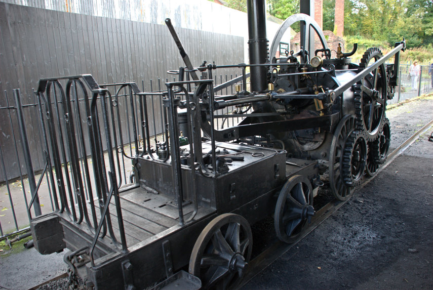
Nearby was the replica of Trevithick's Locomotive which is in steam often on a Saturday (check before you go). This was the world's first steam locomotive to run on rails.

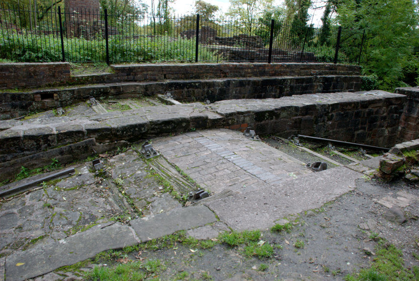
We walked alongside the canal to the far end where we saw the Inclined Plane. This is a VERY steep hill with railway tracks on it which would be far too steep for a locomotive to be used so there was a steam winding engine at the top which was used to raise and lower barges from the canal at the bottom to the canal at the top and vice versa. That must have been a sight when it was working.

We then walked down by the side of the tracks to the lower level but if you are not capable of that you could walk back along the canal to the Funicular Railway or Inclined Lift which connects the upper and lower levels. This is completely automatic so just press the button to call the lift and then ride up or down to the other level.

There is a LOT to see here and you could easily spend a day in this museum alone.

Our next port of call was the Jackfield Tile Museum a short drive away. One point worth mentioning is that parking is chargeable but the ticket will allow you to park in any of the other museum car parks at no extra cost.

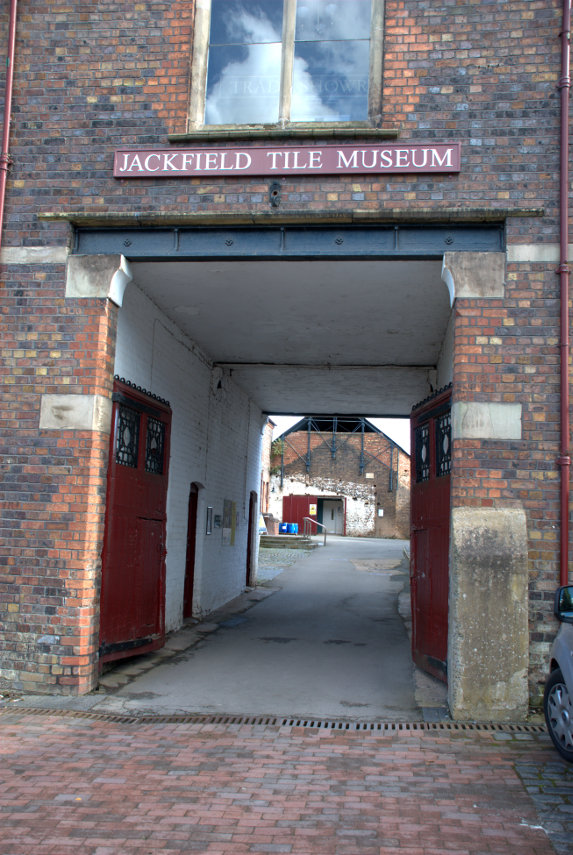
You don't drive through this entrance arch, the car park is off to the right, but you do walk through and the museum entrance is along on the left and is fairly obvious.

This was on Amanda's 'must see' list but I did wonder if I'd find it a bit boring. I needn't have worried; it is amazing.

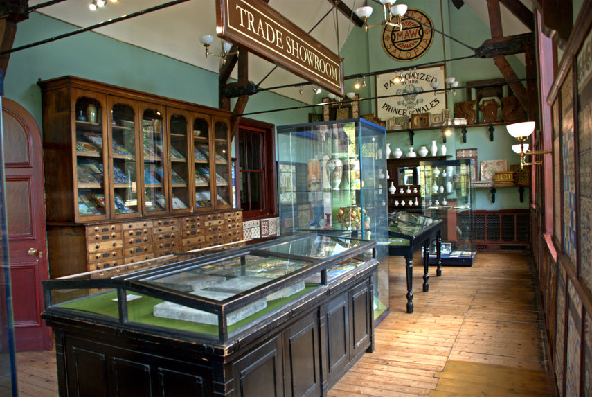
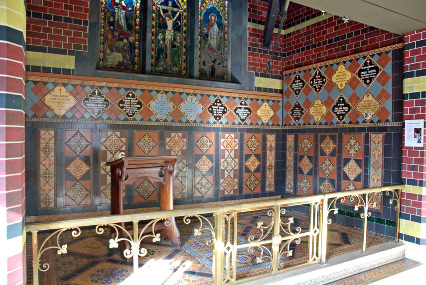
There were some rooms, like this one, which display various, mostly individual, tiles but there are also many tile exhibits like this one.

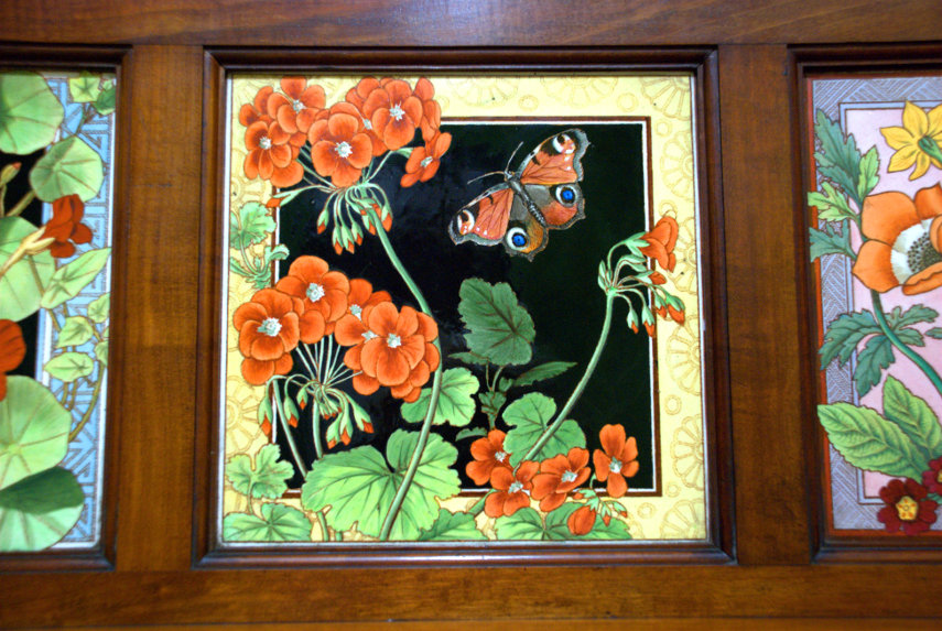
Many of the exhibits and the individual tiles are astonishing.

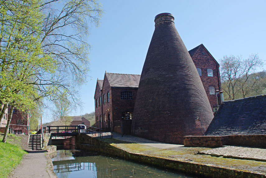
After looking around the tile museum we moved on to the Coalport China Museum. There are two brick kilns here and the photographs below are taken from the same spot looking in both directions.

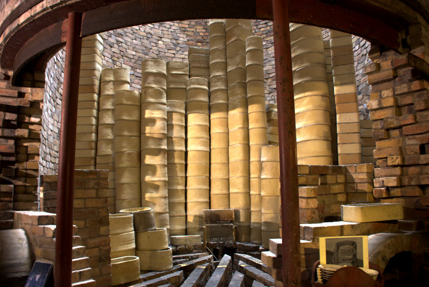
Parts of the internal structure of the kiln in the top photograph have been removed to give an idea of what goes on inside during firing.

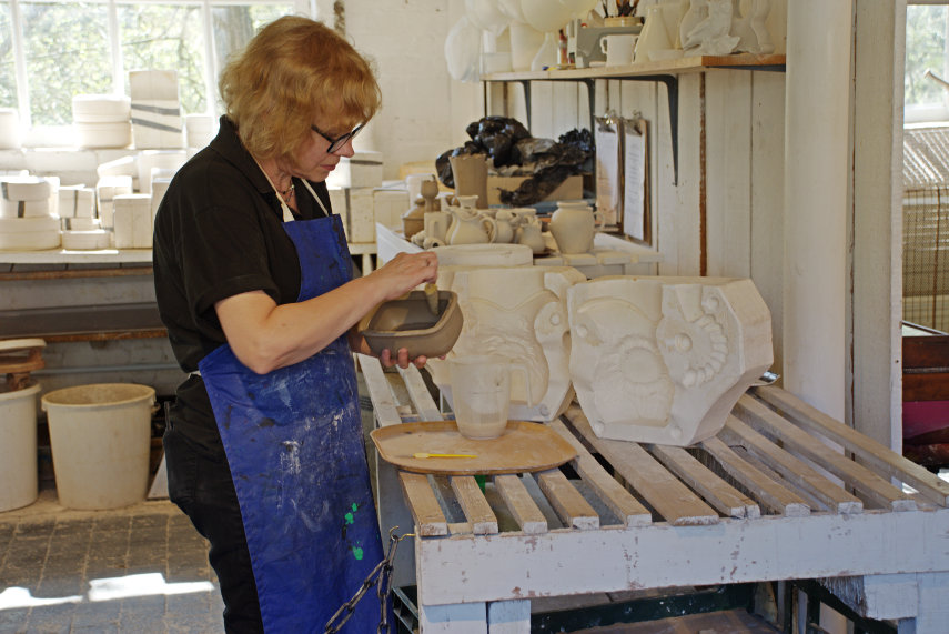
There are also workshops where one can watch pottery being made and hand painted.

Which, of course, brings us to the Saggar Maker. This is him in his workshop and in the past he would have had two assistants including a Bottom Knocker. The Bottom Knocker would have been a young, unskilled lad who would have sat in a corner producing clay pads, using a shaped iron band, which would be combined,by the skilled Saggar Maker, with the sides to make the final Saggar. 

A Saggar is a large container made of fireclay which would hold pottery during firing to protect it and the next picture shows the cut-away view into a kiln with Saggars piled high.

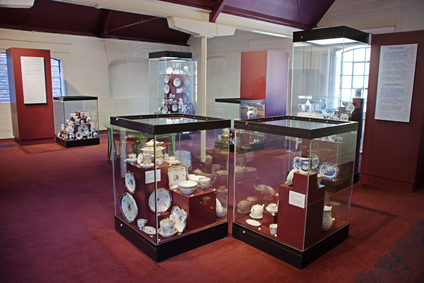
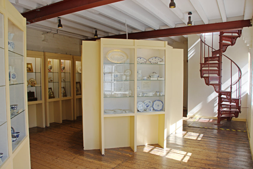
There are also a number of display rooms where individual items can be seen.

As the pottery museum is only a short walk along the canal from the Tar Tunnel we went to have a brief look. I say a brief look because, at one time, visitors were able to walk along the tunnel but now one can look into the tunnel from the entrance but not walk along it. I'm hoping that sometime in the future it will, once again, be possible to walk along it but that may be months or even years.

The tunnel is about 1100 yards in length and it was originally designed to be an underground canal connecting some of the mine shafts to the Shropshire Canal. However whilst it was being dug the workmen hit a source of black, sticky tar which was discovered to be natural bitumen. The bitumen originally flowed in prodigous amounts at about 1000 gallons a week although it reduced some years later.

That was the end of our little trip so we went home. There are more museums that we haven't seen so we'll probably be back.

For more information on these museums see the Ironbridge pages on the main web site.

Galanthus Galore

Galanthus Galore

There were two firsts for us today; it was the first trip of the year and it was the first time that I had used my new camera. It wasn't warm but considering that it was February it wasn't anywhere near as cold as it could have been and the weather forecast was for sunny intervals which from my point of view was ideal. I didn't know whether what I wanted to photograph would look best in sunny or cloudy conditions so it looks as though I'd have the choice. Perfect!

We drove for an uneventful hour and ten minutes to the National Trust's Attingham Park just a few miles south-east of Shrewsbury. It was unfortunate that it was also half-term for the local schools so there were a LOT of parents with children. The National Trust staff told us that Attingham Park was the second in the list of most visited sites which we found surprising.

None of it, however, would affect why we were here.

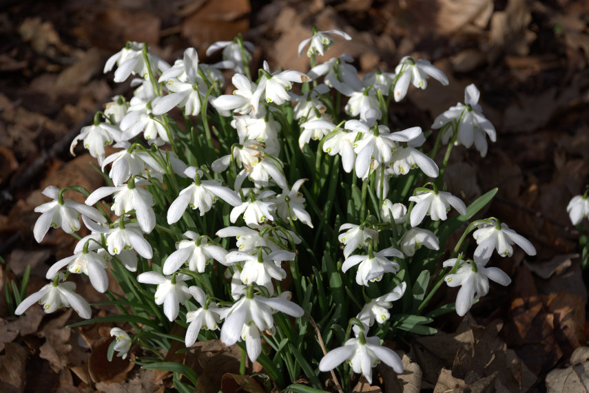
The gardeners among you may recognise Galanthus as being the latin for Snowdrop, which they have here, and for those people who don't recognise the word 'Galore' it means 'in abundance'. They flower in February and this is what we came to photograph.

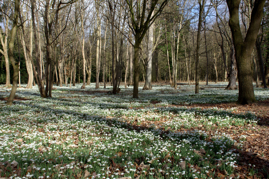
However not just those but THESE:

That's what I call a Snowdrop display.

After walking round the woods with the snowdrops we made our way over to the Walled Garden to see what that was like although we did not expect to see much at this time of year. Just before we entered the Walled Garden we saw this:

This is the Regency Bee House; a rather luxurious home for bee hives and one of only two such houses in the country. We went onward into the Walled Garden.

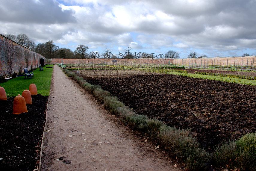
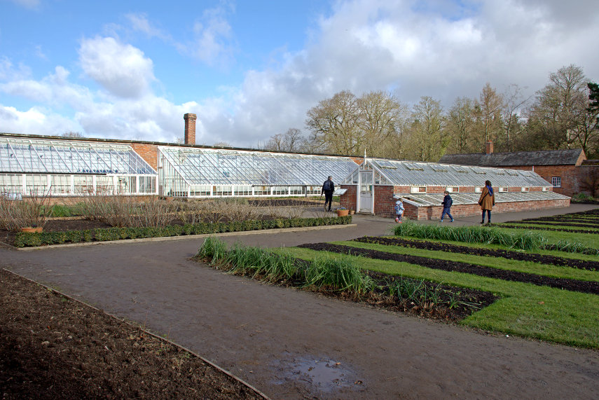
Very large but, as we suspected, there is virtually nothing in the way of plants yet; those pots on the left are covering Rhubarb plants in order to 'force' them i.e. make them grow taller than they otherwise would. There was also a separate walled area through an arch which was where the greenhouses were but again very little planting. We shall have to return in the summer.

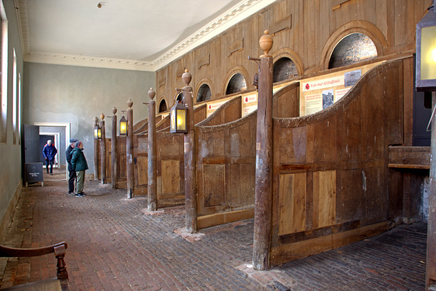
We made our way out of the Walled Garden and decided it was time for lunch. The restaurant is in the Stables Courtyard area which still has some of the old stables which one can visit. You don't have to eat here unless, of course, you happen to be a horse.

There is also a shop and bookshop together with the inevitable toilets. We went into the Carriage House Cafe and liked the meals on offer and found ourselves a table. It has to be said that it was very busy with parents and children moving past nearly all of the time so if you want peace and quiet you'll be out of luck.

I chose a Fish Pie and Amanda had Sausage and Mash and they both turned out to be very tasty and of good quality. We would eat here again but perhaps we'd bring ear mufflers next time. laugh

After lunch we moved on to the house.

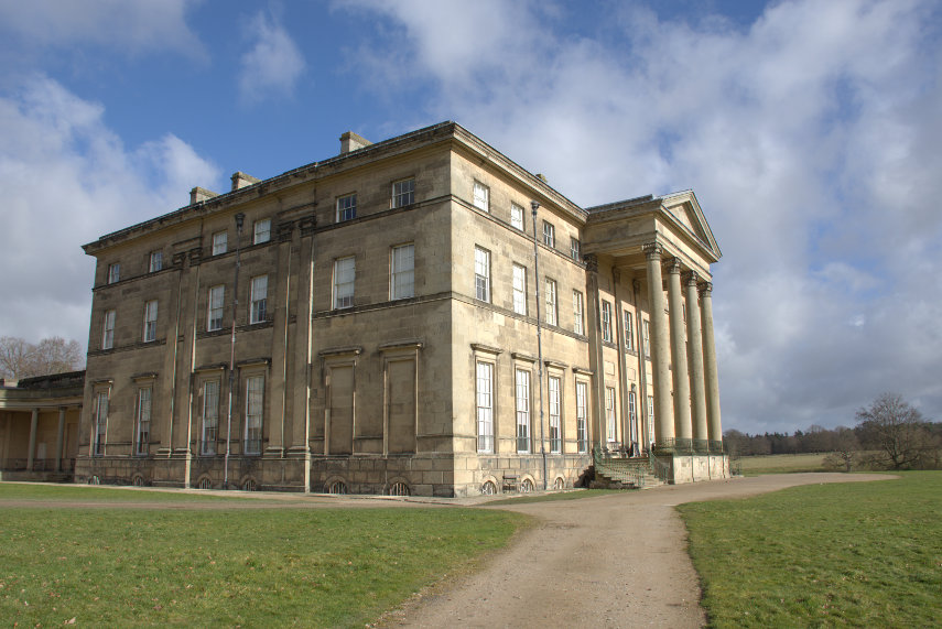
The Attingham Estate includes this mansion together with about 4000 acres of parkland including a Deer Park. We didn't visit the Deer Park this time but we did visit the house going in via the Entrance Hall.

The spaces between the pillars were originally open with the Grand Staircase beyond but John Nash, the architect, changed all that which explains why I thought it not as large or impressive as I'd imagined but I have to admit it's a bit better than ours. We don't for example have any trompe l'oeil panels in our hall but these are very good. The doorway off to the right takes us in to the Drawing Room.

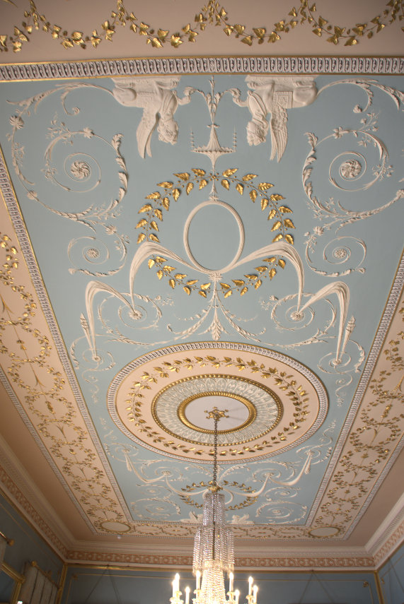
The Drawing Room does have a rather impressive ceiling.

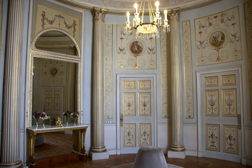
This next room is known as the Boudoir. It is circular with 7 doors (we counted them) and it also has an impressive ceiling. It was created for the 1st Lady Berwick as her own intimate space.

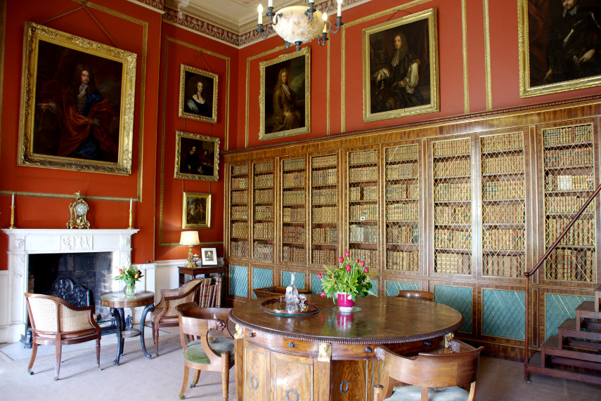
Then into the Inner Library with its Regency bookcases. The walls of the Inner Library are painted red; a popular Regency colour choice associated with strength and masculinity.

Around 1805-1807 John Nash, the English architect, included this rather grand staircase in his redevelopment scheme at Attingham as having removed the main staircase he needed a replacment.

One certainly couldn't miss it.

We now went down to the semi-basement which was the domain of the servants. The next picture showns the Servants Hall where they had their meals.

The rules that servants had to observe, which came from Lord Berwick, included:

"No servant is to absent themselves from the house at anytime or from meals on any pretence whotsoever without especial permission of the Steward, Housekeeper, Lady Berwick or myself."

So they are not allowed to skip a meal without permission which brings us to the Kitchen. Quite a large room with a lovely fire which was very welcome at this time of year.

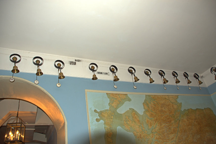
Finally the Bell Room. I thought this to be quite extraordinary when there are so many bells, to demand attention from the servants, that they needed a room to themselves. These bells went around the four sides of the room and were divided into sections of which this was the Ground Floor.

That brought us to the end of our little trip, so early in the year, and back home we went to wait for the next one.

A Grave Incident

A Grave Incident

Today was forecast to have sunny intervals. I'm hoping that at least one of those intervals will be longer than 5 seconds as we have decided to re-visit Shrewsbury using our little train.

We came out of Shrewsbury Station and up some steps on to a high level walkway which took us over the railway and down to The Dana. The Dana is an old prison dating from medieval times although the medieval building is long gone.

There has been a prison on the site since 1793, the original building being constructed by Thomas Telford, although the present prison was constructed in 1877. The name 'Dana' is still often used for the prison, as well as being the name of the road to one side of the prison and the pedestrian route that runs from near the front of the prison into the town centre via a footbridge over the station which is the route we used but in reverse.

There are prison tours available but we didn't avail ourselves of that option but opted to walk onward. We made our way down to the River Severn and walked along the riverside path away from the town centre. There was supposed to be some sort of weir further down river so we though we'd have a look at it.

As we walked along we could hear a background noise which we decided might be the weir. Perhaps bigger than we though then! As we progressed the noise became louder and when we reached the weir we could see why. It was bigger than we thought.

I wouldn't like to go over that in a small boat.

We turned round and walked back towards the town. When we reached the footbridge shown in the next picture we went up onto it and looked down river. We could just see the change in texture of the water surface which indicated where the weir was. You can probably see it more easily in the larger version of the second picture.

We walked along the riverside until we reached the next road bridge over the river. One thing I noticed immediately was that there were trees growing out of the water like the one on the left. Amanda tells me that it is a Willow and that it is not unusual for a piece of willow to float down stream and get stuck in the mud where it promptly takes root. So now you can see the result.

I also took this next photograph of the same bridge because I rather like the effect the low sun was procucing as it shone through the arches. I imagine it's being reflected off the water.

We continued walking and eventually reached the lower edge of the large park known as The Quarry which we visited on our previous trip. The riverside walk looked really nice in the sunlight.

At the top edge of the park is St. Chads Church which I also mentioned in the blog post of our previous trip ( Sun, Signals and Sabrina ) when I wrote:

"I was hoping to get a photograph of Ebeneezer Scrooge's gravestone in the churchyard but we couldn't find it. Yes we know that Scrooge was a fictional character but the churchyard was used in the making of the film and the gravestone was left when filming was finished. It is still there somewhere."

So we walked up to St. Chads and into the graveyard and this time I found it.

On the way back into town we saw Rowley's House which was built in the late 16th century by the wool merchant Roger Rowley. It is believed to be the earliest building in Shrewsbury to use bricks as part of its construction.

That was the end of another interesting, at least to us, walk. So back home on the train for us.

If at first you don’t succeed …

If at first you don’t succeed …

Tuesday 12th September 2017

This is another late report from an outing we did about 5 weeks ago. Unlike the previous blog post this is not accidentally late. I just haven’t got around to writing it until now. In fact going on to the Blog to write this was when I spotted that my previous report hadn’t been posted.

One of the local things we had on our ‘to do’ list was Holloway Rocks. The map in the link will give you an idea of the situation.

http://www.streetmap.co.uk/map.srf?X=330695&Y=273615&A=Y&Z=120

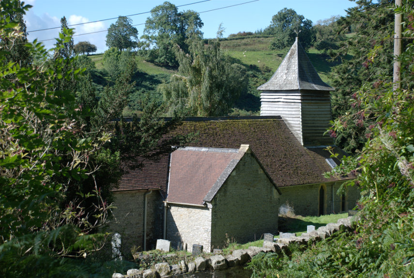
It is a short way from Knighton, where we now live, and short enough that we could walk from home but didn’t. The roads around Stowe are only one car’s width so one has to park off-road. We drove to Stowe Church, shown on the map, where we were able to park our car. It’s a lovely little chuch in the middle of nowhere (Stowe has a population of 140).

We had tried this walk before, about a week ago, having set off from Stowe Church. We started off up the wrong path and having realised that we went back down again and then realised why we hadn’t taken the right path. There was a van parked on the beginning of the path and although there was room to walk past it the van had blocked it from our view. We set off again on the right path. In the past year my health has deteriorated such that, sometimes, I can’t walk far uphill without stopping to catch my breath which was what I was having to do here. I did push myself too hard and eventually had to sit down. After a while I began to feel faint and had to lie down. I did eventually recover but we decided to abandon that attempt.
… try, try again.

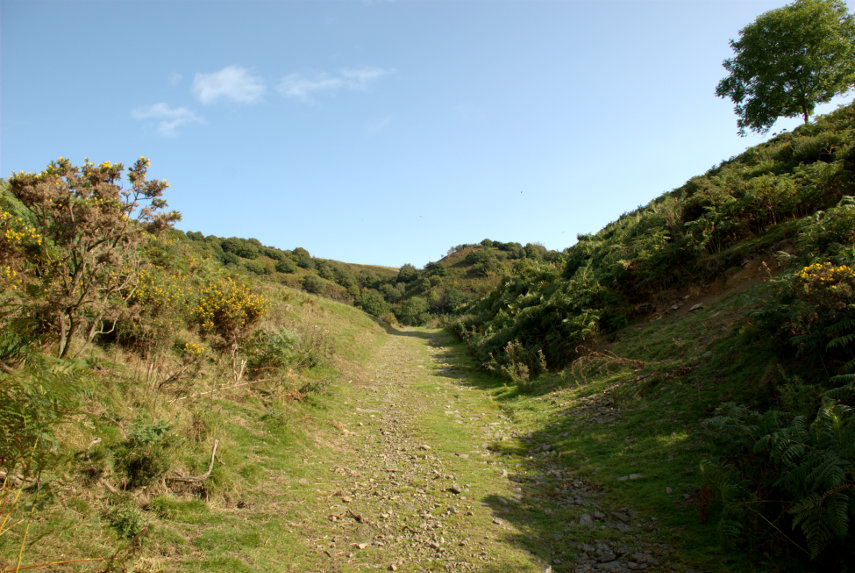
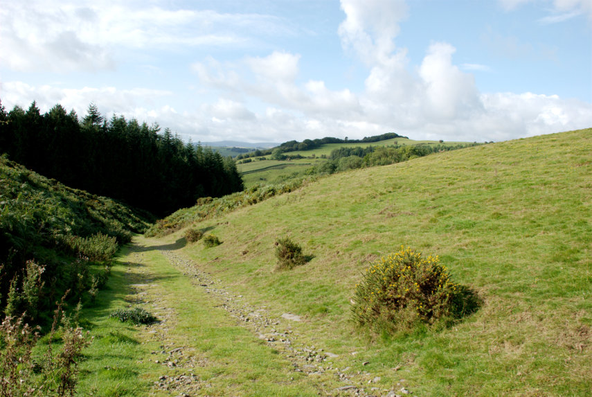
This time we started up the right path, which is fairly steep, with frequent stops for me to recover my breath and I didn’t push too hard this time. I managed to get through the wooded section but by the time we reached the open I had to stop for a breather especially as the path gets steeper here.
Looking back, in the next picture, the wooded part is visible and you can see that we have gained quite a lot of height; most of it previously in the car.

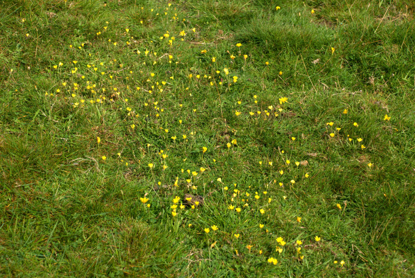
On that bank to the right were a lot of Hawkbit flowers.

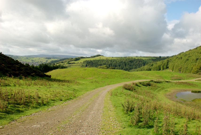
Inexorably upward, stop, puff, repeat and we eventually arrived at an expected junction with another path together with a pond. The path we want continues upward on the other side of the pond curving off to the right.

Having reached the high point in the photograph above we look back in the next picture to see this view. The footpath we turned out of is on the left of this path just before this path splits into two and you can see the pond on the right. The town of Knighton is visible just above the very dark triangle on the left probably better seen In the larger picture.

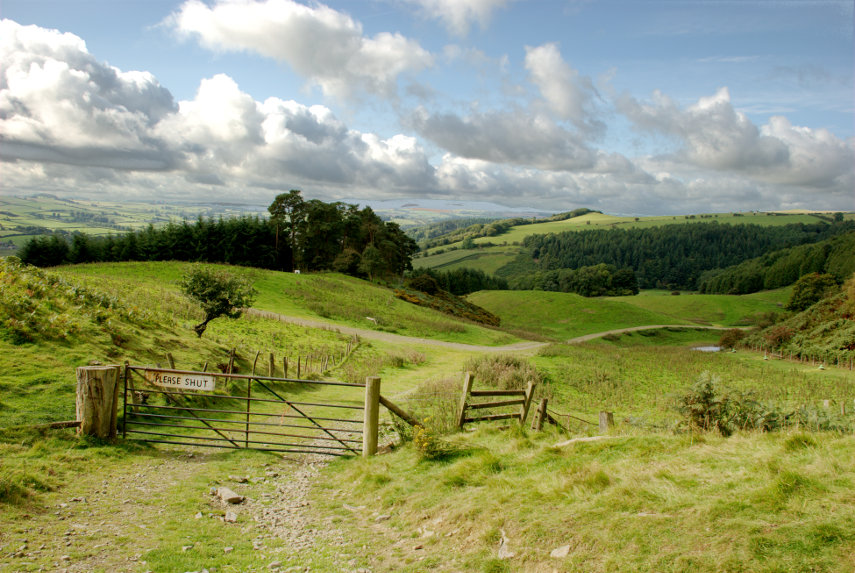
We have now gained more height but we are by no means near the top yet but we do have a lovely view and the sky has cleared a little which makes it even better.

We are still climbing but we are now not too far from the top.

You can see the path levelling off now and you should also be able to see the path plunging downward as it curves to the left. We have just come up that bit and the town in the distance is, of course, Knighton.

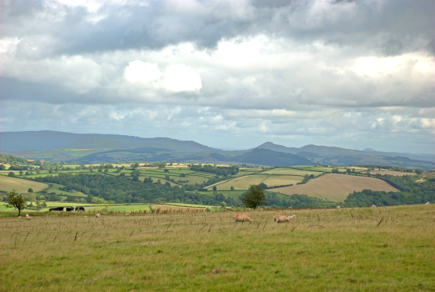
Finally, after crossing two large fields (fairly flat), we reach the top with its Ordnance Survey trigonometry point with Amanda trying to stop it from falling over. The next picture gives an idea of the view with sheep in the foreground and those black blobs on the left are actually cows.

So where do the rocks in Holloway Rocks come in? There isn’t really much in the way of visible rocks although we passed an old quarry on the way up. Perhaps that’s where the name comes from. The hill we climbed is, unsurprisingly, Stowe Hill.

Well I managed to get there even though it took me about three times as long as it would have done a year ago. Measured over the ground it was probably less than a mile but pretty steep for most of the way. I don’t think that I would like to try walking it from home. That would be about 2 miles each way and although I’m fairly sure I could get there I couldn’t be certain that I could get back again which would be a little embarrassing.

So did I get back from this trip? Well, I’ll leave you to work that out.

Moor and More

Moor and More

August has been a dismal month. Cloudy and cool a lot of the time and you would never have guessed that it was supposed to be summer so on the very few occasions when the sun did appear we jumped at the chance to go out somewhere.

About 16 years ago around the time that this web site was started we ‘discovered’ Carding Mill Valley in the Long Mynd near Church Stretton and, having looked on the map, it was evident that there was a walking route shaped like a ‘Y’ where one could start at the bottom of the Y, walk up taking the left fork, where it divided, then walk across to the other arm of the ‘Y’ and walk back down to where one had started.

I’ve always wanted to do that walk but have never managed it until today. The weather forecast was clear skies for most, if not all, of the day. They were lying as usual. Although we had a very good amount of sun the sky was anything but cloudless. We set off for Church Stretton and were planning to come down into Church Stretton via the Burway. This is a very minor road which goes over the Long Mynd.

The picture below was taken on the way up and you may notice that on the right-hand side of the road the ground drops away suddenly. On the way up that drop is on our left and, although not vertical, the drop is very steep and you really wouldn’t want to drive off the edge. The road is only one car wide so if another car comes from the opposite direction one must find a passing place and, for us being on the left, we have to take great care squeezing past so as not to go off the edge.

We did meet a car coming the other way and we survived.

We eventually arrived at the top to be greeted by a large expanse of moor with heather scattered here and there not to mention the amazing view.

I stopped to take this next picture because somewhere down in the dip is Church Stretton and the heather looked wonderful.

As we progressed downward we could see the hills around Church Stretton and there was still plenty of heather in view.

As we descended we gradually lost the heather but the hills still looked pretty impressive. In the picture below the buildings in the trees at the end of that ridge is Church Stretton and, if you remember, we are planning to walk back up here not to mention down again.

We finally made it to Church Streeton and drove into the National Trust car park in Carding Mill Valley and went into their restaurant for lunch. We both had some Pea and Mint Soup, with bread, which was very tasty and very welcome. Afterwards I had some Bread Pudding and Amanda had a Chocolate Brownie which was followed by tea for her and coffe for me.

Now we walk! surprise

The picture below shows the start of the path, near the car park, up the valley.

In the picture below we have reached the banch in the ‘Y’ and are going left behind that tree and, we hope, we will be coming back down the path on the right.

When we got to that junction we stopped and looked back at the view in the picture below then headed further up the valley with its interlocking spurs (Geography) in the picture after that.

We finally arrived at the little waterfall. Here we go off to the right up a near vertical climb. It is rocky which makes it very easy because it’s like going up stone steps. We managed that without incident and continued along the valley until we reached the high moorland once again although not in a car this time.

We found a pond up here and Amanda apparently found something interesting to look at. Probably she was bending down for a rest but didn’t want to admit it.

We walked along the high ground until we found the start of the path down and you can see that we weren’t the only walkers about. You may be able to see Church Stretton in the distance.

As we get lower there is less heather around.

More interlocking spurs in the picture below and although we are losing the heather it is still in evidence.

Finally we arrive back at the junction of the two arms of the ‘Y’. Remember that little tree by the path at the bottom there?

You will have guessed that we made it back to the car otherwise I wouldn’t be writing this. August is not a good time to come to a place like this as the lower parts are very popular and the children are on holiday so everyone and his dog are there but we wanted to see the heather and, guess what, heather blooms in August.

Well it took me just 16 years to achieve my ambition but I finally made it. laughyes

Keep time

Keep time

Now is the time and this is the Keep.

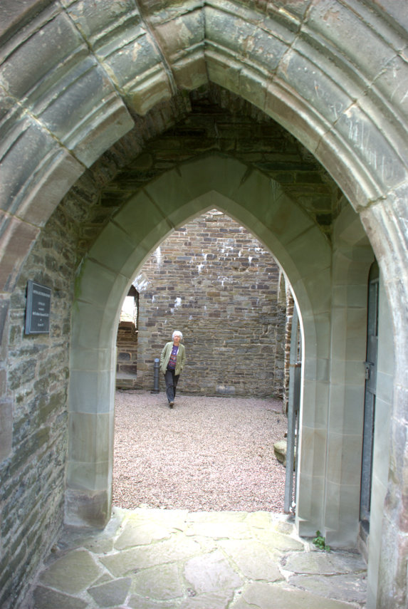
Built in the early 14th century Hopton Castle is about 10 miles from home so, as it seemed like a spring day, we decided to venture out. There is not a lot to see but it is accessable to the public and free to enter and free to park. The main entrance can be seen on the shady side and one can go inside although it is not possible to go beyond the ground floor.

Amanda was pretty keen to get inside and there she is on her way in and by the time I got there she seemed to be on her way out. But, no, she was just coming over to greet me.

It has been suggested that this was not a genuine defendable castle but more of a stately home built by someone who was anxious to show off their wealth. If that really was the case would they go as far as constructing earthworks around the castle as large as this that they would not expect to use? That would need a lot of work and money.

A short but interesting and pleasant visit.


Sun, Signals and Sabrina

Sun, Signals and Sabrina

We have been to Shrewsbury twice before and I have blogged both trips as you may remember. On each of those occasions it was cloudy but today was forecast to be sunny intervals. We have experienced forecasts like that before where we have two minutes of sun followed by two hours of cloud so we weren't hopeful but decided to risk it. So we started off on our third trip to Shrewsbury on the train and it turned out to be third time lucky.

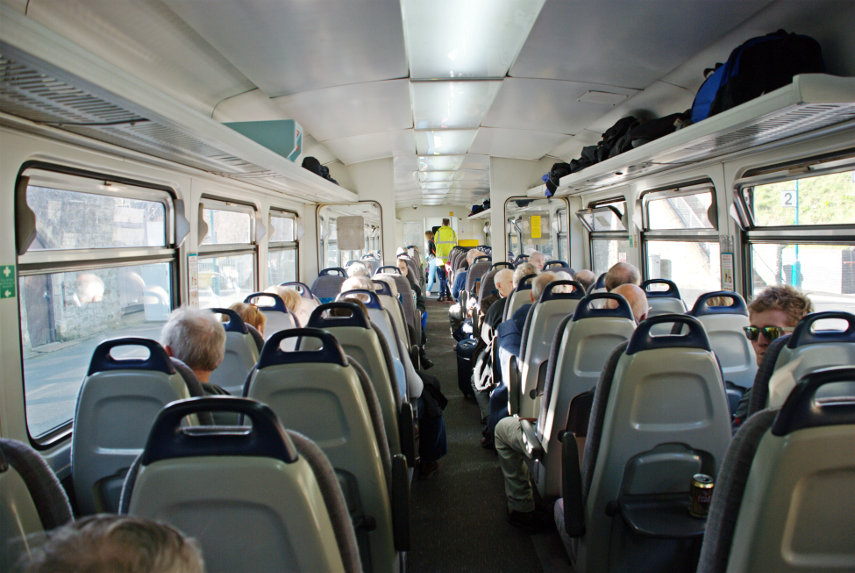
I have shown you pictures of our little one carriage train before, but from the outside, so here's a picture of the inside.

You may notice that it is very popular, especially at this time of year as between 1st October and 31st March old people like us who have bus passes may travel free. This covers the whole line from Swansea in the south to Shrewsbury in the north; a total trip of around four hours. Our part of the trip from Knighton to Shrewsbury is only 50 minutes.

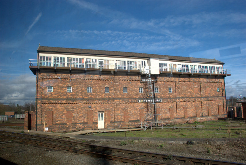
This is a picture of the signal box outside Shrewsbury Station. I took it from the train as we flashed past inasmuch as our little train can flash past anything. "But wait", I hear you cry, "why are you showing us pictures of a signal box.? We don't want to see pictures of signal boxes." Well, you do, but you just don't realise it yet.

This signal box was built in 1903 and is the largest mechanical signal box in the world which is still working. There, you can't fail to be impressed by that can you? When I first saw it I thought it was big but I didn't think it was THAT big.

We emerged from the station into a sunny Shrewsbury and headed south east along Castle Gates. We hadn't gone far when we realised that we had just passed some some steps and we thought 'I wonder where they go?'. Well we had to find out didn't we? The steps led us up to a higher level walkway and I spotted this view.

What do you think that building is? A stately home, a museum perhaps or even a prison. Nope! None of those. It is, in fact, Shrewsbury Railway Station. Quite impressive for a railway station eh? Built in 1848 it is now designated a grade II listed building.

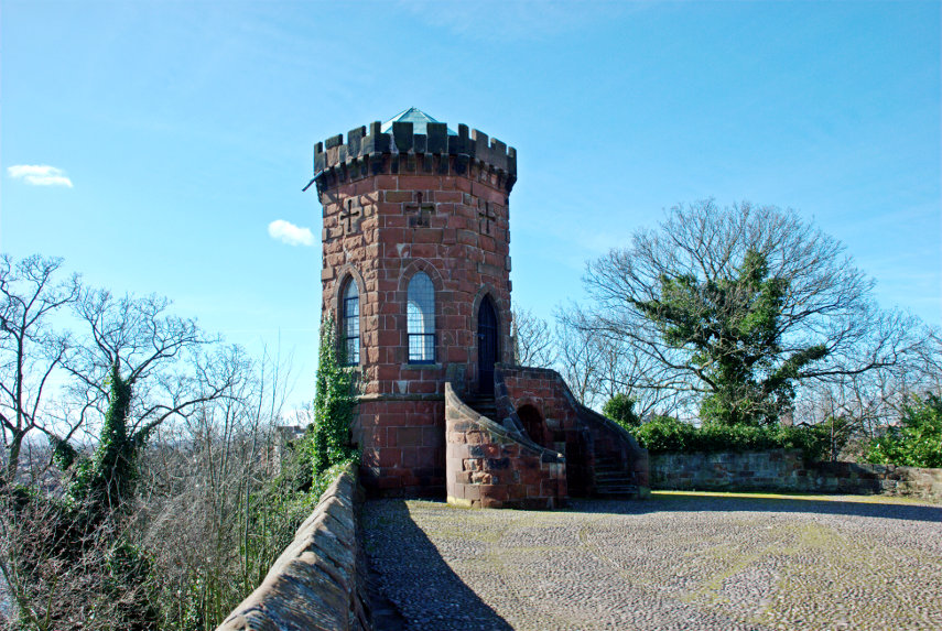
We went back down the steps and after a short walk entered Shrewsbury Castle grounds. Bearing right along a path which was sloping upward we eventually arrived here at the top of a knoll. This is Laura's Tower built by Thomas Telford, in 1790, for Laura, the daughter of Sir William Pulteney, as a summer house.

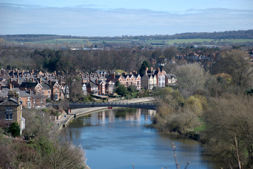
There are some impressive views to be had from the top of this knoll although some of them are obscured by trees. Luckily for us it was March and there were no leaves on the trees so we had some lovely clear views such as this one along the River Severn. Incidentally the steps and walkway we decided to follow earlier would have taken us across that footbridge but we didn't want to spend time going that far today.

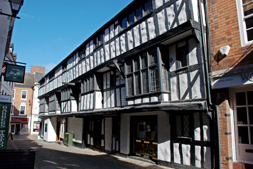
After a surfeit of views over the town we went back down to ground level and continued our walk through the town along Castle Street then Pride Hill where we turned into Butcher Row and saw this fine timber-framed building.

The timber-framed building shown below is at the south-east end of Butcher Row and on the corner of Fish Street which runs across the top of Grope Lane which I have mentioned in previous posts. This particular building still has its original frontage with the deep window sills on which the merchants would have displayed their wares.

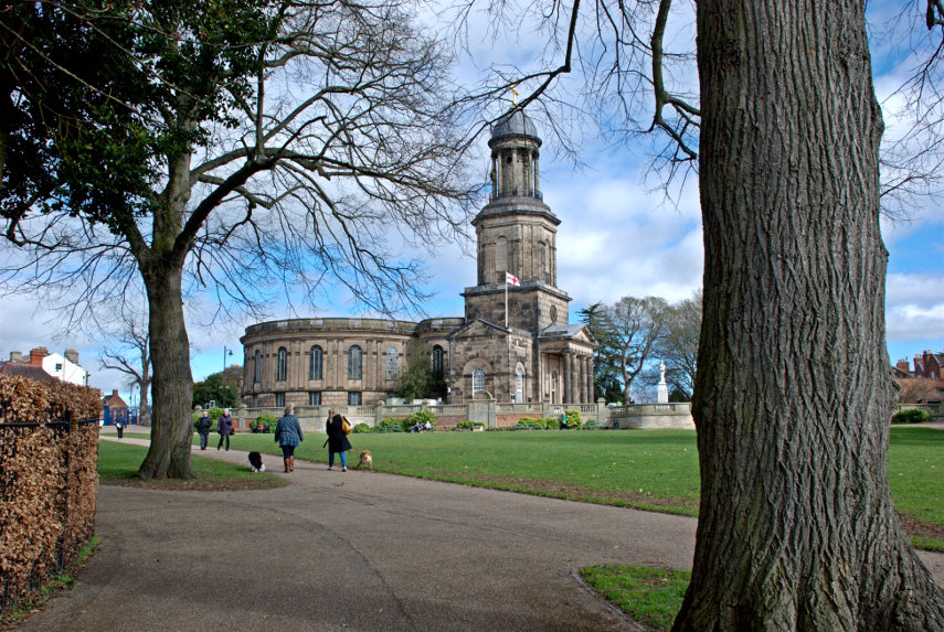
We went back along Butcher Row and turned left along Pride Hill heading south-west. We eventually reached St. Chad's Terrace where we found (you've guesssed it) St. Chad's Church. Built in the 1700s, so not that old, but quite an impressive and unusual church. It created a stir at the time because it had a circular nave. 

I was hoping to get a photograph of Ebeneezer Scrooge's gravestone in the churchyard but we couldn't find it. Yes we know that Scrooge was a fictional character but the churchyard was used in the making of the film and the gravestone was left when filming was finished. It is still there somewhere.

The circular nave is unique, with pews arranged like a maze and Charles Darwin was baptised in St Chad’s Church.

Just across the road is the Quarry park which incorporates the Dingle. Dingle, apparently, is another name for a Dell. Either way it's a very attractive garden and there were plenty of blooms in spite of it being the middle of March.

This view shows St. Chad's Church, with its very tall tower, in the background.

This statue of Sabrina was created in 1846 by Peter Hollins of Birmingham for the Earl of Bradford. A folk etymology developed, deriving the name from a mythical story of a nymph, Sabrina, who drowned in the River Severn nearby and Sabrina is also the goddess of the River Severn in Celtic mythology.

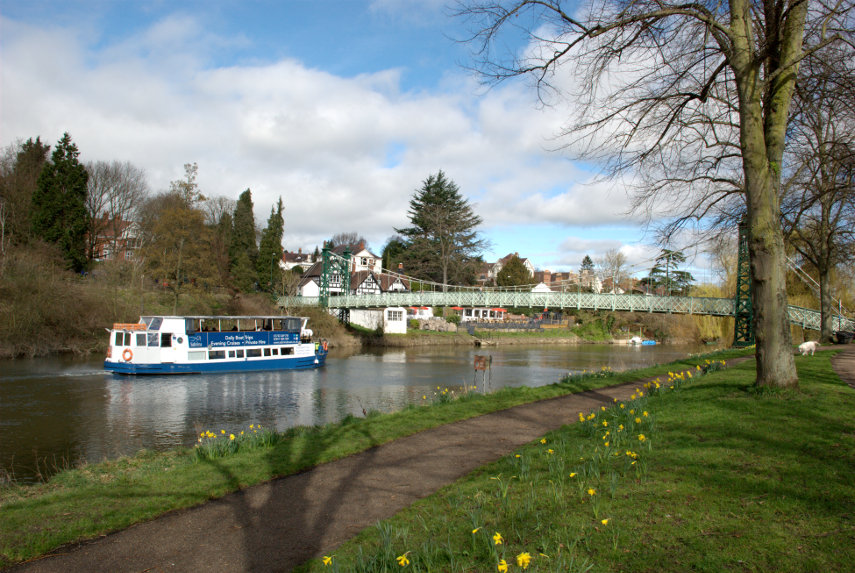
That, however, is not the only Sabrina, as there is a boat called Sabrina which takes visitors for a cruise around Shrewsbury on the river. It was very convenient that it happened to come along as I was photographing the river.

After our last two visits Amanda wasn't particularly enamoured of Shrewsbury but she says now that she is really beginning to like it. We are, of course, planning to come again in the warmer weather when the leaves are on the trees.

We caught the train back home where we arrived without incident.

I suppose that that was our first 'proper' trip of the year. More trips to come I hope.